Another one of those overperforming days when I didn’t think it would perform much at all. It was a low-end marginal risk going in the day before, which I had departed to allow myself a chance to target areas near the OK Panhandle, but when I awakened the morning of in Goodland, the target had shifted to… well… Goodland… and what was a low-end marginal day upgraded to a solid slight risk for potentially very large hail.
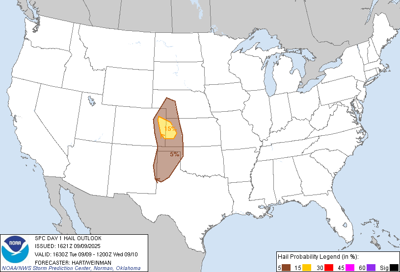
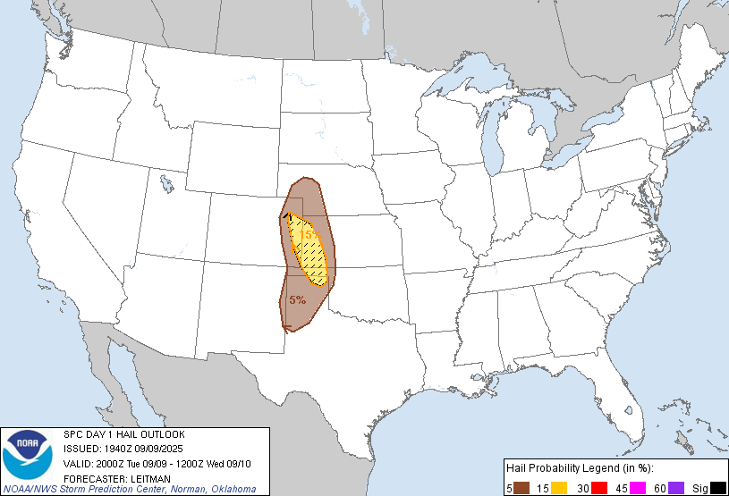
After killing time with some video shoots and lunch, I had held up in Colby (yes, east) before returning back to the west, making the 45 minute drive from Colby to Burlington where storms were starting to get organized along and just north of I-70.
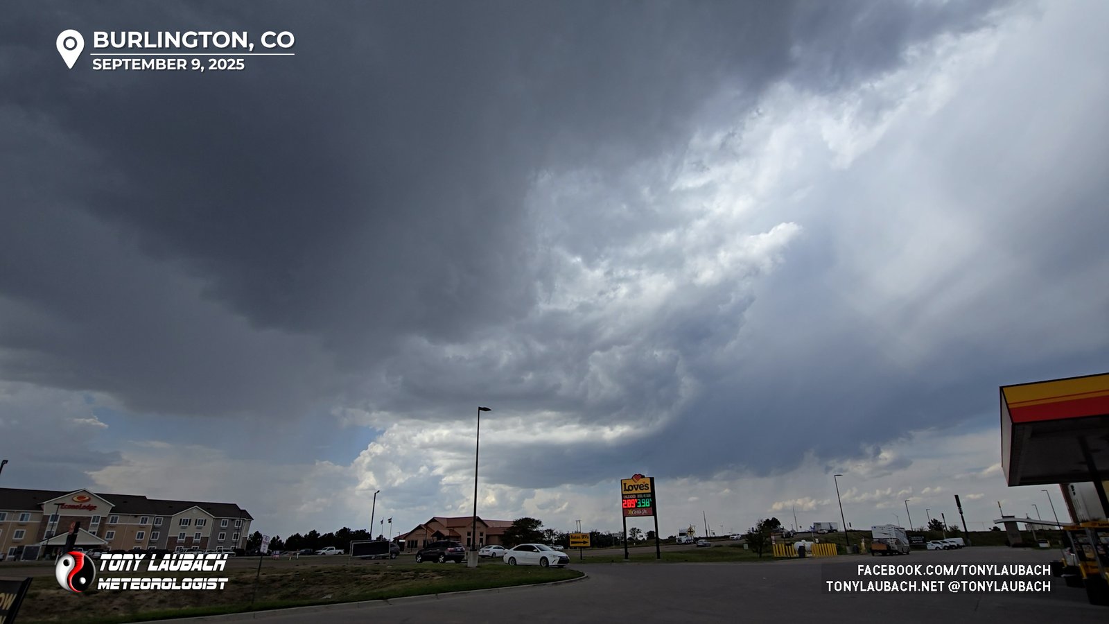
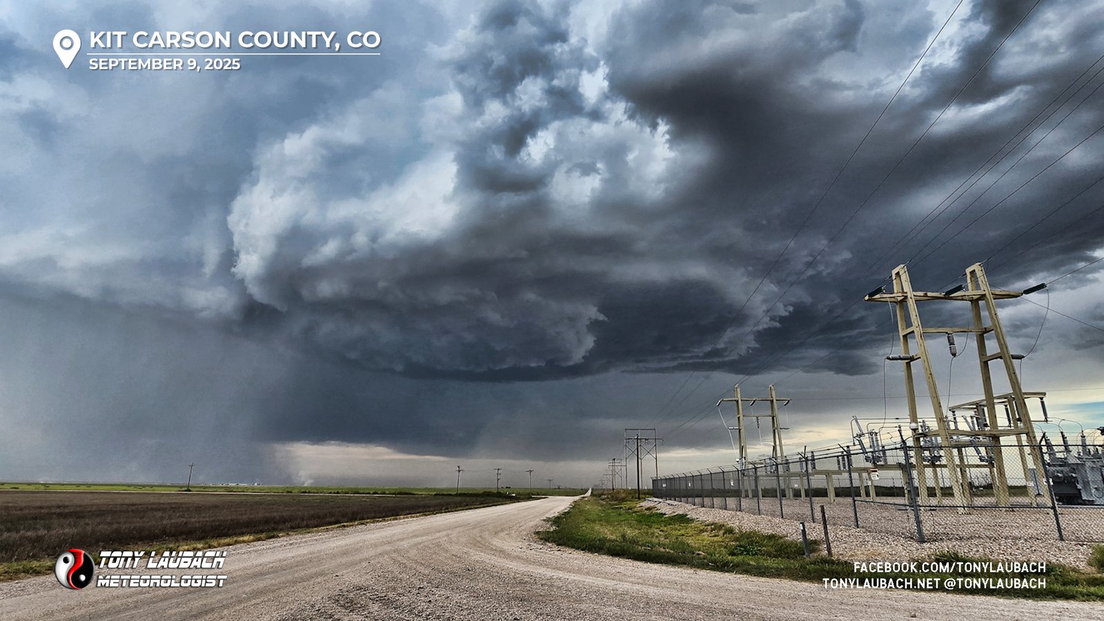
The storm of interest to me was about 10 miles north of I-70, an easy roll up US-385 through town. I got up to the south side of the now severe cell as another storm was quickly exploding back to my south over Burlington (figures). My cell was producing sub-severe hail, but nothing more than an inch.
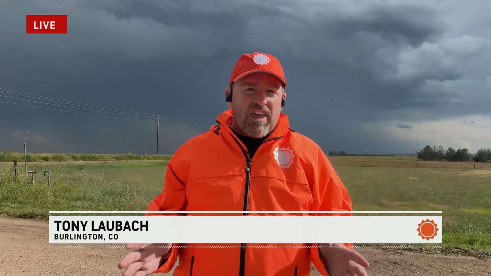
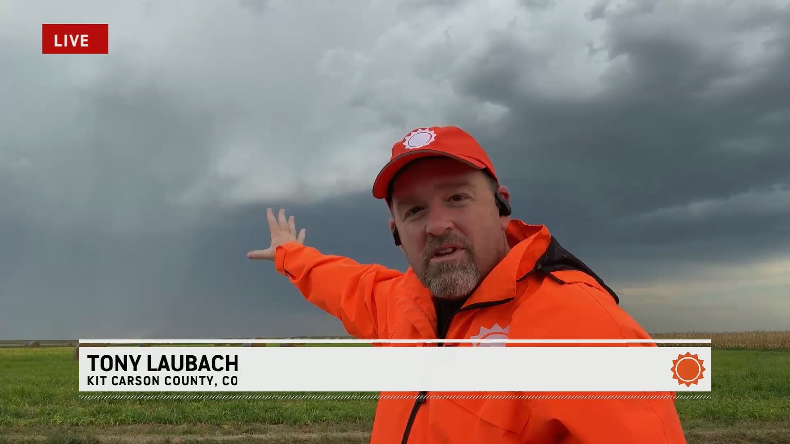
Both cells were severe-warned, the one over Burlington for golfballs, so I knocked out my live hit at 4pm with the Burlington cell behind me.
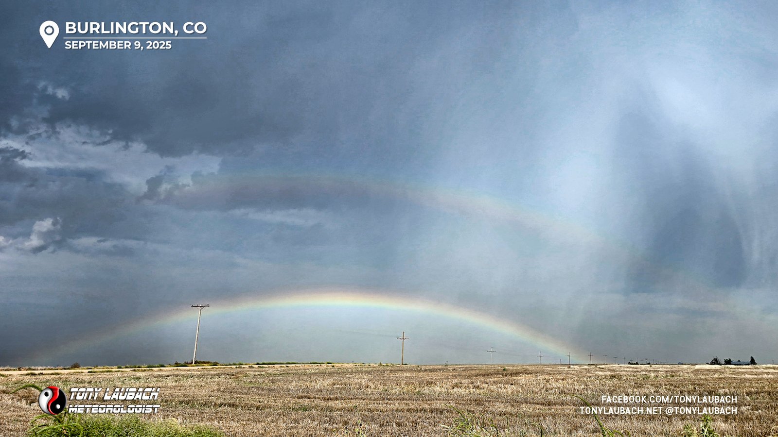
After I wrapped up my live hit, I was quickly throwing my gear back in the car when the northern cell, which was quickly weakening, provided a nice scene usually reserved for the end of a chase. I snapped a picture, hopped in the car, and blasted south toward Burlington.
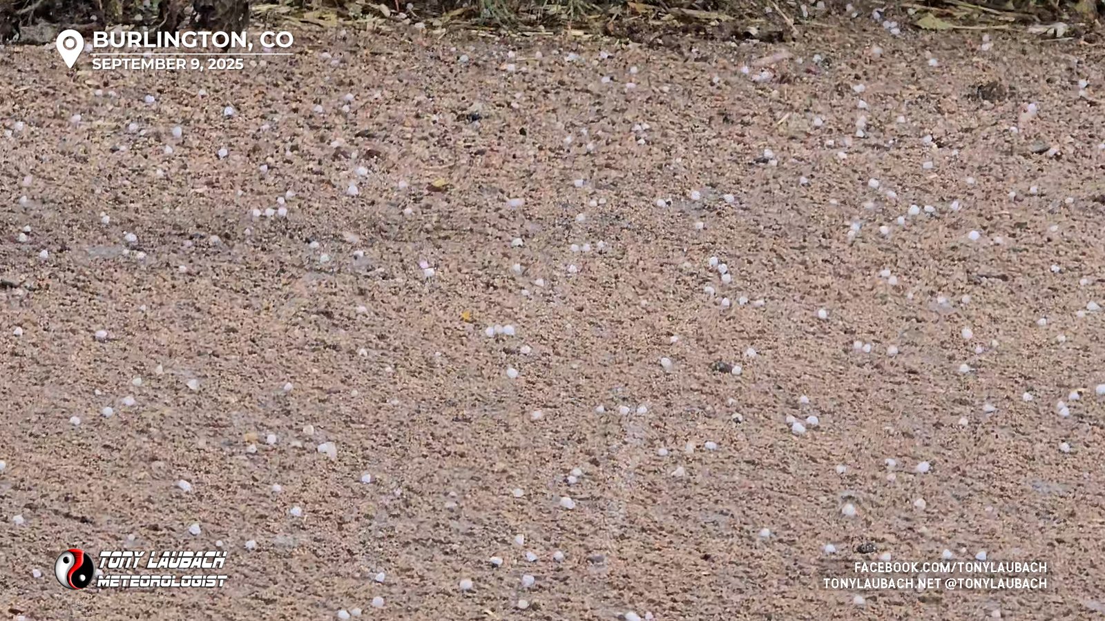
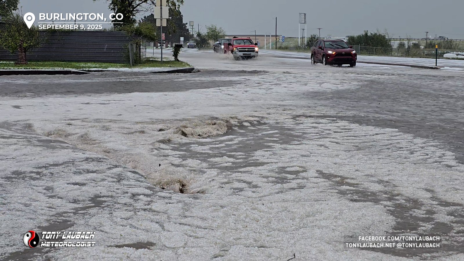
I rolled into the north side of Burlington as the brunt of the core had shifted just east of town and was starting to show signs of moving southeast. I didn’t need to get very far into town when I came across the flooding and hail coverage left behind from the core which had spent about 20 minutes over town.
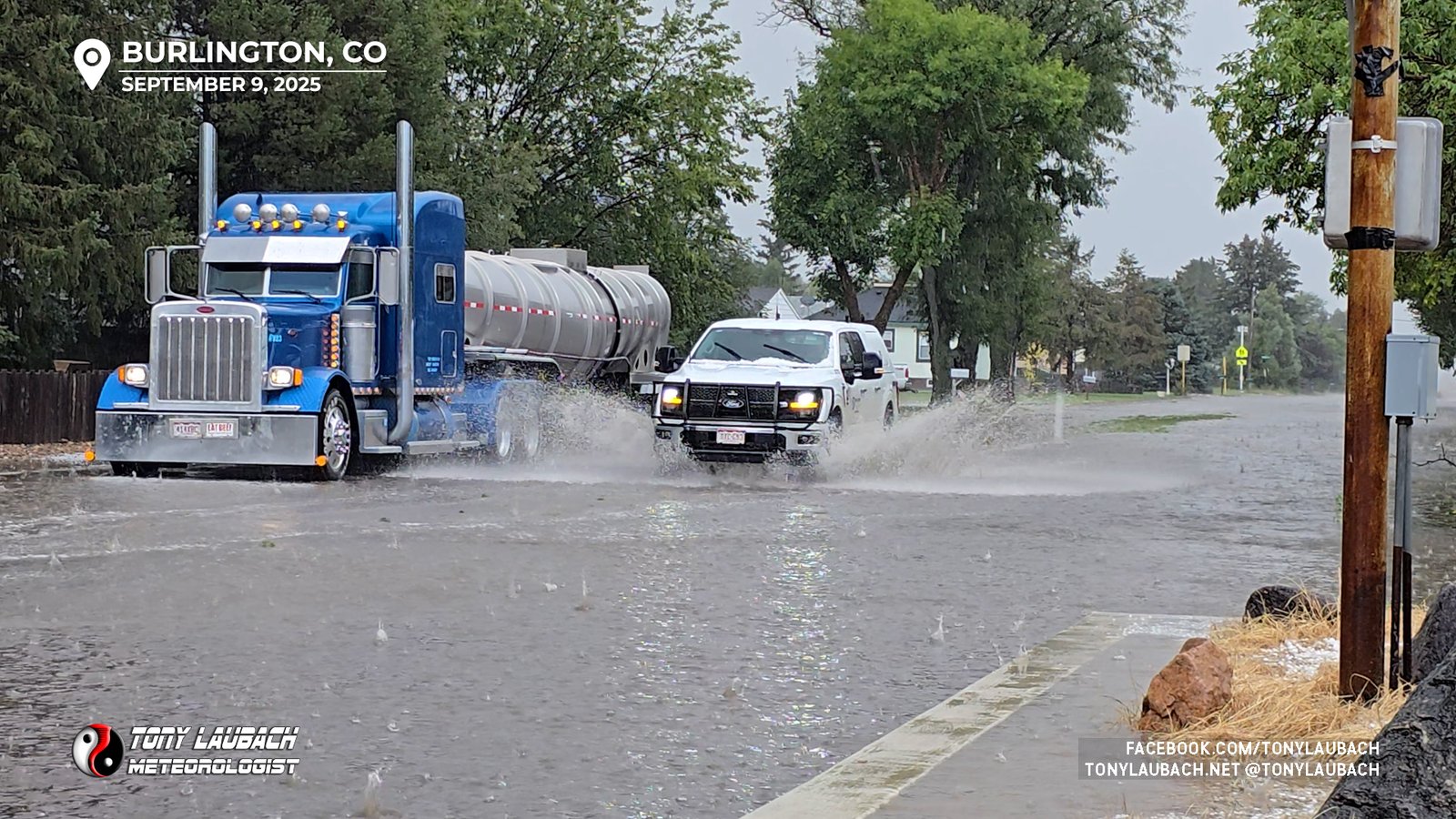
As I was filming the street flooding, the storm back-built into town again and severe-sized hail, some up to 1.5″ began to pour down along with torrential rain. I found a place to cover up so I could more easily shoot video as the second round of this severe storm began to unleash over town.
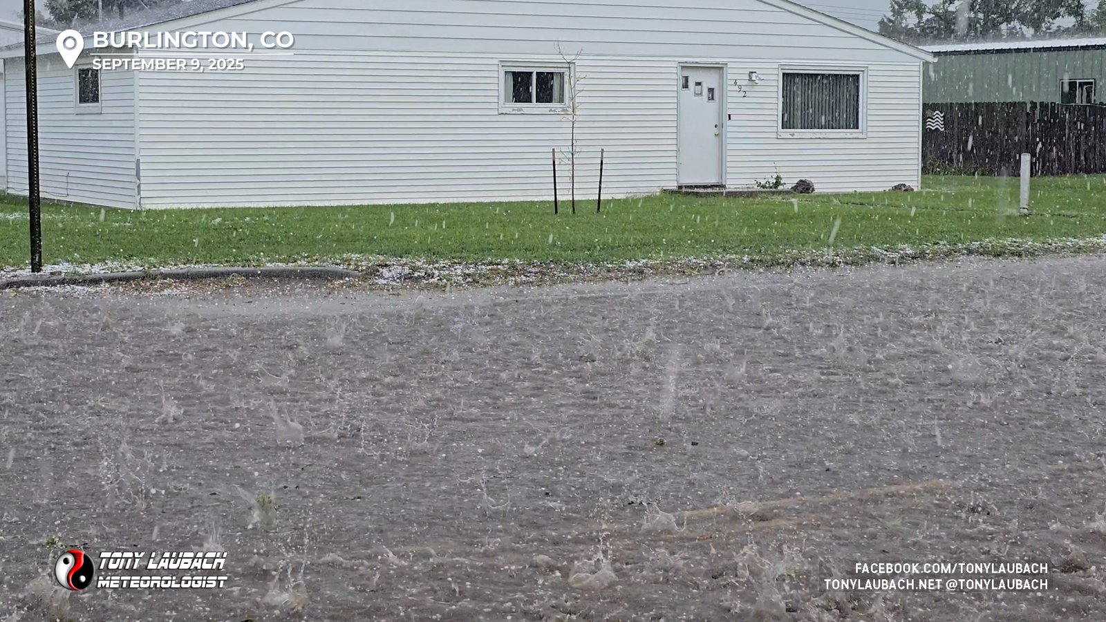
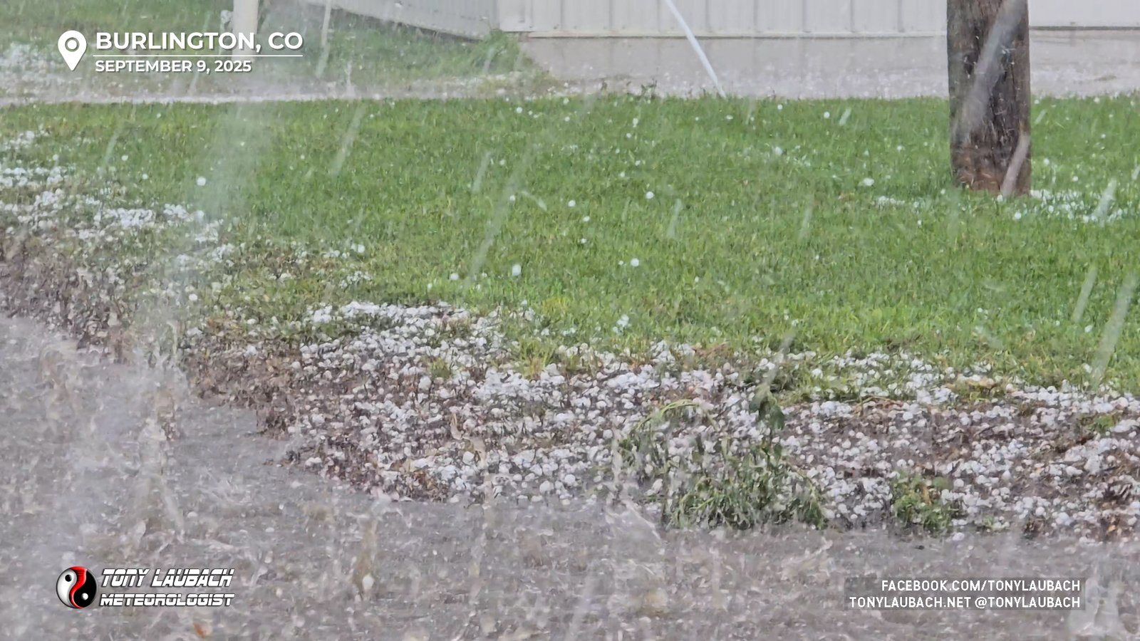
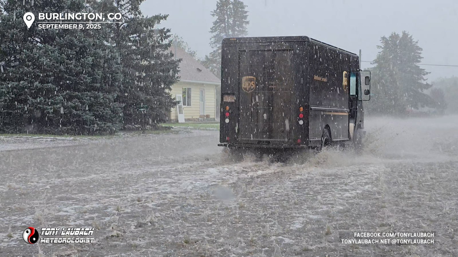
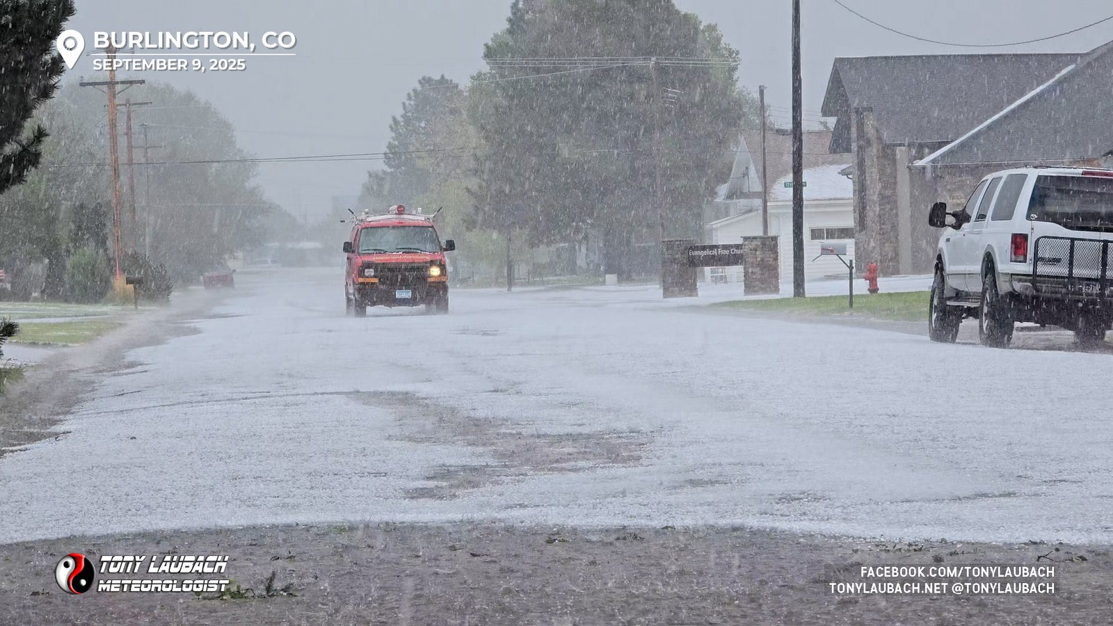
I made my way to Rose Avenue, the main east/west strip in town, and it was quite the scene as literal rivers of hail were rushing down the road.
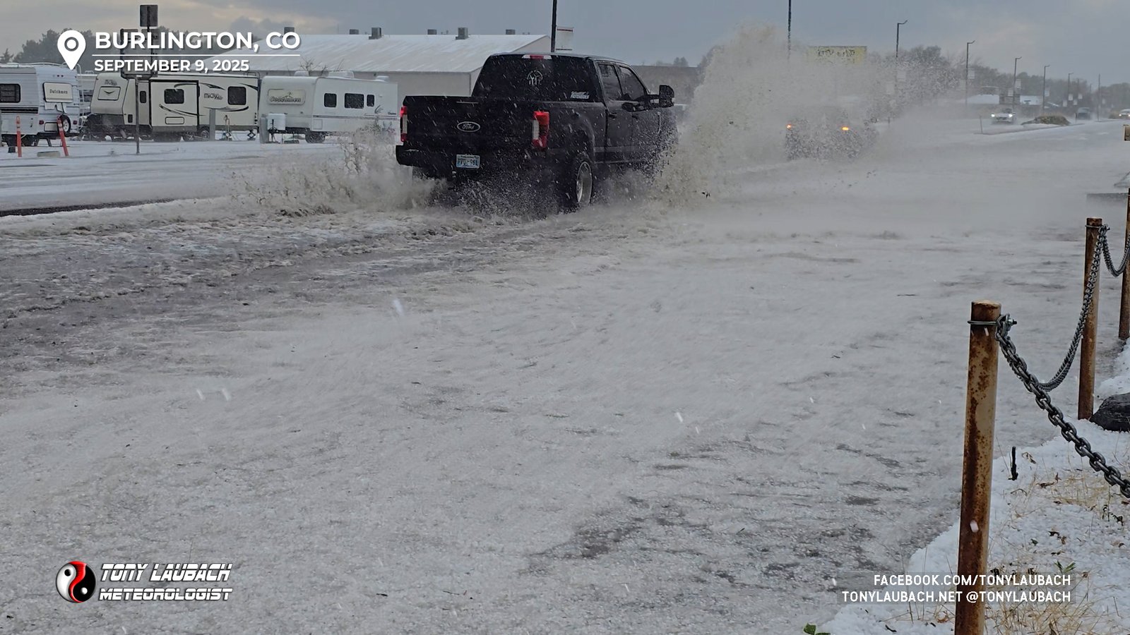
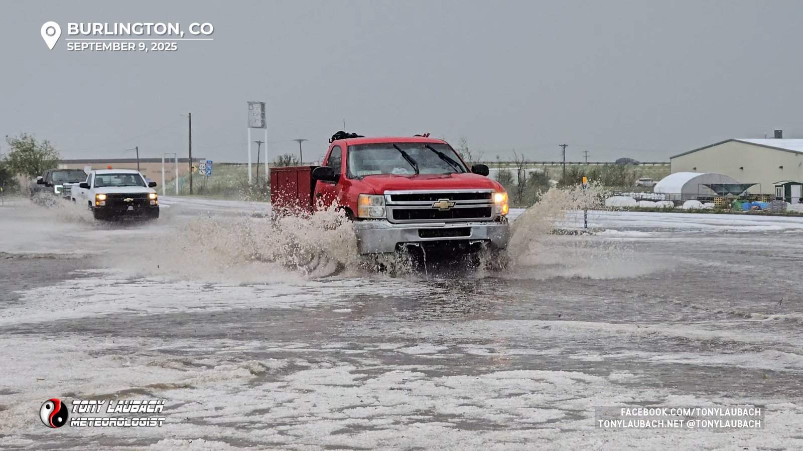
Amazingly, the water was receding pretty quickly in my immediate vicinity, although the eastern interchange with I-70 was pretty clogged up with flooding and hail, but the storm was finally getting some wheels and I didn’t want to get behind, so I rolled south out of town along US-385, got myself ahead of the storm, then started stair-stepping east and south to keep with this high-based cell.
I had a second live hit at the 5pm hour, and despite being in the middle of nothing, I had great service and had a terrific live with the severe storm behind me, recapping what had happened in Burlington 30 minutes prior.
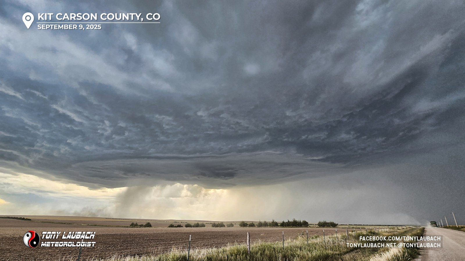
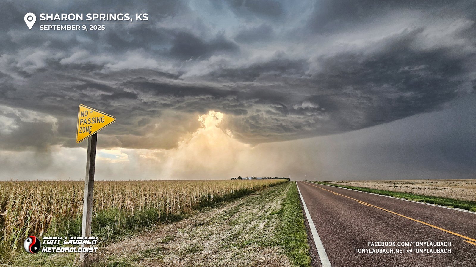
The storm looking north from near the CO/KS border as it moved into Kansas.As I indicated in my 500pm live hit, I was eyeing Sharon Springs for the next intercept as this storm was moving southeast toward town. I worked my way on a series of dirt roads to Highway 40, connecting up with it right on the state line, and I hauled east to ensure I was in Sharon Springs well ahead of the storm. The structure was improving quite a bit, and while still high-based (and likely so much so to be tornadic), it had lowered a bit and was definitely showing some cloud-based rotation.
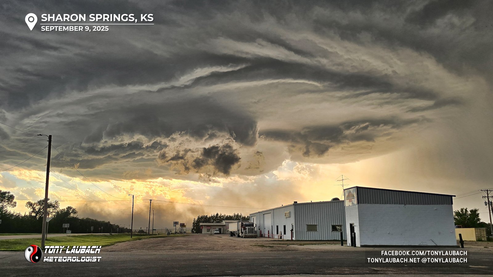
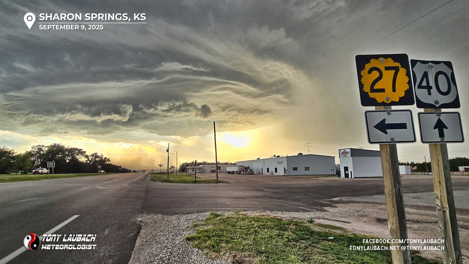
While my original intention was to take on the hail from a covered spot in town, the increasing visual rotation changed me out of hail mode. I was also thinking the brunt of the core was going to stay west of town, so I departed my gas station cover and dove south on KS-27, getting about 10 miles south of town to enjoy the incoming view.
As the storm continued to push southeast, other updrafts and showers began to spring up west and south of this storm, some of that starting to congeal into this supercell. The discrete nature of this storm was beginning to wane, but the views were still very impressive.
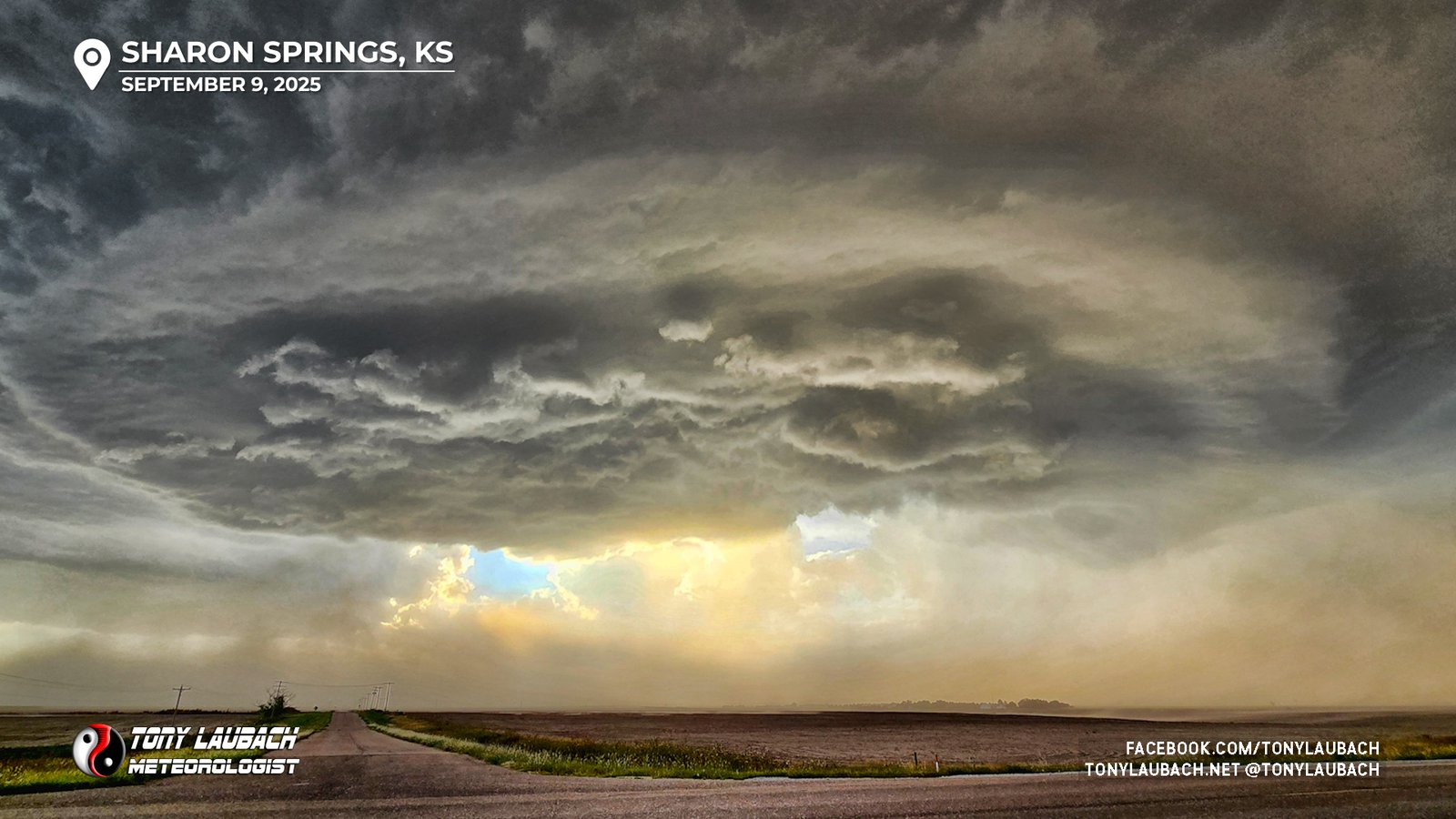
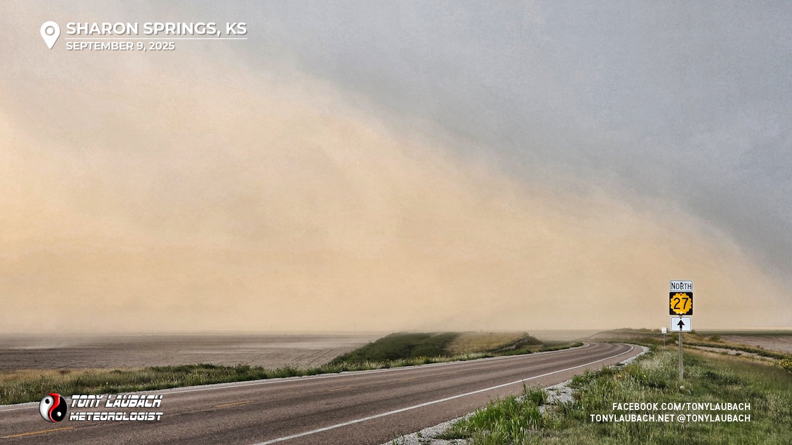
Meanwhile, another hazard of this storm was starting to take hold as the now outflow-dominate storm was kicking up a ton of dust and sending it across the highway between me and Sharon Springs. The National Weather Service in Goodland issued a dust storm warning for this severe cell.
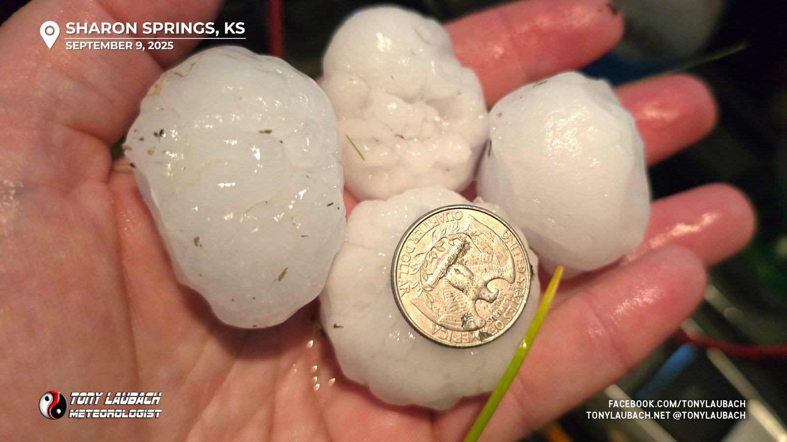
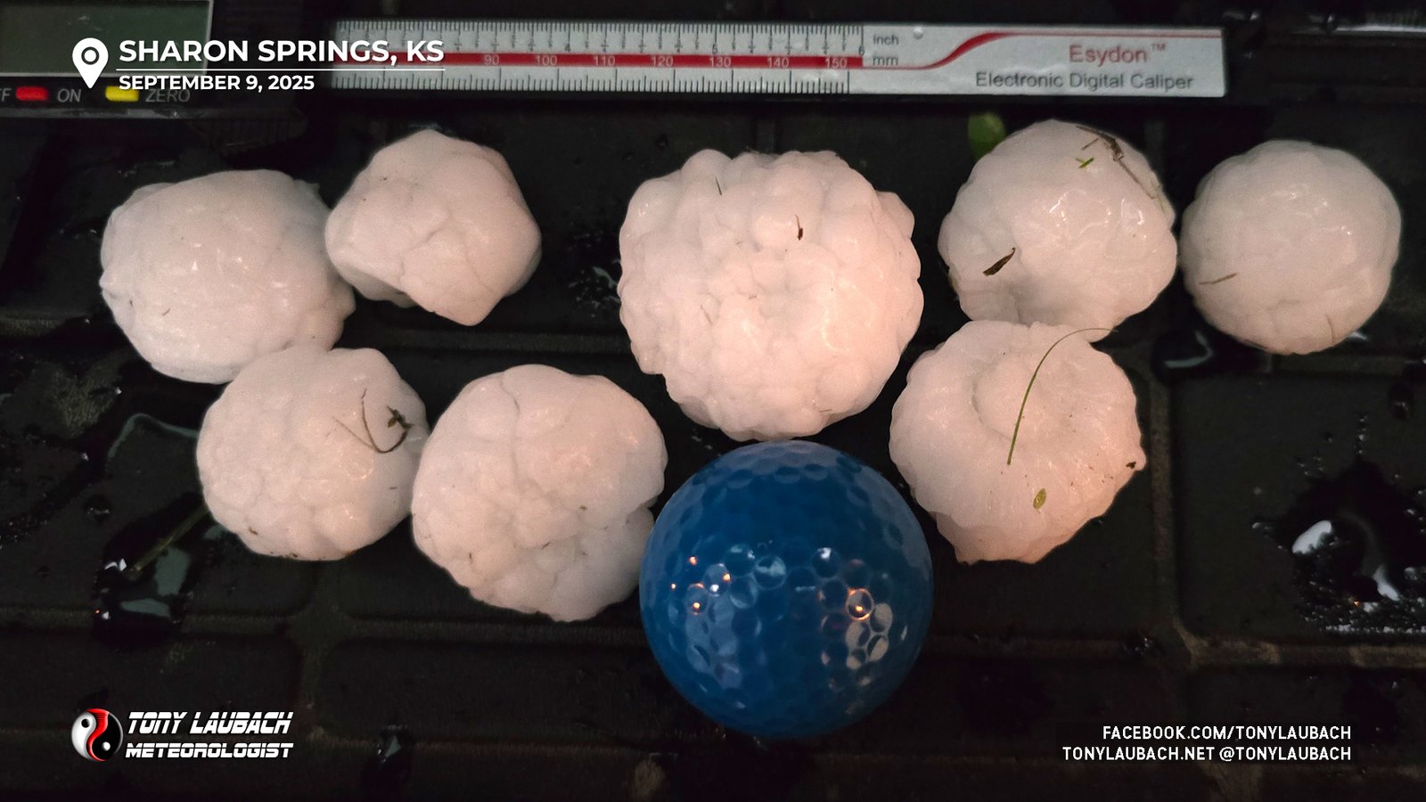
Radar was indicating the storm, which was currently warned for 2″+ hail, was starting to weaken as multiple smaller showers were beginning to merge with the supercell. I decided to go ahead and poke north to see what the hail was looking like. As I rolled up, hail began to fall, first quarters, then growing to near golfballs. I sat on a pull out along KS-27 as the hail fell, running out to grab a few of the bigger stones I could find. I went further north along KS-27, only about a mile, before I came across the heaviest hail left behind; larger stones covering the ground, some of those approaching 2″.
As my storm was becoming part of a larger cluster, it remained severe as it slid to the southeast, pulsing up and down in intensity, but with darkness falling and more storms coming in from the northwest, I began to shift my focus to the one thing I was hoping to do more than anything else today, lightning photography.
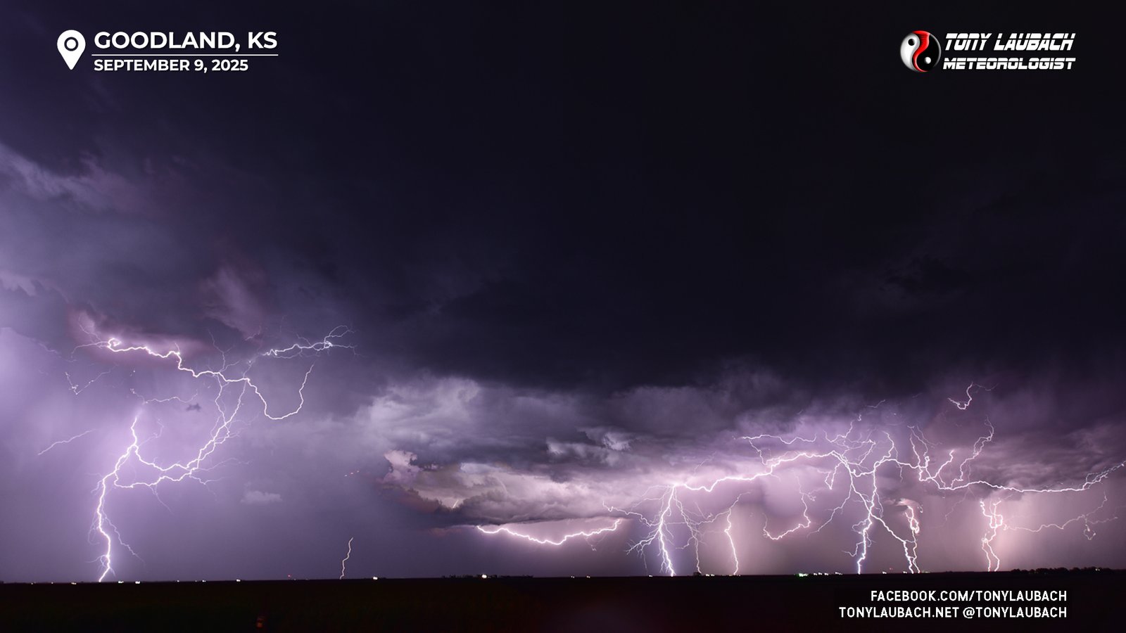
My target cells were closer to Goodland, so I shot north back through Sharon Springs on KS-27, getting about 10 or so miles south of Goodland to set up for my initial shots once I got clear of the precip from the storms to my south. Unfortunately, I wasn’t having much luck with CGs, but the cloud-to-cloud stuff was not terrible, even as the storms themselves were still pretty far away.
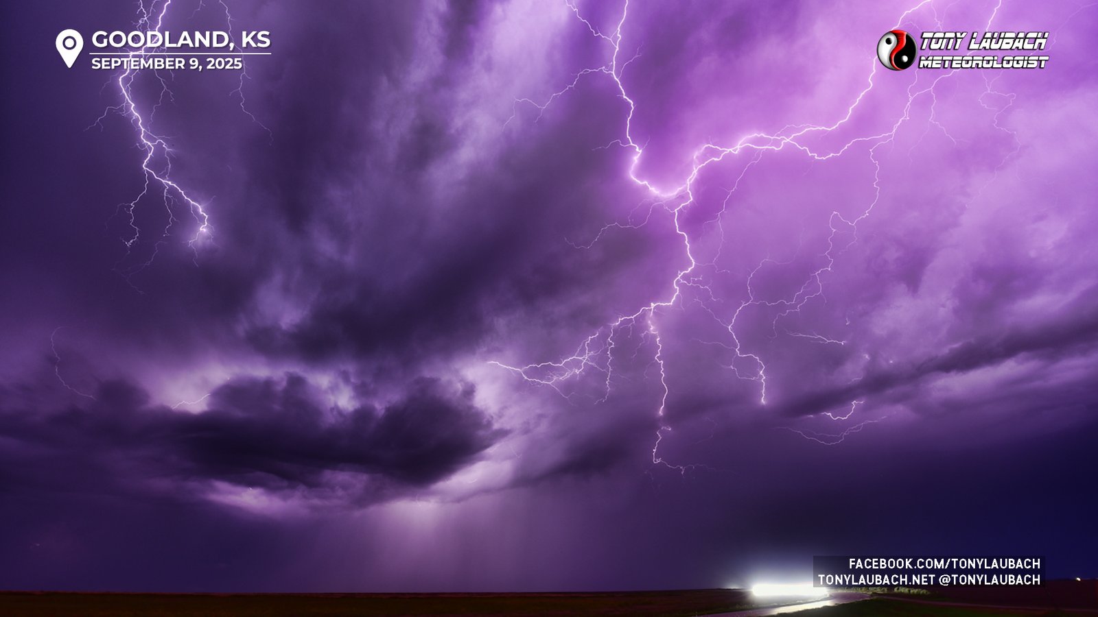
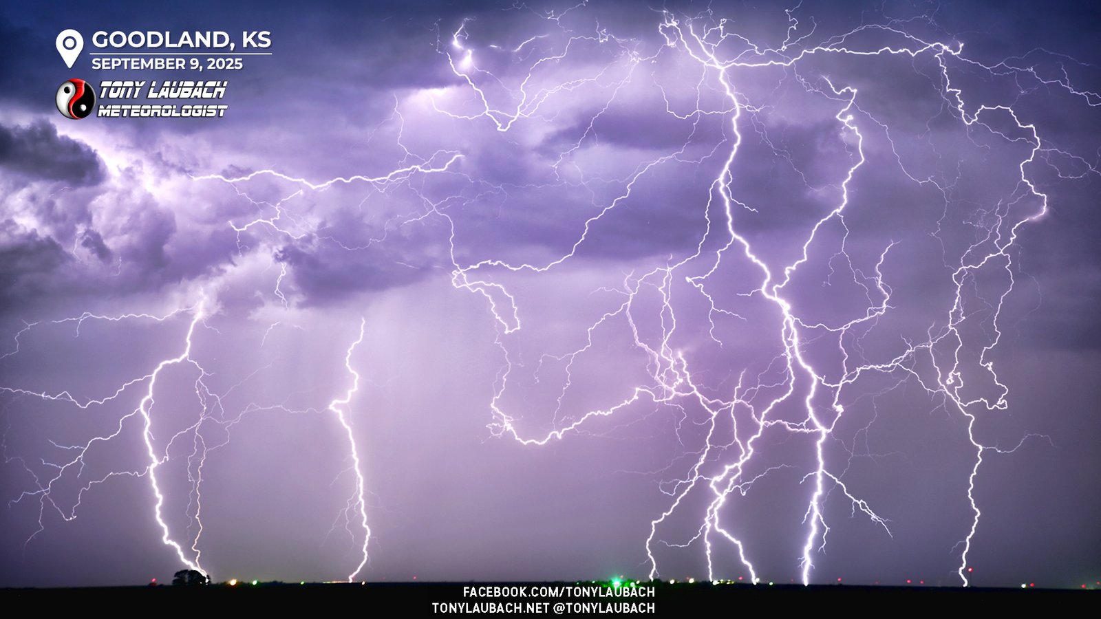
More disorganized storms were closing in on Goodland, and I could occasionally see faint CGs well off to my northwest, so I decided to get myself a bit closer, getting to about 2-3 miles south of Goodland where I found a solid vantage point looking west and south at the approaching storms. Lightning was flashing in three different directions of me, and while the CGs weren’t flying yet, I’d see the occasional one dart down. The cloud-to-cloud continued to be the main thing, but suddenly off to my due west, CGs began to explode. I had two cameras going, one with my 12-24mm, and the other with my workhorse 24-120mm. I kept the wide angle going, but decided to take a chance and extend the full 120mm in the direction of the CGs and was immediately rewarded.
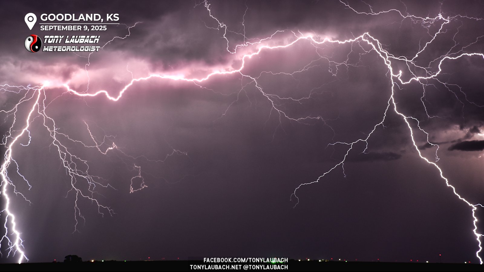
So perhaps I needed a little less zoom; I dialed back to 110mm given the previous shot was literally stretched across the entire frame. I wanted a little room to work. Turns out that would be the correct call as I had a small window of time where the CGs were nuts.
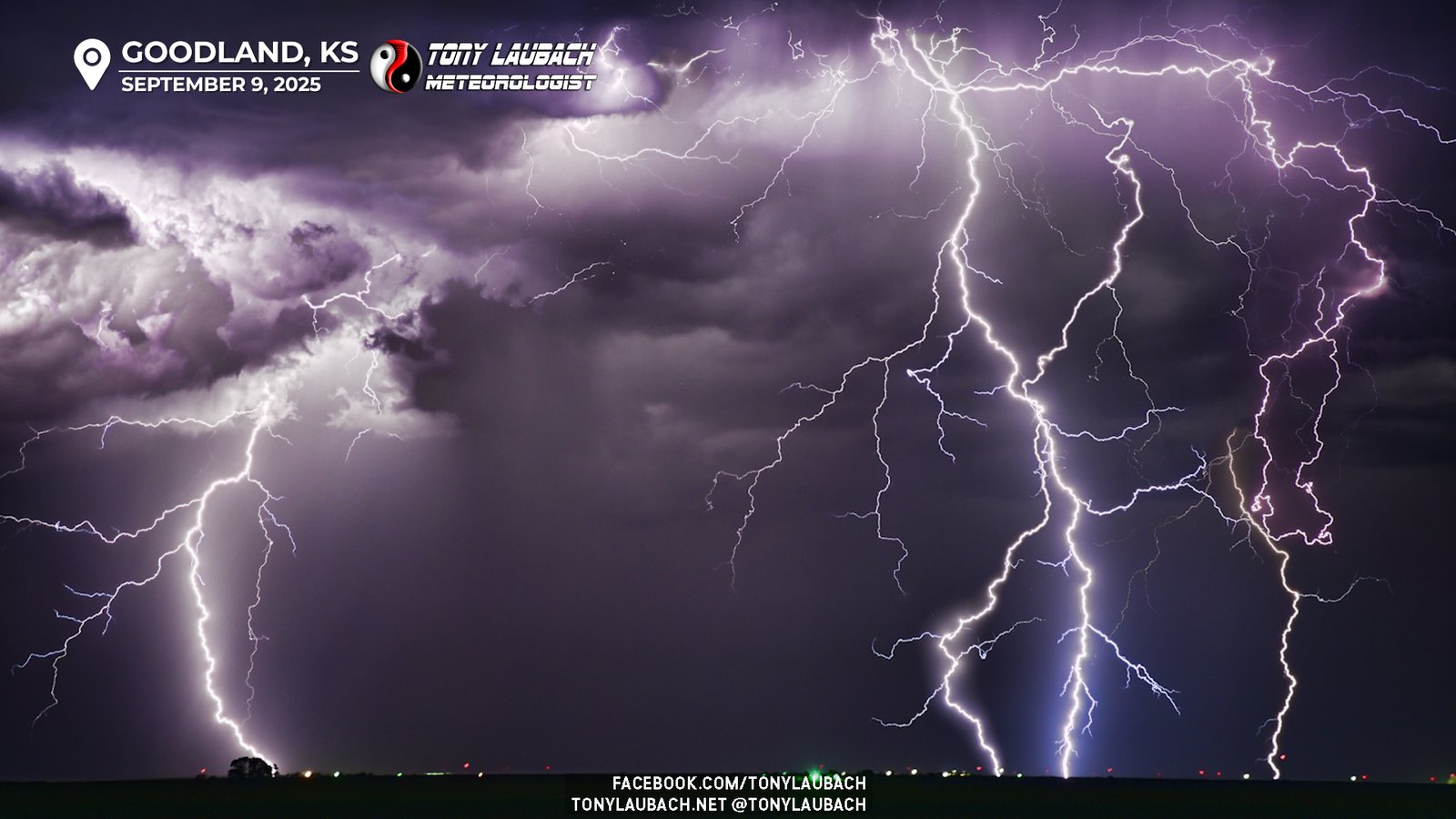
Meanwhile the wide-angle was doing its thing, capturing all these bolts from a much wider vantage point. While I was pleased with the shots, I would’ve loved to fill the top of the frame a bit more, but I will not be upset in the least over my haul.
This CG window was fairly short, only about 5-10 minutes or so, but it provided my best nighttime shots of the year, hands down. I stacked a chunk of images from the 110mm zoom session into a composite, and love the results.
After the CGs either died out or were hidden behind precip, I snapped away for another 10 or so minutes to see if I would pick up a second window of CG opportunity, but alas, that did not materialize. The storms to my north and west were weakening and ‘developing’ further south, so I was content to call it a night and head into Goodland, staying in the same hotel I did the previous night before heading back home the following morning.
I have been waiting all year for a good chance to shoot some nighttime lightning, but despite an active monsoon season, there have been virtually NO opportunities for it along the Colorado Front Range. And my previous chases have not yielded a good opportunity, so while I’ve made out well with my daytime stuff, the nighttime shots were lacking. That was until this chase. I was elated, particularly because I was very much wanting this opportunity, and going into this chase, I knew there were going to be later rounds through this area, so it was in the back of my mind all day. So as soon as I ended my daytime errands, I was rarin’ to go for this, and the hour or so long investment to set up and shoot paid off HUGE and was the icing to what was a wild chase day.
September is a slow month for tornadoes for me as I have not had much success in that department, but occasionally I will have a chase to remember during this month, and this certainly was one of those. The intense hail-rivers in Burlington to the awesome structure over Sharon Springs which led me to a respectable hail intercept and eventually to my best nighttime lightning of the year. An A+ chase all-around on a day that started out very low-end marginal. These are the chases you end up loving the most!