A rather incredible chase day across southern South Dakota where I tracked a storm through the Badlands National Park, my absolutely FAVORITE National Park in the Country, hands down. I make it a point to go through here at least once a year if possible, and for the SECOND time in 2020, I found myself here, but this time, for a chase!
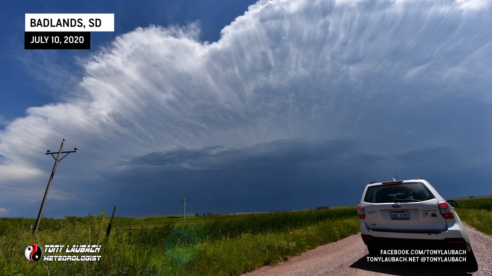
The storm I ultimately got on formed just west of the park. I planted myself on the north side of the park south of I-90 on SD-240 watching as this storm blew up to my west. It was moving south, so it lead me straight into the park, where I watch this storm among the incredible rock formations of the Badlands.
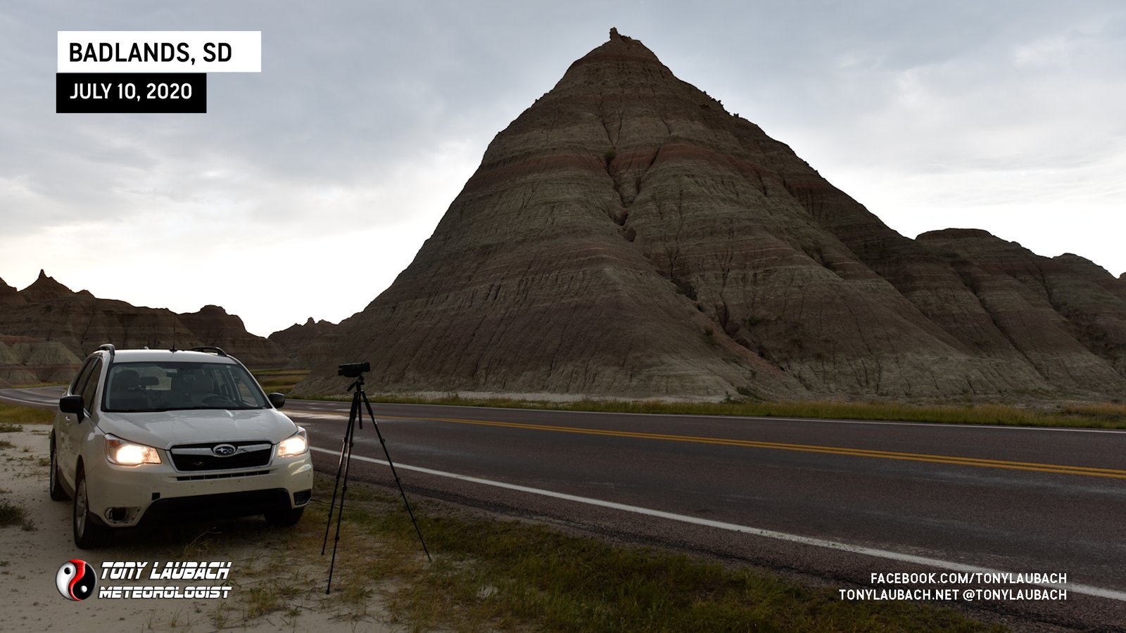
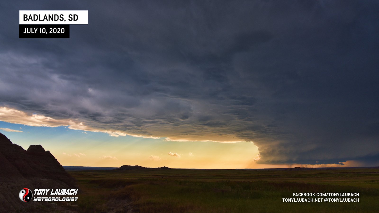
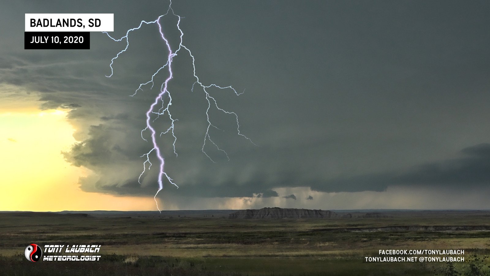
The storm was on a path that was going to take it to the west and south of the main park as it was moving southeast. I spent as much time as I could among the rock formations trying to catch various shots since I was not to actually experience any part of the core of this storm in the park as it would miss it, but I was perfectly fine with that.
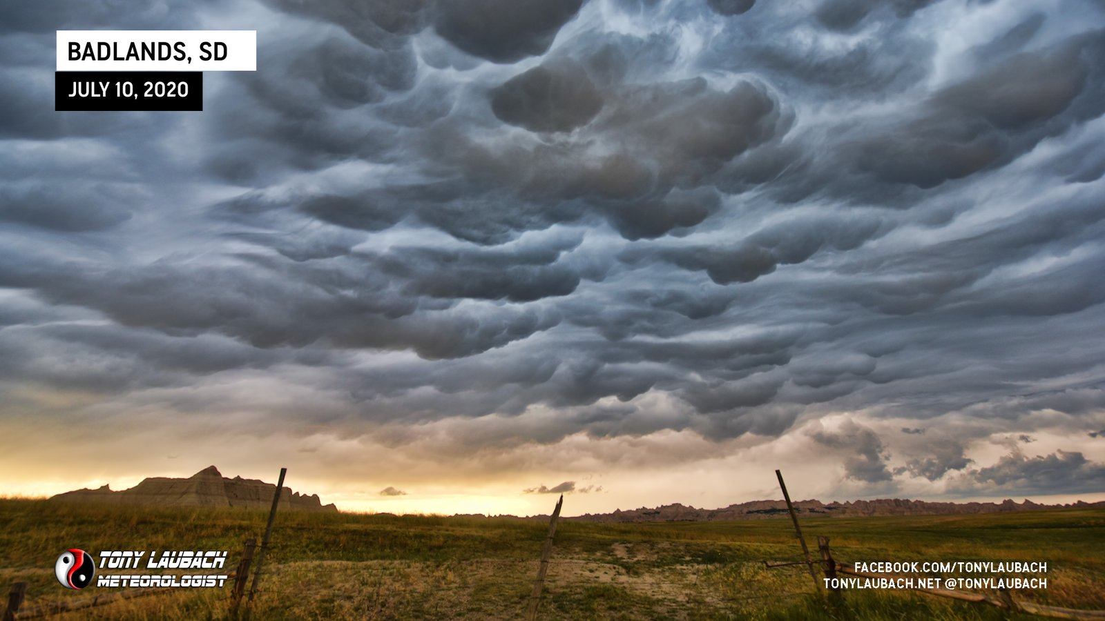
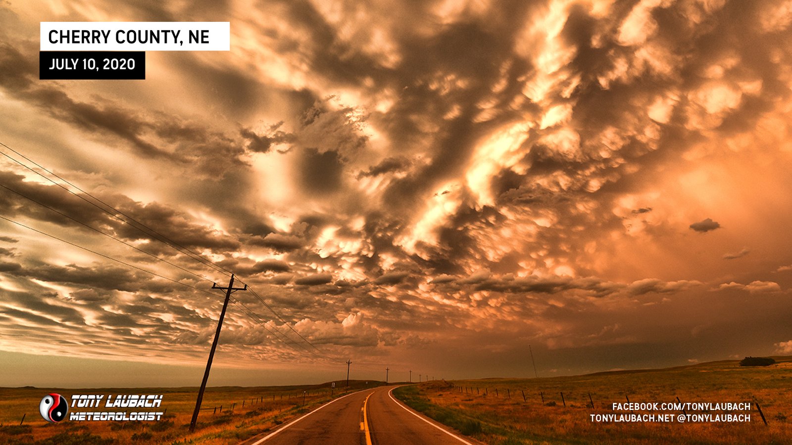
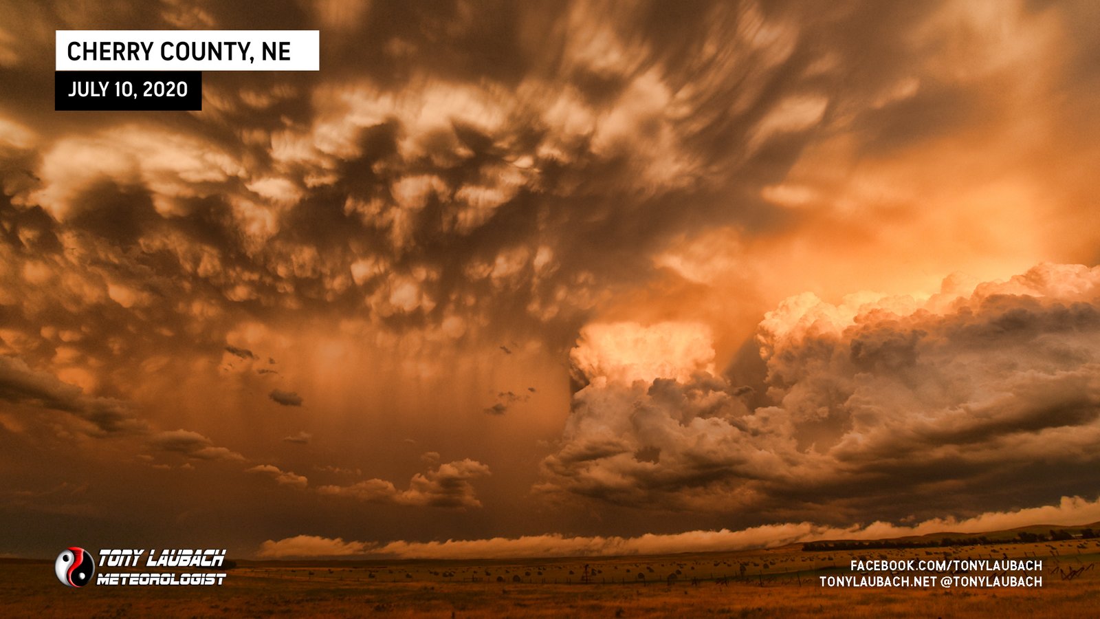
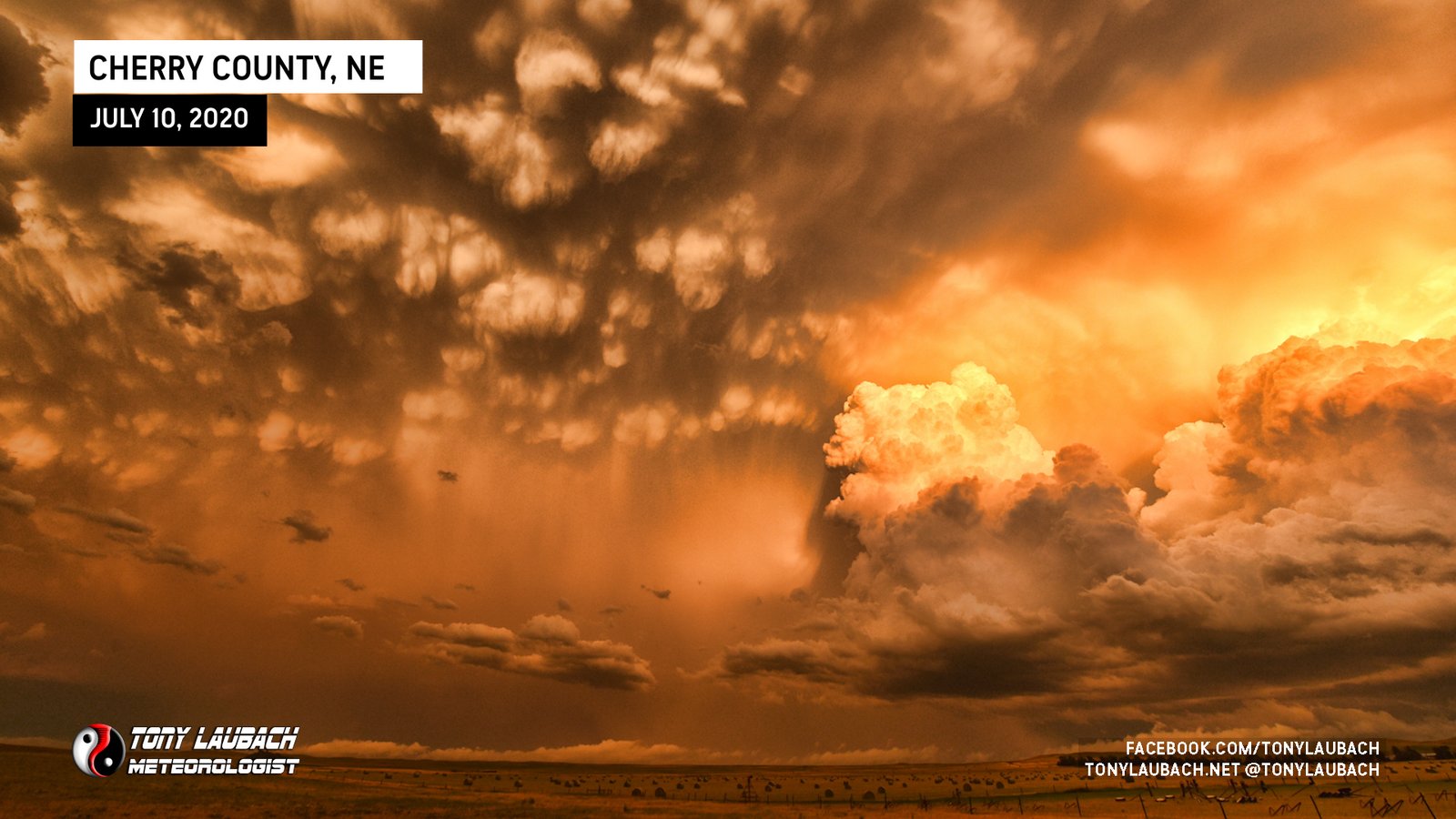
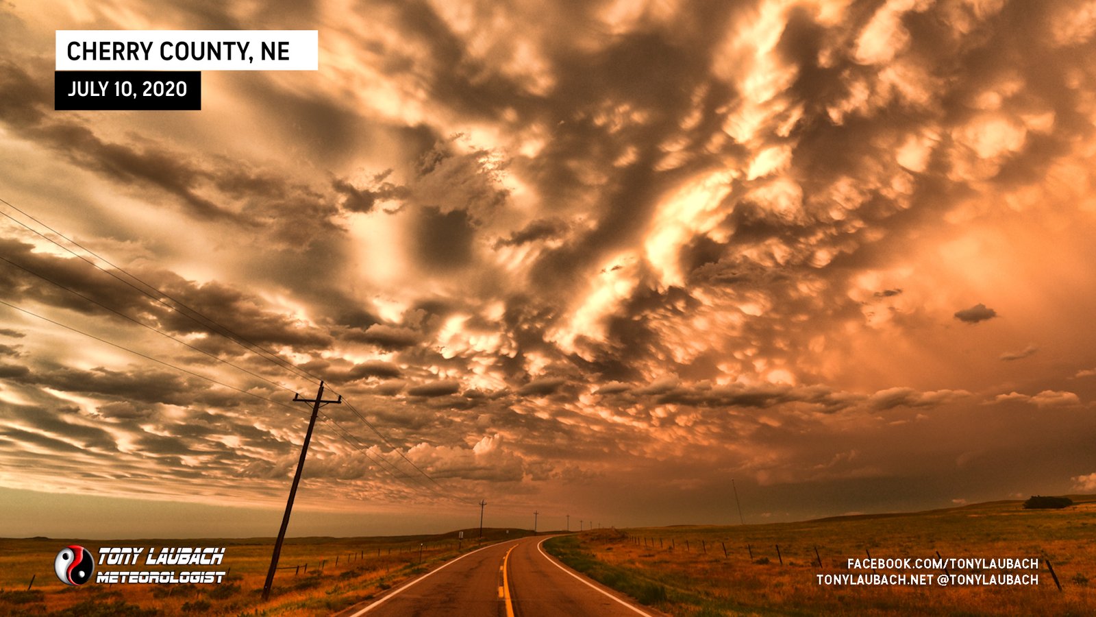
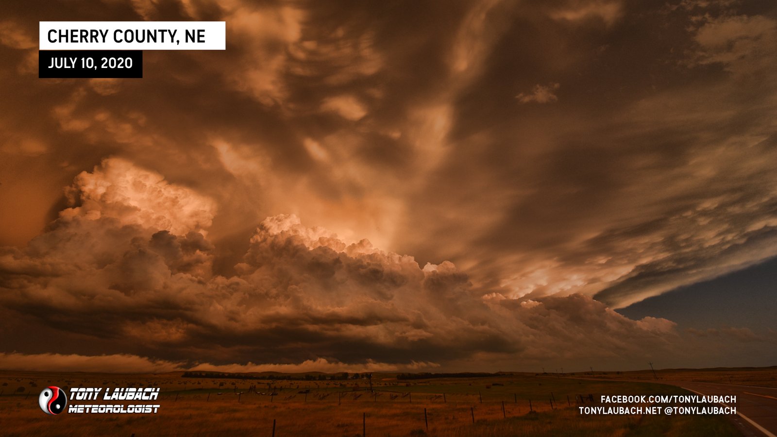
As the storm slid south of the Badlands, the mammatus in its wake were fantastic. I couldn’t help but stop and grab a couple shots.
At this point, it was now a race to get south back ahead of this monster. I dropped south out of the park via SD-44, cutting over to Wanblee and eventually south on SD-73 toward Long Valley. My hope was to beat it to US-18 just north of the state line, and I needed to get there and cut west in time to get ahead of the core. My target town at this point was Martin.
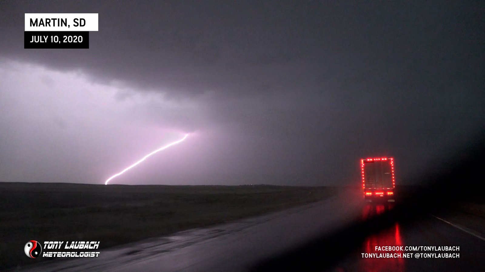
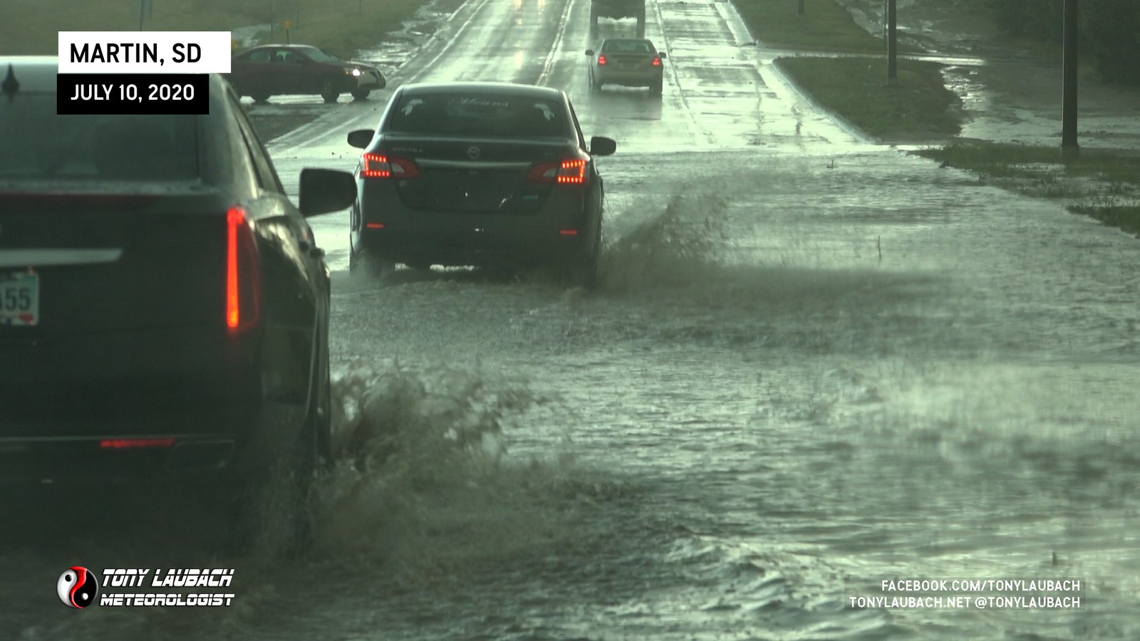
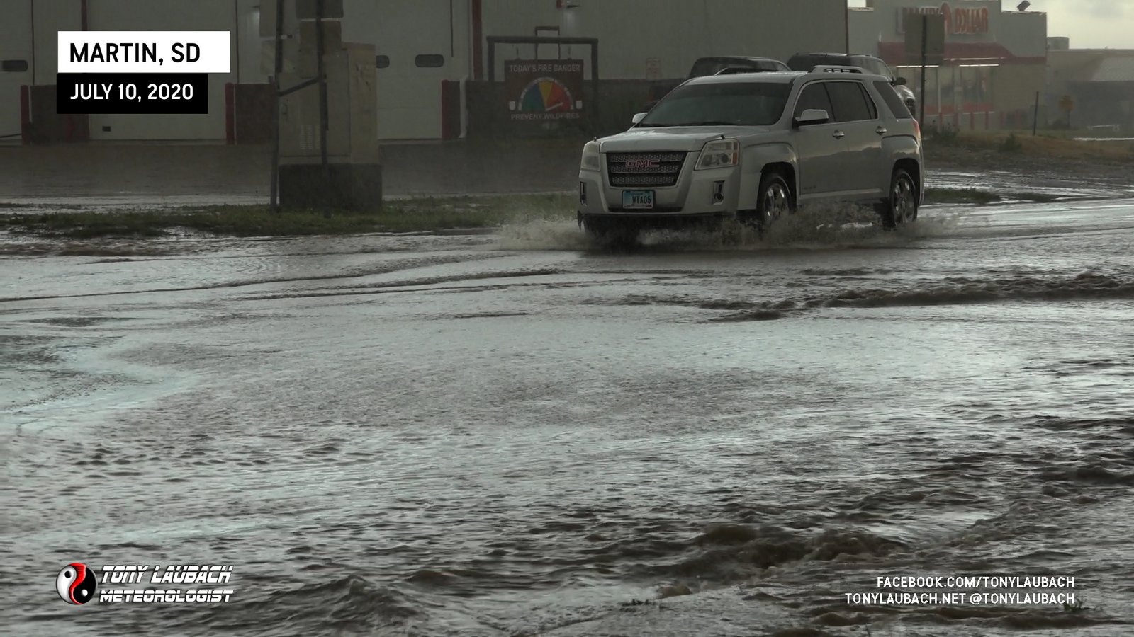
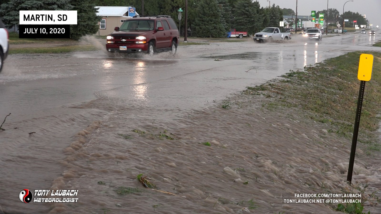
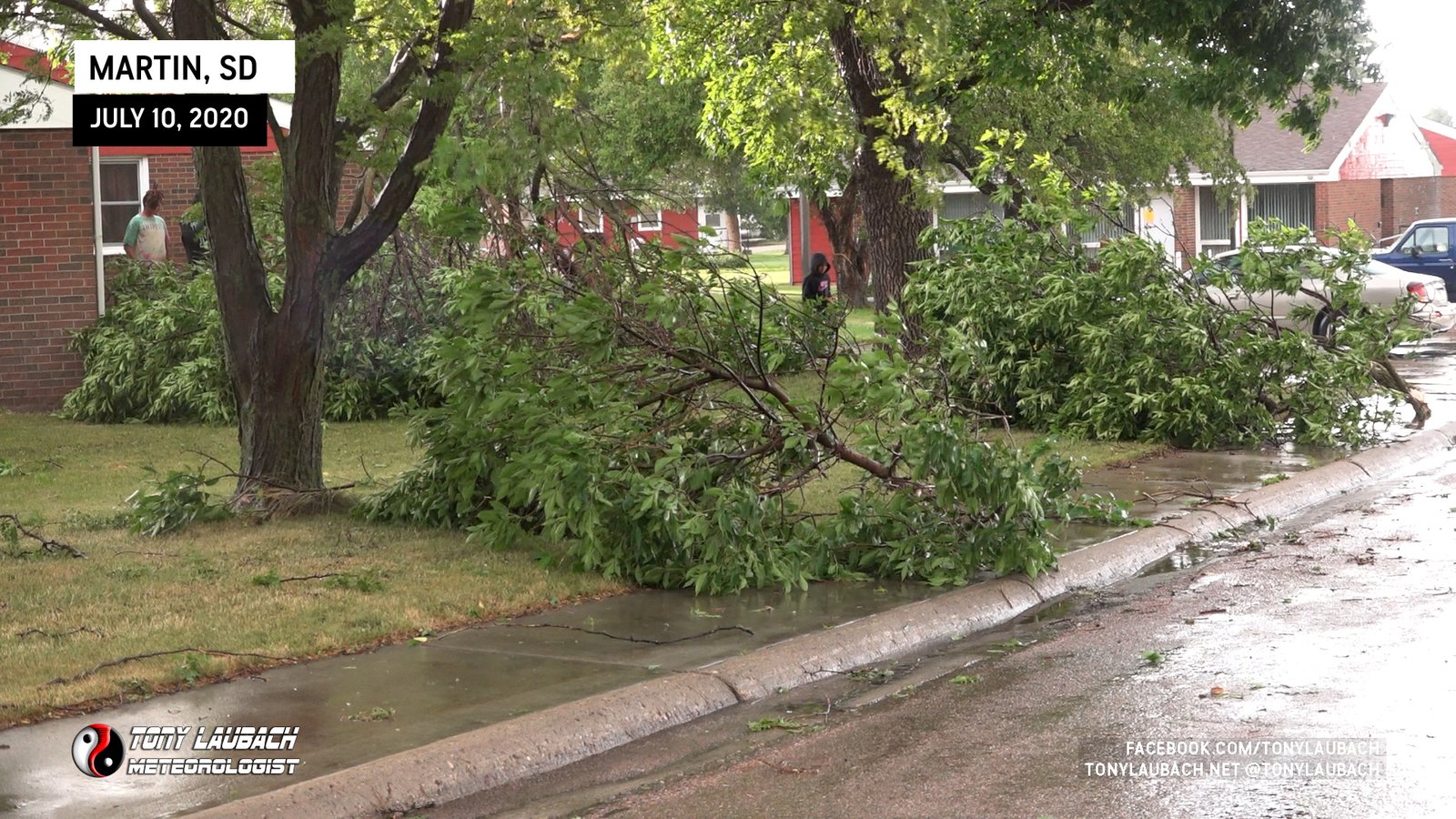
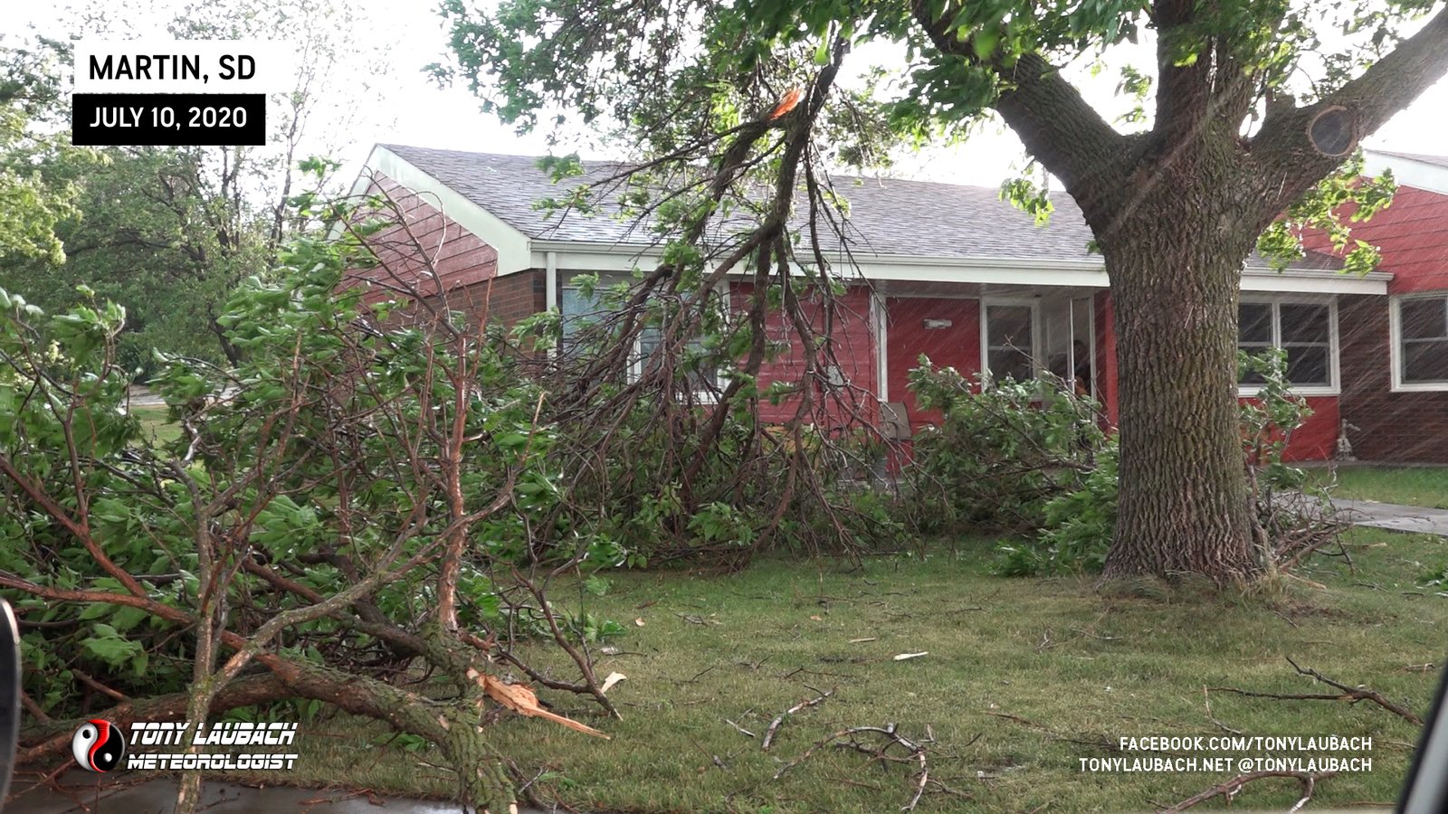
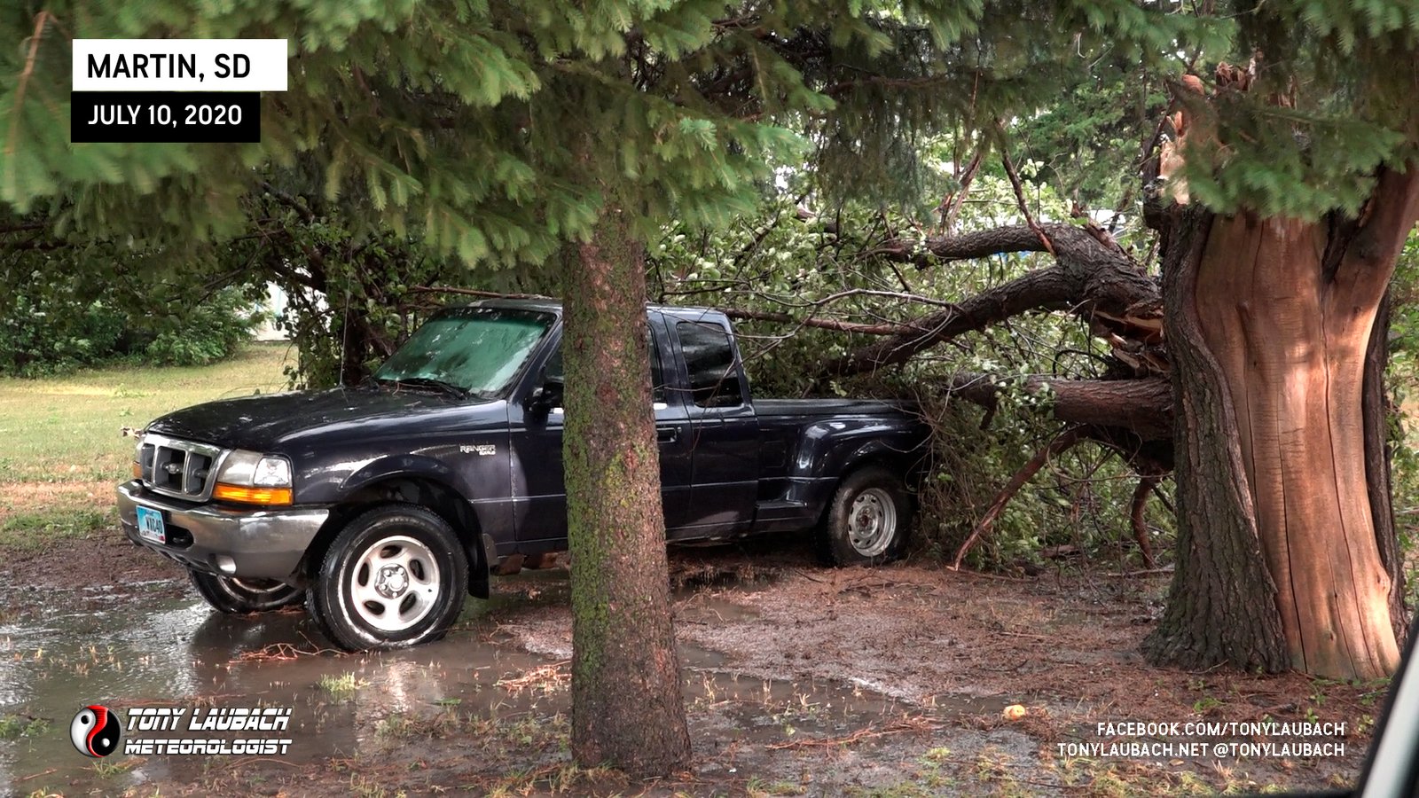
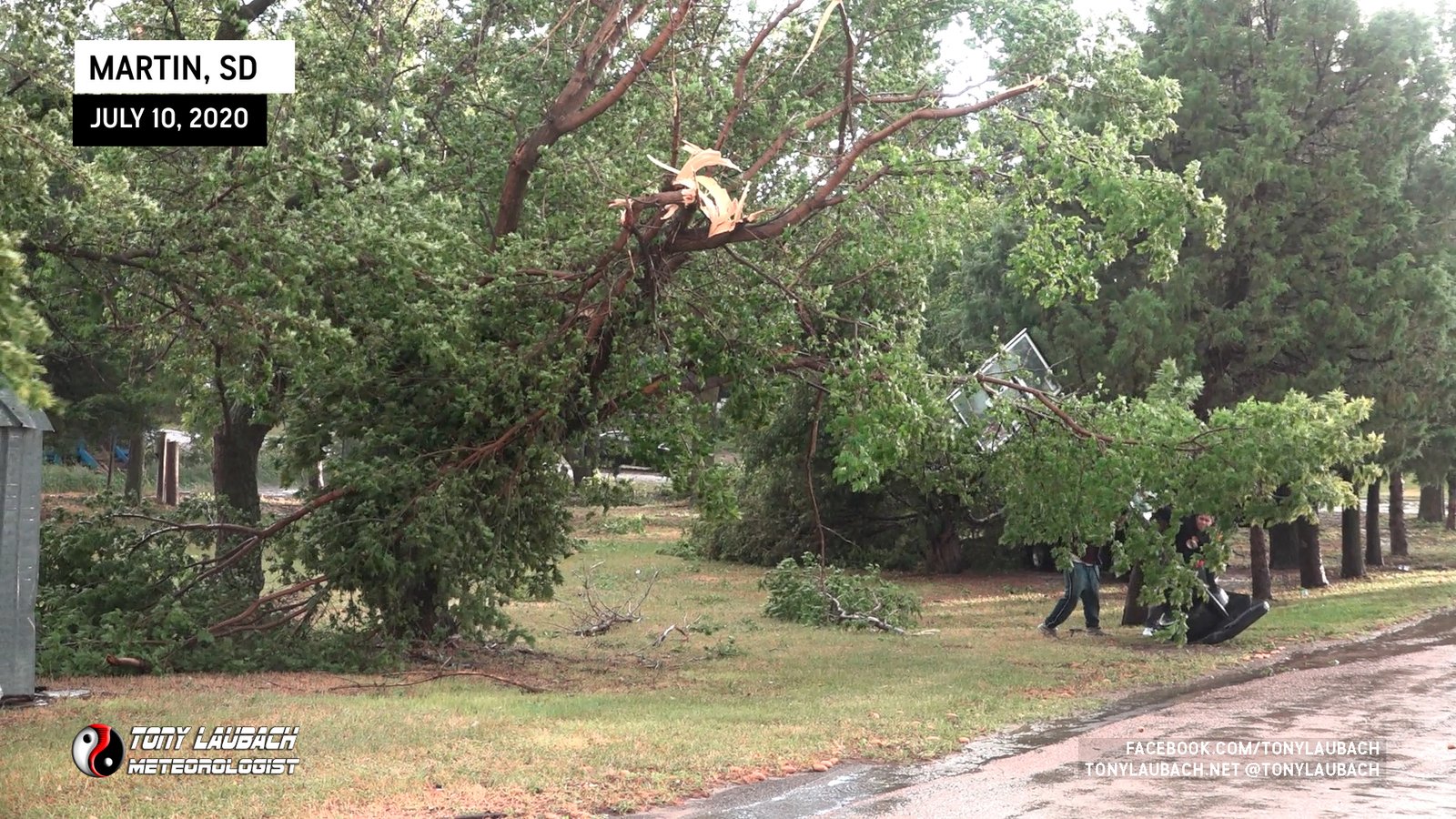
I was not going to make it into town as the southward moving supercell overtook me on the highway about 2 miles east of town. I’d estimate the winds to be between 60-70mph, perhaps a bit stronger. They ripped through with blinding rain, but no hail that I observed (or really heard for that matter). Once the winds and rain died down enough, I continued west into Martin where I documented some of the flooding and damage left behind from this storm.
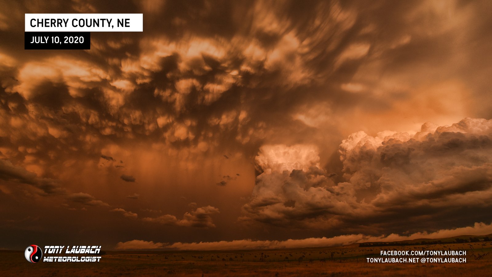
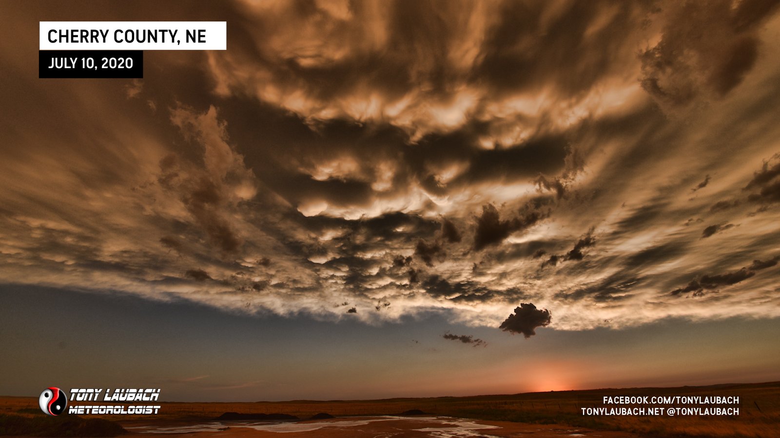
After about an hour or so in town, I gassed up and began my southward journey toward North Platte. I wanted to get down to I-80 and set myself up for the lower-end chase the following day, which was basically going to be a ‘scenic way’ home. However, the scenic was about to go absolutely nuts for me. Shortly after crossing the border into Nebraska, I was southbound out of Merriman as the sun was setting to the west against the cluster of storms to my east. I got about 10 miles south of Merriman on NE-61 and stopped to take in the jaw-dropping views.
After that spiritual experience, I made the three hour drive south to North Platte, arriving to my hotel and crashing out, very happy!