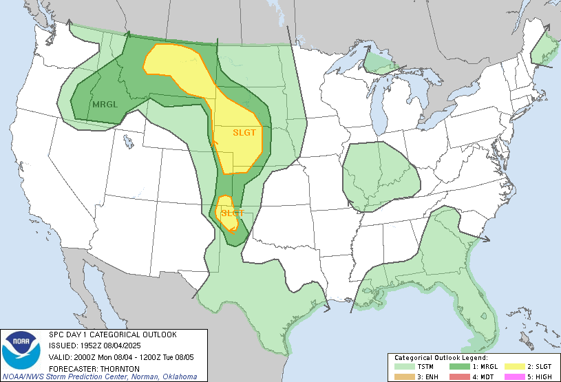
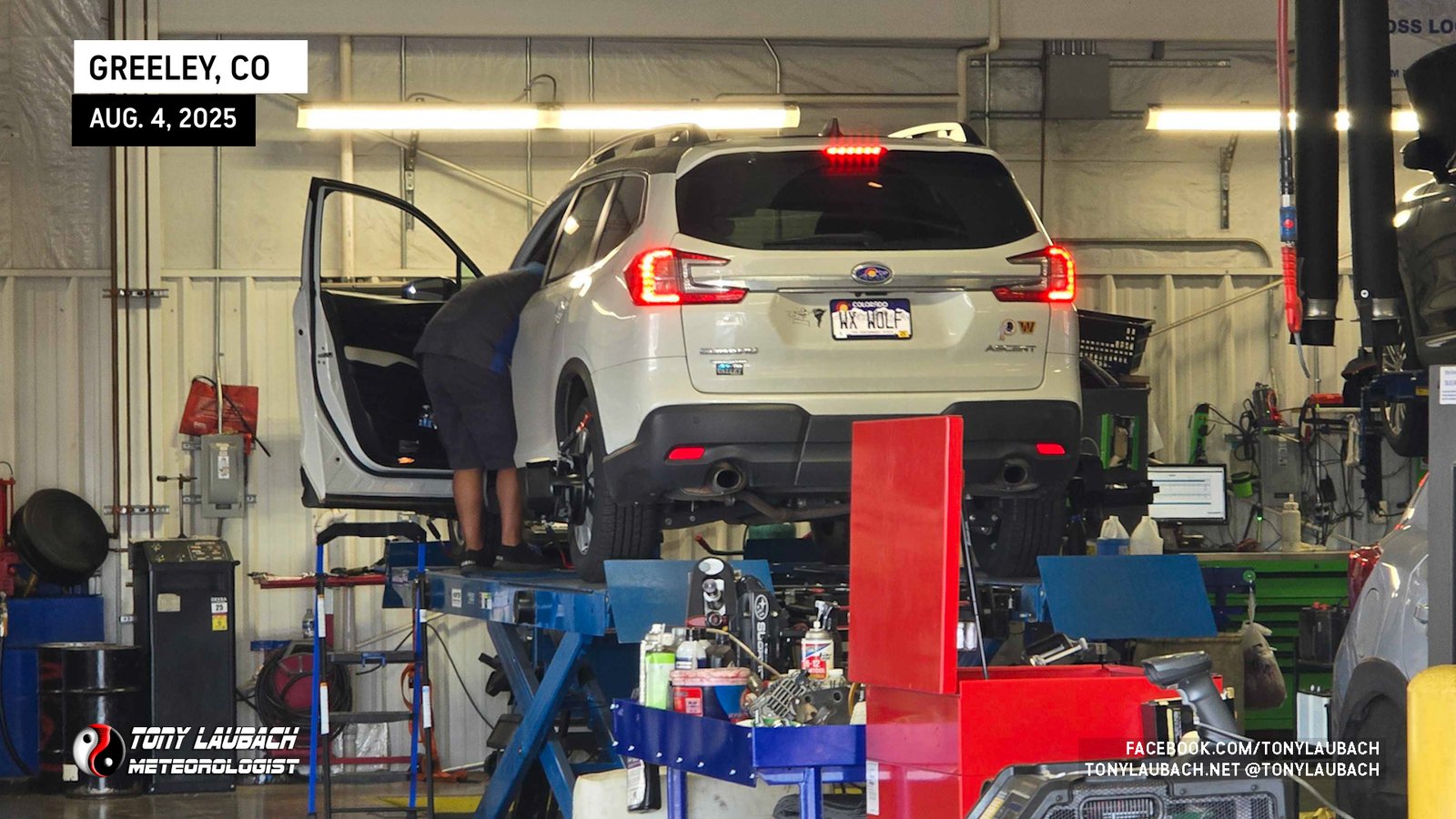
Not sure exactly what I wanted out of today when I got up in the morning. I had a 9:30am appointment at the Subaru dealership to get my seemingly bi-weekly oil change, plus the overdue alignment for the new set of tires I put on the week before. Something that should’ve taken no more than a couple hours. But as it turns out, I also had a couple busted struts, which were fortunately warrantied out, and included with it was the alignment, so the stars had aligned nicely for me. About three hours later, I was free to roam.
Given the shorter window to get to a target, mine was Kimball, Nebraska where most of the high-rez models were indicating the strongest storms in the area would fire. That timing was going to be about 3pm, so I knew, leaving at 12:45p from Greeley, that I would get up there with about 30 minutes or so to spare. Originally, I was going to cut over to I-25 up to Cheyenne, then cut over from there on I-80 as there was some indication storms may fire as far west as I-25 north of Cheyenne, so that allowed me the chance to be closer to initiation as opposed to my plan of being ahead of the developing storms.
As it turns out, I got goofed up with traffic and construction, and in my distraction, I went my usual way, heading east out of Greeley on US-34 instead. Since the time difference was minimal, I didn’t bother to correct and just went ahead and made my way up to CO-14 and eventually north on CO-71 with a straight shot at Kimball.
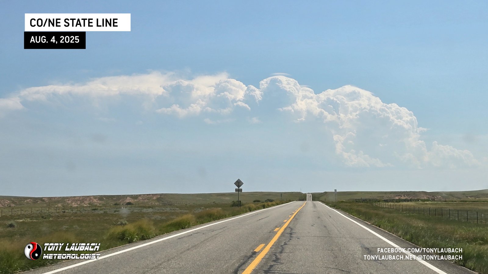
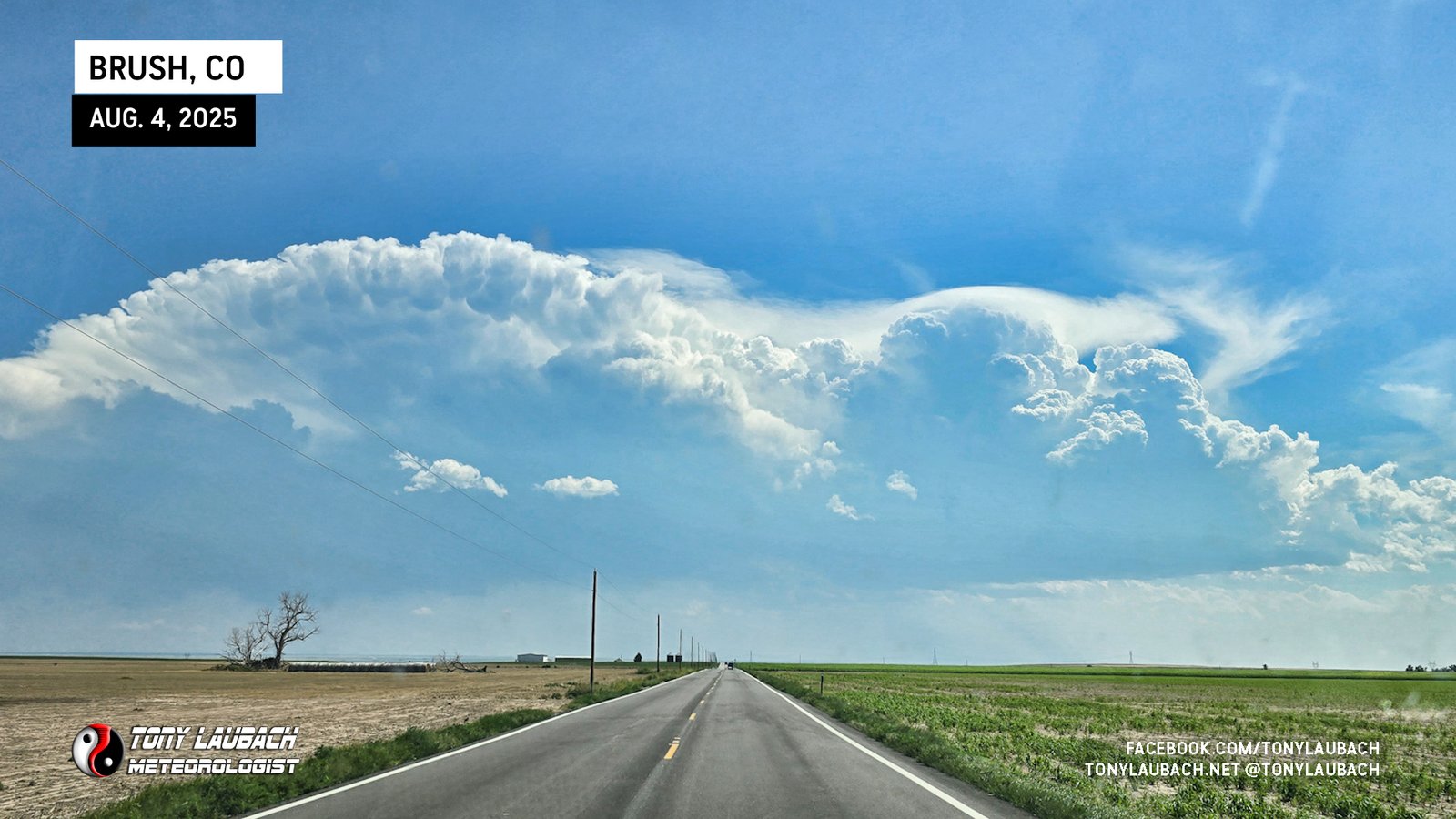
Well, as I was northbound on CO-71, a little over halfway between CO-14 and the state line, the first signs of initiation were occurring to my south near Fort Morgan. I gave it a few scans, and it was growing fast, definitely not a fluke, and was enough to give me pause at the state line. Glancing at visible satellite, it was evident that my Kimball target was in no-man’s-land, with the closest area of interest between Wheatland and Torrington, much further north than I was motivated to go. And I figured, early storm, early prize, right! And it’s closer to home. So with the biggest reason being laziness and the potential to turn an early day, I flipped around and retraced my treads southbound on CO-71 with eyes on Brush.
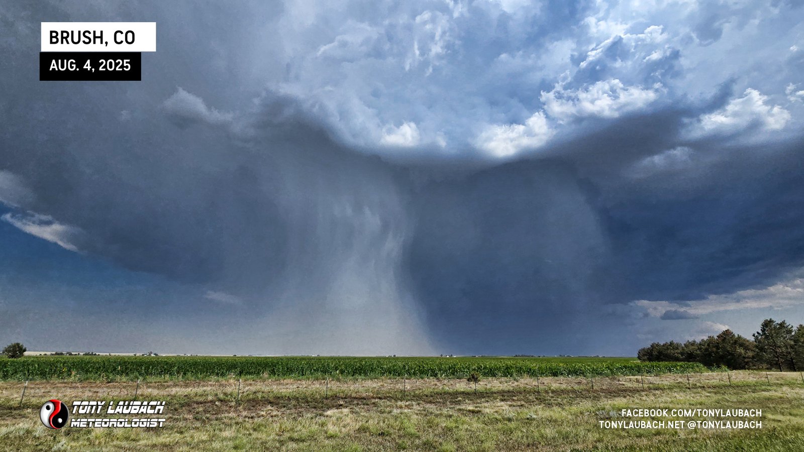
The updrafts were impressive, and despite several weakening cycles on radar, the storm was holding its own. I had about 45 minutes to cover to get down south of Brush. I hit the CO-14 junction, made the quick east jog, then back south toward town.
I got into town and grabbed a couple video clips for work, and a glance at my gas tank now approach 1/4 tank, I SHOULD’VE filled up then, but another radar scan indicated rapid intensification about 10 miles south of Brush, and with very little movement to the south, I decided to go ahead and bank south to see what I could find in terms of hail. Honestly, I wasn’t planning to do much with this as for over an hour, the storm had remained sub-severe despite several scans indicated a pretty intense core.
So through town I went, getting about 10 miles or so south, the core wasn’t terribly impressive on radar as it had weakened on the few scans while I was enroute, so I decided to get in and see what was coming down.
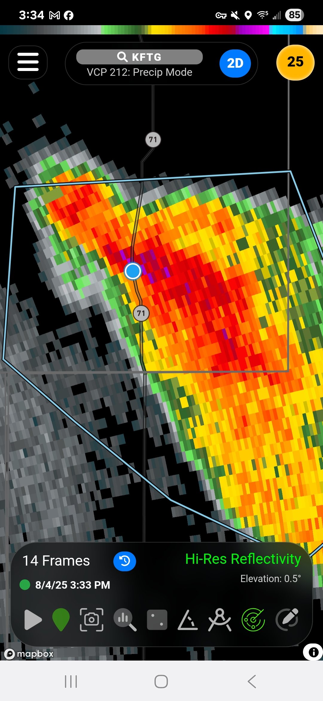
To my surprise, though, there was some decent hail in there.
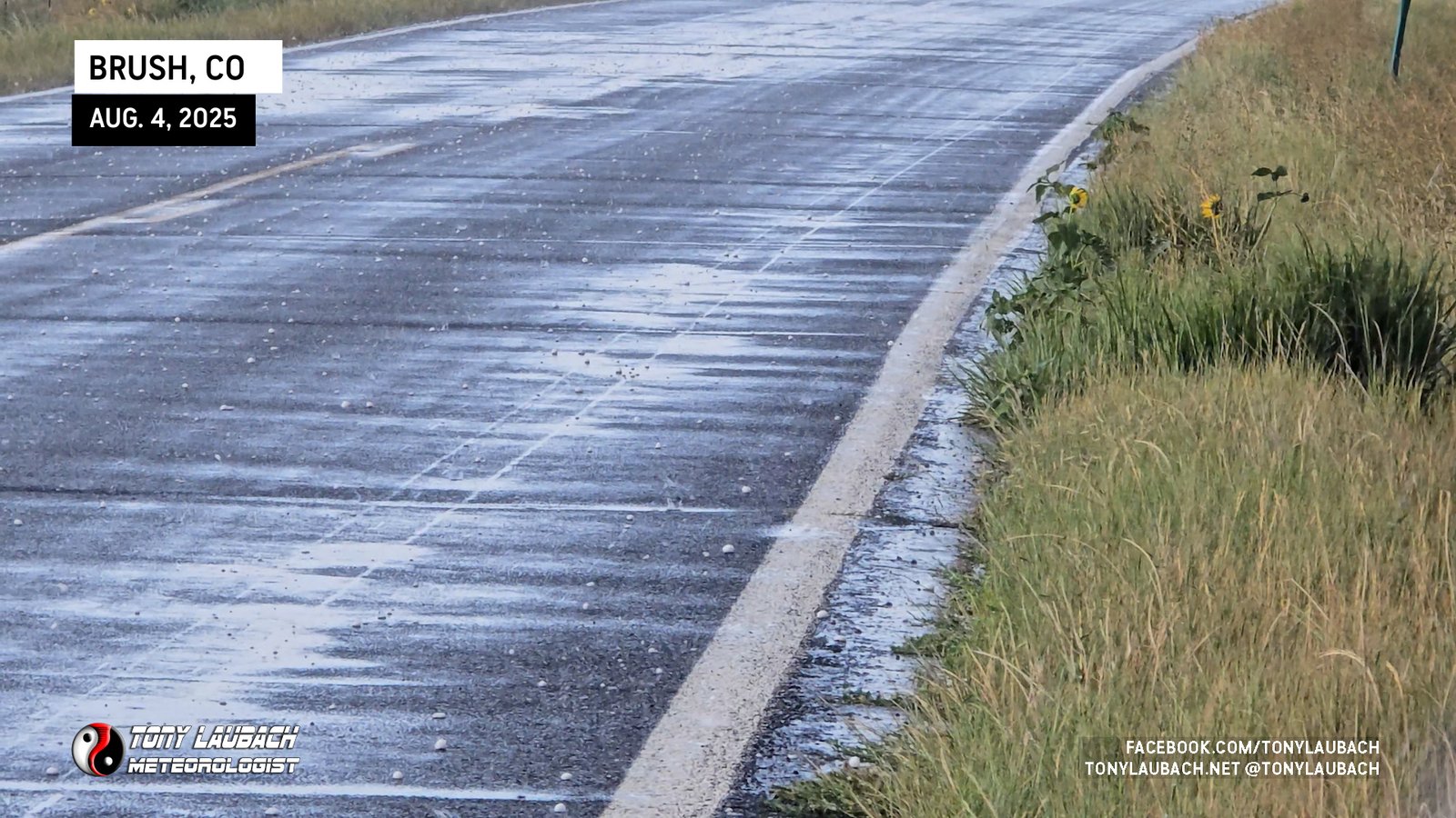
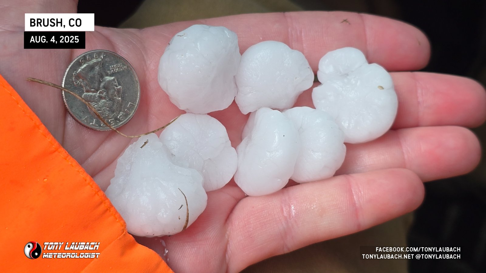
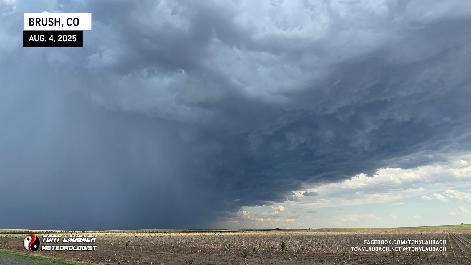
The hail wasn’t terribly heavy, as indicated by radar, but what was falling was technically severe, a couple stones exceeding 1″ in diameter. I danced up and down CO-71 a bit, sampling various parts of the core as the storm CRAWLED to the southeast. When the hail moved east of the highway, I grabbed some of the bigger stones in my area and submitted my report to NWS Boulder.
I poked east on a couple dirt roads as the core had again re-intensified. Despite my report, NWS continued the ‘Special Weather Statement’ on the storm, not warning it. But deeper purples in the core indicated either bigger or more hail was falling. Unfortunately, east of CO-71 are nothing but dirt, and the heavy precipitation of the core started to make the roads more cumbersome, and about 3 or so miles east, I opted to NOT take my chances on the mud.
After flipping around, I worked my way semi-slowly back to CO-71, and upon my arrival to pavement, recalled my gas situation. With the storm moving south/southeast, VERY SLOWLY mind you, I knew that it was heading into a gas station void and I would likely be pushing my luck if I continued to pursue this storm on my current levels. Brush, only about 15 minutes to my north, would offer me that chance, and given the storm’s forward speed, still allow me an intercept and a chance to get ahead of it down on US-36, so I decided to make that run and head back to Brush.
Made the easy haul back to Brush and stopped in at the first gas station I came to upon getting back into town. I started the fuel fill-up, ran inside for a couple beverages, then came back out to a full tank and was ready to re-engage on the storm to my south.
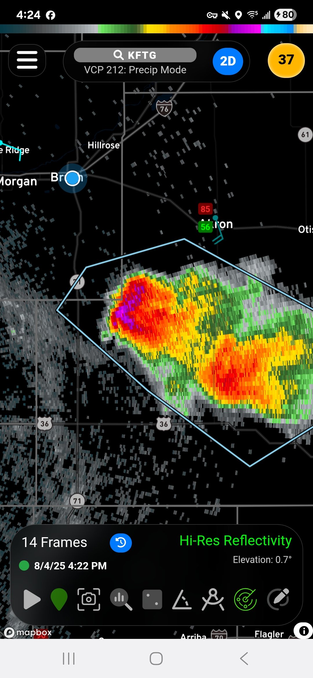
My one storm had split, now two distinct supercells, and neither warned yet. I proceeded south with the initial plan to try and get even with the western cell, which was displaying a hook and some mid-level rotation. The storm was still high based, so I wasn’t terribly excited on tornado potential, but still wanted to ensure I was looking at the right part of the storm. Fortunately the cells were moving about 15mph, so they were easy to catch back up with. But the new problem was the western cell, my closest and easiest intercept, was weakening while the eastern cell was strengthening. But FINALLY, starting with the western cell, NWS pulled the trigger on severe warning both.
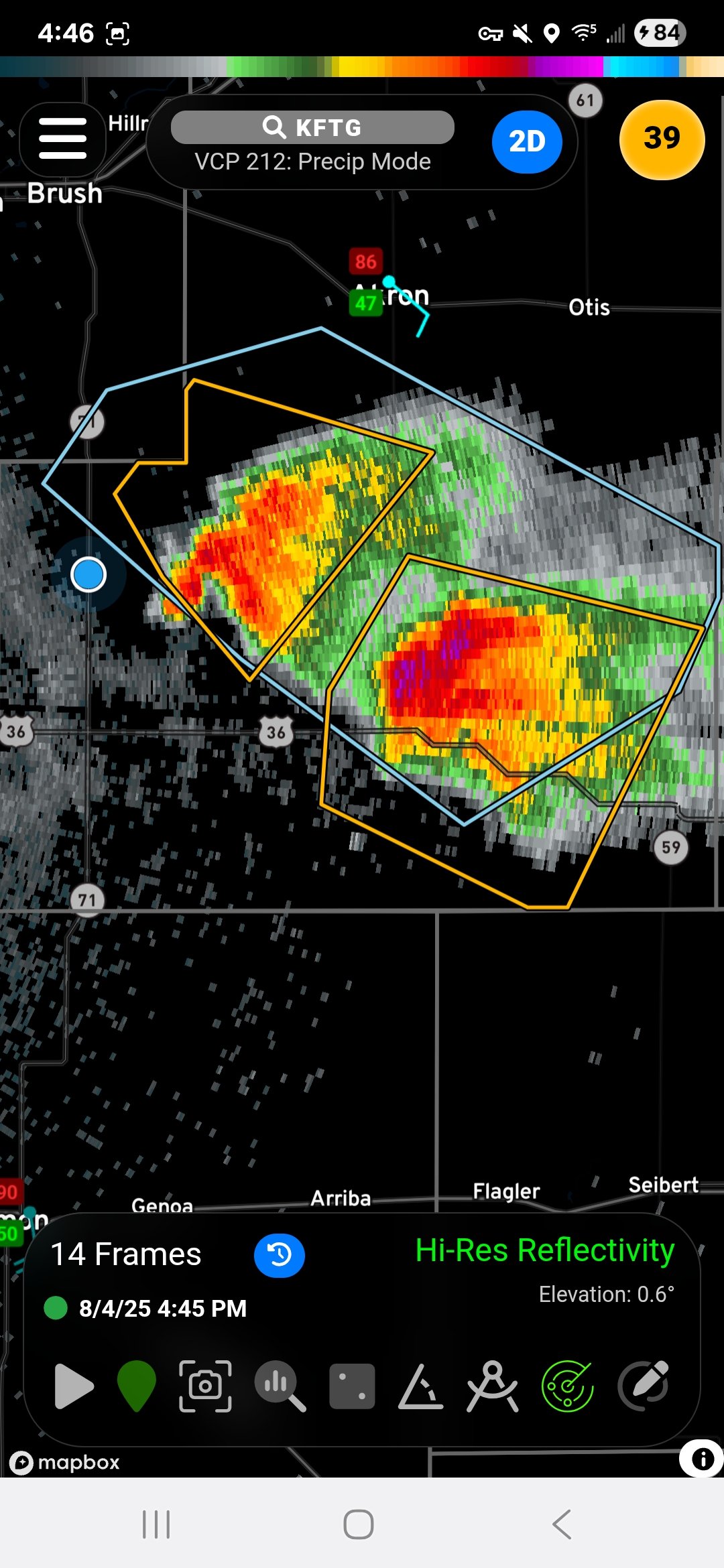
With the western cell still north of US-36, my new objective was to get in front of that cell. I was struggling with a plan to get the eastern most cell in play, so I was trying to take it one mile at a time. I got to the US-36 well ahead of the western cell, which had re-intensified while the east cell was cycling down a bit.
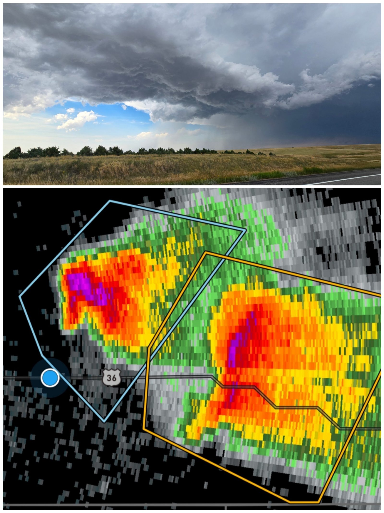
The western cell wasn’t striking me as particularly strong, despite the radar presentation. I mean, I knew it had hail, probably bigger than the warning indicated, but it really looked like it was going the wrong direction. The eastern cell, which now was well in front of the western cell with plenty of clean air in front of it, was now my new objective. But there was a problem…
The only paved option I knew of was CO-59 south out of Cope, unfortunately that was too far east, and would require circling around the entire storm, and was going to take time. There were two other routes prior to that I was eyeing; a south option out of Anton which lead down to Arriba along I-70, and a few miles east of that, a southbound option out of Arickaree that dropped down to Flagler. The Arickaree route seemed destined for a messy ride, particularly if it was dirt as the brunt of the core, and potentially big hail, was going to be more a threat there.
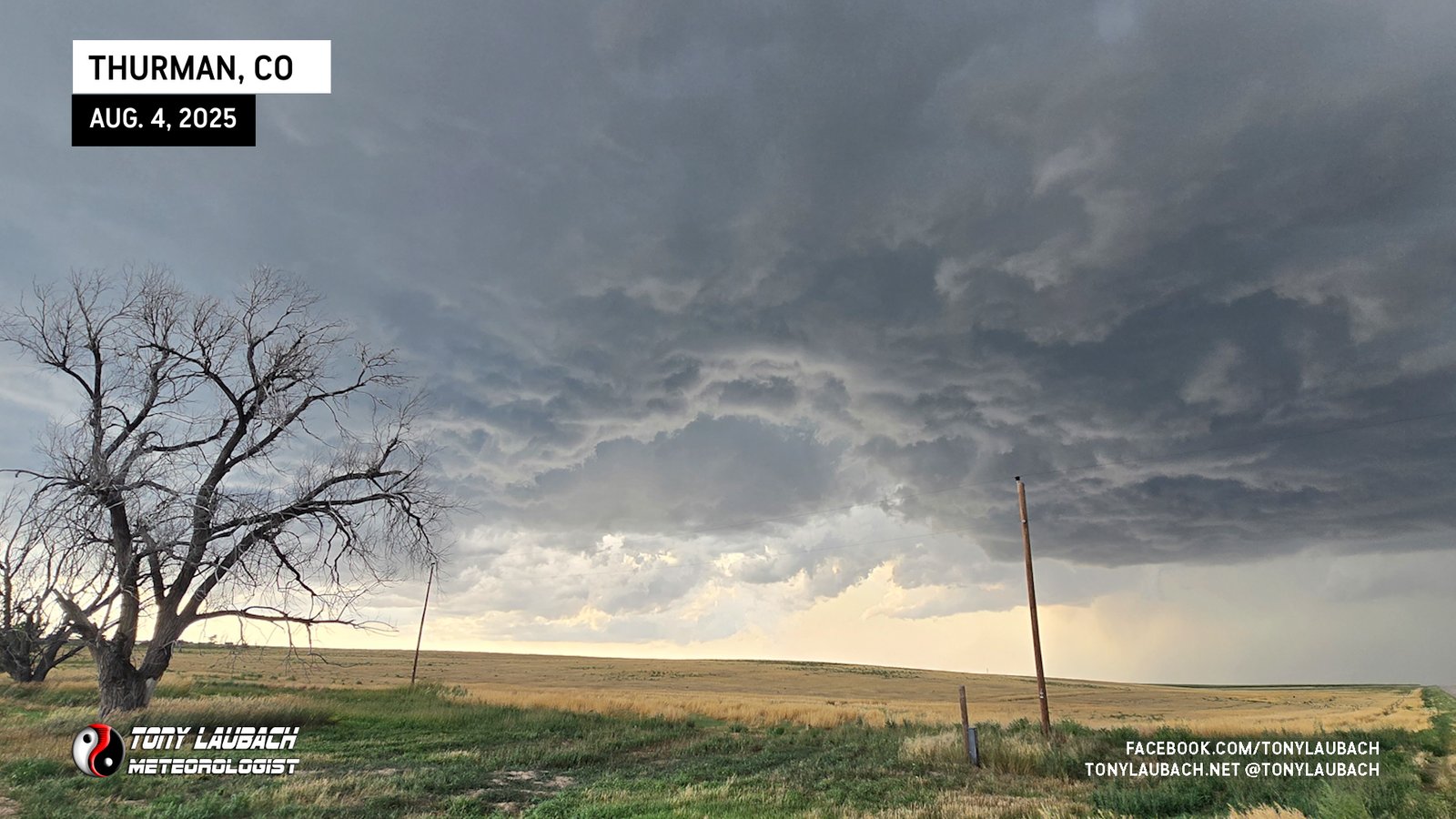
Meanwhile, the core, which was just a hair to the east of the southern route out of Anton, gave me confidence that I could indeed get down in front of this thing. So after a brief stop to yap with another chaser, I turned south on County Road CC and away I went. I was feeling pretty good as the first few miles were pavement, but that turned to dirt quickly. The rain hadn’t been too heavy on the road at this point, and the road seemed pretty well packed, so I continued on. Unfortunately, the storm, while having a small easterly component to its mostly southerly track, was back-building to the west, and with it was a new heavy hail core that was starting to overtake the road.
My concern then began to compound. Not only was wind-driven rain making the road slicker and slicker, I was now getting to increasingly heavier hail. At first, it was manageable, mostly 1″ or less, but as I got further and further south, the storm further and further intensified, bringing the hail size up to what I was guessing was probably at least two-inches. I knew I only had a few miles I needed to get to get clear of this core, and the final couple were the most butt-puckering as I saw a few of what looked to be tennis balls. Fortunately for me and my ride, the bigger stones were pretty spaced out, and I didn’t take a hit.
I put a couple miles between me and the core, relayed my report to NWS, and took a minute to decompress, seeing a couple other chasers gathering south of the storm. I conversed with a chasers whose plates read ‘HAILNO’, to tell him NOT to go north or he’ll be ‘HAILYES’. The skies were turbulent, with varying degrees of unorganized, chaotic rotation, but nothing that looked imminently tornadic. At one point, I did see a high-based funnel, but it was brief.
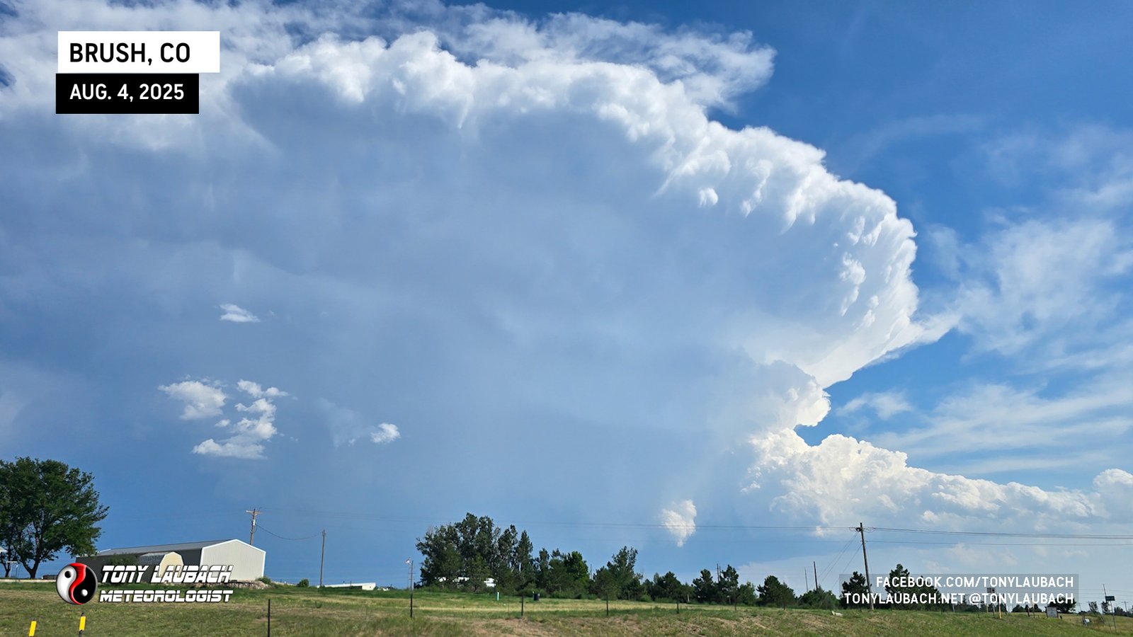
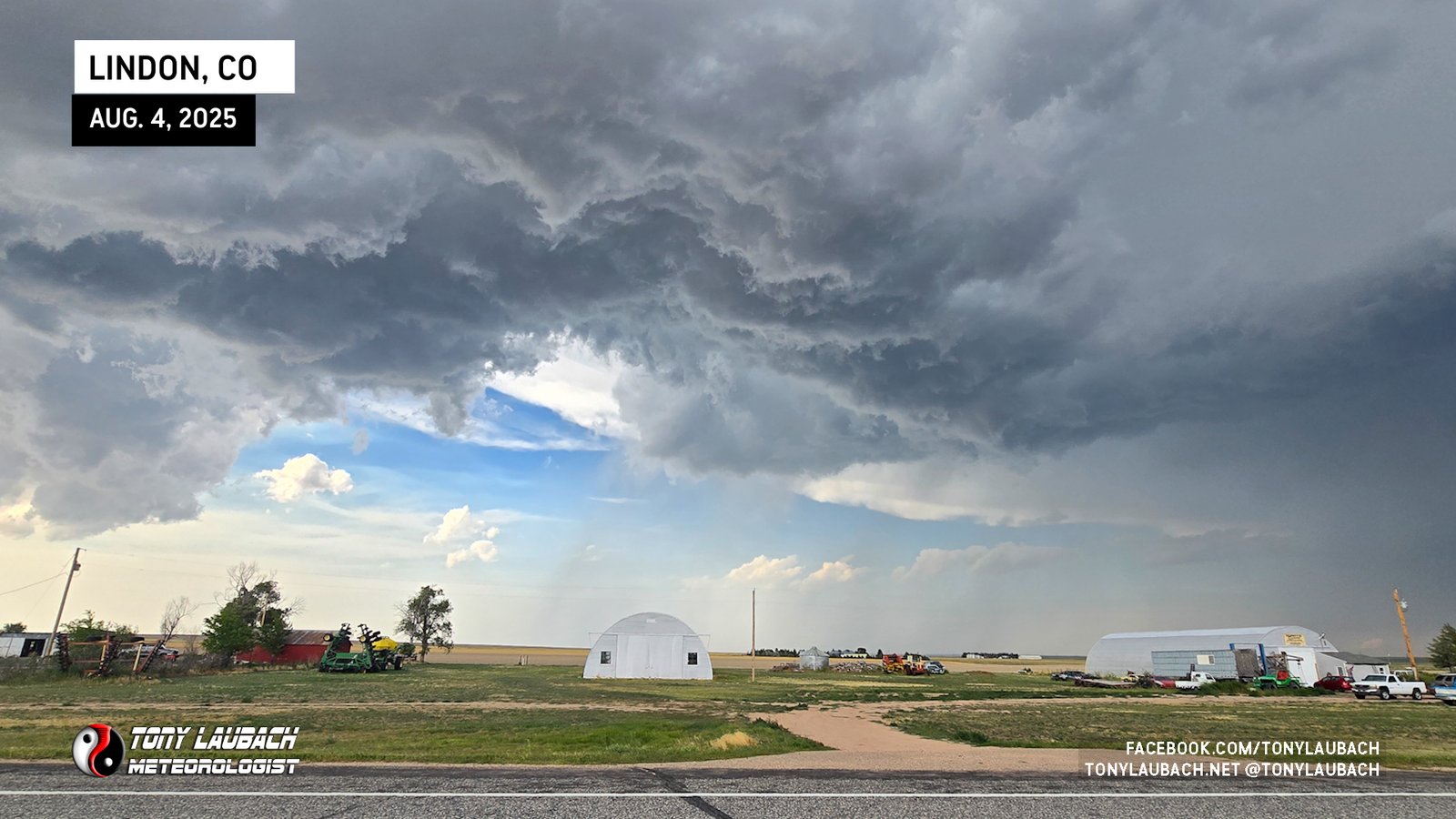
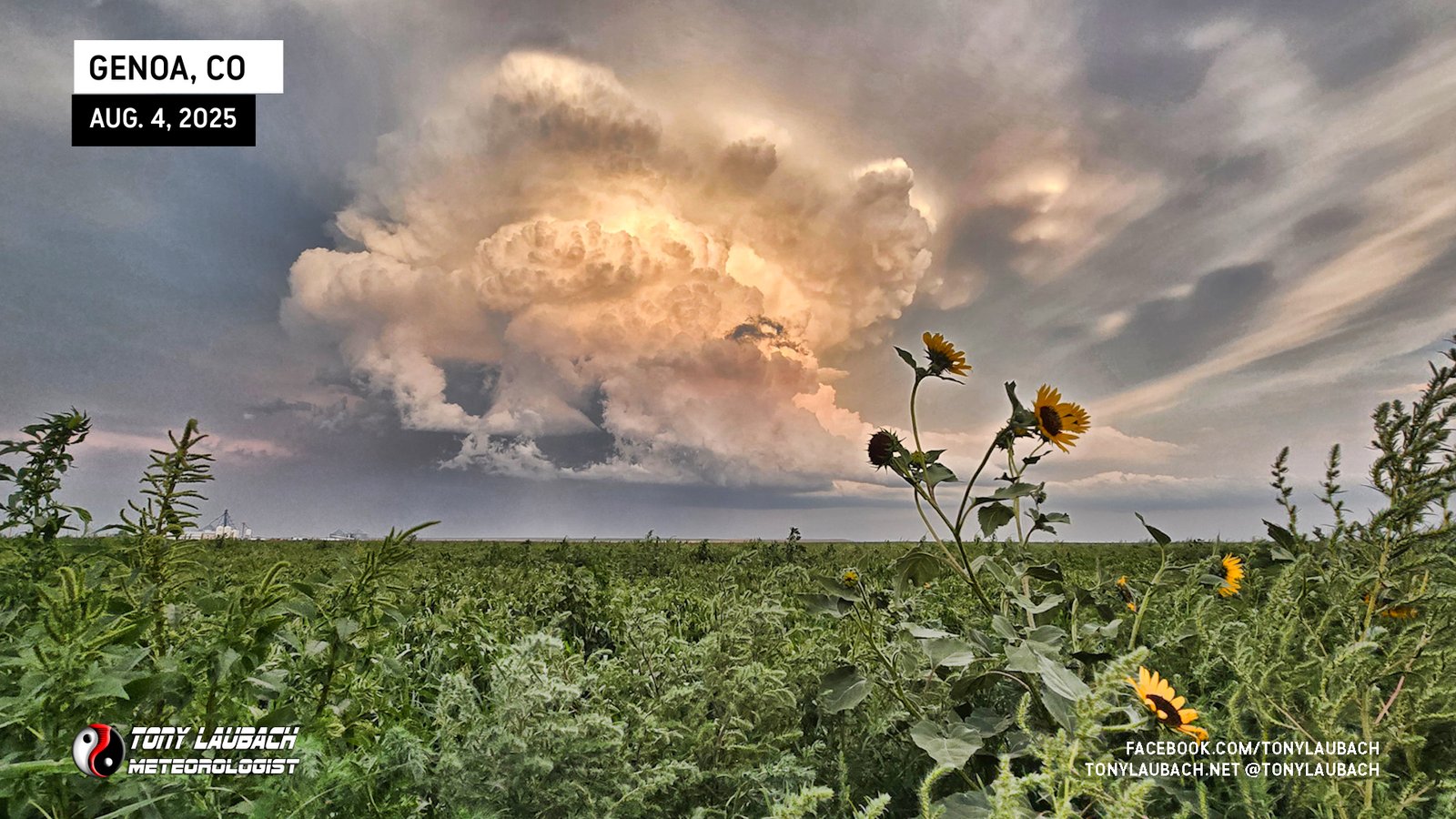
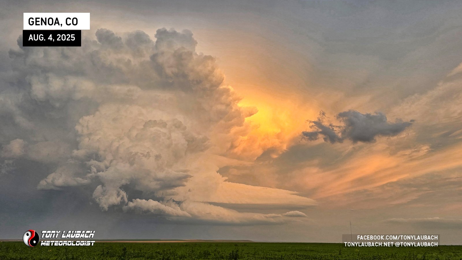
The hailcore still approaching, I banked south again a few miles, and put a little more distance between me and the storm, finally stopping to see the incredible structure that developed from this new western development.
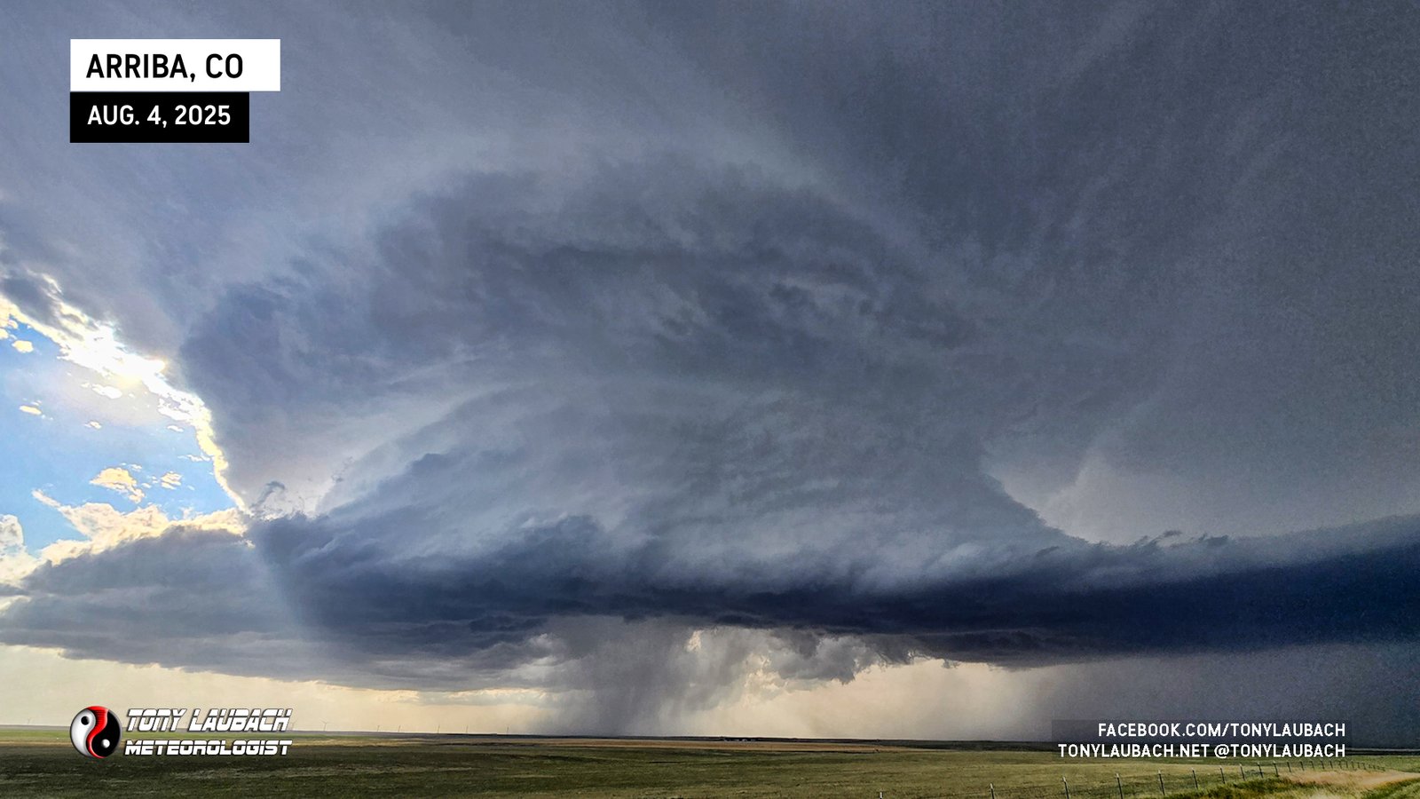
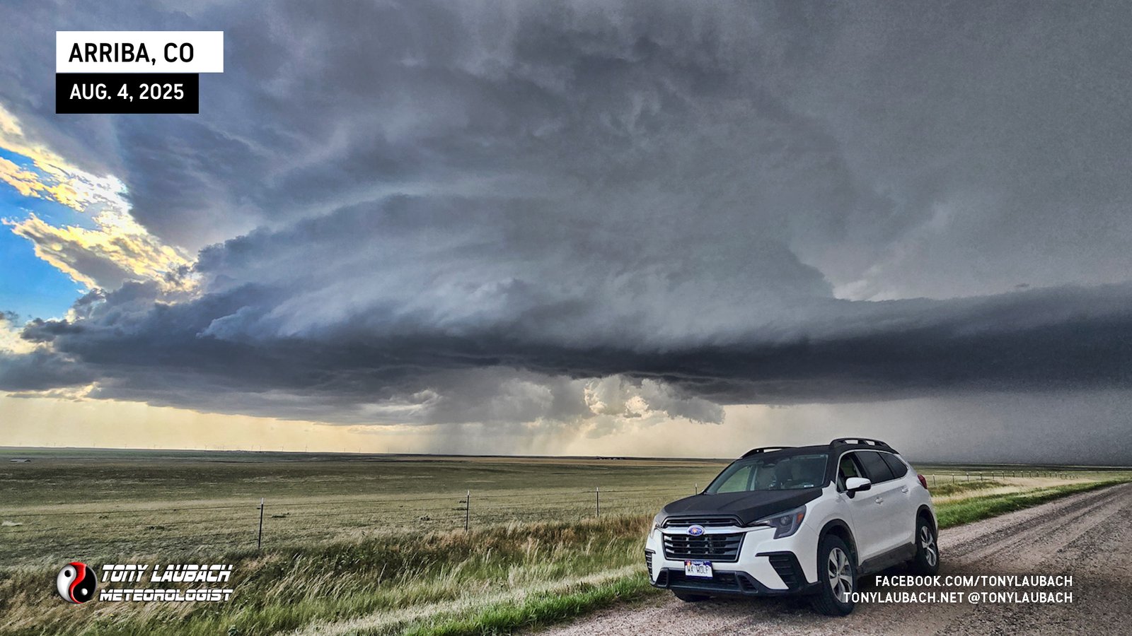
It was an incredible sight behold, and honestly took me by surprise, but that’s what you get when you’re right up in its grill. You don’t see the wider picture. And with this still not blowing me away with any tornadic potential, I was now poised to play the hail. Structure like this, you know there are some biggies in there, so my plan was Arriba, and see if there would be any shelter to take on some of that hail.
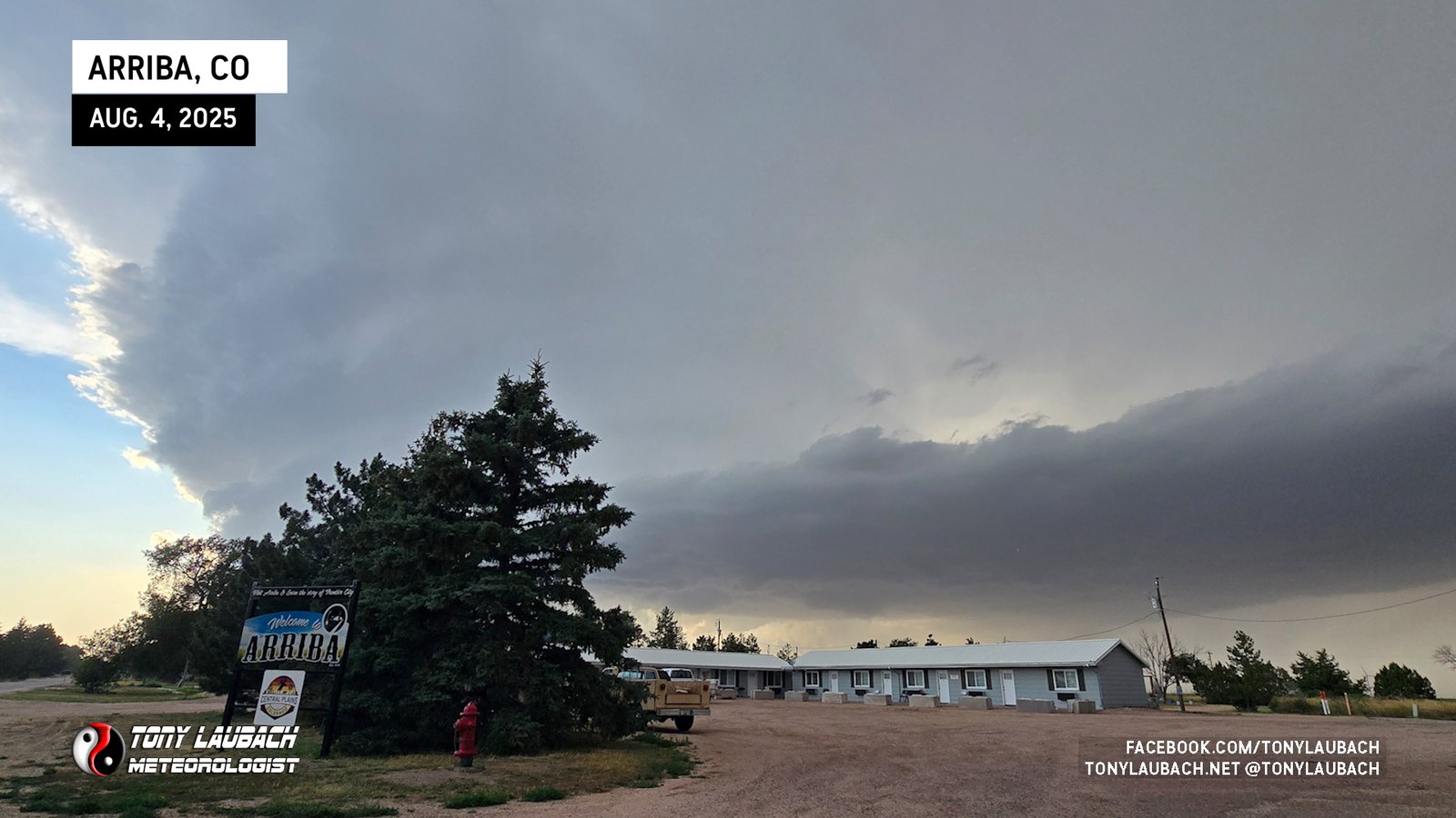
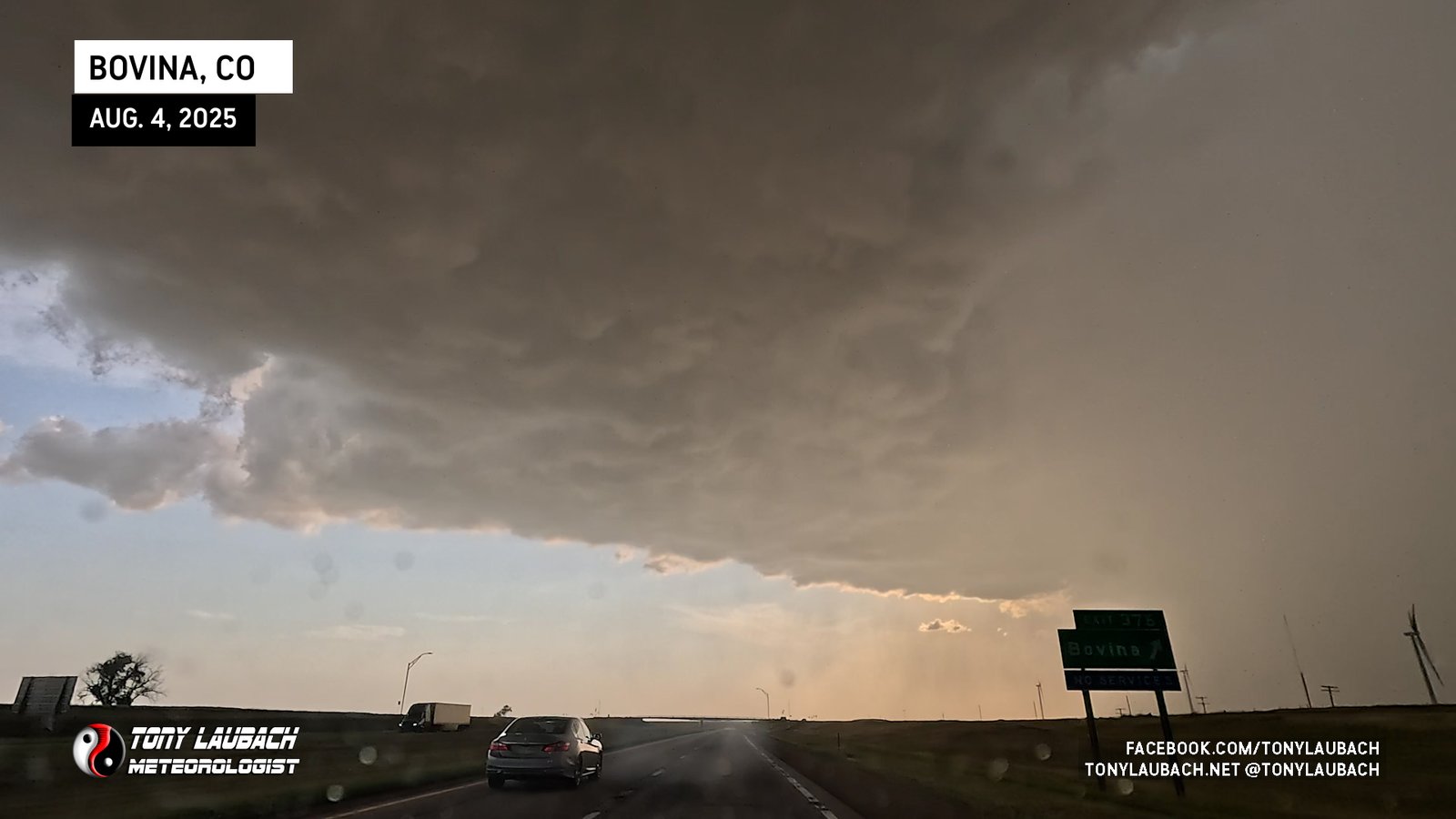
The western development had actually sent the path of the hailcore a bit further west, making Arriba a little less ideal for an intercept. Unfortunately the next exit to the west was a virtually non-existent town, just an exit with nothing to hide under. But Bovina was going to be my best bet, so after flailing around Arriba for probably a bit too long, I was quickly westbound on I-70.
With no safe cover (and I refuse to do the ‘overpass’ thing), I got west, and put myself on the west edge of the core, got flipped around and onto the I-70 Frontage Road that ran along the south side of the interstate so I had more maneuverability than I’d have on the interstate itself (don’t worry about that sequence of events).
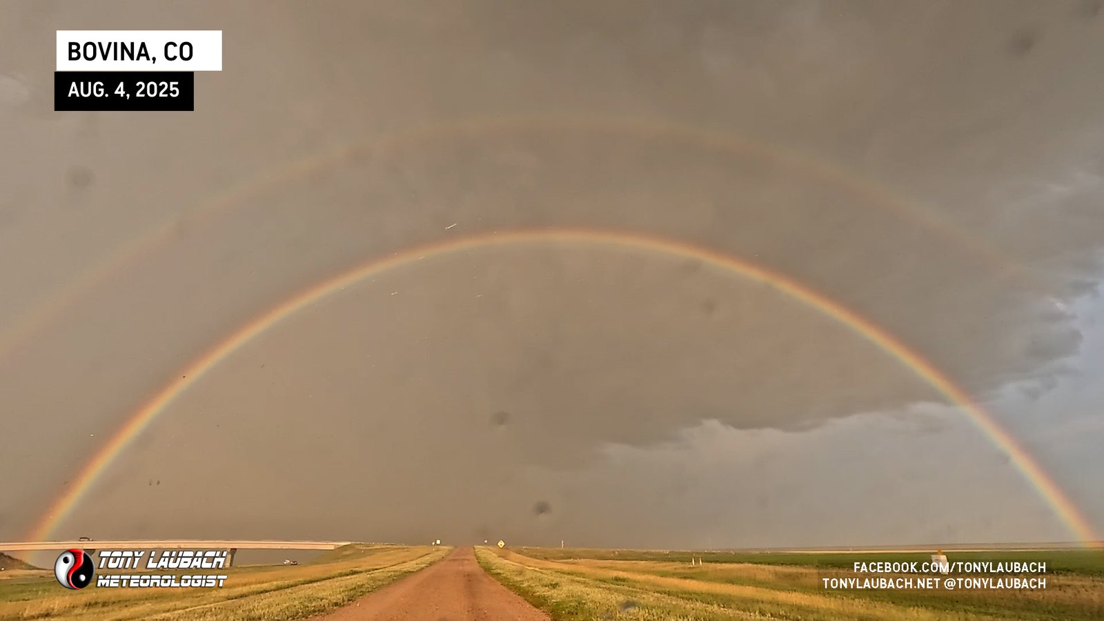
But, being on the west side of the storm with a lowering sun angle, a beautiful double-rainbow stretched across the sky. And while absolutely stunning and vibrant, I knew bad things were going on behind it.
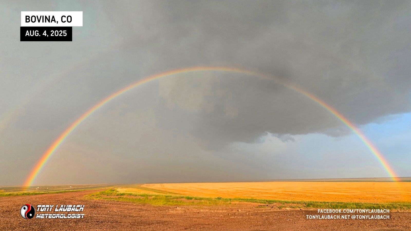
I was clear of any precip where I was, but I knew just up the road was where things were getting back. I SLOWLY worked back to the east on the dirt frontage road, basically following the rainbow to taste the rainbow.
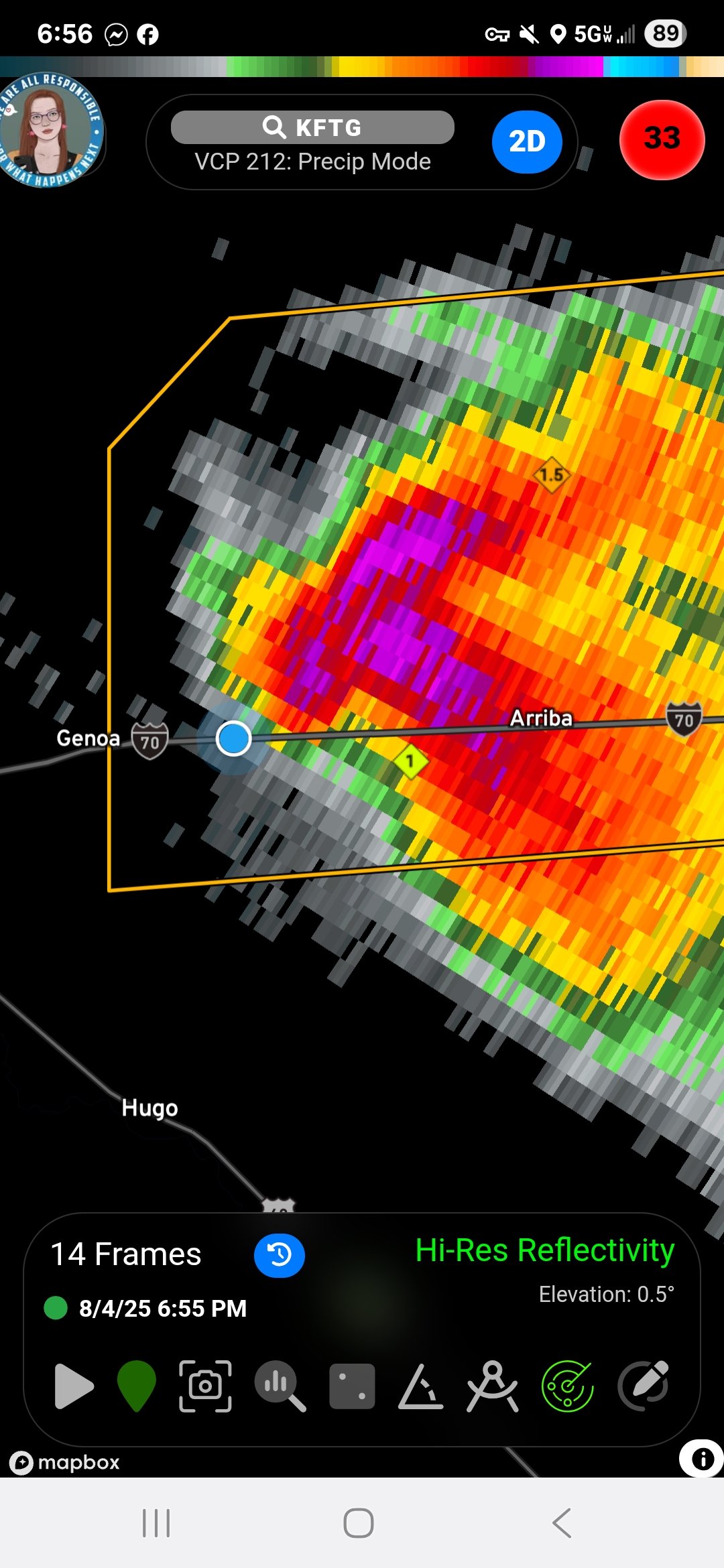
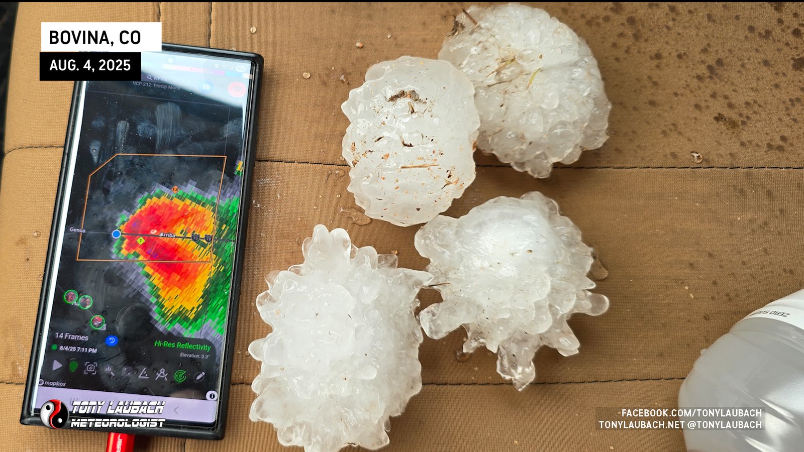
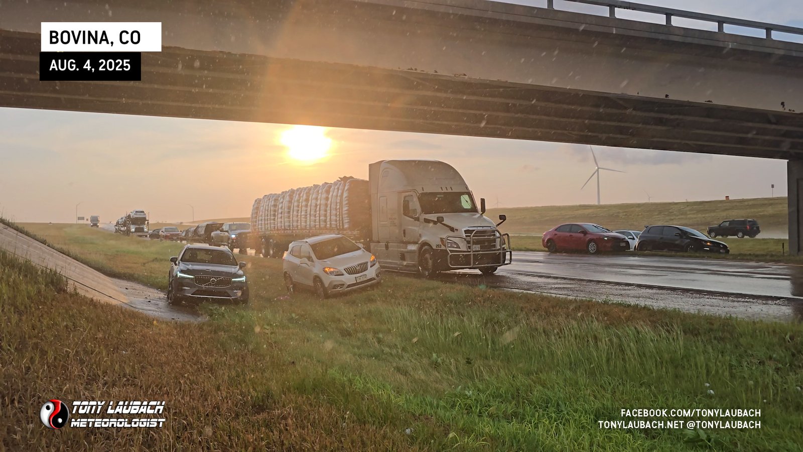
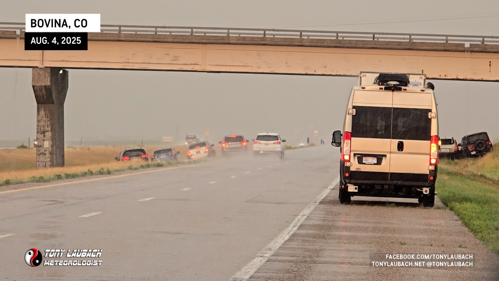
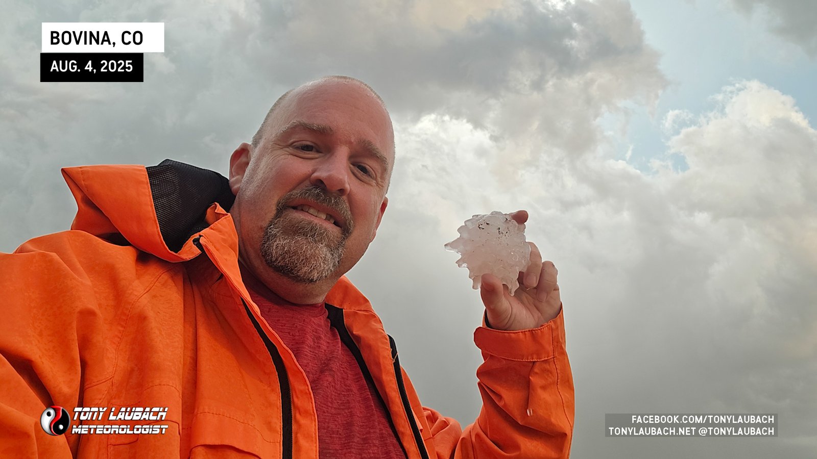
I re-approached the Bovina exit, this time from the west, as rain and smaller hail began to fall on me. I stopped to grab a few shots of the falling hail, but that was very quick as I saw a massive hailstone crash to the ground near me and I wanted nothing to do with that, so I flipped back around on the frontage road and got myself about half a mile west before turning back around. I waited until the next radar scan showed most of the core now south of the interstate before I proceeded into the hail zone. As I got deeper into the hail swatch, I saw more and more bigger stones, eventually seeing them dotting the landscape in every direction.
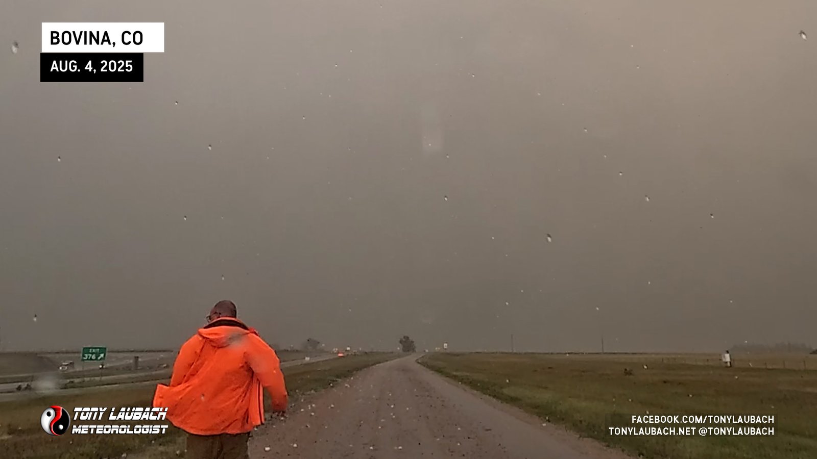
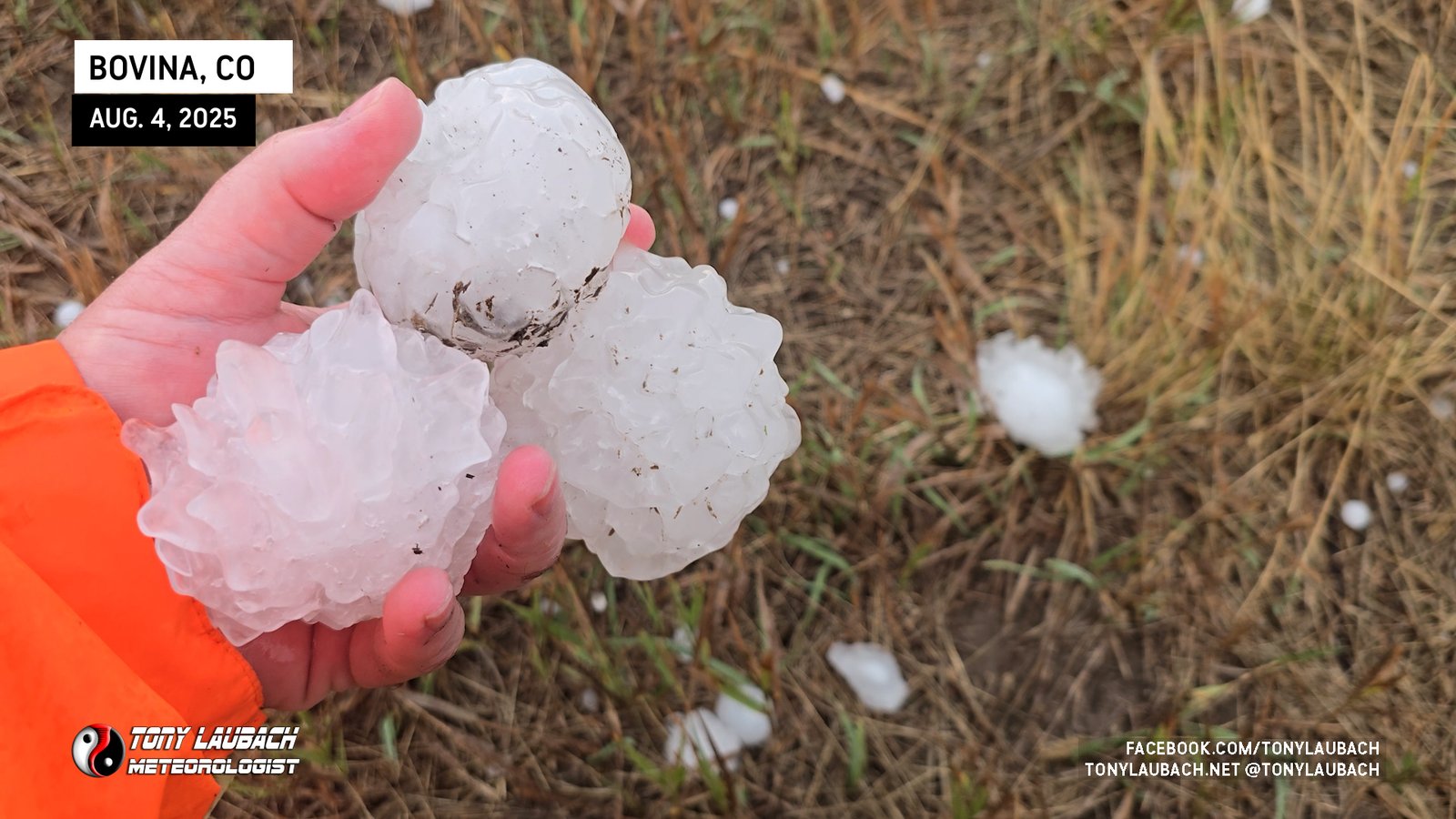
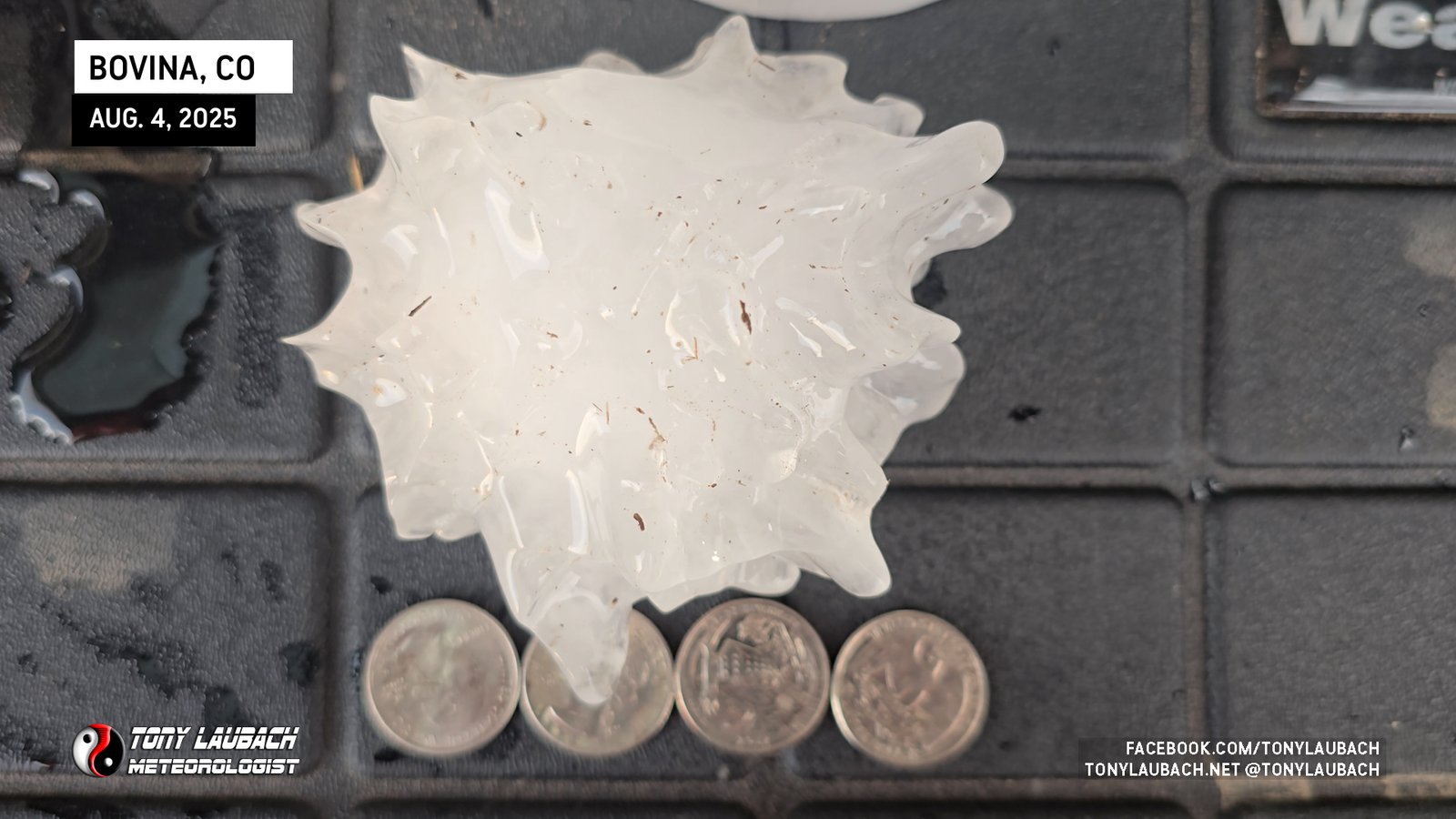
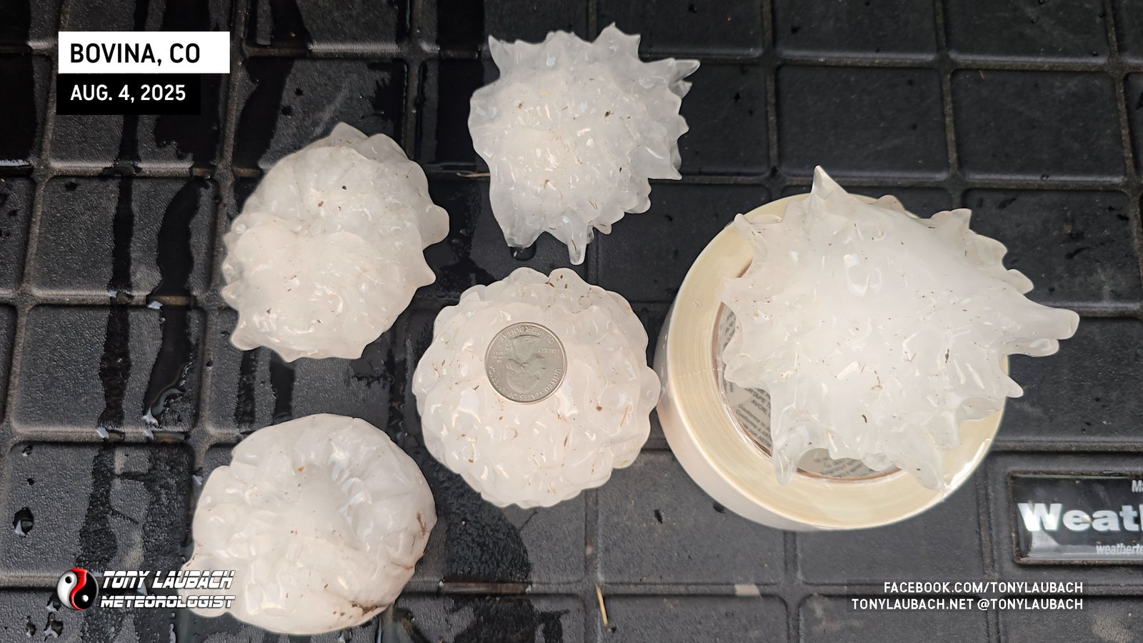
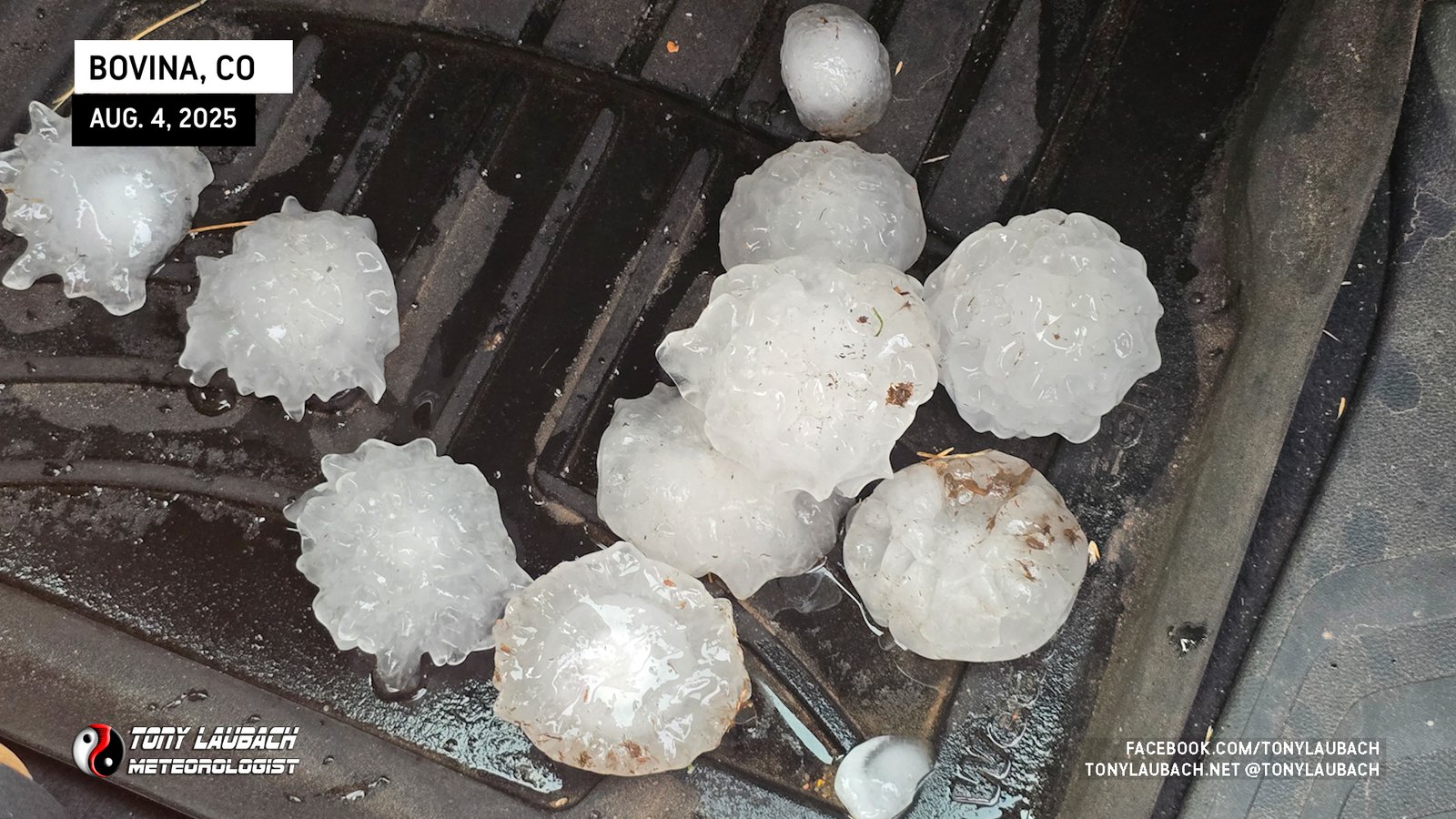
It was crazy, but at the same time, given how long a duration the core was over this area, it’s likely these larger stones were a bit more sporadic than what the ground-cover indicated. Still, there were a TON of baseball-plus sized stones. I conservatively reported 3″-plus to NWS as I didn’t have anything to measure the stones with (still kicking myself for not having my hail kit with me). But one stone I grabbed and pictured with four-quarters side-by-side indicates to me some stones of 4″.
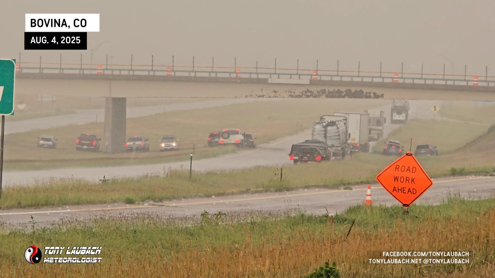
Two overpasses on I-70 were pretty much in the core, and most of the motorists in the area took shelter beneath them. This is HIGHLY discouraged for a variety of safety reasons, but I’ll save my soapbox for when I am sitting in a backup thanks to a bunch of people hiding from nickels. This one, I’ll give a pass…
I dinked around a bit, collecting various hailstones and taking in the scenes with the satisfaction of knowing I came out of this one unscathed, including the earlier dive through the core on the way to Arriba.
The day was drawing to a close, and the sun was starting to set. By this point, the storm had peaked, and the loss of daytime heating was starting to weaken the storm to the point where I felt like I was satisfied to call it a day. But, as the storm hadn’t moved too far south, I still had a pretty sick view, and the setting sun provided some amazing sights as the storm began it’s dying phase.
I’d been yearning for a day like this where I could spend several hours tracking a slow-moving storm. I think I was a bit unprepared to put in such a day as the morning shop appointment had me bringing a very limited gear set, so I didn’t have my full compliment of gear, including dash cameras and my hail kit, both which would’ve been useful. I did have my Go Pro, which I mounted AFTER my ride through the hail to get south of the storm earlier, so I had limited documentation of a lot of the chase. Still, it was a VERY nice, easy chase. Not anywhere near my initial target, which was starting up in the southwest Nebraska Panhandle with the idea I’d track it toward I-76 in northeast Colorado. But this Brush-to-Bovina series of supercells provided an incredible chase, and easily my best hail chase of the year, with my biggest ‘documented’ hail of the season.