April 26, 1991 was the event that made me wanna pursue storms as a career… 33 years later I had what probably will be my most intense storm chase of my career…

Chase partner Ed Grubb and I started the day in Concordia, Kansas… given the previous few events, in particular being burned on the April 16 event (running away from the surface low), we decided to make a b-line for the low north of Kearney. We had some reservations about whether this day was ultimately going to pan out (similar concerns to Dan and previous recent events). So after a lunch stop in Columbus, we shot back west as storms fired near Kearney and we rolled up to the storm east of Farwell, catching this brief little nader east of town. NWS Hastings says this was the initial stages of the Elba tornado, but this quick spin-up dissipated pretty quickly and we cannot confirm any continuous tornadic activity for a couple minutes after this lifted. I’d venture to say the main tornado was developing and this was a satellite of the big one based upon my observations.

With the storm moving north/northeast, we flipped around to Highway 11 and came up through Elba, stopping about a mile or so north of town at the intersection with Odell Road where we put ourselves pretty close to the main circulation, which had a formidable RFD wrapping around. We stopped here for several minutes as it roared away to our immediate north. We watched the power poles on Odell Road come down one-by-one in the RFD, possibly a domino effect from the tornado taking them down further up the road.


Once the RFD cleared and it was safe, we turned back around through Elba, shot east to St. Paul, then north on US-281 to make our second intercept of this storm. At the time, we thought we were observing the same tornado given the strength of the initial intercept north of Elba, but as Hastings has come out, this was a second, larger tornado southwest of Wolbach. This one we hung back about a mile or so as the visibility with this one was not nearly as good, so we opted not to chance it as close as the previous intercept. This RFD took down several trees in our immediate vicinity.


We let the tornado clear and we proceeded north, then eventually east through Wolbach on NE-22. We were going to make one more attempt to get north, but the two roads we tried were mud, and we didn’t want to chance getting stuck. We did try to stay with this storm, but could never get back into view enroute to Albion. About this time, we started to take note of the cells near Lincoln, and figuring the next round of the show was about to begin. We started to passively make our way east with other storms forming to our south, but once the tornado reports starting pouring in, we committed to the east route.
While that drive was going on, reports and images starting pouring in from the Lincoln/Omaha storms, and we were plotting a way to get across the river into position where we could actually intercept them. We hauled east on NE-91, going through the town of Snyder, and we discussed the two options before us. One was the quickest route to the storms, southeast through Scribner via NE-91 into Blair and crossing the river at Missouri Valley. We were immediately concerned with the potential of getting stuck in the damage path, and never getting ahead of the storms. Our other option, and the one we opted for, was to take the northern route via NE-51. We gauged the storms were moving at a slow enough speed that would allow us to get across the river at Onawa, then take the southeast route via IA-37 to get in front. That ultimately was the decision that made the second half of our day possible.
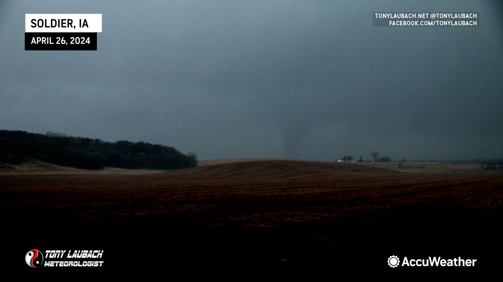
So it was about an hour before we got into Iowa, and when we did, the target storm was the one heading for the Harlan area. We had one storm to the north that we’d tangle with enroute, but by far the most impressive storm within our reach was the next one down the line. We needed to make Dunlap for a fuel stop, so that was the main goal at that moment. Turns out, the northern storm we were gonna skirt was producing a tornado taking aim on Soldier, and when we realized we could beat it there, we made the stop and observed this tornado briefly, crossing back to the northwest to the other side of town where another, less definitive tornado ripped through the trees northwest of town. We didn’t stay too long; just padded the stats and proceeded with gas and got ready to intercept the ‘Tornado Emergency’ coming up from Harlan.


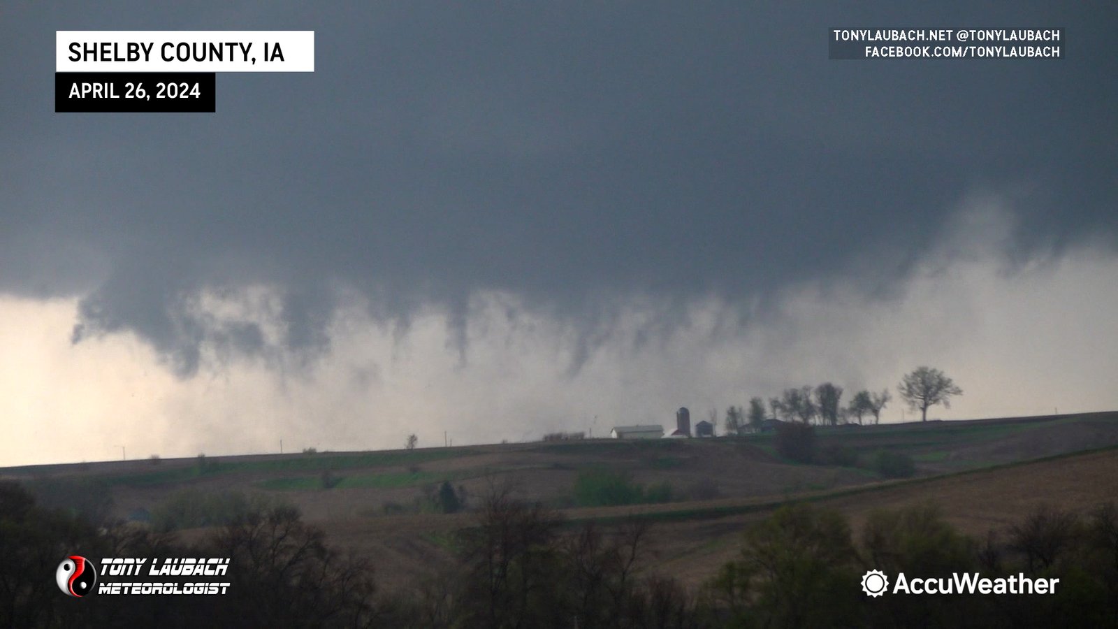
By this point, I was prepping for my 6PM live hit with AccuWeather. We were rolling through Earling just before the top of the hour when Ed got a visual on the lowering through the trees and hills to our south. We were approaching US-59, and the initial plan was to peel north to get in better position, but when we arrived at the junction and it was clear the tornado was still a ways to the south, we opted to poke south about two miles to setup on a hill with a great view of the approaching tornado. All this while we went into the live hit and crested the hill as I went on air with the tornado in full view.
For the next 25 minutes, I was giving a play-by-play of this tornado live on the AccuWeather Network as it churned its way in our direction. Once it got within a couple miles, the contrast was divine. It isn’t often when you can get a view as pristine as we had coming in from the north. Aside from about 60-seconds of hail approaching 2″, we were mostly precip-free til the tornado got right up on us. It made for one of the best TV moments of my career with a clear picture of the approaching tornado and great live coverage between AccuWeather Broadcast Meteorologist, Geoff Cornish and myself.
FIRST PART OF THE LIVE COVERAGE OF THE SHELBY COUNTY TORNADO EMERGENCY ON ACCUWEATHER


I’d say we were probably kissing the north edge of the parent circulation. This tornado wasn’t always fully condensed at ground level, but as it crossed Highway 59 to our immediate south, I’d be lying if I said we were more than a quarter mile from the northern edge. All the while, the occasional sub-vortex would spin up and rifle right to left across the highway. I feel like it took several minutes before the circulation fully cleared the highway, all the while giving the play-by-play on the network as it did so.


Unbeknownst to us, the Harlan tornado was ending, but a new tornado developed to our north while we were partially blocked from view by terrain and the ending tornado that was continuing. According to damage survey maps, a new tornado developed near Defiance, and while were thinking we were still on the Harlan tornado, we realized after the fact that a NEW tornado had indeed developed near Defiance, and that became the tornado we were then tracking. From our vantage point in the moment, we just assumed this to be the same tornado, and when you look at the tracks, there is an overlap, so it’s easy to see how we would make that assumption. In the moment, I suppose it’s not that important, a tornado is a tornado (or in this case two), but it turns out we watched one tornado die off as another got going near Defiance.


Once the tornado cleared the road, we flipped back around to the north, taking a series of county roads immediately behind the tornado as it narrowly missed Defiance to the east. Occasionally part of the main circulation would condense, all the while little vorticies would spin down, but it stayed churning on its way to Manilla.
We eventually ended up on IA-141 heading east toward Manilla where what appeared to be a satellite circulation developed in the field immediately to our south and crossed literal feet in front of the hood. Original surveys had this tornado as a satellite to the bigger one, indicating that this brief tornado ended shortly before crossing the road. I believe what we encountered here was the literal final breath of that tornado. Future surveys and reports from NWS removed this apparent tornado, and I am unable to find the original report that contained this tornado info. Upon seeing that in the initial reports, I relayed this video to NWS, suggesting the track likely extended to the road with this swirl being its last moments.

We let that storm go as more tornadic storms were coming up from the southwest. We ended up dropping south into Audubon where we opted to close out the chase after watching two storms go by the area. With darkness falling, we called it a chase. In total, eight tornadoes, starting as early as 12:45PM. The most impressive without question was the Harlan-to-Manilla intercept which we had most of it aired live as it was happening.
The chaser in me had some brief bouts of regret with our targeting of the early storms, costing us a chance at the Lincoln-to-Omaha tornadoes. Those certainly were the most visually impressive of the bunch, and certainly had the most impact. But I was very happy that we were able to secure the early tornadoes north of Kearney and still make it east with the very wise decision to take the northern crossing, which allowed us the opportunity to document the back end of the Harlan tornado. This chase could easily rank as number 1 for intensity/experience given the close proximity to several of the larger tornadoes we encountered, and the Harlan tornado definitely was a top-tier intercept. Obviously it was most certainly NOT the result we wanted to see having so many destructive tornadoes in populated areas. It’s always a double-edged sword when that happens, particularly to the extent that it did this day (more so the following night).
Definitely a day to remember… major kudos to my chase partner, Ed Grubb… we’ve chased together for many many years at this point, and his eyes and call outs made what would’ve been a very stressful solo chase much easier and successful.


