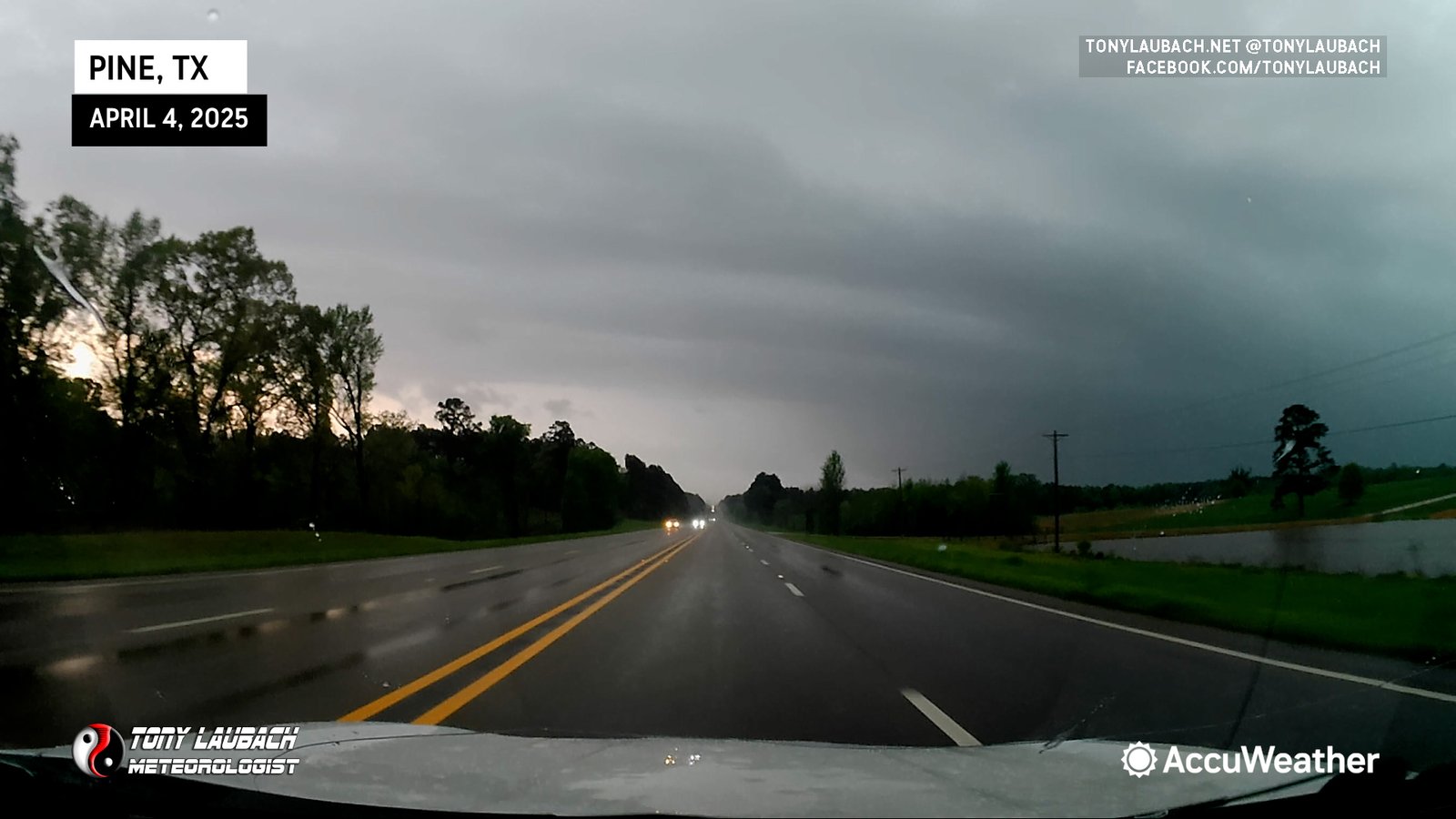
Drove southwest via I-30 from Little Rock, targeting the area in northeast Texas. Opted for this region due to likelihood of daytime initiation and terrain that was somewhat better than anything we’d find in southwest Arkansas. Fortunately Ma-Nature obliged, and as we rolled through Texarkana, a line of supercells had developed, and within an hour, four were tornadic.
Our initial target storm was one to our west/southwest, basically over I-30 and we were planning to head north out of Mt. Vernon to catch it on TX-37. However, as we neared the Mt. Vernon exit, a cell to our southwest looked MUCH more impressive on radar with a much more intense velocity couplet. Given it was southwest of us moving toward us as opposed to our original target cell which would be moving northwest AWAY from us, we decided to make the play to the south (also eliminated us having to go through Mt. Vernon).
We dropped south via TX-37, getting into the town of Winnsboro which held us up over ten minutes between two lights downtown. They were some of the longest lights I had ever sat at, and traffic was horrendous (some school busses were out, so we assumed it was school’s out time). None-the-less, that was a frustrating delay. But we finally cleared down and booked southwest, continuing on TX-37 toward Quitman. The delay cost us a shot at an intercept west of Quitman, so we turned back to the north on FM-69 north of Quitman to try and get a view into this HP supercell. We made a run with it as far as we dared until radar indicated the couplet had weakened, so we turned our attention to the next storm down the line, and returned to Winnsboro via FM-269 (much quicker shot through town this time), and headed east out of town on TX-11 to US-271 at Pittsburg.
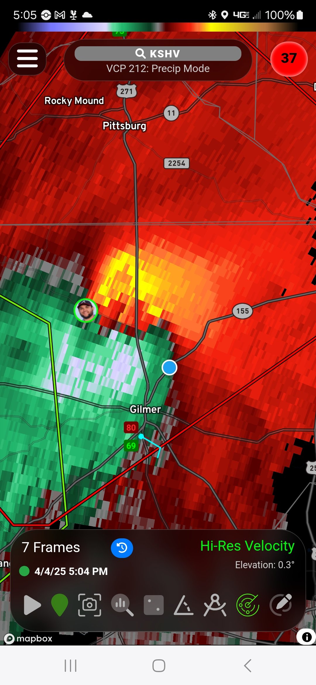
We turned south on US-271, hoping to beat the storm to the highway. It was on a track that looked like it would take it north of the town of Gilmer, so our plan was to shoot ahead of it into the northern side of Gilmer, then cut up northeast on TX-155 to parallel the storm. We had a pretty wicked view of the storm as a whole, but absolutely no visual on any tornado buried in the rain.
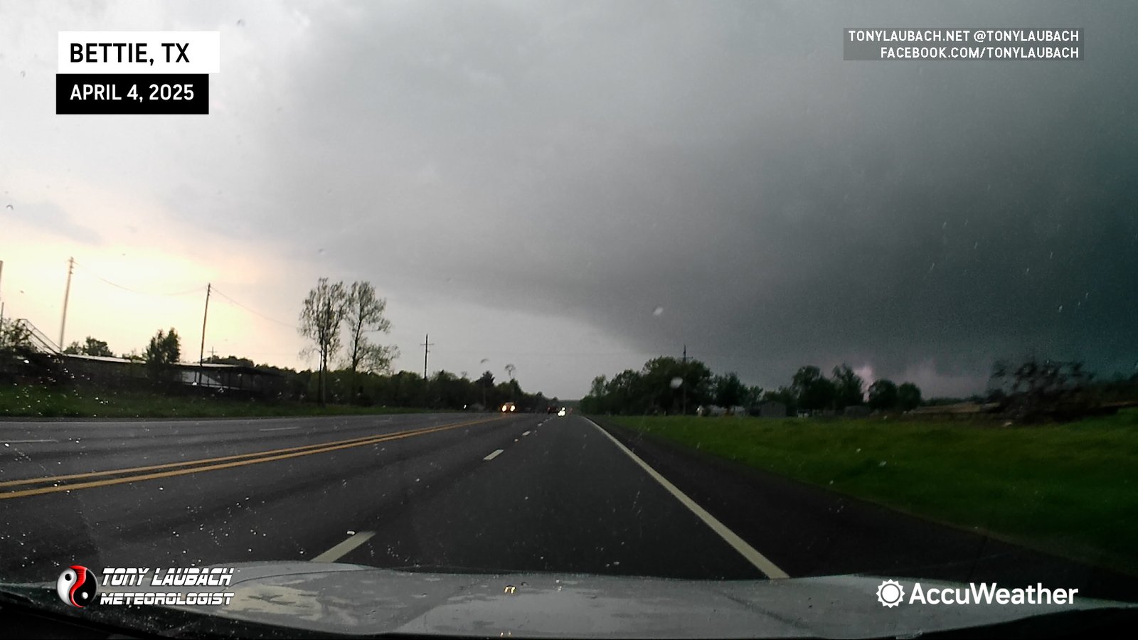
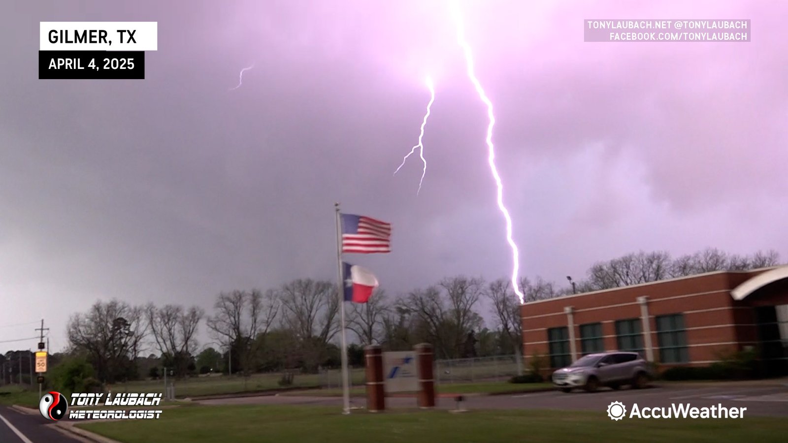
While it’s likely there were a series of tornadoes going on, we had ZERO visual on any of them. During my live reports for AccuWeather, I certainly was very animate about assuming there were tornadoes in this thing and warned folks from Gilmer to Bettie to be under cover cause they would NOT see the tornado before it hit. We did beat the storm to the north side of Gilmer, and were likely cutting east when the circulation area crossed US-271 to our north. We hit TX-155 and immediately began the northeast pursuit.
We had a good couple miles where we were basically on the south side of the RFD, and once TX-155 doglegged more to the east, we were quickly able to escape the blinding precip and make some eastbound headway and get some distance ahead of the storm. Our next piece of the plan was to get to US-259 and turn north toward Lone Star.

We stopped briefly about a mile north of the junction as we had a pretty good view looking to the west/northwest. I took a brief video on my phone as our naked eyes weren’t doing so well with the HP contrast, but the HDR setting on my camera was able to get a better shot of what we thought was a fairly large tornado.
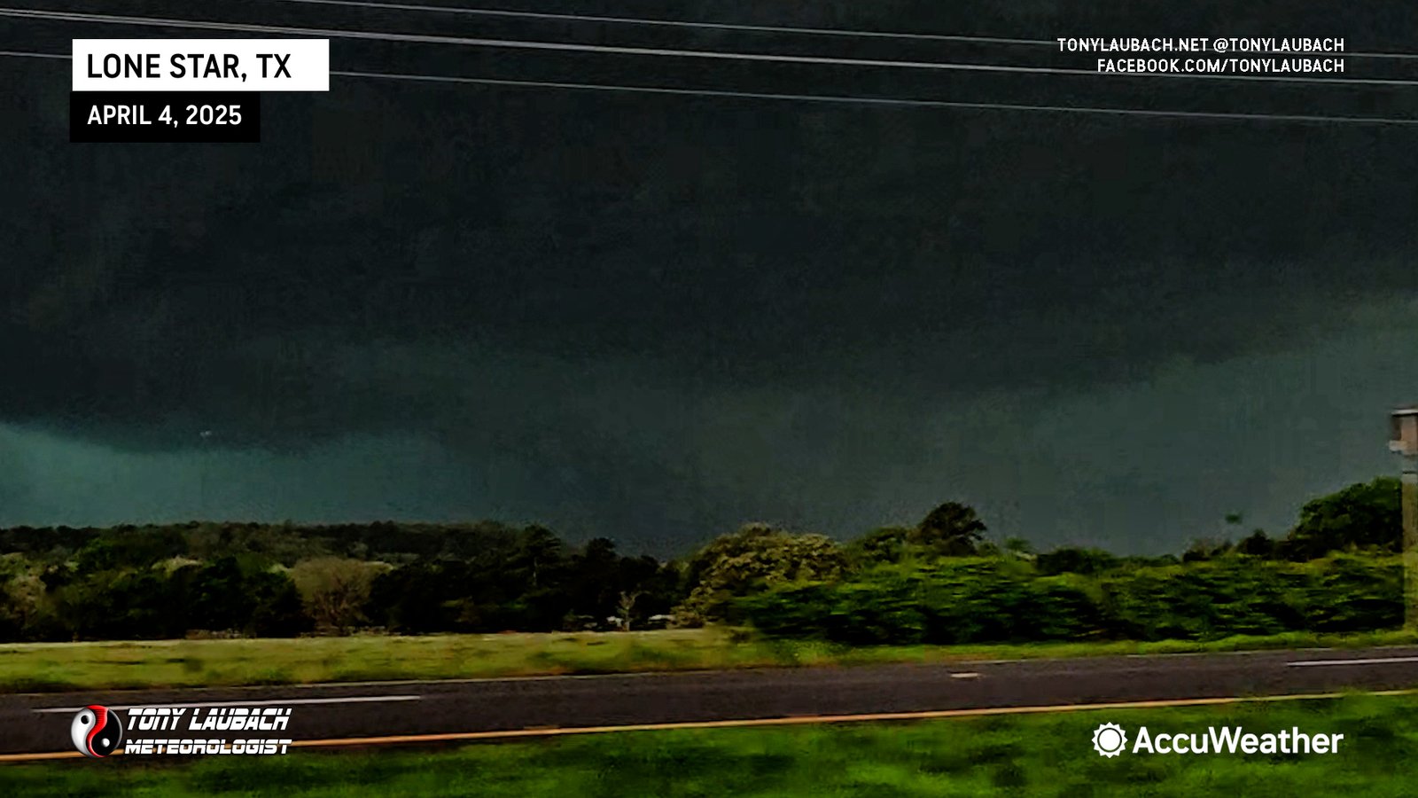
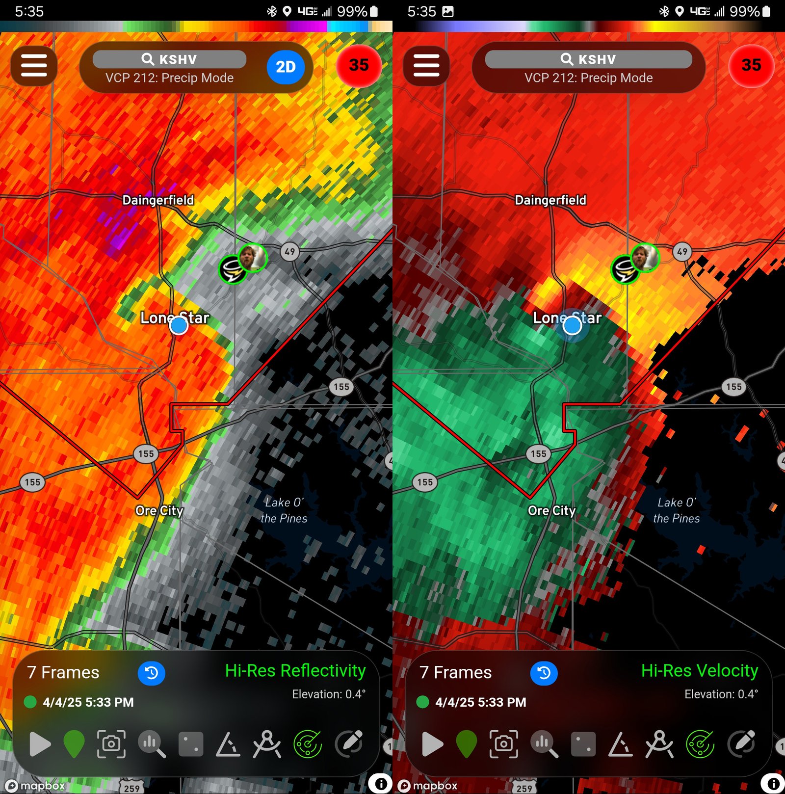
We were aware of the dual couplets on radar, but given we could barely make out the eastern most one, we certainly weren’t even bothering with the west. The eastern couplet, we projected to pass as close as the northern half of Lone Star or points north, so we shot up to the south side of Lone Star, parking at a church near the FM-729 Junction and pointing ourselves west/northwest.
We didn’t give ourselves a ton of time, and I was doing a pretty quick live hit as the RFD of this storm rolled in and overtook us. We probably had winds in the 40-50mph range with a few gusts exceeding 60mph early. Ed grabbed a couple intense lightning strikes within the RFD to our immediate north as I was wrapping the hit to get us turned around and back on the road.
From Lone Star, we cut up FM-250 toward Hughes Springs, then east on TX-11through Sardis over to Linden where we turned north on TX-8 to get a view of the incoming supercell.
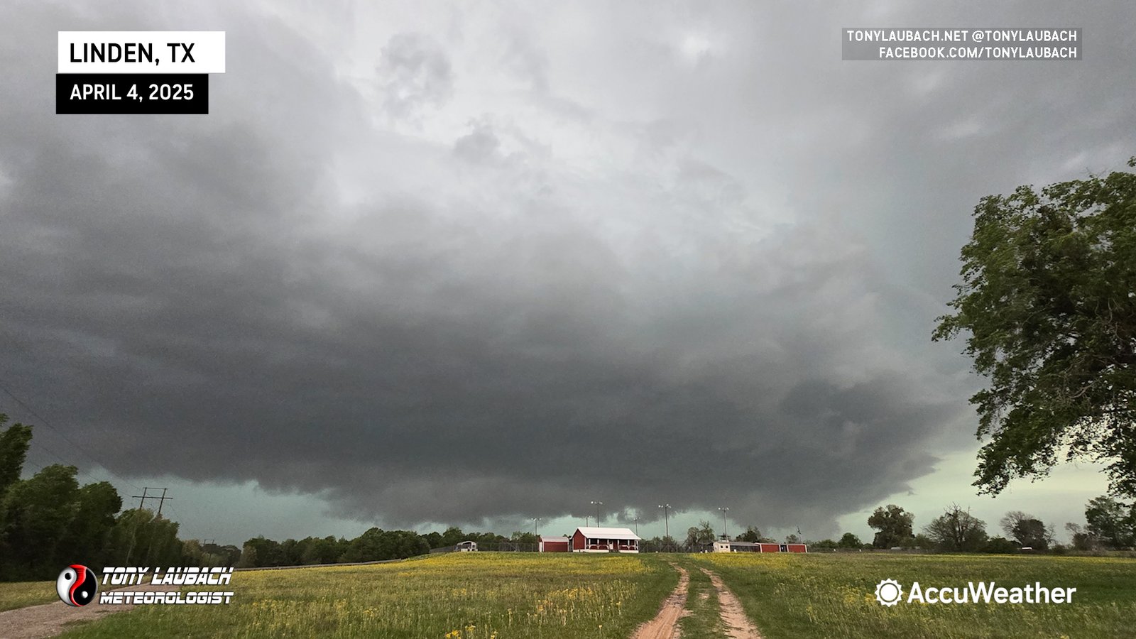
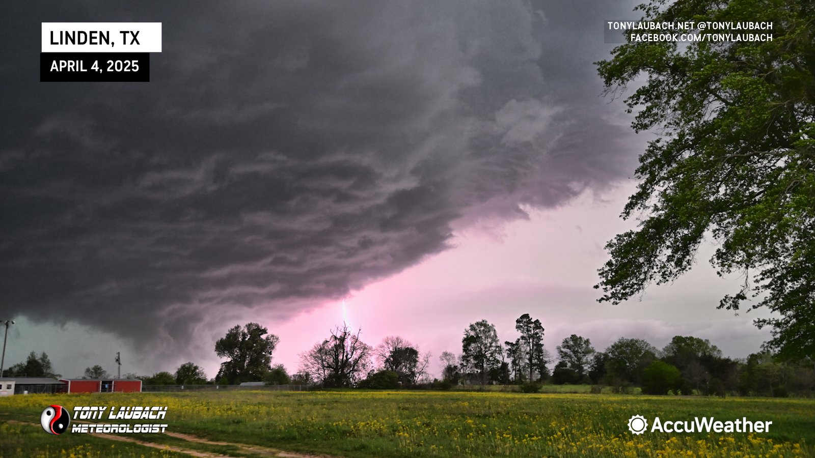
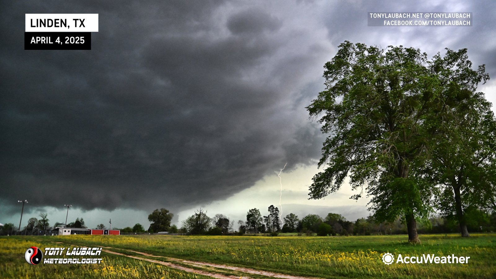
From here, I did another live hit with the storm in full view; a meanancing HP as it approached us in Linden. The lightning, which had been insane our entire intercept to this point, was so vivid and so crazy, that after the hit, I went out with my Nikon to capture some photos, hoping I could press the shutter in time when I’d see a bolt to actually handheld capture one. And I didn’t get one, I got THREE bolts on 12 attempts in 90 seconds (and yes, all attempts were reacting to a lightning strike).

The storm was moving at a pretty good clip; warning text had it as high as 55mph, but I’d guess it to be a bit slower. Fortunately the road networks were very favorable, and we were able to stay out of the thick of the heavy precip to allow ourselves the chance to utilize those good roads to continuously stay just ahead of it and get a few short stops in to capture/report on the storm.
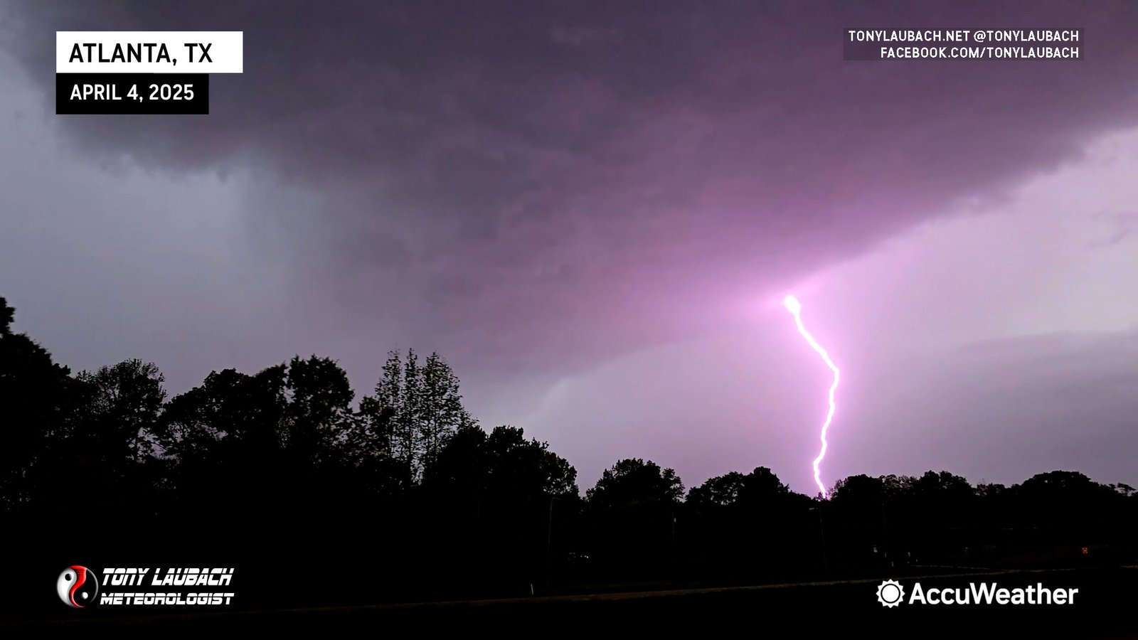
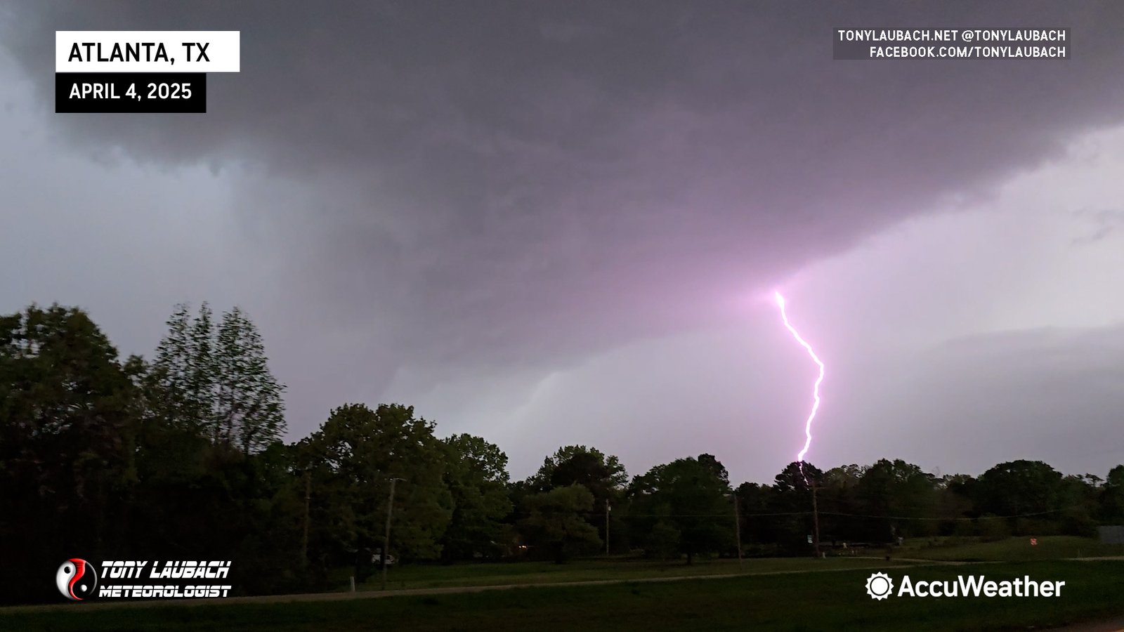
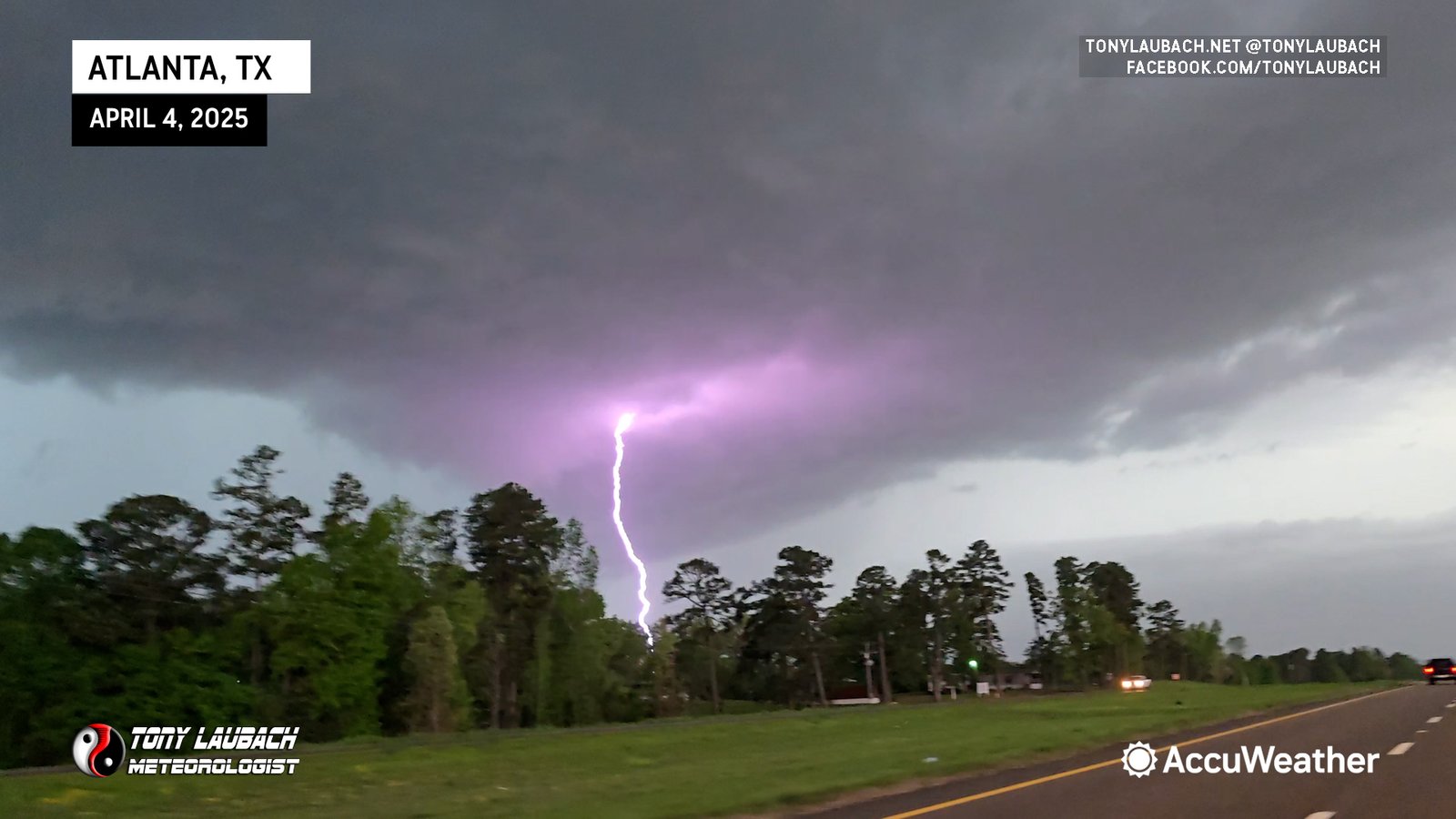
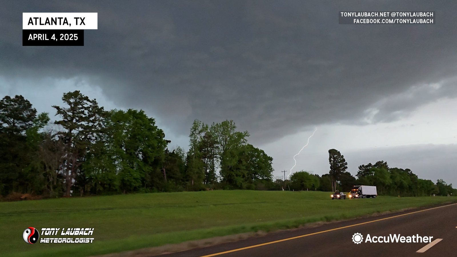
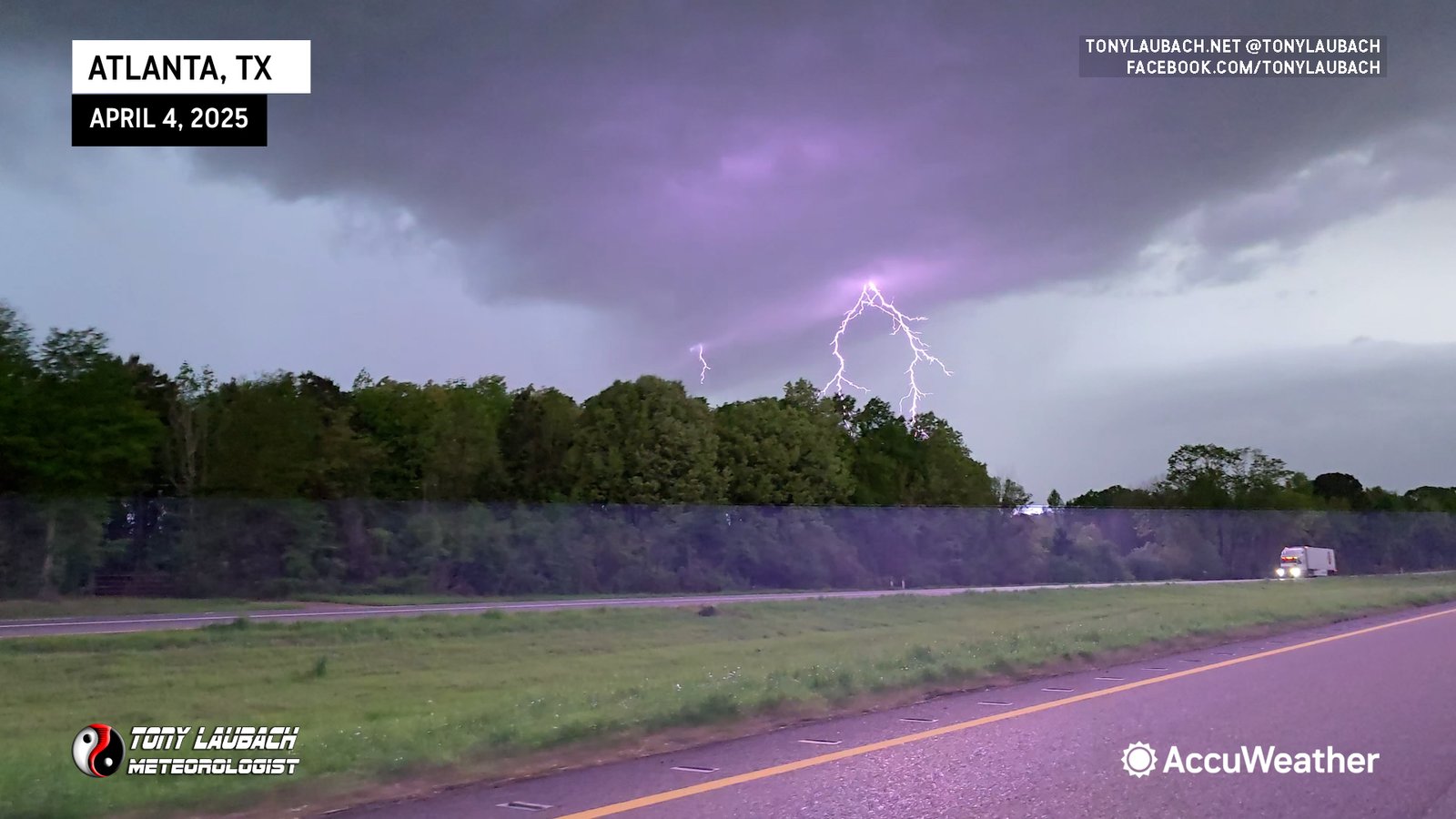
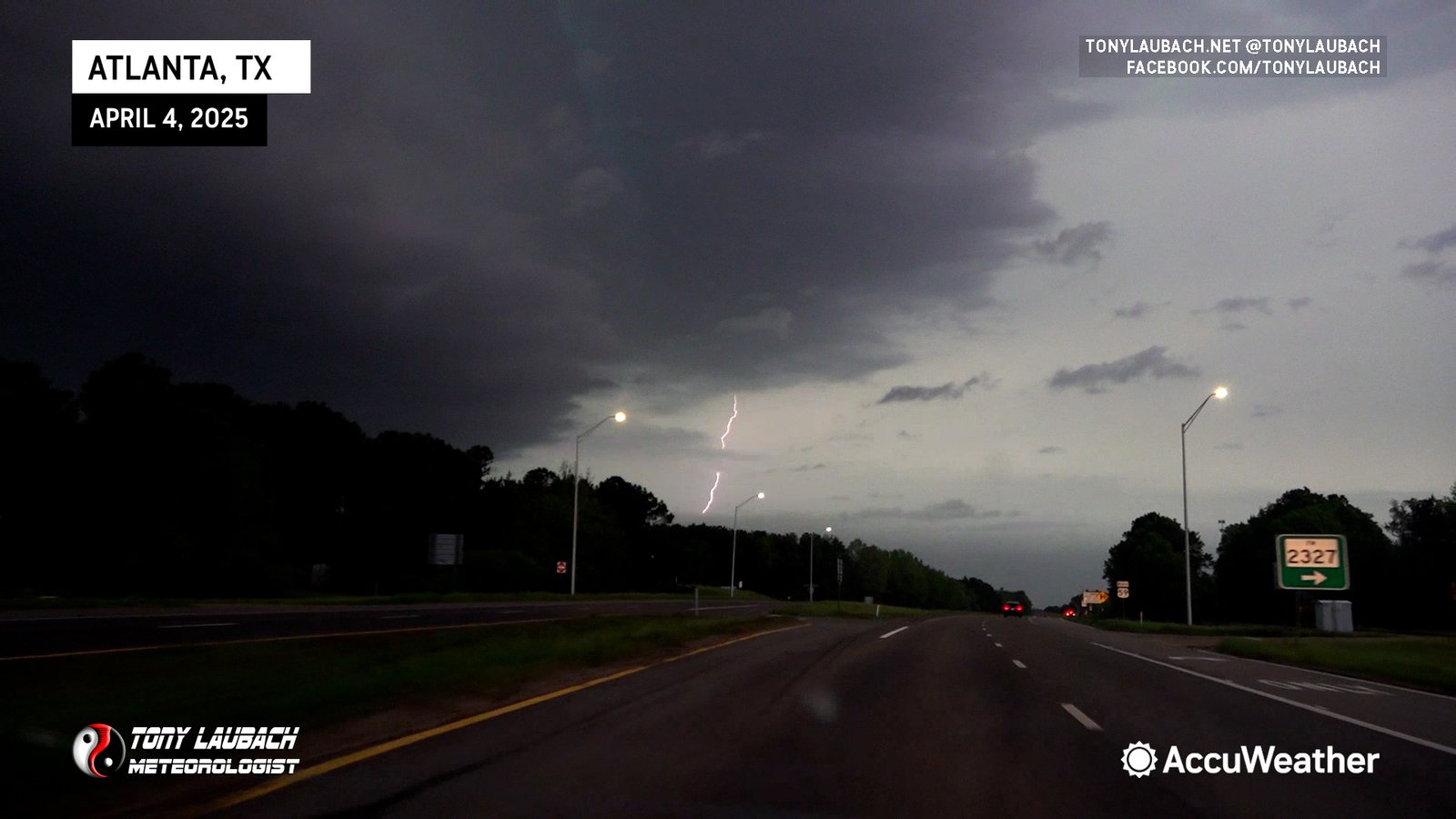
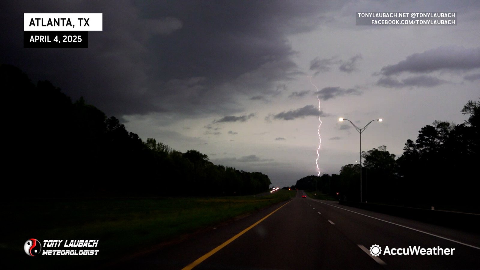
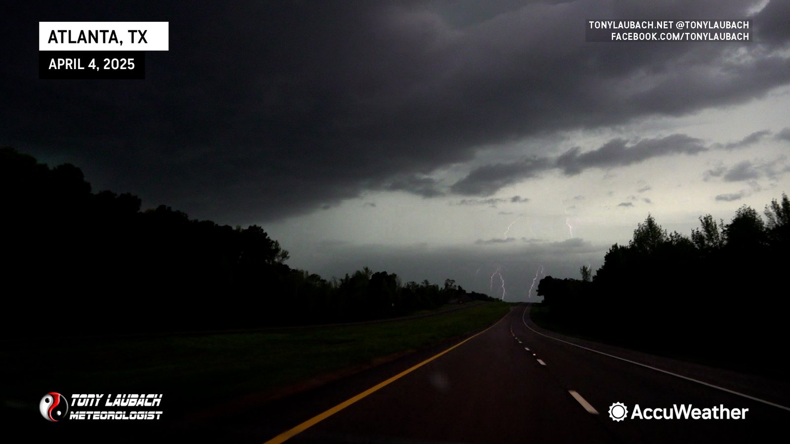
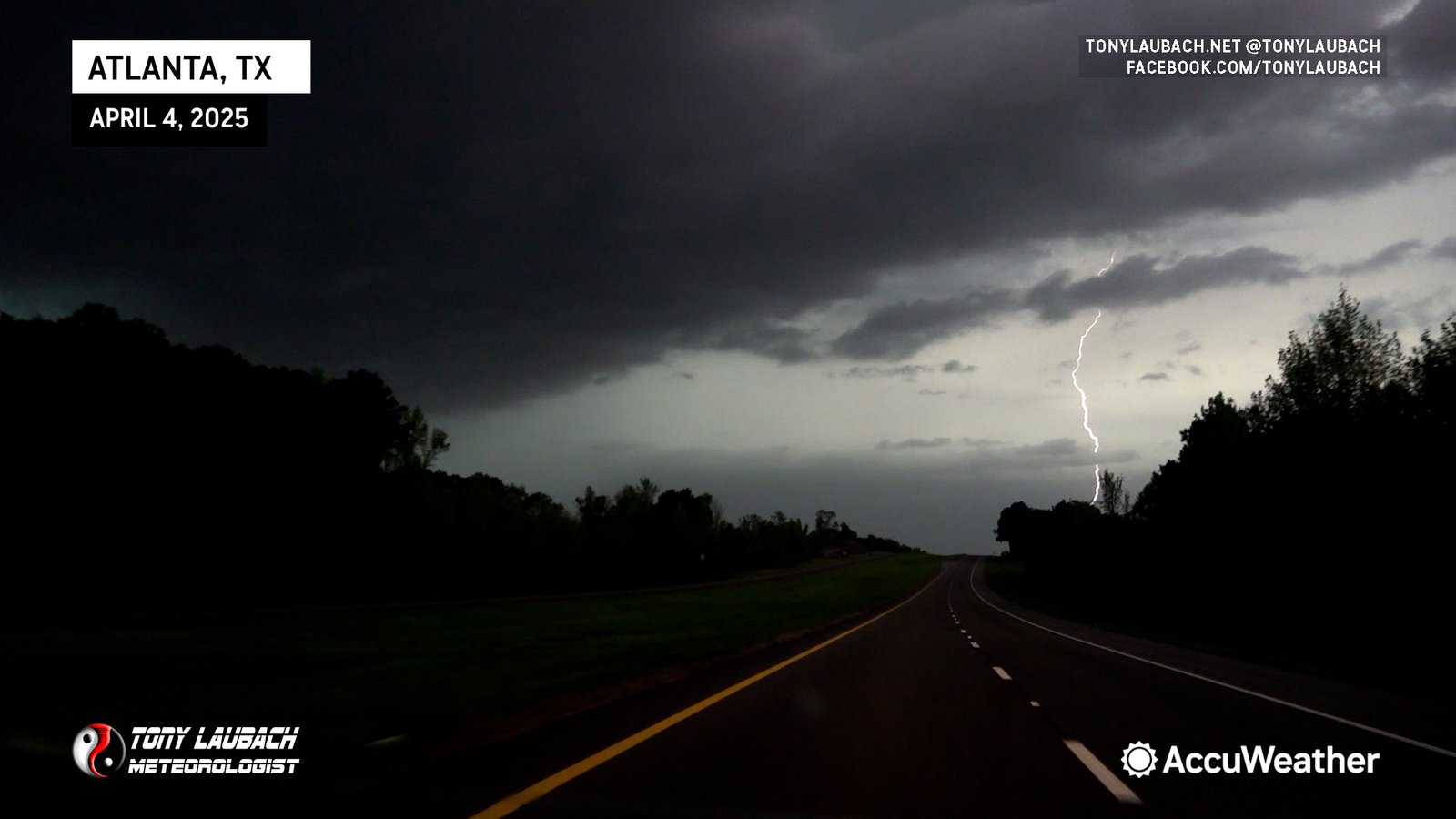
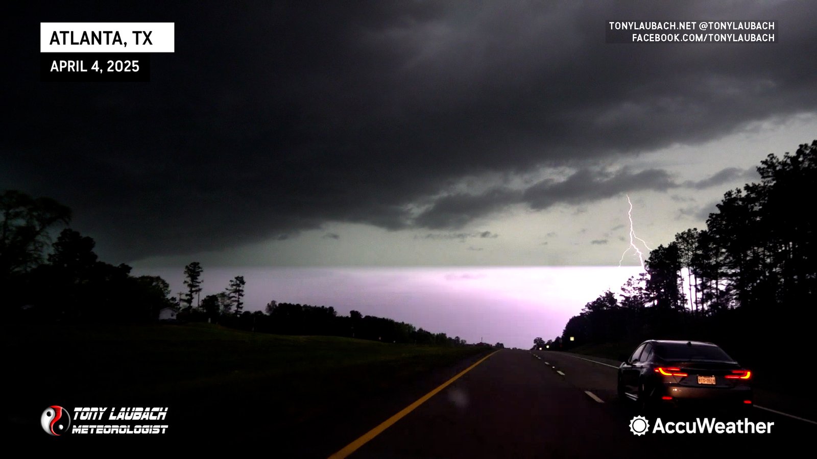
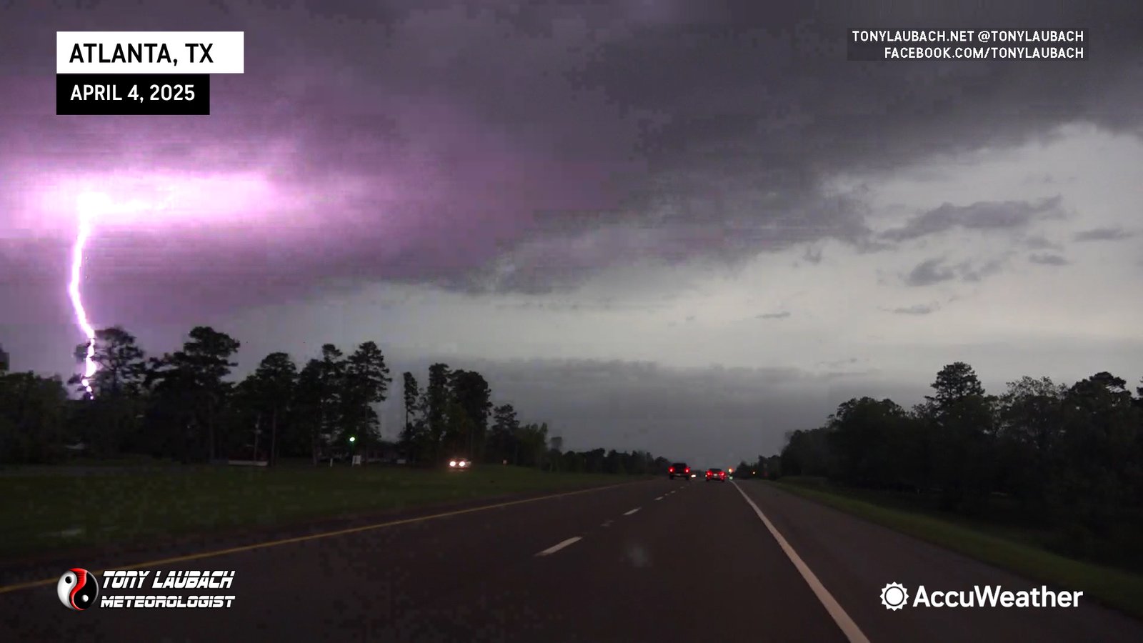
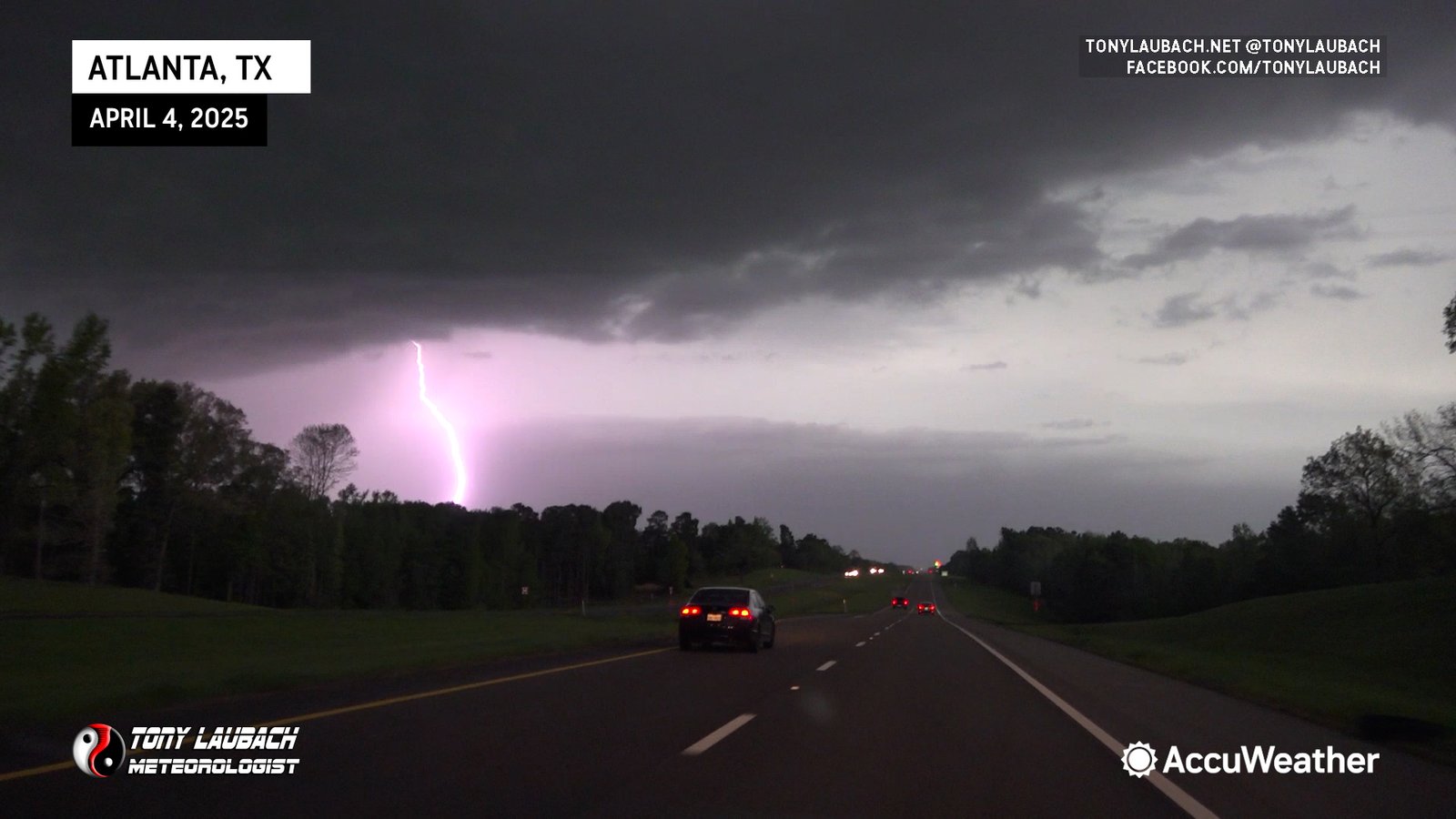
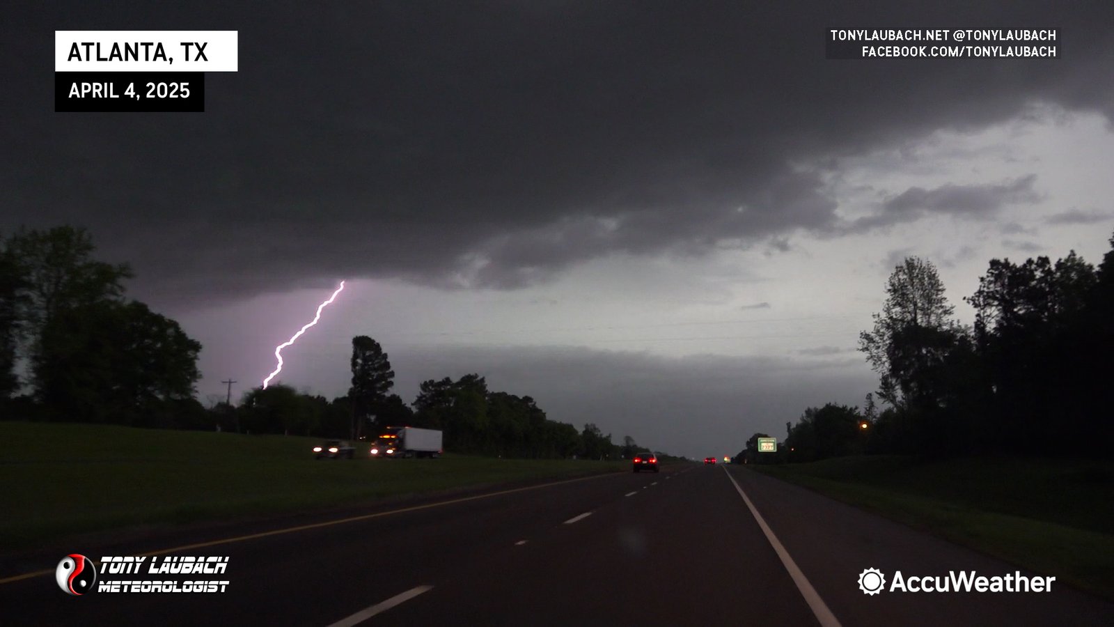
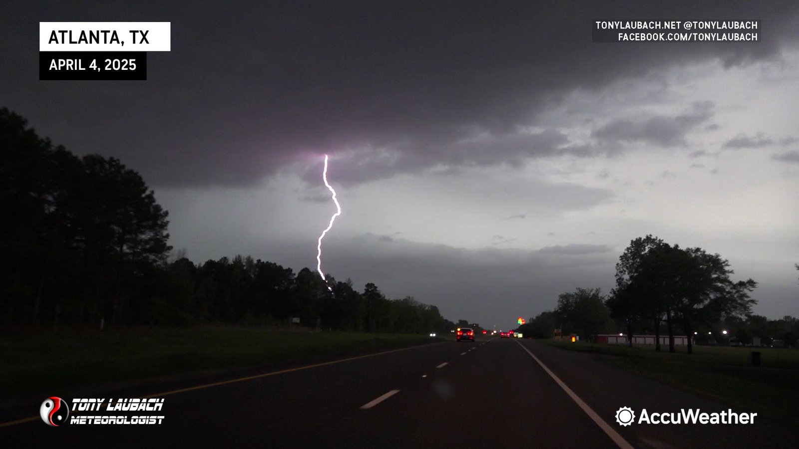
Next down the line for us was Atlanta, Texas, a straight northeast shot up US-59. Again, perfect road option as it ran us parallel to the storm, and we could get some distance at highway speeds. We got up to Atlanta quickly, then followed US-59 north out of town.
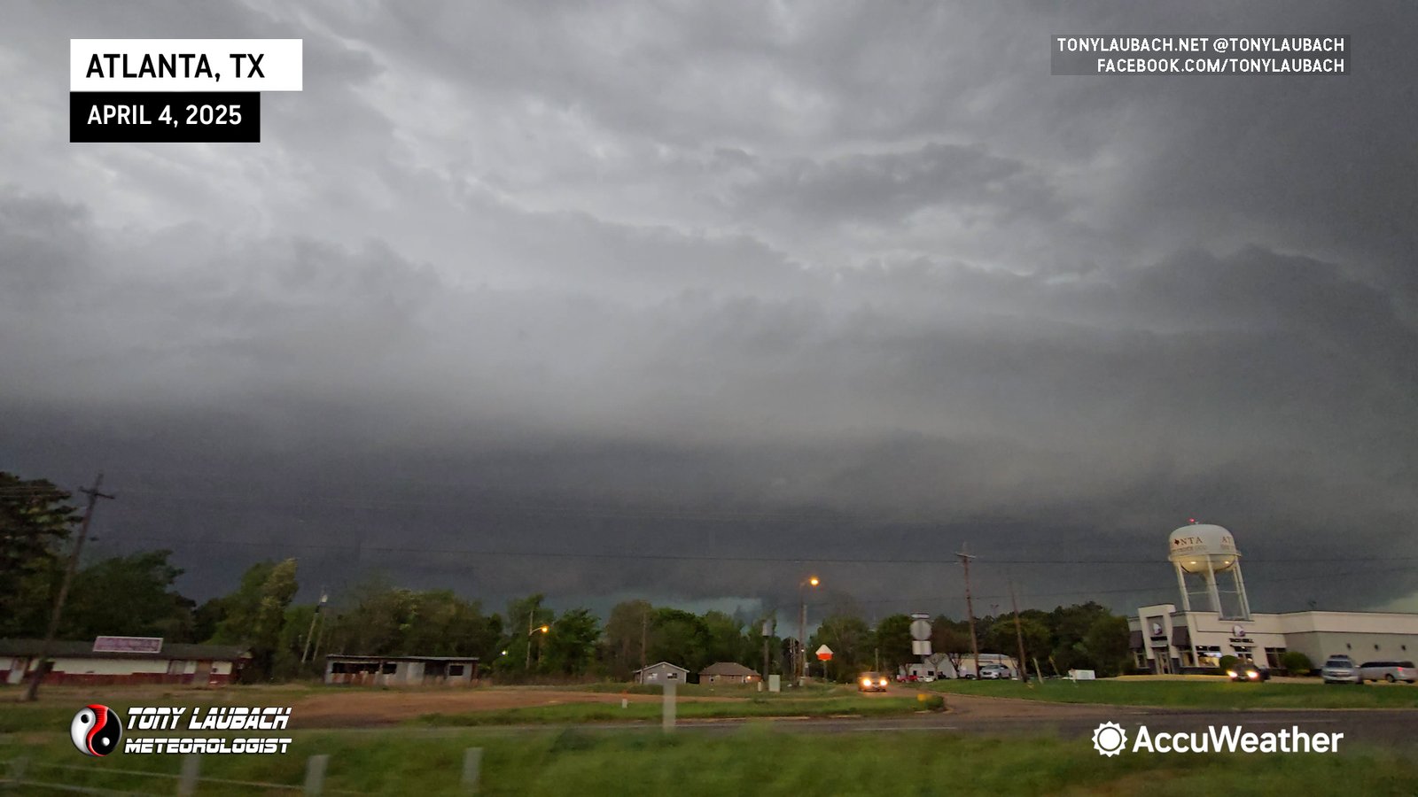
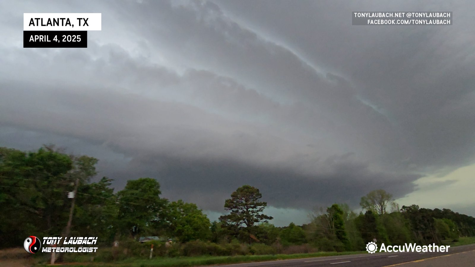
As had been the case this entire evening, this storm was just throwing out incredible amounts of positive lightning strikes ahead of the core. We captured several of the bigger bolts on multiple cameras as they were just raining from the sky.


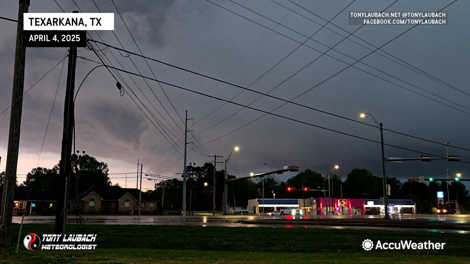
As it was starting to get late, we stopped on the southwest edge of Texarkana with hopes we’d get cored pretty good. But when the storm pushed in, we were basically in a torrential downpour with little to no hail (heard a couple tinks off the car). We did a final hit from there at the gas station as the storm rolled in.
By this point, the HP supercell we had spent the better part of several hours covering was now part of a linear cluster that was starting to set up the training that would lead to our threat becoming more of a flood threat. We opted to hang out in the city, grabbing dinner at a favorite place of ours before venturing back out into the continuing rain.
Flash flood warnings were upgraded to flash flood emergencies, and we documented several flood scenes there in town. The flooding in Texarkana was pretty intense; flash flood emergencies were out for the city later in the evening as the train of storms just continued. I-30 was closed for a while as water had collected in a low-lying area, so traffic was diverted. We documented several scenes where cars drove into and subsequently stalled out (turn around, don’t drown isn’t just a cute phrase people).


After we trolled around town documenting the flooding across the state line, it was time to wrap on the day. Our original plan was to get back to Little Rock to set up for tomorrow (I was due to dump Ed off at the airport so he could fly home). However, given how late we were out and the editing I needed to do ahead of tomorrow, we opted to go up the road to Hope and bunk down there where I spent a couple hours doing edits, finally crashing out around 3am. Also the idea of driving 100+ miles from Texarkana to Little Rock in what was now an overnight training MCS pretty much centered on I-30 just sounded awful and would’ve probably taken twice as long to do assuming we didn’t hydroplane ourselves into oblivion.
One of the sayings we have in TV is “you win TV”, and that’s what today was. We spent several hours with this storm, doing frequent live updates with very compelling visuals as this storm was approaching town after town along its path. While we weren’t technically wall-to-wall, we did multiple cut-ins during our live broadcast and they took my camera views multiple times beyond that.
ACCUWEATHER LIVE HIT: Lone Star, Texas RFD Encounter
ACCUWEATHER LIVE HIT: Linden, Texas Structure Lightning Encounter
As a chaser, it was another frustrating day of being in great position, but HP storm mode plus terrain and trees limit your views. We opted for northeast Texas as it offered ‘the best’ terrain of all possible targets, and had the storm not been an HP monster, I’d argue we would’ve had some pretty compelling views of multiple tornadoes. Unfortunately the storm mode just wasn’t going to cooperate, but we made the best of it, and managed at least some imagery of the tornadoes near Lone Star.
Of the four days of chasing in this stint, this was by far and away the best of the bunch. Thanks to amazing road networks in east Texas, we were able to stay with this storm, arguably the storm of the day, for several hours despite it’s forward speeds over 40mph. While the terrain and trees were an issue, we still managed to keep a decent view in a lot of spots, and obviously could find a few vantage points to stay with the storm. All-in-all, I’m happy with the chase as a whole, but definitely am looking forward to being back on the Great Plains again.