


This day was on the radar a couple days out as a favorable severe weather setup was forecasted and parameters were looking promising. The morning of, things continued to look good as a very well defined boundary set up from roughly Castle Rock northeast into Nebraska. This stationary boundary became the target early as convection began to fire along it. With slow moving storms firing over this stationary boundary, it felt ripe for landspouts.
I picked up Ed Grubb at his place and we ventured out toward Brighton where we gassed up and grabbed a quick Wendy’s lunch. We were initially thinking a target up along I-76 from Brush to Akron to Sterling, but the boundary sitting across eastern Adams/Arapahoe County along with the towering CU going up lead us to take CO-52 east to split the difference in case that area were to go.
As we ventured east, towers continued to grow with cells showing up on radar along the boundary along CO-71 near Last Chance. That became our target, and thus we ventured across a few county roads to CO-71 and eventually southbound toward Last Chance.
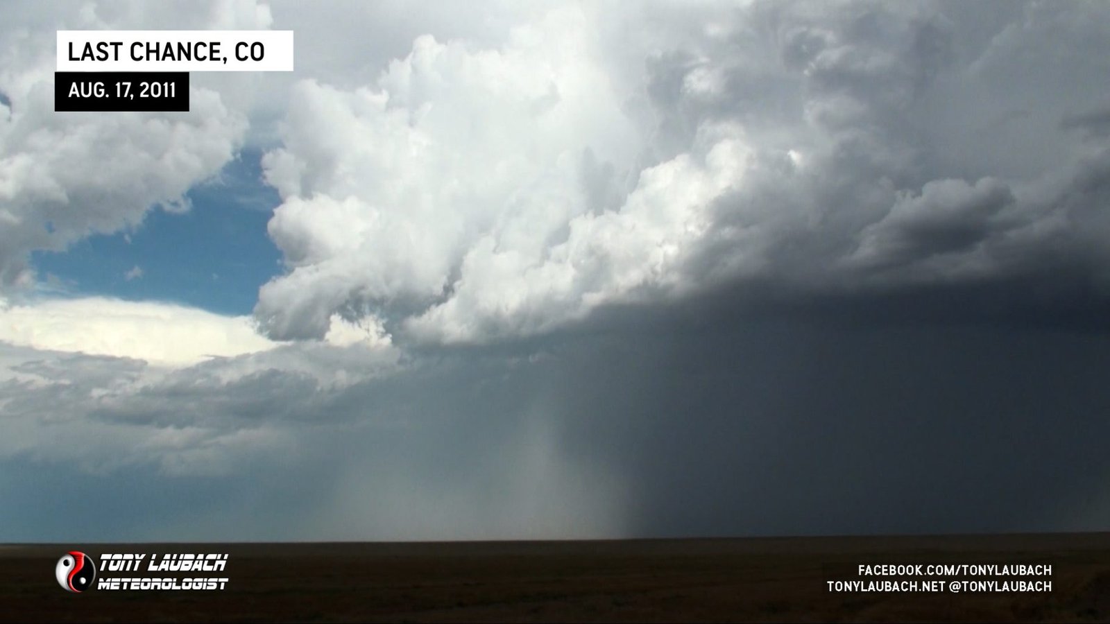
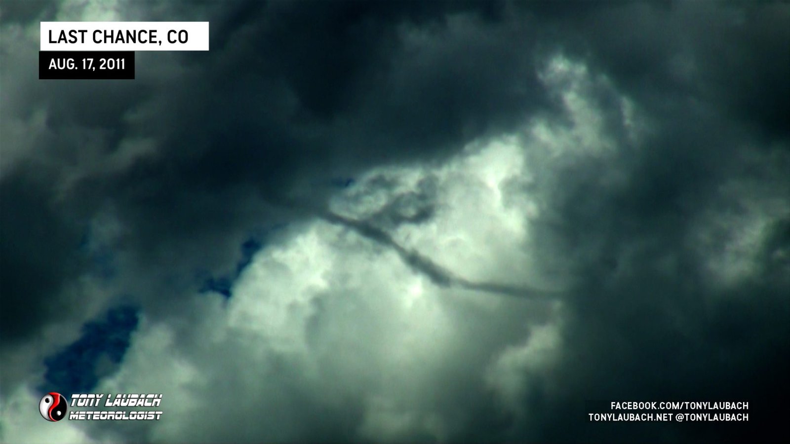
As we arrived to CO-71, we were observing numerous spin-ups along the boundary. Initially, none of them were forming under updrafts, but it was a good sign of the surface vorticity in the area. We were basically awaiting a storm to form over one of these areas and pull that vorticity up to give us the landspout show we all thought was imminent. These features continued to develop as the boundary slowly pushed south thanks to outflow from the north. One of these spin-ups formed to our south along CO-71 on the southern edge of a developing updraft base.
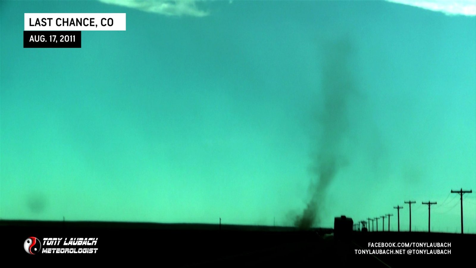
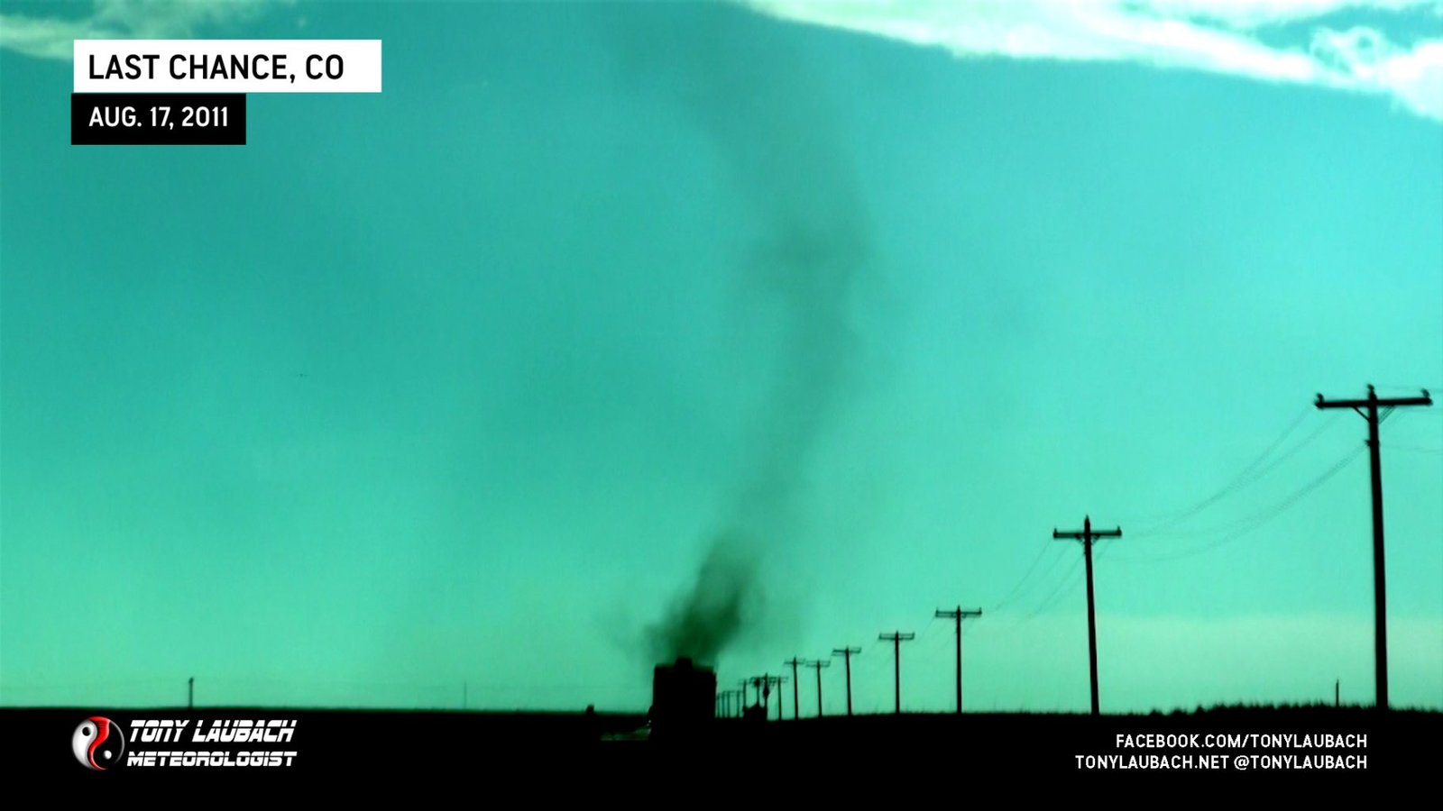
With most of the updraft base above and behind us, we were unable to determine whether or not this feature was associated with any cloud-base funnel or rotation, but it did give the best show of the day for the Colorado storms.
About this time, we met with Verne Carlson, Kendall LaRouche, and Scott Hammel who were also out chasing these dust devils. While Verne missed the bigger of the whirls, Scott and Kendall saw it from a distance and could not confirm a funnel from their view several miles to the southwest.
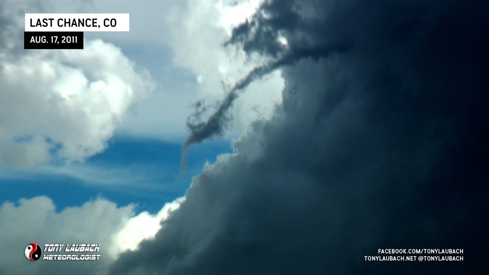
We continued to watch storms pulse up and die as the main area of convergence continued to slowly push south. Once a storm moved off the boundary, it would fizzle quickly. As this boundary pushed along the US-36 corridor, the ground circulations stopped and several funnels did manage to form.
About this time, our patience was running thin and a developing capping inversion over the area was really spelling out doom for this setup. More cells continued to fire, but quickly die struggling against the cap. We pushed east to Anton and were about to throw in the towel on this area as nothing was surviving.
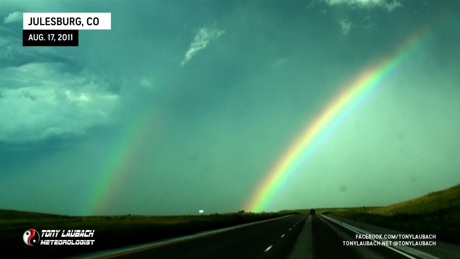
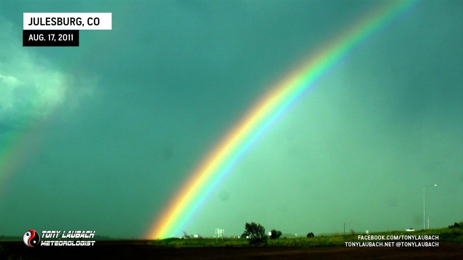
Meanwhile up north, a nearly stationary group of storms were ongoing along I-80 from Sidney to Big Springs in Nebraska. While nearly 2 hours away, they had managed to hold themselves together long enough to warrant the trip up. Given it only being 4pm, we decided to give them a look. We abandoned the struggling storms and raced north through Akron and eventually up toward Julesburg. Of course, one of the cells we left went severe-warned after we passed through Akron, giving us concern we left too early, but a Facebook post from Scott indicated this storm didn’t earn the warning it received, so we continued on feeling like our decision wasn’t a bad one. As we approached Julesburg along I-76, we watched a vivid rainbow on the backside of the storms.
However, as we entered Julesburg with intention to quickly fill up on gas, the storms took a massive dump in front of us. At this point, we stopped and chatted for a few minutes as to our next course of action. To this point, both our targets failed to verify. The first along the boundary failed to produce and our second (and initial target) across northeast Colorado also fizzled. Meanwhile, two storms were ongoing; a severe-warned beast down near Pueblo, likely out of reach by sundown. And another tornado-warned super beast coming down out of Cherry County. I did some line drawing on a map and determined that we could intercept this storm with about 30 minutes of useful light north of North Platte if we hurried up after it.
With neither of us having to be up for anything in the morning, we decided to try for it. To this point, the storm maintained a beautiful signature on radar with a consistent 3-inch plus hail core and a beautiful flying eagle look. However, no tornadoes were confirmed or reported by spotters, so even with our late departure after it, we hadn’t missed a tornado yet.
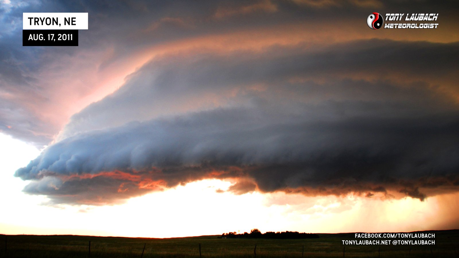
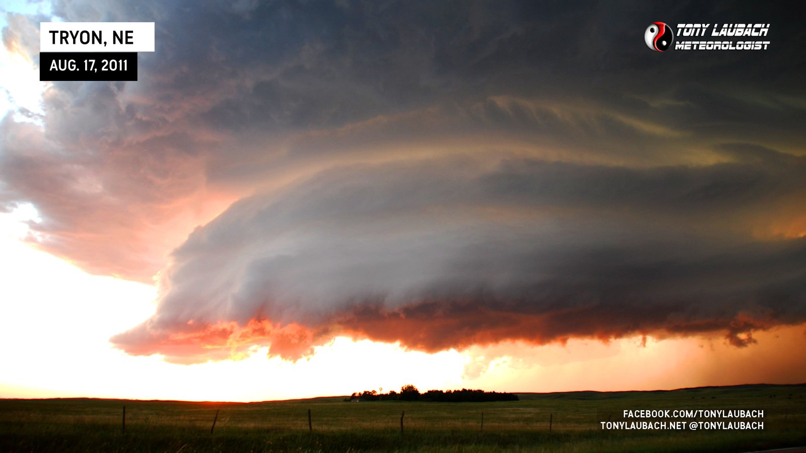
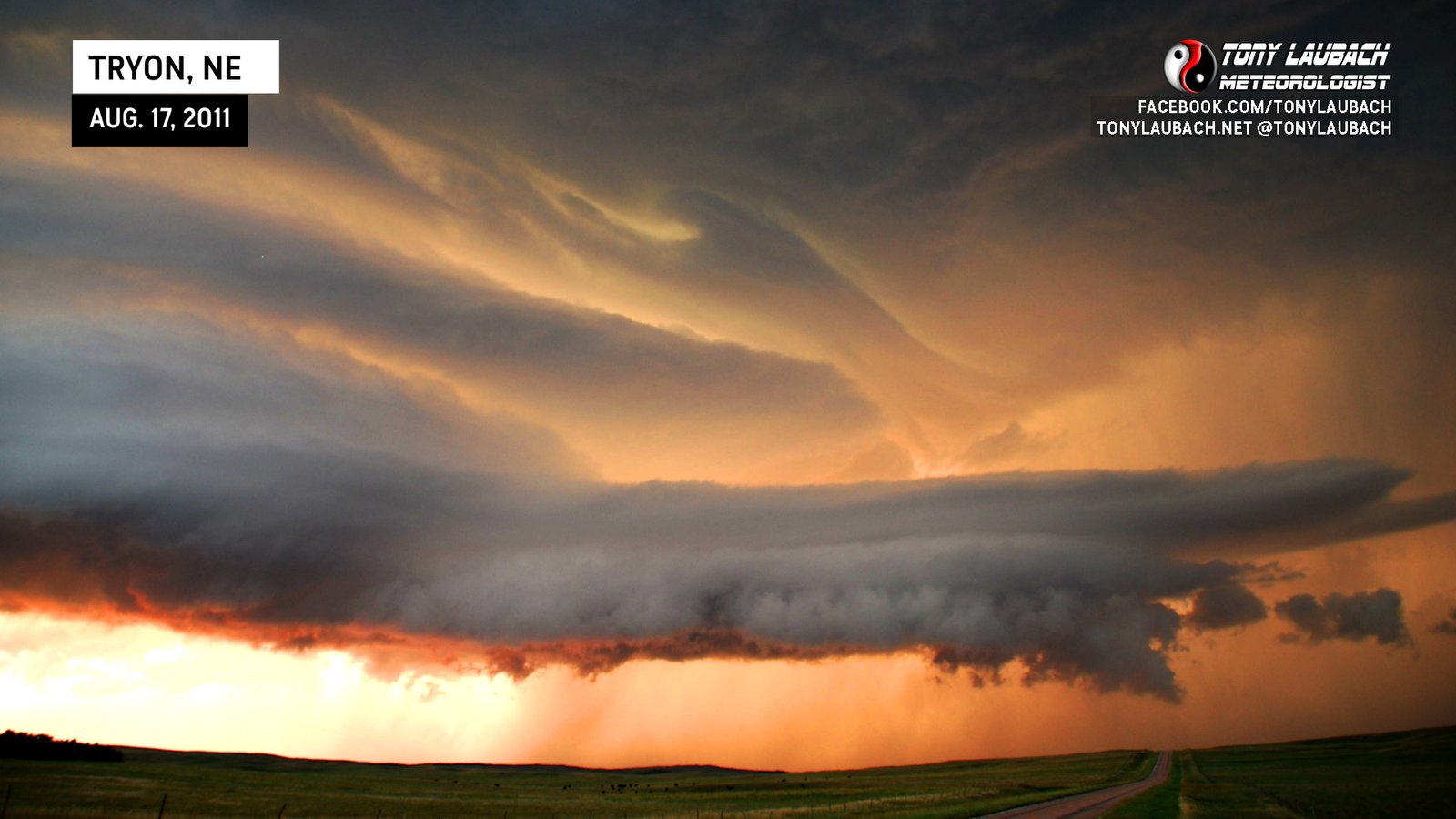
The trip was quick after we got to I-80. We flew east on I-80 toward US-83 with a target intercept in Tryon, Nebraska, about 30 miles north of North Platte. When we hit the junction, we quickly navigated through town and eventually up to NE-97 where we hauled up toward Tryon. We could get more detail out of this storm as we moved north and could tell the structure would be gorgeous. Of course in true Laubach/Grubb fashion, the long-lasting tornado warning was replaced for a severe thunderstorm warning.
We arrived in Tryon to watch the hail marker also dip below 2.50″ for the first time since we took notice of it nearly two-hours earlier. This was an indication that the storm was on its way down and that the ongoing theory of certain chasers (i.e. me) getting within range of a storm can indeed kill off tornado potential.
Fortunately, the cell didn’t learn of our arrival quickly enough for it to completely die off before we arrived. The setting sun illuminated the structure like nothing I had seen before with the brilliant colors showing through the storm’s striations. Of course, this was likely due to the detachment process the storm was undergoing as the main updraft separated from the main core within 15 minutes of our arrival. Still, it made for some amazing photos..
During our gawking session, Dustin and Kelly Price along with Scott Bennett rolled up with us and we enjoyed the demise of the storm. While I don’t think they’re going to admit it to my face, they should safely assume that our arrival to the storm was likely the cause of its 30-minute demise. I’m just kidding of course, but you can’t help but wonder.
With the storm expected to be nothing but a piece of cirrus before hitting North Platte, we called it a chase and met with Scott at the North Platte Applebee’s where we got to enjoy the company of our favorite Waitress Jay Jay whom we had the pleasure of meeting earlier in the season during one of our TWISTEX stops there. After dinner, Ed and I parted ways with Scott and made the nearly 4-hour trip home to Denver, me arriving home after dropping off Ed shortly after 2am.
While the amazing sunset-lit supercell saved the chase from being a complete loss, I’m not sure I would’ve gone through the extra effort, gas, and additional 200 miles round trip if I had known the storm was going to be a 20-minute structure show at sunset. While I greatly appreciate beautiful structure, it’s not something I normally go out of my way for. I’m thrilled as hell to have gotten it since I was there, but I would not have been terribly upset to see these pictures from other chasers had we decided to tun and go home. Still, the beautiful photos we grabbed definitely made the trip and were certainly worth while on a day that absolutely aimed well below expectations. Colorado again depresses with another poor showing in a season full of duds for my resident state. Had to again go to Nebraska for something good.


