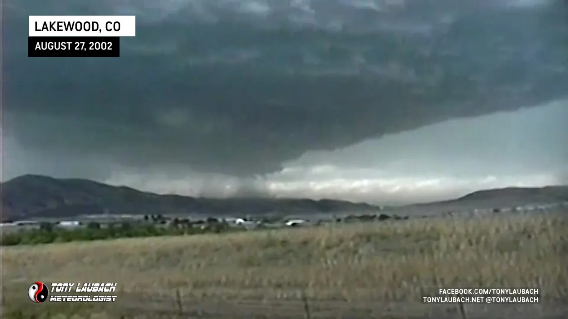
This was my first LP Supercell ever, and it was literally within walking distance of my house. The official track of this storm took it directly over my neighborhood, so had a tornado dropped from this, it would’ve paid my house a visit. Most of the trip milage was from the following of the storm after it had lost its main rotation. Incredible video shows the green sky before golfball sized hail bombarded my chase vehicle; a perfect view into the clear slot of the supercell; excellent time lapse footage of the rotation as the storm spun just to my south and east, including a funnel which tried to form. Video was used to open Denver’s 9 News at 5pm and my reports made the local Mix 100.3 radio station as I was unable to forward my report to NWS.
2:00pm – My Chemistry teacher excused me from class, telling myself and Jennifer (a friend in class), “If you guys want, you can play hookie the rest of the day.” Quick to take her up on that, we left. When I stepped outside, I saw the beginning of a gorgeous thunderstorm over the mountains to the northwest. Keeping it in the back of my mind till I reached my car, I turned on my WX radio to hear a Severe T-Storm Warning had been issued for it. I hurried home.
2:34pm – After glancing at the radar, I noticed what I thought to be a hook on the storm as it was slowly making its way to Denver. I decided to prepare for a serious chase; mounting my tripod and video camera on the dash and rehooking a majority of my scanning equipment.
2:47pm – After leaving the house, I headed north on Kipling to Hwy. 285. While sitting at the Quincy light, my WX radio fired off its high pitched tone. I glanced at the screen to see TORNADO WARNING on the screen. Figuring it to be another nearby storm, I listened attentively to the warning with the previous radar loop in my mind. Low and behold, it was for my storm.

2:55pm – I pulled off to the side of Hwy. 285 to start shooting my first video. The sight, an unbelievable shot of the storm as it began to push over the foothills. A lowering defined the area of concern as rotation became evident in the storm’s wall cloud.
3:00pm – A cluster of clouds began to rotate due north of me. Lowerings were starting to fizzle off and on, dissipating as quickly as they would form. The turbulence in the clouds was definitely becoming clear.

3:03pm – Green hues in the sky indicate the approach of hail. I elect to try and get myself closer to the rotation and take Hwy. 285 to C-470, then heading north on C-470 to Morrison Road. Just as I hit the on ramp to C-470, I begin to take on golfball sized hail. Fortunately for my car, it was the softer kind of ice Denver is use to seeing.


3:12pm – I find myself parked off to the side of the road on Morrison. I take 15 minutes of film as the storm’s base continues to rotate like a top. The wall cloud spins a couple of funnels, nothing that amounted to much. Time lapse of this video shows the incredible rotation this storm held as it pushed through Morrison into western Littleton, passing nearly right over my own house!!!
3:44pm – After shooting the wall cloud; me having to move eastward along Morrison Road to keep out of the hail shaft which was slowly pushing eastward with the storm. The hail within it continued to drop as golfballs. After the wall cloud dissipated, I hauled south along Kipling Street, my video camera running just in case. At this point, I was on the phone with the Mix 100.3, a local radio station, explaining to the DJ as to what was going on and what I thought was next. I said to him that most of what was being seen now was scud cloud lowerings and rain shafts; not funnel clouds. I indicated to him that I thought the storm was dying out and all that would be expected is heavy rain and small hail. That was my best prediction all day! The storm began to die out, leaving behind an impressive beaver tail as I turned east onto C-470!

4:17pm – The storm gives its final look before dying away, giving way to later heavy storms that dump heavy rains and nickel-sized hail on the southwest Denver area.
4:41pm – After officially calling off the chase, I called up the local news station and informed them of the video I shot earlier. They directed me to one of their trucks that was literally right down the street from me at University and County Line Road. I pulled in and was immediately asked about my vehicle. During our joking session, we found ourselves being hit by another storm developing over top of us. Some nickel-sized hail fell on us briefly from that.
4:48pm – When the storm passed, they began to feed in my video to the station for their 5:00pm news show. During this time, they were preparing the anchor to report, but lightning very close to the area kept the anchor hiding inside the nearby Applebee’s. I can’t blame him; the tower on top of this van reached well up above most things in the area. I took shelter in the truck, watching as my video streamed into the station. At 5:00pm, my video was shown to intro the news show. Another part was used again during the main report. It was pretty cool!

