


SBen McMillan, a TWISTEX participant, flew out the night before to chase a promising setup to which we targeted the Nebraska Panhandle along I-80. When we awakened that morning, our target was defined as Sidney, Nebraska, so I-25 into Cheyenne and over on I-80 would be the route.
We awakened at 9am, gathered our things, and made a pit stop over at the tire place to get my tires rotated and balanced. They promised us a quick 15 minutes, so we ran over to a nearby bagel place for breakfast, then strolled over literally as they were pulling the car out of the shop. We fueled up the tank and were northbound.
The trip out was quick, and as we neared Cheyenne and eventually turned east on I-80, we observed a cu-field to our west over the mountains and a developing cu-field with some agitation to our east/northeast. We pressed on, initially stopping in Kimball, but continued to our target of Sidney. We arrived in town as some cells were trying to form, but nothing imminent. Meanwhile, a massive storm was ongoing near Ogallala which had our attention, but we resisted the urge to fire off after it.
We grabbed lunch at McDonalds and attempted to fill up in town. Pumps were extremely slow, so we grabbed our 2 gallons and made our way north a few miles to check out the first developing cell along the boundary. It looked decent for a while, but got fuzzy and weakened. Meanwhile, a stronger storm was developing immediately south almost right over town. We turned around and made our way for it.
About this time, we observed some dust on the ground which tightened up and made its way toward the cloud base. We assumed it to be a landspout as it was way more defined than a gustnado. Radar indicated a strong couplet and with the storm over the boundary, it seemed like a pretty textbook landspout producing scenario. Definitely not a dust devil!
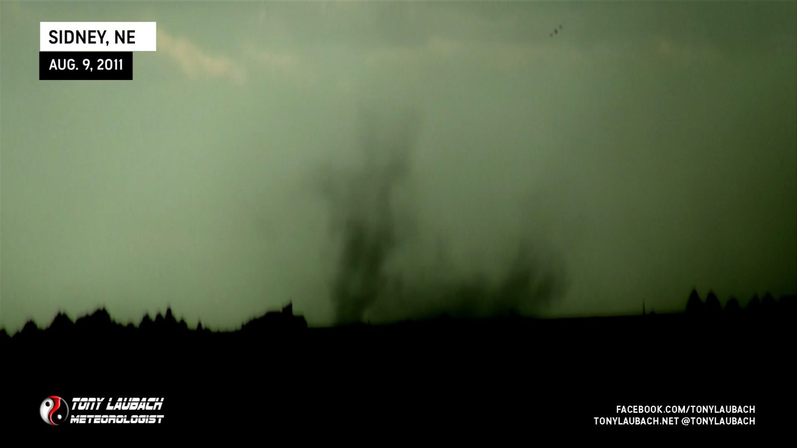
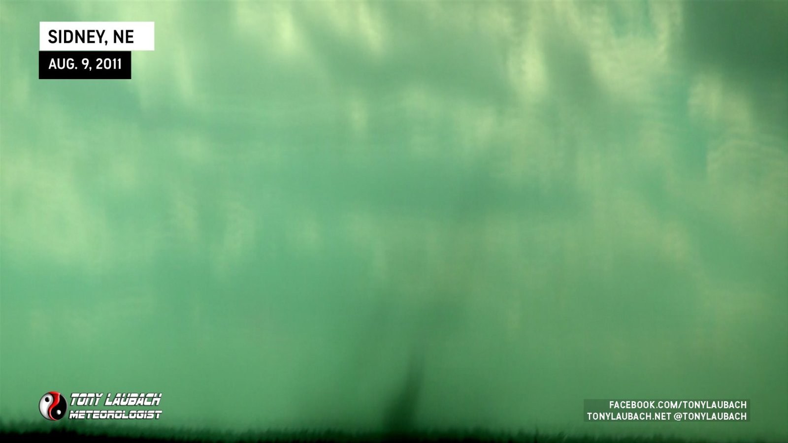
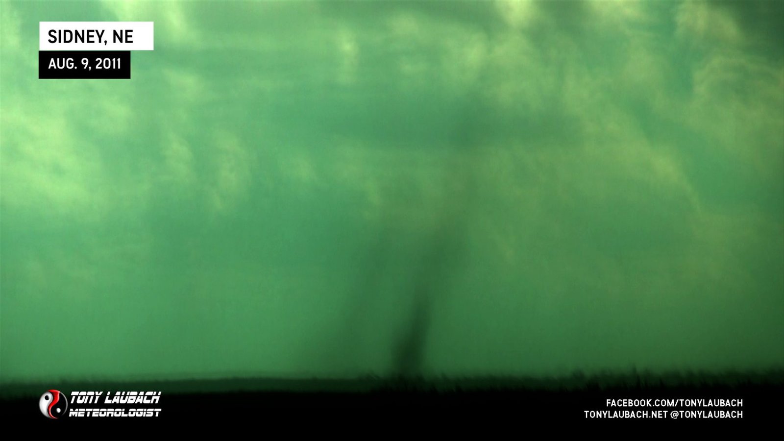
We estimate the spout to be on the ground for roughly 6-minutes from 2:14-2:20pm and it likely dissipating south of I-80 toward the west side of Sidney. We were unable to confirm any cloudbase rotation or funnels from our angle and distance, but the laminar look to the dust column and the radar signature and presence of a well-defined boundary lead us to believe it was indeed a landspout.
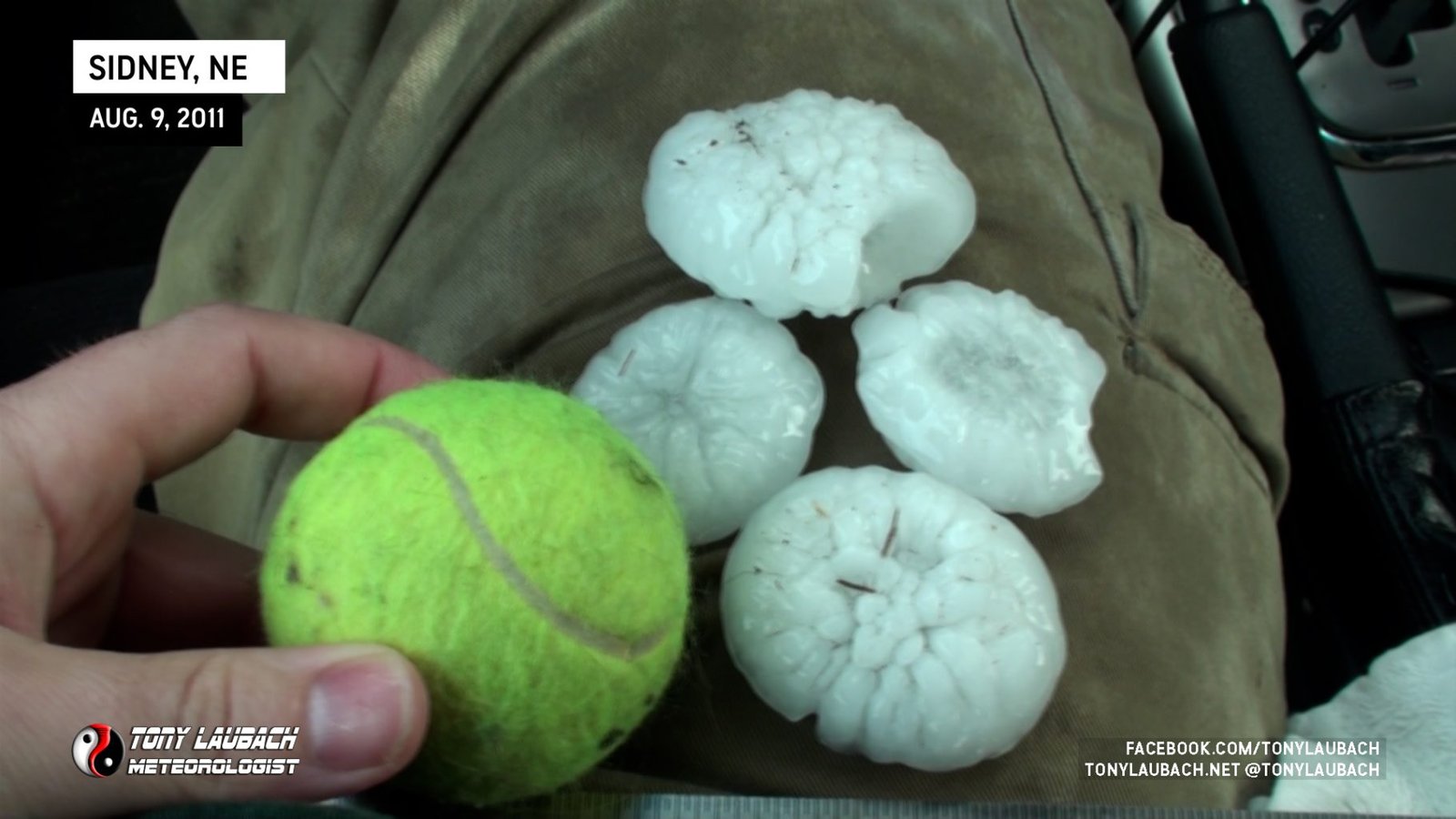
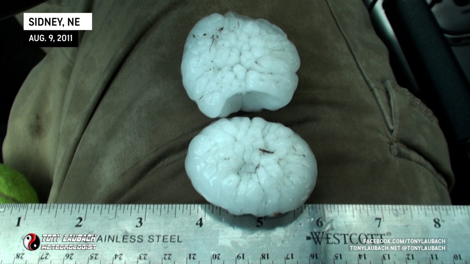
As we neared I-80, the spout had dissipated and gave way to the storm’s core. Large hail up to 2.25″ in diameter began to fall along the interstate. We measured the hail to 2.25″ near mile marker 58 south of Sidney.
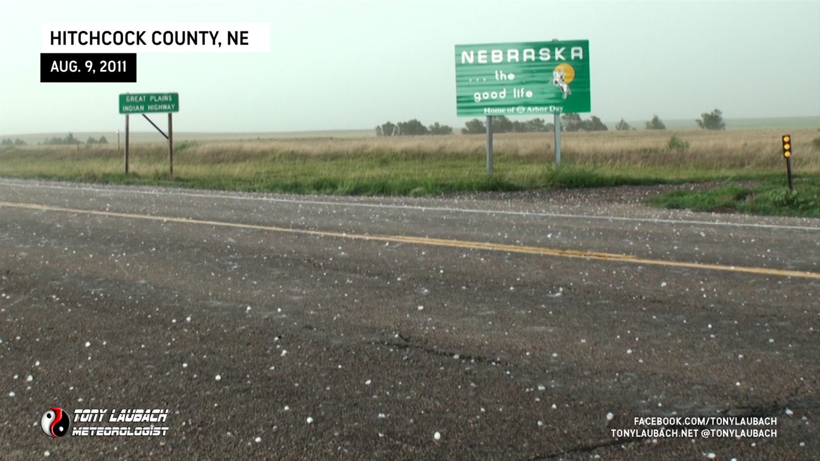
With the storm sliding southeast, we needed to get back in front of it. We blasted east on I-80 in hopes to take a southbound option to get us around the storm and back in front of it. One exit we tried, the road immediately proved to be too much, so we raced over to Chappell and dropped down through Julesburg on US-385. The storm crossed the highway before we did and we were left to observe the hail that had piled up on the highway to the northwest of Venango.
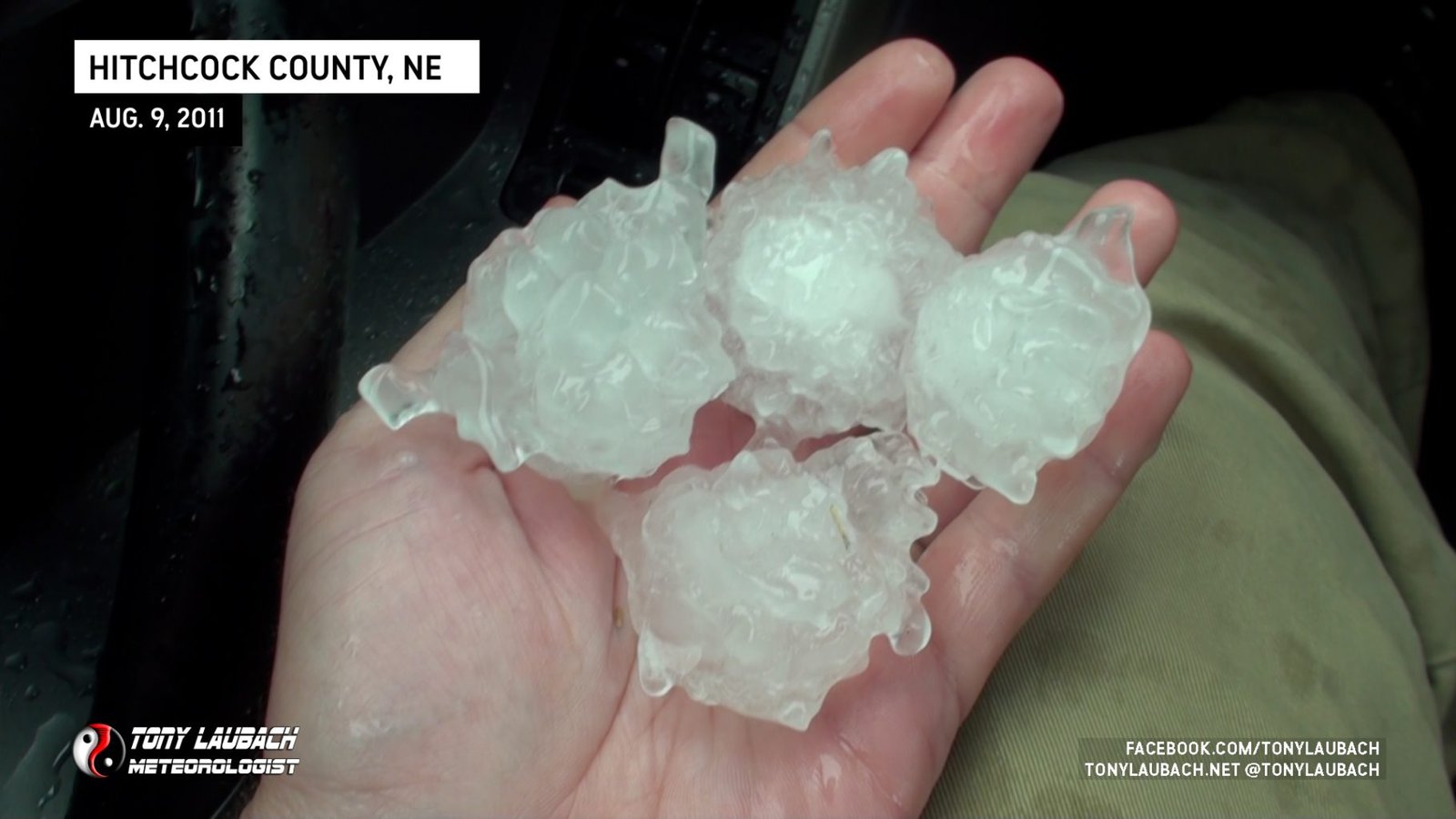
We jumped east on County Road 4 into Venango where we hit the backside of the hail core right on the border. We briefly stopped in town for a few shots before heading south on a series of county roads that eventually lead us back to pavement on US-6 west of Imperial. We tried to beat the storm into Imperial, but still were battling to get back in front of the cell. We raced east on US-6 which fortunately runs southeast out of the city and eventually got ahead of the storm and were able to drop south on NE-25 through Trenton where we got in front of the storm along the KS/NE border. Hail again began to fall, most of it 2-inches and smaller, but it had a more spikey appearance.
With us finally ahead of the storm, we coasted south into Atwood and then east toward Oberlin where we again were side-swiped by the core with some very large stones coming down. We estimated most approaching baseball size, and when we finally found a place to get out and look, the core had passed and we were only able to recover stones up to 2.25″.
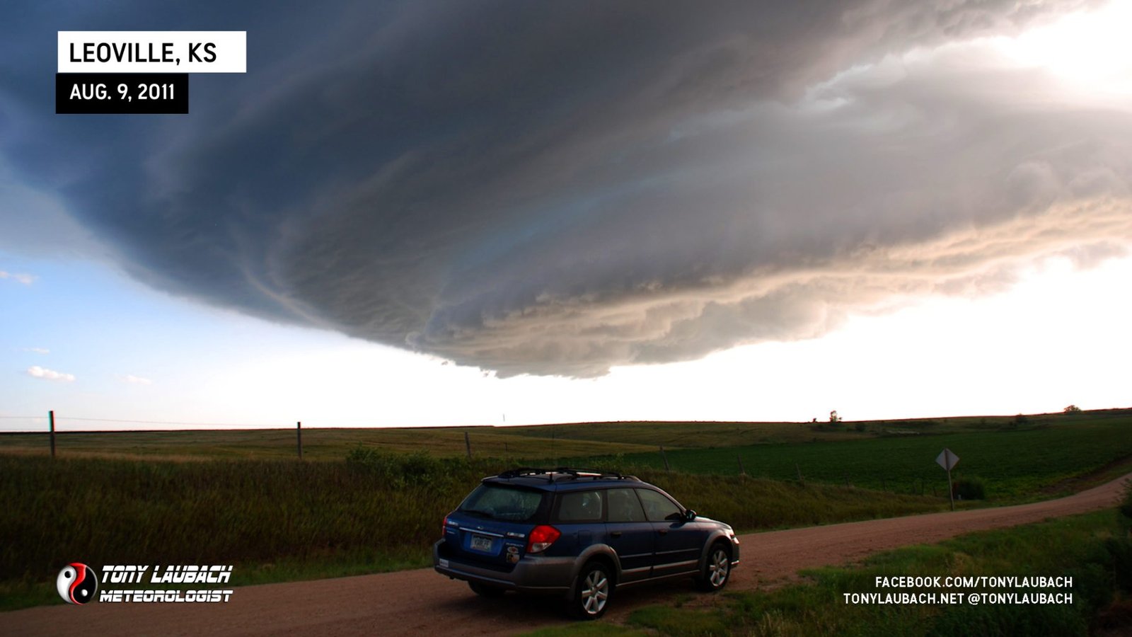
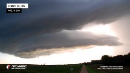
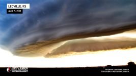
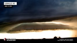
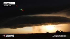
We continued east to Oberlin, then south to Leoville where we stopped at the junction of KS-23 and KS-123 to admire the beautiful storm structure. A few occasional stones up to 1.50″ fell as we stopped to shoot, but most of the core was to our north and moving southeast.
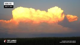
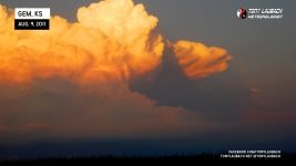
We gave the core one more shot as we ventured where KS-23 intersected KS-9, but the hail had diminished to sub-severe criteria, so we called it a chase and headed west on KS-23 to US-83 and eventually into Colby for a victory dinner at Montana Mike’s before returning back to Denver. Along the way, we stopped to shoot some of the towers being lit up by the setting sun.
All-in-all, a pretty terrific chase! With the northwest flow, we figured hail was going to be the big intercept and it surely did not disappoint. The boundary that was originally draped across the southern panhandle was going to offer the best chance for tornadoes, and while it was a landspout and fairly weak, we were able to get one produced beneath the rapidly building updraft which brought my 2011 tornado count to an even 30 and added another tornado to an elusive August list.


