An absolutely INCREDIBLE chase day in my former backyard! Was absolutely (pardon the pun) BLOWN AWAY by how this day unfolded. No surprise given the lead-up hype to it, but none-the-less, exceeded all my expectations!
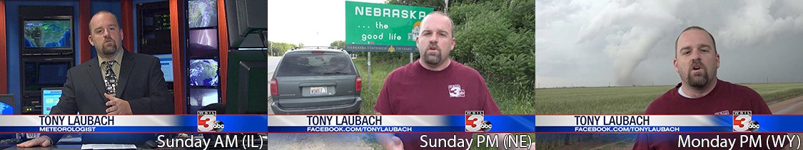
Speaking of hype, this day started really gaining ground about five days out, and I began to countdown my trip. Fortunately as my work schedule went, I was off the early part of the week, so how perfect was that. Obviously the distance from my place in southern Illinois all the way to Cheyenne (my first pick) as going to be a haul! My plan was to catch a quick nap after I weathermanned on Sunday morning, then truck out to someplace in central Nebraska for the night.
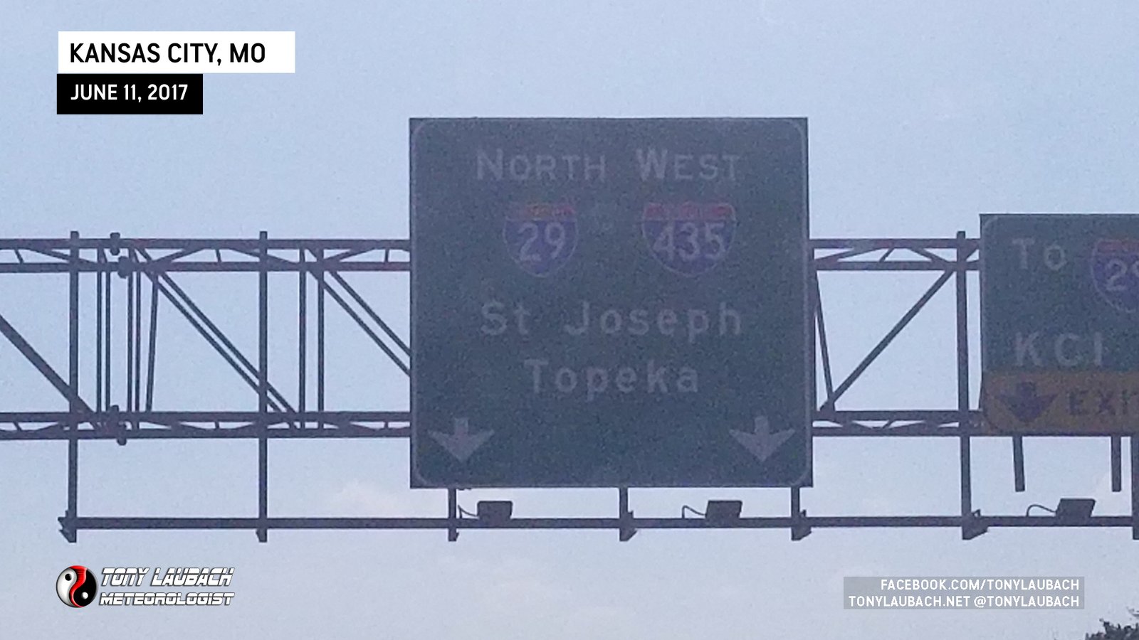
A nap didn’t happen, but it didn’t matter. I was super-hyped to be getting out for this chase! I got packed up and headed out the door, rolling up to I-70, then the long (my least favorite) drive across Missouri to the Kansas City area where I jumped on I-29 north toward Omaha.
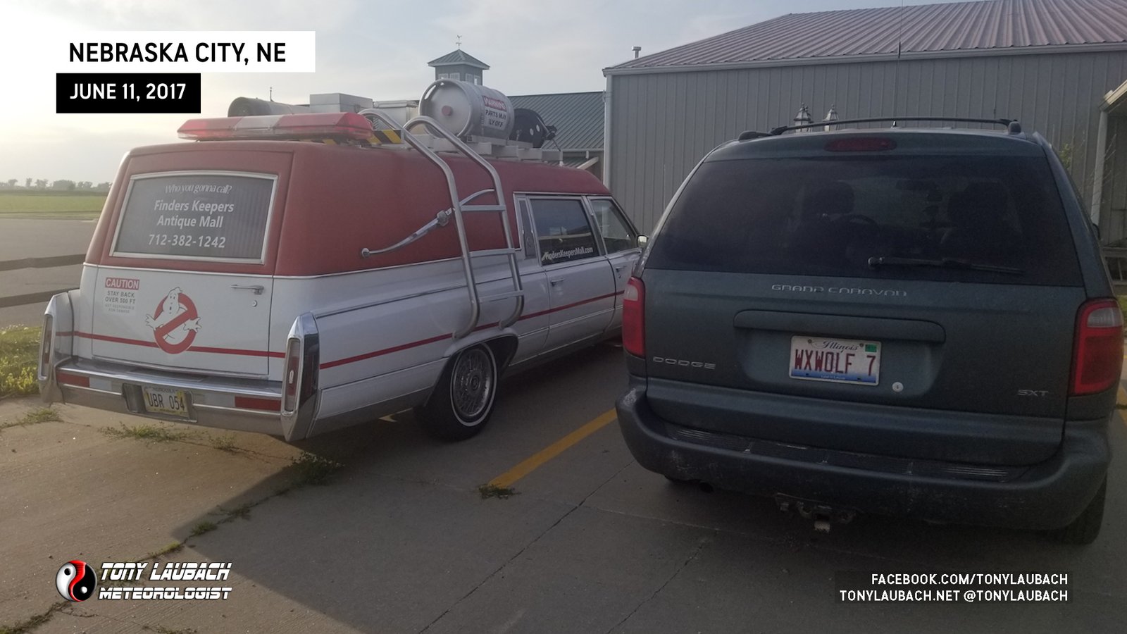
Rolling up I-29, I got off at Nebraska City where I stopped for gas and a photo-op with a curious find…
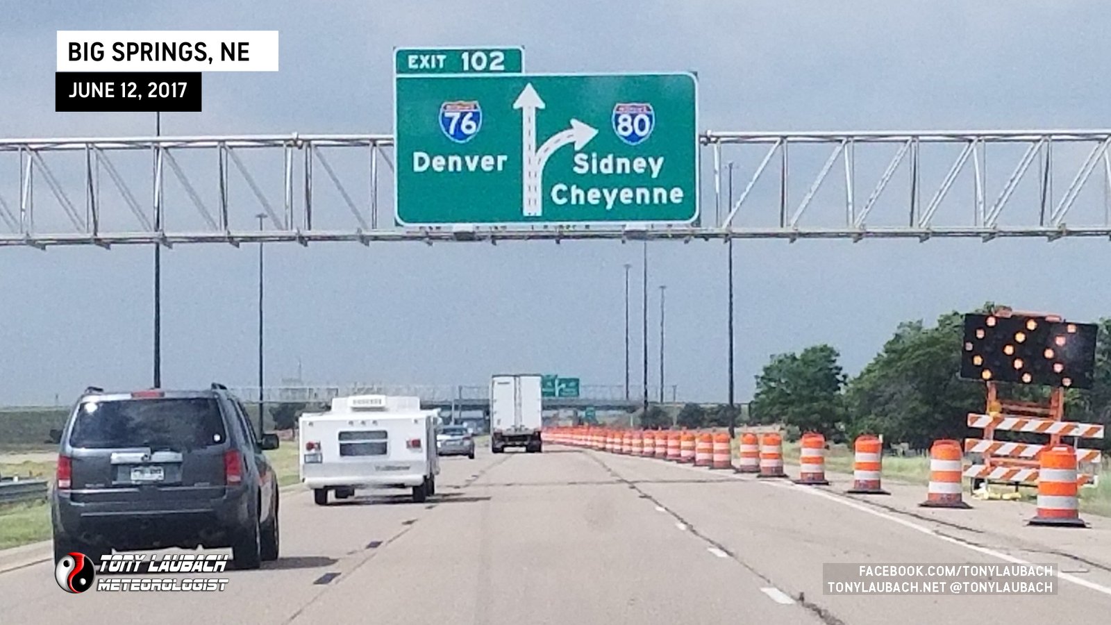
I sawed off a couple more hours, settling down in Kearney for the night. I got up the following morning pretty early as I had a five hour haul to get to my target city of Cheyenne.
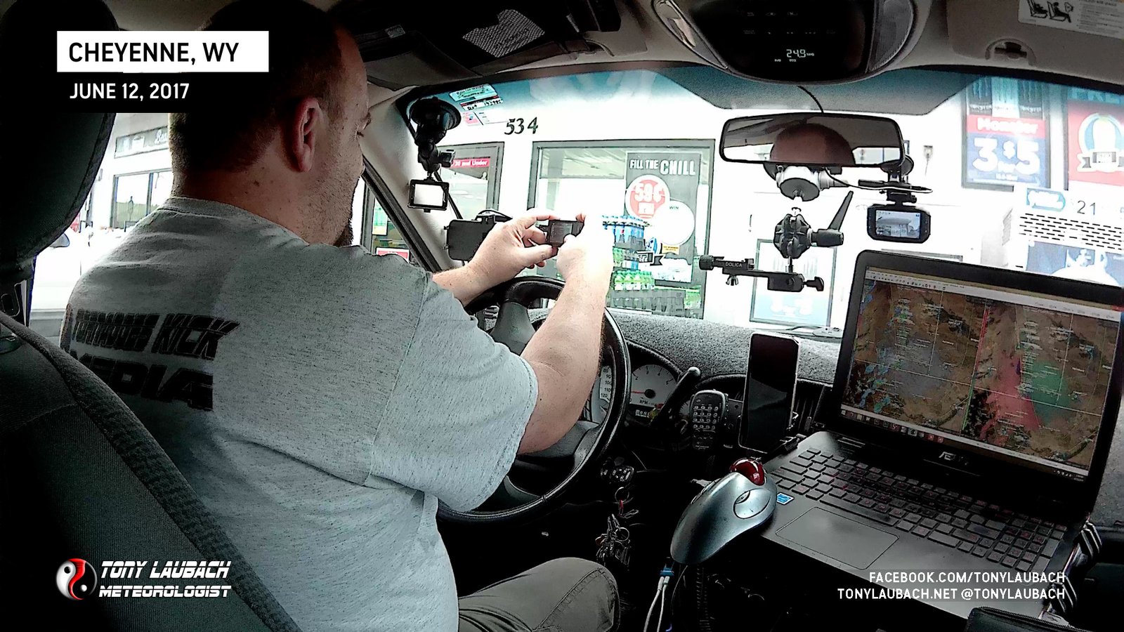
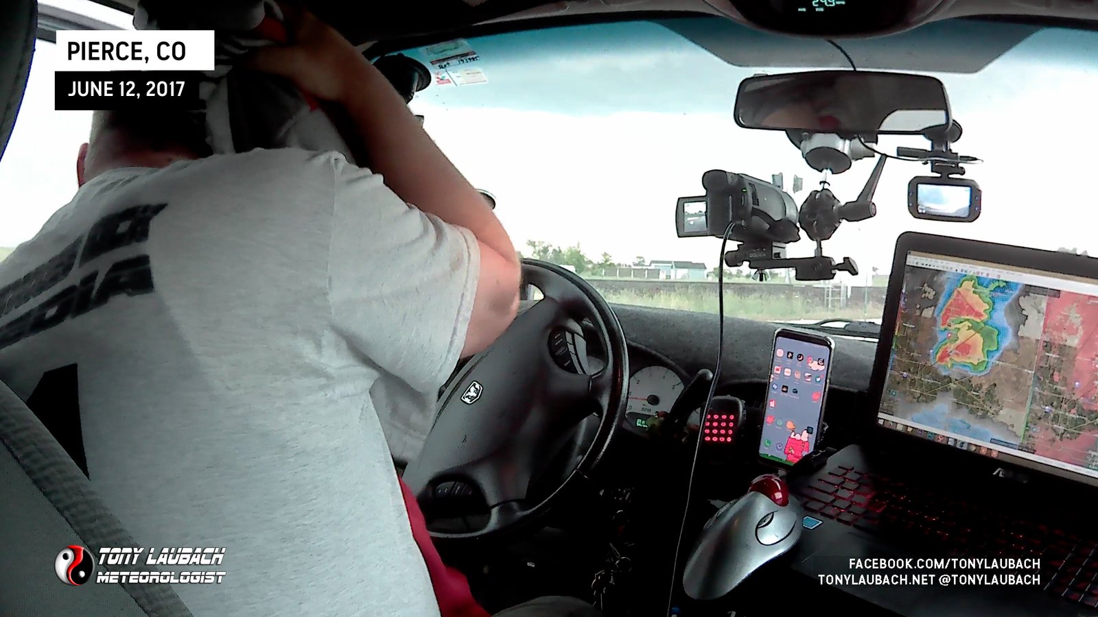
I got to Cheyenne with no issues, stopping at one of the truck stops to fill up with food and gas (not all in the same way), before setting up my gear for the day.
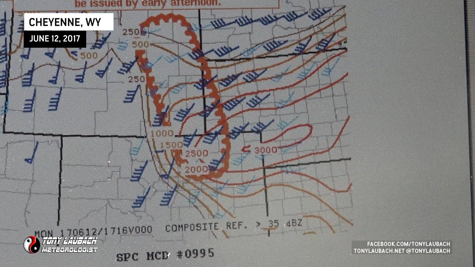
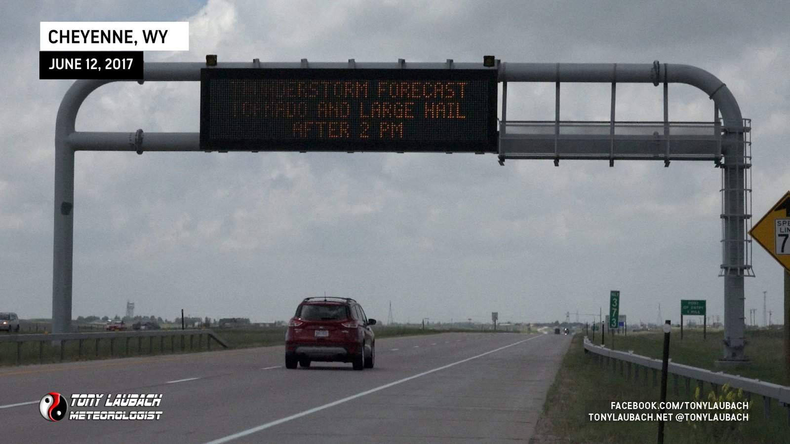
With cells popping in northern Colorado, it was time to head south. As I made my way out of Cheyenne, I saw one of the DOT signs that warning motorists of the rather rare event that was shaping up.
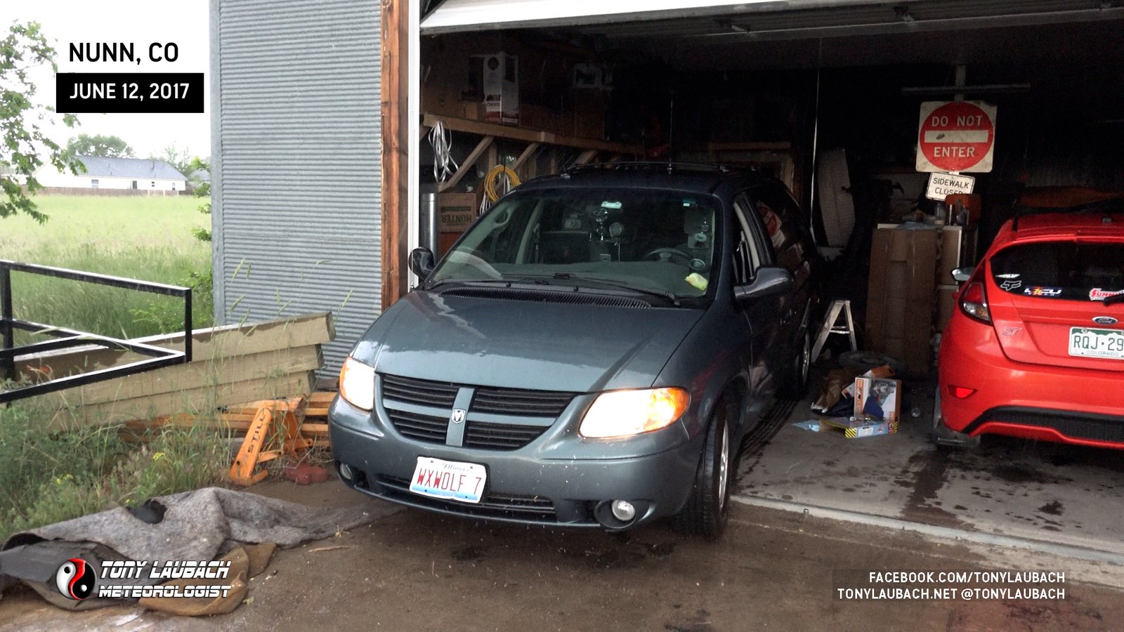
Storms were maturing quickly, and one to my south was really going full beast supercell mode. I cut off I-25 over to US-85 and started heading south into the approaching core. As I neared the storm, golfball hail started to come down. I pulled off to wait it out when a family waved me over to take cover in their large garage on their property, which I happily took them up on. I backed in so I could roll the dash cameras and let the hail come down.
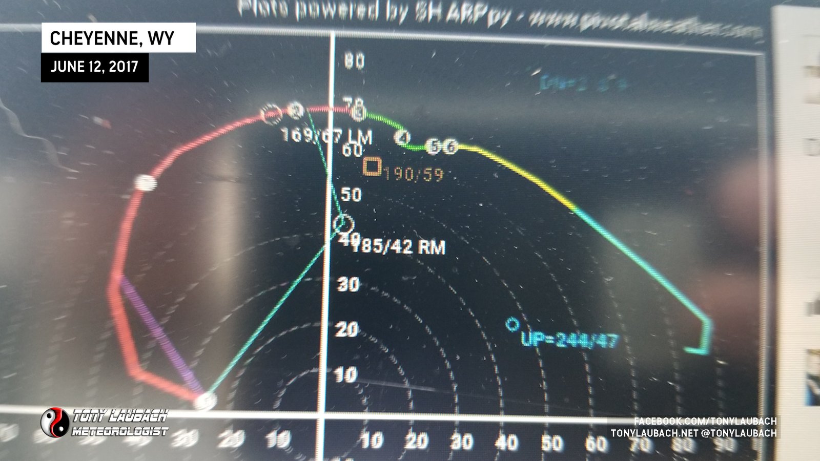
As the core passed overhead and the hail began to cease, we were within view of the hook. An impressive wall cloud developed, slowly rotating, but definitely garnering attention.

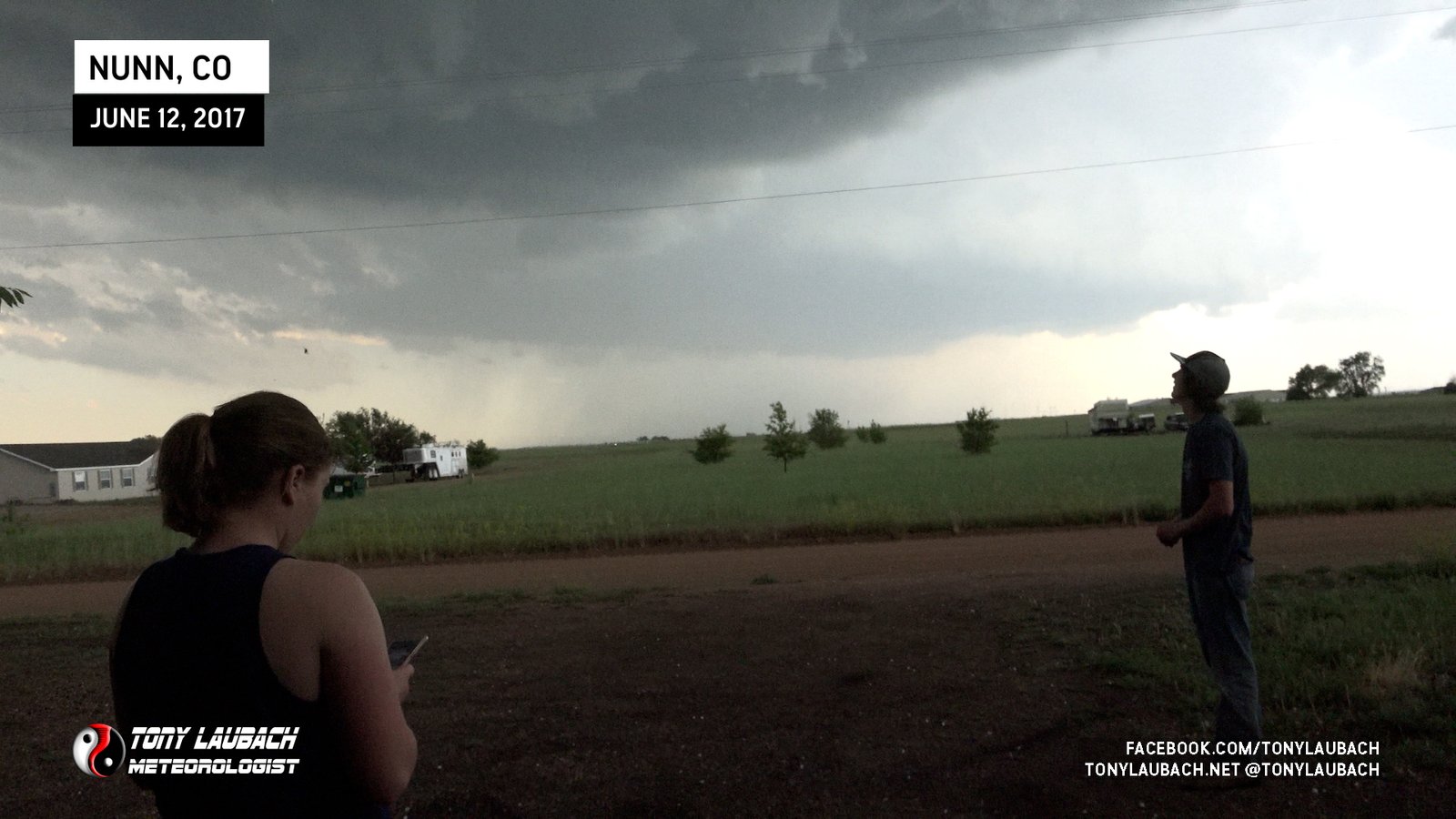
About this time, NWS Denver issued a tornado warning for the storm, and as we were watching the wall cloud, tornado sirens from town started blaring away. Meanwhile, a new cell had formed south of this one. The question then became, stay with this one, which is definitely rotating and has tornado potential… OR…
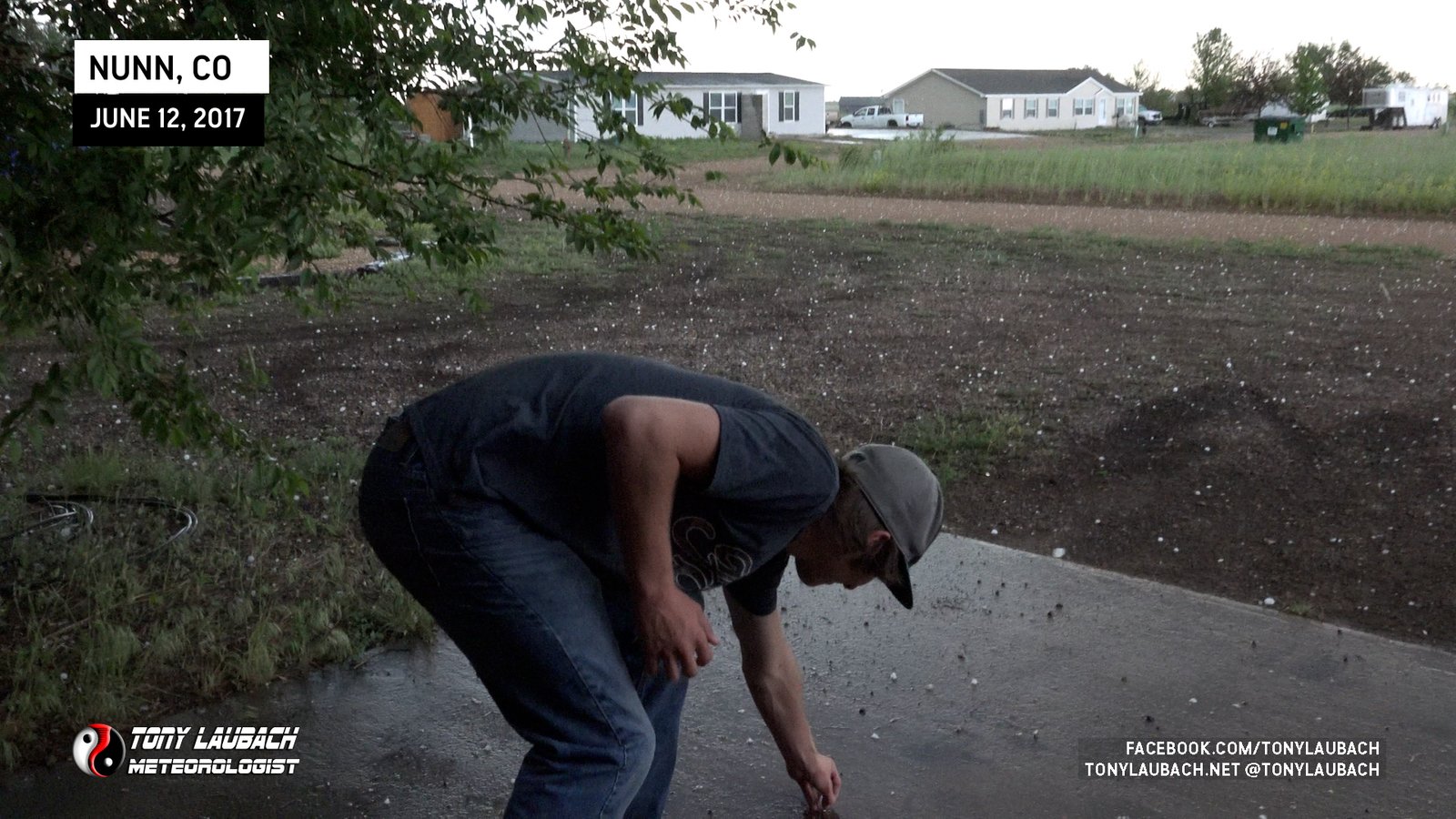
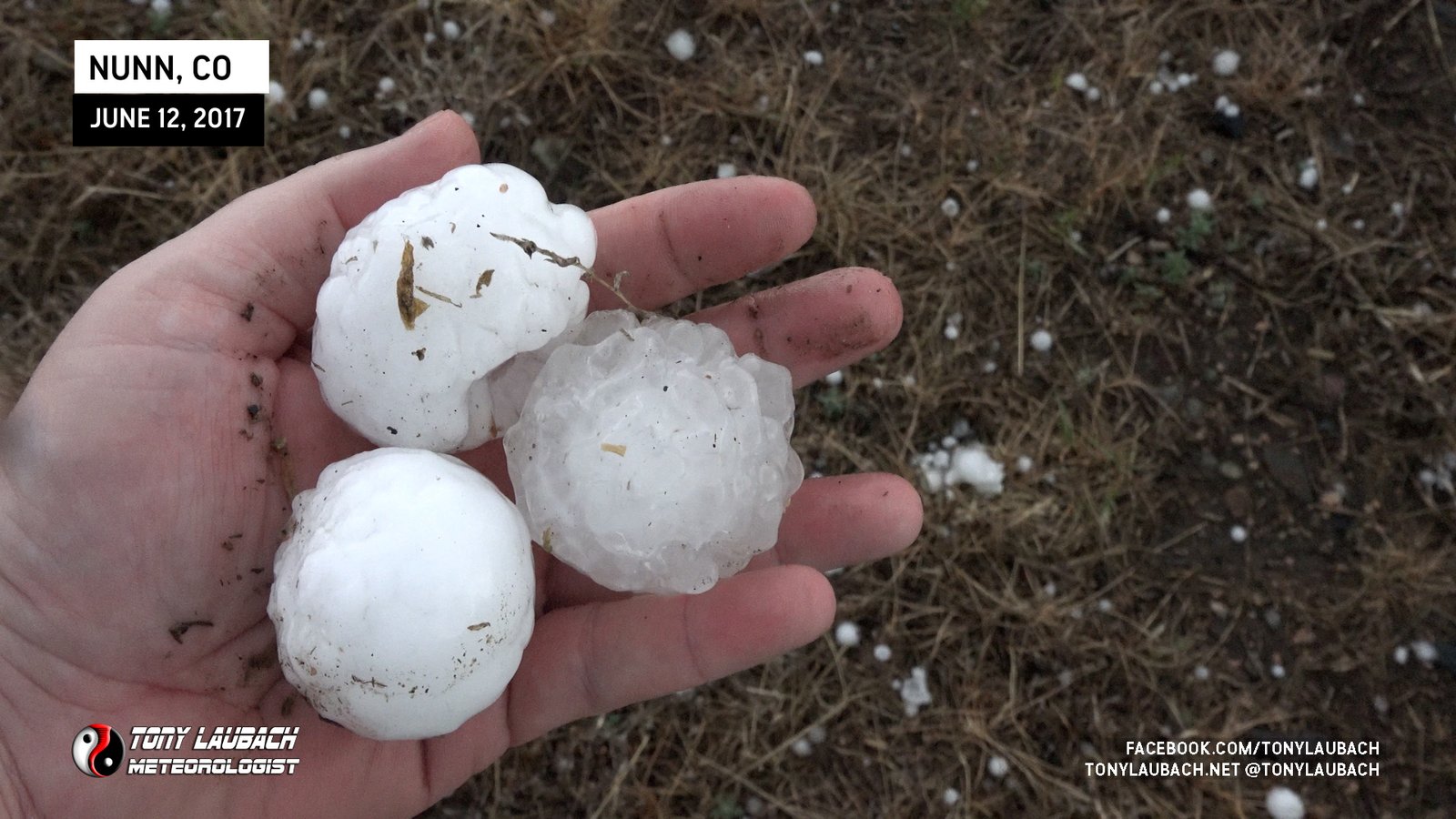
Using the old logic, “when in doubt, go south”, I decided to abandon the northern cell for the southern one. Figuring the north cell was going to be interfered with now, and the southern cell had much better cleaner air to pull in, it was an obvious choice. But this cell had BIGGER hail, baseball (if not larger). I pulled off to the site of US-85 on the north side of Pierce and fully expected to lose some glass, particularly when I heard the sound of one of those large clunkers slamming into the roof of my van. Others also pulled over as the hail came down.

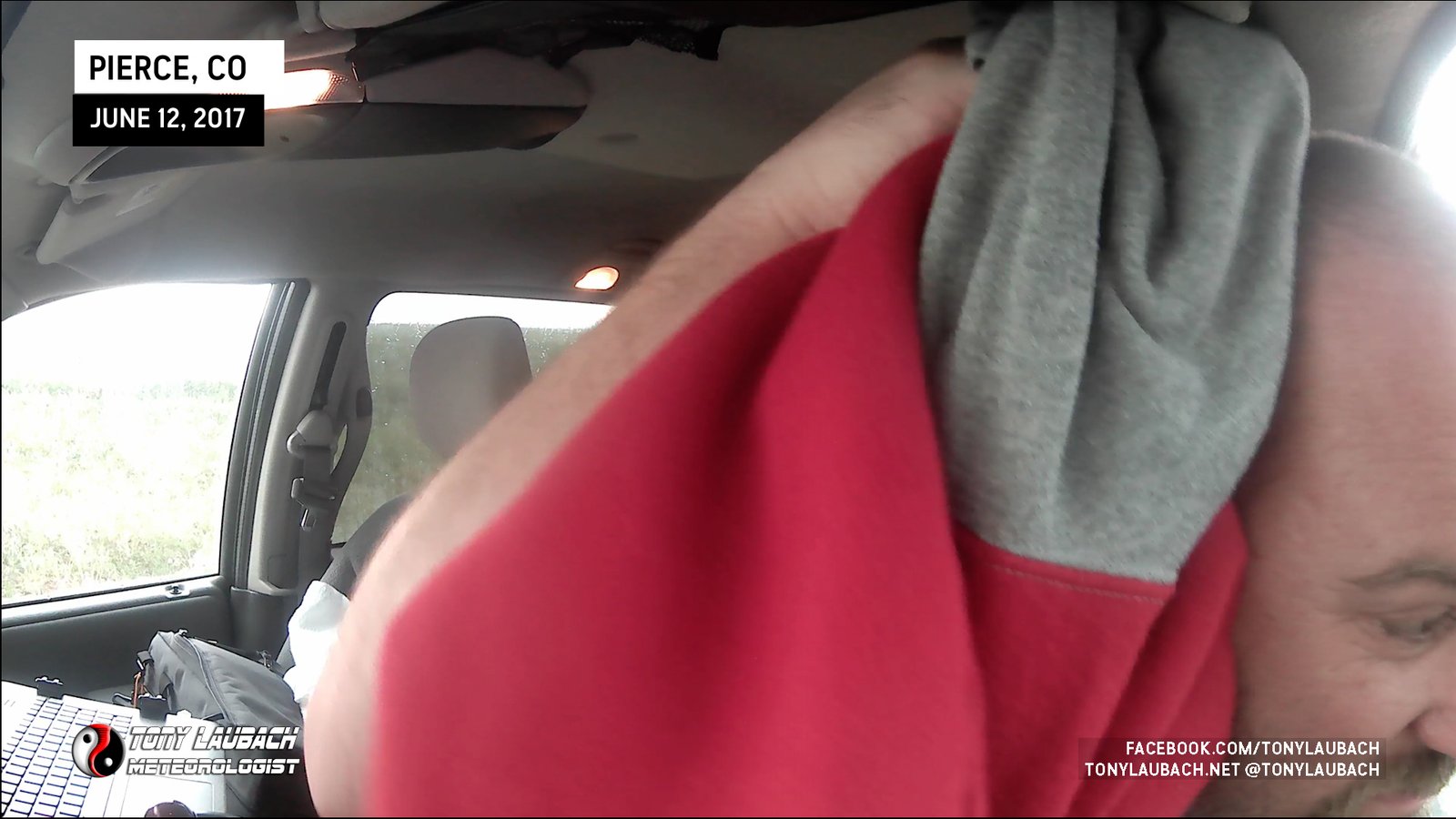
Unlike the golfball hail earlier, I decided to wait out this core a bit before I launched myself out to grab a few stones. The hoodie I was covering myself in just wouldn’t cut if verses a 3-inch piece of ice. Once it lightened up, and the thuds were more spaced out, I figured I’d take my chances. I threw my hoodie over my head and dash out to grab a few nearby stones.

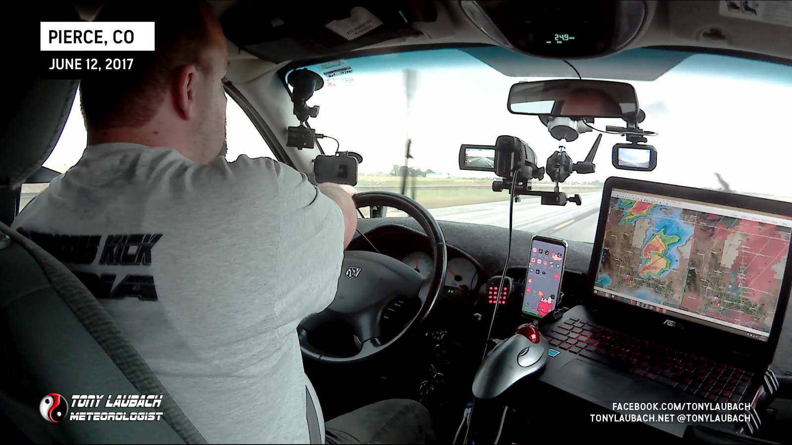
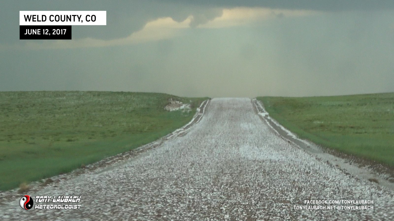
With nothing imminently tornadic with this cell, once the brunt of the core passed, I flipped around back toward Nunn, making several more punches into the core along the way, gathering more impressive hail, all while NOT losing ANY glass.

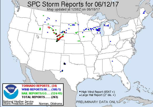
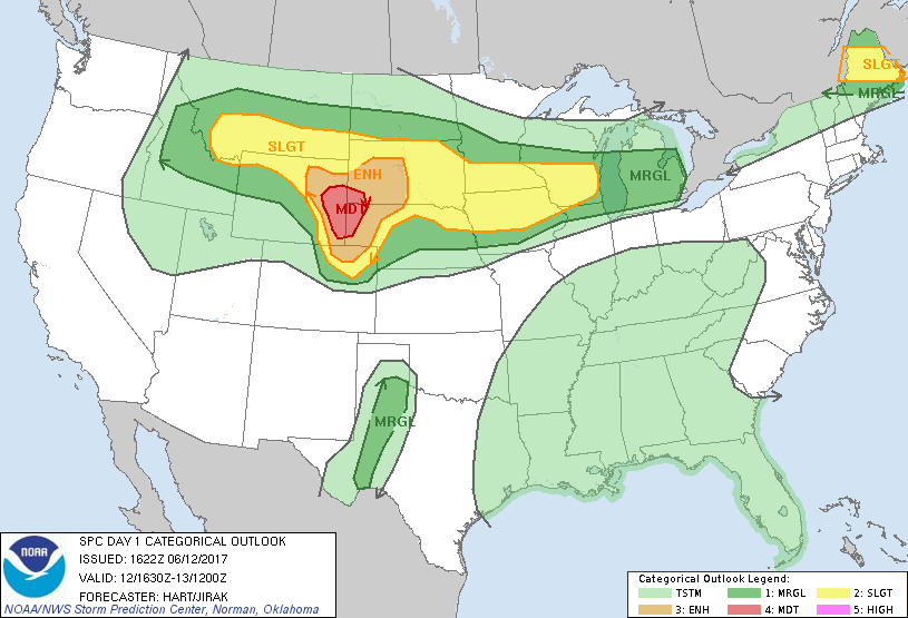
I was pretty darn happy up to this point, knowing plenty was still to come, but that was a pretty amazing hail core intercept. But things were starting to really ramp up with this storm. The northern cell was still going, but all eyes were on this southern cell. Rotation began to rapidly increase, so it was time to get out of hail mode and get into tornado mode.
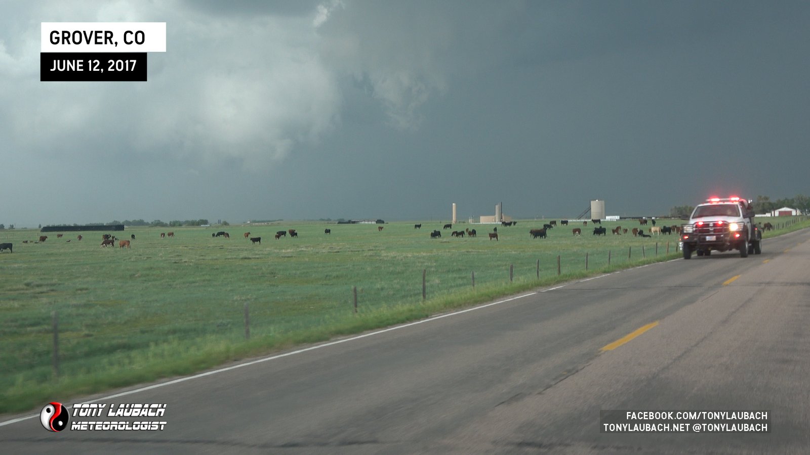
I stopped to assess my routes, seeing a risky route that would take me east from US-85 all the way over to Grover. It was a risky endeavor cause that route was NOT paved and that area just saw the same core I did. None-the-less, if I wanted to stay with it, that was the way I had to go.
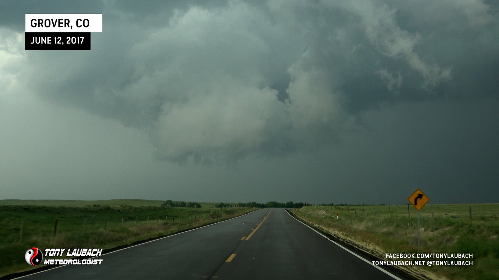
While it wasn’t the worst drive ever thanks to the well maintained road, it was still slick and pretty slow. The storm, which was moving slowly (thank God), was putting a little distance between us, but when I finally got to Grover, I was back on pavement and could get the wheels really rolling. About this time, a organizing, and quickly rotating wall cloud was developing.
It took less than 10 minutes from this point before the show would kick off. Moments after passing through Grover, the wall cloud, spinning like a top, was getting ready.
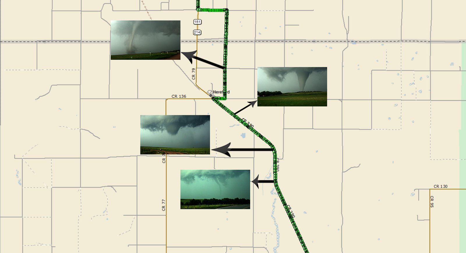
And about five miles north of Grover…
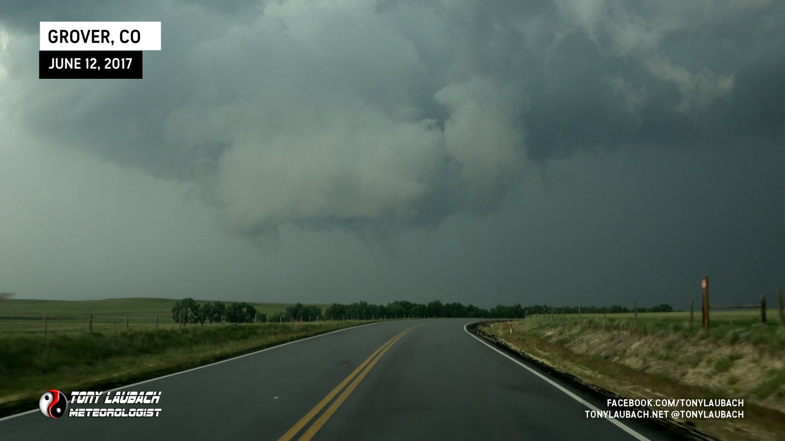
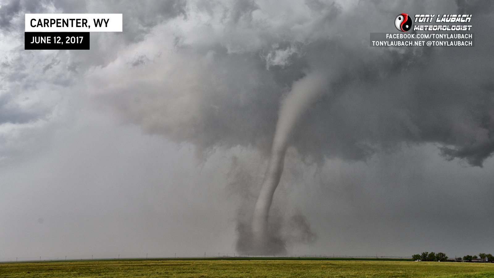
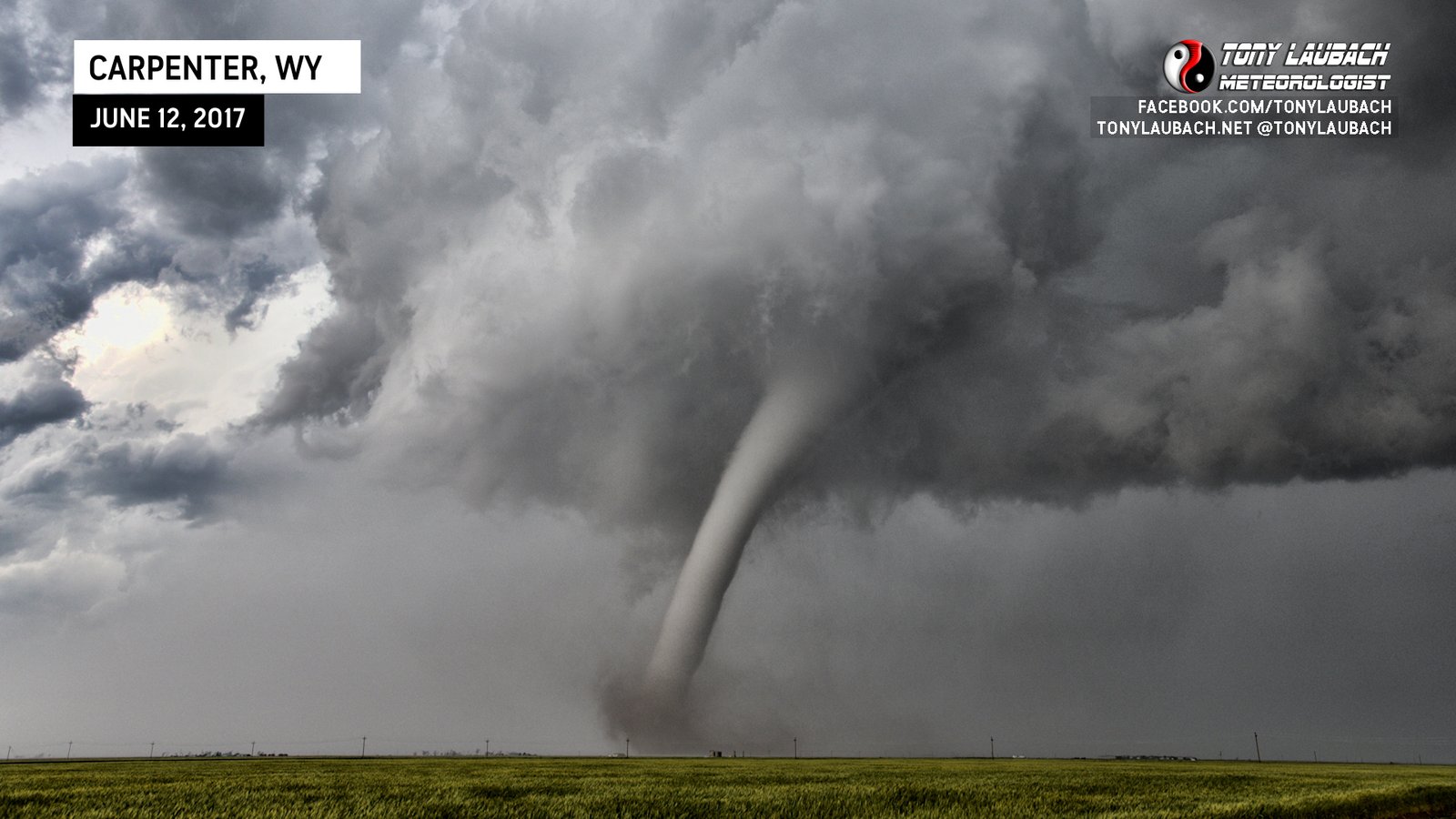
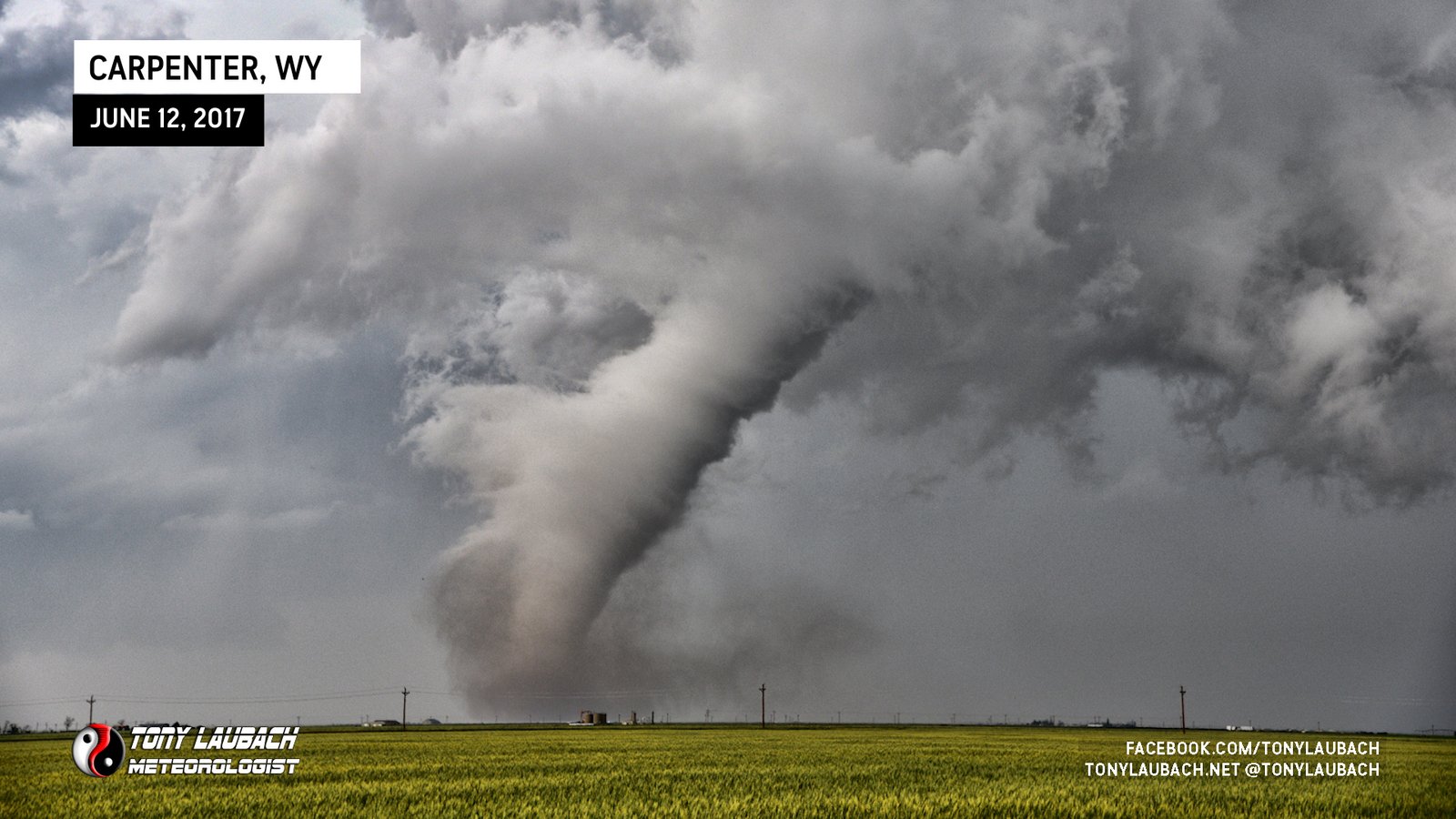
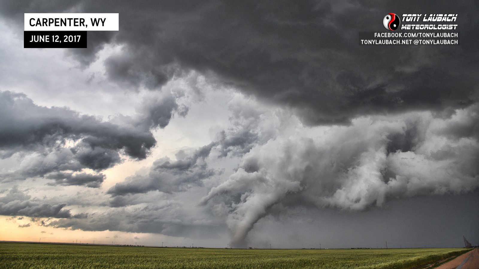
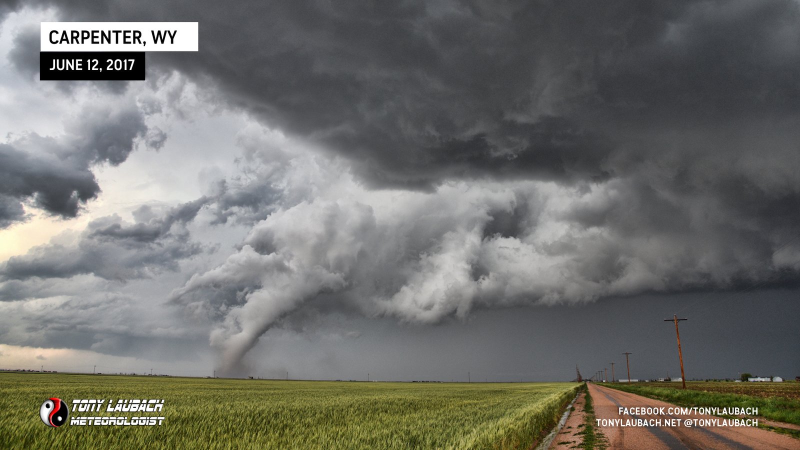
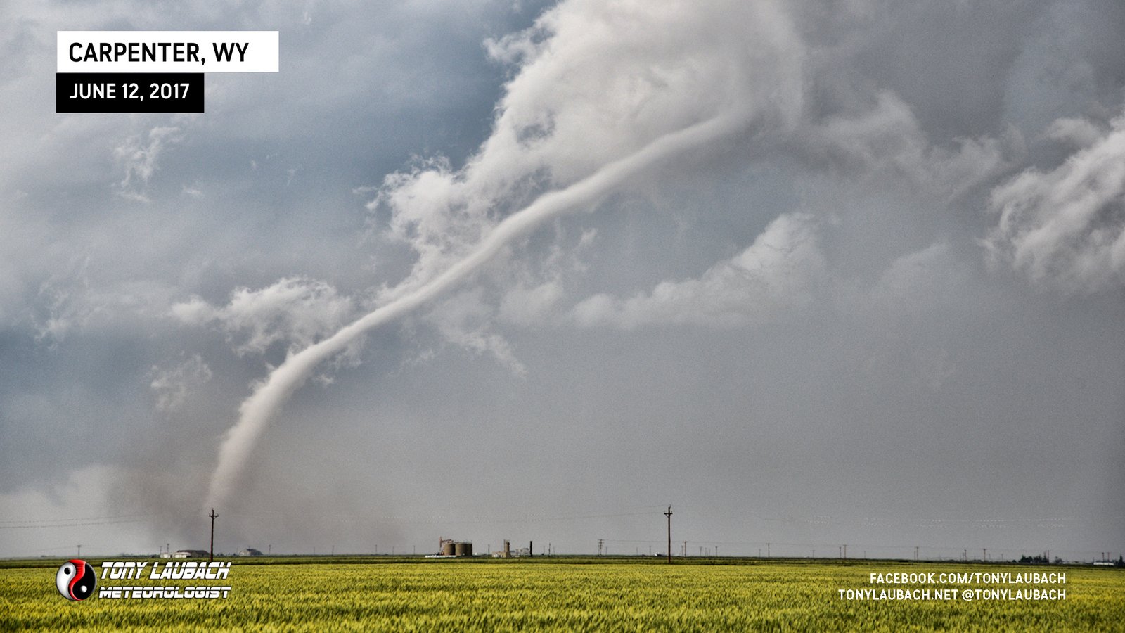
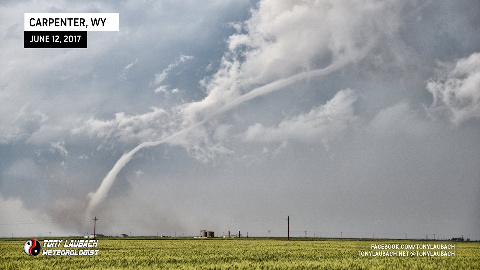
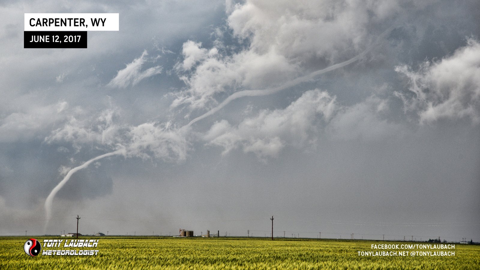
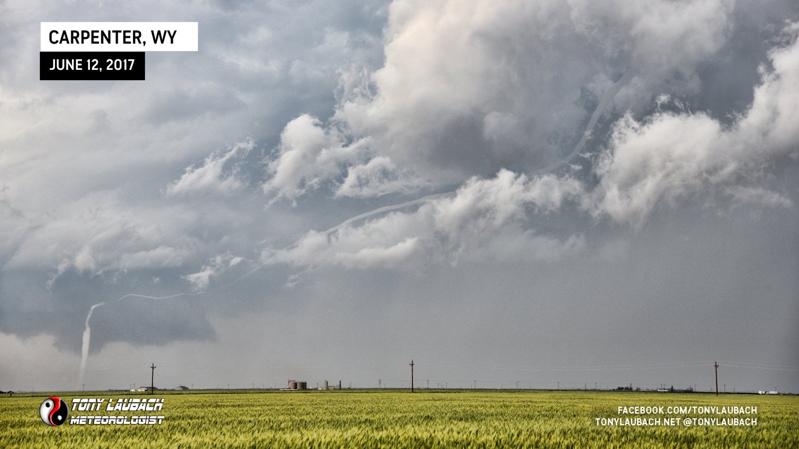
The funnel would intermittently touch down, then retract, but when it fully condensed, it looked amazing.
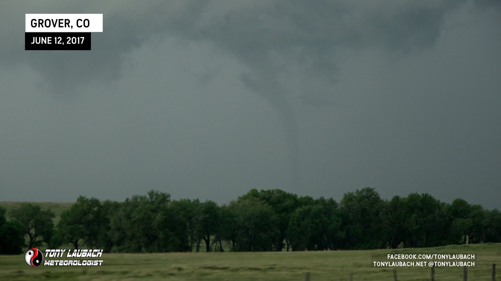
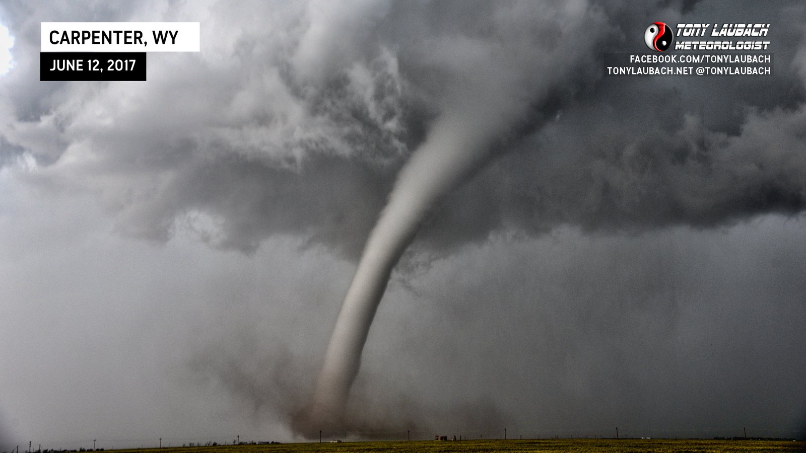
The road I northbound on made a 45-degree pivot from nearly due north to northwest, putting the visual of the tornado now on the right side of the road per my view, and once again, it fully condensed, and this time it was to stay.
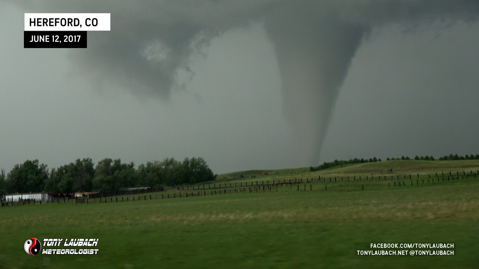
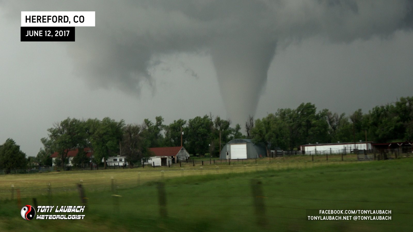
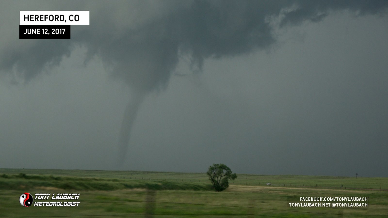
When I got to Hereford, I opted to make the decision to jump east a half a mile out of town to Weld County Road 81 and go north as opposed to continuing northwest on my current road, which turned due north not too far north of town. I did this because my visual lead me to believe the tornado was further east than I thought. Immediately upon turning east in Hereford, I realized the tornado was west of my line, so I opted to take the next road north, which ultimately wasn’t the worst thing.

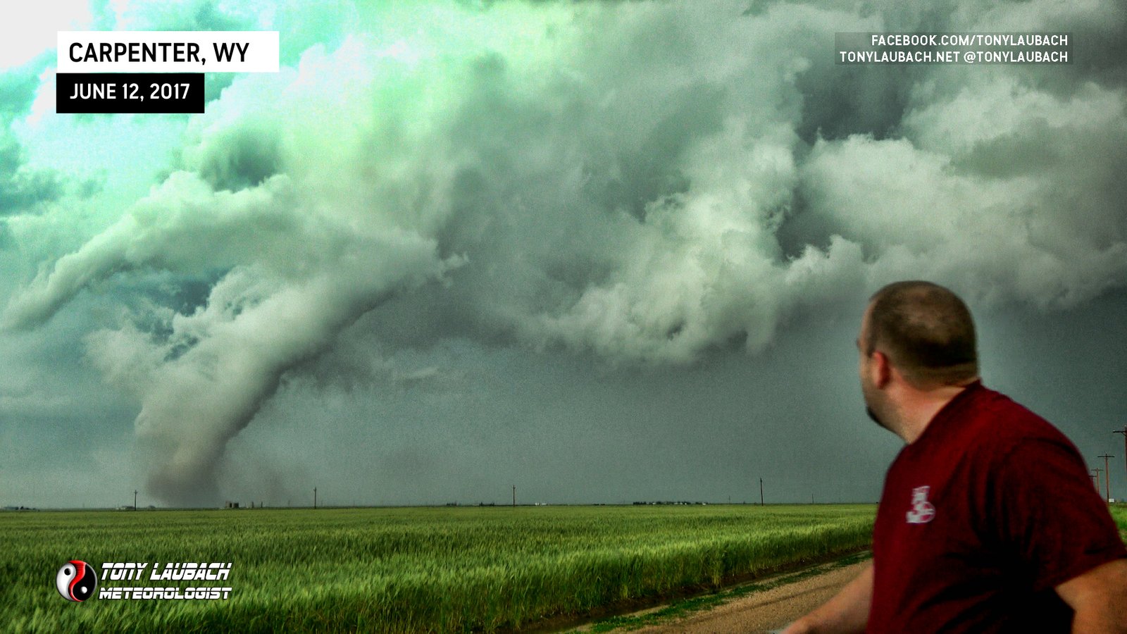
The tornado really started to stouten up as I approached the Wyoming State line, the tornado now about three miles to my north/northwest. I wasn’t making the time I wanted as the dirt road I was on was slick, so I was sliding around a bit trying to keep pace. Again, fortunately this storm was not moving all that fast and as I continued to creep north, my contrast would improve.
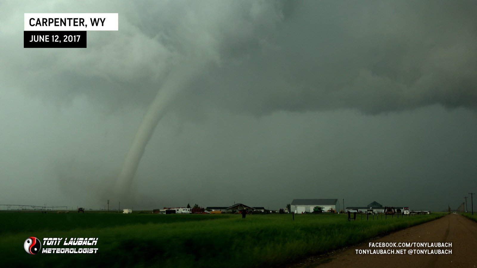
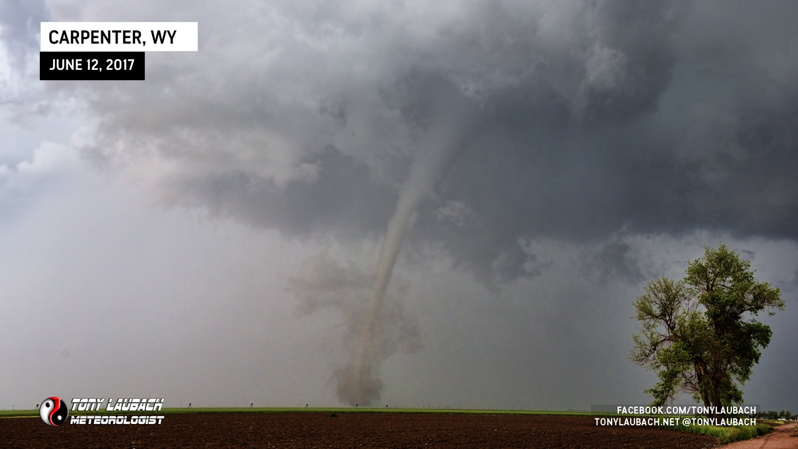
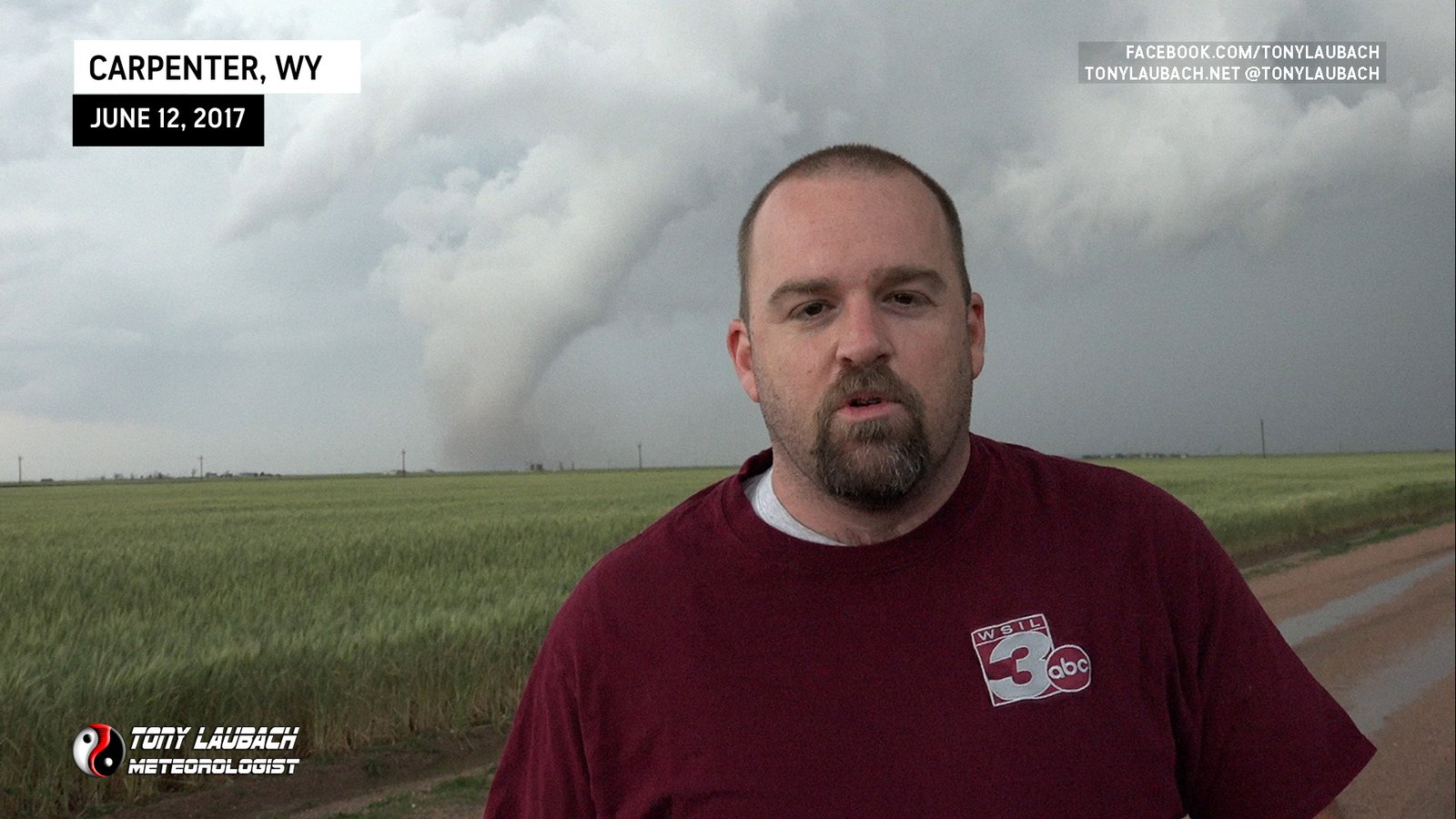
More than satisfied with the view, I got about a quarter-mile north of the state line, clearing the house/barns that were on the west side of the road. I pulled over on the side of the dirt road as I wanted pictures, standups, the whole nine yards. This was a rare treat, and I did not want to spend the entire rest of its life stuck behind the windshield. I knew immediately this was my dream tornado, and I did not let my good Nikon go to waste. I got out of the car with the tornado about a mile to my northwest and went to town!
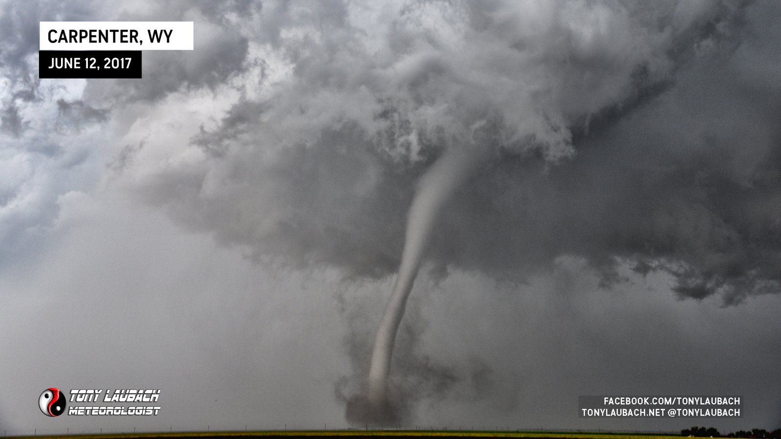
Shooting the most incredible tornado of my career was not the only thing I was doing. Given it was practically stationary and with a more than acceptable view of it, I also thought it would be fun to record a quick standup for the news package I was going to turn on this event. I had never done a standup in front of a tornado, so I took the opportunity. I put the Nikon down, set up a tripod, and went for it, doing a couple quick, 15-second takes that I’d use to wrap my piece.
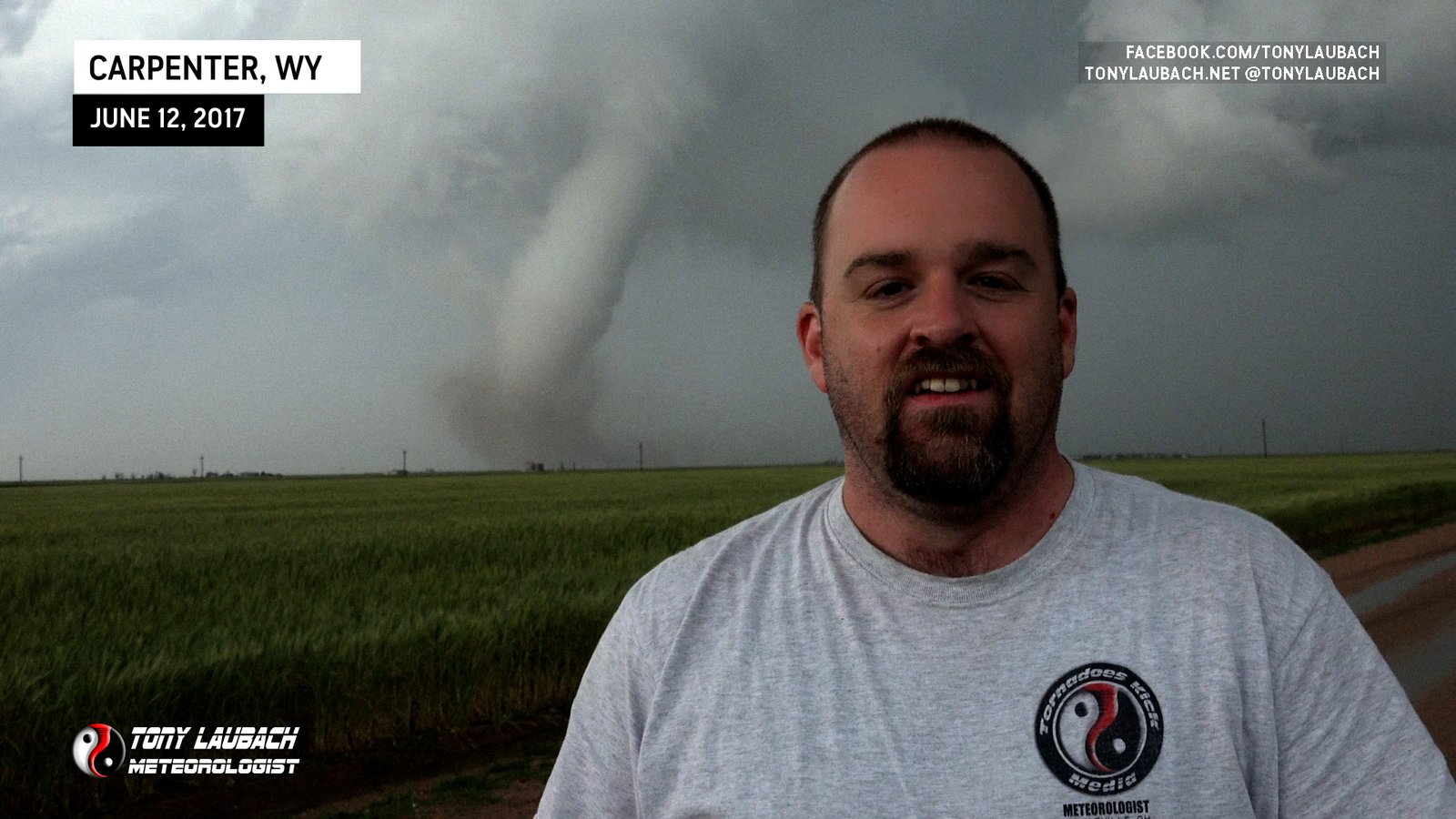
The issue… I was not wearing an official station shirt haha Yes, that occurred to me after doing THREE quick takes. But no worries, right? This tornado wasn’t going anywhere. I literally had time to record those takes, realize my shirt was wrong, run back to the trunk, grab a work shirt from my suitcase, put it on, and redo the standup with the RIGHT shirt on.
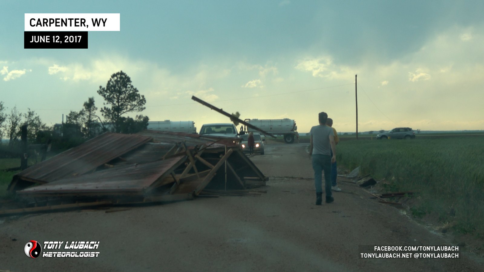
This all took place over the course of about 9 minutes… it felt like an hour honestly. But it times out to roughly 9 minutes from the moment I pulled over to the moment I saw the final rope-out. After getting everything back in the van, I headed up to the next county road and turned west to get back over to pavement. The tornado had hit some farm buildings, tossing the debris across the road. I believe this earned the tornado it’s EF-1 rating.
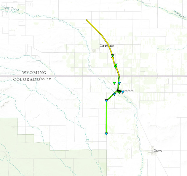
So while technically this tornado DID touch down in Colorado, I credit Wyoming as the state given it was at it’s peak once it crossed the line. The tornado was on the ground in Colorado for about half it’s lifecycle, but I’ll call it what I want since the picture on my wall is from Wyoming. Birthed in Colorado, died in Wyoming.
Despite what was easily the tornado of my career to date, the chase wasn’t over! After navigating around the debris, I got northbound to I-80, and worked my way east across the state line into Nebraska. This supercell had cycled after the Carpenter tornado had lifted, and was again starting to go nuts. It produced another tornado or two while I was enroute, but I was blocked by precip and did not see either any of these while eastbound on I-80.
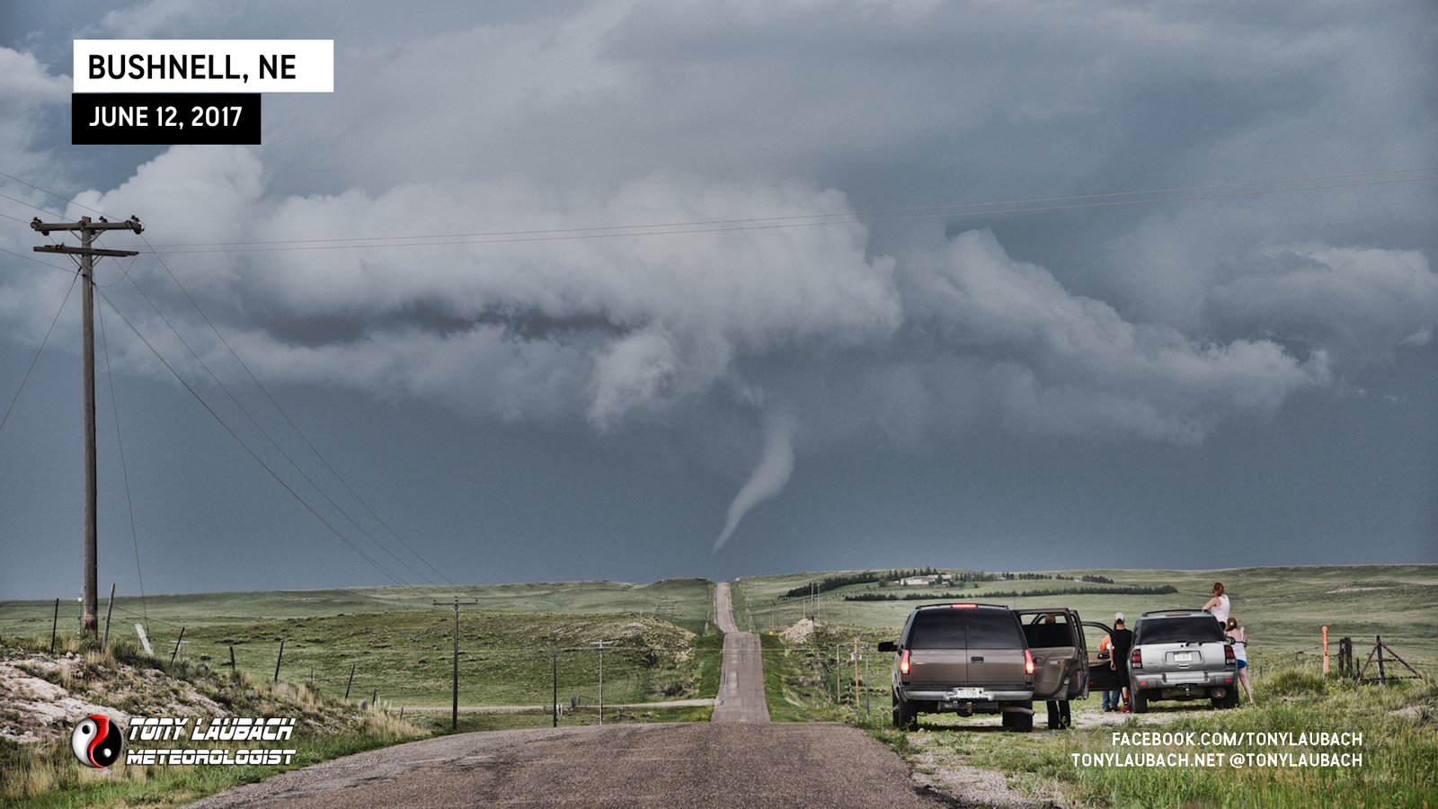
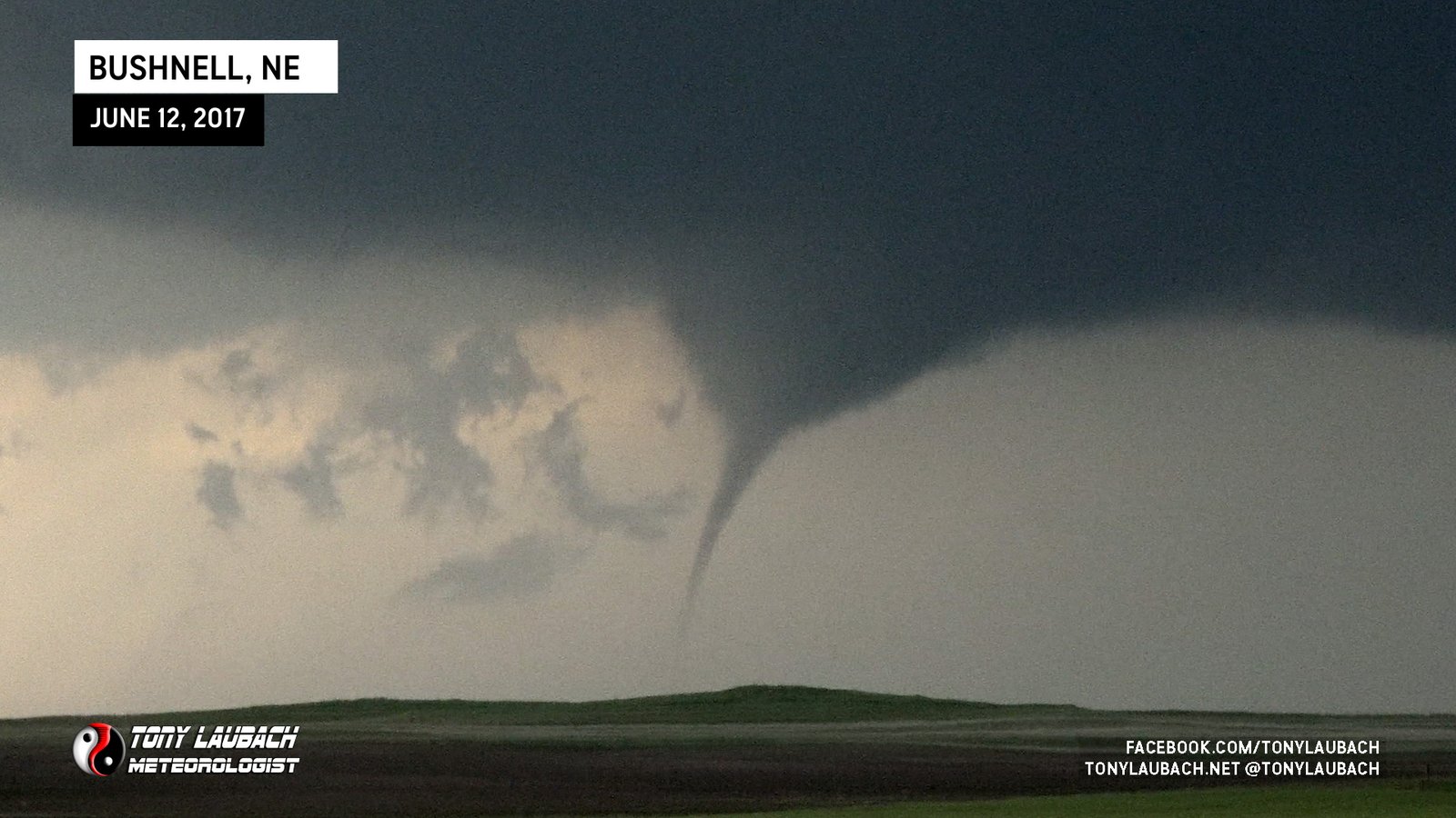
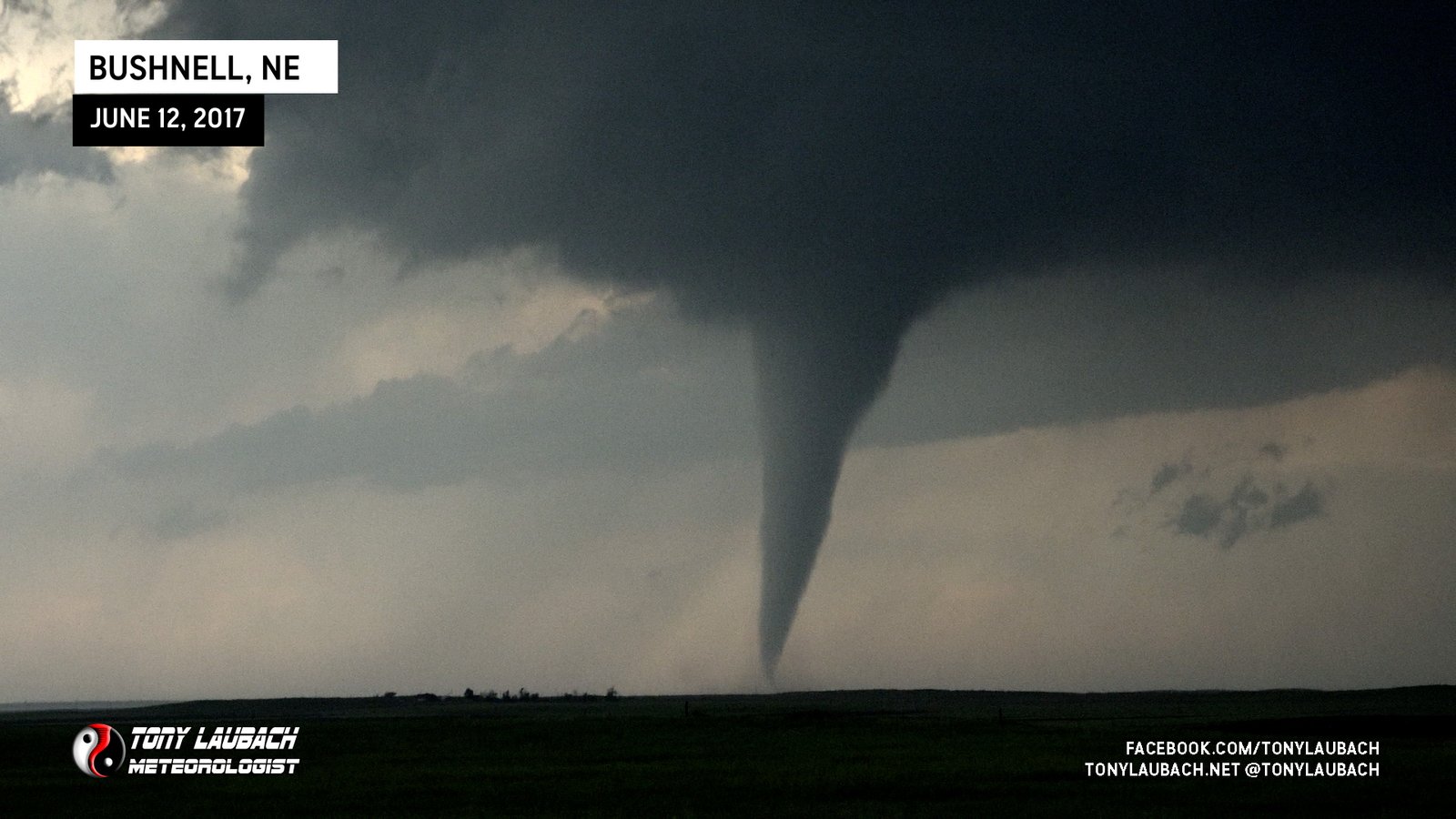
After crossing into Nebraska on 80, I raced over Exit 8, the Bushnell exit, and jumped north. My plan was to get up on Hwy 30 and go east to stay with the storm, but immediately upon getting into town and making that turn, I spotted a tornado to my north. I flipped around back into Bushnell and took the north road straight up, getting a view on the top of the hill about a mile north of town as that tornado roped out. This thing looked stout as I worked out of Bushnell, and I wish I had gone straight north sooner as I may have had a better view before it roped out.

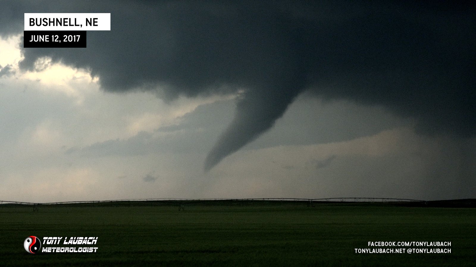
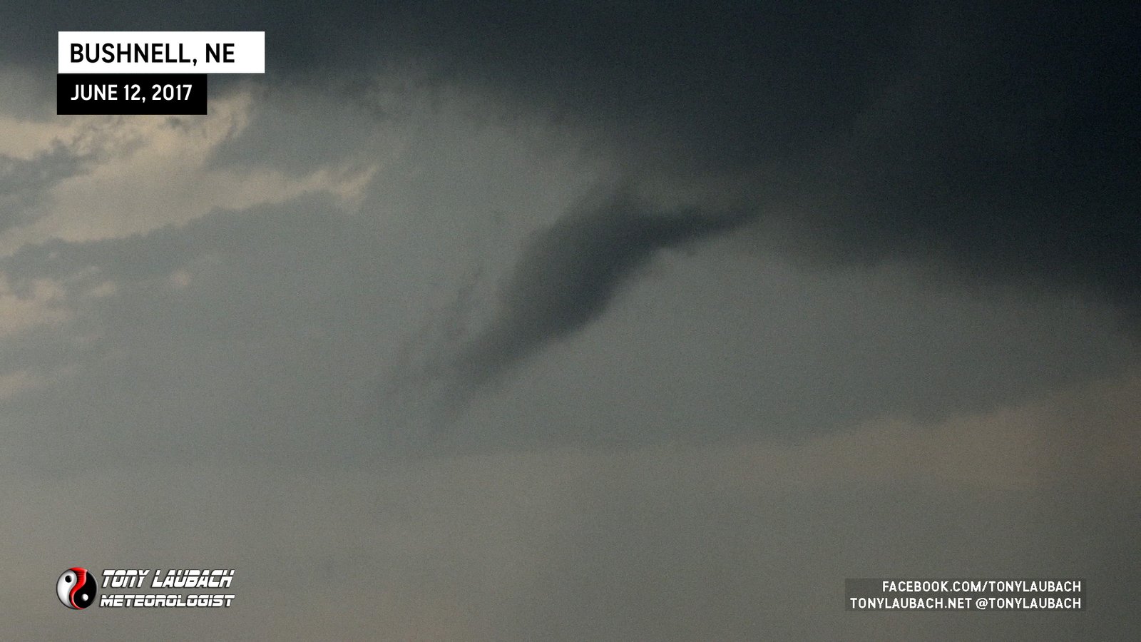
After that tornado roped-out, I continued north on the dirt road. With my attention focused to what was ahead of me, I was lucky that I looked out my driver’s side window cause I caught a glimpse of a funnel cloud developing to my west.
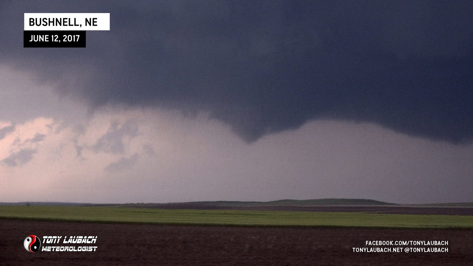
No reason to NOT stop for this, right? Haha This turned into a thing of beauty and I got some good captures of it as well.
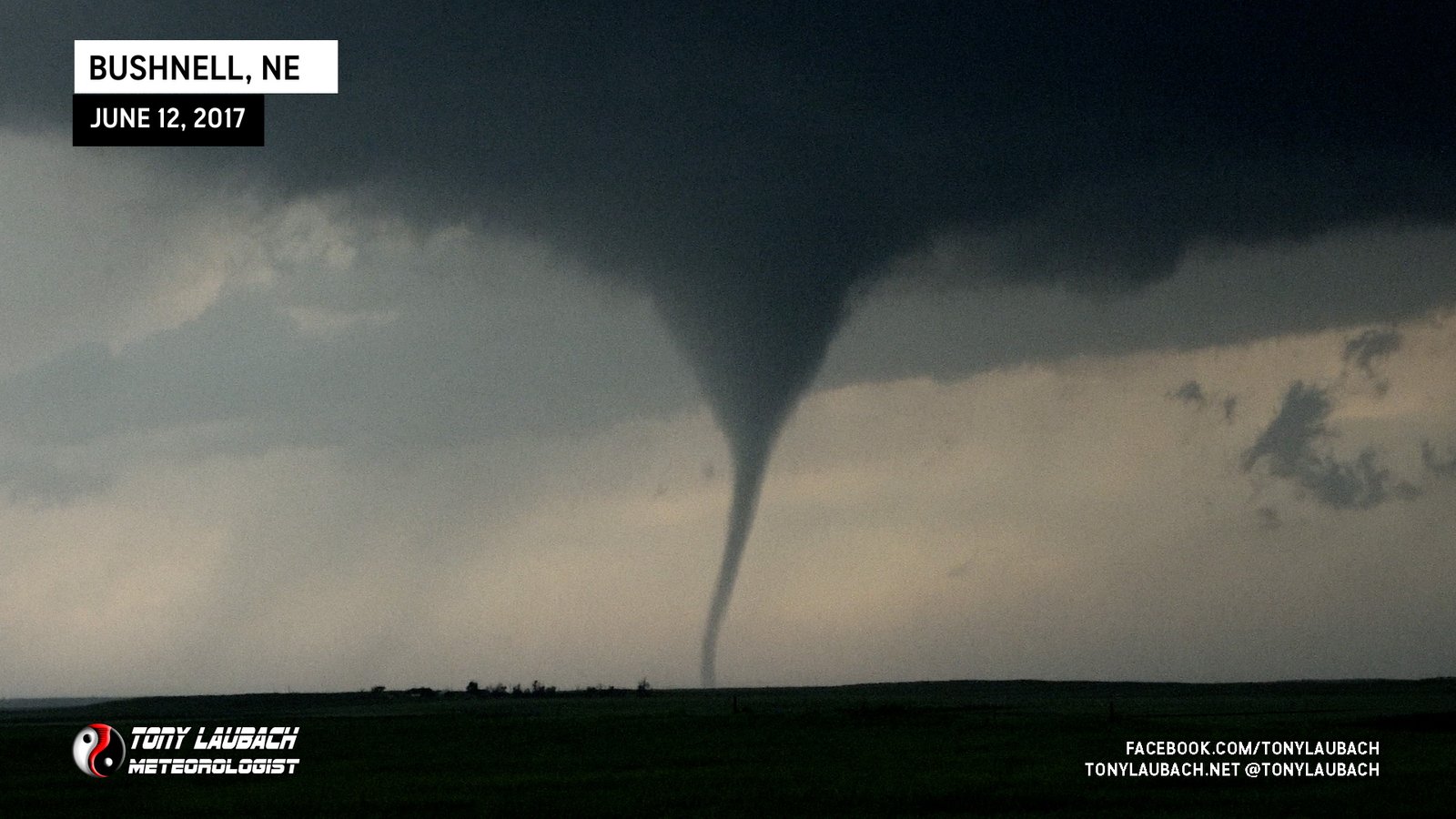
I was more focused on video, but I did reach down and snag a couple shots on my Nikon while it was all coned out.
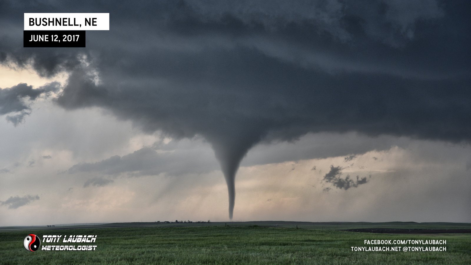
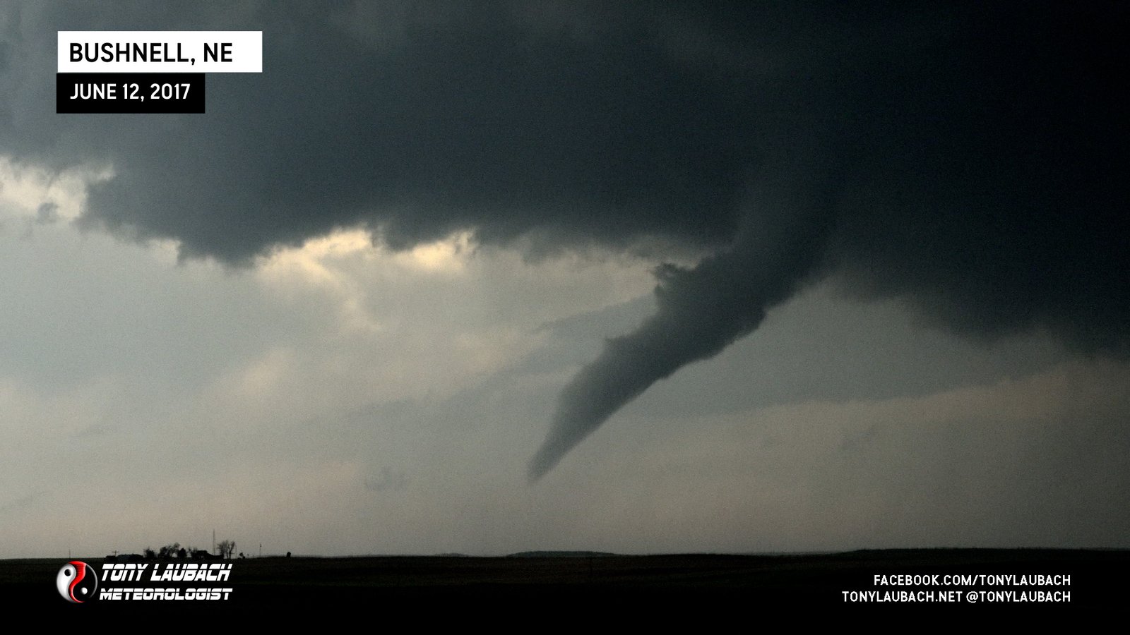
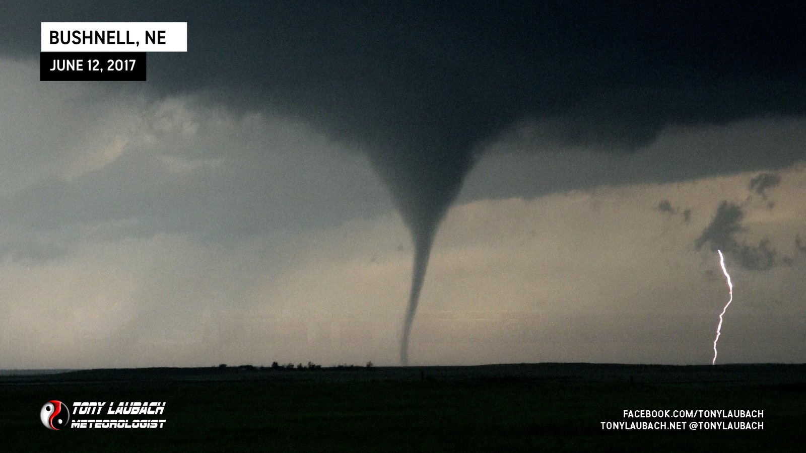
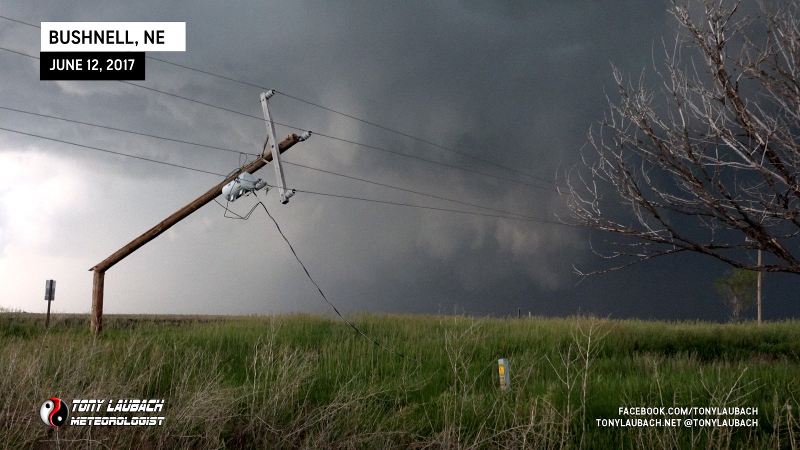
Radar showed the evolution between the two Bushnell tornadoes as a west hook developed as the first Bushnell tornado ended. That would be the hook that produced Bushell II. This impressive tornado hung around for a few minutes before it roped out. I had taken a few clips as I was northbound. After stopping to see the tornado’s final moments, I proceeded to keep with the storm. Along the way, there was some power poles that were snapped along the road.
I continued north before I was able to find a east route to cut over to NE-71 (Pavement). While doing that, I observed a stout funnel to my north. I was unable to see any ground contact, nor confirm it via other sources.

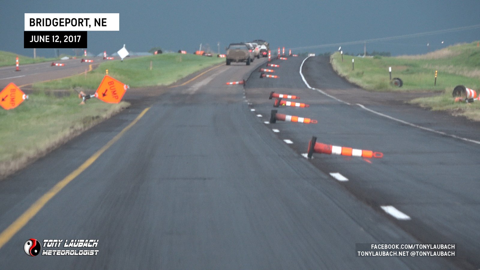
I got to NE-88 and cut east toward Bridgeport. Eventually jumping up on US-26 where I saw a construction site that had taken some wind.
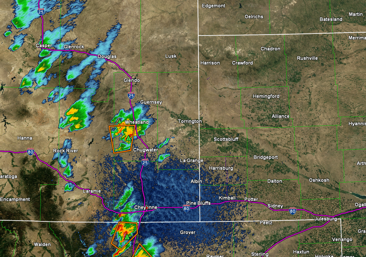
Below is a radar animation taken from NWS showing the lifecycle of this incredible supercell.
At this point, I decided I was feeling pretty good. I continued southeast on US-26 as our storm had lifted quickly to the northeast and with no direct route to stay with it, it was an easy call. I caught US-26 into Ogallala and booked myself in for the night about 45 minutes east on I-80 in North Platte. A lower end setup would lead me back home the following day.
It’s hard to sum up this day in a few simple words. What started with some insane hail that (again) somehow did NOT break any windows turned into the tornado of my career! Then following that up with a couple not-too-shabby tornadoes in Nebraska. I was in chase heaven! This was easily a top 3 chase for me, just on the Carpenter tornado alone! But add to it the other two naders plus the massive hail and yeah, it was incredible. And while I didn’t take as many photos on my good camera as I could’ve (and probably should’ve), I still managed at least one fantastic photo of each tornado on my good camera suitable for a wall print!
Definitely worth the long hours on Sunday on just a few hours of sleep. And oh yeah, the tornado standup was a HUEG hit back home 😉