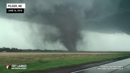
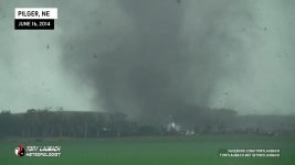
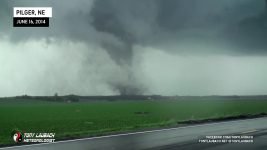
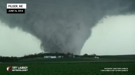
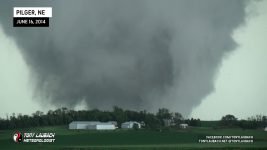
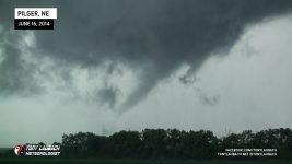
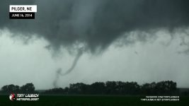
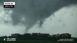
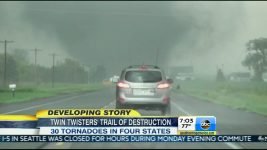
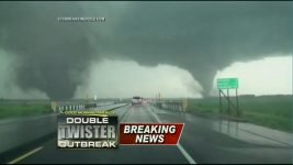
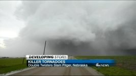
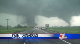
After a down day between chases, it was time to hit the road once again. We got up in Grand Island, Nebraska and I met with Ed and Brantley for breakfast where we met with Colt and Lauren Forney. We chatted about the day ahead, Ed and I were pitching the play in eastern Nebraska. As we loaded up our cars, it was dreary, nothing too exciting. We had a warm front that was going to lift through and that would be the focus for our target, was just a matter of how far north it was going to go.


We departed eastbound on I-80, heading over to York, Nebraska as the warm front was still to our south, but as it continued to lift, so did we, following north through York and eventually up to Columbus, Nebraska where we held up for lunch at the Wendy’s and chat with a handful of other chasers that were also hanging out around town. One in particular, we’ll call him Jeff, was on the phone in his usual “Jeff”, uh… enthusiasm… talking about the day ahead and using a variety of rather strong words in a not-so-indoor voice as to seriously concern a few of the locals who were also partaking in a peaceful meal.
We took our time there, grabbed some fuel on the way out, but it was almost two hours after we arrived before we headed out as the first showers started to pop up along the front to our north. Nothing explosive to start, but certainly enough to warrant a mass-evacuation of chasers from the Columbus, Nebraska area.
We proceeded north on US-81 to Madison, Nebraska, making a couple observation stops along the way, before jumping east on NE-32, heading about 13 miles or so to the junction with NE-57 south of Stanton. We went south about half a mile, finding a nice little pull-off with a view back to the west at the now quickly developing storms.

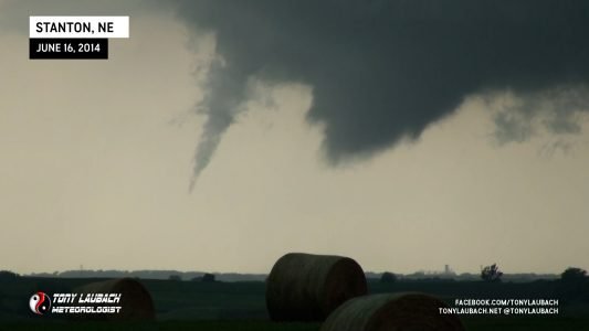
We didn’t have to wait long… a stout RFD cut in around the area of rotation, and without much fanfare, a funnel developed and plopped down the first tornado, a brief little touchdown ahead of what was soon to come.


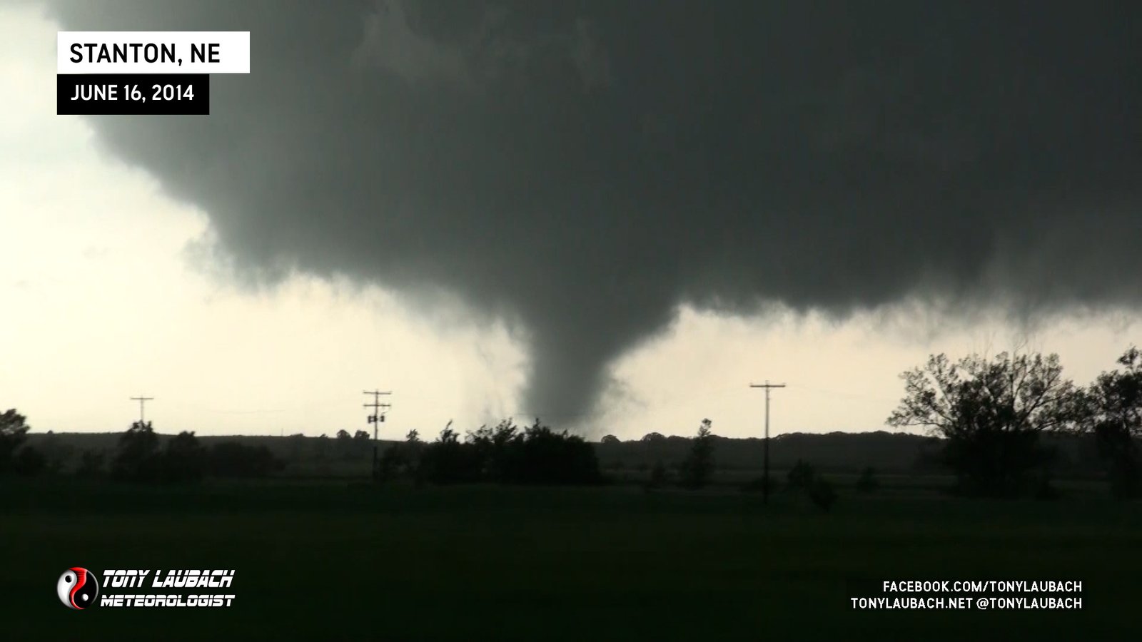
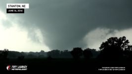
As the storm pushed to the north, we abandoned our overlook and pursed the storm up along NE-57 on the way up to Stanton. This tornado grew in size very quickly as it maintained its condensation after multiple funnels fizzled over a constant ground swirl.
We continued north before catching back up with the tornado, making a brief stop about 3 miles south of Stanton to film the tornado from a stationary position on NE-57.
After the stop, we shot back north into Stanton, cutting quickly through town and emerging on the north side of town, taking Ridge Road north instead of cutting back over to the state highway. We stopped immediately on the north side of town with an INCREDIBLE view of the entire meso-cyclone with the now wedge tornado ongoing to our north/northwest.


The storm continued north, putting a few miles between us and it, so we continued north as well, our road turning to dirt/mud shortly after getting a little further from Stanton. As the road made a slight dogleg back toward the northwest, I crested a hill with a view of the tornado now directly in front of me.
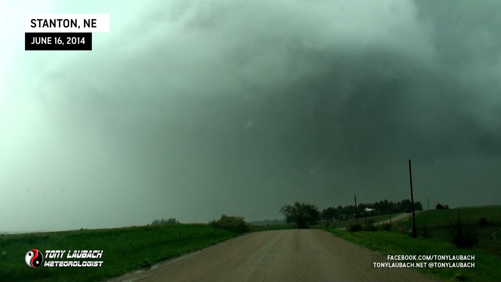
Further up the road as the tornado continued on, a horizontal funnel extended out to the east/southeast of the main tornado. We slowed up, eventually stopping due east of Maskenthine Reservoir.
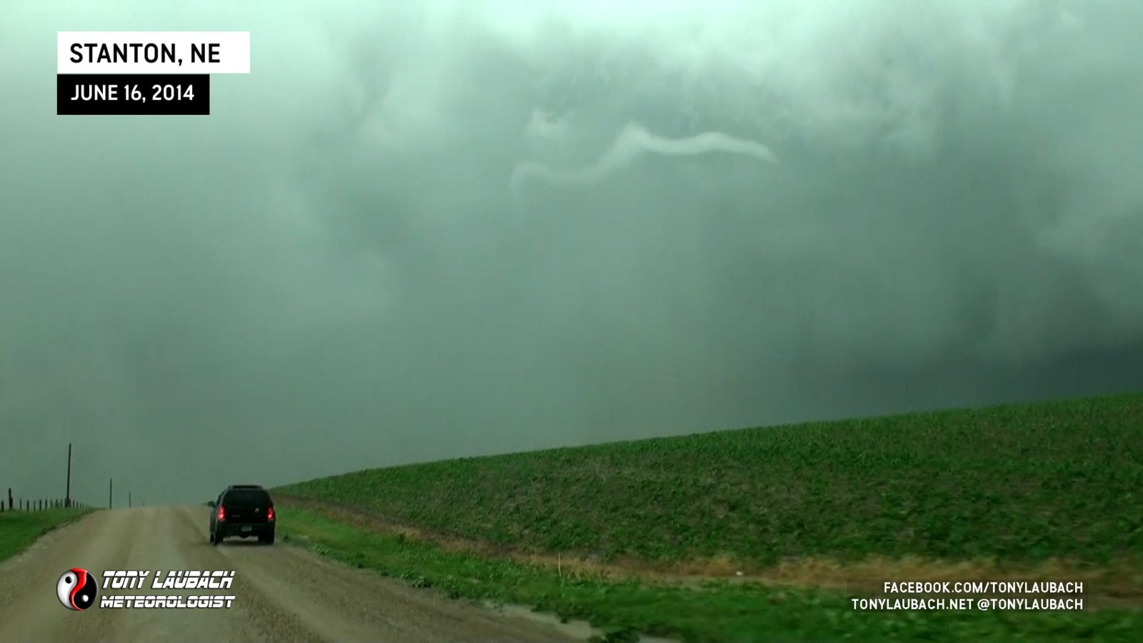

With the road getting a little more difficult to navigate and the tornado seemingly just to our east view, we took the next east/west road back over to NE-57, turning back to the north. The tornado was very hard to see now as the wrapping precip and distance had significantly reduced contrast. The eastbound jog, although only about a minute or so, also cost us some view. We finally made it to 57 and made the turn. Not long into our paved northbound pursuit, we came across some debris what was hanging out of the telephone poles along the right side of the highway. It was also about this time that we had closed enough distance that we could start to pick out the tornado again, seeing it was surrounded by a massive amount of dust.


As we arrived to the intersection of NE-57 and US-275, we encountered a little minor damage with mud and small debris strewn across the road. A sign was knocked down at the intersection as the tornado had passed about half a mile to the west of here.

We turned east on US-275 with the tornado now just east of the highway, but only went a mile to the next north/south road, turning north and parking as we began to see the Stanton tornado roping out.


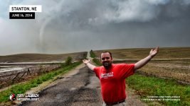
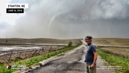
Of course, with the tornado now fully in-view and no apparent hurry to be anywhere else (haha), Ed and I exchanged photo ops of us with the tornado roping out behind us.
After what seemed like an eternity, the tornado took its final breaths, the funnel retracting off the ground and absorbing itself into the meso, putting an end to this long-track monster.


Literally seconds after the Stanton tornado roped out, we all began to return the cars, me uttering something along the lines of “lets go do it again” while Ed, who was already looking at what we were about to do again frantically calling out my name… “Tony! Tony! Tony! Tony! Look!”
“Holy sh!#” I exclaimed as I dove back in the car, following Ed back onto eastbound US-275. Having already had a career tornado intercept with Stanton, you would think there was literally no way to top it… well, when we crested the hill a couple miles east, we quickly realized we were indeed about to top it.

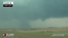
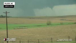
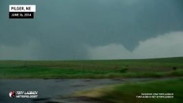
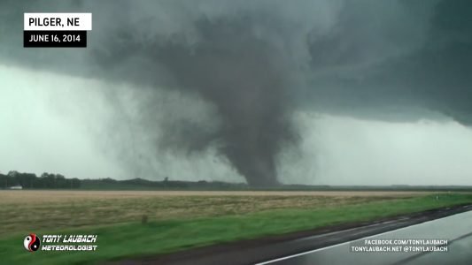
We were quite a ways away, about six miles as the crow flies between us and the town of Pilger, where the contrast at the ground due to distance and some rain that was between us hid the fact that Pilger was being obliterated by that main tornado. We did see a significant debris plume emanate from the tornado, but could not make out anything that indicated to us that a town was being hit. We could see the noticeable growth of the first tornado as the debris cloud significantly widened, but were too far with too low contrast to know what had happened. Meanwhile, the second funnel was beginning its initial touchdown phase as it was gathering strength.
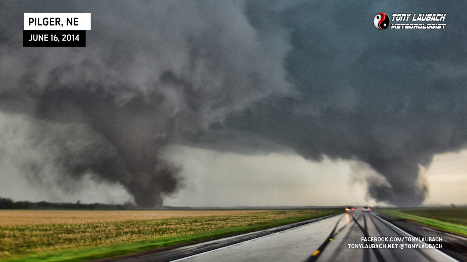
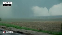
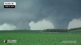
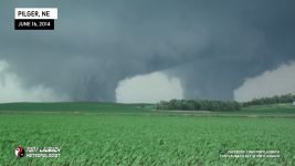
We had a little rain still between us and the tornadoes, but as we got within a couple miles of the US-275/NE-15 junction, we cleared the rain and finally had a pristine view looking east at the twins.


After Pilger #1 crosses the highway to our east, we pass our friends from Iowa Storm Chasing Network, including Ben and Brennen, who were parked off the side of the highway and were retreating back into their vehicles as we passed, them taking position directly behind me.

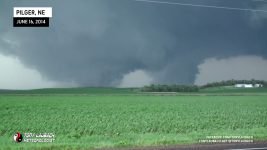
We cross passed NE-15 which heads south to Pilger, still completely unaware what happened about a mile south of us in the town, and finally emerge to an unrestricted view looking down the highway with both tornadoes, each very strong, straddling the highway ahead of us.


As we did not get a chance to fully process the Stanton tornado, my Nikon still had the wide angle lens on the body. I tightened up the shot as much as I could on a brief stop and captured one of my most insane tornado photos to date at a slightly-less-wide 24mm…

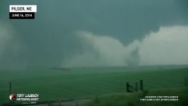
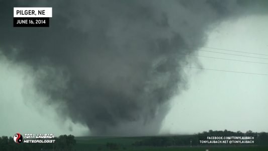
Ed, who was ahead of me with Brantley, radio’d back a couple times that he wanted to stop, but decided to keep going. After a couple of those “fake outs”, we finally pulled over as the first Pilger twin ripped through a farmstead to the north of the highway.
Meanwhile, Pilger #2 (Pilger East) crosses the road ahead of us by a couple miles and dramatically strengthens into a very large tornado.
Meanwhile, Pilger #1, which looked as if it were going to ropeout, starts to re-collect itself to our immediate north, the funnel getting more pronounced again.


After this stop to documenting the twins, Pilger #1 was quickly growing to size once again. With both tornadoes now east of NE-15 north of US-275, we decided to continue east on the highway with plans to jump on NE-51 north of Wisner after US-275 turns southeast. After passing the northbound turn to NE-15, we went another mile up the road and stopped again as both tornadoes had apparently ‘wedged out’, creating a once-in-a-lifetime view to our north.


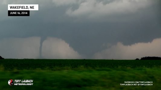
Once we hit the junction with NE-51, we hopped off US-275 and shot east. It was about 12 miles before we reached our northbound turn to NE-9 south of Pender, so we pretty much were out of the chase from this point. While we still had a view back over our shoulders initially, we would temporarily lose view of the show back off to our northwest. After we made our north turn and put on the gas to get north, we were able to quickly regain view of the tornadoes, still two on the ground. However by this point (and us completely unaware), a new tornado had formed as Pilger #2 (Pilger East) had dissipated (Pilger #1 still ongoing).

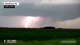
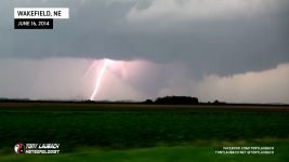
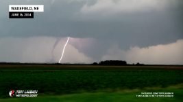
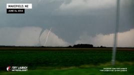
One of the most notable images of the event (aside from the various shots/angles of the Pilger Twins) was an incredibly vivid bolt of lightning that came down between these two tornadoes. I was able to capture that on the northbound haul.
Shortly after this, Pilger #1 whipped around the developing Wakefield tornado, I caught the initial stages of this sequence before we got into the Pender area where trees and structures blocked our view as well as slowed us down through the town. After we got back into view, the tornadoes had become largely rain-wrapped, and we never got a view on them again.


The Wakefield tornado continued north after Pilger #1 finally died off. We tracked it along north of Pender, eventually stopping one more time south of Emerson as the Wakefield tornado had died out. The three of us gathered and collected ourselves a bit after the show we just witnessed. Concerns had mounted as this supercell was making a direct line right at Sioux City, but fortunately after Wakefield, the storm started to weaken, although tornado warnings continued as the storm tracked at Sioux City. We tracked the cell it on a wonky curvy NE-35 northeast toward Sioux City. We never saw any further tornadoes, and there was apparently a final, brief tornado, but after that, nothing else touched down. Still, we kept with the storm from behind, arriving later that evening well after the storm moved through, which had avoided any significant impact to the city and continued to weaken as it moved northeast into Iowa.

Upon our arrival in town, we met up with our good friends, Skip Talbot and Jennifer Brindley who also witnessed the Pilger event. Brindley and I, longtime friends, immediately ran to each other for an embrace after this unforgettable day.

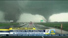
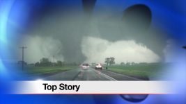
Of course, this was the top weather story, pretty much all over the world. National and International Networks were running footage from chasers of this once-in-a-generation event in northeast Nebraska. I would get in on a lot of that coverage as this became one of my widest viewed videos of my career.
Obviously a lot of the news of what happened would come later in the evening as we returned to the news cycle. This of course includes learning of what happened in Pilger and hearing the tornado was unfortunately fatal. NWS damage surveys concluded a total of EF-4 tornadoes occurred with this storm, along with a brief, fifth tornado that kicked off this event. Two of those EF-4 tornadoes, the Pilger Twins, stayed on the ground together for an extended period of time, with the initial Pilger EF-4 pairing up again with the Wakefield EF-4. This was truly a once-in-a-generation tornado event. Violent tornadoes (EF-4/EF-5) make up such a small percentage of tornadoes, and to see four of them in one day, let alone together and within a few hours, is astonishing. It took a few days to fully process this event, and one could argue that it will never fully settle in what we witnessed. I would have to return home the following day due to work obligations, missing the next two days which also included significant tornadoes in Nebraska.
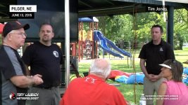
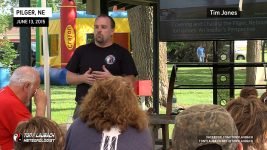
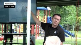
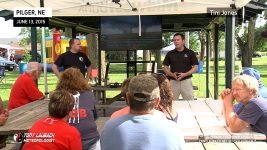
The following year on the anniversary, Ben McMillan and I returned to Pilger to share with the residents our chase and explain how this event took place and the significance of it in tornado history. Truly an event unlike any other in the past, and likely in the future.

