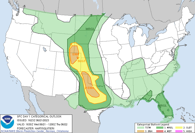
Where to start… at the beginning, I guess… It was an Enhanced risk. For the days leading up to this, all the models were SCREAMING Chugwater. As soon the high resolution models got within range of Wednesday, they all kept popping this lone, isolated supercell near Chugwater. Every freakin’ run had it, and every freakin’ chaser was going to populate the tiny I-25 Wyoming town. I was planning to do the same.
Woke up with every intention to join the masses up in Chugwater, WY. I left my house around 11am, took the route up through Windsor and cut over to I-25, but only drove to the north side of Fort Collins, stopping at the CO-14 exit. I was text-chatting with a fellow chaser/friend about the day, and I was concerned about the cloud cover in Wyoming and drooling over 70s freakin’ dewpoints in eastern Colorado, and not just at the border, like deep into eastern CO (Sterling was 80/70 at this time).
MY FORECASTING THOUGHTS AT MY LUNCH STOP
It was clear to me the instability the hi-rez models had been hooked on was not coming to fruition due to the clouds that were lingering up there. I saw a nearly 10 degree temperature difference from the initiating HRRR to the current surface obs, and with satellite showing these clouds likely hanging around another hour or so, I just didn’t see the instability recovering enough. Meanwhile in Colorado, storms were starting to fire in far northeast Colorado along a boundary out in that area. What triggered my initial change of plans honestly came down to laziness. Figuring the Chugwater storm was not going to be terribly exciting, and would lead me four-plus hours from home, I thought I could do ‘just as well’ here in Colorado and be only TWO hours from home when all was said and done. So honestly, it was more of a choice to NOT chase Wyoming verses the choice to chase Colorado.
I’ve been burned many times by “not staying with my original target”, so I told myself I’d drive over to US-85 (Ault) and think about what I was doing. The high-rez CAMs were focused on two areas; Chugwater storm (which was advertised for a couple days), and a cluster of storms along I-76. Clearly, the visual winner of the CAMs was Chugwater, but my inner voice said “don’t bail on 70s dews in Colorado).
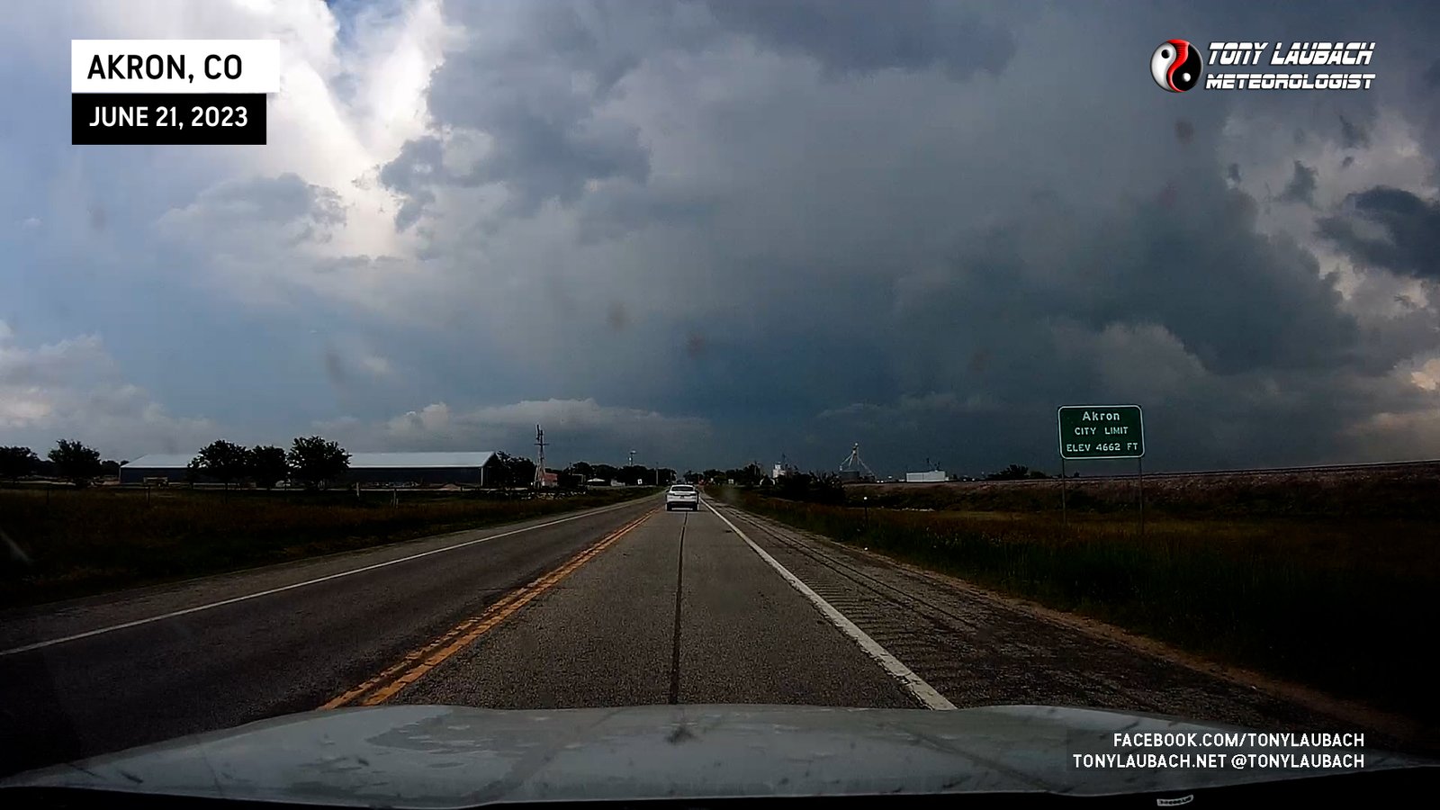
I got to Ault, and decided to go all-in on the I-76 play… I turned south on US-85 to Greeley, then caught US-34 east to Wiggins where I chatted briefly with Justin and Simon at the Sinclair there in town. Storms had already gone up near Sterling, and a landspout was reported via Twitter. Meanwhile, storms were initiating south of Akron. With nothing going on west, and lessons learned from “waiting too long while tornadoes were going on” in Texas last week, I said, hell with it, we’ll jump on the early stuff.

So east on I-76 I went to Brush; this was where the decision was made. I pondered on the 10-miles stretch between Fort Morgan and Brush; do you stay on I-76 and make a play for the Sterling cell which had already produced, or do you go east on US-34 out of Brush to the newly developing Akron cells. With nothing south of those, and my gut saying Akron, I shot east to Akron, then south on CO-63.
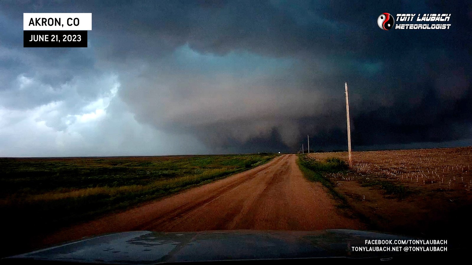
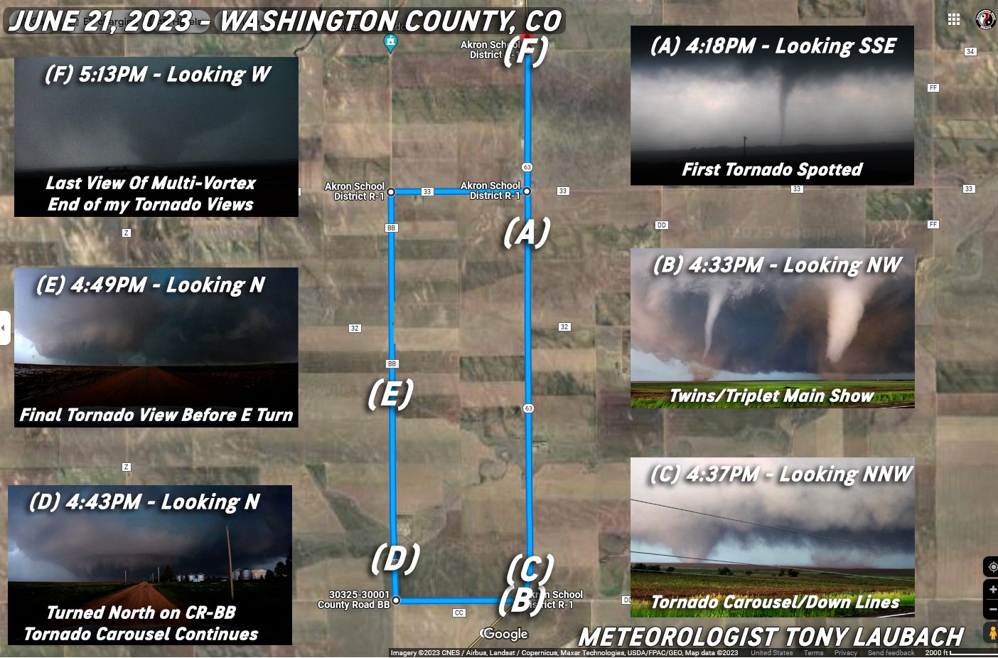
Two storms were going, both sharing a warning til the north storm separated; each eventually getting severe-warned, but for fairly small hail. I got a handful of miles south to County Road 33, a longer east option to get closer to the storms. The southern one had a very nice lowering and some solid rotation. I took County Road 33 about 4 miles east when hail much bigger than the warning indicated started coming down on me and my less-than-a-week old windshield. I hit County Road HH and dove south, getting through the wrapping hail unscathed.
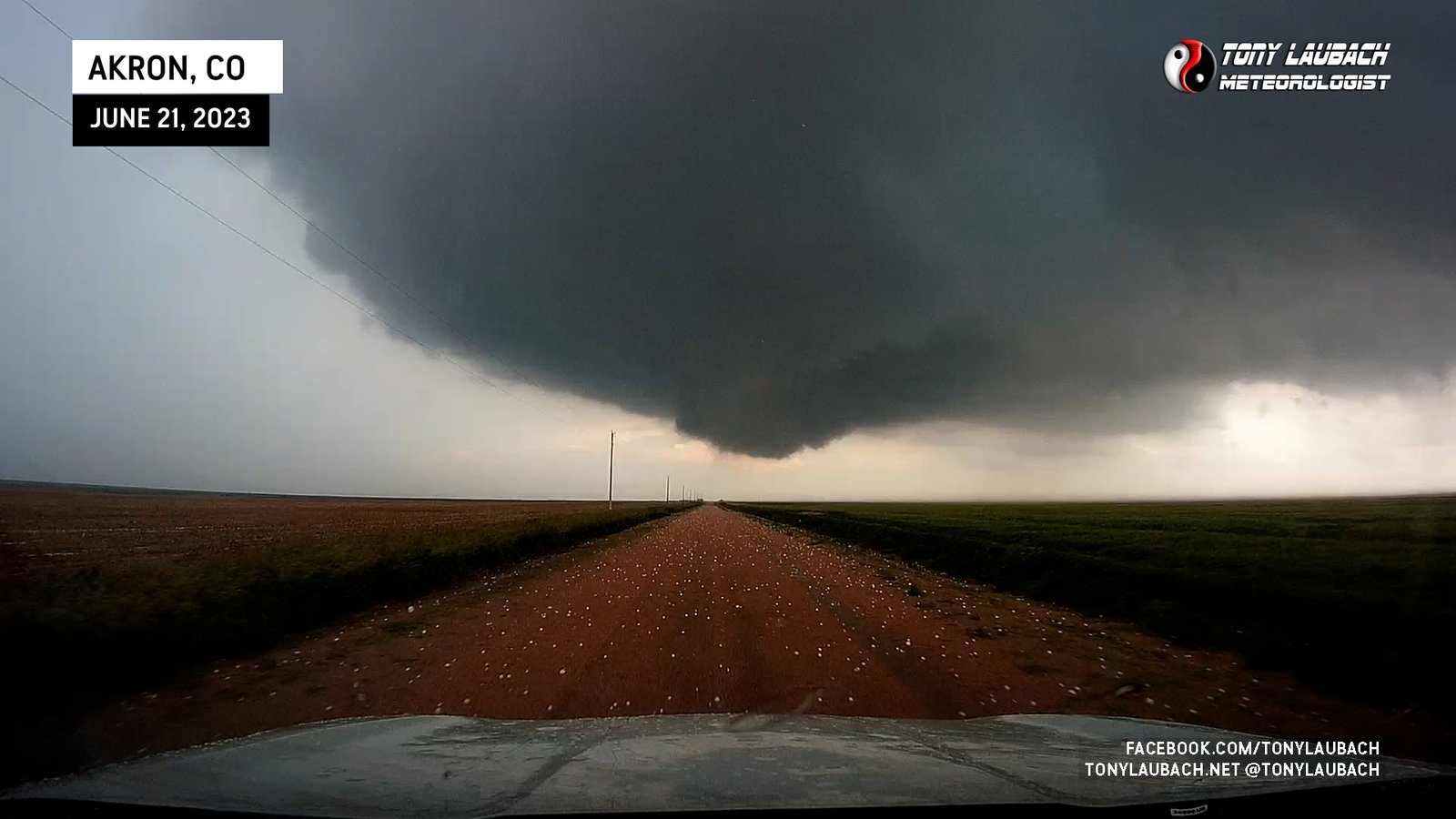
This was when the storm REALLY started to wrap up. As the business end SLOWLY drifted west (yes, WEST), the rotation tightened up dramatically, even dropping a convincing funnel. I got back up to County Road 33 and pointed west with the circulation immediately to my south. But after a few minutes, it dissipated, and I was thinking to myself, “here we go again with another so close but no tornado”.
Getting back to CO-63, I was now playing the back and forth game. The northern cell, albeit pretty buried in precip, had acquired some solid rotation and picked up a tornado warning. About this time, I was hearing more reports out of the Sterling cell of tornadoes, so I was leaning toward a north play because if my storm wasn’t going to do it, I had a straight shot north to the tornado-producing cell.
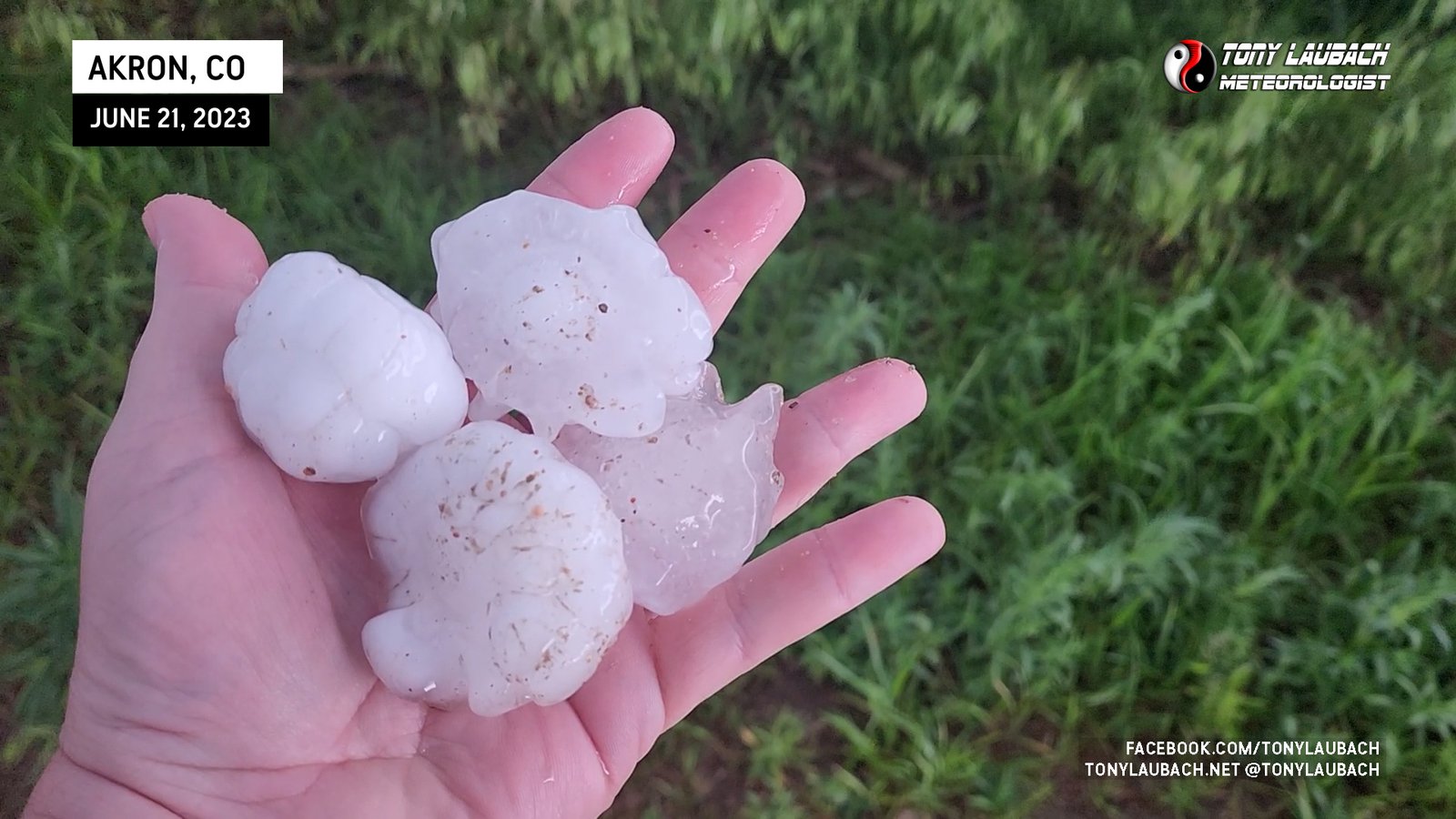
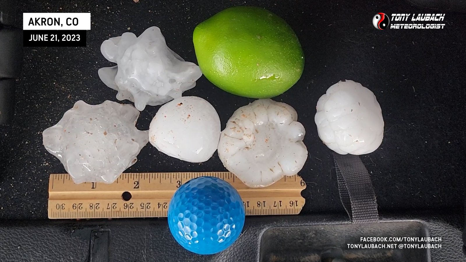
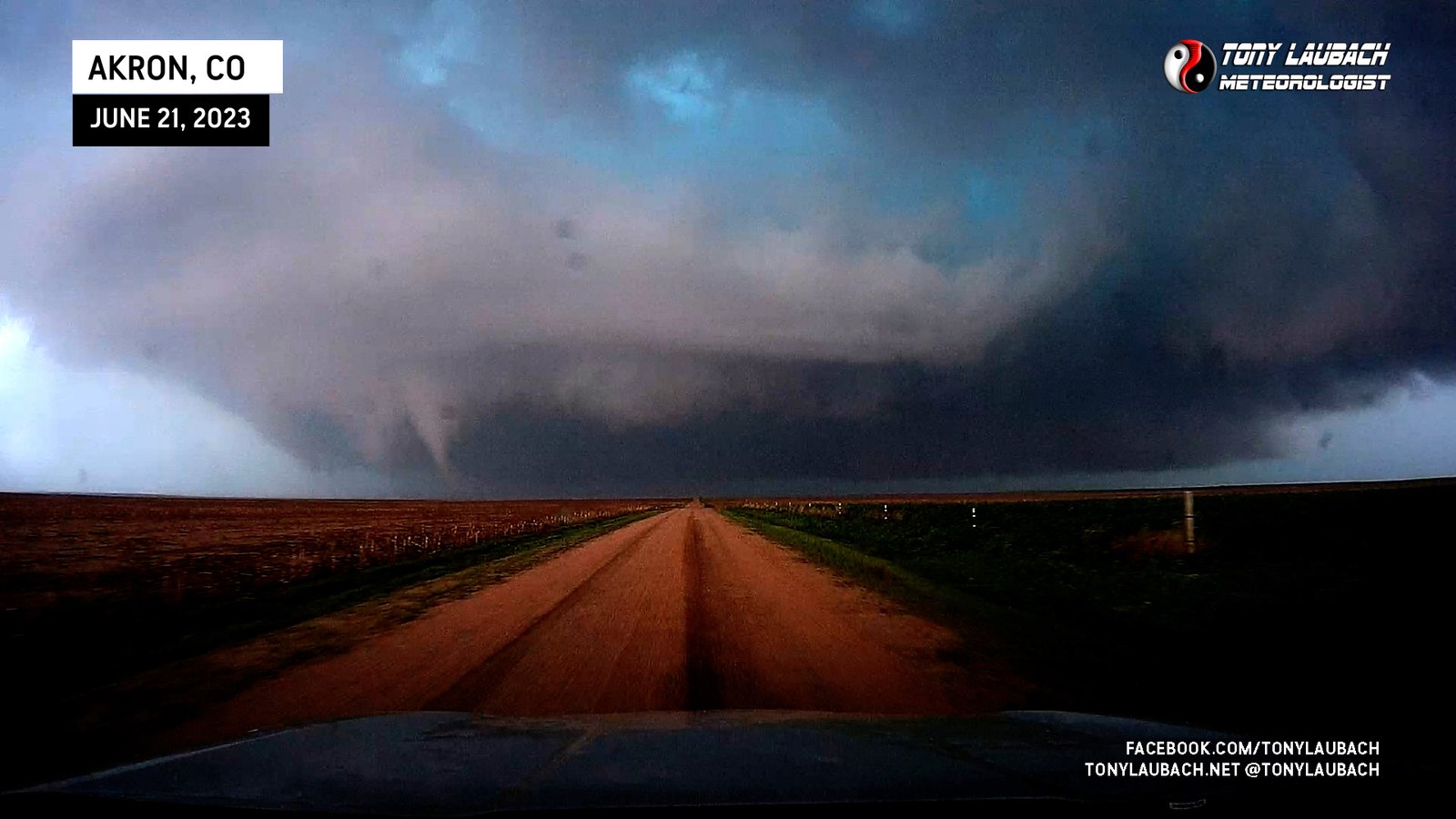
Well, I barely made it to the south side of Akron when I noticed on radar the impressive couplet developing on the cell about 10 miles to my south. I was also starting to again take on much larger hail than I really cared to get involved with. So flipping around and south I went. Buried in the core, I got multiple instances of either large hail (> golfball) or tons of small hail. I stopped briefly as visibility was stupid low and took a quick shot of the small hail barrage.

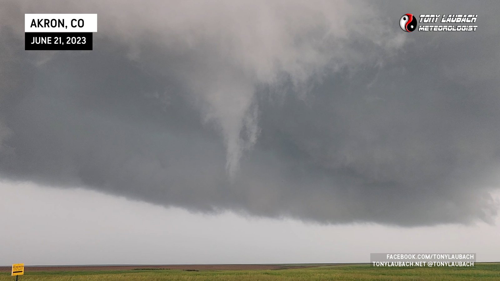
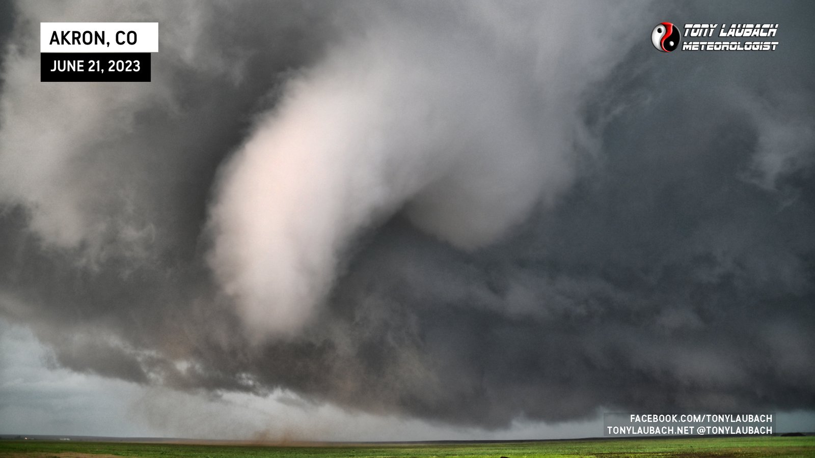
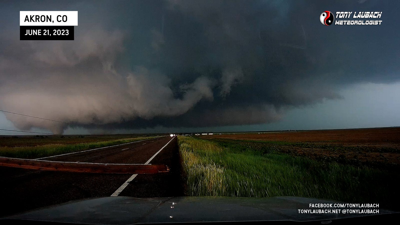
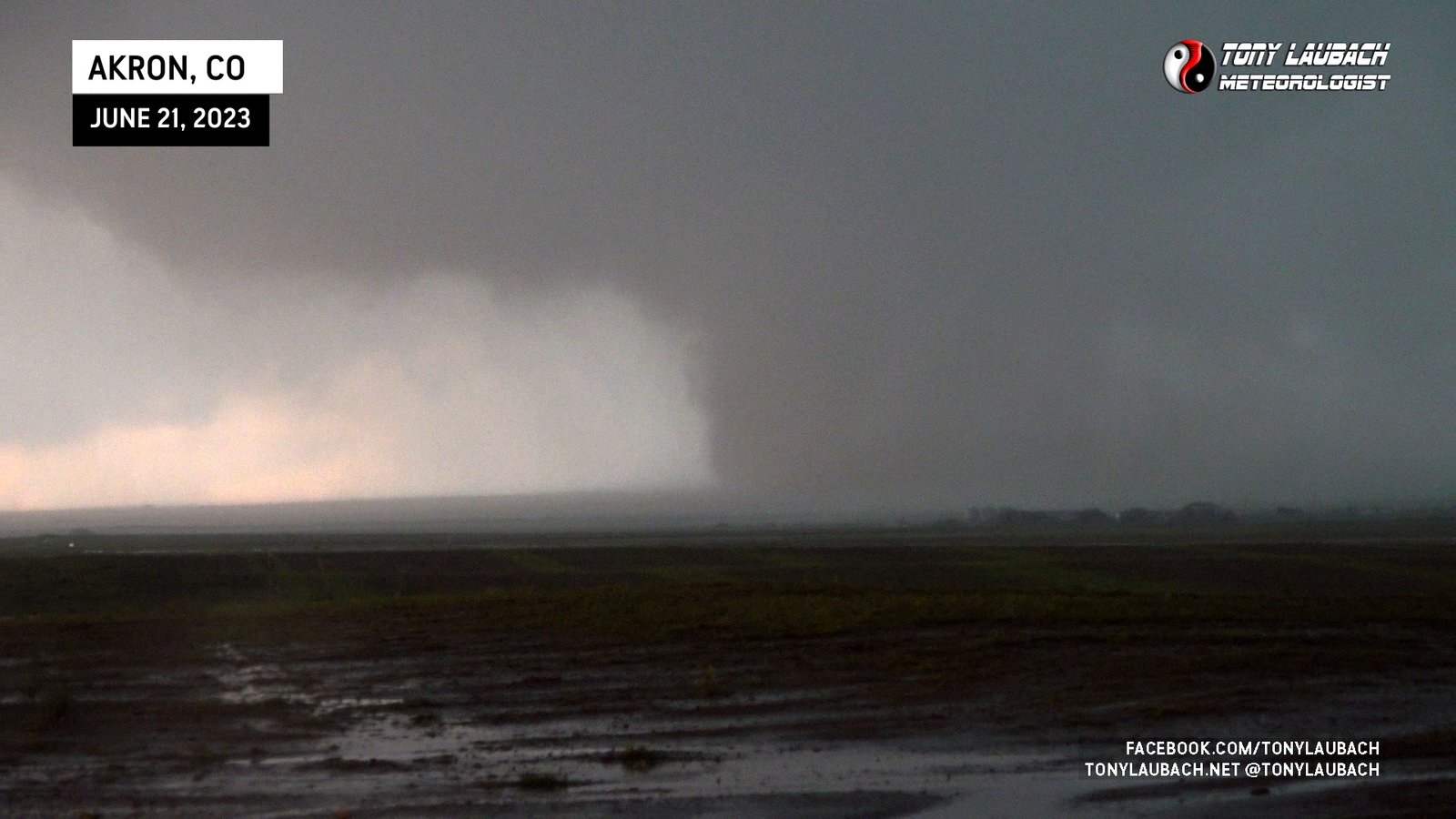
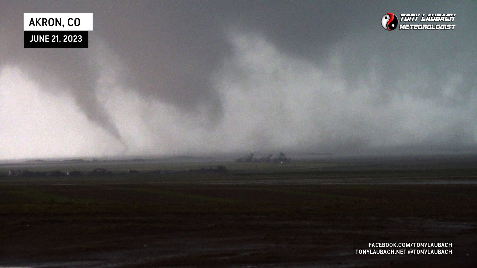
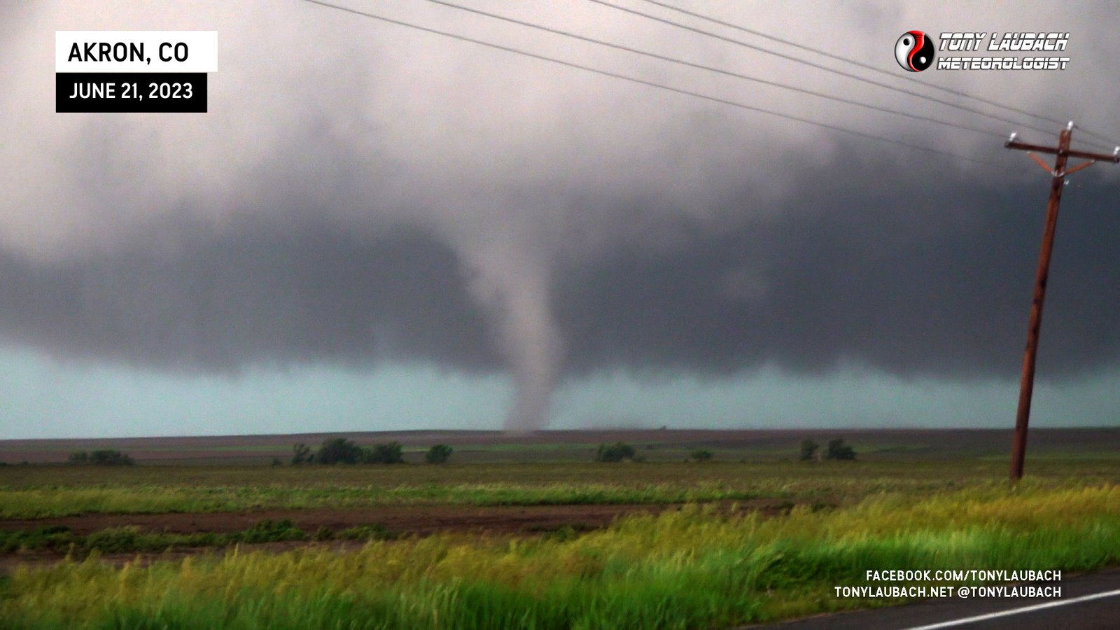
With precip lightening up enough to once again see, I continued south. As I cleared away the miles, I started to get a better view of the southern edge of the clouds. A couple more minutes and I saw the first tornado of the day, a skinny little guy that I watched go from the east side of the highway across to the west side, probably within a half a mile or so of me, harmlessly passing over powerlines as it moved into the field east of CO-63.
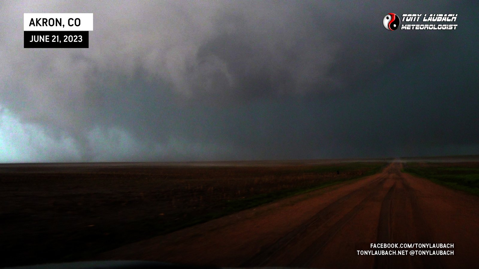
“Awesome”, I thought to myself as this churned off into the field, eventually dissipating to my immediate south. That’ll earn me a steak… after a brief stop to get some shots of the rotation, which was slightly weakening at this point, I continued south to get out of the rain and arrived at County Road 30 where CO-63 doglegs to the southwest. I pointed west, things were quiet, so I began to pull the tornado footage for my network when all of a sudden…

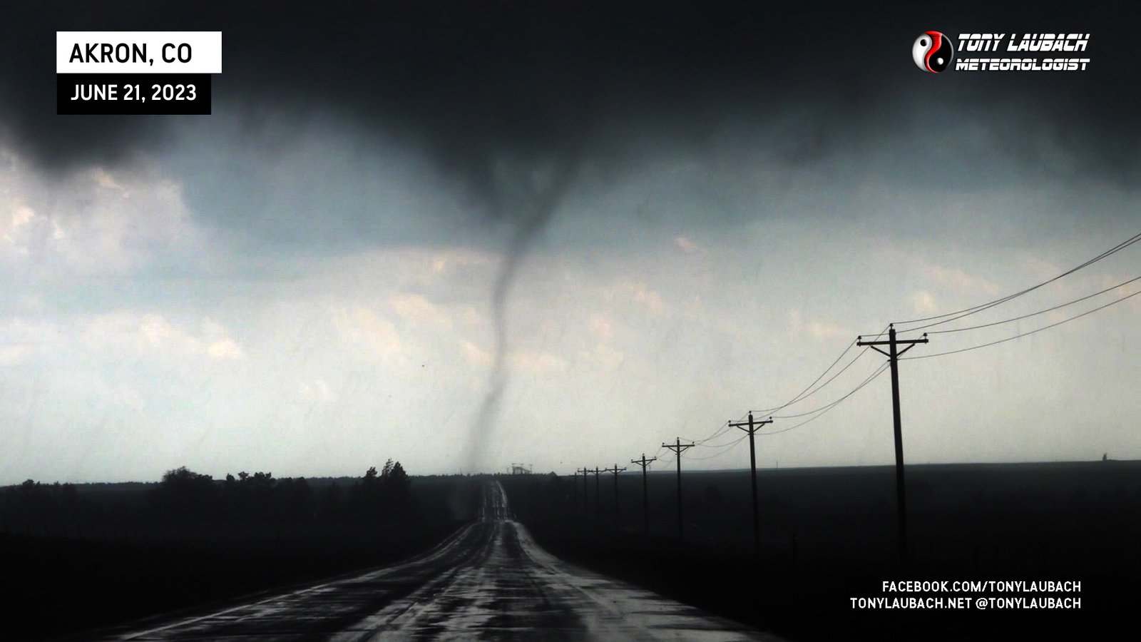
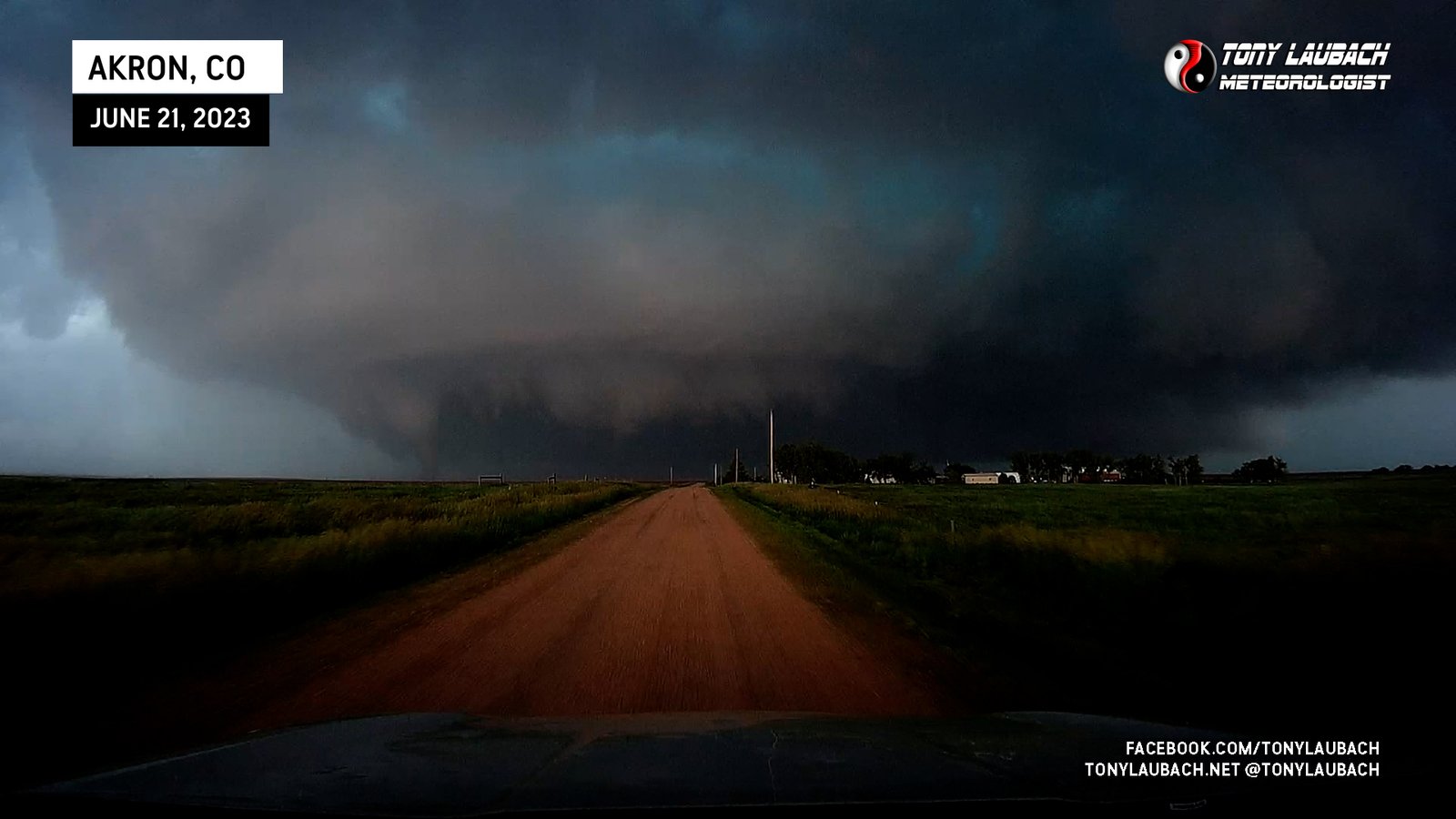
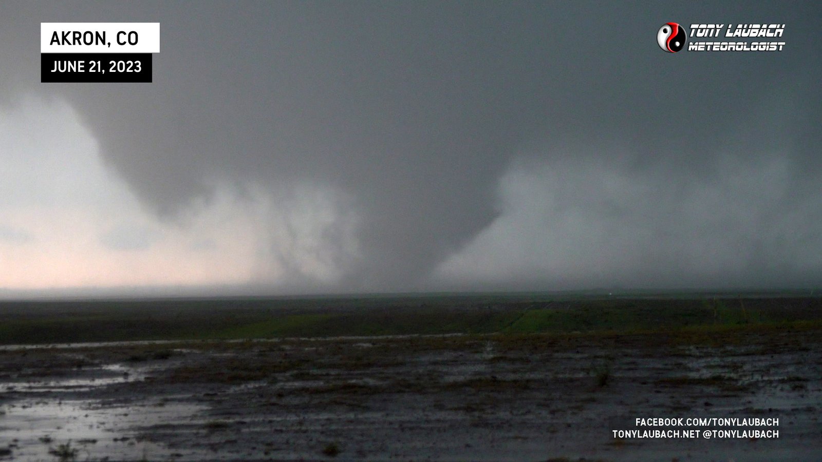
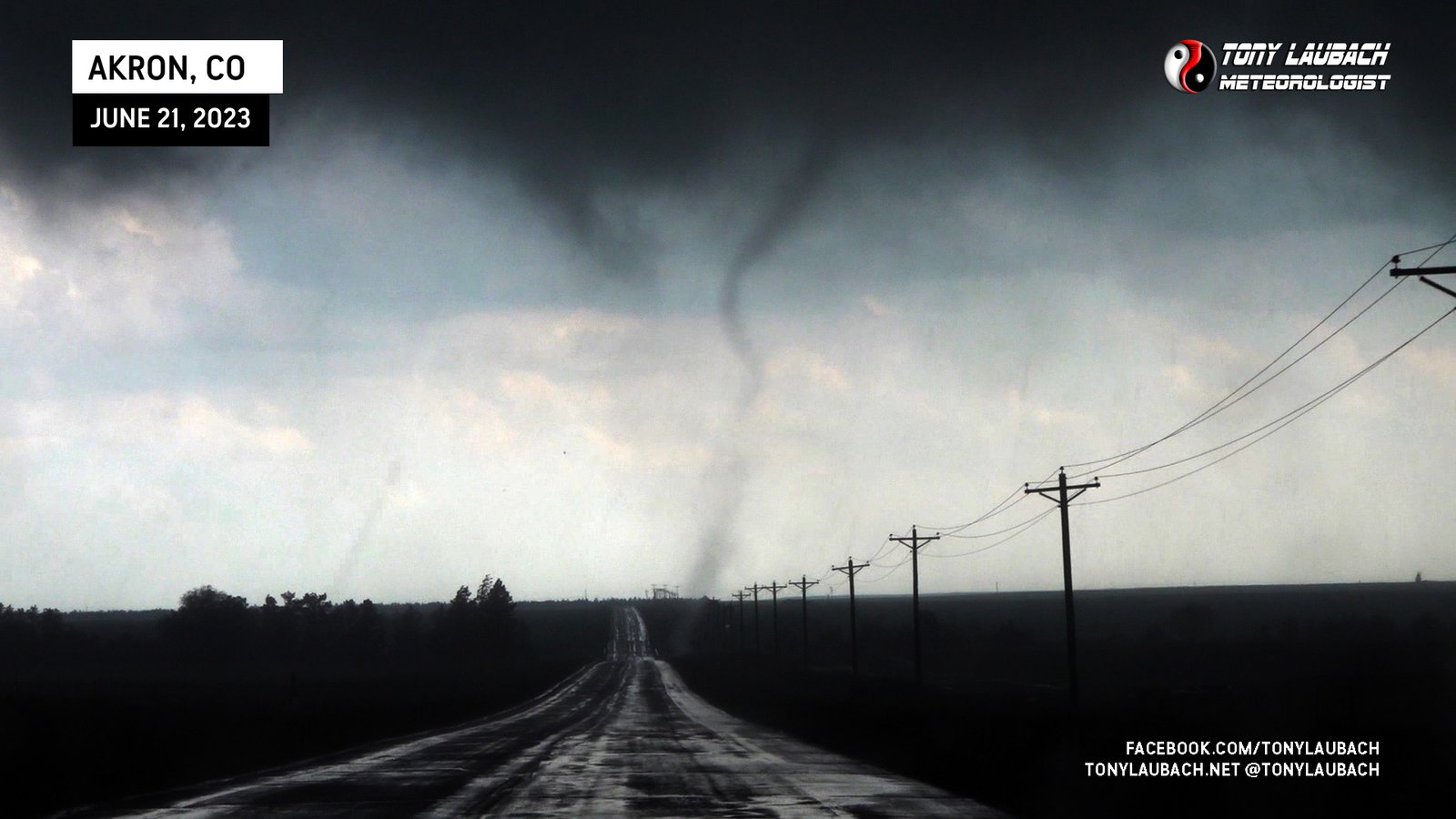
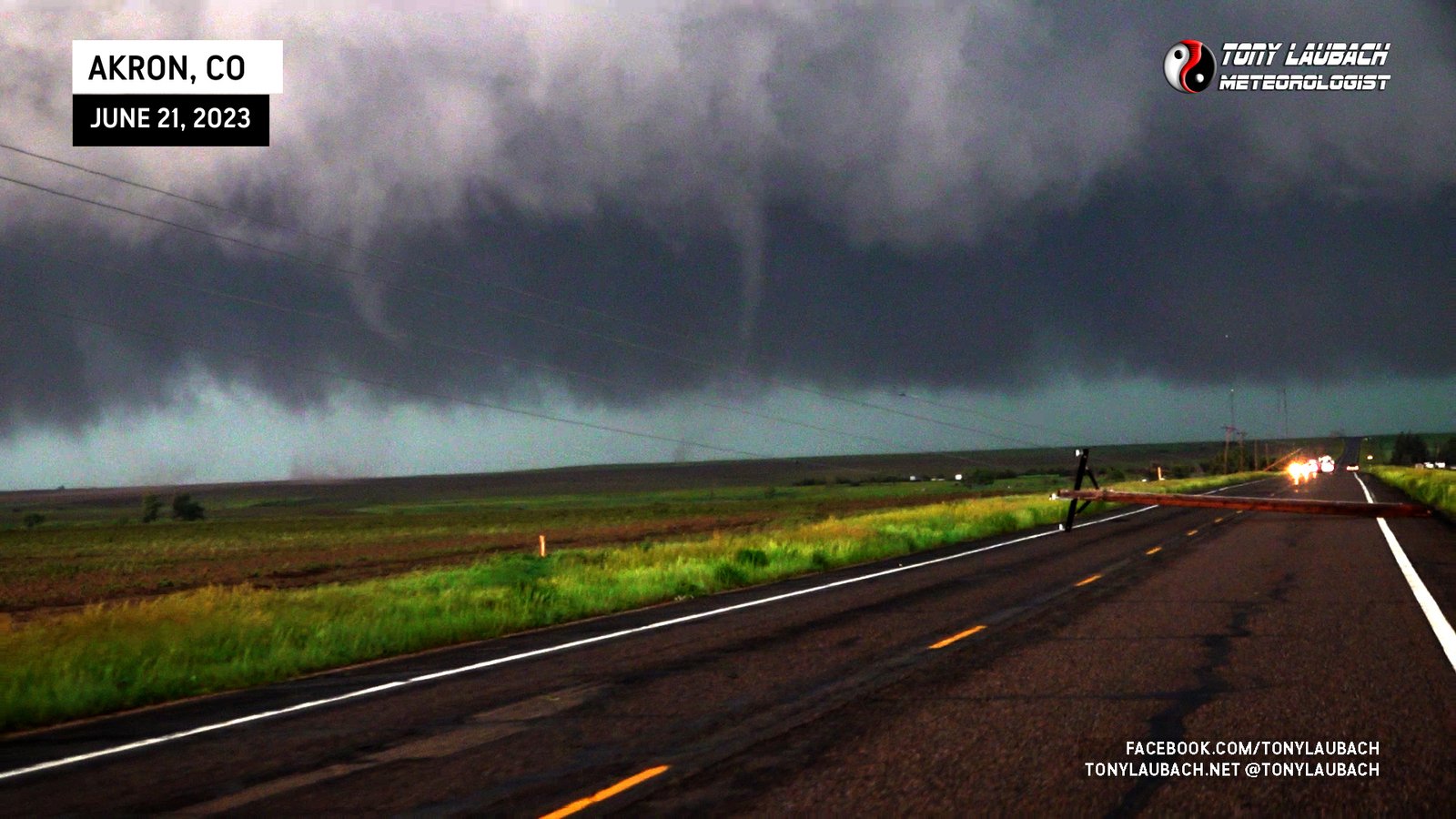
Suddenly the weakening rotation not only un-weakened, but formed a funnel/tornado within seconds about two powerpoles down the road to my west, and fortunately it was moving north, but I still backed out to the highway, turned myself north so I could shoot out the window with no issues, and with a front row seat, witnessed Colorado magic at its best.
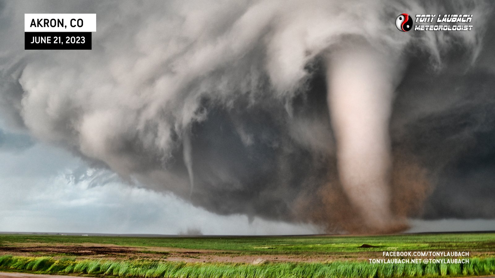
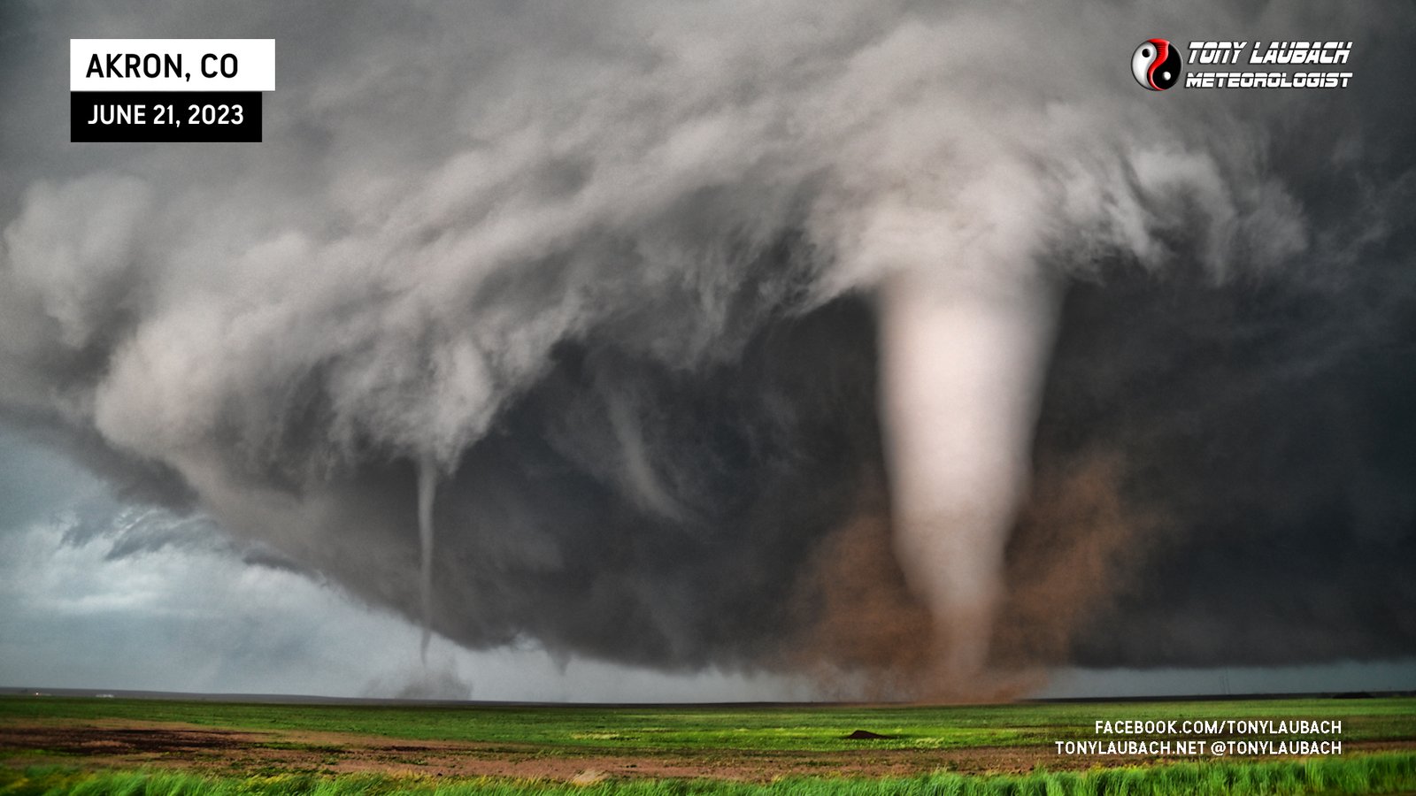
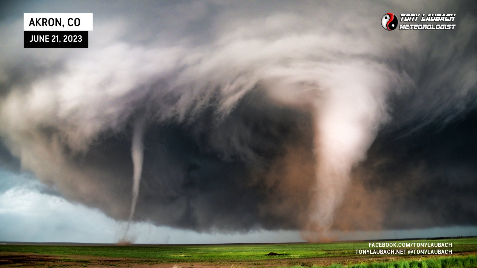
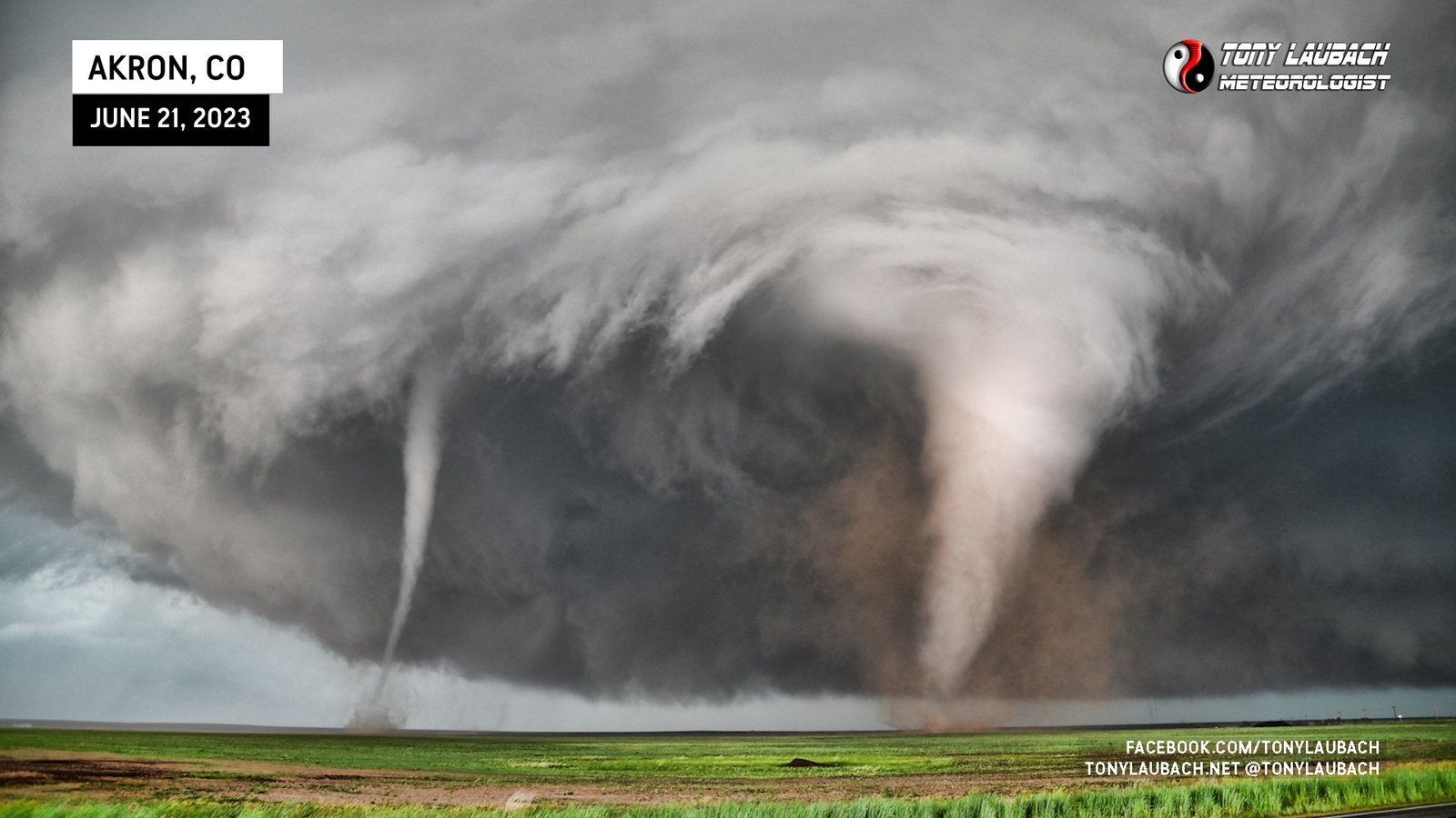
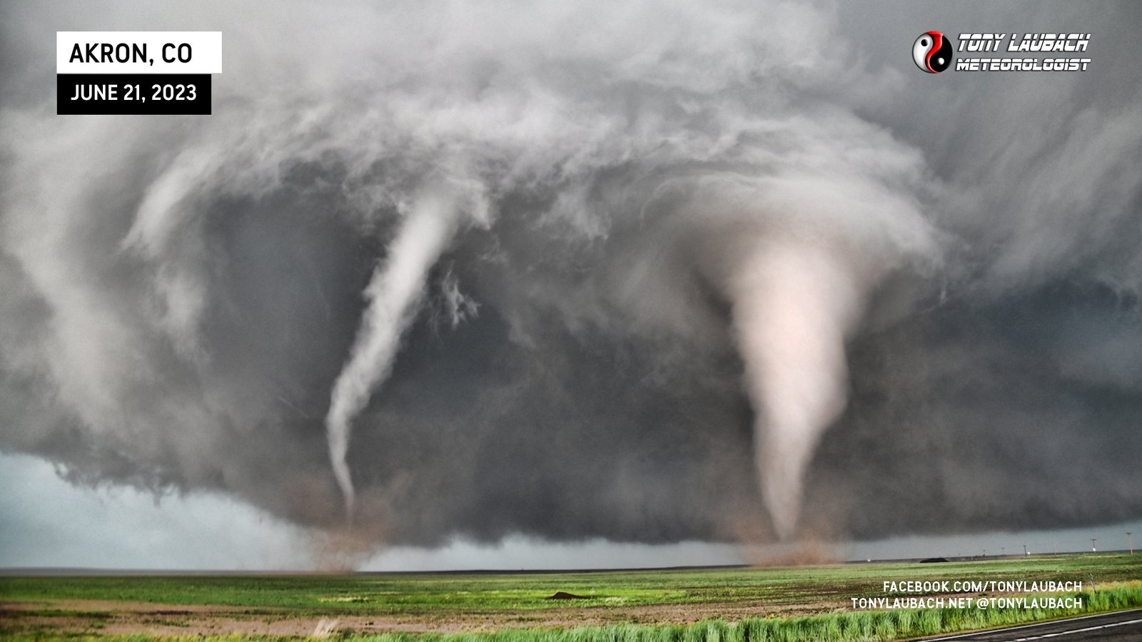
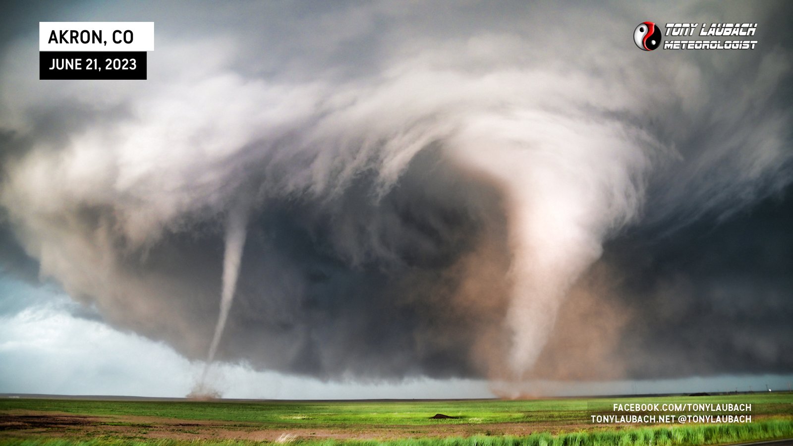
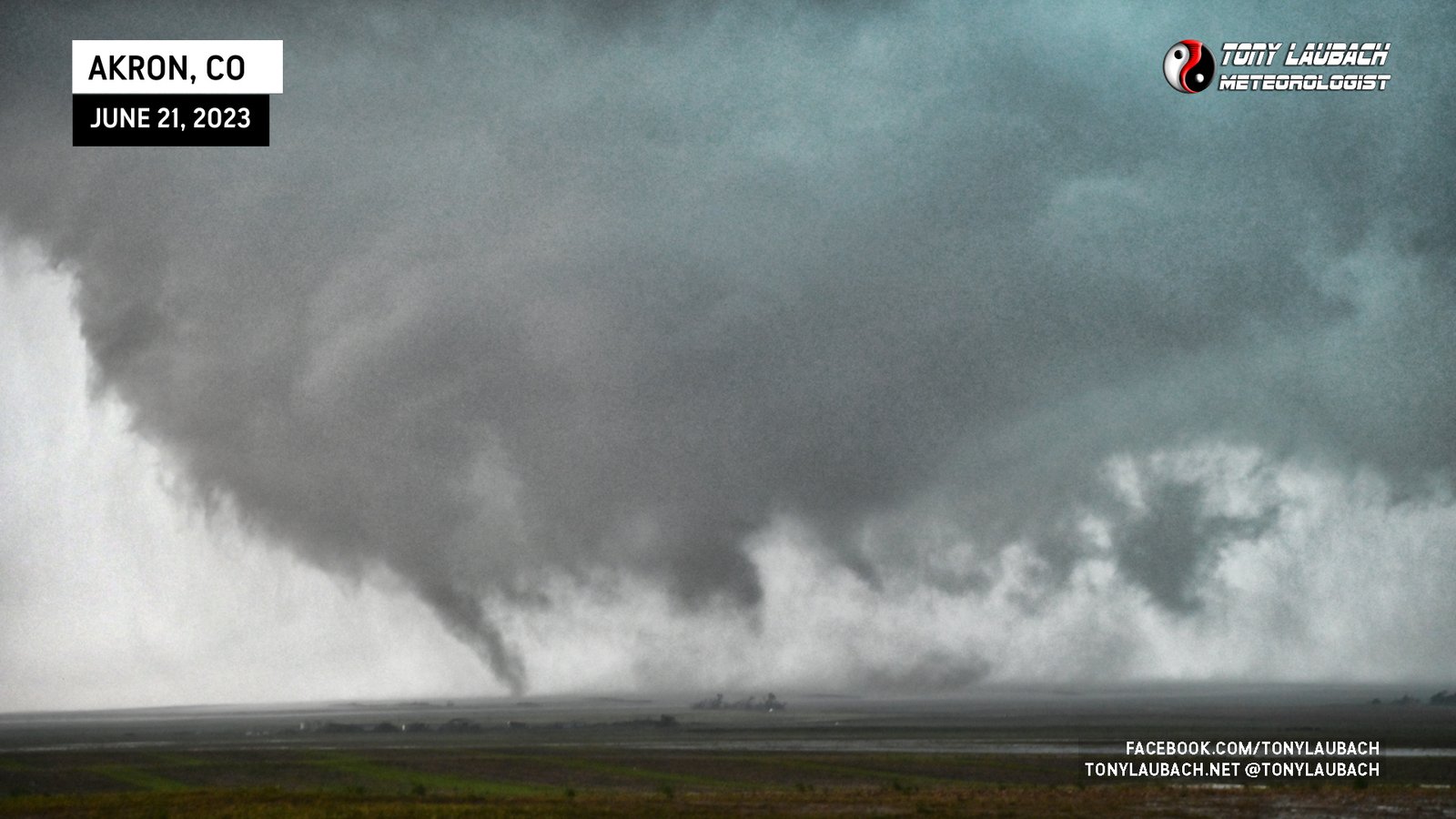
A BEAUTIFUL tornado was ripping through the field, easily within 1/2 mile. As it was doing its thing, multiple satellites, at one point two with the main tornado, were churning around the main tornado. The bigger satellite raced around the south and east side of the tornado, possible getting absorbed into the parent tornado as it hit CO-63 about 1/2 mile to my north, taking out the power lines and knocking the poles onto the road, making it impassable. While this was going on, I was shooting video in one hand and photos in the other. I wish I had a camera pointing at me during this point, I must’ve looked ridiculous. I was watching the whole thing with my bare eyes, so both the photos and video were a little cock-eyed at times, but the results were a dream come true.
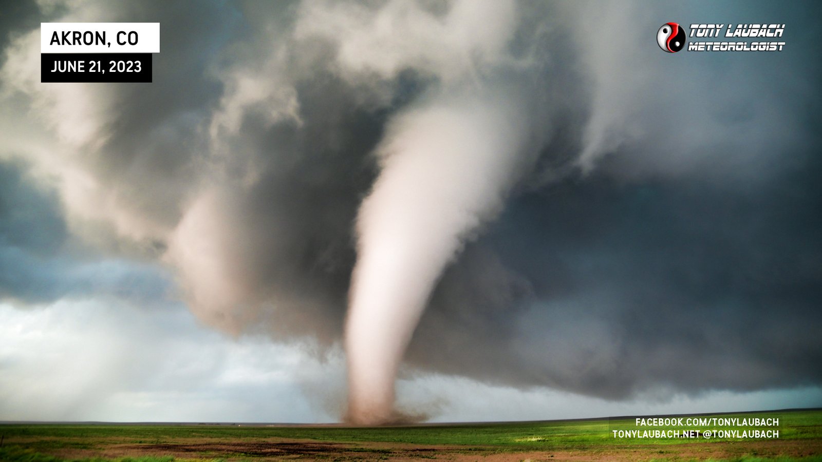
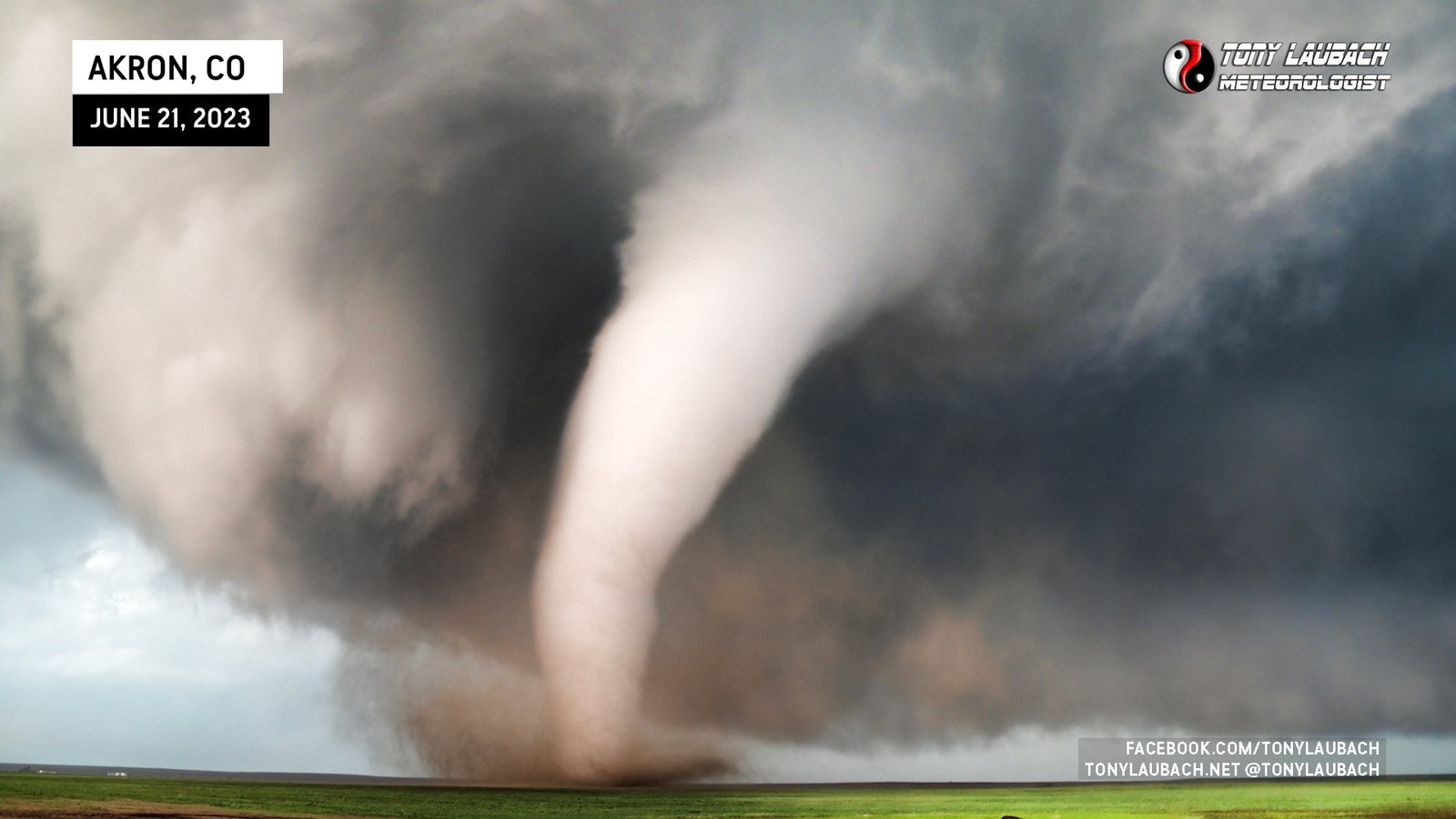
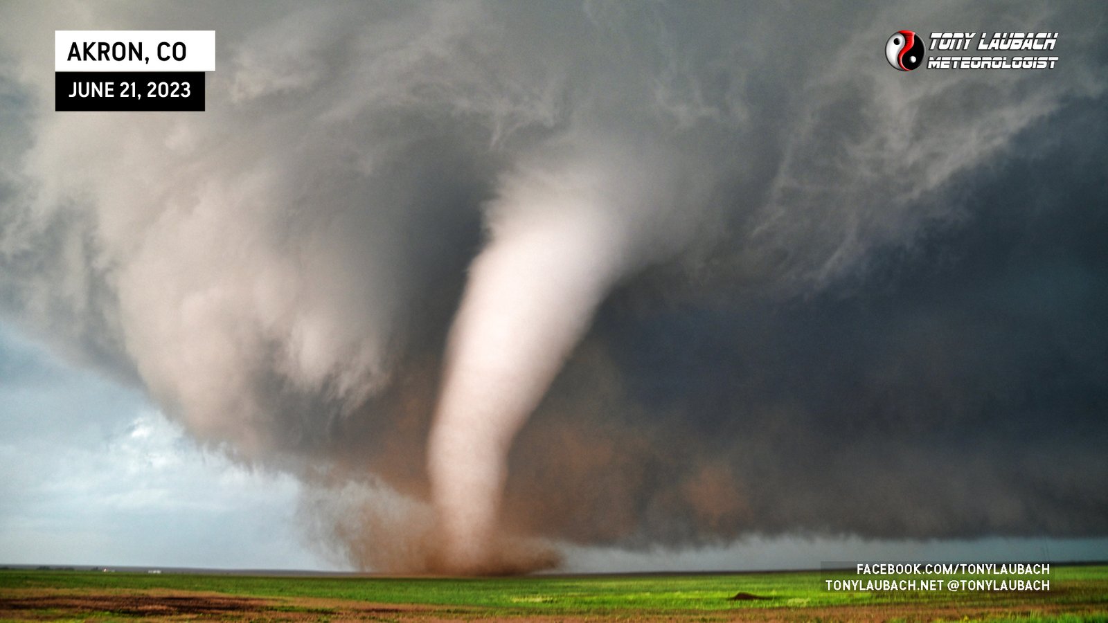

There was an exclamation that emanated from me in a prepubescent crack of my voice in the few moments I had to digest what I had just witnessed. I honestly probably missed the first couple tornadoes of the carousel as I was too busy clipping through the photos on the back of my Nikon wondering if I had somehow just dreamed up this tornado. I was dumbfounded. I felt like the break between that tornado and the next was an hour long as time just stopped for me in that moment. I immediately beamed over the video to my peeps at AccuWeather with about as big a words I could find for PUT THIS ON TEEVEE NOW. Once that was enroute, I took a cell phone shot of the back of my Nikon to post on social because there was NO way I was letting this one stew. While I don’t remember much in the moment because the shaking I was experiencing was probably preventing my brain from settling the hell down, I do know there were NO other vehicles anywhere in my view, so I knew immediately I probably had just witnessed the tornado event of the year by myself (certainly no one was closer than me). I wanted to pull the shots from my camera, but there wasn’t time. This would have to do (and it was probably the quickest way to prove it was legit being it off the back of my camera with timestamps and all).
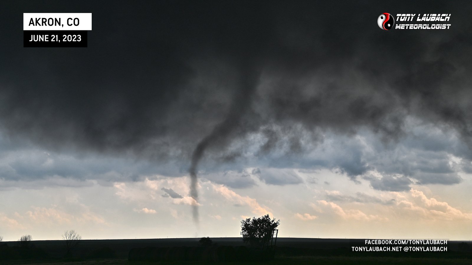
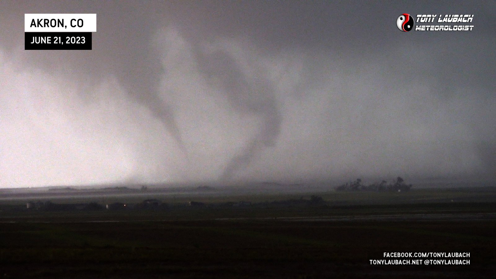
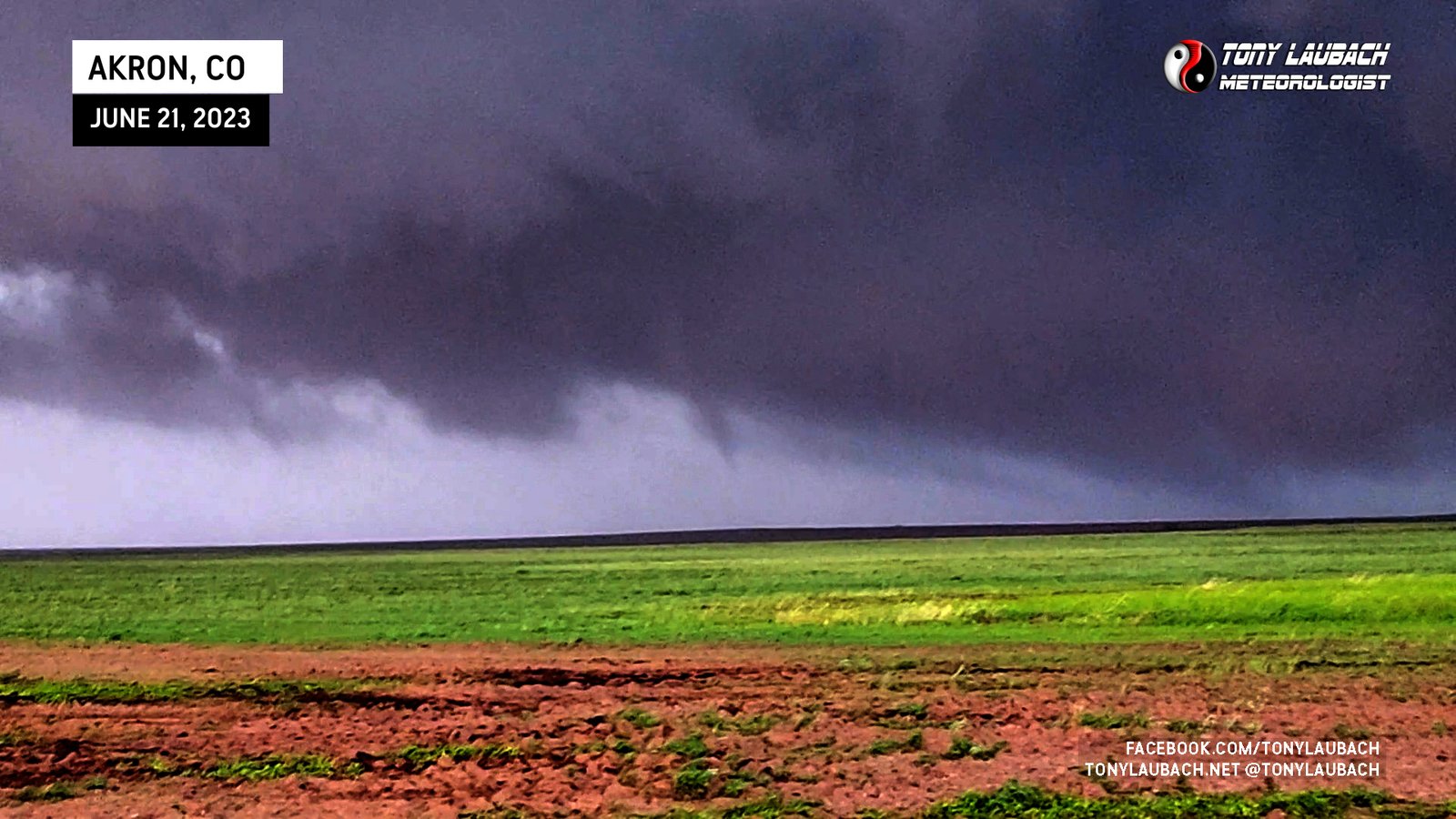
Before I could even think about taking it in further, I happened to glance up and see the beginnings of another tornado. “It’s gonna do it again” I uttered as I drifted slowly to the north. No, no it was not going to do THAT again, but lets call this phase 2 of this three-phased tornado-palooza. Like okay, lets do this again, shall we…
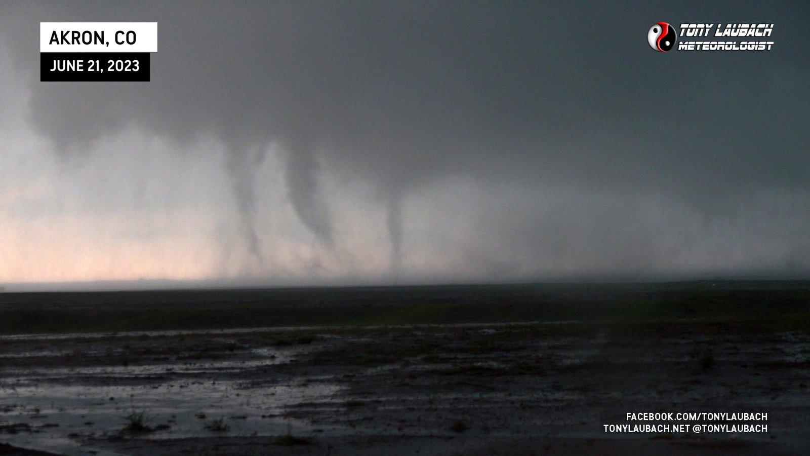
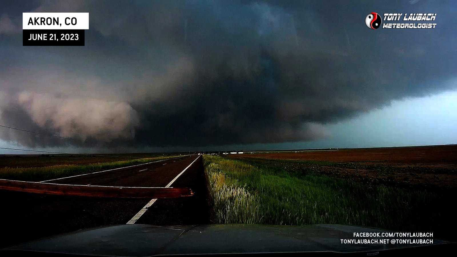
As I slowly pushed north, I discovering the poles, and while I was able to get around one with little issue, wires and more poles down made it impossible to go forward. A C-DOT truck was sitting on the highway (he had passed me shortly after the show) and I went around him and saw him looking in total shock at what was unfolding (I’d love to hear his story as I think he was on the approach from the south during the biggie). It was here I watched a merry-go-round of vorticies churn away for nearly ten minutes with as many as 5-10 distinct vorticies spinning out of the edge of the larger circulation.

Taking a quick glimpse at the map, I saw a north/south road about a mile to my west that could get me around the power poles. I went back to County Road 30, drove a mile west, then turned north on County Road BB. I had THREE miles I had to go to get to the road that would get me back to pavement (County Road 33), but heavy rain from this storm played hell with this road. This, ladies and gentlemen, is why I own an all-wheel drive Subaru, because without it, I was doomed to be stuck. But despite very limited traction, multiple fishtails, and a reoccurring RFD that did its best to slide me off the road, I managed to maintain enough speed and momentum to slowly stay with the carousel of twisters that was going to town a mile to my north.
I wish I had a better opportunity to document this phase of the storm. As I was slipping and sliding down the road, I knew my momentum was the only thing keeping me moving forward and stopping at any point would’ve been the end of my chase. Fortunately my wide-angle dash cam was able to capture the sights, albeit much less quality than I would like, but you can at least see the wide shot of this incredible storm.
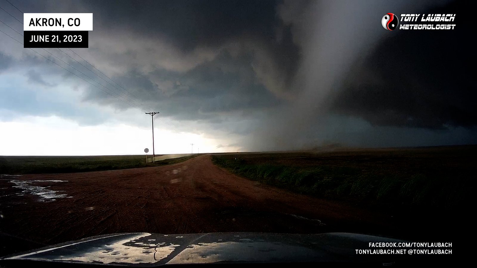
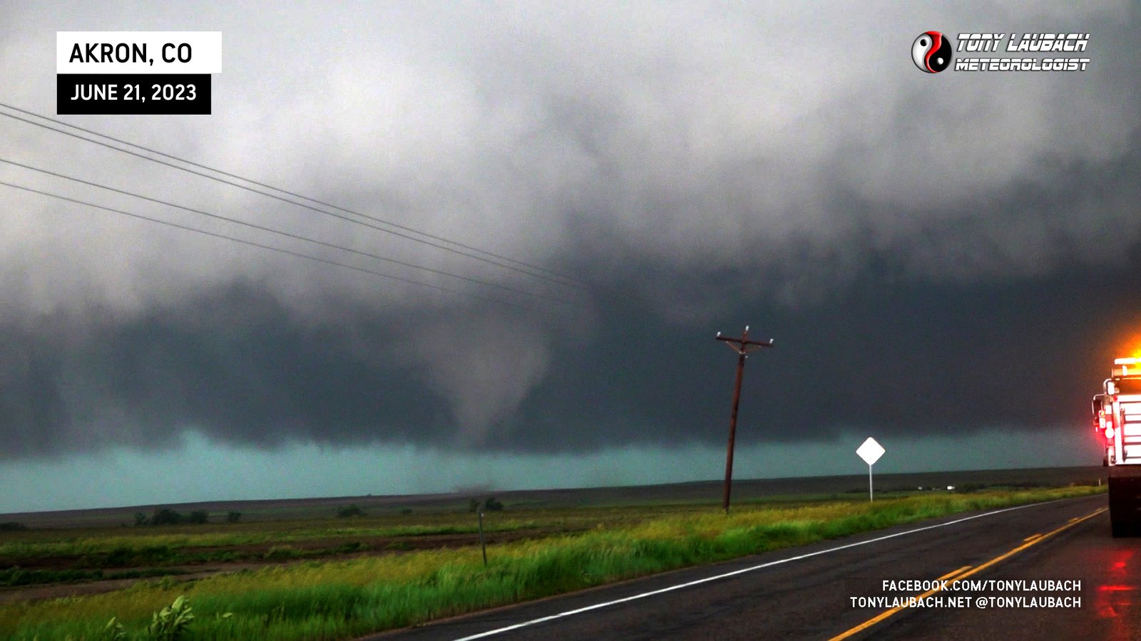
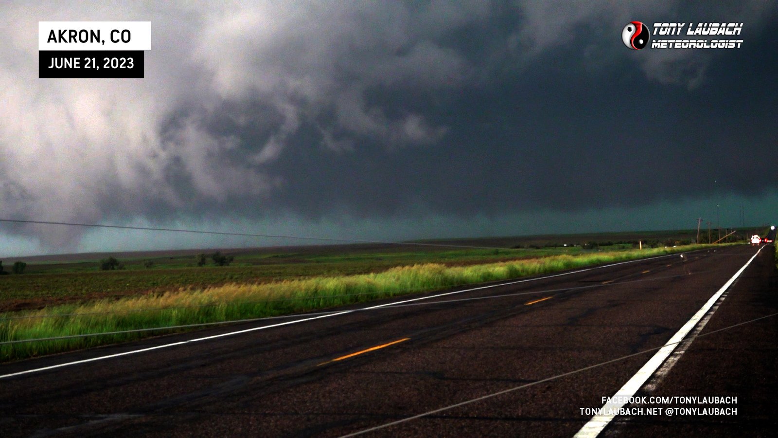
After what felt like forever, I finally made it to County Road 33, turned back east, and with one more mile of slip and slide, I made it to pavement, turned north, got lined up with the carousel to my west, and found a perfect vantage point to watch as the tornado drifted slowly to the north and west. I put this part of the tornado live on the AccuWeather Network as it was literally tornadoing its brains out. As many as 3-4 vorticies down at the same time, all rotating around a parent circulation. This emulated some of the more incredible tornado shows I’ve seen in the past, albeit not nearly as contrast-friendly as the initial meeting of this tornadic storm, but still plenty enough to just be in awe.


As the tornado drifted further to the west, the rain eventually wiped it from view. Radar indicated it went on for some time after that, but I was never able to get back south again. US-34 east of Akron was closed due to a bridge out, CO-63 south of Akron had been closed down while crews tended to the power poles (those stuck in the backup probably took on some 2″ hail), and of course all the dirt roads were probably in similar shape to what I had not long ago barely survived.
With that, I kinda gave into the fact my chase of this storm was probably done. I drove through the precip west on US-34 back to Brush, and did a brief jog to the south on CO-71 when more storms fired and became severe south of me. With hail estimates starting to creep up to “would ruin your week-old windshield” size, I decided I had probably seen the best of what this storm was going to offer. I returned to Brush to wrap up my network coverage, and then proceeded west, flirting with a few severe storms enroute, but eventually pulled back into my garage just before 10PM.
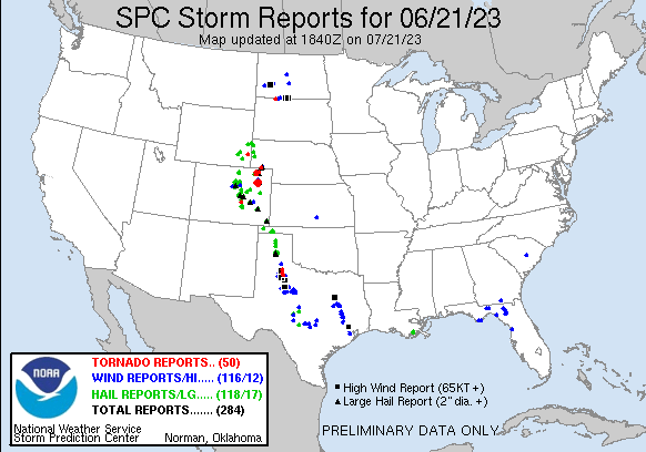
Initially I was extremely conservative with the tornado count as I was looking at the carousel sequence as a single tornado, but working closely with the NWS office in Boulder and after a more detailed analysis of my video, we determined that that sequence was indeed a rapid series of tornadoes. Eventually, a true-multivortex tornado did occur, this being the last one I saw before the storm, oddly moving northWEST, shrouded itself in rain and blocked my view. In total, I documented 19 tornadoes (I have included screen-grabs of those below), probably saw several more that I did not have a camera on due to repositioning. Add almost-baseball-sized hail and you’re sitting on an amazing chase.


The National Weather Service in Boulder, after coordinating with myself and others that were in the area, determined this storm produced a total of 27 tornadoes. This is addition to nine other tornadoes in the scattered storms further northeast totaled 37 tornadoes on the day which was a new record for most tornadoes in one calendar day in the state of Colorado (previous was 27 in May 2000). It’s likely I saw more than the 19 tornadoes I documented (and I had since found others), but repositioning with my back turned to the storm caused me to miss a few during the carousel stage.
NATIONAL WEATHER SERVICE BOULDER SURVEY (note their mapping appears off based on my positioning, but it shows the counts and imagery).
The video below is from friend and fellow chaser Trey Greenwood as he took a deep dive into the meteorology behind this historic event. He offers up a solid explanation as to why the Wyoming target did not pan out and offers some insight as to some of the ingredients that came together near Akron.
For me, this was my holy grail. To capture an incredible tornado up close like this, and then do it with TWINS (technically triplets), was a dream come true. I had literally just two weeks earlier, invested in an upgraded camera, the Nikon D780, and that’s what snapped those photos. And all this, again, within half a mile at most from me. I had a clear shot, no significant precip, and aside from Simon and Juston and I think one other chaser, there was not a soul around. And no one was closer than I was. This was my shot of a lifetime, and on a chase that beats out Conway Springs ’04, Dodge City ’16, and even Pilger. I was able to capture such quality images out of it, and be so (SAFELY) close and experience it, and do it here in Colorado so close to home. This is the new number 1.
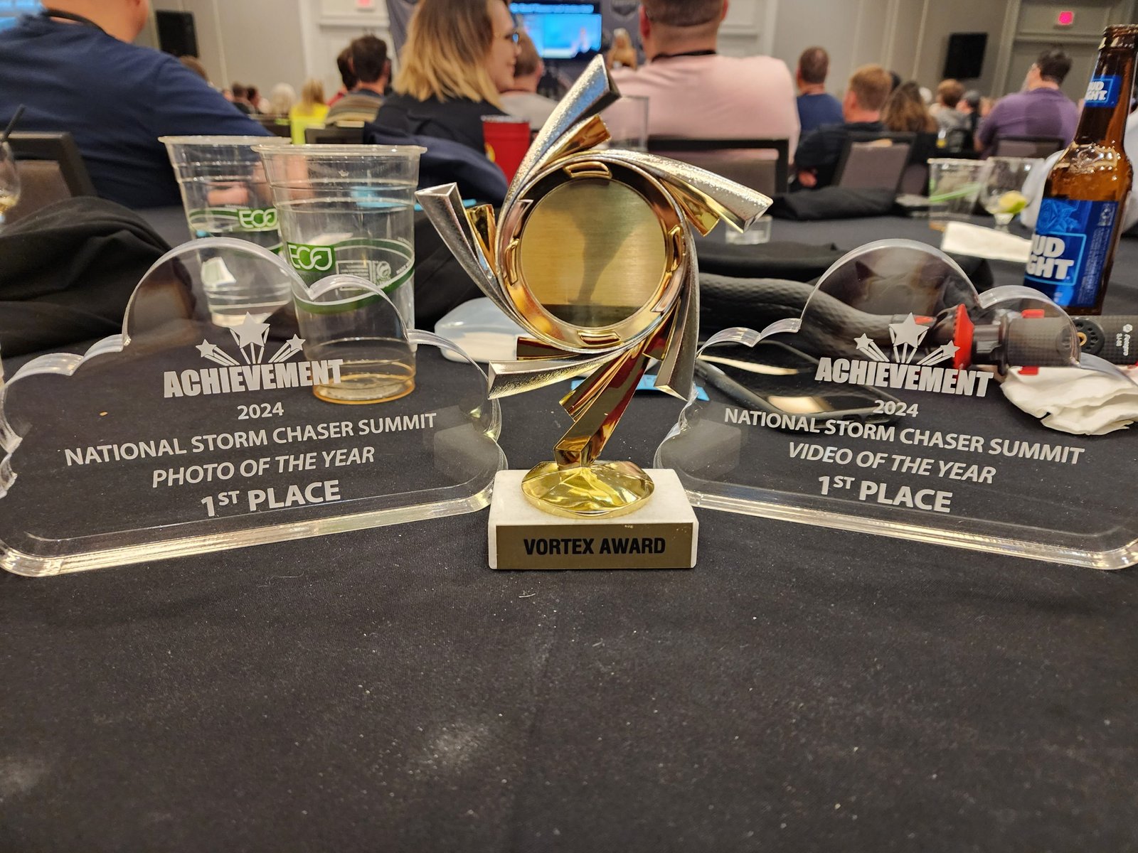
The following February at the National Storm Chaser Summit, I was awarded for both the Photo AND Video of the Year from this event. No surprise this was dubbed the event of the year. I even took home a Vortex award for best tornado-fest of 2023! 😀