

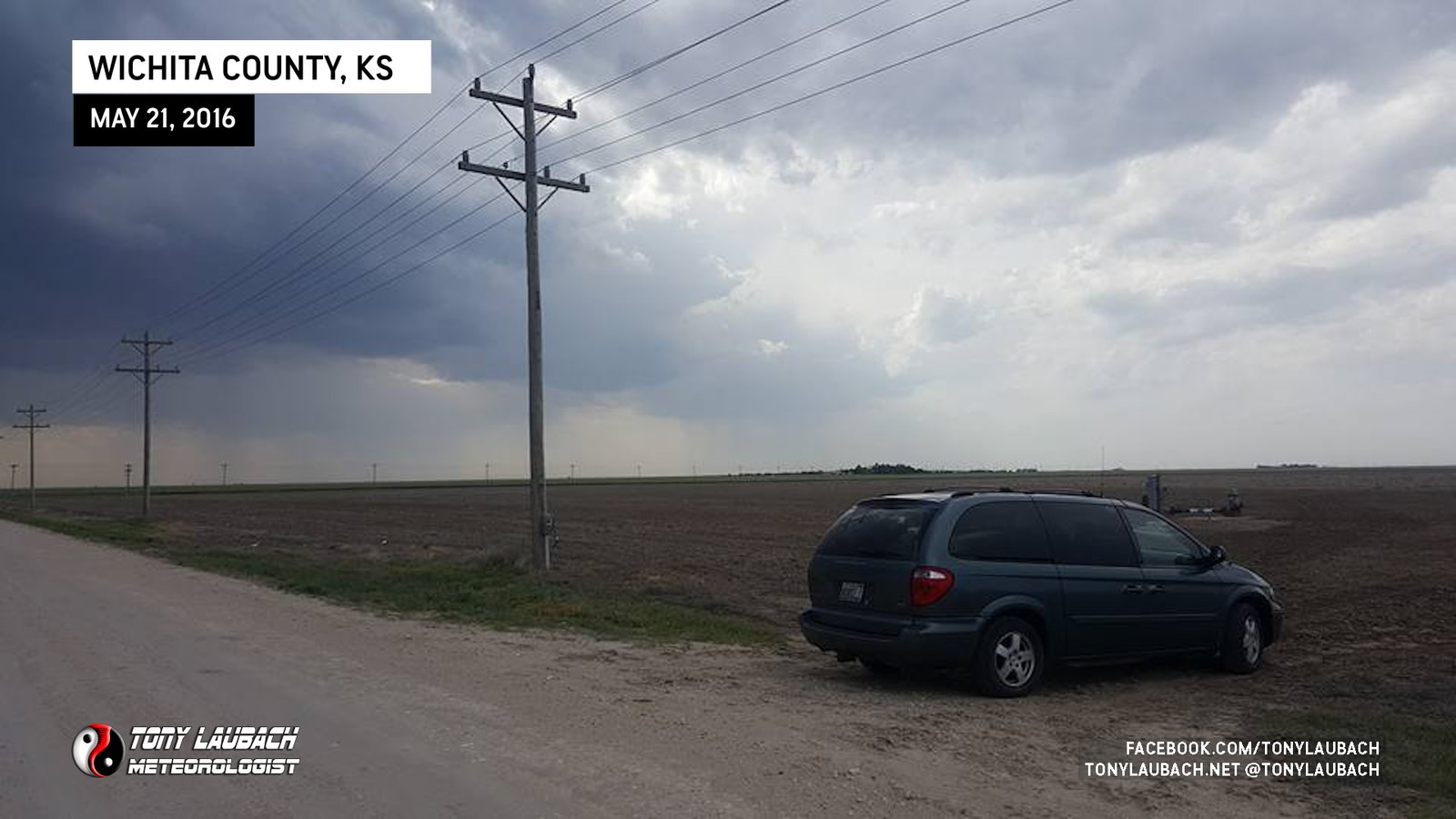
VFresh off the engine blow up that ended the run of my Subaru, I quickly worked to get myself into a new ride, one I considered a temporary solution as trying to get a new vehicle in the middle of a storm chasing season, particularly now as we were days away from what was likely to be a VERY busy stretch, was not going to allow for shopping around.
Given the tight window between purchase and the upcoming series of days, starting with this one, I took care of the equipping as best I could from home while other ordered parts were shipped to a friend in Wichita where I could swing through and pick up there, spending a long morning installing those before hitting the road for western Kansas.
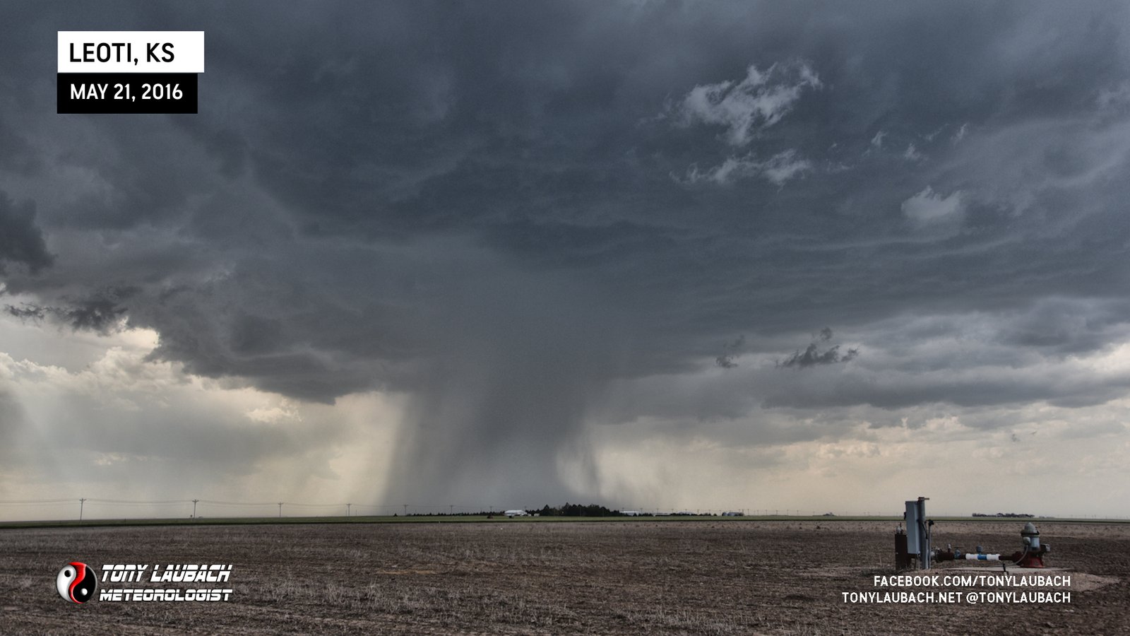
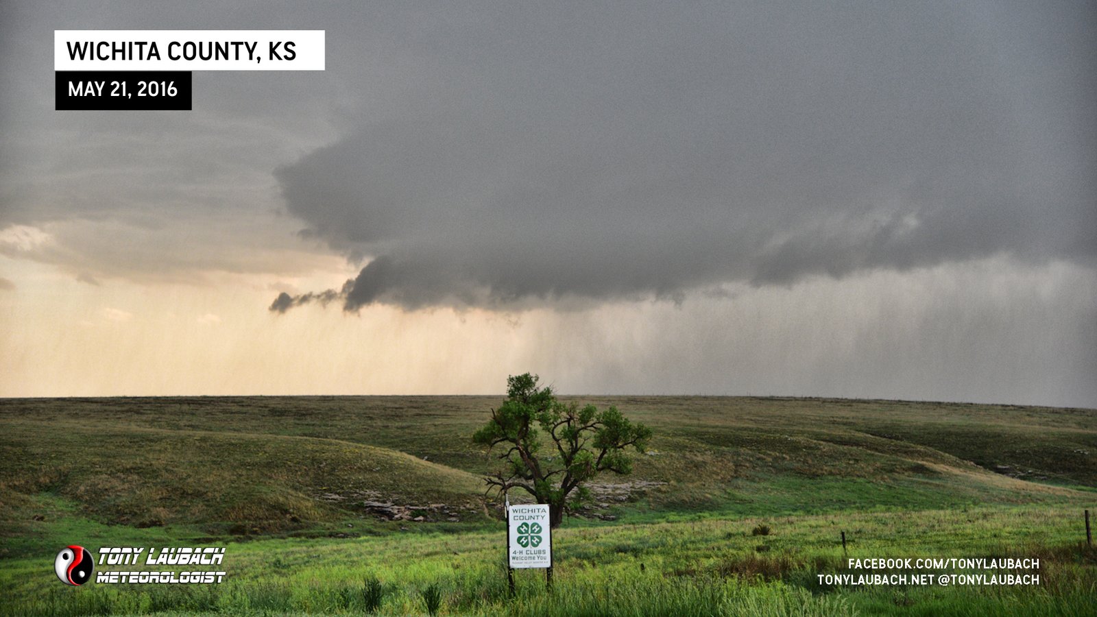
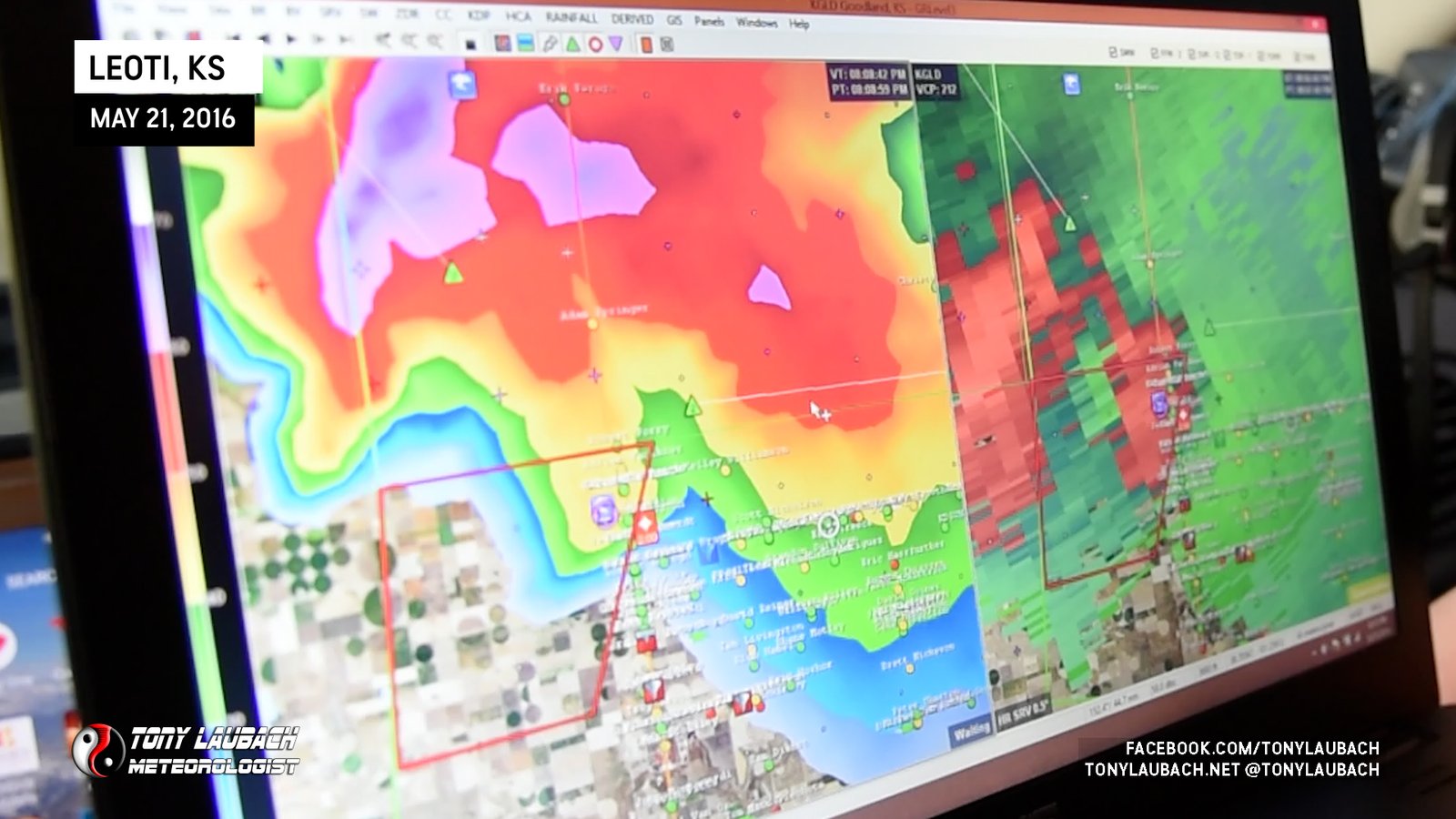
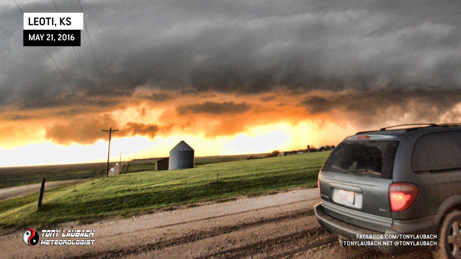
We hit the road from Wichita made the lengthy drive across southern Kansas all the way to Garden City, then over to Lakin before we cut north on KS-25 and shot straight north up to Leoti, Kansas. A cell had gone up west of town and basically seemed to just park there. We stopped briefly in town to gas up, then moved north of town to set up as the storm was drifting northeast.
We headed up to near the county line to get up into the core and sample the hail. I had a running joke all day that I needed to break in the new van with some hail dents, so that was the early goal. And while we did get into hail, nothing was big enough to really leave a mark on the van… but…
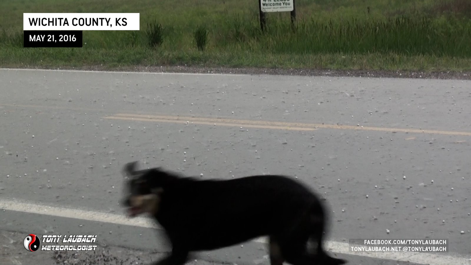
While I was shooting the hail, most of it 1″ or less, suddenly a dog flashed across my frame. It wasn’t happy, we could tell, so we lured it over to the van and let him come in to shelter from the hail.

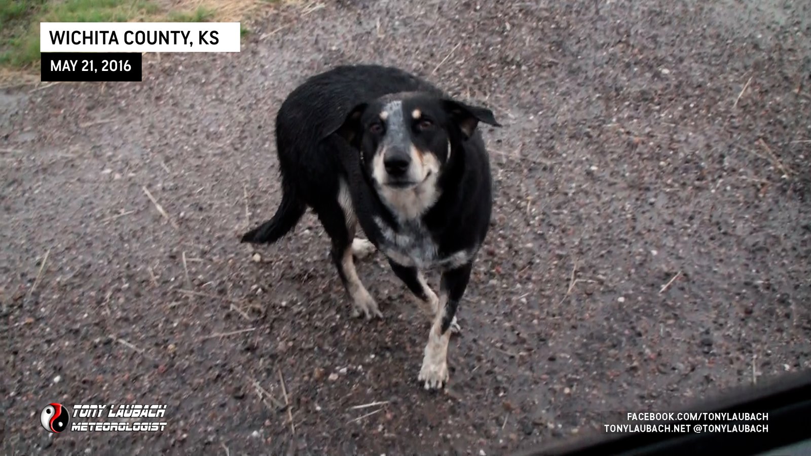
Once the hail subsided, we let the dog back out. It didn’t have a collar, but certainly looked well off, so we assumed it to be a dog from one of the nearby farm properties. We didn’t wanna take him with us as we felt confident given the health that he belonged somewhere nearby. He hopped out of the van, gave us a thankful glimpse before he took off to where I assume he came from.
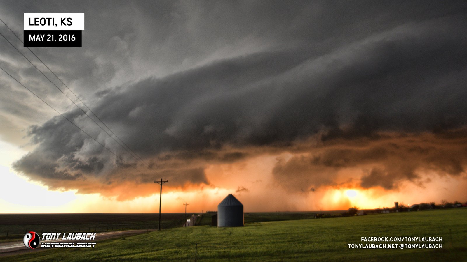
Meanwhile, our storm to the south was starting to gain some spin. The storm, which was virtually stationary at this point, having stopped any of it’s northerly movement. Enough so where we were suddenly TOO far north up here at the Wichita/Logan County line.
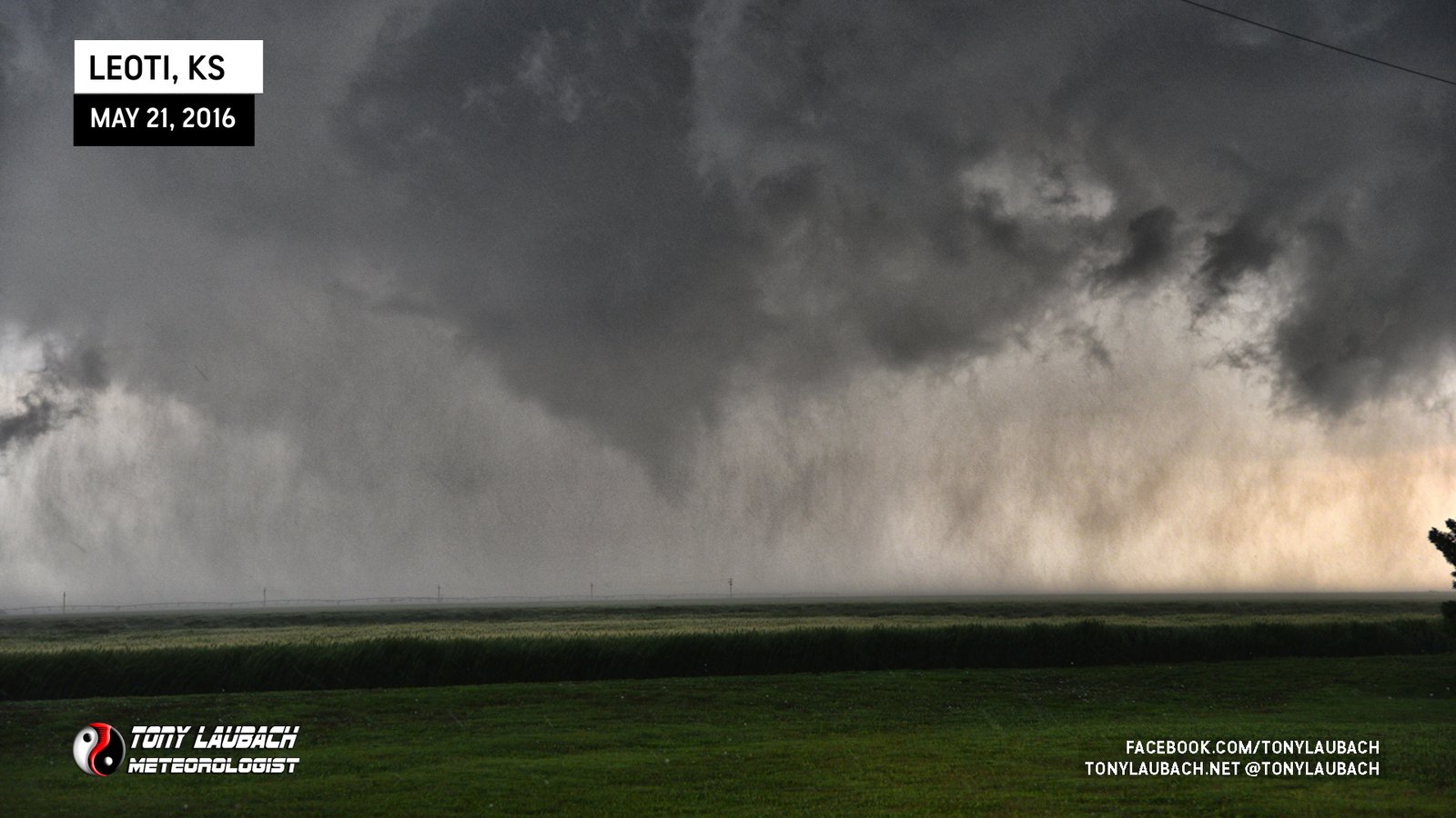
As the rotation began to really tighten up, we decided to head south from the county line. As we were dropping south, by this point approaching County Road D about three miles south of the county line, we observed the first tornado starting to come down.
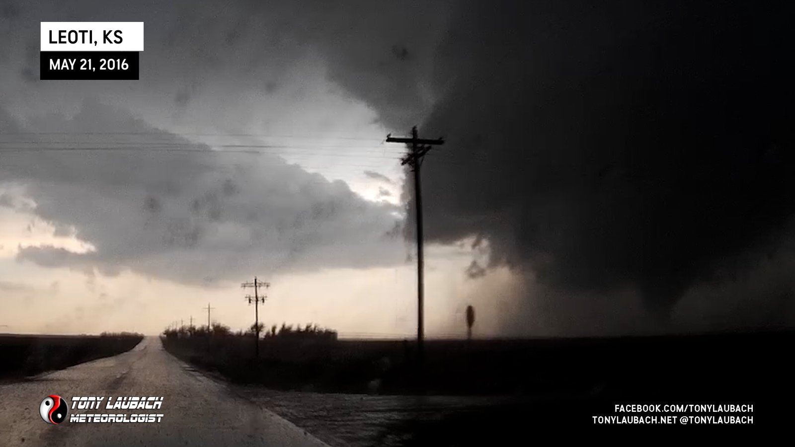
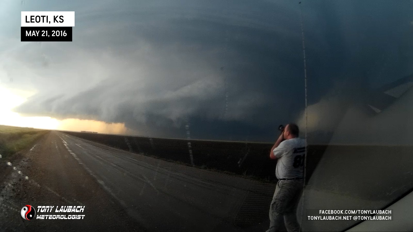
After crossing County Road D with the tornado in progress, we found the first available pull-off about a half a mile south on a business property on the west side of KS-25. While it didn’t offer the greatest view looking due west as we were partially blocked by the building and trees, we still had a view of this circulation and associated tornado.
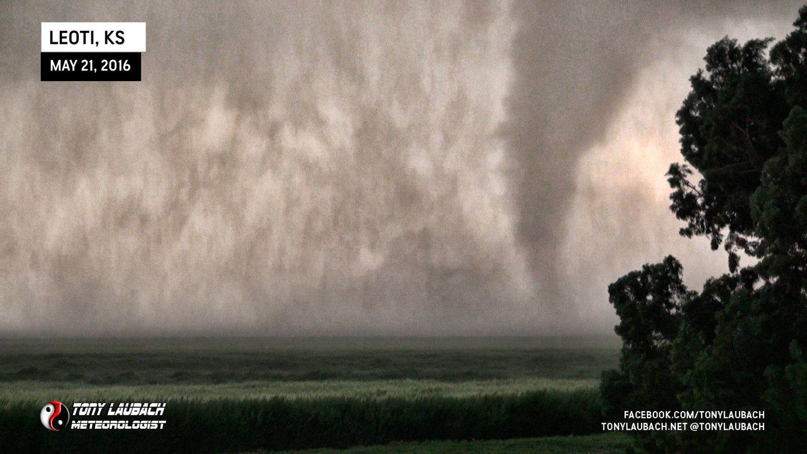
The tornado, while continuous, would lift and touch down sporadically. Visually, the wall cloud and parent circulation at the storm’s base was definitely falling apart, so it was apparent this tornado would not hang out long. I was hoping to get one or two moments of full condensation like we saw while southbound, and fortunately the tornado obliged for us.
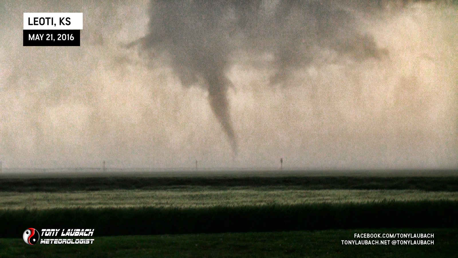
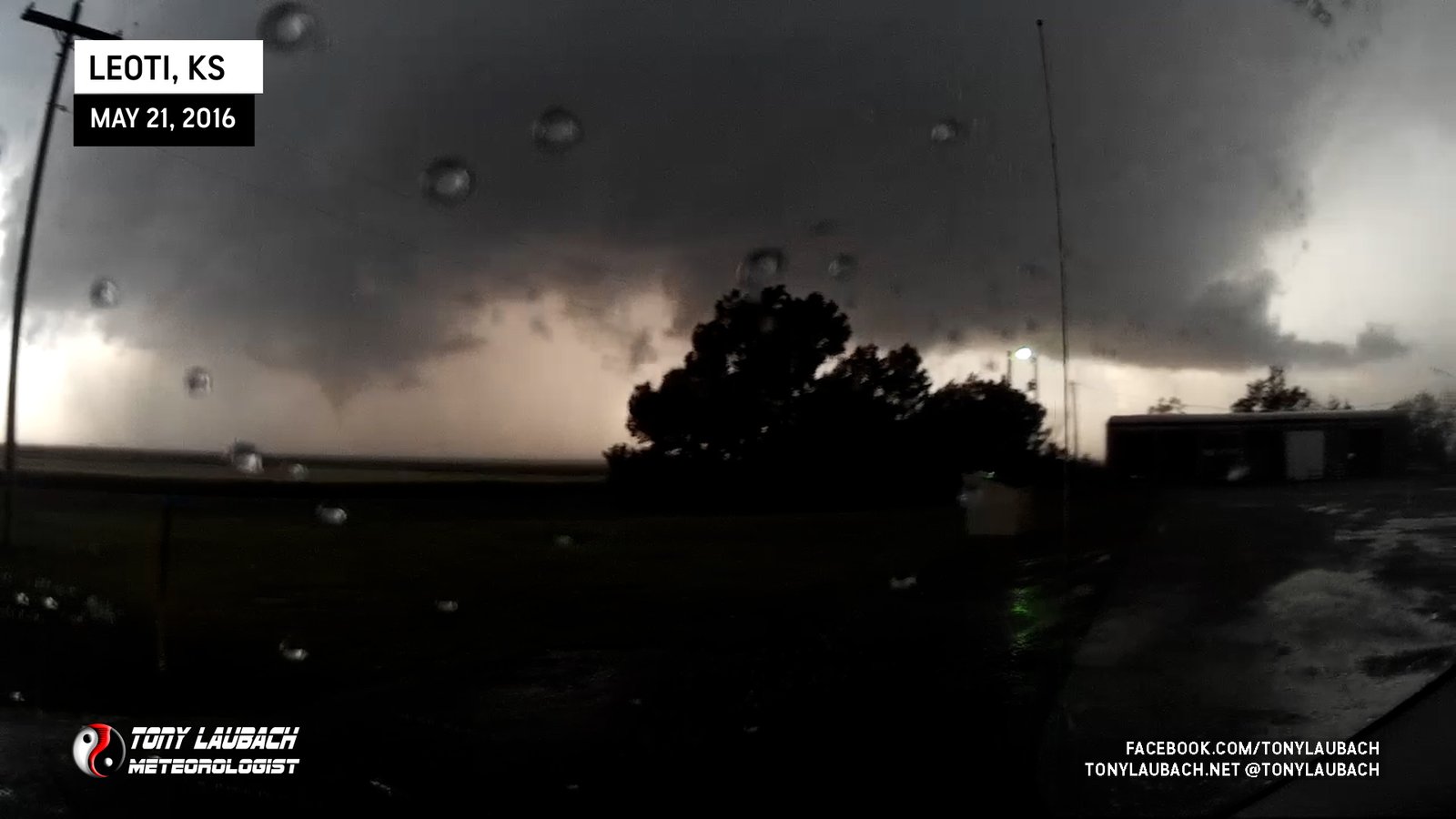
After the first tornado ended, the parent circulation of that began to rotate back to the north, meanwhile, a second area of rotation began to circle in behind it, and about two minutes after the first tornado ended, the second tornado came down.
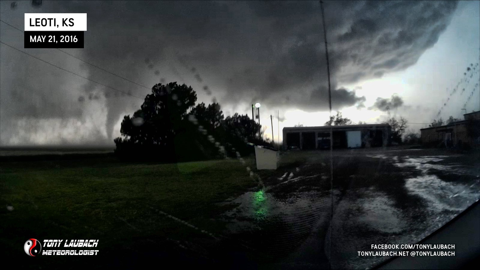


Like the first tornado, this one didn’t last long, but also did as I hoped and would get photogenic for a short window, allowing both my dash cameras as to film video while I shot some stills on the Nikon.
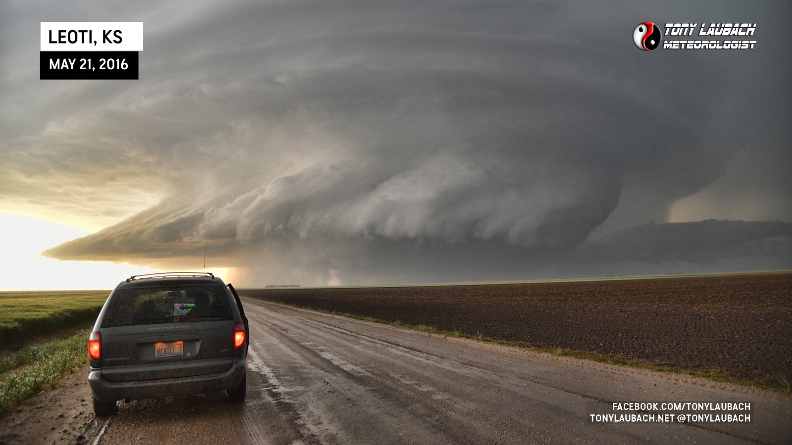
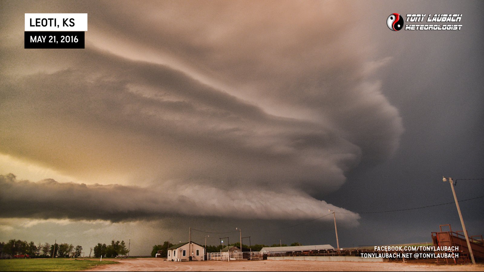
We held on for a couple minutes to see if another one would drop, but nothing came to pass. We eventually got back up to County Road D and shot east as we were seeing incredible structure shots of this storm that we couldn’t get being right under it. We went about 10-15 miles east on County Road D to take in this incredible looking supercell!


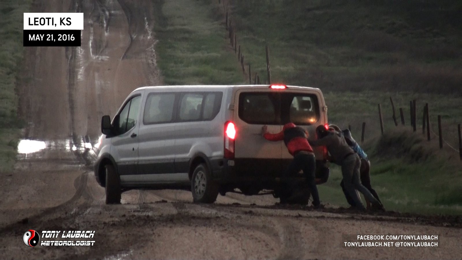
With sunset approaching and this storm still going to town with its show, we closed in a little bit west as the orange coloring was taking over underneath the storm. The muddy roads were taking their tool, many chasers having issues navigating the slickened mud left behind from the storm, including a chaser tour group who fortunately had enough guests and hands to push their vehicle free of the mud.
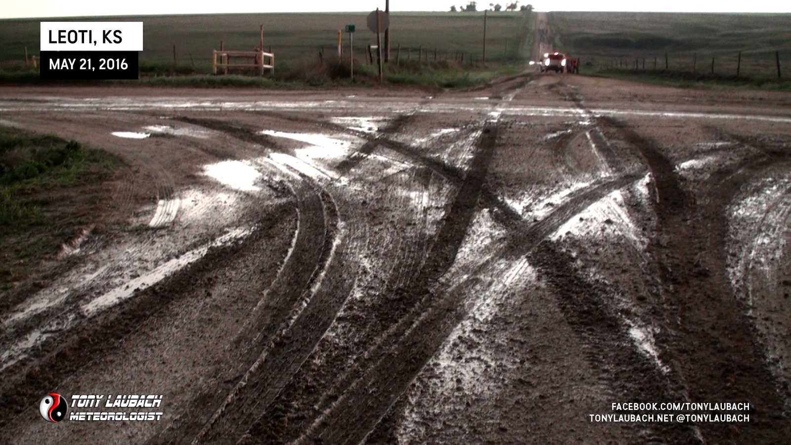
Despite not having the all-wheel-drive of my previous vehicle, brand new tires and staying on somewhat better surfaces prevented us from having any issues. We were useless to help anyone along the way, but most that we saw up our back roads northeast of KS-25 were able to get themselves underway somehow. Meanwhile, the sun was setting marvelously beneath our supercell, which required more stops enroute west back to KS-25.
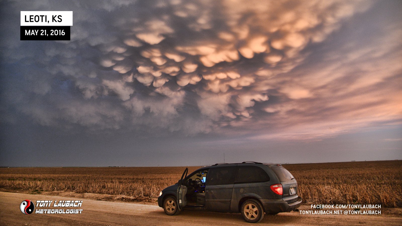
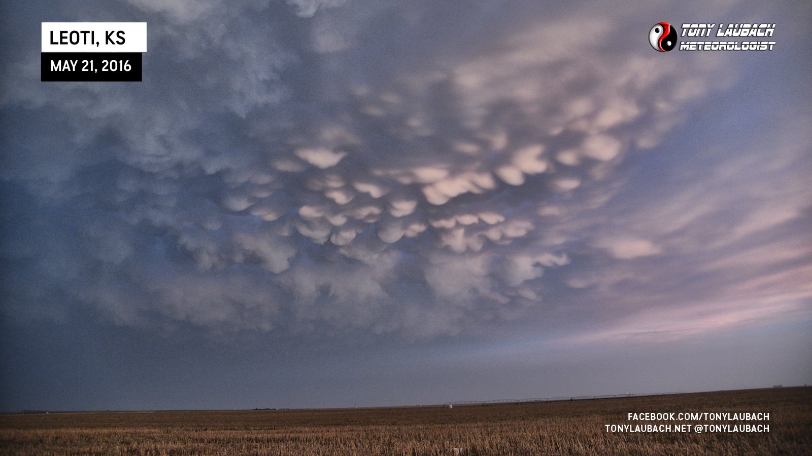
Of course, no sunset storm would be complete without awesome mammatus clouds, and this storm certainly did not disappoint.
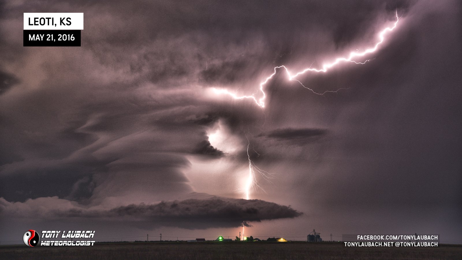
With darkness starting to fall, we returned back to KS-25, then south into Leoti, making a quick stop in town to top off the gas, then proceeded eastbound on K-96 a couple miles out of town as the lightning started to REALLY ramp up on this thing. I didn’t want to let that go to waste, so we stopped about 3 miles east of town and set up to capture some amazing lightning/structure shots post-sunset.


As the lightning began to fade with the storm, we finally opted to call it a night, heading east to Scott City, then south to Garden City where we bunked down for the night.
This was an incredible start to this trip, just a few days after acquiring my new van and getting it set up the morning before in Wichita, we got an AMAZING show from this incredibly sculpted supercell. While the hail was not terribly impressive, it was still hail, and of course a couple decent-looking tornadoes added to the plate, but it was definitely the structure that took the show. I never claim to be a structure guy, and I will never complain ‘missing’ structure, but daymn am I happy when I am there to enjoy it! And oh yeah, some awesome lightning to cap off the evening before we called it! A spectacular, easy chase day in western Kansas in the books!


