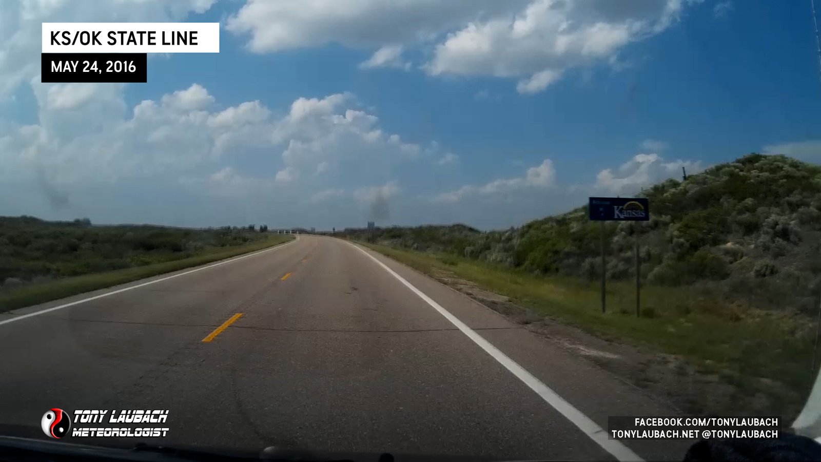
Woke up in Woodward, Oklahoma and had a pretty casual morning as today’s target was only a couple hours drive at most. After a leisurely breakfast and fuel-up, we headed north toward the Dodge City area along with a whole line of other chasers, many of whom also stayed in Woodward after the previous day’s chase. Few times can you really say that a chase day was a ‘no-brainer’ target, but unless we wanted to make a ridiculous run to northeast Colorado, this was indeed a ‘no-brainer’ target day.
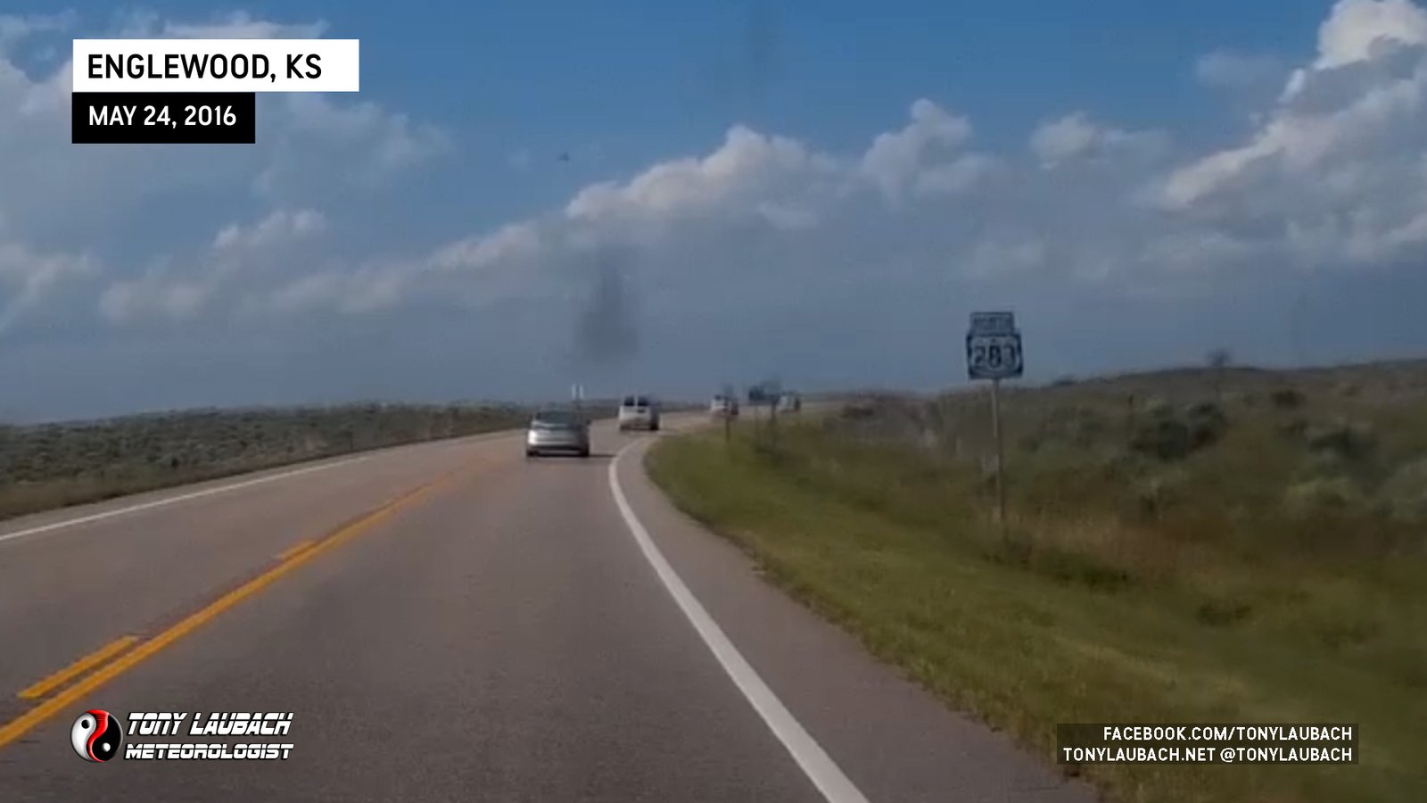
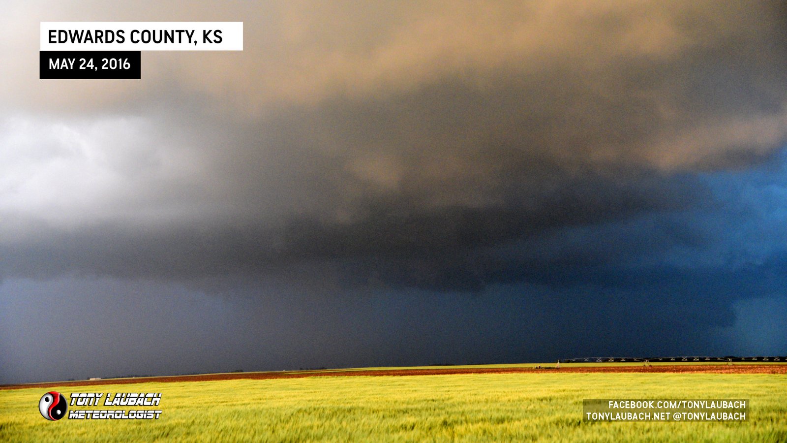
We took a perch off US-283 about 15 miles south of Minneola on a dirt road near Big Basin Prairie Preserve Wildlife Area with a great overlook west, watching as the cu-field thickened. Meanwhile, as conditions through the day continued to improve, after SPC updates increased potential for strong tornadoes.
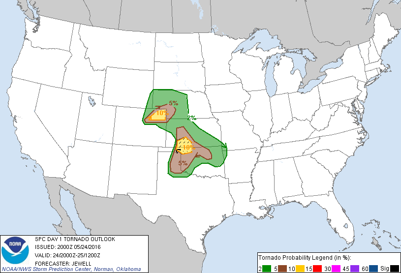

We sat there for well over an hour as we waited for the first signs of initiation. When that occurred to our north, we made our move, getting back on US-283 and heading a few miles north of Minneola as we watched the organizing storm and eventual wall cloud.
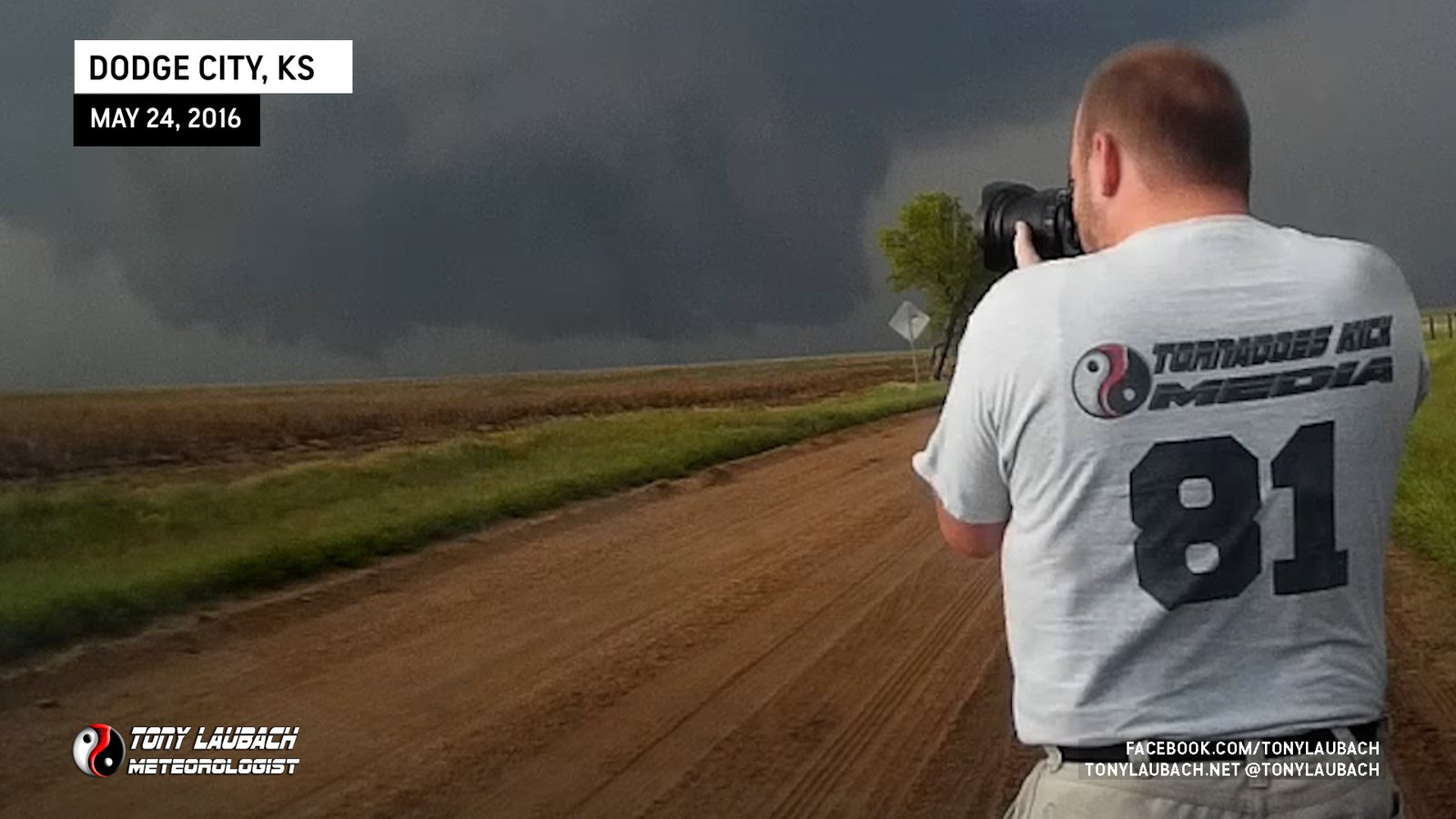
As the storm started to ramp up, we decided it was time to move. With the massive amount of other chaser traffic, I decided to test out the literally days-old van and try for lesser traffic on the local road grid. Obviously this meant unpaved, dirt/gravel roads. But I had new tires on the van and figured it was worth gamble to allow us the opportunity to move faster and have more options to stop as needed. That said, we crossed over US-283 on Yucca Road, went 3 miles west of the highway to 108 Road, and that would be our north play from here all the way up to Dodge if needed.

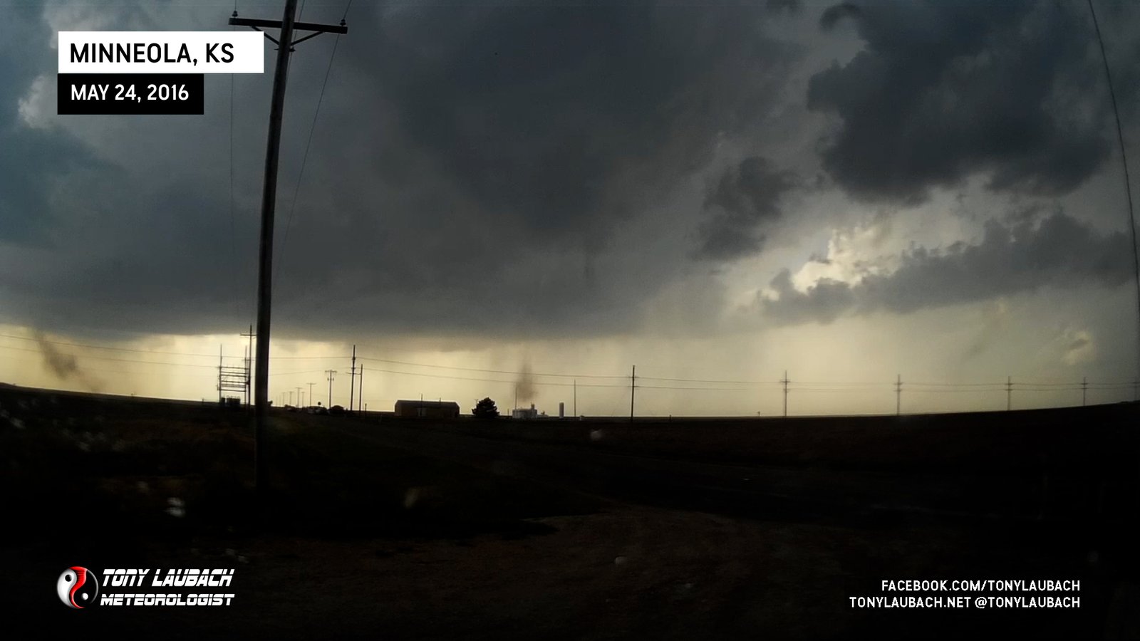
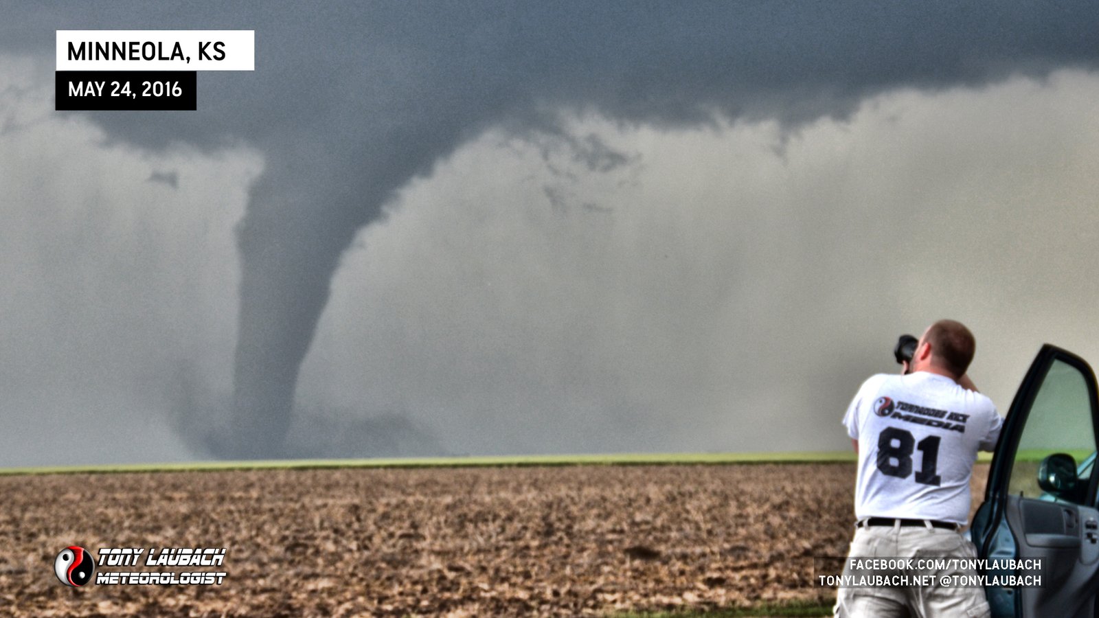
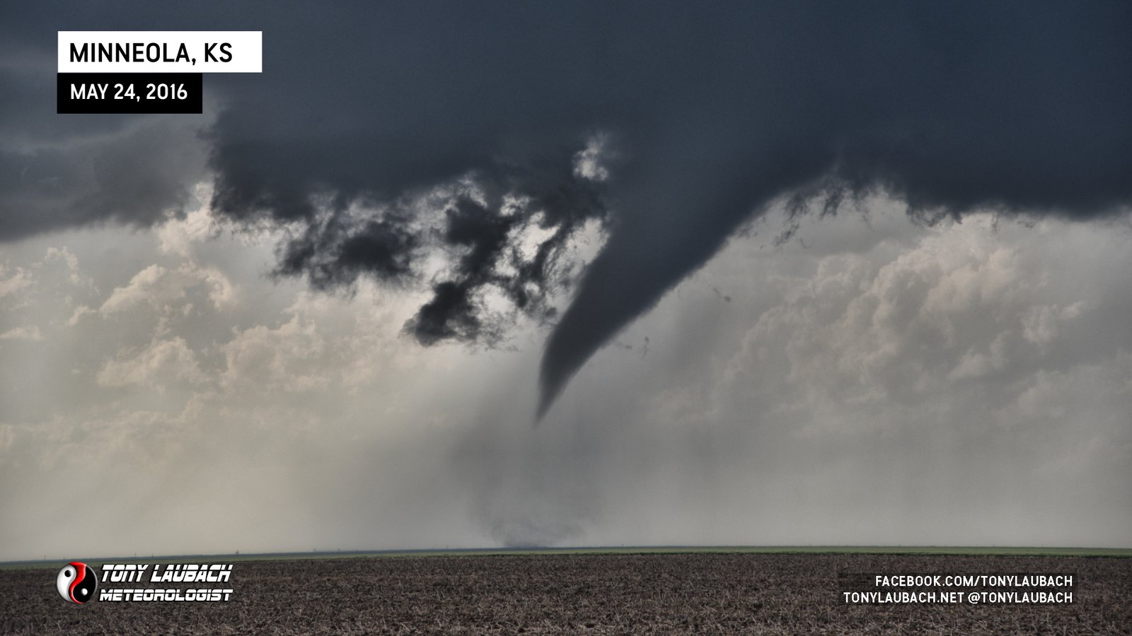
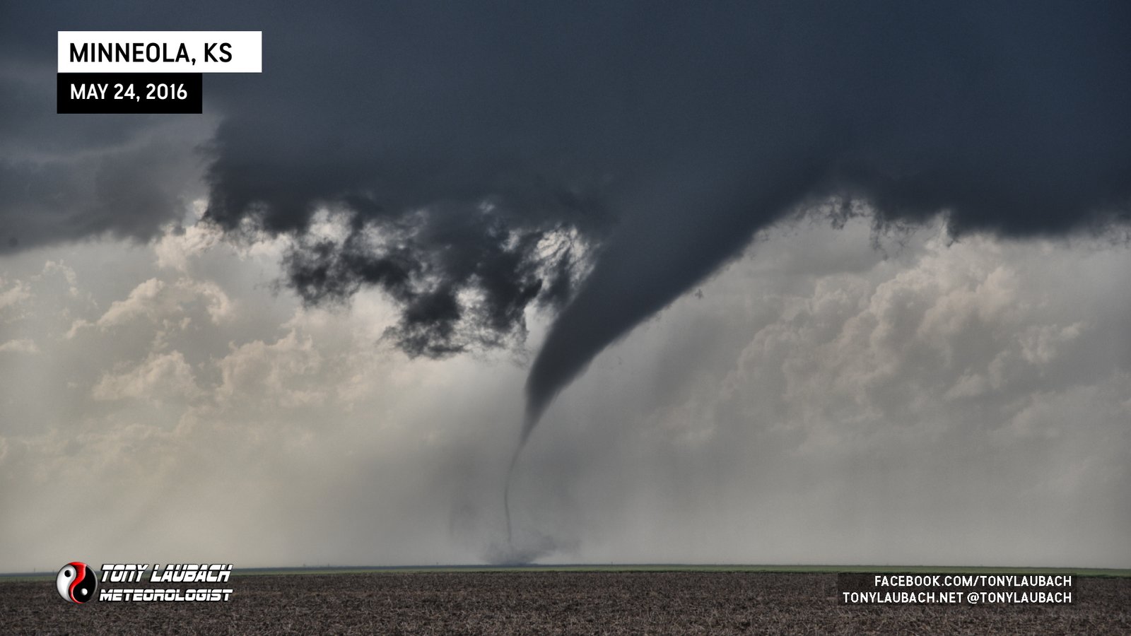
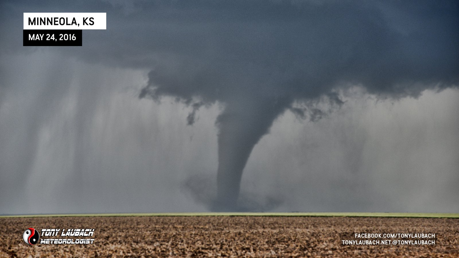
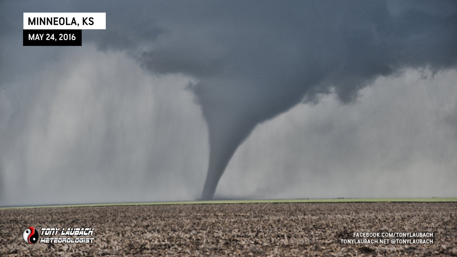
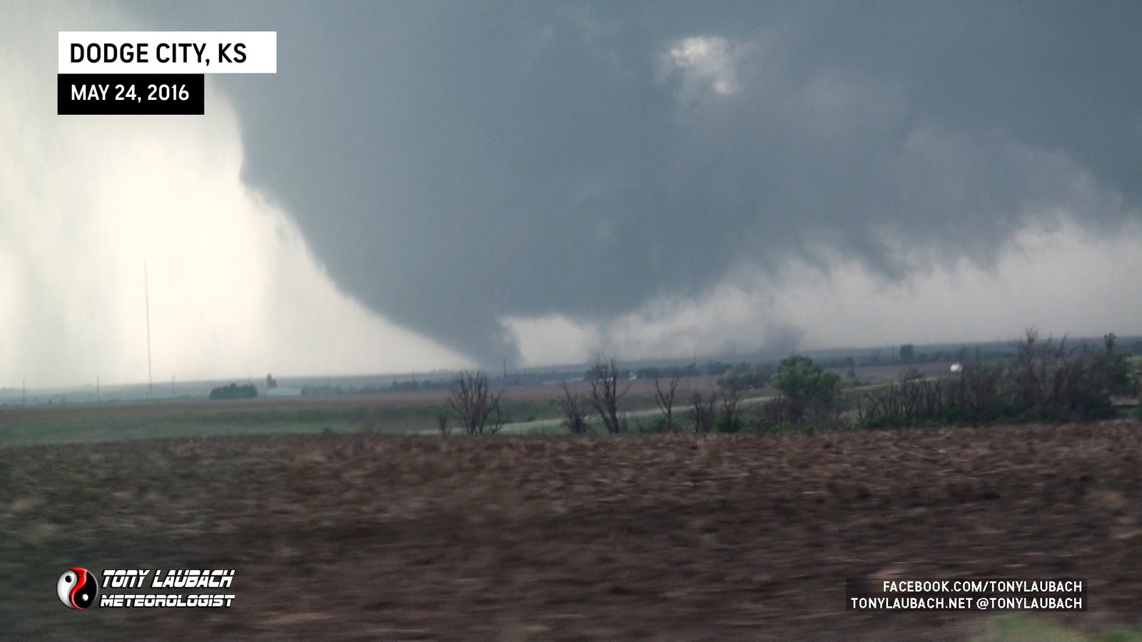
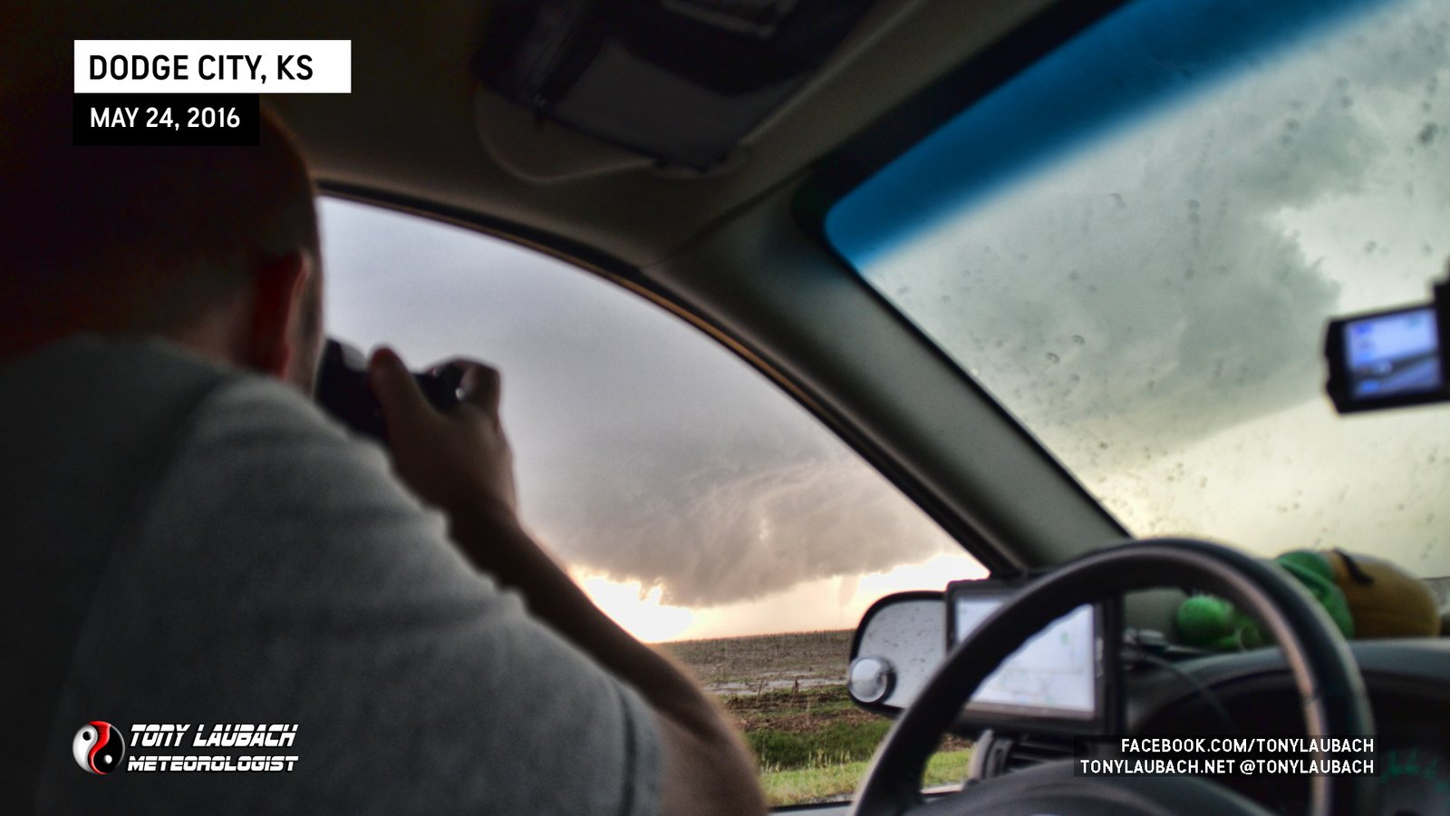
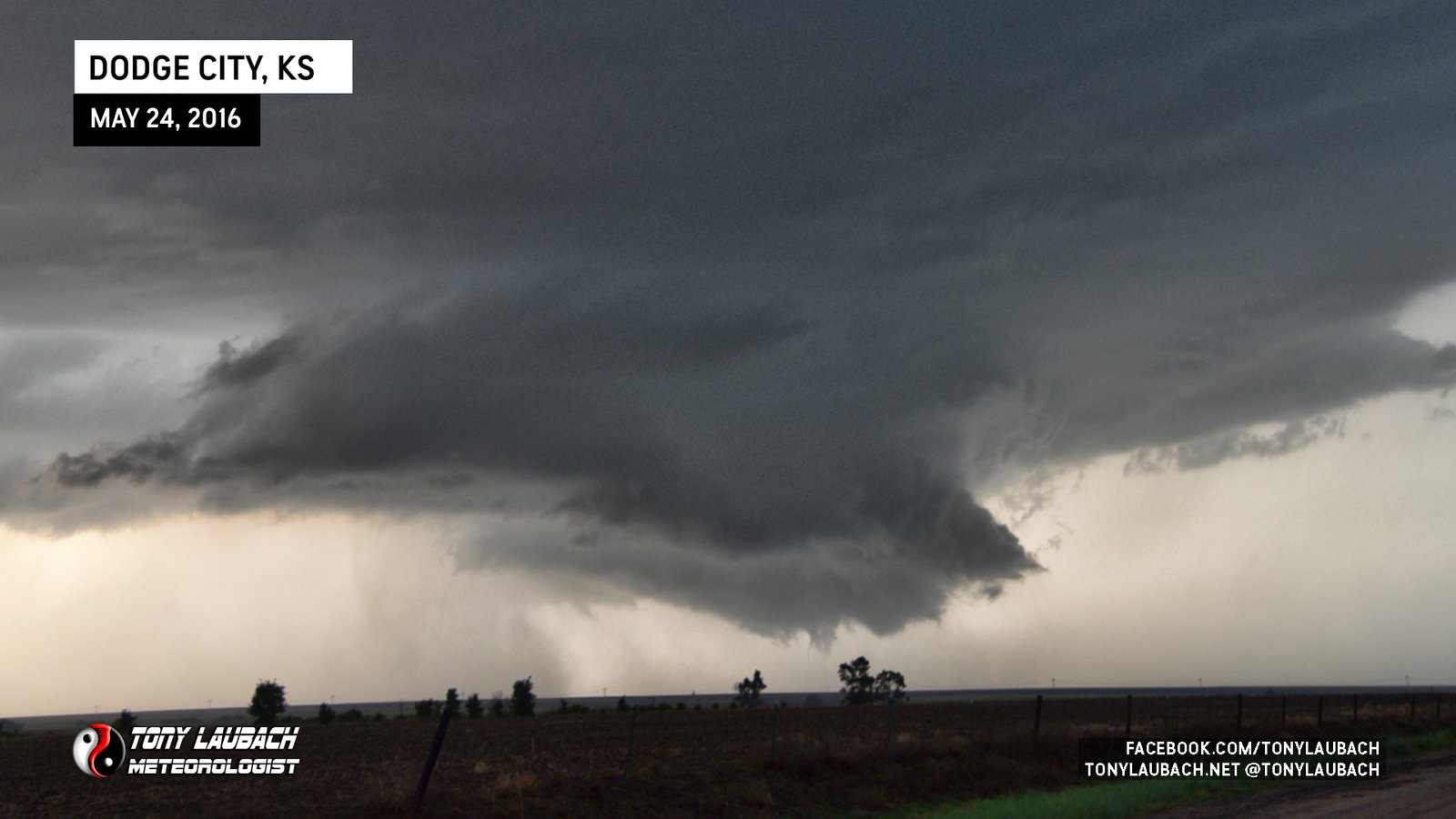
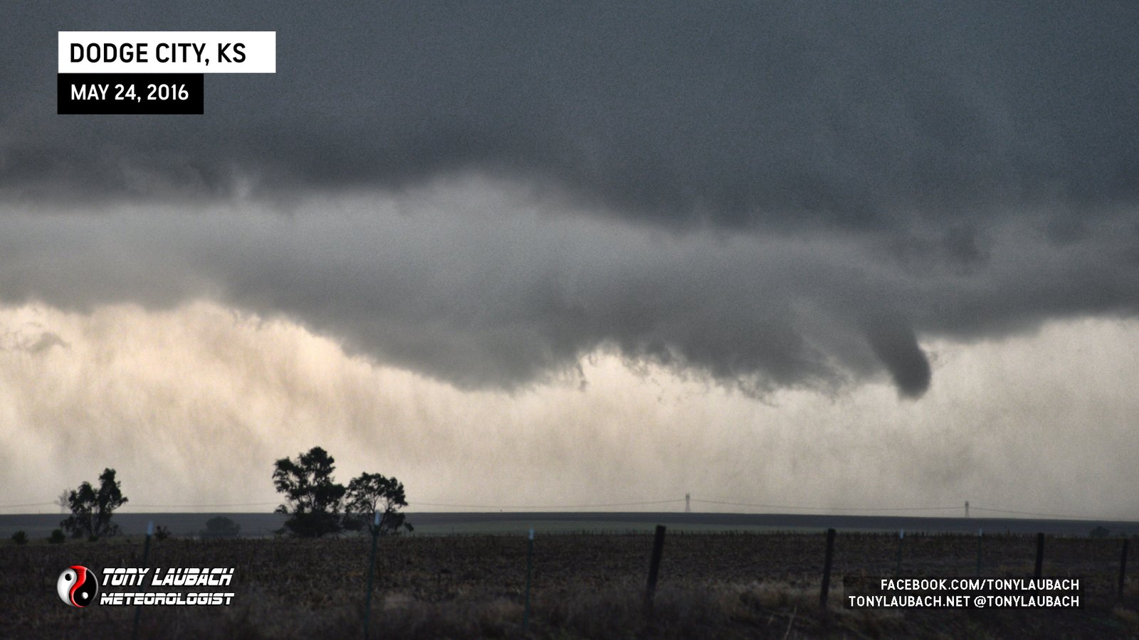
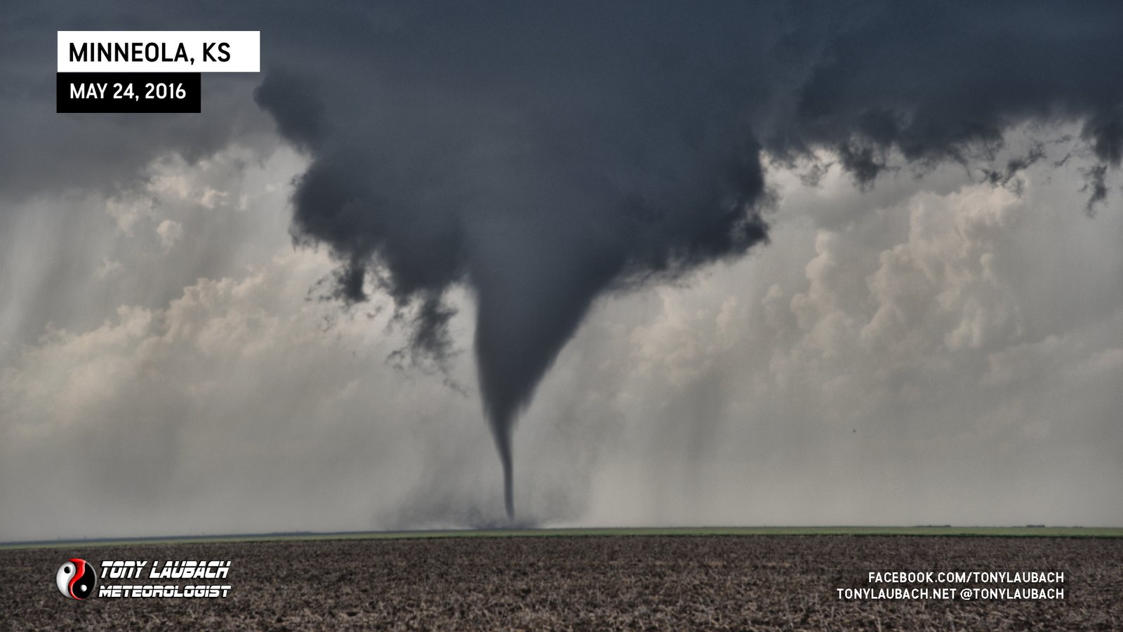
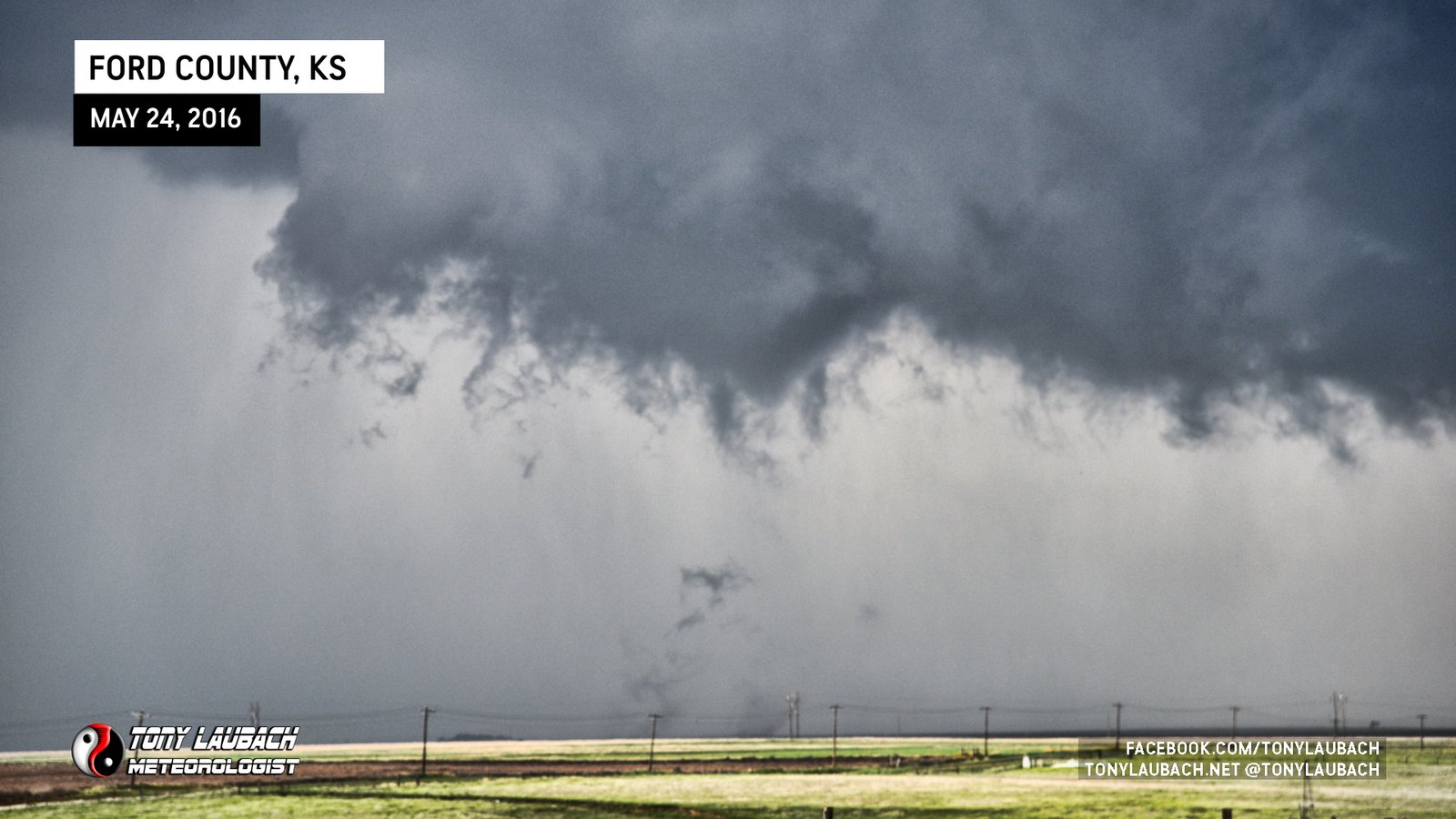
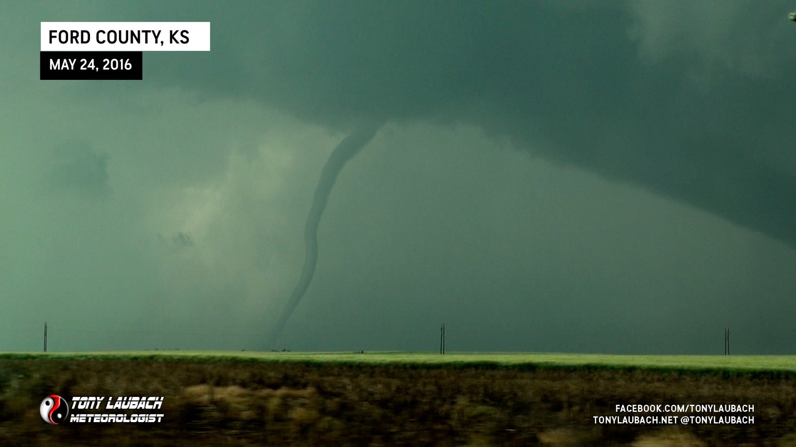
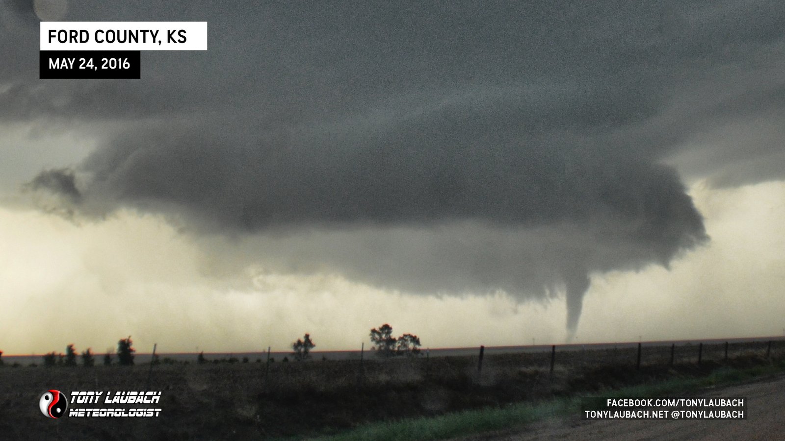
We turned north on 108 Road and drove north about half a mile before pulling off. The strategy to avoid the traffic seemed to pay off as there was very little traffic around us, giving the illusion that we were one of a few in the area knowing that US-283 was probably turning into a traffic jam three miles to our east. This road also put us a few miles closer to the action as the wall cloud and associated rotation was nearing tornado-genesis. We watched as this area slid north before a funnel dipped out of the rotation.

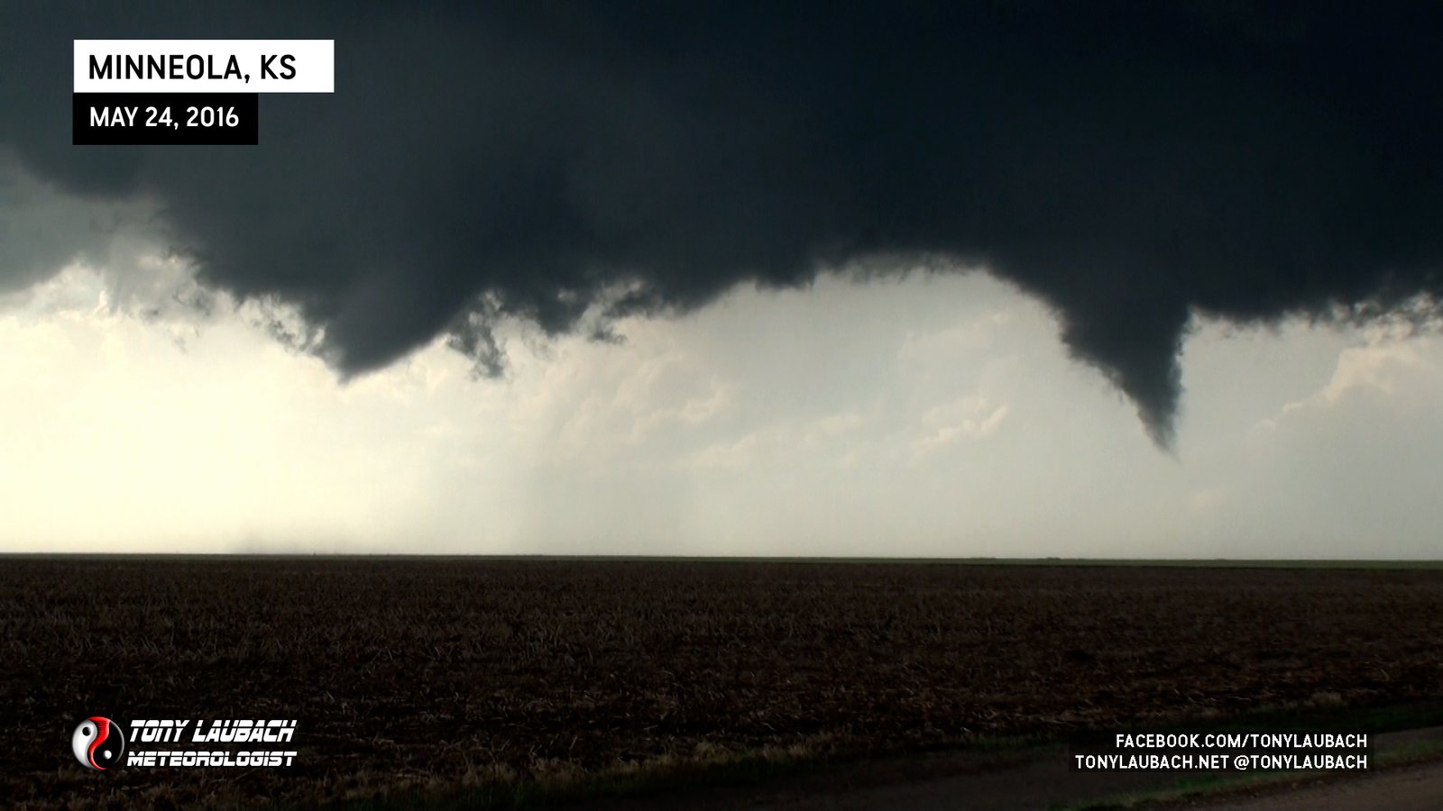
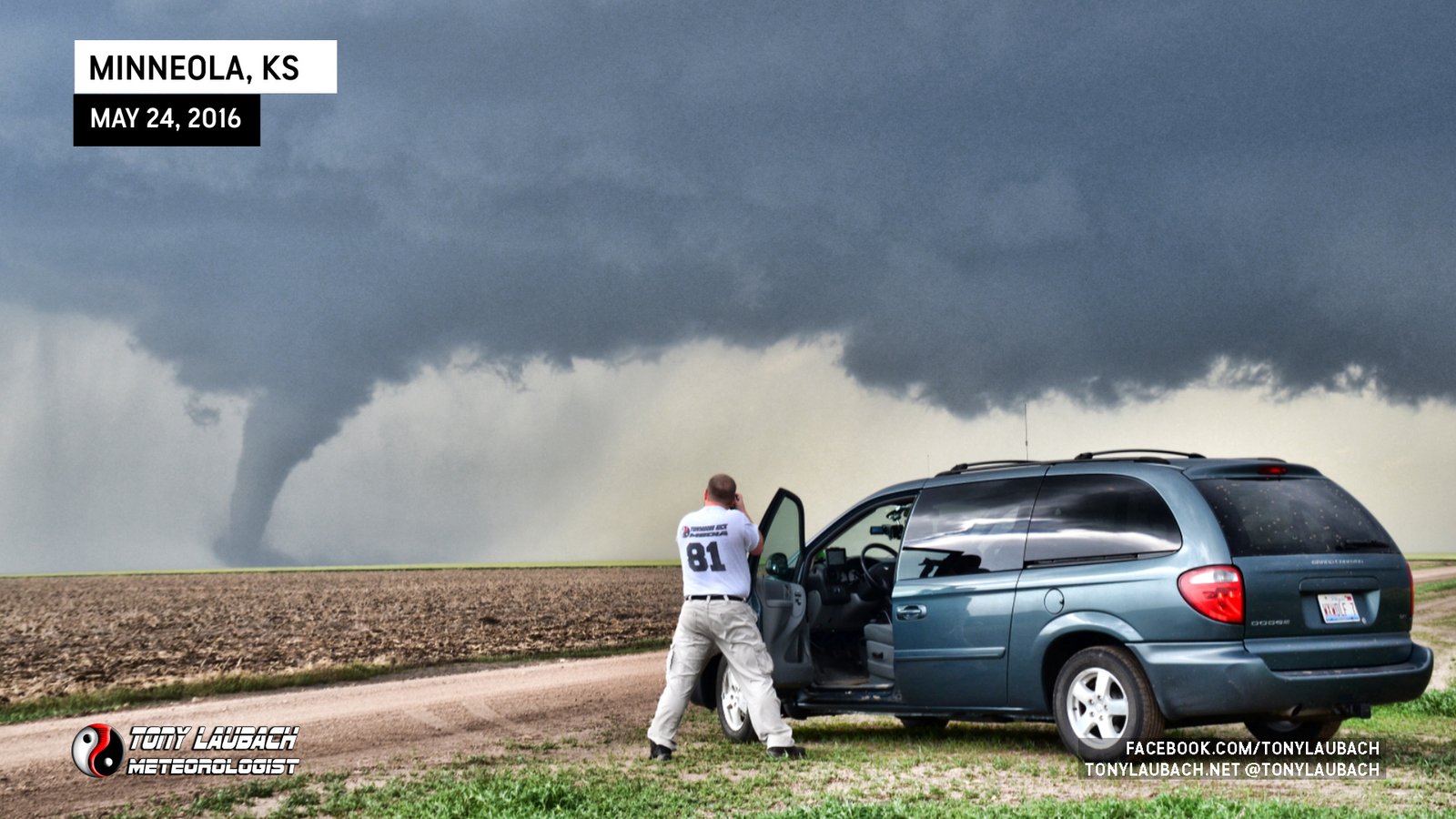
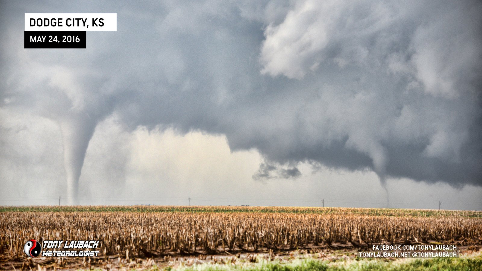
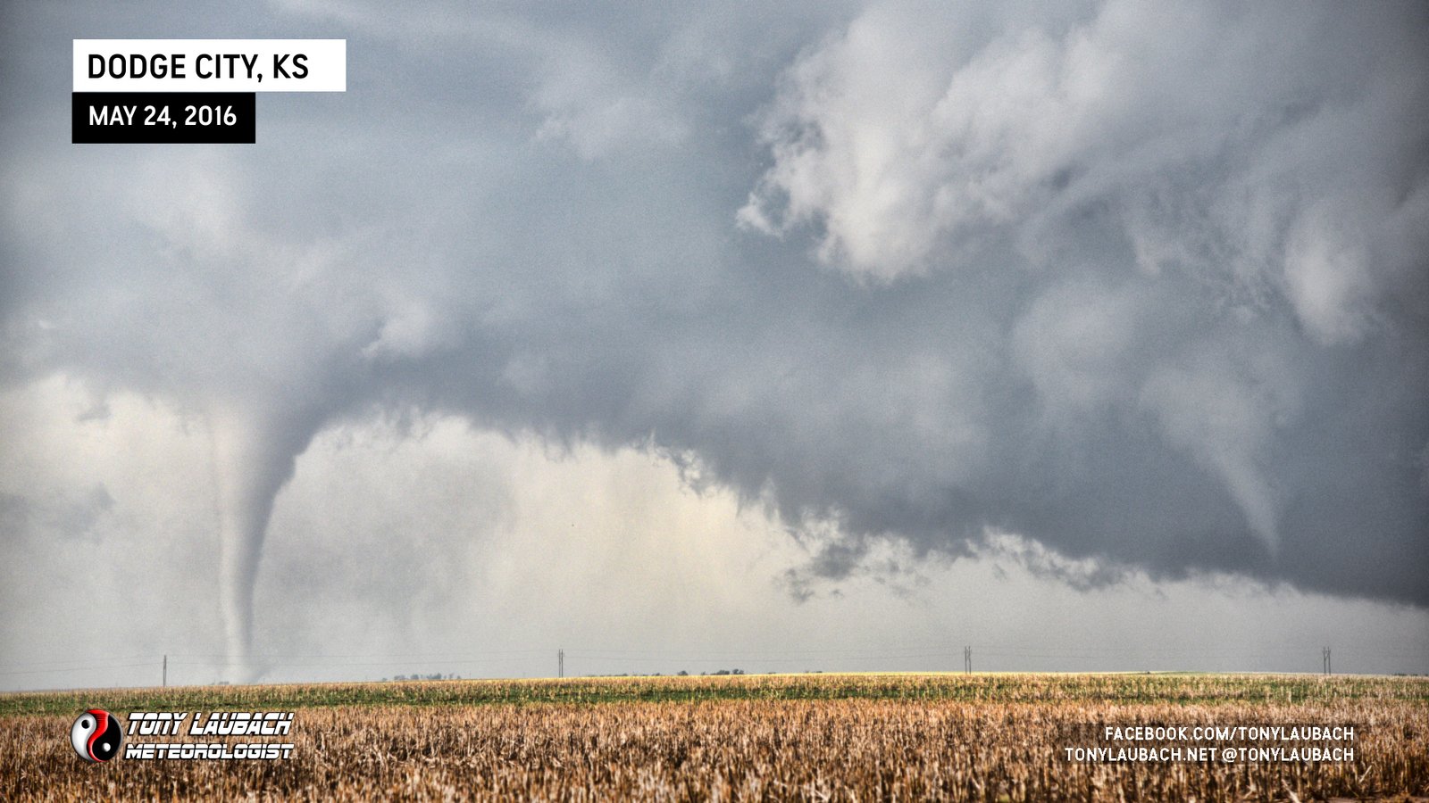
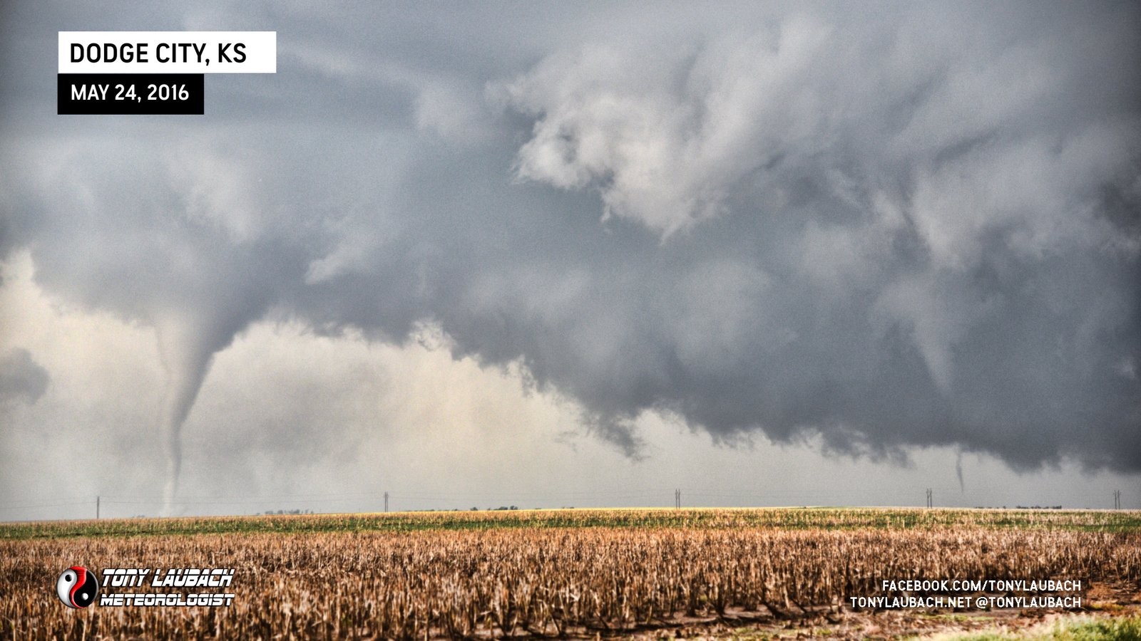
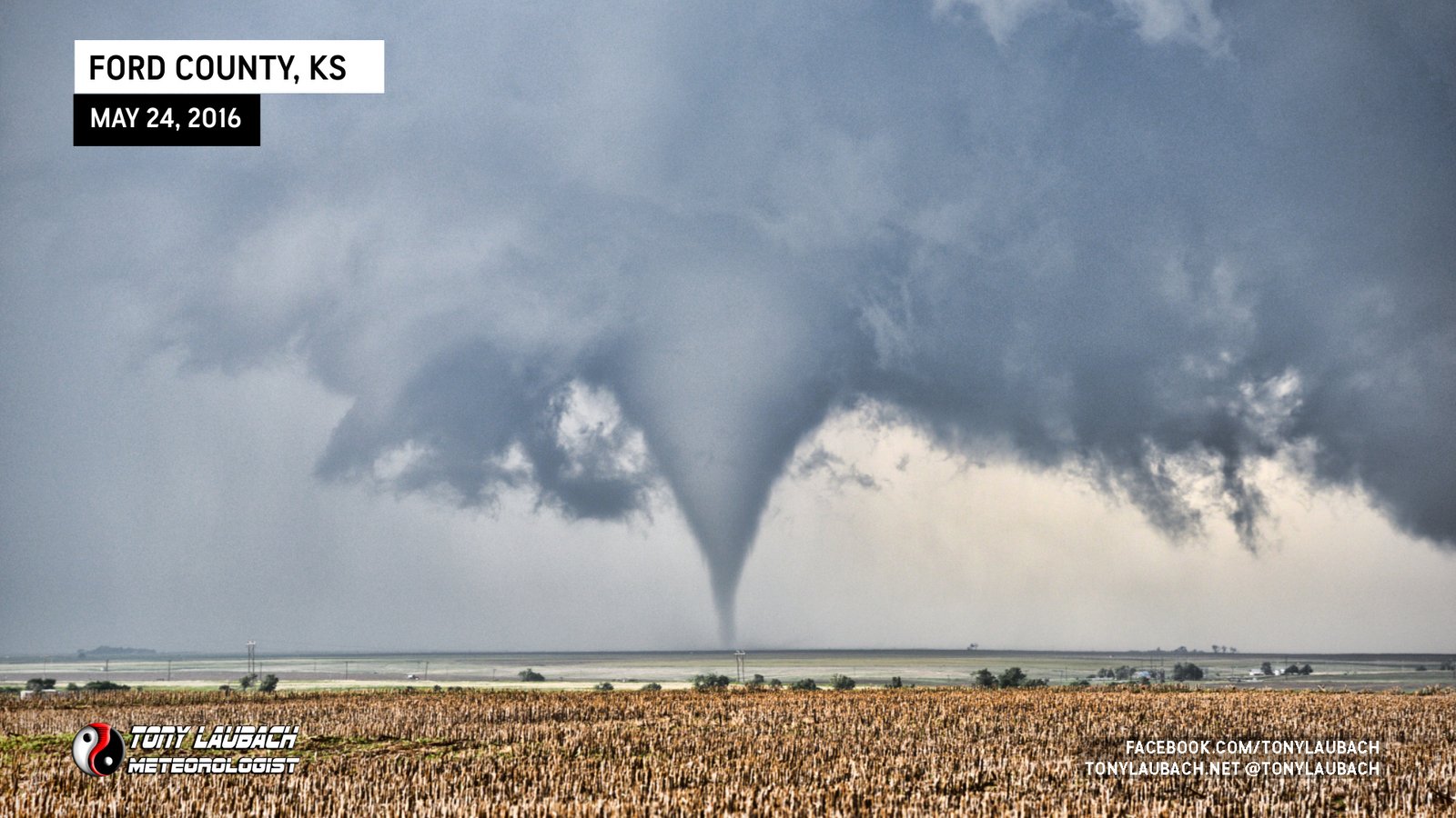
The funnel churned on for several minutes before putting down in the fields to our northwest. This tornado was a beauty, dancing around as it moved north away from us. At one point, we had twins, a brief touchdown to the right of the main tornado as it poked up and down.
We stayed in our spot for about 10 minutes, putting multiple cameras on it as it did its thing. We had a great view, but once it had proceeded a bit too far north for our liking, we hopped in the van and pushed north.


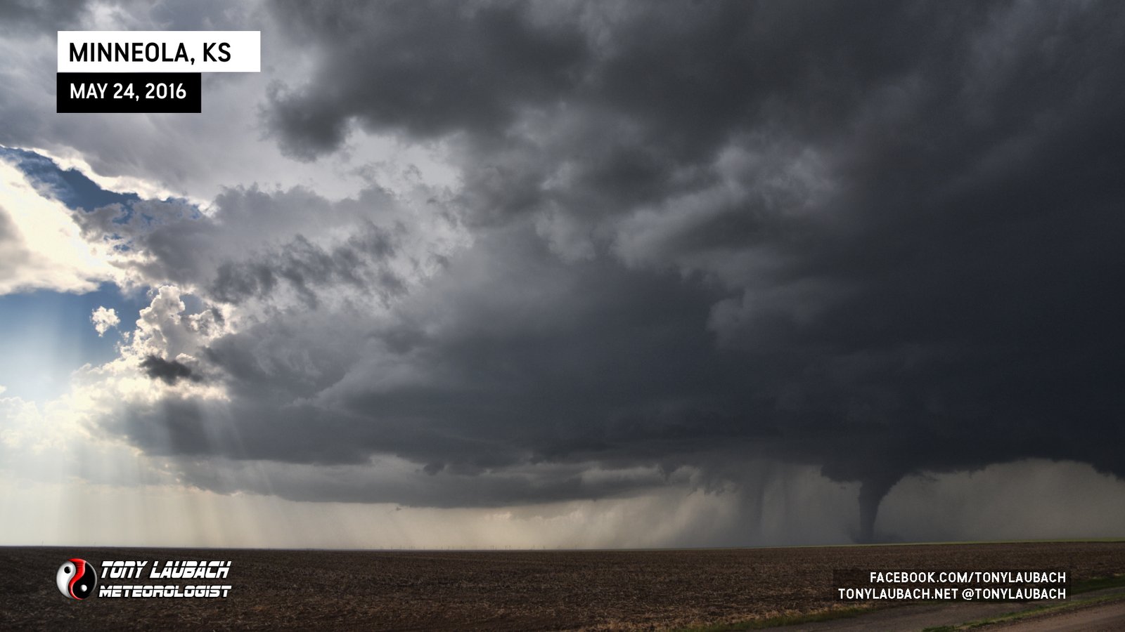

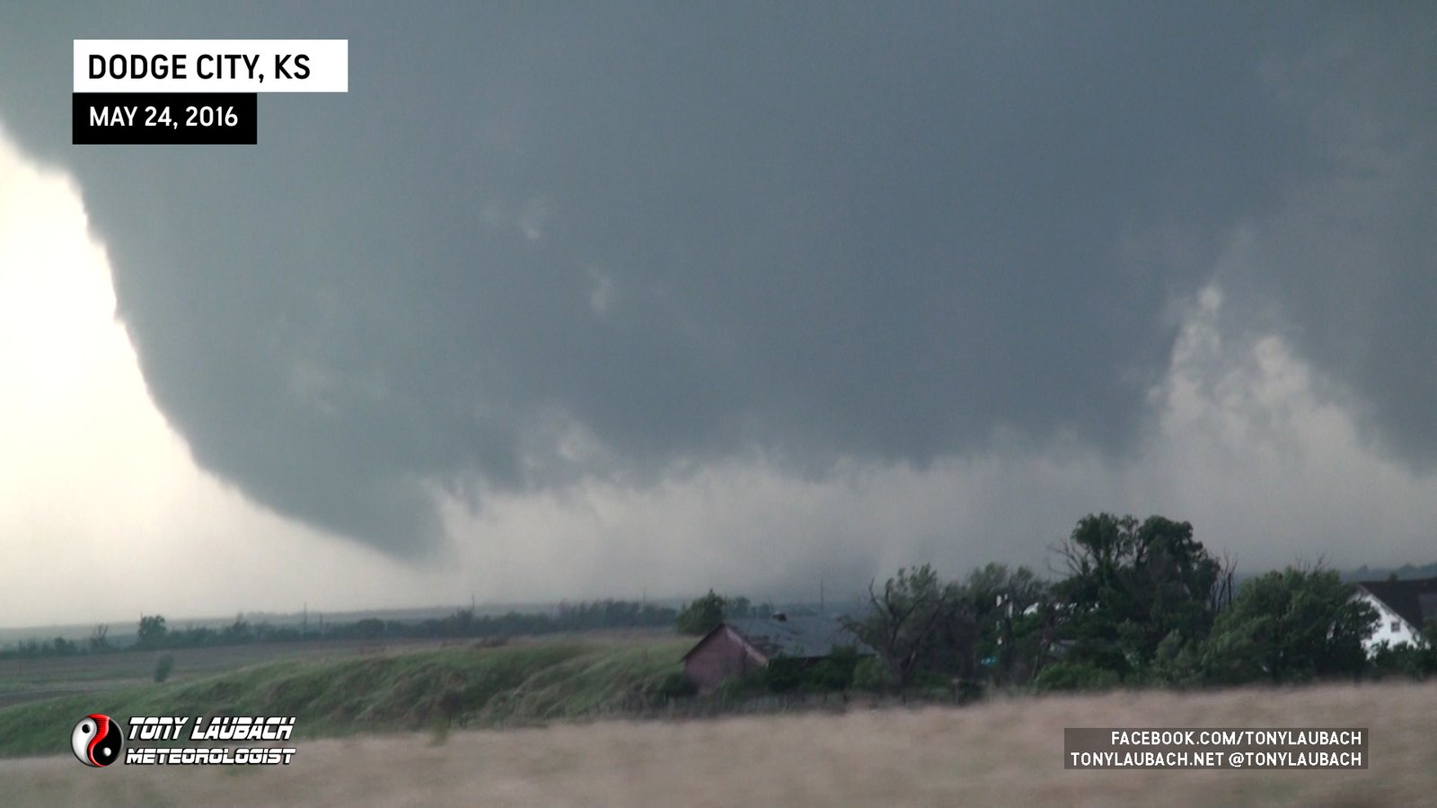
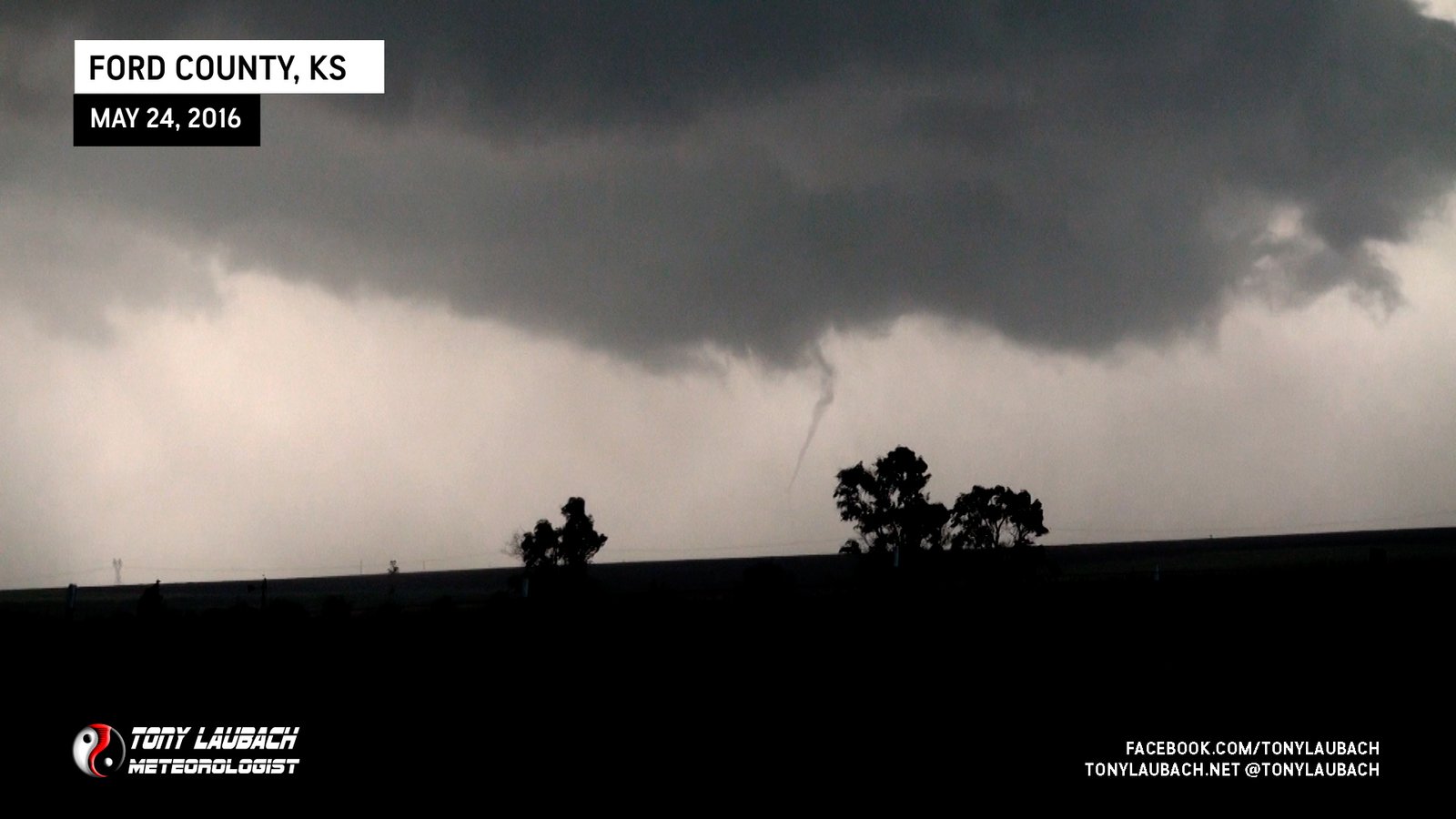
As we proceeded north, it was becoming apparent that we were not the only ones with the idea to NOT be on US-283. We began to encounter many more vehicles/chasers as we continued north, and that led us to a little longer of a northbound drive than we had planned. We worked our way up about six miles from our original stopping point, turning east on Warrior Road and clearing the property and its trees to keep a view on what was an incredible show.

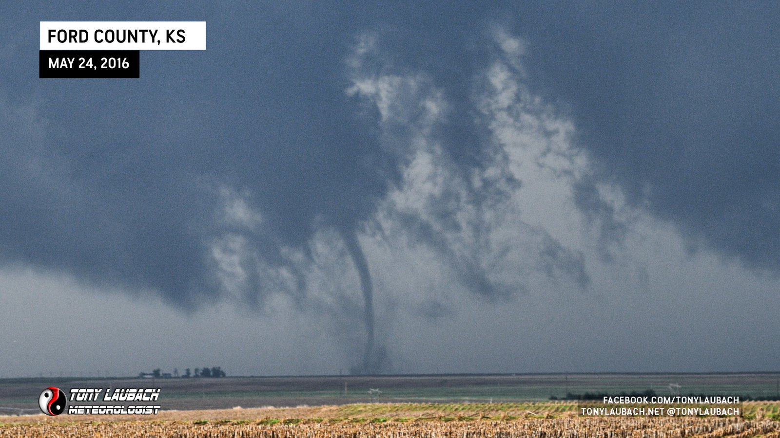
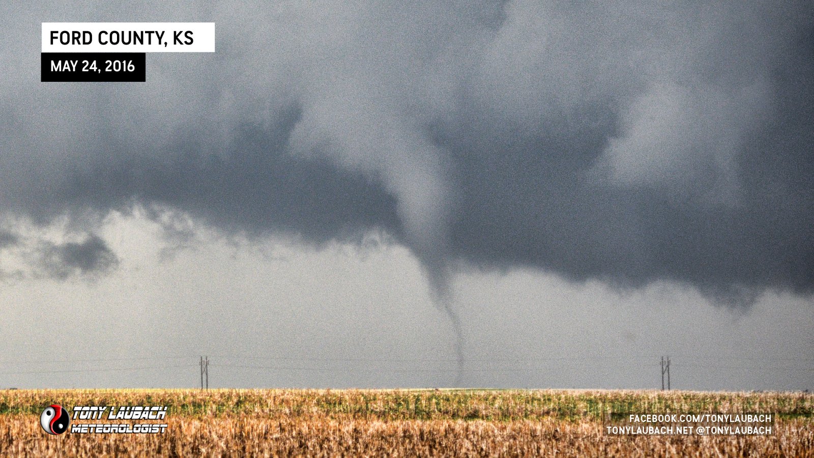
Once we reached our stop, the color contrast had greatly improved, giving a little more variety over the view we had about 10 minutes prior. The storm was moving north, not terribly fast, but enough to where we had to be mindful of how long we stopped. Still, the show continued, and we were beginning to see multiple instances of multiple tornadoes ongoing at the same time.


So going in to today’s chase, I thought I was four tornadoes shy of my 300th career tube. After three tornadoes to this point (and I had painstakingly been keeping count), I made sure that when number 300 came down, I was ready to capture the moment. Our second stop, allowed me that opportunity.

Hindsight being 20/20 and likely cause recent chases hadn’t had a proper tornado count, I was actually only TWO away from 300 going in, so while I did pose in front of the fourth tornado of the day, that one turned out to be #302. The actual 300th was the first satellite of the opening tornado.
With traffic continuing to increase on our northbound road and the surface conditions of that road deteriorating as it became more and more muddy, we opted to shoot back east a couple miles to 110 Road, still opting to stay off the busy US-283, but keep a northbound option. From our vantage point, it looked as if the tornadic area of the storm had drifted a bit east of where it was when we saw our first several tornadoes, so we felt like it was a decent move.
As we were eastbound on Warrior Road to 110 Road, this was the triplets show. Unfortunately we didn’t document much of this on the roll as we were feeling a bit behind and wanted to get ourselves north as quickly as possible to get back into the good view we had. Once we got to 110 Road, we shot north about two miles, stopping just after Upland Road, now 7 miles south of US-400 on the south side of Dodge City.


This stop was about a third as long as the previous stop as the storm seemed to be accelerating a little faster than it previously was. So hopped back in the van and continued north. About this point, we started getting into very bad road conditions. Other vehicles were stopped and/or stuck along the way, which slowed the forward momentum, and made and already less-than-ideal drive a bit more adventurous. The only saving grace was we were not in the path of anything tornadic, but we were losing ground on the tornadic storm as it was approaching Dodge City.

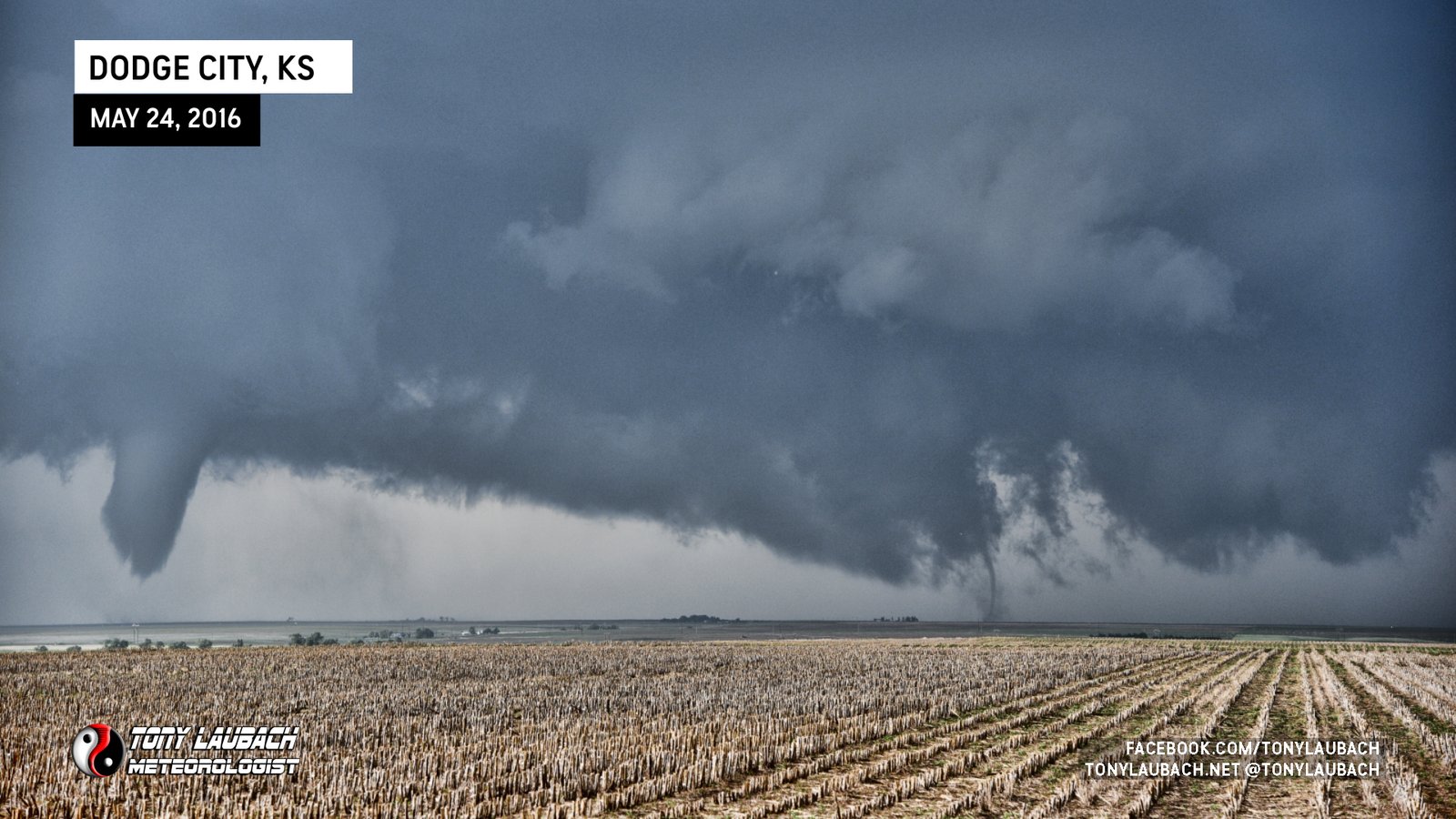
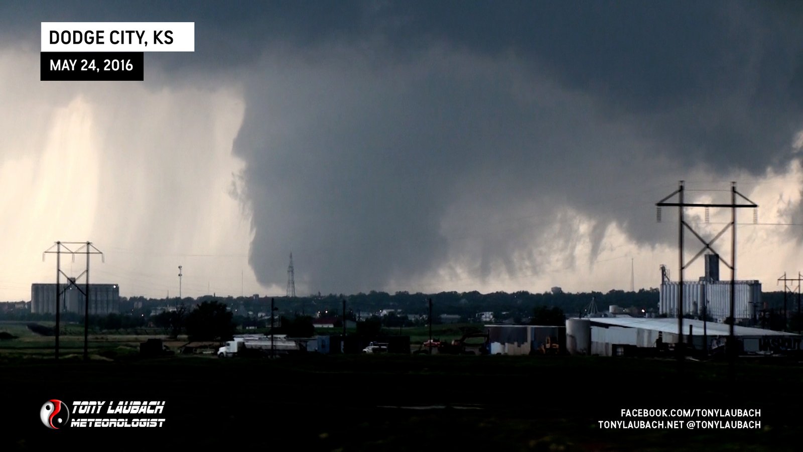
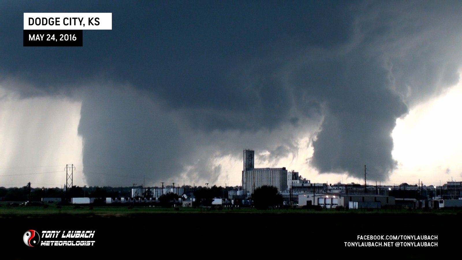
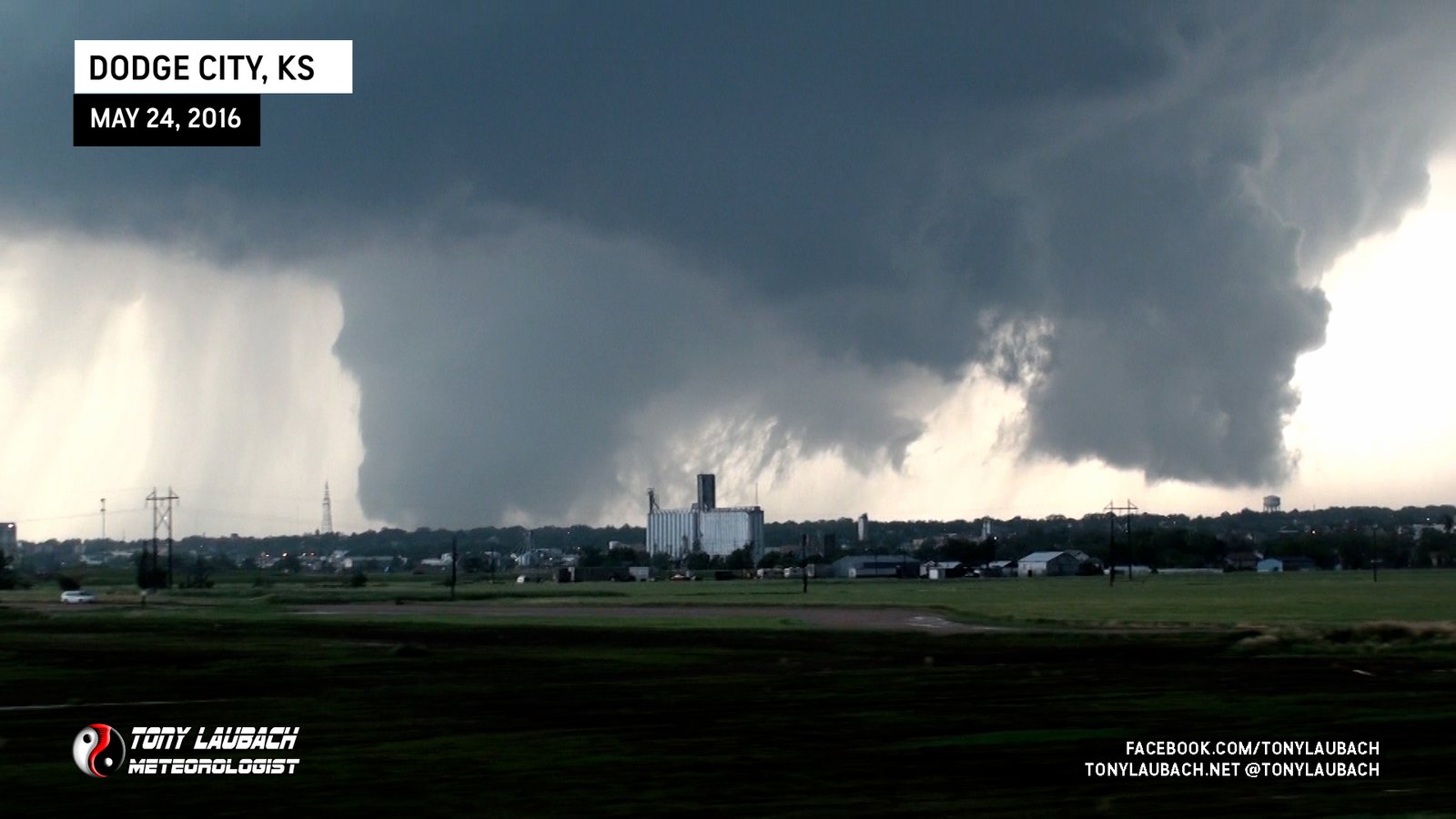
It was a slog, and despite getting almost stuck a couple times, we were able to make our way up to Saddle Road, a paved road. At this point, we decided the chaser traffic on US-283 was going to be a better option than getting stuck on mud roads. Looking back, I wish I had taken Saddle Road WEST, which would’ve offered paved options to get up to the west side of Dodge and closer to the action, but I was more focused on getting to the pavement I KNEW existed over on US-283, so that was the deciding factor in the moment. The wait to get onto US-283 was a bit long as it was a left turn onto the highway, so we spent several minutes in the backup waiting for our chance to get on the highway. Once we finally did, we shot north and watched as the Dodge City show got underway.

We had serious concerns about what was going to happen in Dodge City. Given our relative position to the storm, the view we had on US-283, and knowing we had just seen tornadoes due south of Dodge, we truly thought this massive tornado was going to roll through the heart of Dodge City. Fortunately, it was a bit further west than we thought, and this ultimately passed just to the west of the city.

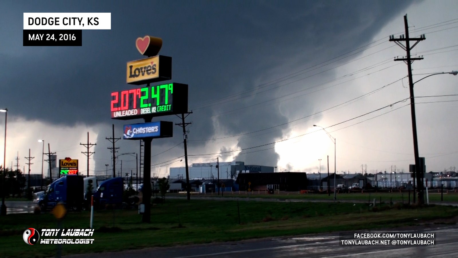
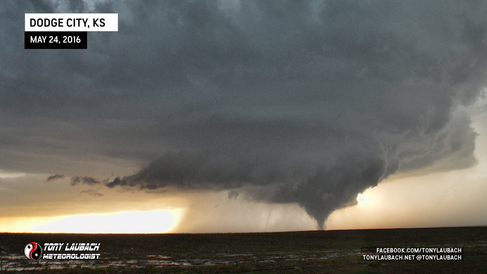
At this point, the goal was simply to get north of the city to clear our view back to the west. We shot straight north on 113 Rd across the northeast sections of Dodge and emerged north of US-50 a mile or so as the main Dodge City tornado was roping out well to our west, the new tornado starting to get going to our north/northwest. We went up a couple miles north of US-50 and pulled off to document this next series of tornadoes.

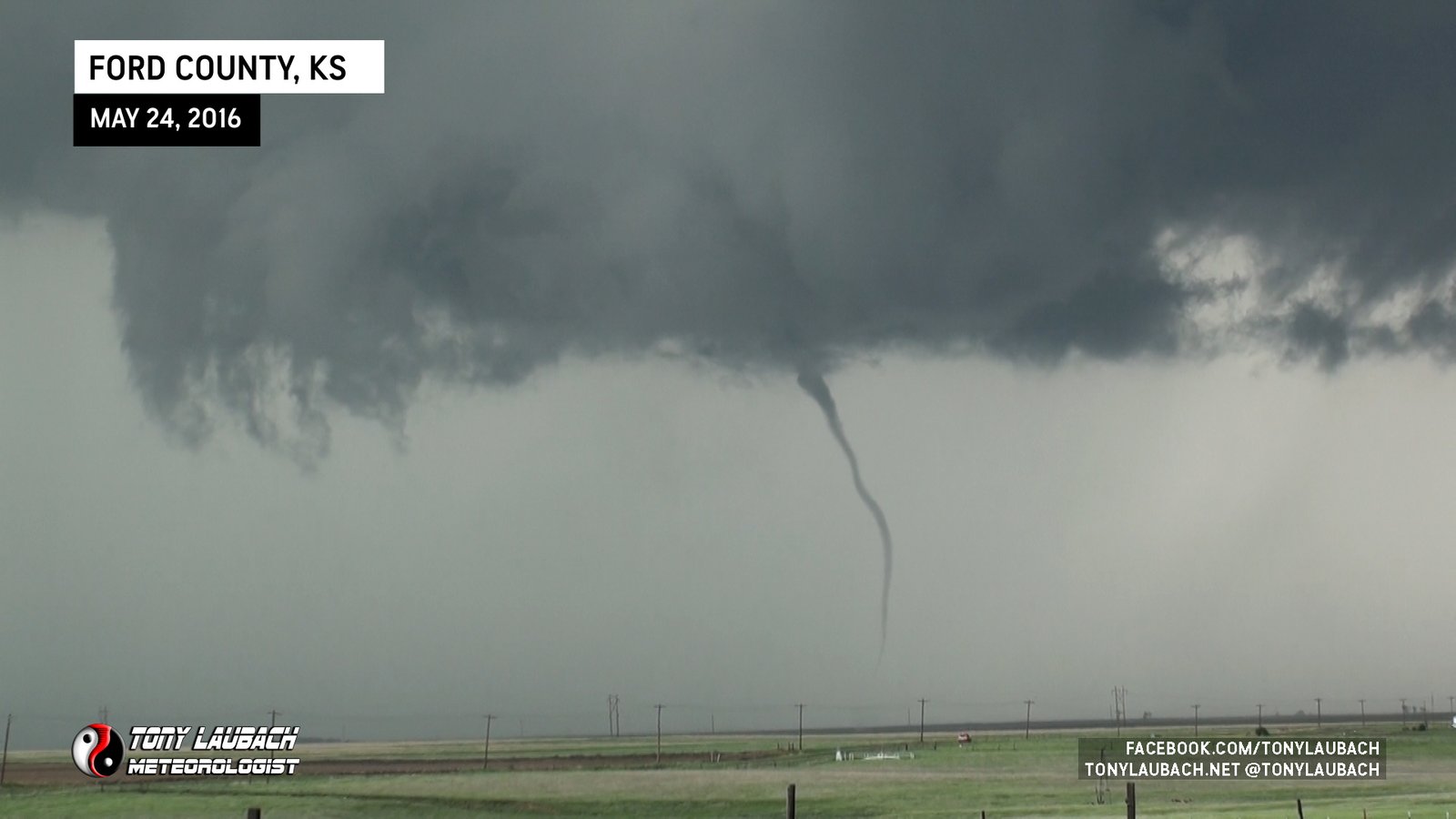
As we were shooting away at the distant tornado, the new wall cloud that developed to the east of that put down another tornado, so for the like the millionth time in the last couple hours, we were watching two tornadoes at the same time.


That tornado had some spunk, certainly looked every bit of it’s EF-3 rating as we watched it churn away, throwing a variety of debris about.


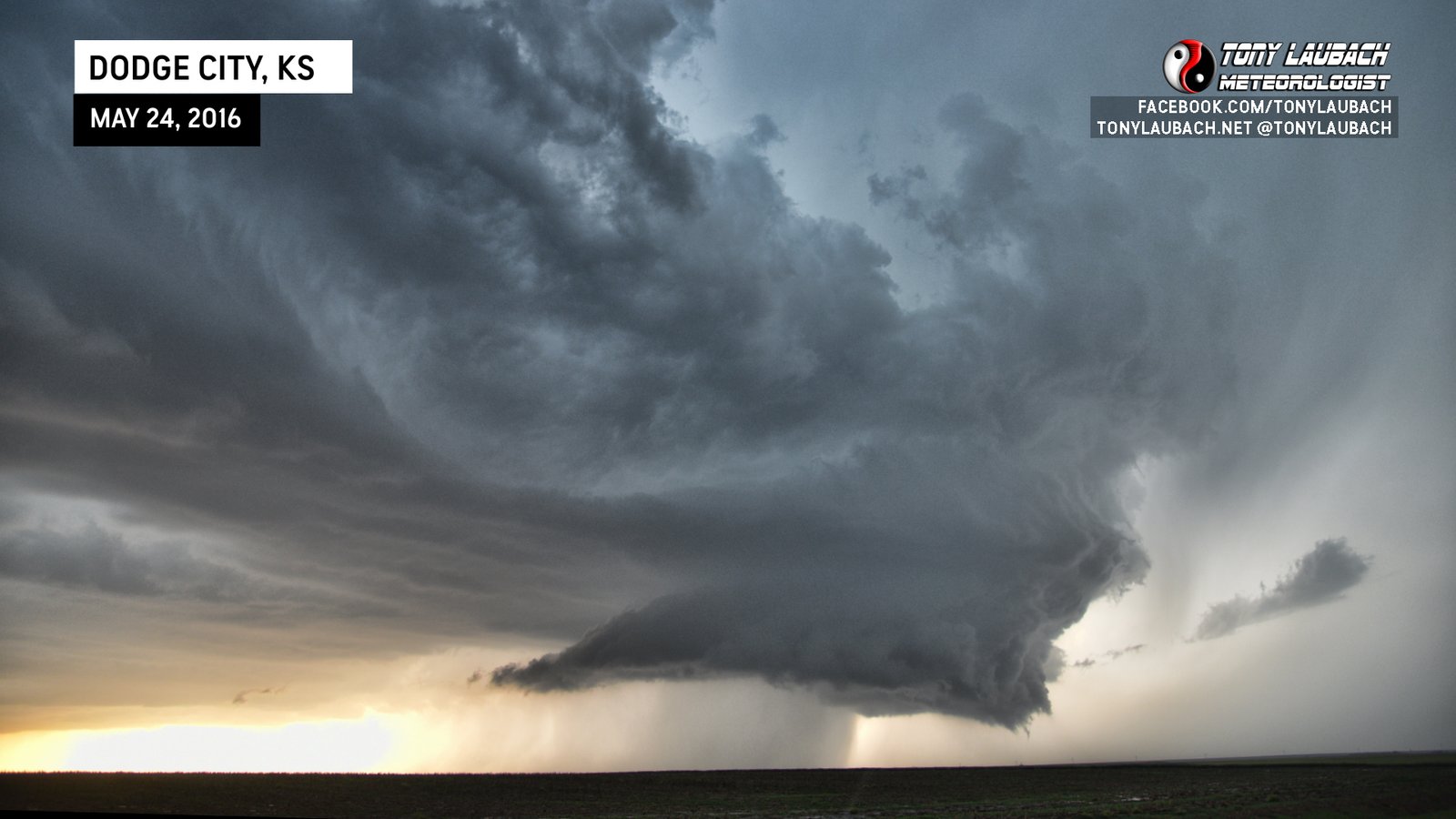
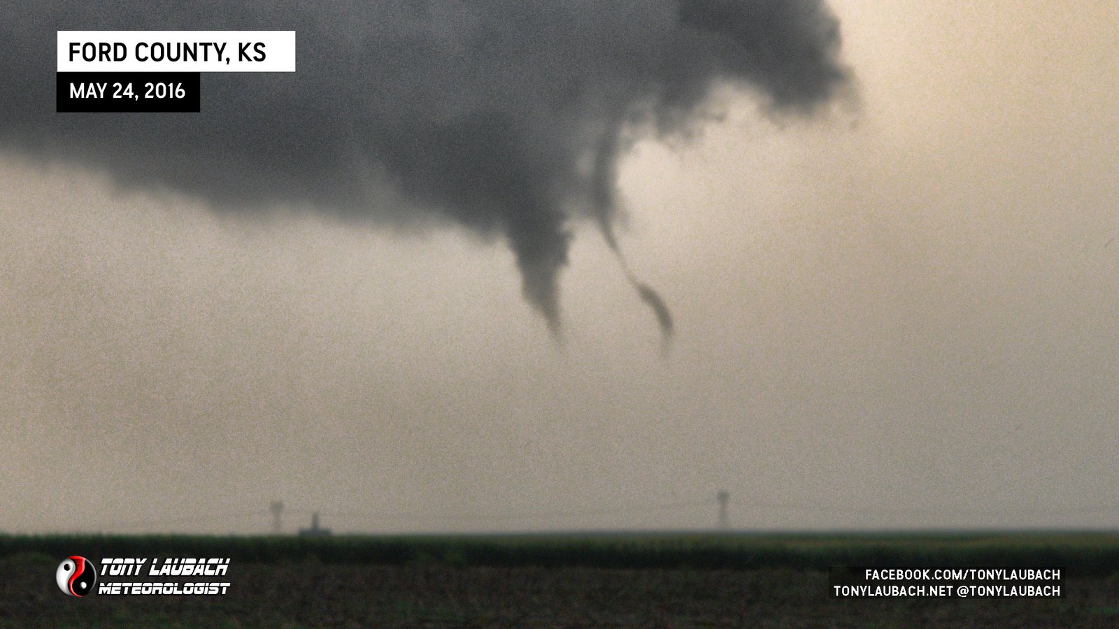
This tornado would shrink, looking almost like it was going to completely dissipate. We took this time to relocate, moving a little further north, but before we headed off, I took a wide shot of the structure as the storm had put a little distance between us during this stop.
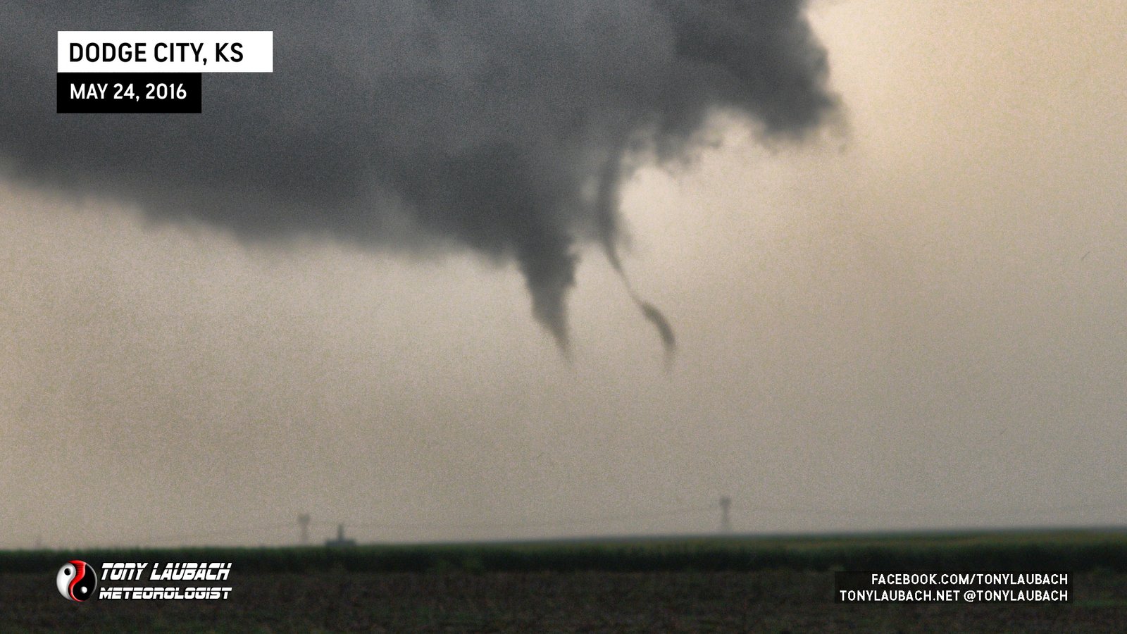
As we proceeded further north, a new series of funnels/tornadoes kicked off, adding to the ridiculous count for the day.
Our final stop before we pushed east saw the last couple brief little birdfarts.

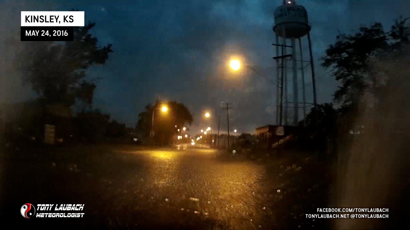
We cut back east and jumped on US-50 and headed for Kinsley, indirectly chasing the storms that were east of our show. As we closed in on Kinsley, we observed what we thought to be a tornado well to our distant southeast (no imagery, not counted). As we arrived in Kinsley, the plan was to take US-183 northeast, but we encountered blocked roads due to street flooding as the core of the tornadic storm had passed directly over town, and we were slowed significantly trying to get around the flooding. We found a path south toward the US-183/US-50 junction, but the storm at this point was getting out of range.
At this point, with darkness hindering our view, we opted to go ahead and go south, semi-deciding that we had seen more than enough. We finally got out of Kinsley, southbound on US-183. We rolled ten or so miles when we came across what we assume to be the damage path from the tornado we thought we may have seen off in the distance.
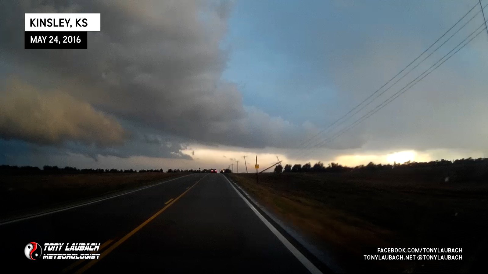
After the poles, we took a turn to the east, and by this point, the EF-3 that touched down south of Lewis was underway. We were unable to see through the precip, but lightning would occasionally reveal the edge of what I assumed to be the wall cloud. The tornado, however, was hidden from our view.

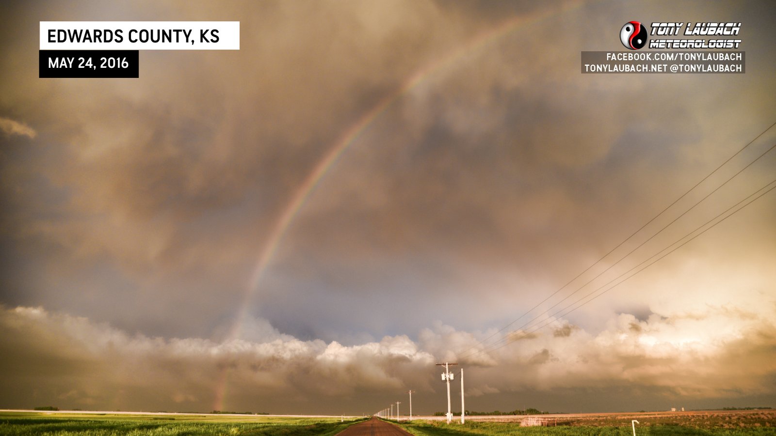
We took US-183 on its eastward jog til we hit the turn back to the south at U Road. We pulled off there to watch as the Lewis tornadic storm sped off to the northeast. As we watched the storm, the backside of the clouds cleared giving way to amazing lighting as the sun was setting back off to our west.


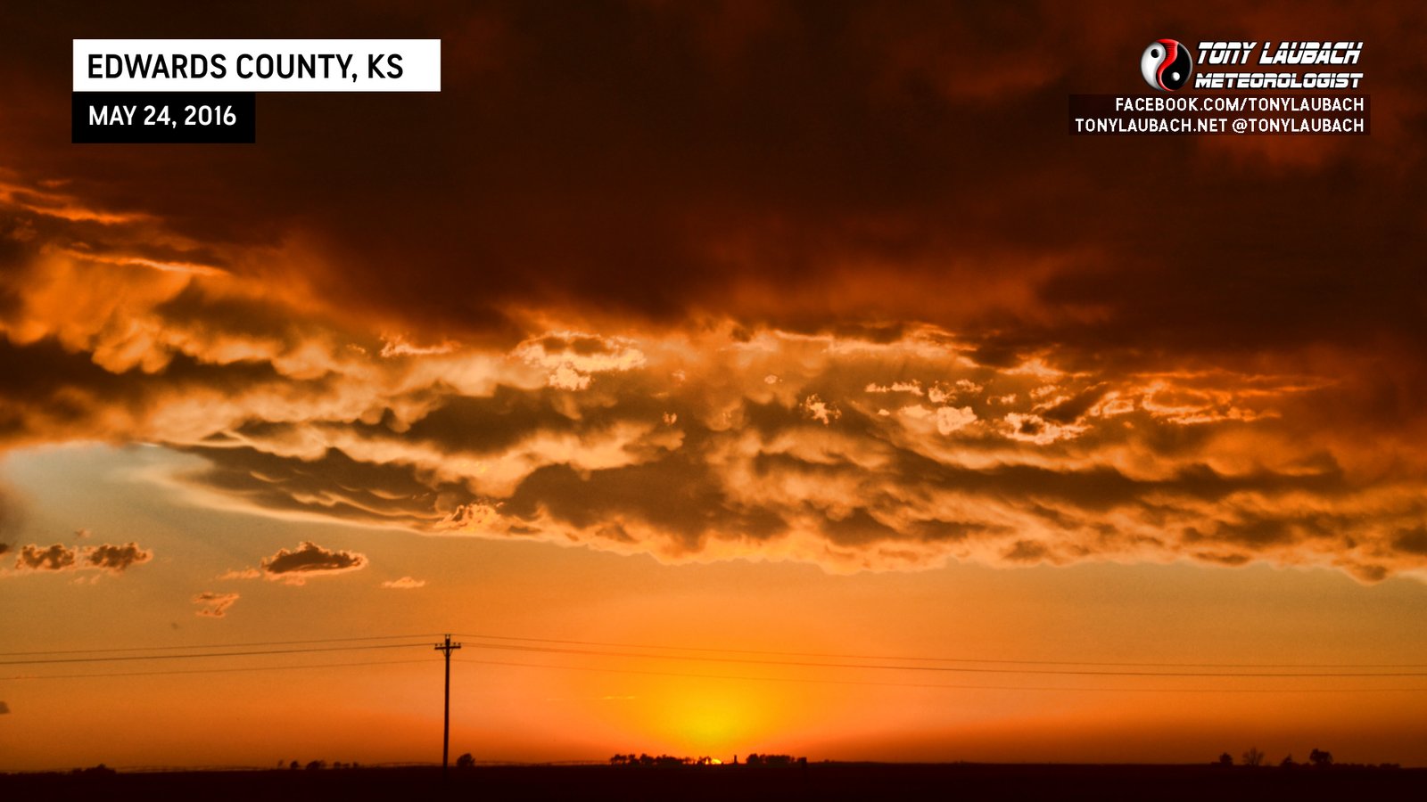
After the sunset show put an end to the day, we packed ourselves up and headed down to Greensburg, then east over to Pratt where we bunked down for the night.
Tornado-counts certainly vary, but a dozen doesn’t seem too far fetched given all that went on. I painstakingly went through all my video and photos and held my count at 12; one could argue against a couple while I could also argue for a couple I didn’t get totally convincing shots of. That said, I could be as low as 10 or as high as 14. I’ll split the difference and call it a dozen, all of which came out of the Ford County/Dodge City cells.
This chase will easily go down as a top chase, easily top 5 if not top 3. Nostalgia for May 29, 2004 may be the only thing keeping this out of the number one spot, if I am being honest. The amount of video and photos we shot of these tornadoes is absolutely unreal. Its amazing to me the number of lessons you take into a chase like this, and while I shot more video than I will ever begin to process, I was constantly clicking away on my high quality Nikon camera, and I took away some of the best images of my career. If I had to do it all over again, I probably would’ve tried for a further northwest intercept and perhaps getting into that position earlier. I felt we were in a good spot with good viewing, but we always could’ve been closer. The mud road really slowed us down and ultimately chased me back to the pavement of US-283, where I think had I had a clearer mind at that moment, I would’ve shot west from there.
Still though, you can’t complain with this. Amazing tornadoes, crazy structure, and then an epic sunset and rainbow on the backside after padding the stats with a couple more tornadoes. This is the modern day May 29, 2004; most chasers of this generation will easily put this as their all-time top chase, and honestly, I could probably do that as well. We’ll see how this sits with me as the years go on, but all-in-all, it’s a career chase that will be hard to top.