
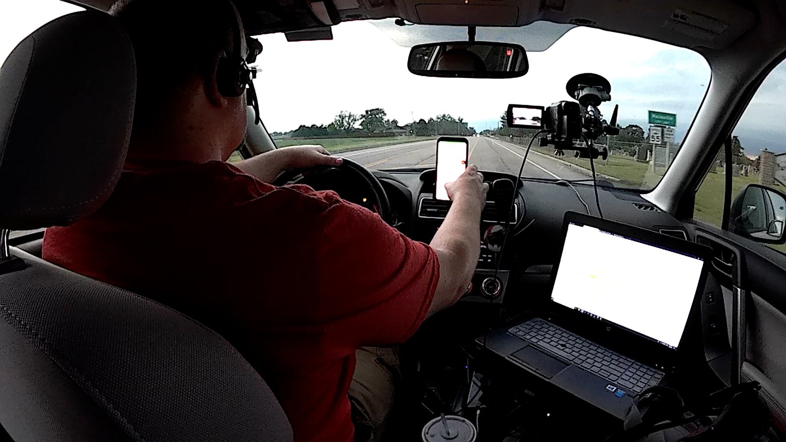
Another KAKEland special; I certainly don’t take for granted living in Wichita for days like this where you can literally take off after lunch, go get on a storm, and be home before midnight. The day before offered that, and I get to do it again today! Initially targeted Great Bend, Kansas, getting up that way shortly before 4pm. Headed southwest on US-56 toward Pawnee Rock on a developing cell, then cut southeast on a series of county roads to KS-19 just west of Seward, Kansas.
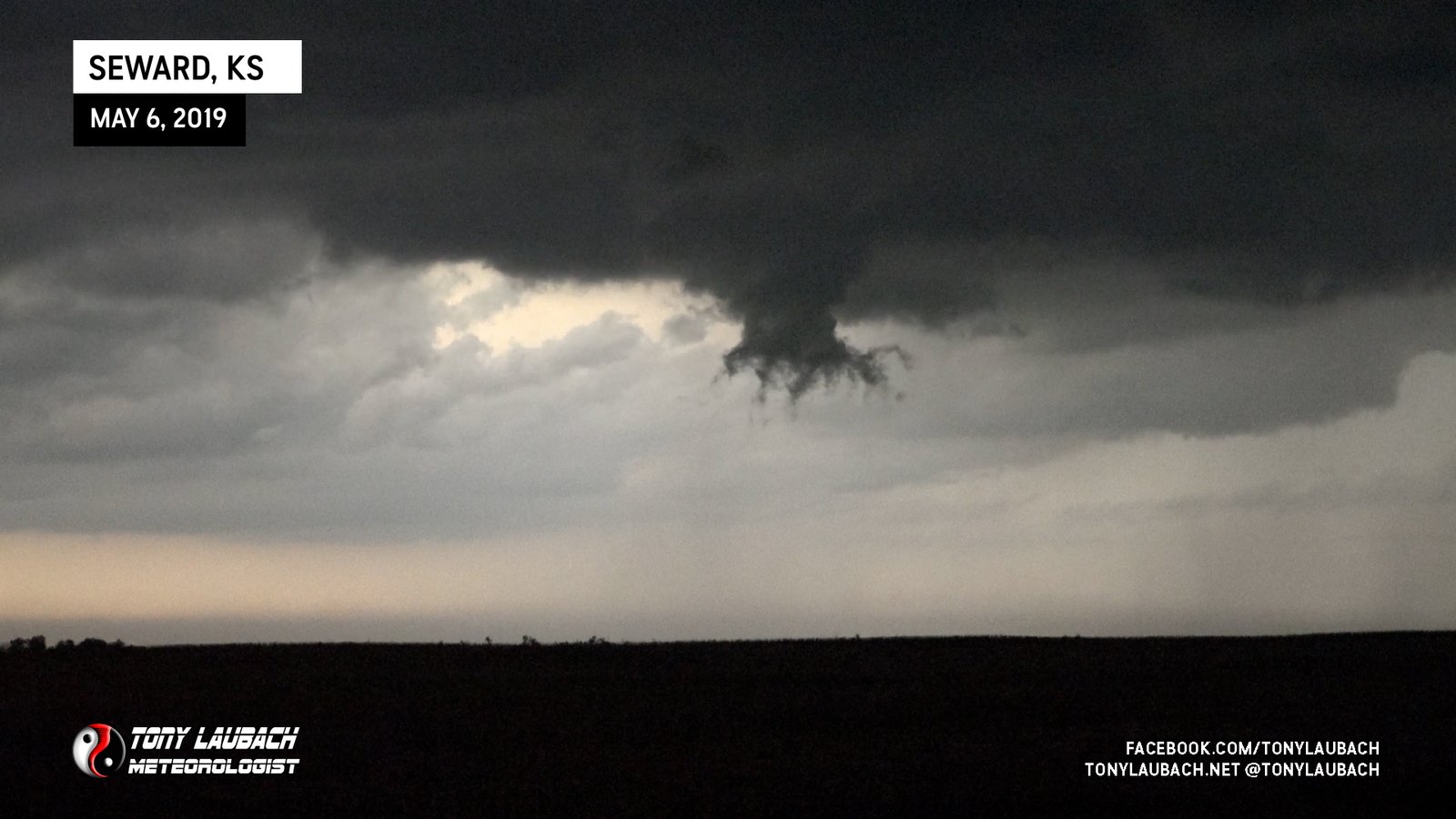
Nothing too exciting with the southerly-moving cell at this point. Occasionally some dangly bits would develop, but it was a slow build for it.
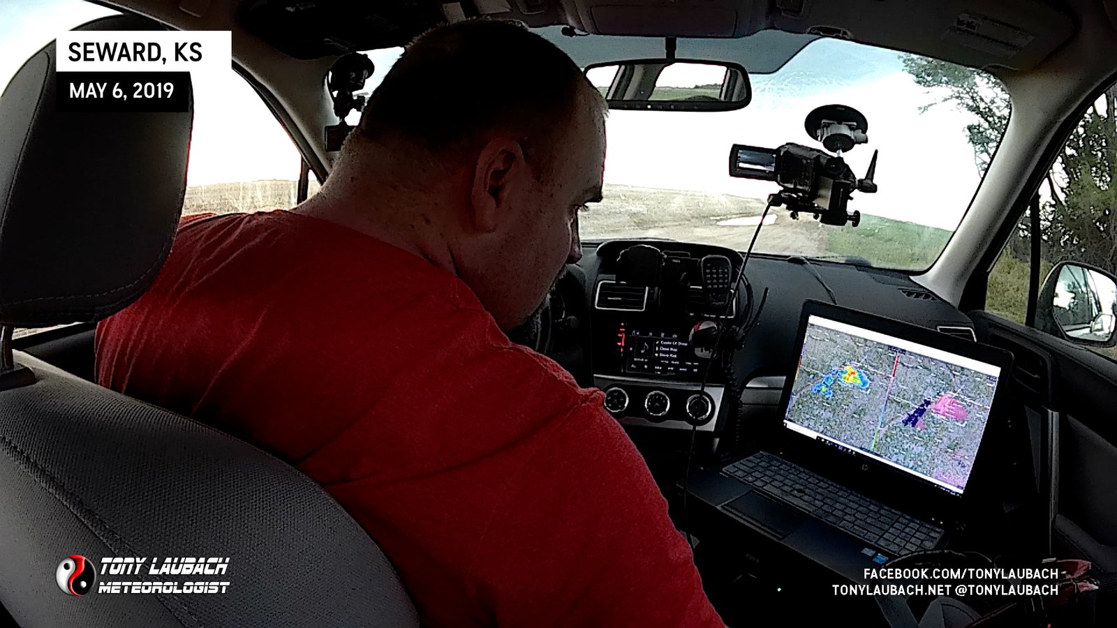
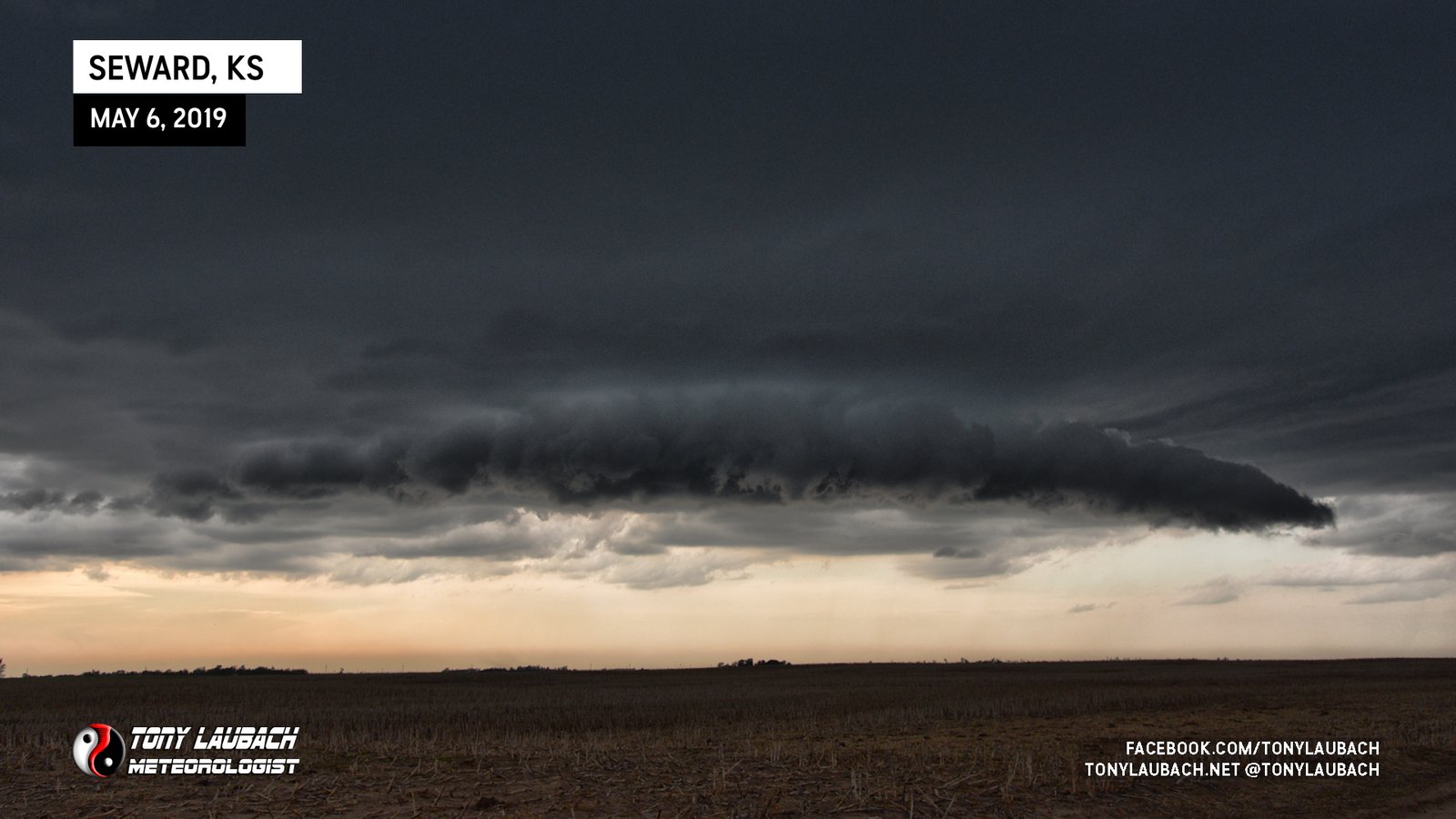
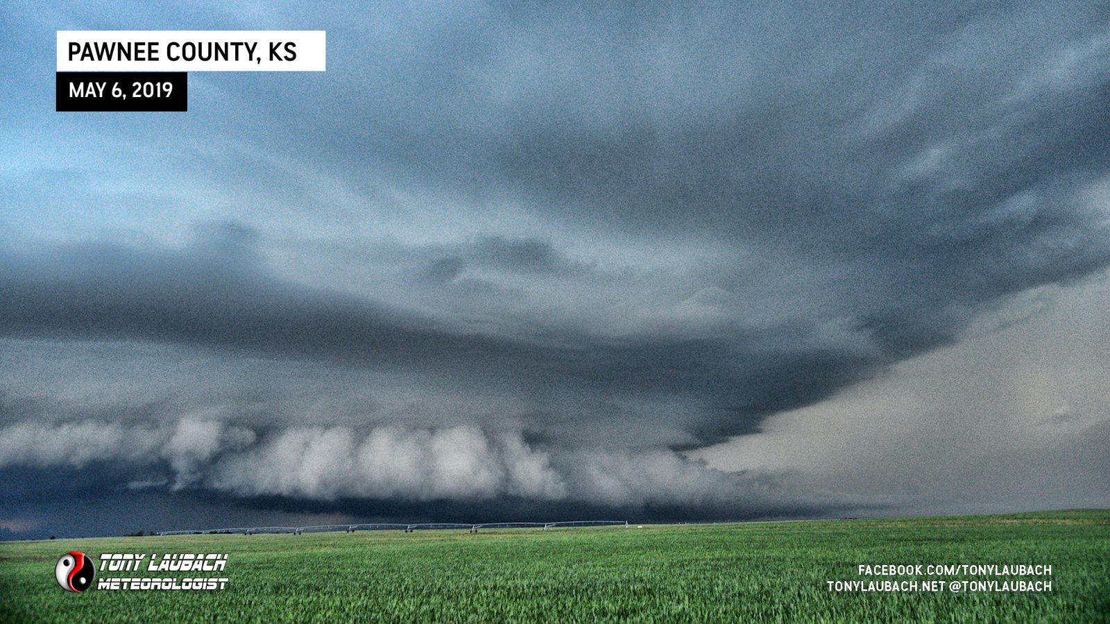
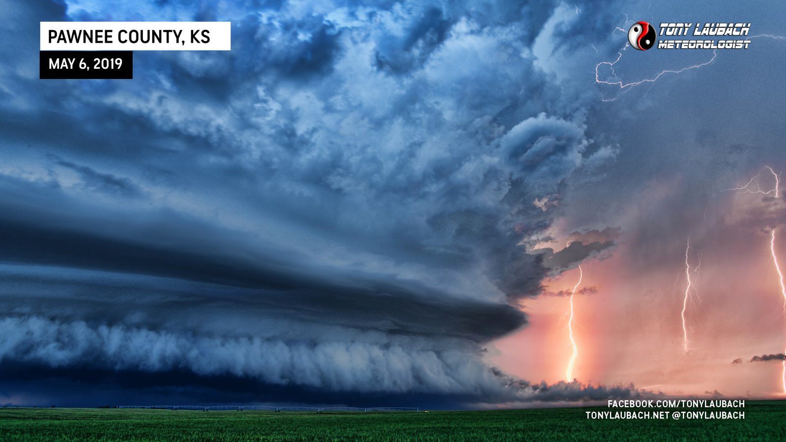
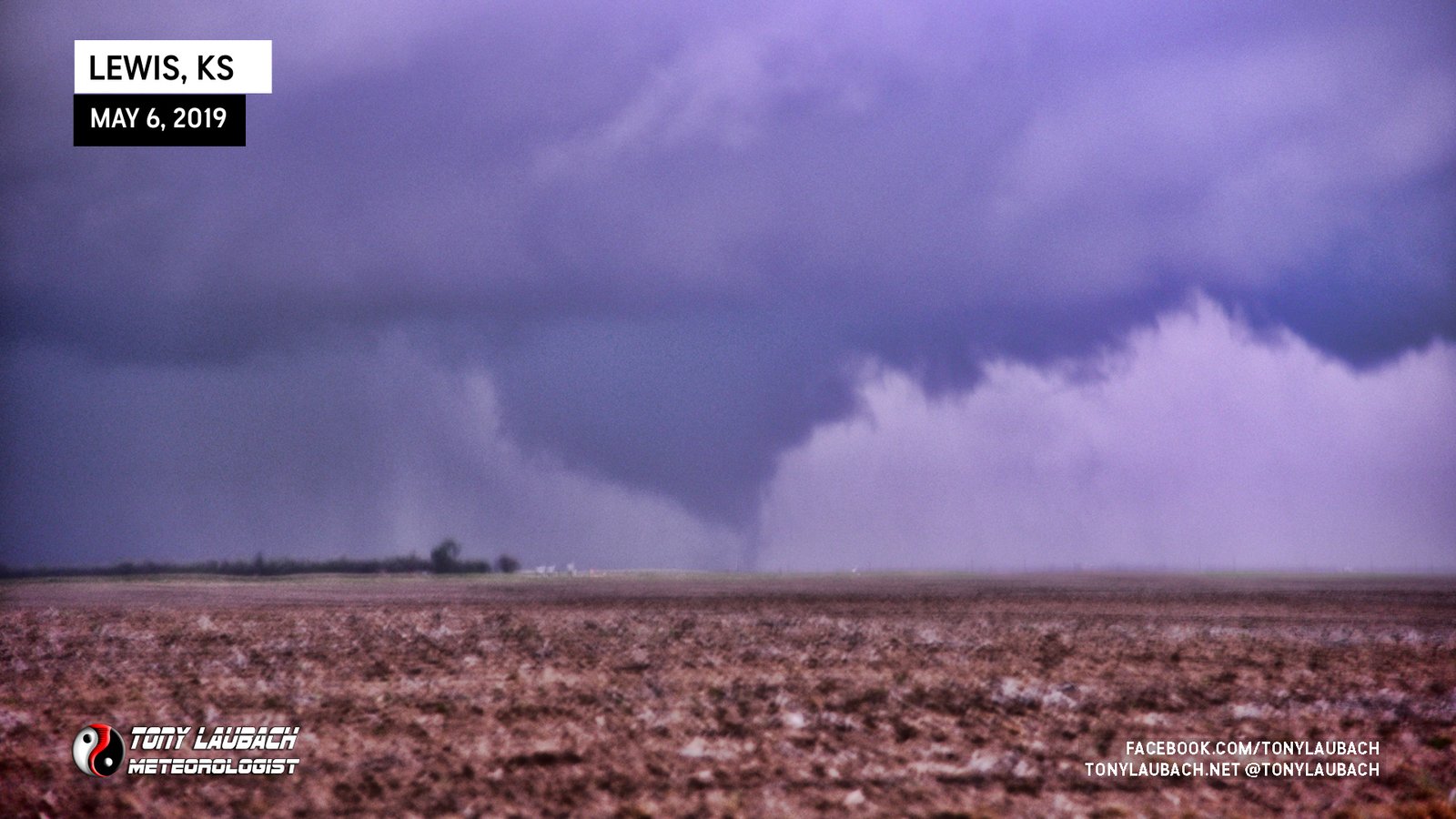
After a couple quick live hits for KAKE, I continued south with the cell using a series of dirt county roads, making a couple quick stops along the way as the storm was indeed strengthening. I kept myself a fair distance to the east as the hail-size potential was rather large and the overall structure of the storm was definitely very impressive. But best of all, the view underneath the storm was fantastic, allowing for a little more distance to not only keep myself clear of a monster core, but to also keep a wide enough view of the structure, which was only getting better as the afternoon went on.
It had been a pretty slow burn up to this point. The storm, while cycling through various wall cloud attempts, never looked particularly tornadic at any time between Pawnee Rock and Macksville. I did multiple live updates, many were short (sub-45 seconds), but I stayed with the storm into the early evening. Upon arriving in Macksville, the structure of the storm was really starting to impress, and the lightning also had become a focal point of the storm, so having been fairly far south of it now, I decided to head northbound out of Macksville on NW 130th Ave about five miles to get into the open country to have an unobstructed view of the storm as the sun set.
I set up on CR-C five miles north of Macksville and started to take in the view. The lightning and colors were absolutely ridiculous. I would occasionally get in another quick live hit, but between those hits, it was all about the photos!
As the sun started to set, the colors got 1000% amplified. And with a low tornado threat to this point, I was able to focus on getting some of the best lightning/structure shots I had ever taken.
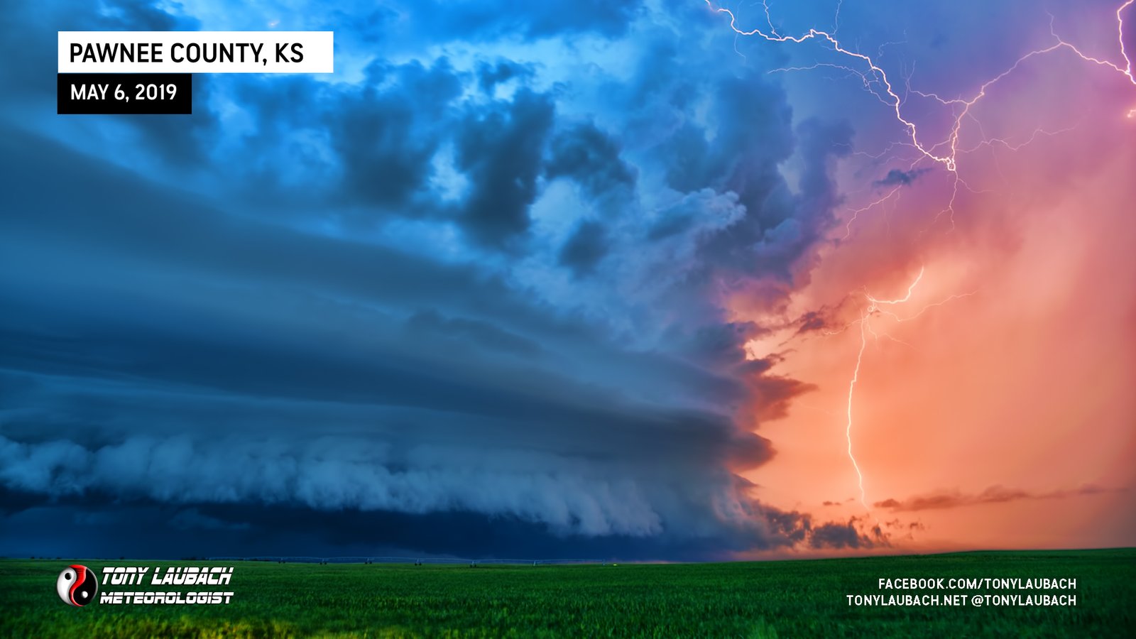
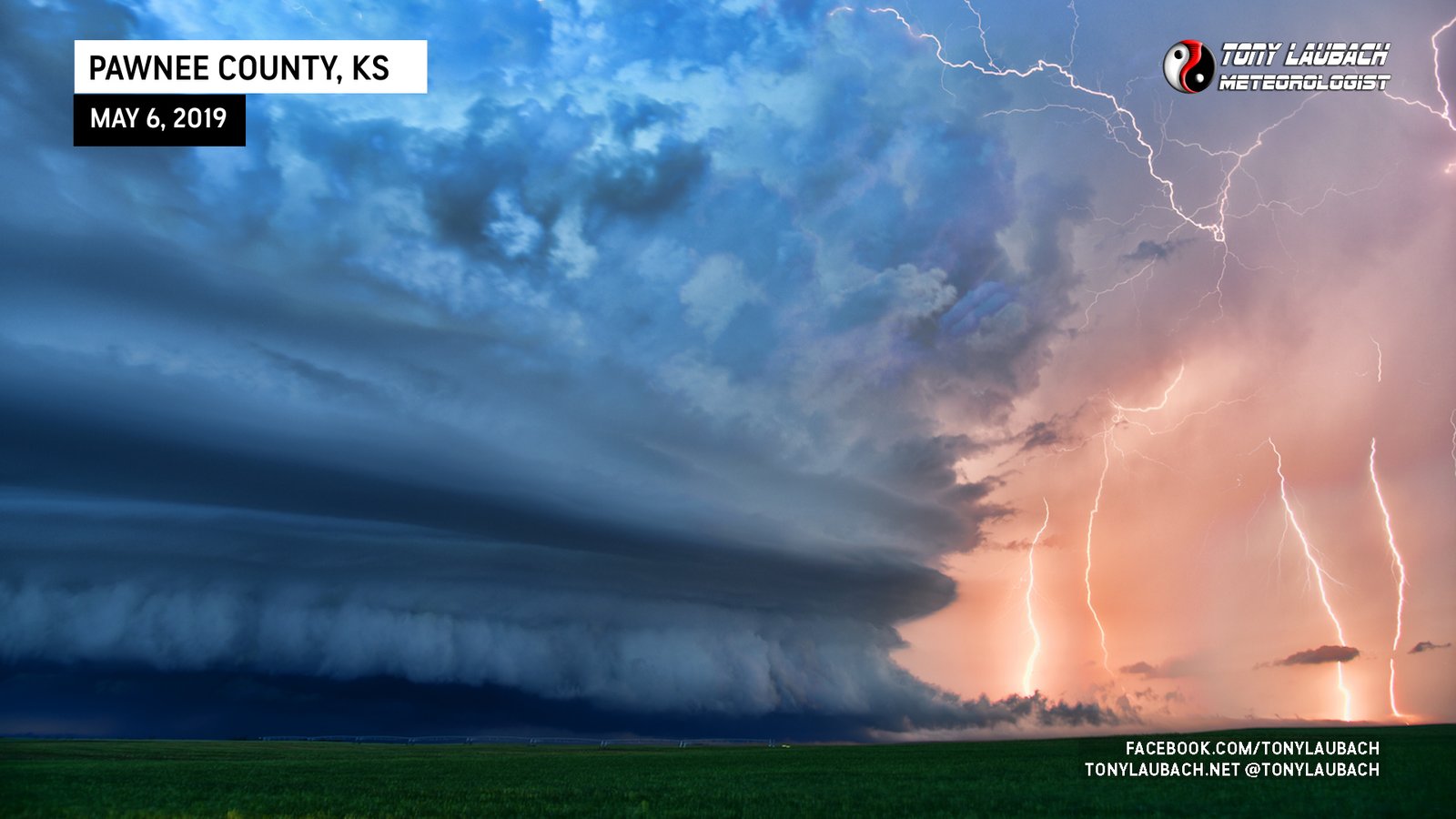
My only complaint was the low number of shots I could get. With there still being a lot of daylight, I was doing short exposures, meaning a lot of the lightning that was coming out hit between shots. But I certainly had the QUALITY shots over quantity, so I was absolutely THRILLED with the few I mustered in this sequence.
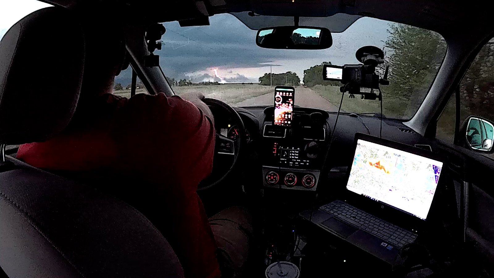
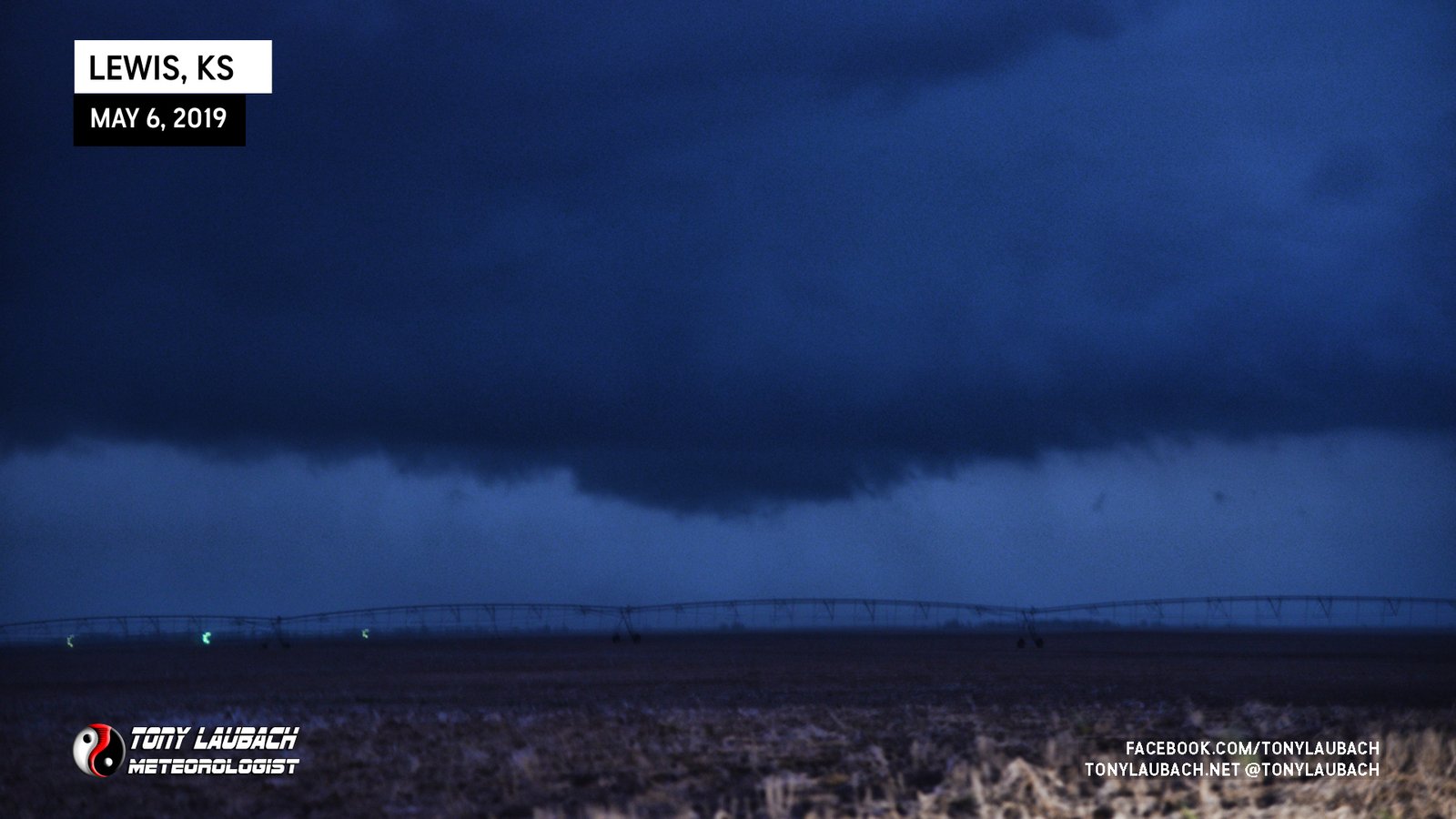
As darkness took over and the storm had closed in a bit, I was losing both the coloring and the view. I decided to retreat back south into Macksville with the idea I would get some distance back, basically trying to keep the structure wide. My Chief Met, who was paying more attention to the radar at this point, informed me that there was increasing velocity on the storm. His little heads up prompted me to get a little closer to the storm so I could get a better view underneath it. As it was dark, I rolled up pretty close, cutting west on US-50 through Belpre, then 3 more miles west before taking a county road north a mile to set up.
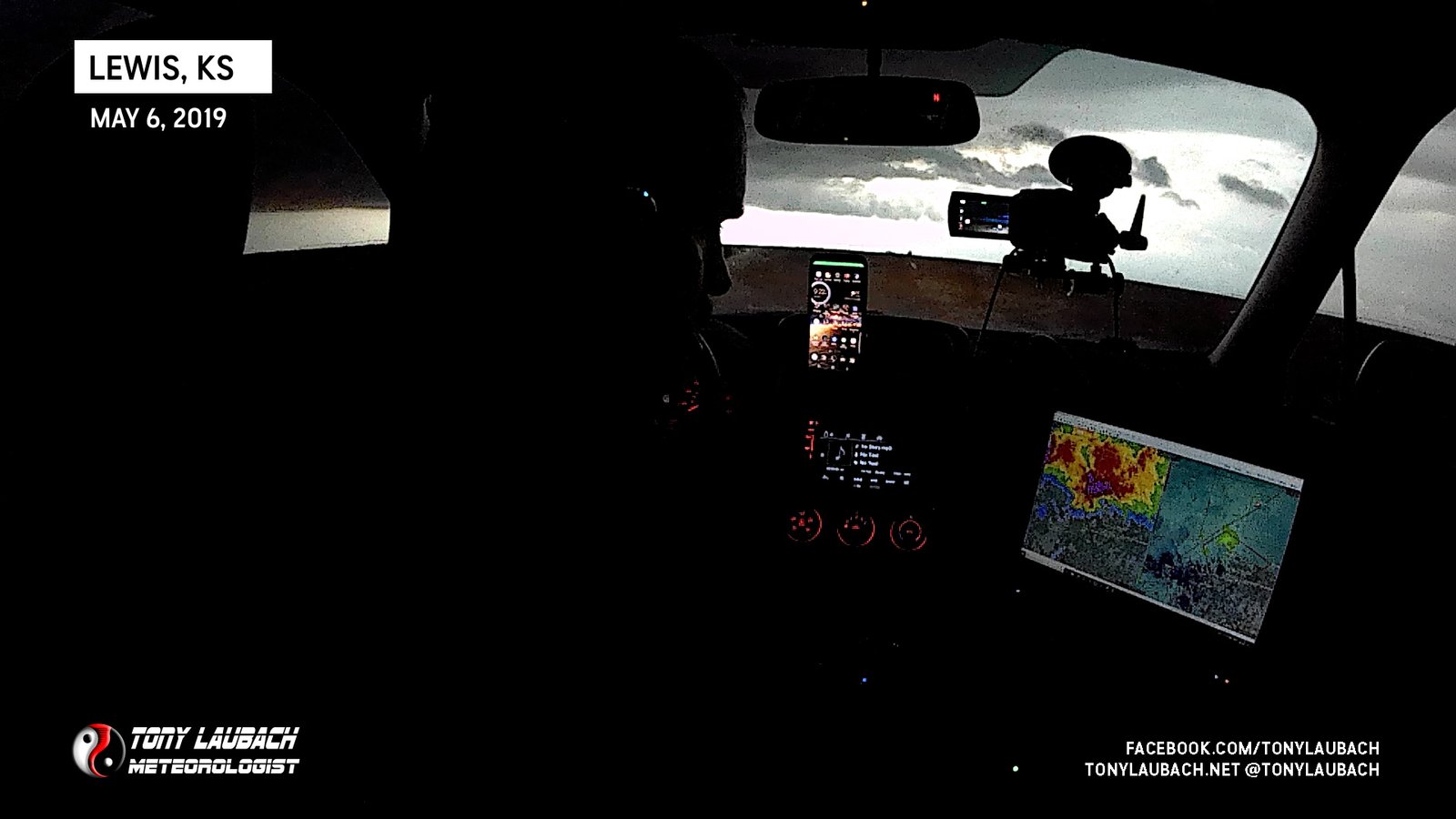
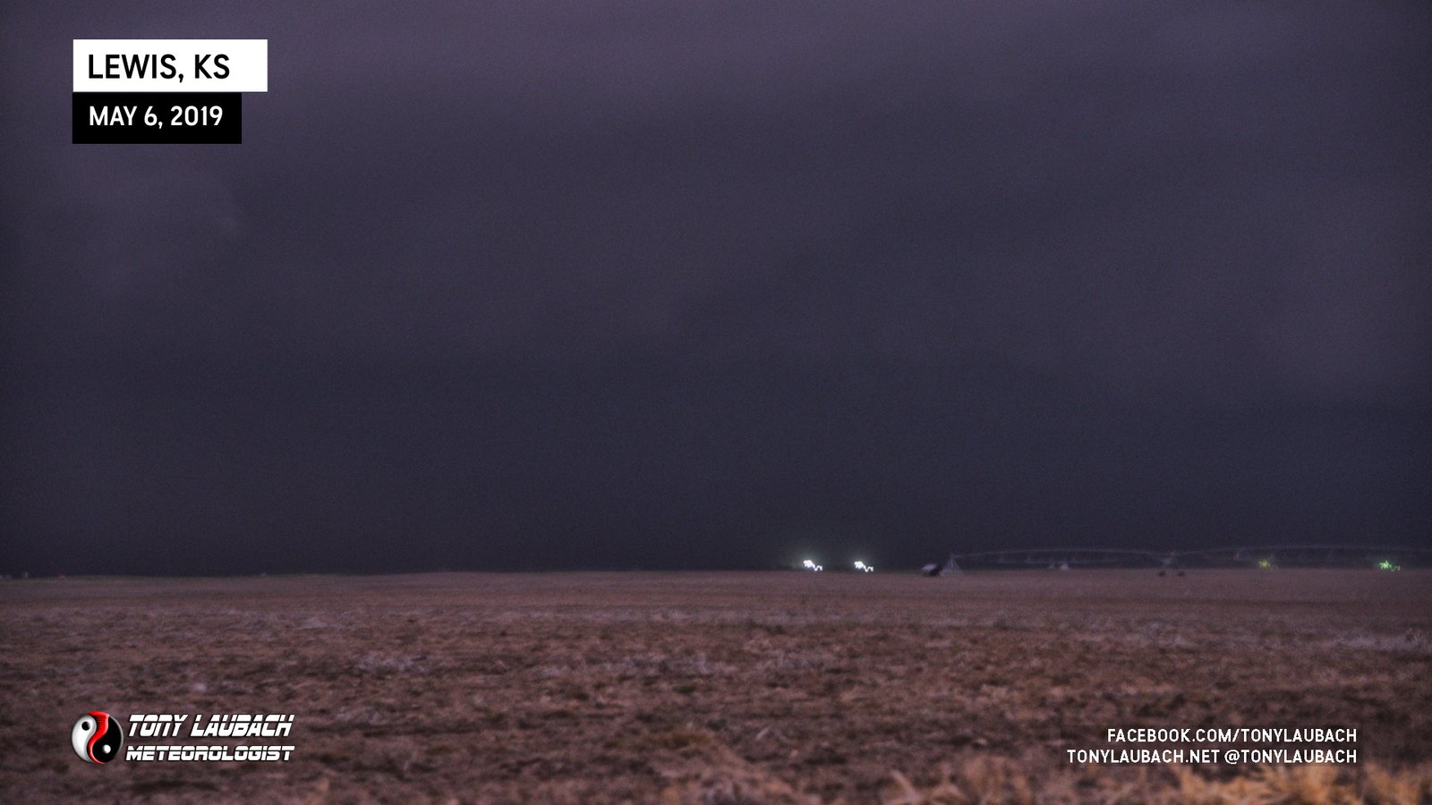
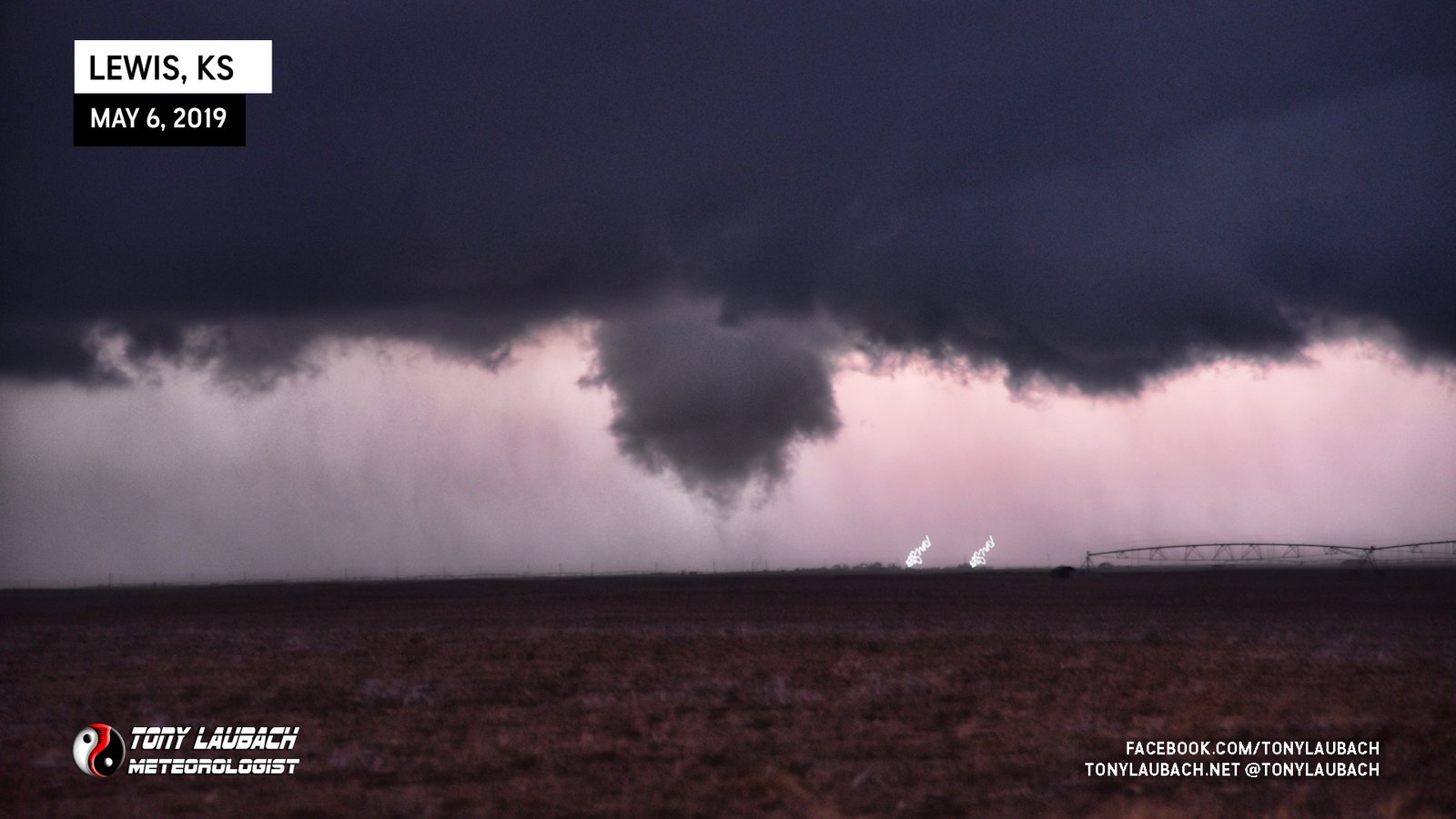
It was dark, impossible to see anything under the storm outside of the lightning flashes (which were fairly frequent). I had video rolling, but it was pretty worthless. So I thought I’d try for a couple lightning photos as there were a few bolts coming down out of the base. I set the camera up pointing out my open window, bracing myself on the window frame and resting the zoom lens on the mirror to point northward at the storm with my exposure time at 1.6 seconds to account for handholding the camera.
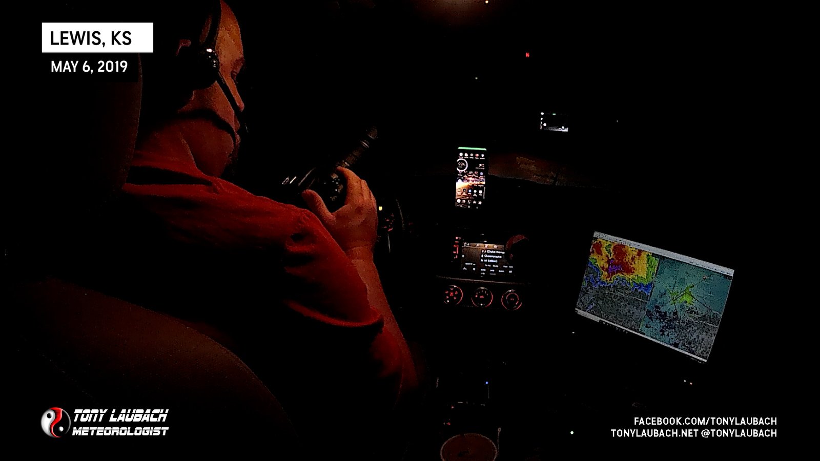
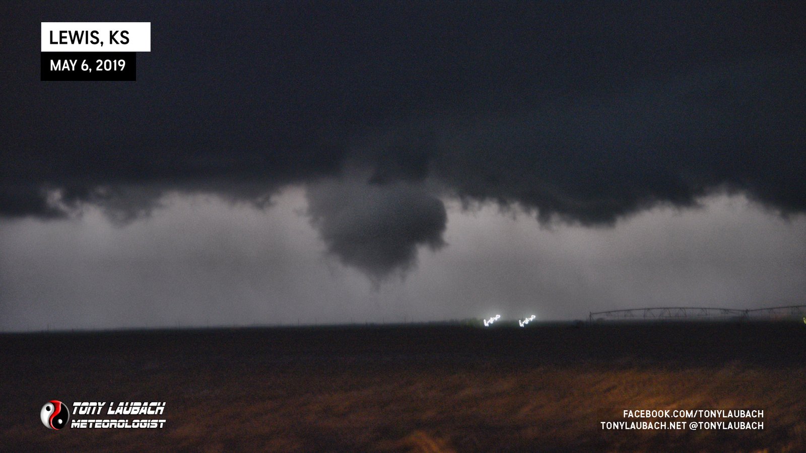
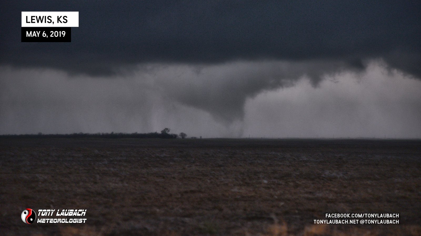
I took a few shots that looked like that… nothing exciting lightning-wise, but I was missing what was going on. While not totally obvious initially, there was a shallow rotating wall cloud right in the middle of my shots where a lot of the lightning was emanating from. I took about two or three more photos, then put down the camera for a minute or so before another lightning bolt sparked. I then grabbed my camera again, took another photo, and it was mostly black as I got no lightning in that quick 2-second shot.
After a quick glance at the photo preview showed what was basically a black screen to me, I propped the camera back on the window frame and tried my luck again… about 2 seconds later…
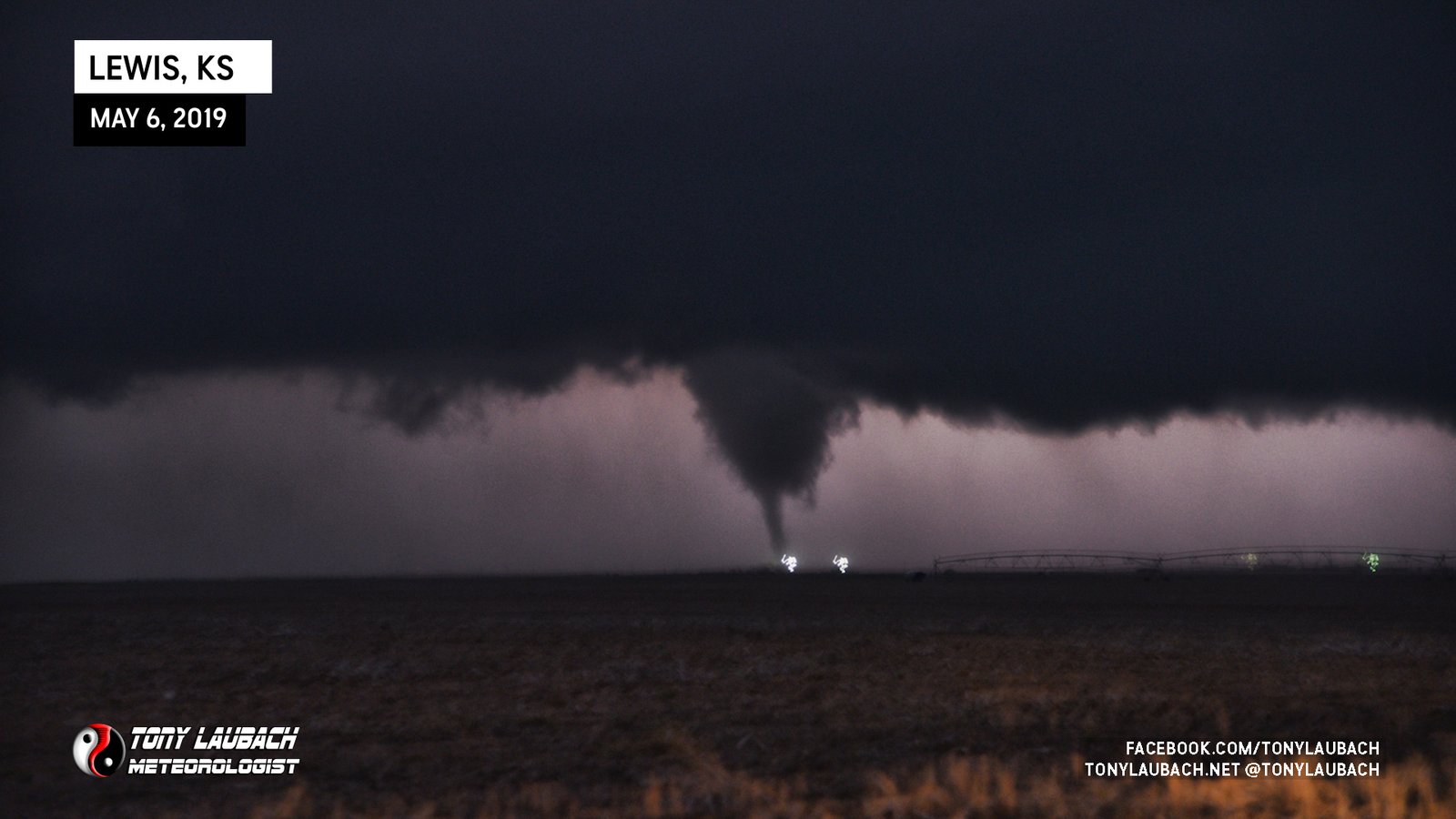
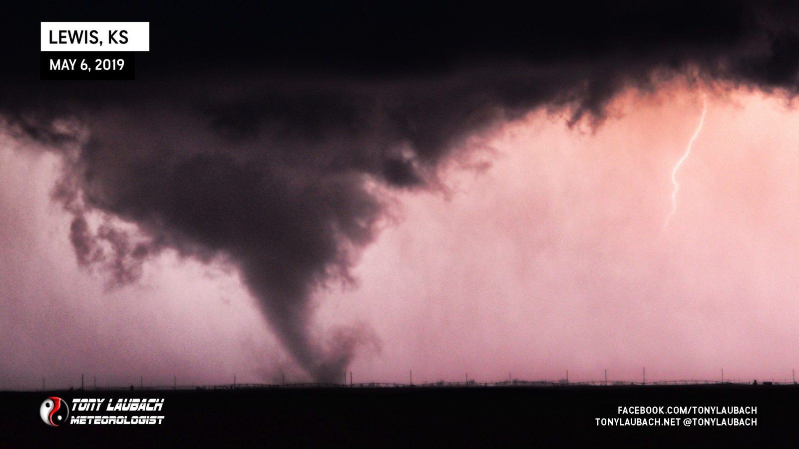
I was not live at that very moment, which was a very good thing. I was connected with my Mets back at the station as we had been chatting off and on. When the previewed showed up and I saw this, I didn’t immediately connect it as a tornado until I zoomed the shot in on the preview window. As soon as it registered, I exclaimed pretty quickly there was a tornado ongoing under this storm!
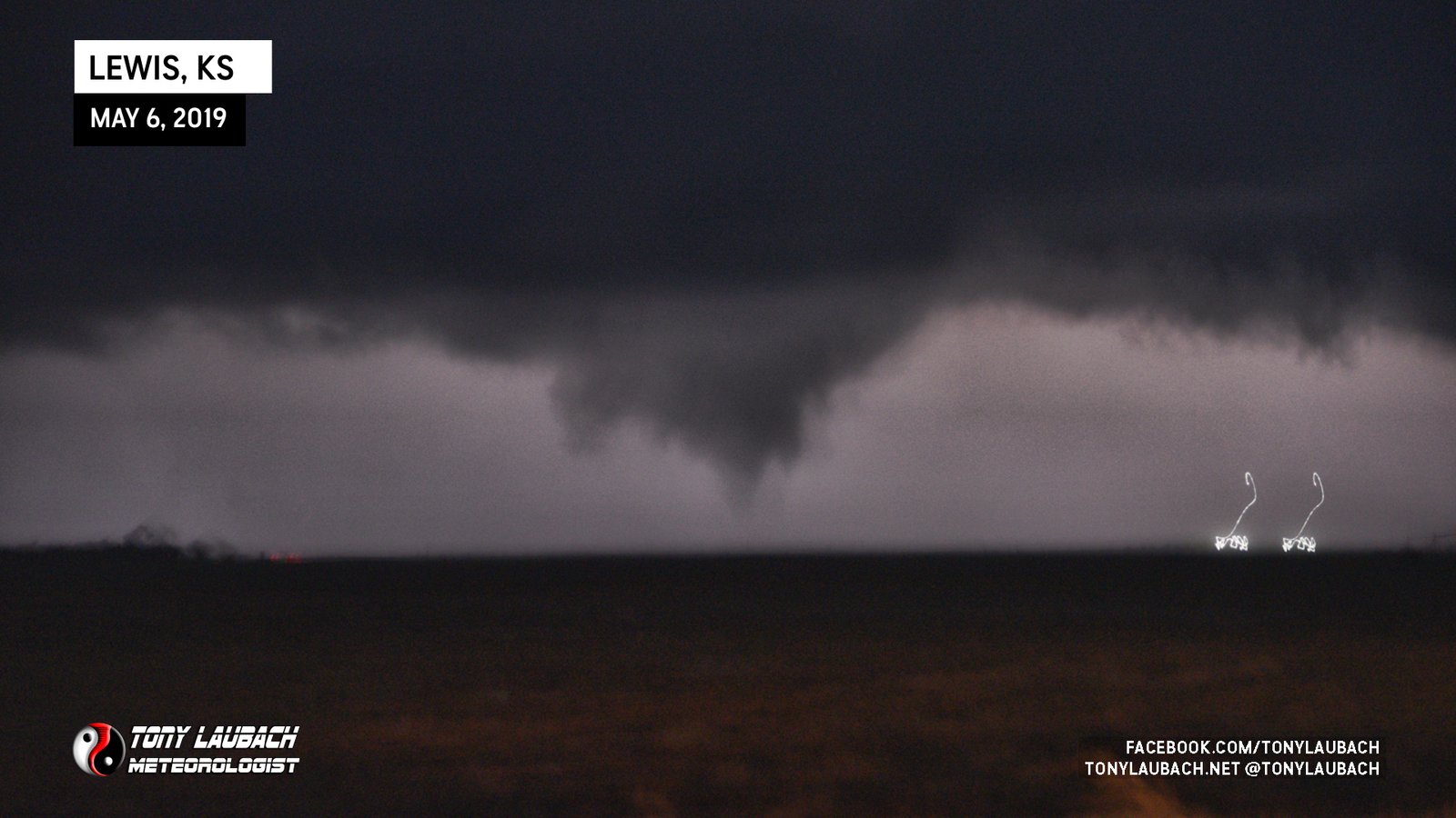
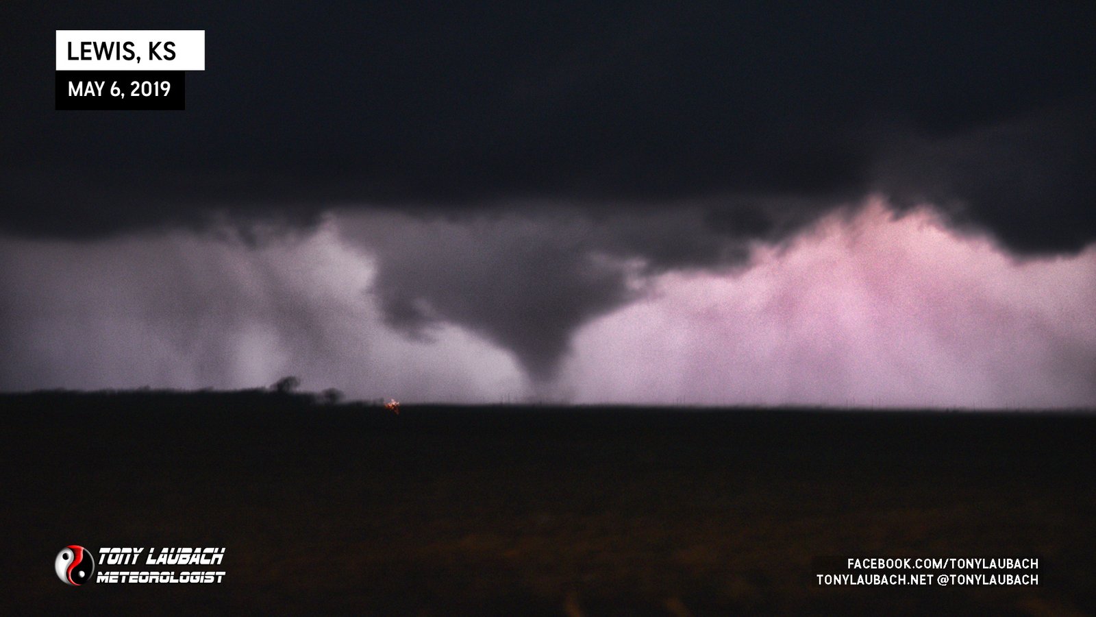
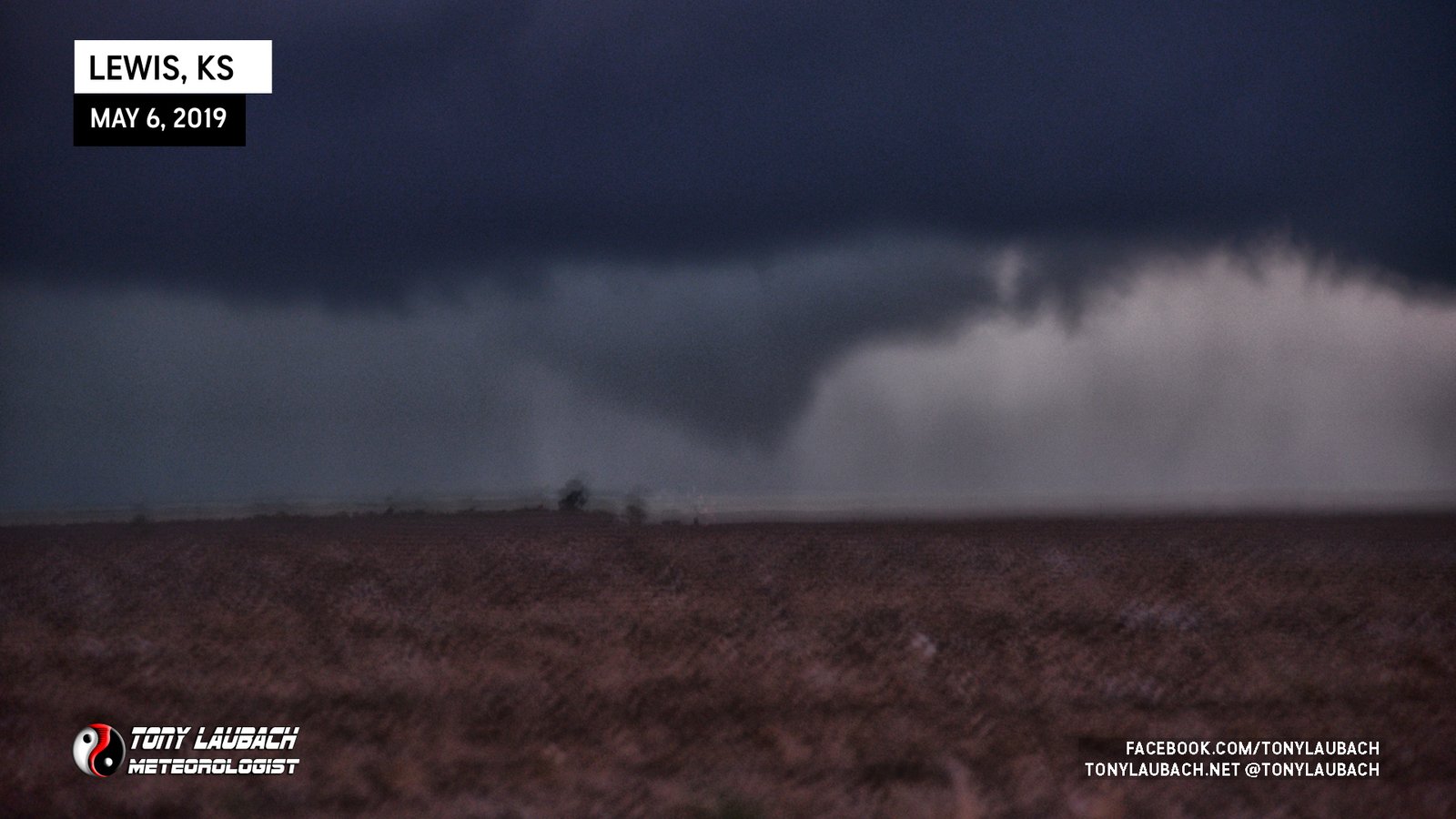
The series of photos above included a little more adrenalin, along with more conversation as they were working quickly to get me back on air in the studio. The photos, while not good to this point, were at least capturing the ground-truth that there was indeed a tornado occurring. I went through a series of several rapid-fire 1.6-second exposures, all blurry, but did the job. I made a concentrated effort to keep the motion-blur to a minimum as I wanted at least ONE good looking shot… then it happened…
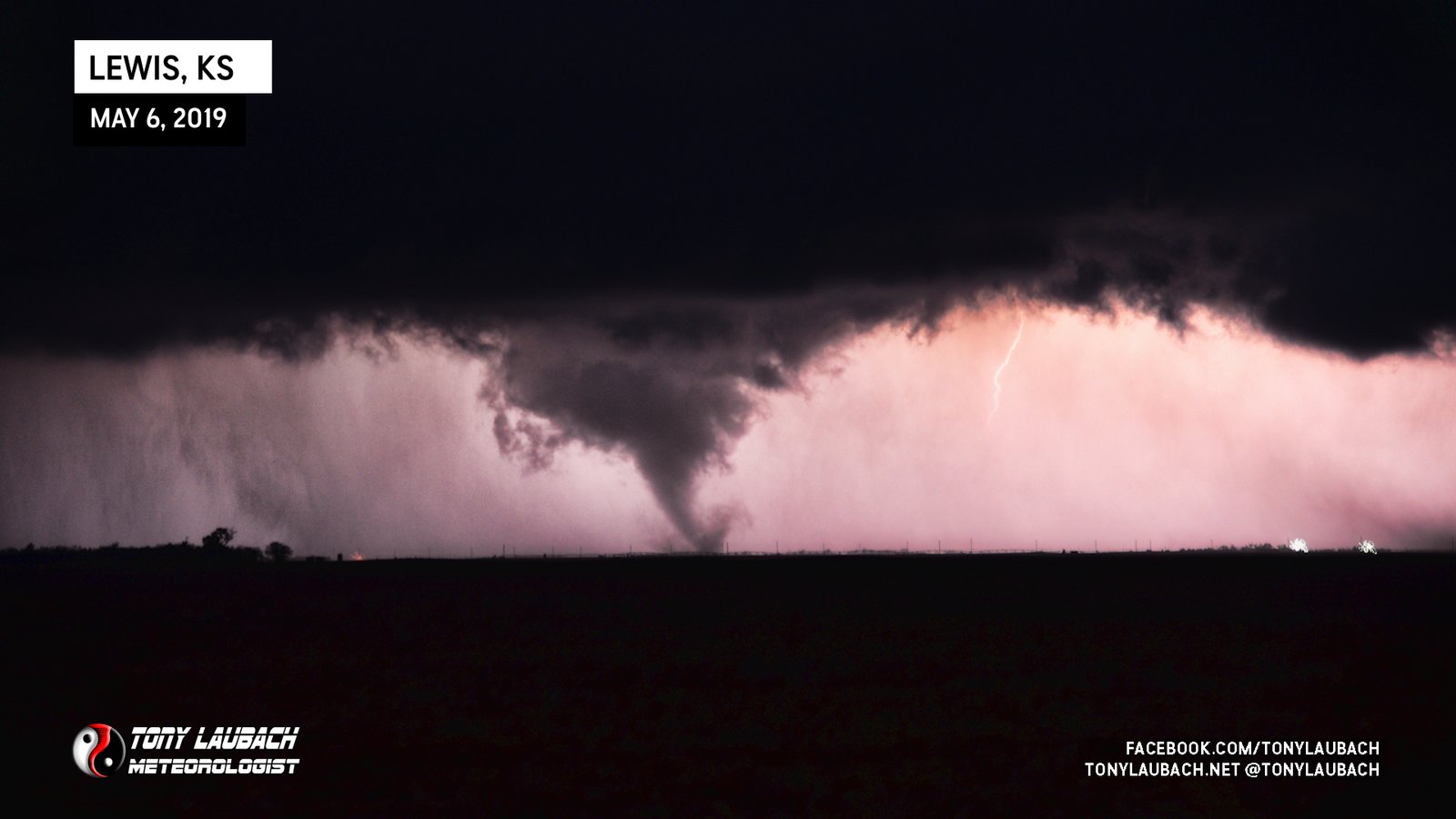
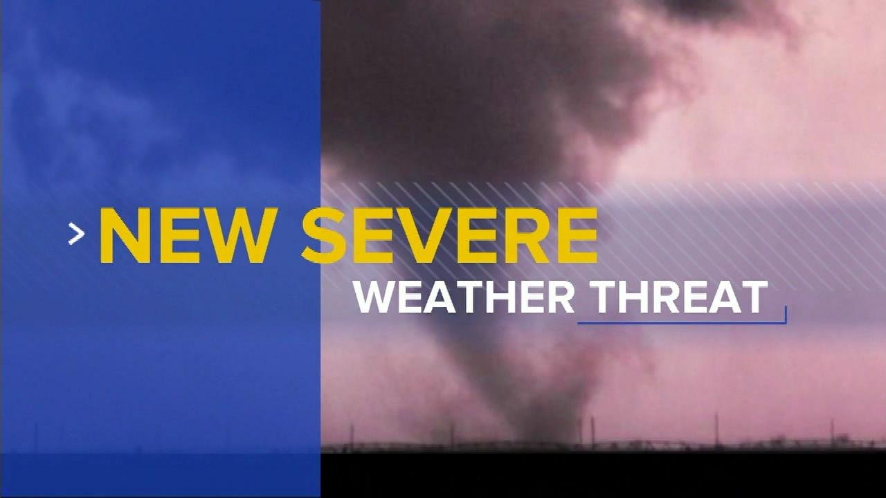
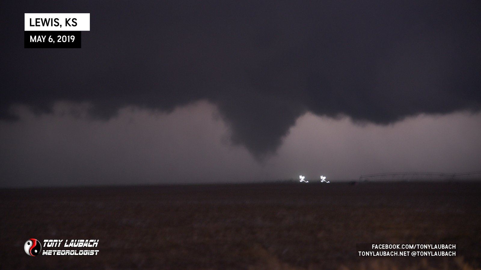
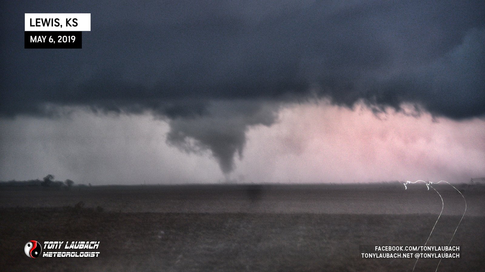
The shot! THE shot! A perfectly timed lightning strike illuminated the tornado at its strongest point. The photo, while still a bit of blur as shown with the lights on the left side, was the steadiest of my shots, and it couldn’t have timed out better. When I saw the preview, I lit up, it was a cool moment. I zoomed in the shot to get a better look at the tornado, which looked gorgeous against the pink backdrop of the lightning strike that peaked out of the precip just to it’s left.
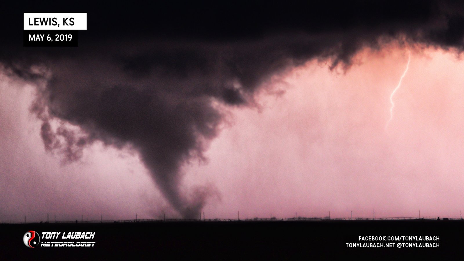
I squeezed in a few more photos in the moments following this, but even more adrenalin prevented a repeat performance, albeit still capturing the tornado in progress.
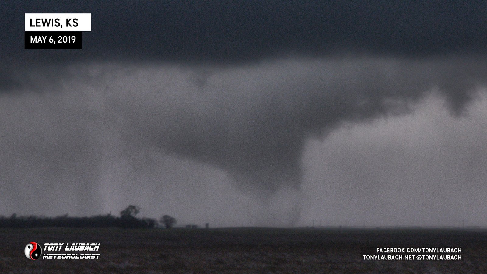
In the midst of that sequence, I did manage to snag a steadier shot of what appeared to be the tornado in a multi-vortex stage toward the end of its life. I did a cropped version of that photo to show that moment.
It was only a couple minutes worth of photos (about 3 minutes from first tornado photo to last), meaning the tornado was likely in progress about that time (perhaps a little longer on the front end before I got that first photo). But by the time I relayed the report in and I was on air again, the tornado was gone.
I stayed in that spot long enough to get a couple of those photos processed and sent back so they were ready for air as I had no video worth putting on TV, but none-the-less, I had imagery that confirmed the tornado was indeed down, no-question imagery to boot. I stayed with the storm a little bit longer as it was moving almost due south, but was becoming less of a supercell and more of a cluster.
I followed it south via series of county roads between US-50 and US-56, stopping a few times to observe, but not shooting anything of consequence. Once I reached US-56 east of Greensburg, I had called it a night, hopping on 56 and taking it back to Wichita where I went straight to the station to celebrate our TeeVee win!
I love these lower-end, 5% days… they’re much less stress and craziness compared to the higher end setups, and they often yield the best visuals because you can actually take the time to capture it. While I did not take as many photos as I could’ve between doing live hits and navigating, I was absolutely THRILLED with the results. The nighttime tornado/lightning photo was hands-down the best nighttime shot of my career, and I did it handheld (imagine if I could’ve tripoded those things). Easily my best chase of 2019, and certainly one of my better photogenic storms of my career. Even the nighttime tornado photo got some love the following morning from Ginger Zee as it was used on Good Morning America to kick off their storm coverage.