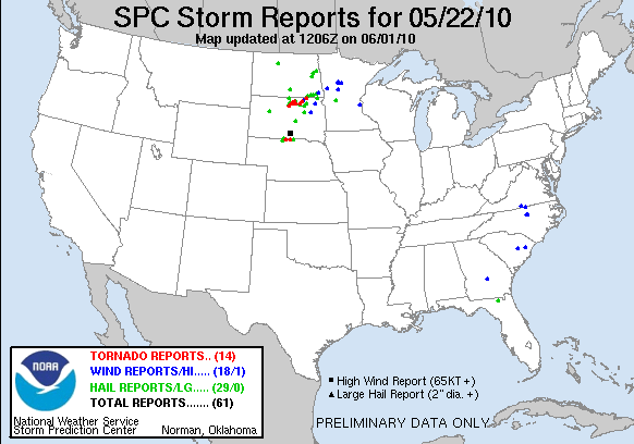

SUMMARY
May 22 was easily one of the most prolific tornado intercepts and deployments during the entire TWISTEX operation. As a team, we collectively intercepted seven tornadoes on a cyclic supercell across northern South Dakota, deploying instrumentation in several of those tornadoes, including full mesonet deployment AND deployment of Tim’s Tower Probe, collecting first of it’s kind wind measurements (more on that later) in the early stages of the Bowdle EF-4 tornado.
THE DAY BEFORE (May 21)
We awakened in Goodland, Kansas and were preparing for a chase day across northeast Colorado into southeast Wyoming. Tim had discovered that the data logger in the new tower probe had died and unfortunately did NOT have the spare one with him as it was at his home in Lakewood, Colorado. Given the close proximity of the day’s target, perhaps even as far west as the Front Range, Ed and I volunteered to head into Denver with our Discovery camera lady in M3 to retrieve the data logger and meet with the group, ideally to get on the chase with them. Tim agreed to this idea and Ed and I hit westbound I-70 to Denver shortly before noon.
This put us rolling into Denver shortly before 3p, and as was typical with Denver, traffic was hell. We got to his place closer to 3:30pm, retrieved the logger, and made a stop to gas up M3 before we were to head out. Unfortunately for us, the target, which we had hoped would be no more than an hour or so away, had shifted quite a bit up to the northeast, and now it was closing in on rush hour, and thus began a HORRIBLY frustrating commute to try and get out of Denver.
Meanwhile, we were seeing on radar the storm up near Torrington, WY which was looking beautiful, tornadic, and the rest of the crew was up there on. Meanwhile, we were slugging along at 5mph trying to get north out of the south-side of town. Every freeway was clogged, and I was losing my mind trying to get us out of there. Finally, after what I believe was almost 90 minutes to go from one side of the city to another, we were finally northbound.
As that took forever, the storm and the team ultimately had worked further to the east, thus extending our drive to meet them. We never were able to catch up in time to formally chase this day, but met them early evening somewhere in western Nebraska to get Tim the logger. I was very upset and annoyed, having missed the chase day to go fight in Denver traffic with the target storm firing well north of where we initially thought it would go, thus making our commute even longer.
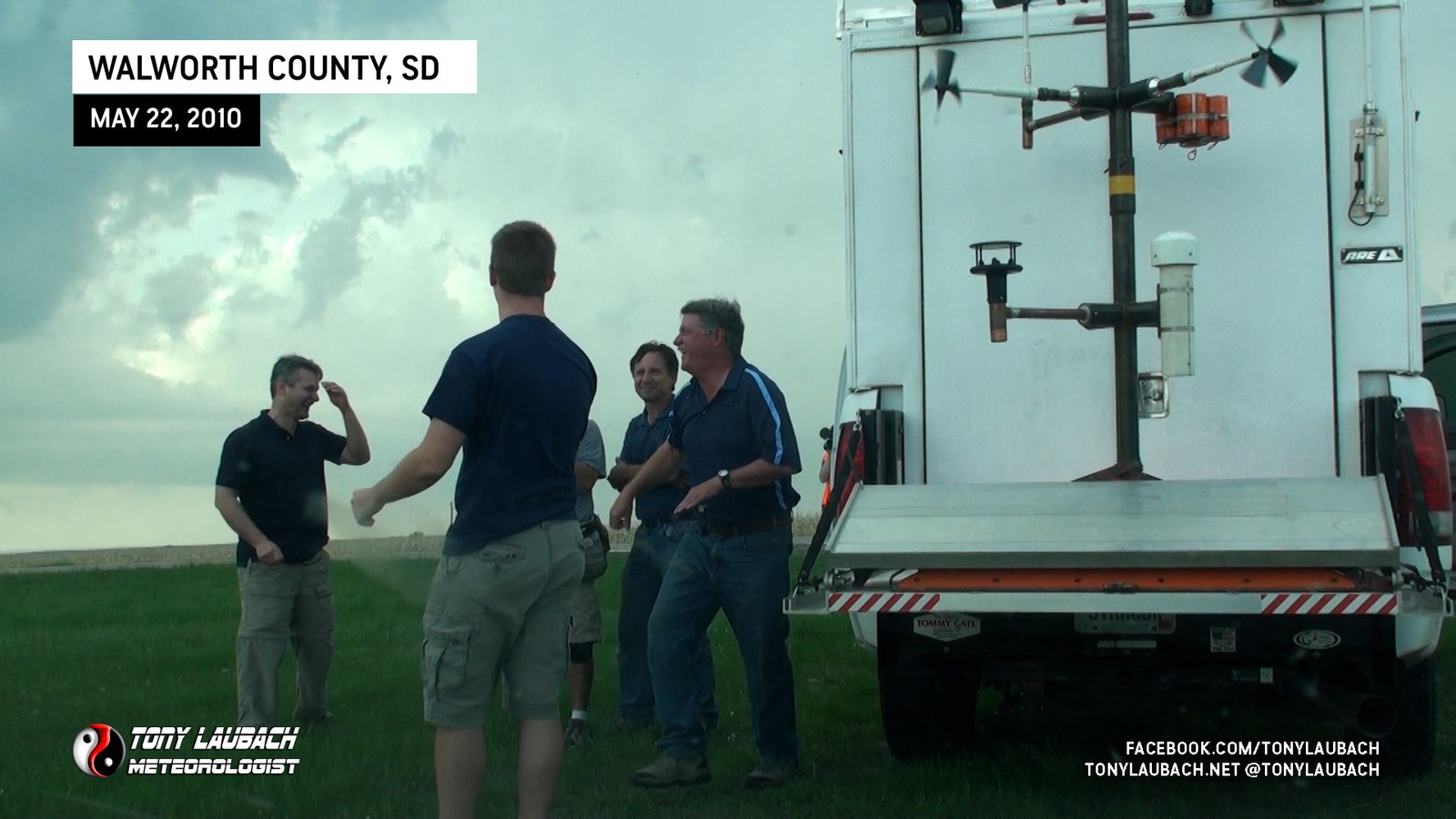
The team rolled up into Chadron, Nebraska for the night, and Tim got up pre-dawn on Saturday morning, the day of, to swap out the loggers in the tower probe.
THE DAY OF (May 22)
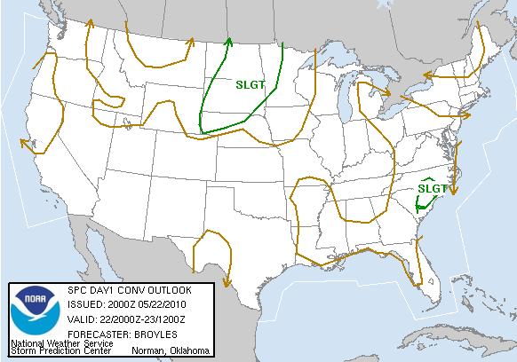
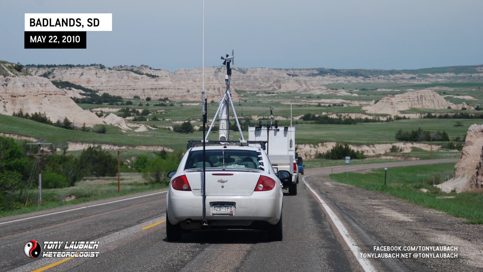
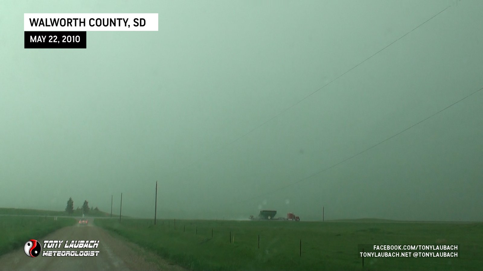
Got started in Chadron, Nebraska, left about 8am with an initial target up near Mobridge, SD; about a 6-hour haul up from there plus stops. We took the scenic route up SD-73 through the Badlands, cutting east on I-90 to US-83 at Vivian, then up to our target, arriving by mid-afternoon. Biggest concerns going in were the capping, and our target was based on the idea that the cap would erode further north into South Dakota, hence the long drive. The overnight stay in Chadron really helped, as had we stayed on I-80 in Nebraska, we’d be looking at an additional couple hours drive.
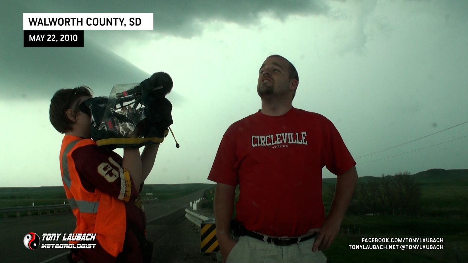
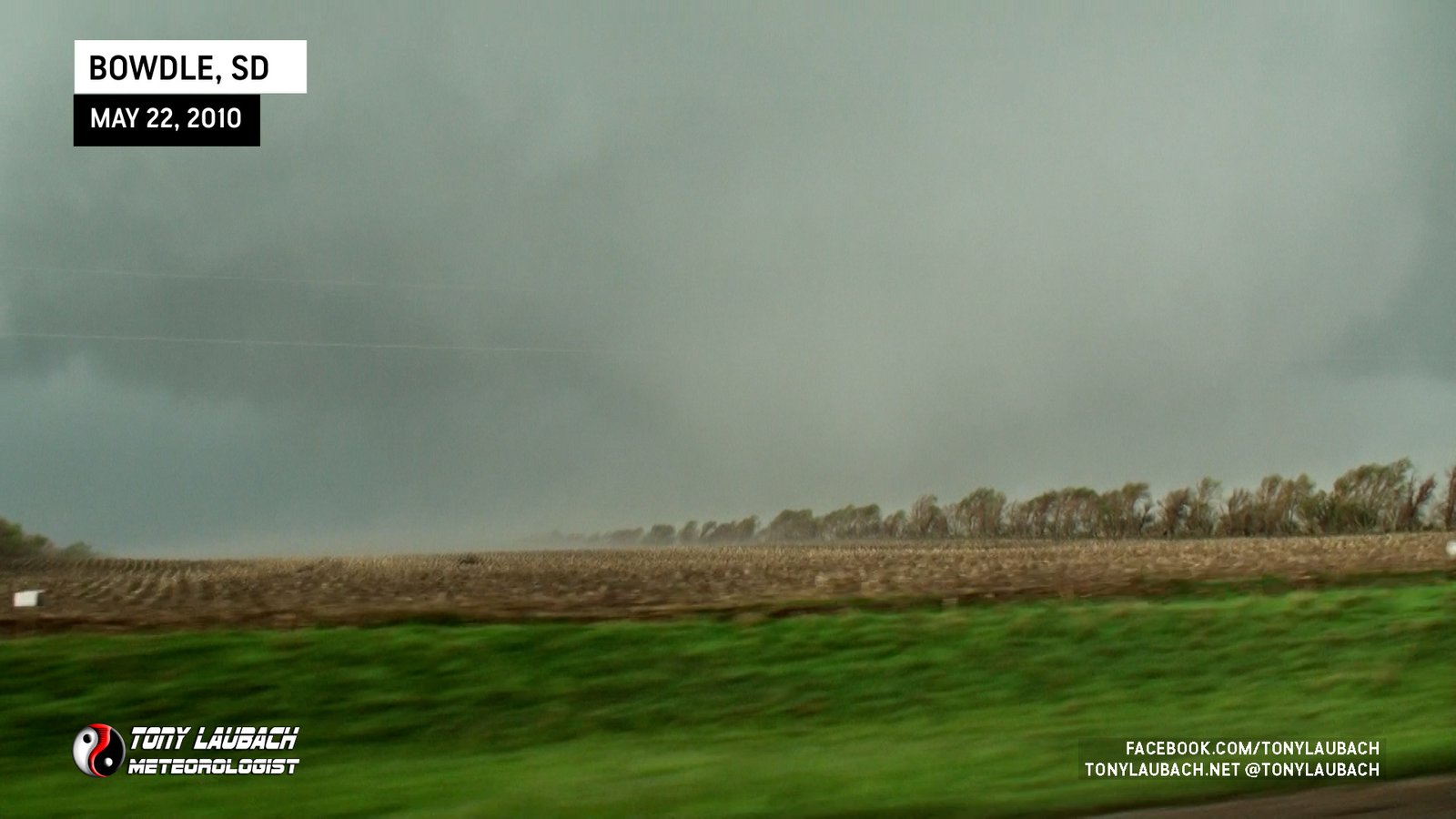
We arrived up to our staging area south of Mobridge, South Dakota, setting up in a field near US-83 and waiting for storms to initiate. The crew was pretty amped, and while I was internally, I was kinda chilling in the car while everyone was out in the sun as I felt pretty confident we’d be having a big day today. A sentiment shared by Tim and Carl as well.
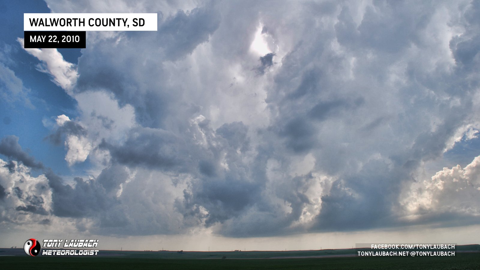

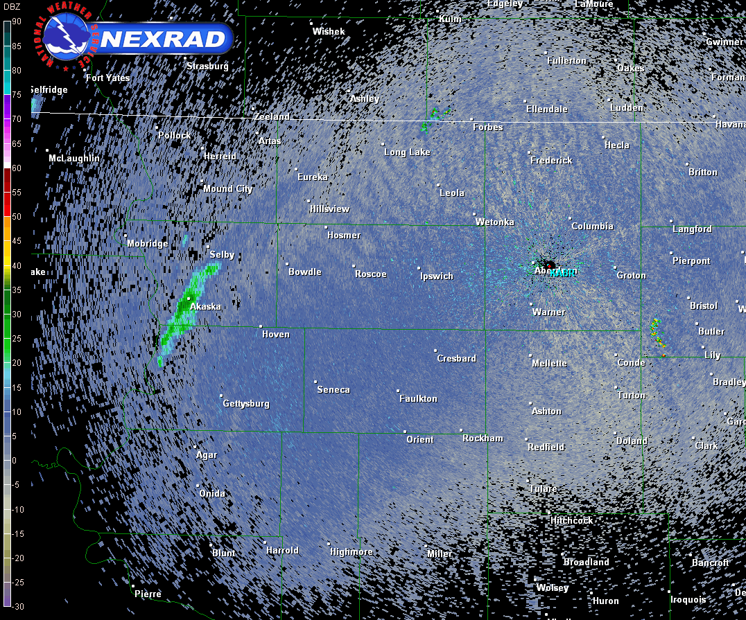
Our target storm went up near Akaska, South Dakota, and we got on it really quick southwest of Akaska there on US-83. The storm moving east/northeast, we decided to get on 144th Street heading over to Lowry.
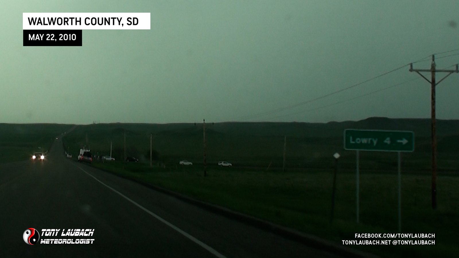
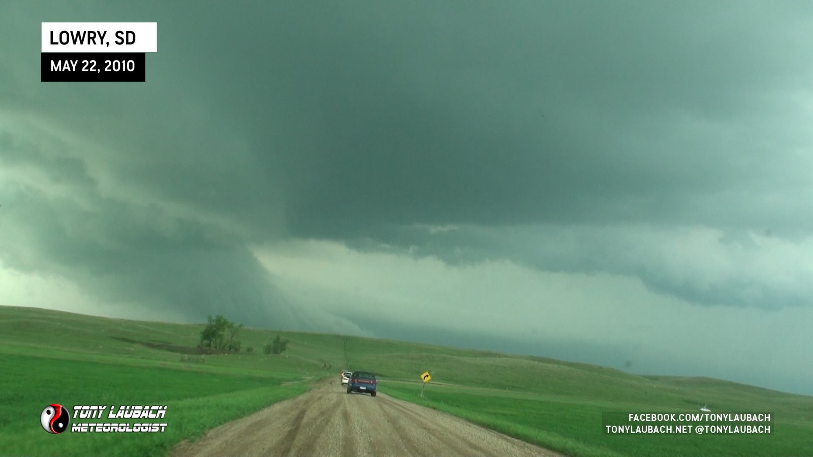
We ventured east to Lowry, making a couple stops along the way to observe the storm that was off to our west/northwest. We continued into and through Lowry to E. Lowry Road, following it east over to 315th Avenue where we pointed ourselves north. Plenty of other chasers were on this series of dirt roads as well as our developing cell was the only game in town in this area.
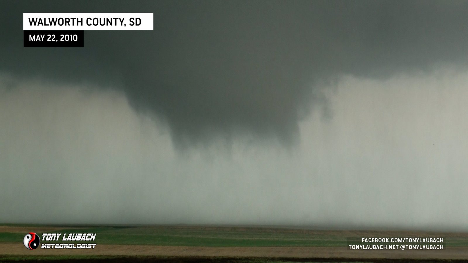
TORNADO #1 (NORTHEAST OF LOWRY, SOUTH DAKOTA)
As we were northbound on 315th Ave east of Lowry, we were observing an area of wrapping rain. Very quickly, we were trying to decide whether or not we were looking at a fairly large tornado in progress to our west. We would all soon agree that it was indeed a tornado going on to our west.

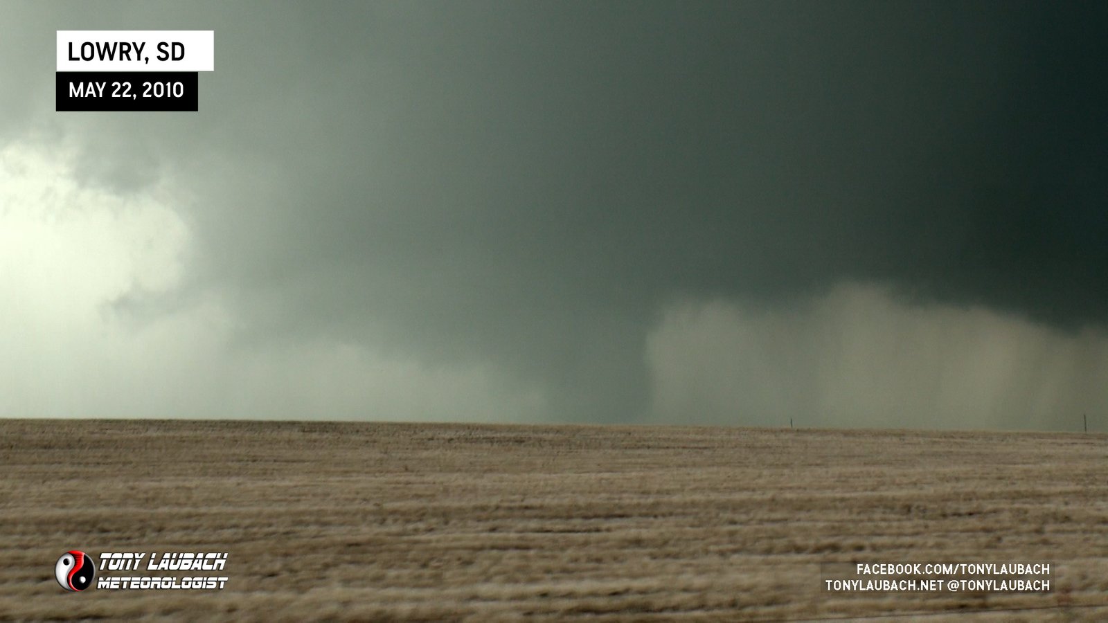
The tornado would dissipate as we continued north on 315th Ave.
TORNADO #2 (SOUTH OF JAVA, SOUTH DAKOTA)
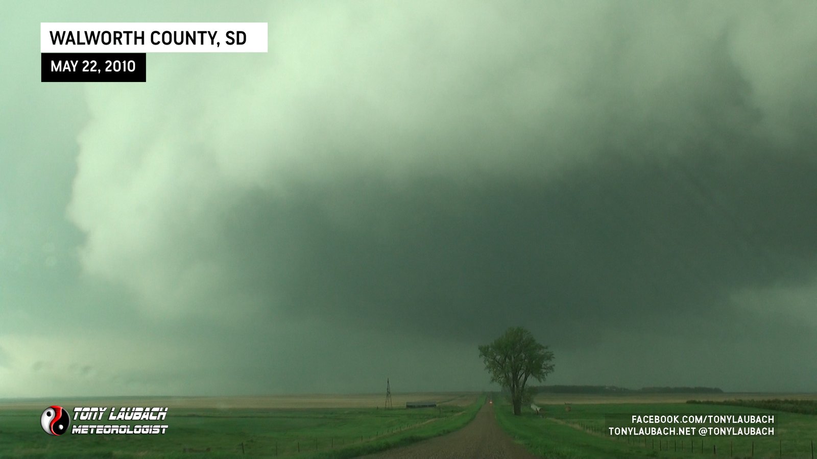
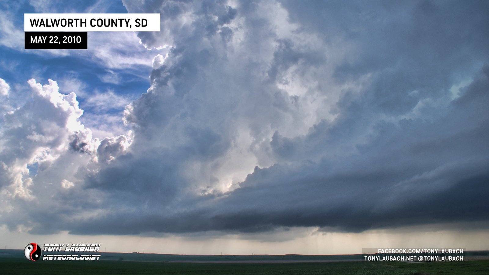
After cycling down a bit after the first tornado, the meso really started cranking up. We were slowly working our way up 315th Ave and we slowed to a stop as the meso reached the road with the intense rotating wall cloud spinning like a top over the road as it moved left to right in front of us. We were radioing back and forth about how amazed we were this was NOT dropping a tornado given how hard it was rotating.

Based on NWS surveys, this was NOT the Bowdle tornado. We finally got north to US-12, plenty of precip between us and the tornado now. But we got on to US-12 about 10 miles west of Bowdle at this point, and we began our eastbound run to catch back up with the storm.
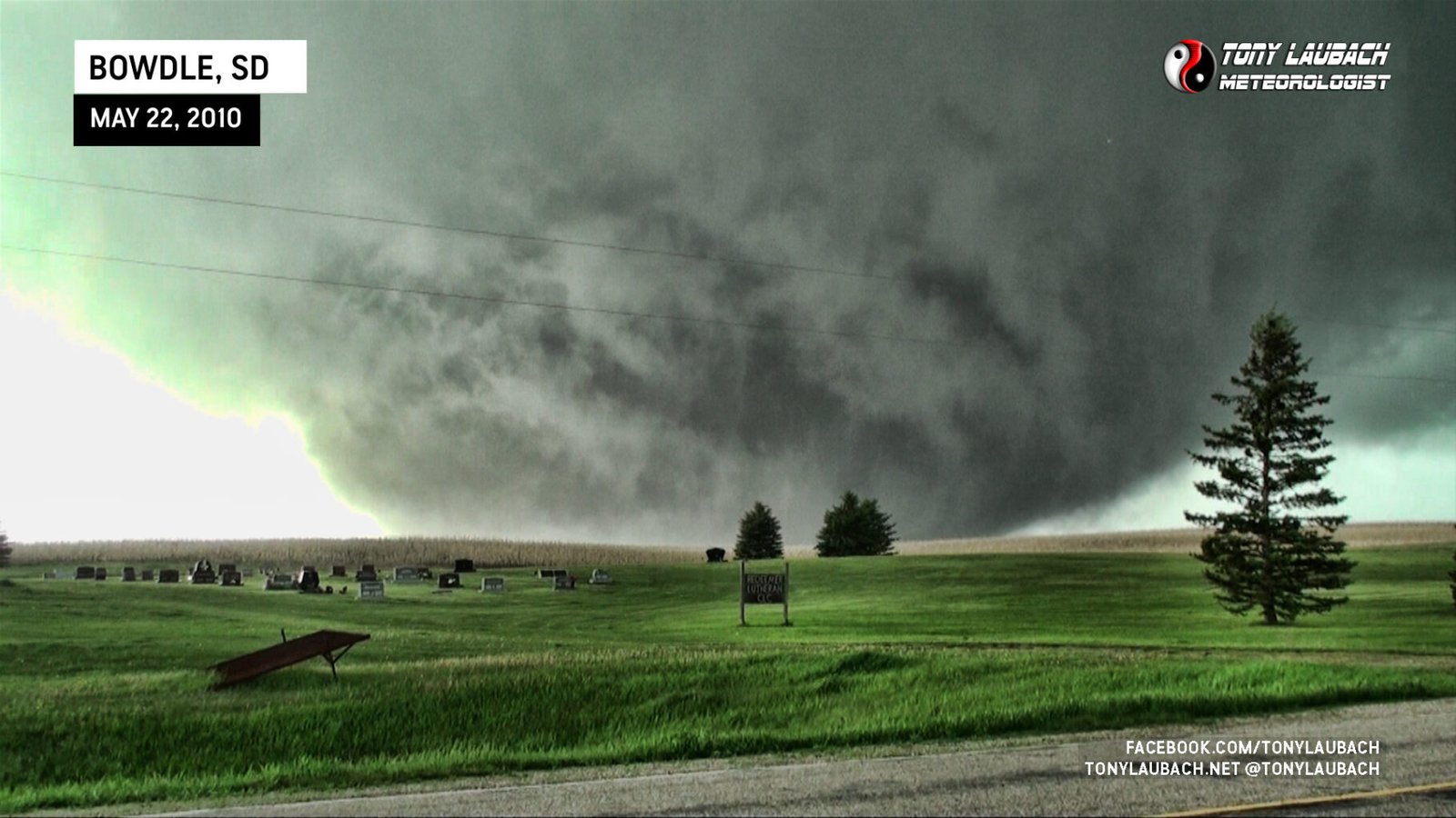
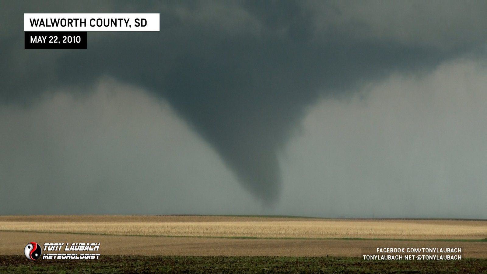
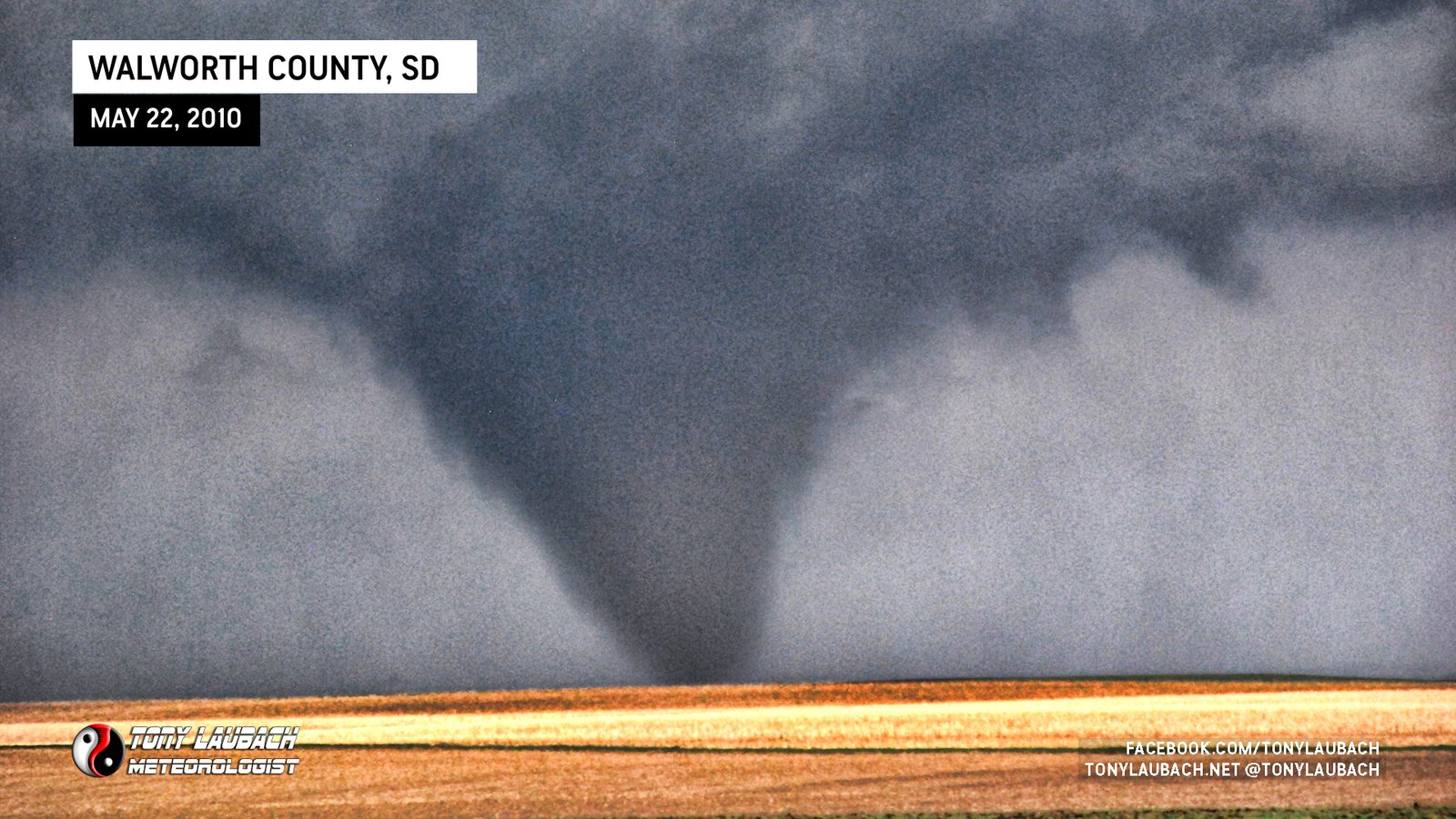
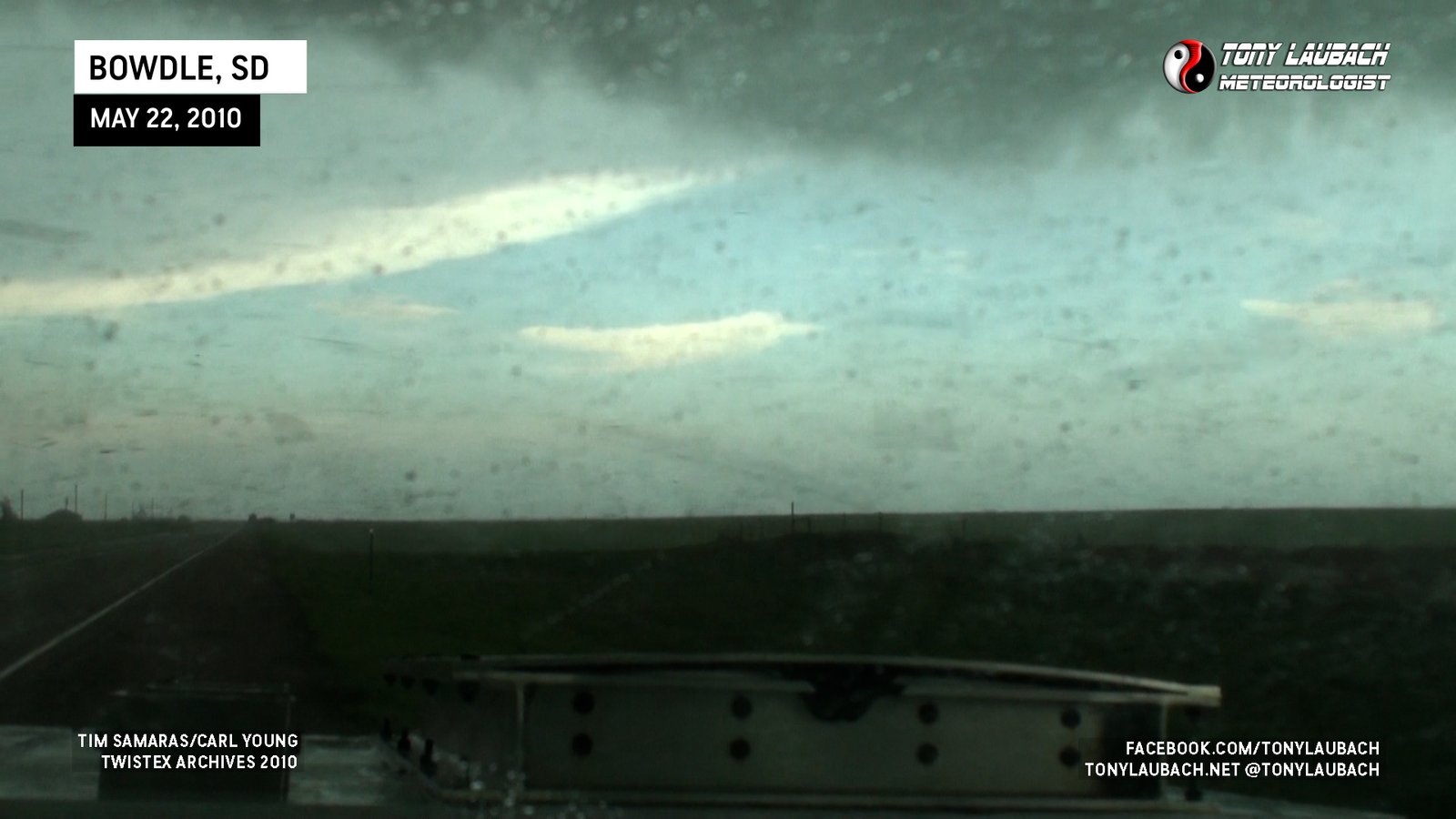
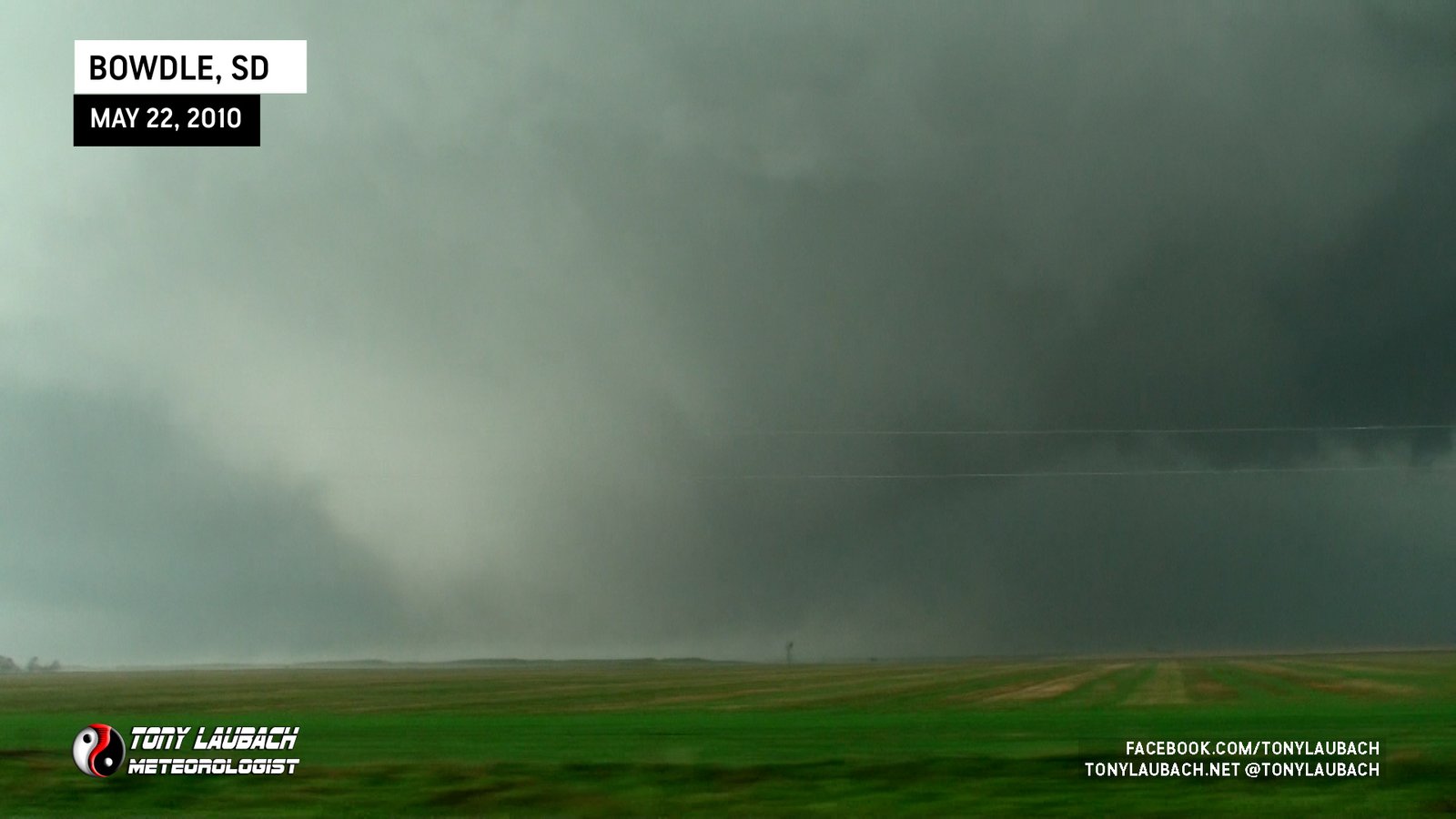
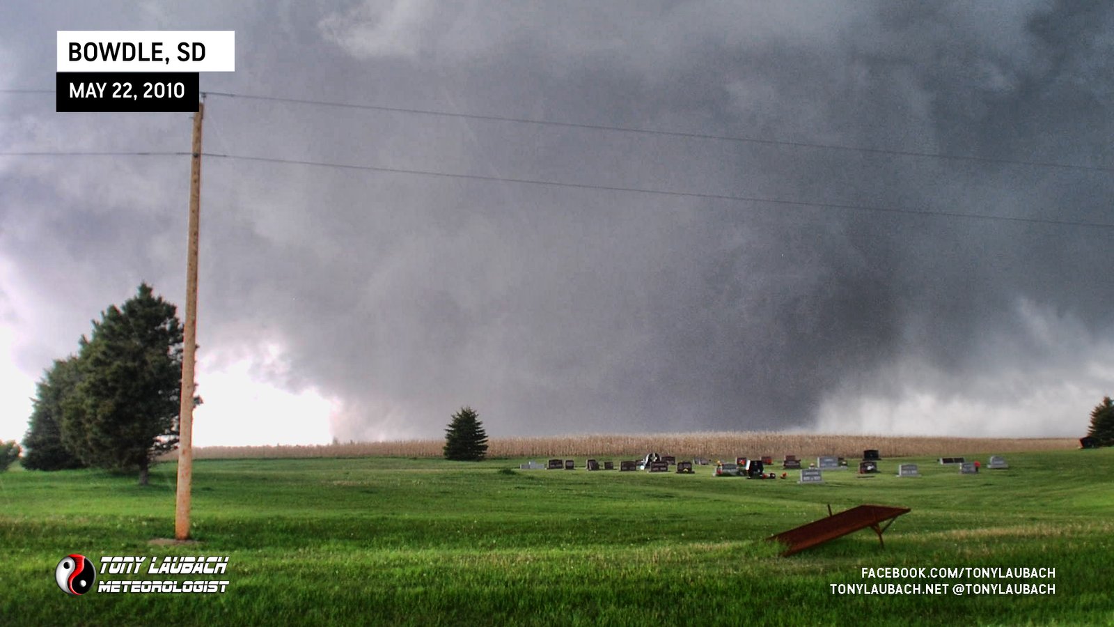
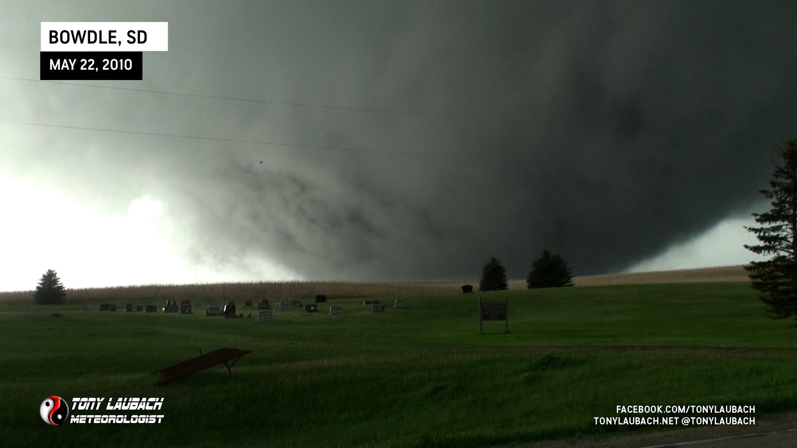
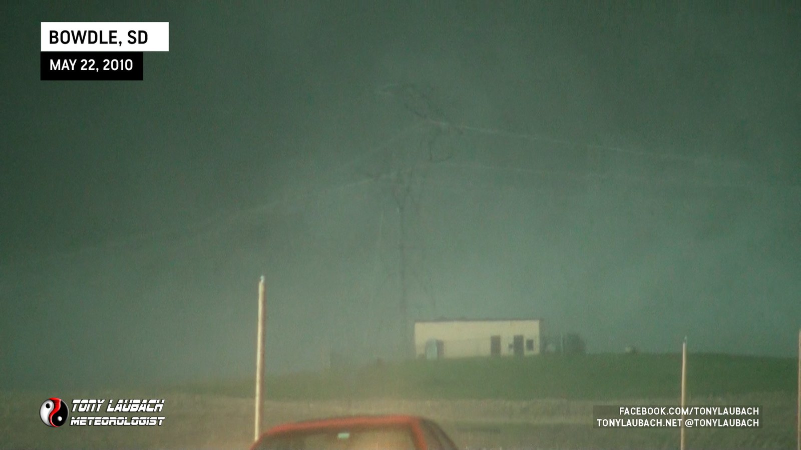
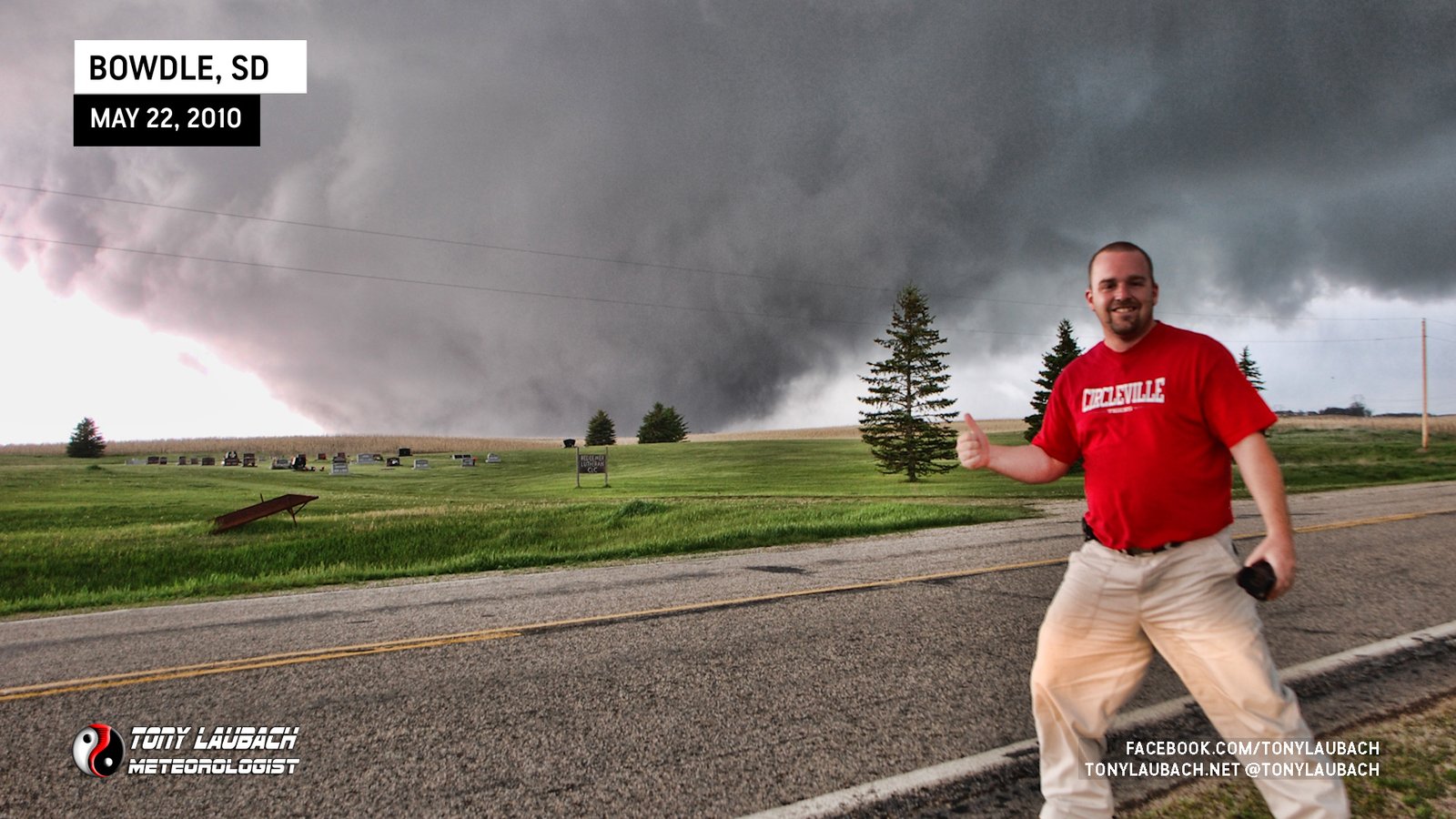
TORNADO #3 (BOWDLE, SOUTH DAKOTA)
Eastbound on US-12, back on pavement (a huge relief to those of us in our little FWD Cobalts). The tornado we were watching was out of sight and likely had lifted moments earlier. We had several miles east to go before we would get back in view of the area of rotation, but radar indicated this storm was not going anywhere anytime soon, so we knew it was just a matter of miles before we cleared enough of the precip to get our view back. That would happen about 4 miles down the road as we approached the junction of SD-47 South.


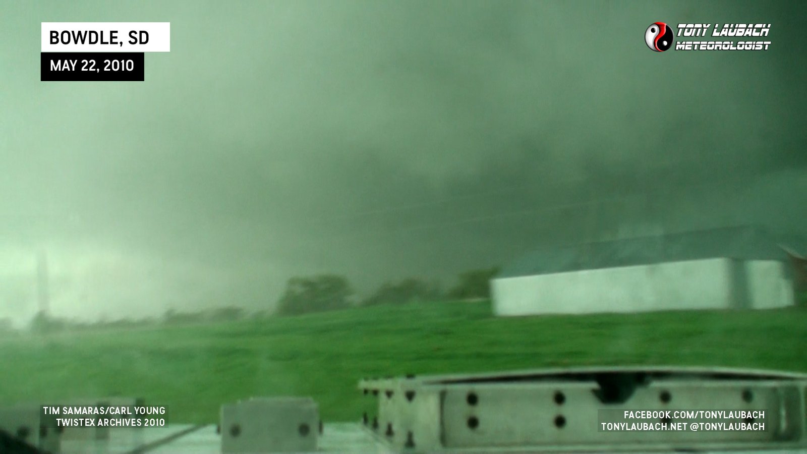
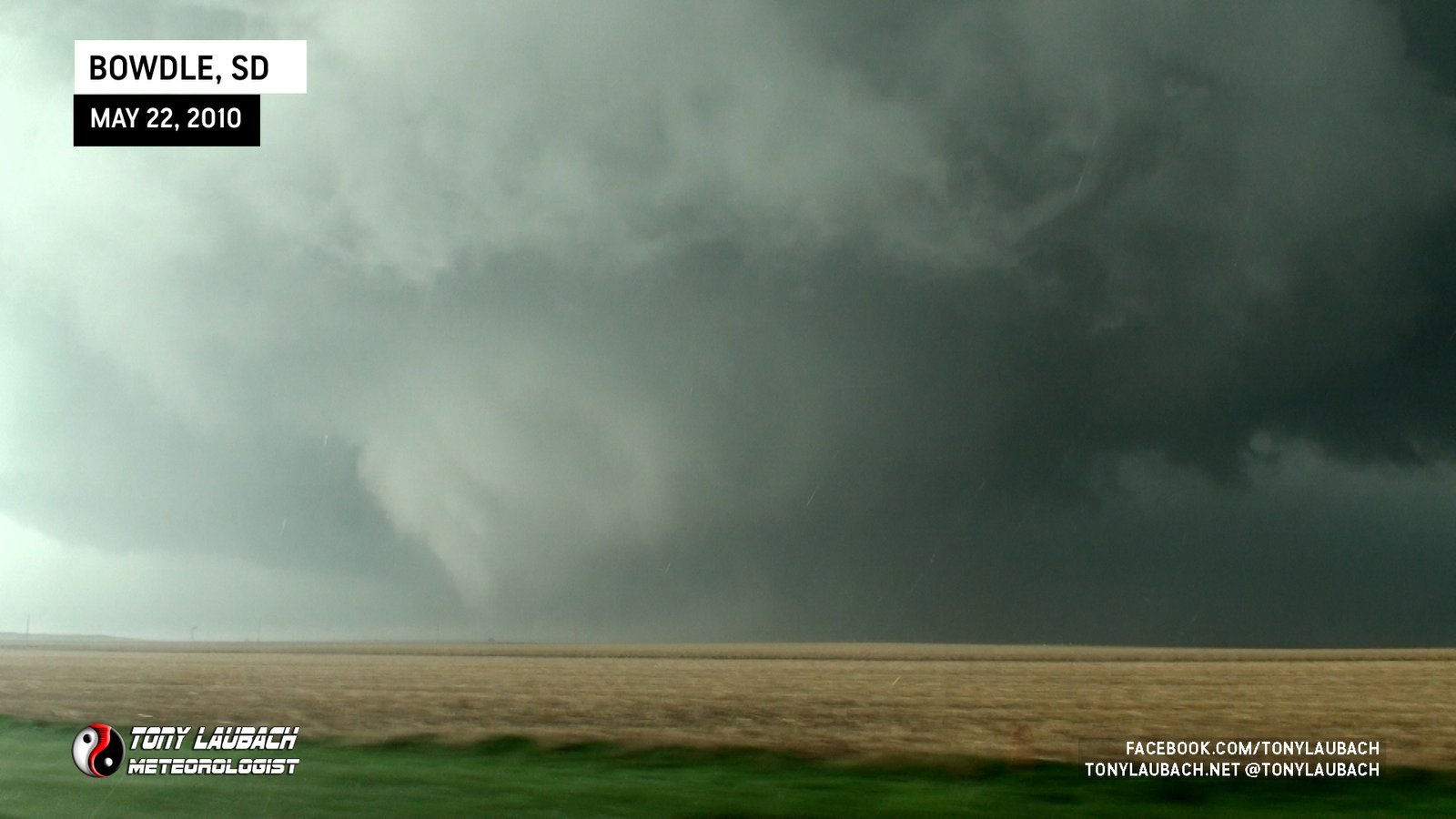
It took us a minute to determine that we indeed were looking at a new tornado, as only our cameras were able to show us that with us still battling views through the precip. But as we cleared the southbound SD-47 intersection, it became apparent we were watching the birth of a monster.


The inflow from the south into this thing was unreal, it was is if the developing tornado was pulling the entire sky in behind it as it crossed US-12. It quickly crossed the highway in front of us, which sparked some concern over debris possibly blocking our eastward advance. All the while the tornado continued to strengthen north of US-12 heading for Bowdle.

Meanwhile, a few miles east of us, our TWISTEX Probe Vehicle with Tim and Carl had deployed the Tower Probe, complete with the new data logger Tim installed that morning. We were unaware of this taking place as we were eastbound as there was no mention over the radio of a pending deployment of this instrument.
As we were in pursuit and after they turned back west to head back to the probe, Tim announced over the radio that they had successfully deployed the tower probe into the tornado. This was met with screams and cheers from all vehicles, including ours as Ed and I knew immediately this meant our efforts and frustrations the previous day to retrieve the replacement logger just paid off in the ultimate way.
It wasn’t too long after this announcement when Ed and I observed smoke streaming across the road. It wasn’t immediately obvious to us that this was the smoke released from the tower probe, but it didn’t take more than a second to realize what we were looking at.


We were super excited, and everything in passing looked as if it was functioning as it should and most of the instruments were in their respective places, meaning the tornado didn’t rip it to shreds when it passed over. We radioed up to Tim and Carl that we observed the instrument still standing and it looked visually intact. Seconds later, we saw them coming back at us down the road, to which we shared exclamations through open windows you could easily hear over the nearby tornado.

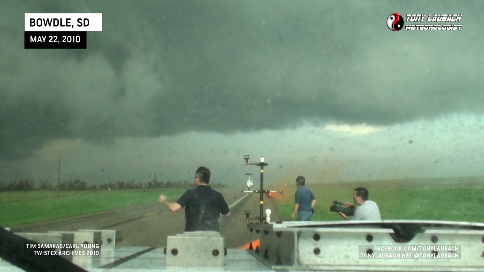
This all taking place in an area that was severely damaged as this tornado crossed US-12 and the probe.
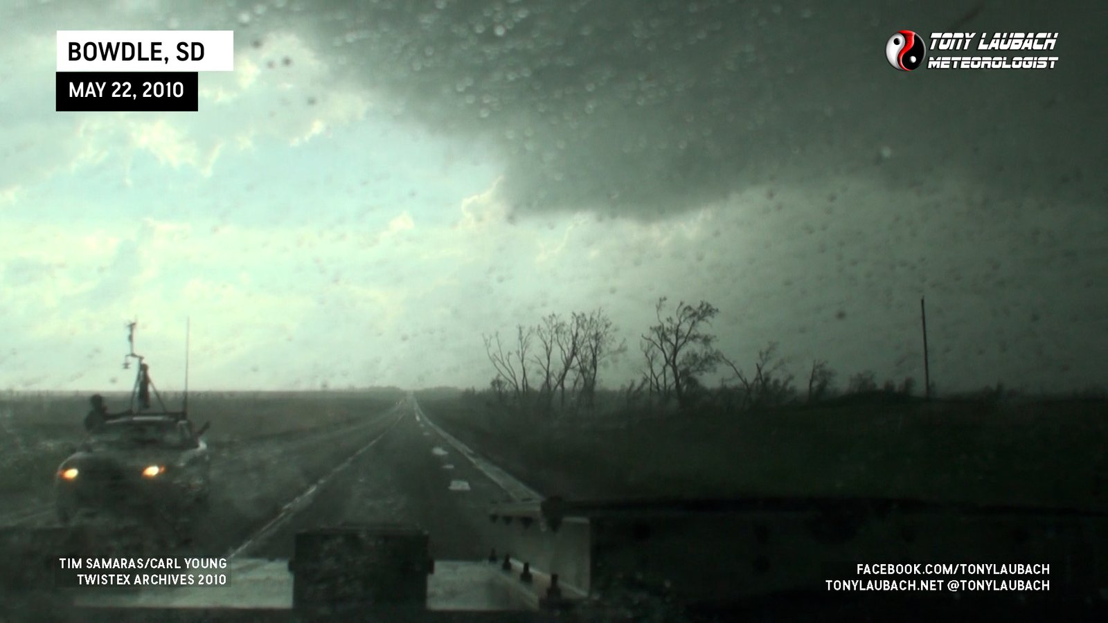
After our brief celebrations, we had to refocus on the tornado which was obviously gathering strength very quickly to our north. It was a no-brainer of what we were planning to do. Once we got to Bowdle, we were going to take SD-47 north passing the town to the east and get set up there as we were expecting this tornado to cross that highway. We kept a strong visual on the tornado as we got to its south and eventually ahead of the tornado as we approached down to make our northbound turn.

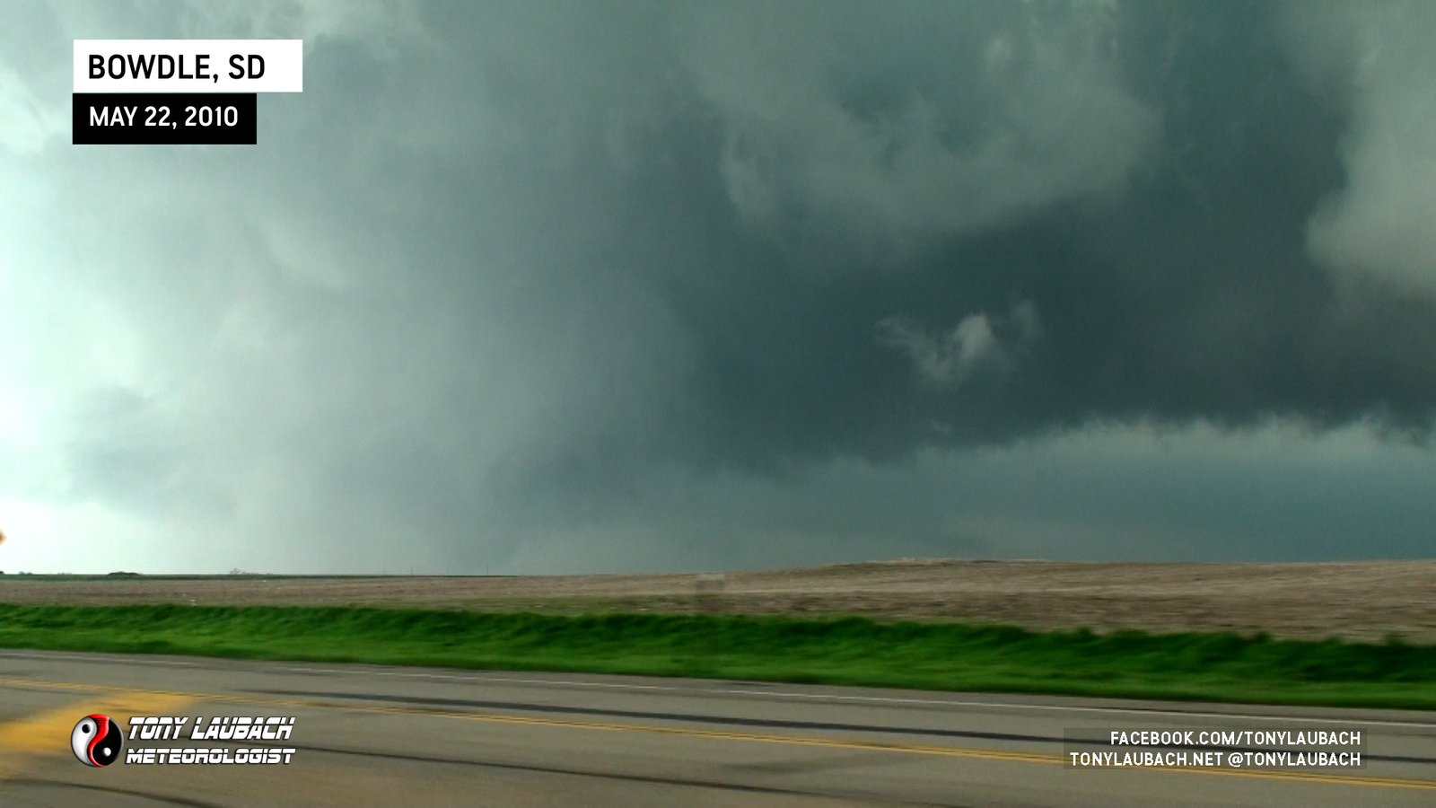
As planned, we hit SD-47, we turned north and followed by our lead mesonet vehicle who proceeded a couple miles north. We, in turn, went up passed the golf course, setting up about a mile and a half north of the US-12/SD-47 intersection on the northeast corner of town. The tornado, now a violent wedge, was well in view as we settled into our deployment spot across from the cemetery.

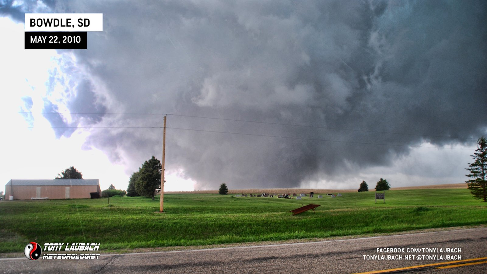
As we were sitting there, Tim and Carl in the probe vehicle had reacquired the tower probe and caught up with us, passing as the tornado was tearing away to our northwest. We had noticed the forward speed had significantly slowed down as there was very little movement from the spot we were watching it.

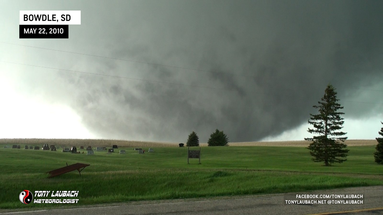
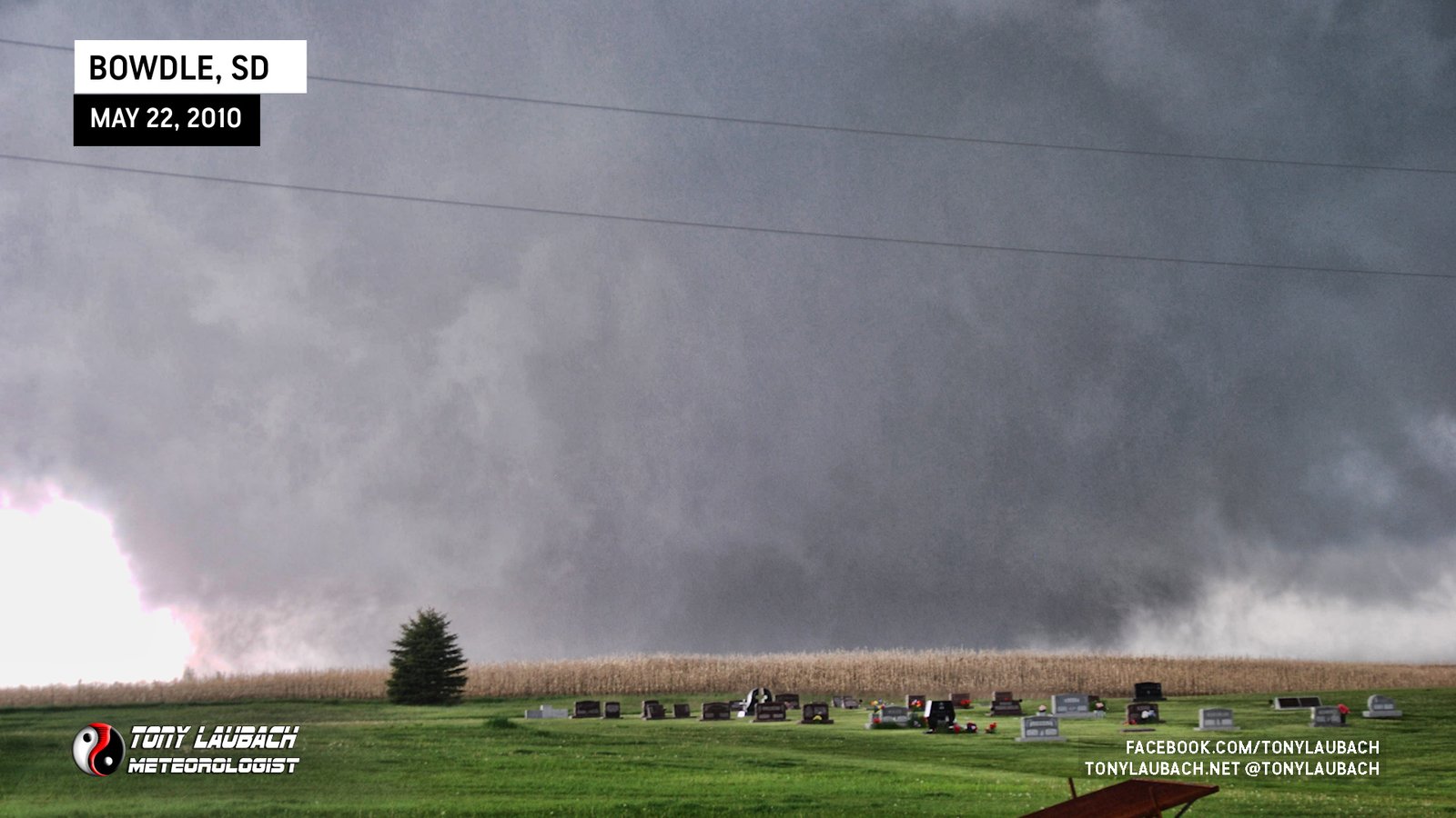
The RFD finally did get to us, blowing rain into the car, so we were forced back inside the vehicle and closed the windows. Still, the tornado was just going to town northwest of us.

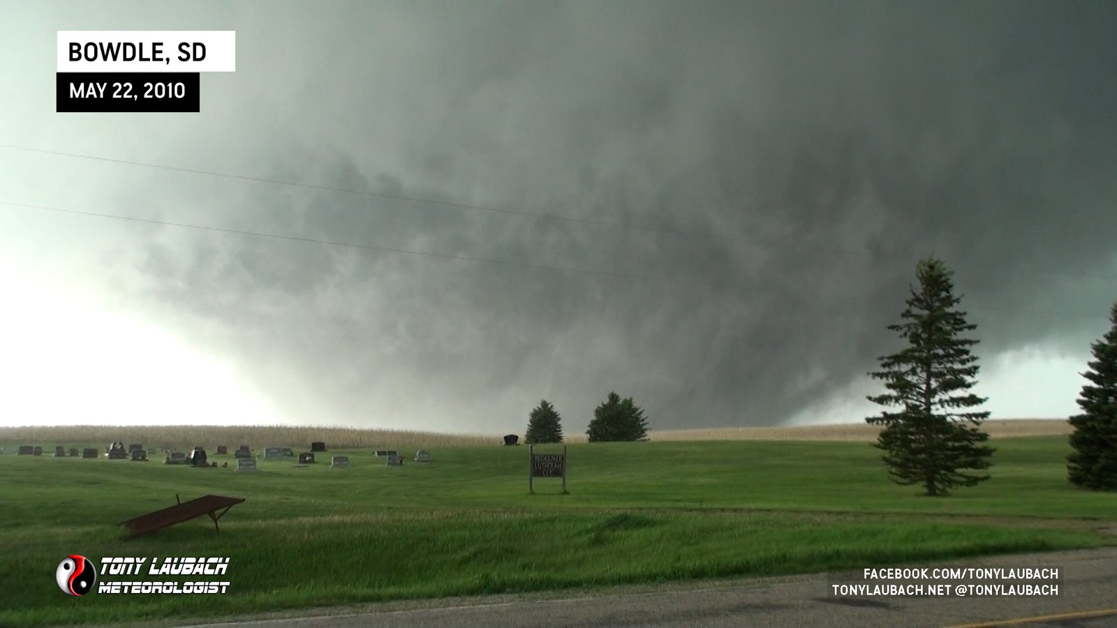
The RFD threatened to cut off our view as rain began to really whip in. The car was shaking pretty good, about as much as I can recall being in a car shaking in the wind like that. Gusts easily topping 60mph as the tornado CRAWLED closer and closer to SD-47 to our north.

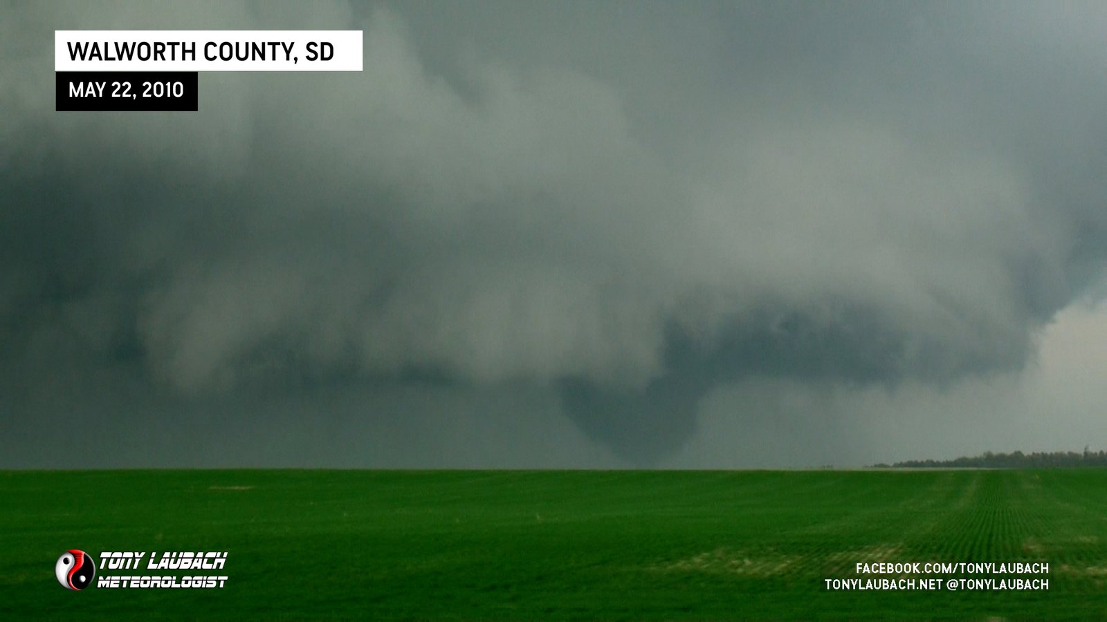
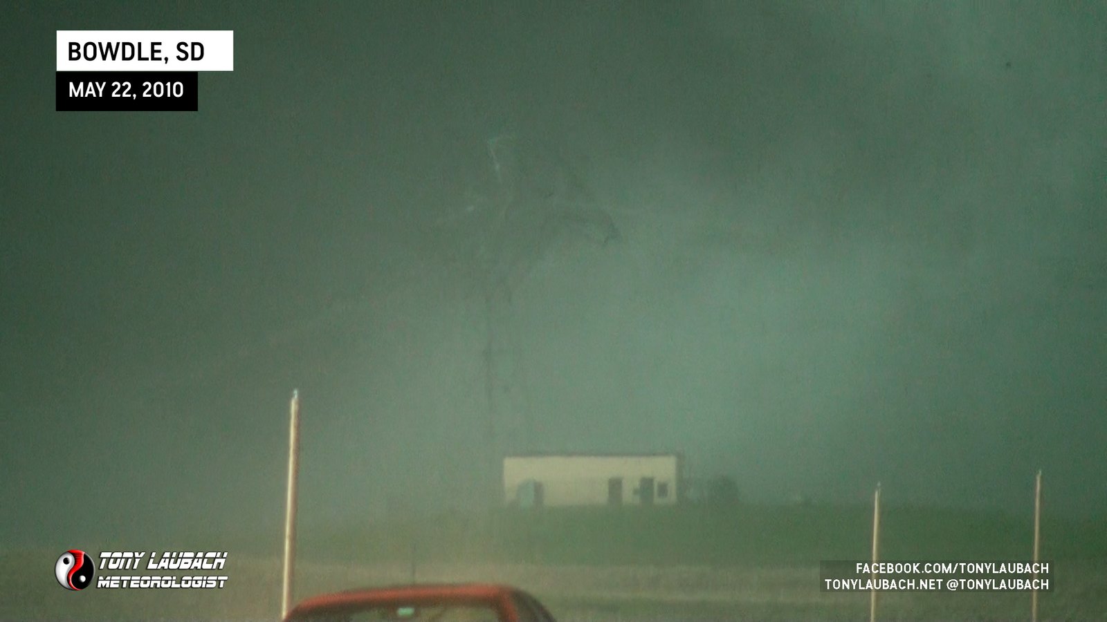
Fortunately, though, the rain kinda ceased, even as the RFD winds continued. Our view improved again, showing the tornado much closer now to SD-47.

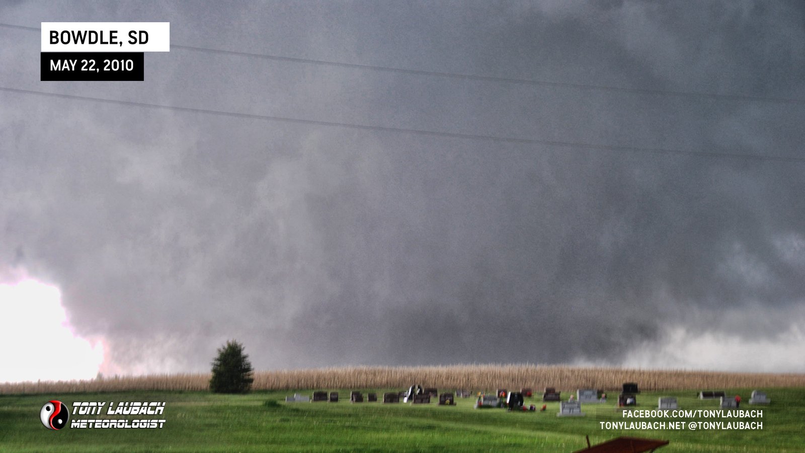
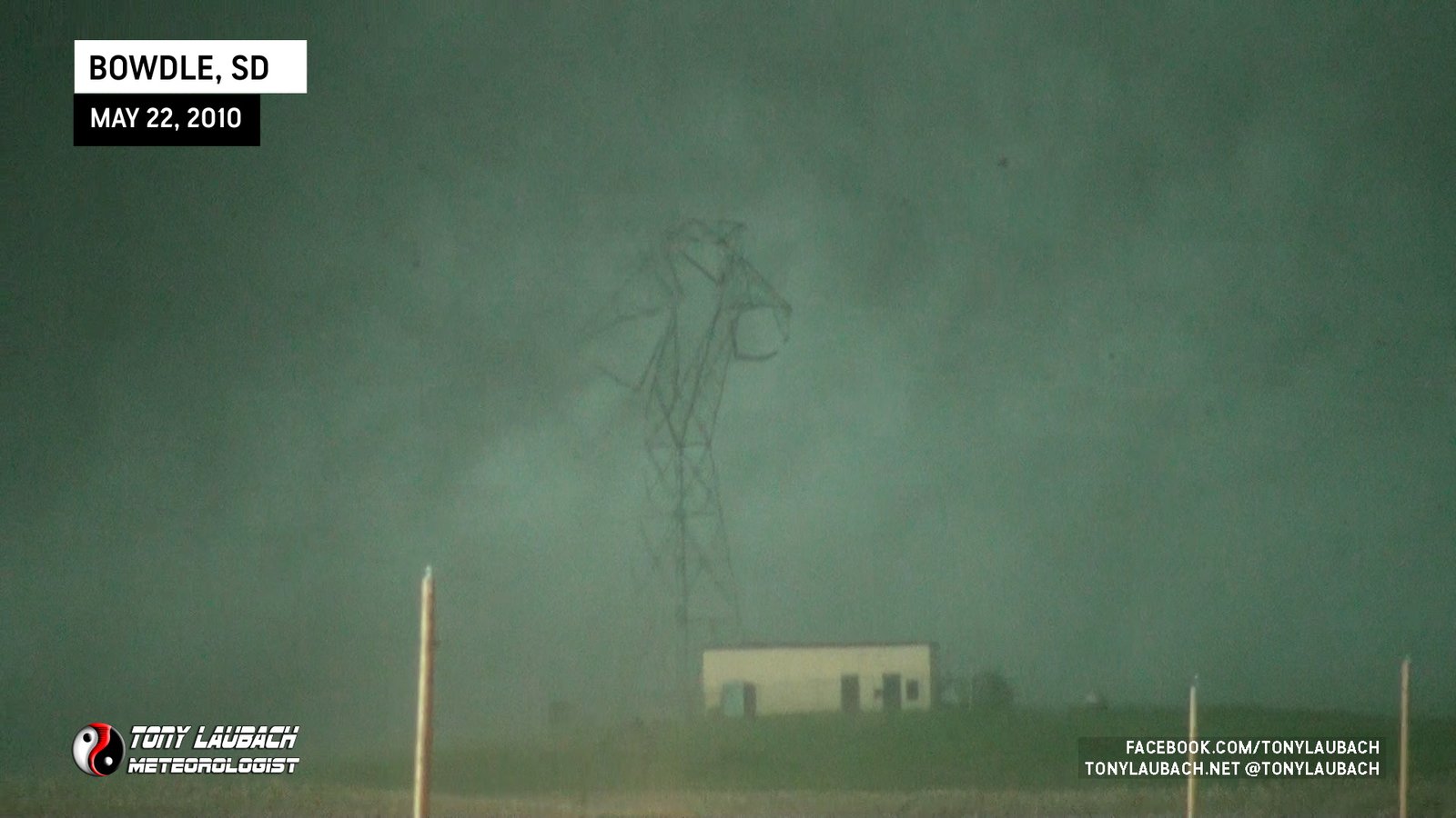
About this time, large transmission towers to our north started to come down. One which we had an eye on to our immediate north on the west side of the highway was being encroached upon by the tornado and would eventually topple over just as the tornado overtook the tower.
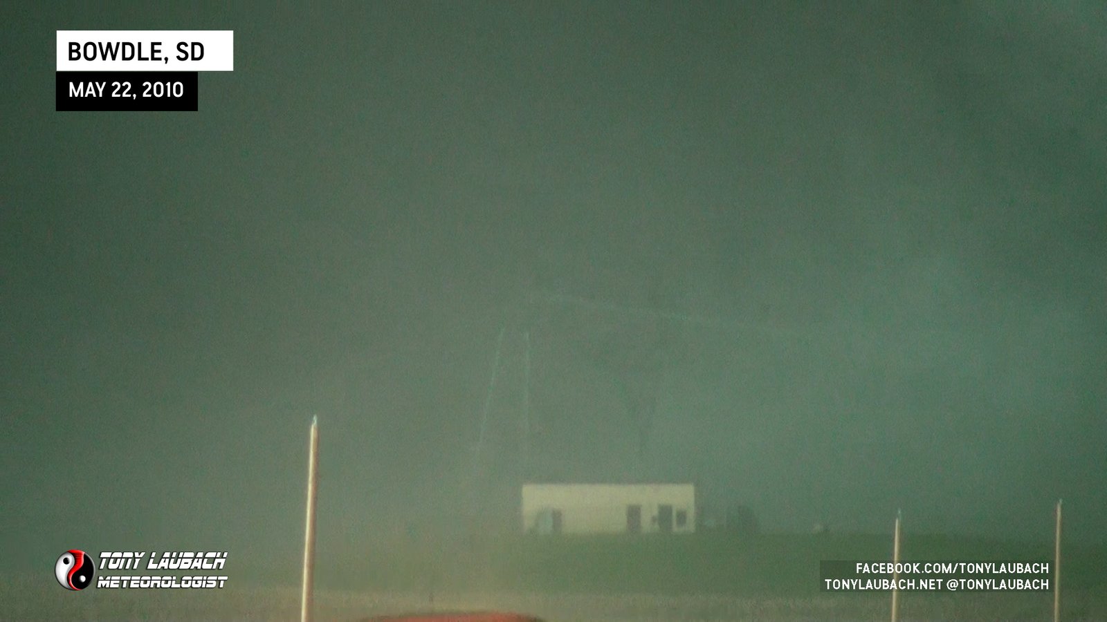
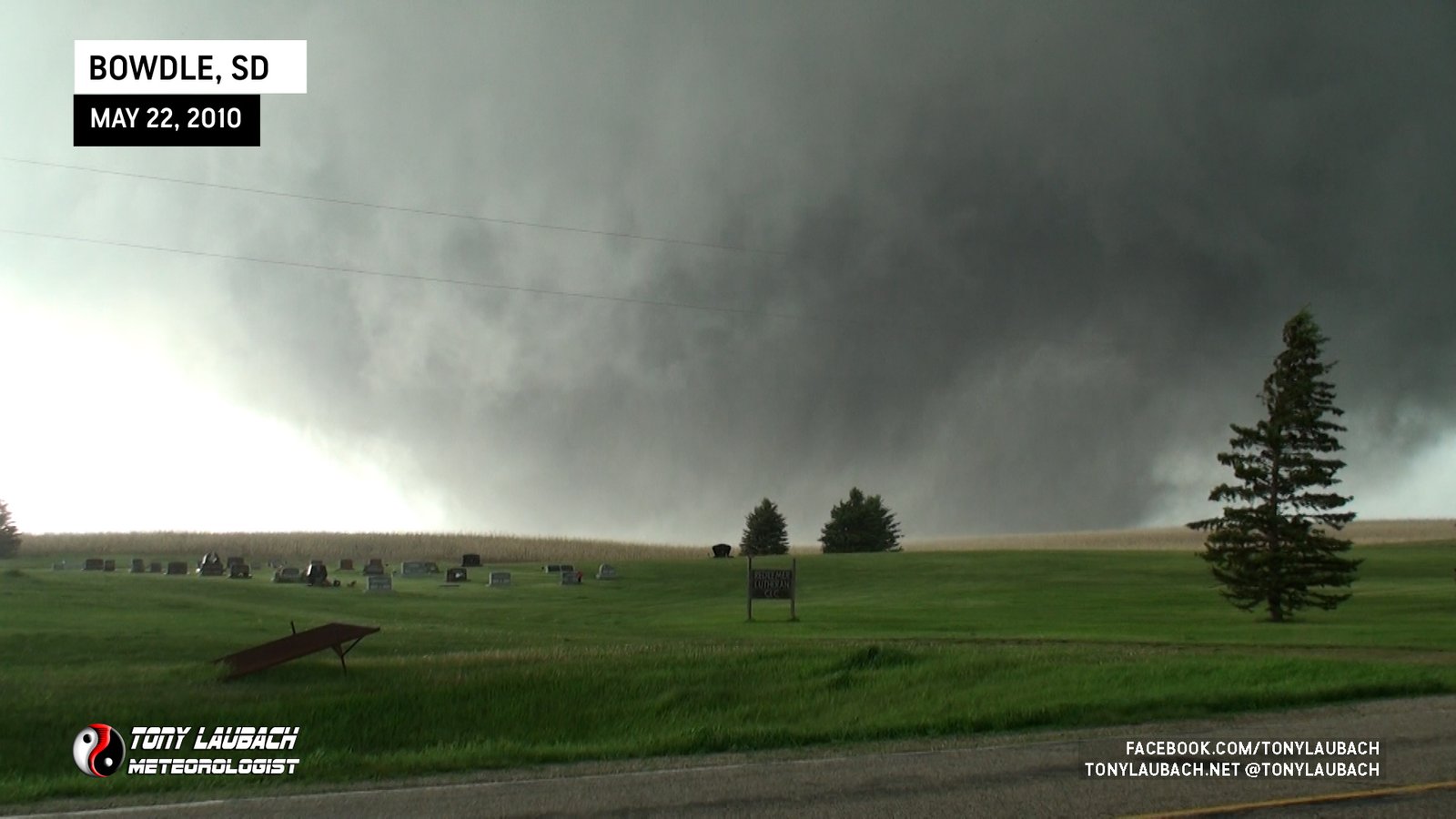
Another surge of rain in the RFD began to significantly reduce our view of the tornado as it approached the highway to our north. Occasional clearings would allow us view of the tornado as it was starting to shrink from the wedge it was.


With the tornado completely rain-wrapped and shrinking, we concluded the roping-out process had begun. Closer team members, M1 and probe, both lost sight of the tornado as it crossed the highway immediately to their north. Given we could not tell if the tornado was still in progress AND if it had completely cleared the road, we decided to get flipped south and then back eastbound on US-12 for our next opportunity.
TORNADO #4 (GRETNA, SOUTH DAKOTA)
We didn’t have to wait long for the next tornado. As we were discussing whether the Bowdle tornado was still going or not, a new meso to the northeast became apparent, and about 3 miles down the road, we observed our fourth tornado touch down to our northeast. We watched this tornado for several minutes as we approached Gretna from the west on US-12.
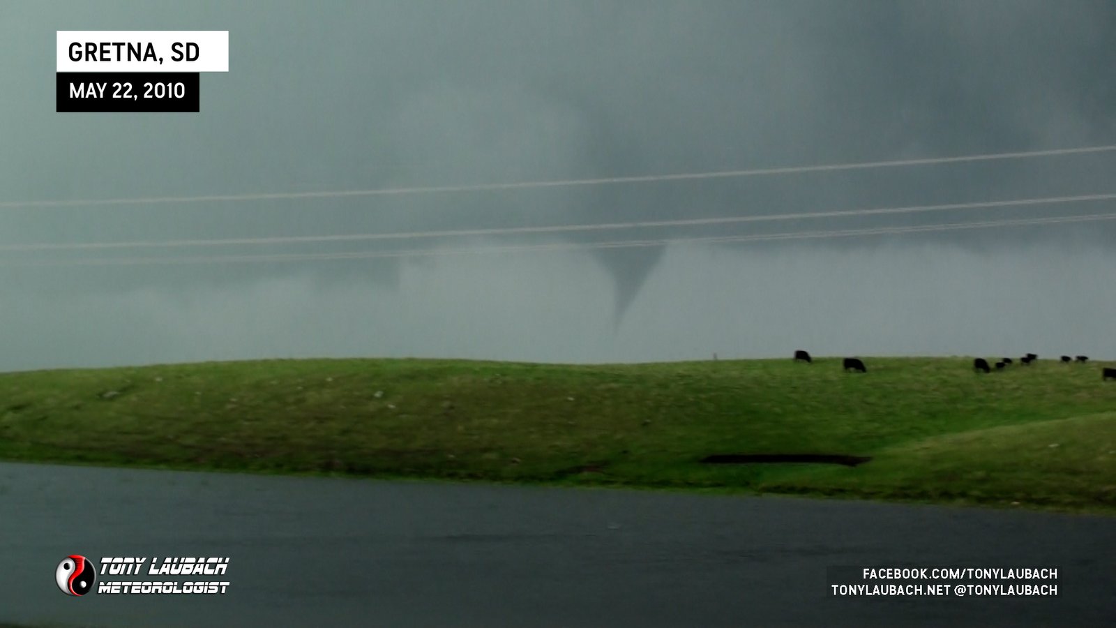
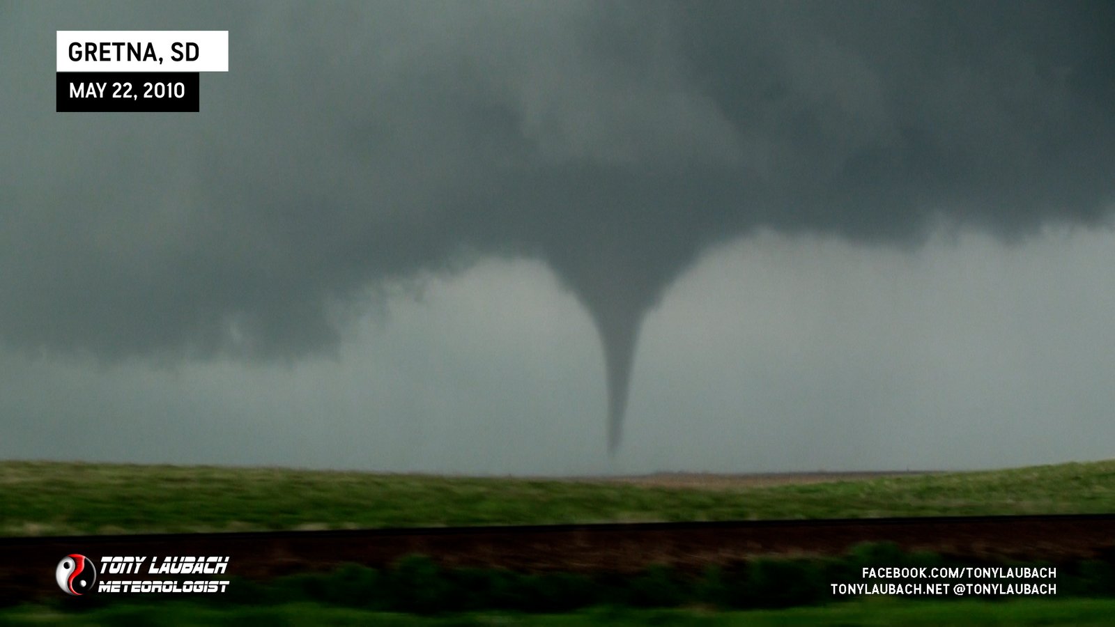
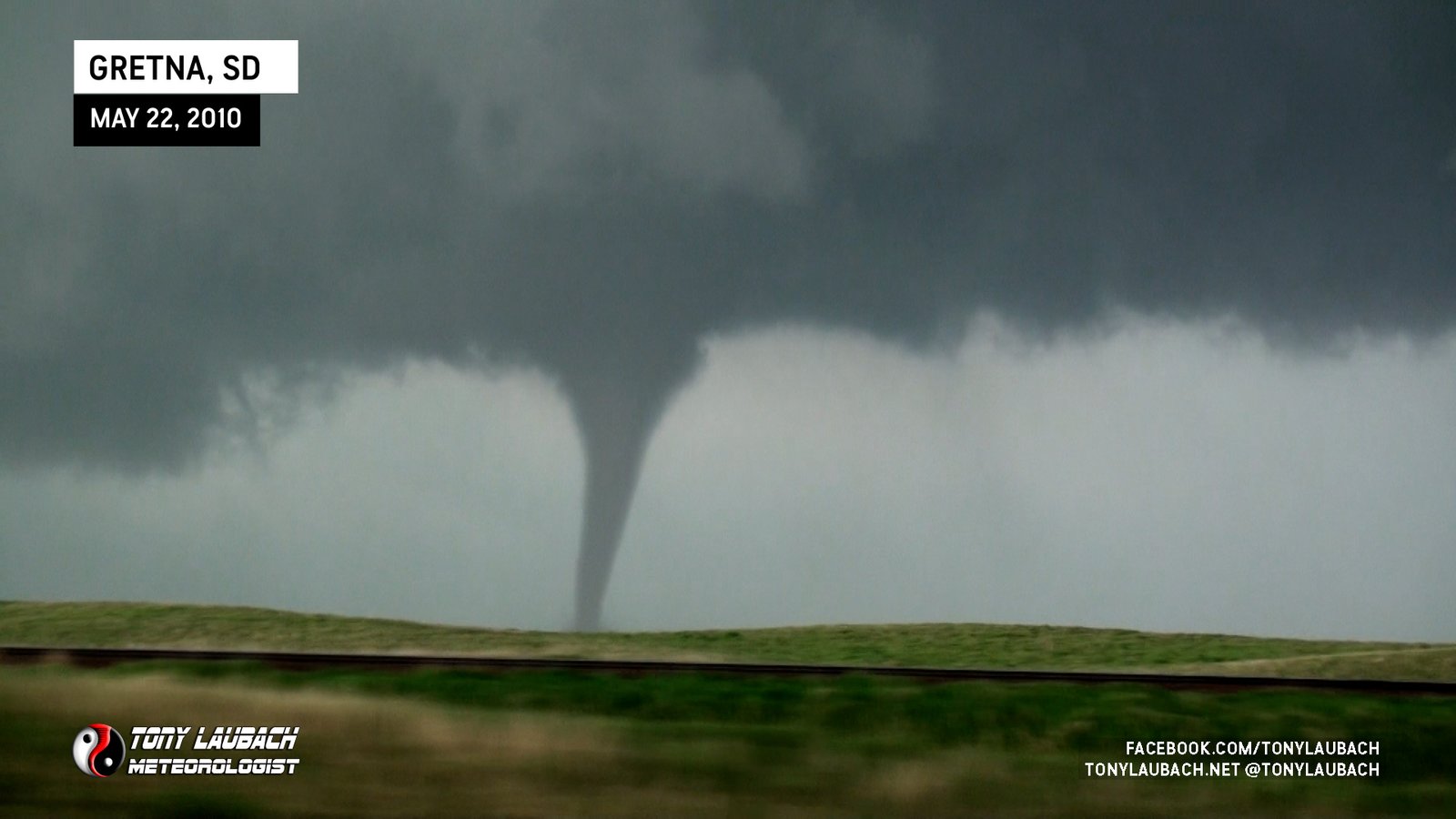
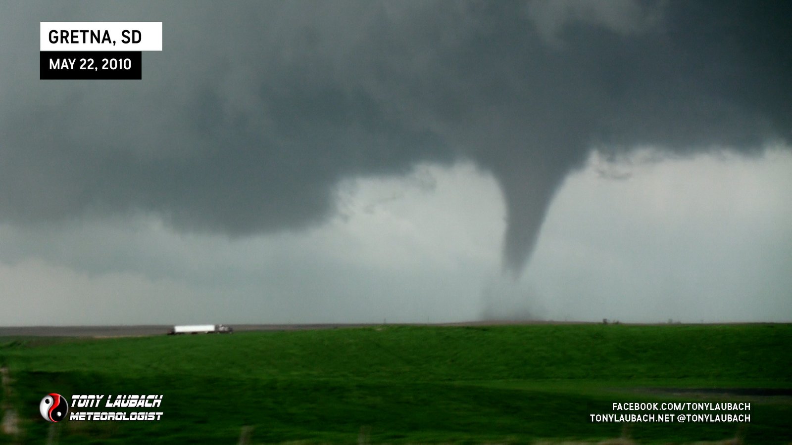
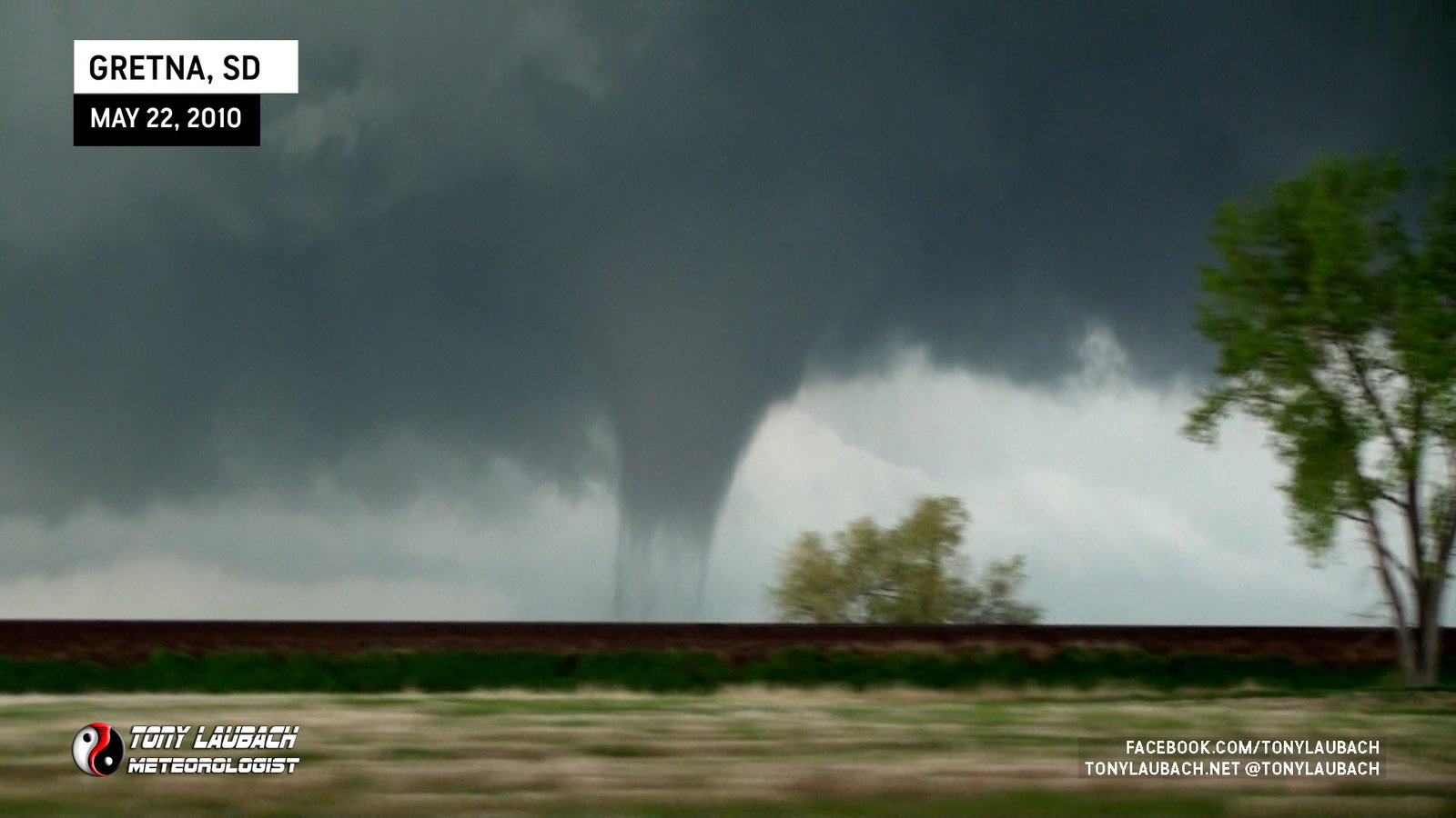
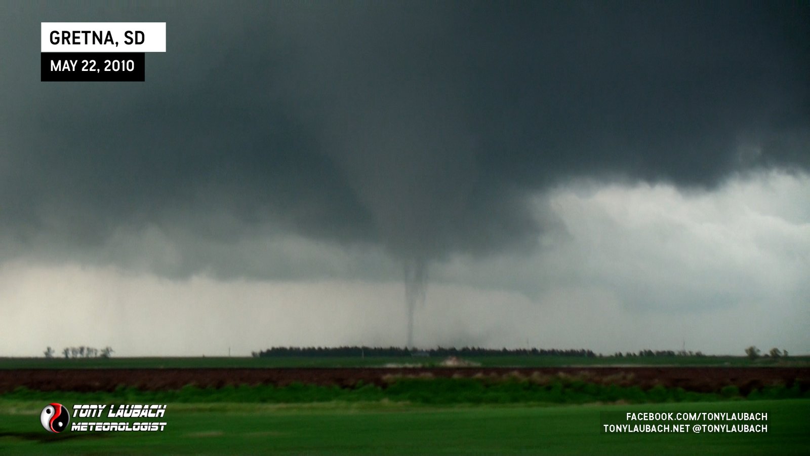
This tornado would lift shortly after we passed Gretna, and we continued east to set up for the next one.
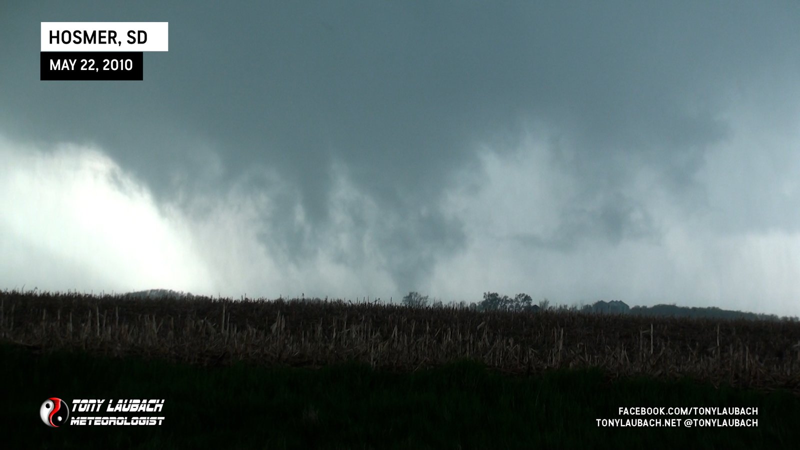
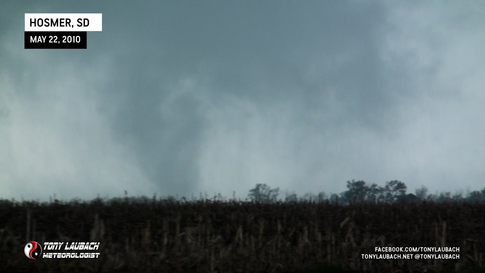
TORNADO #5 (SOUTH OF HOSMER, SOUTH DAKOTA)
When we reached SD-253, we turned north heading in the direction of Hosmer. The fourth tornado had lifted and a new area was rapidly developing in its wake.

This tornado wasn’t as quick to form, and as the RFD brought some rain around the tornado, it began to get tougher and tougher to see.

Of course, at max loss of visibility, that’s when this thing would finally touch down.
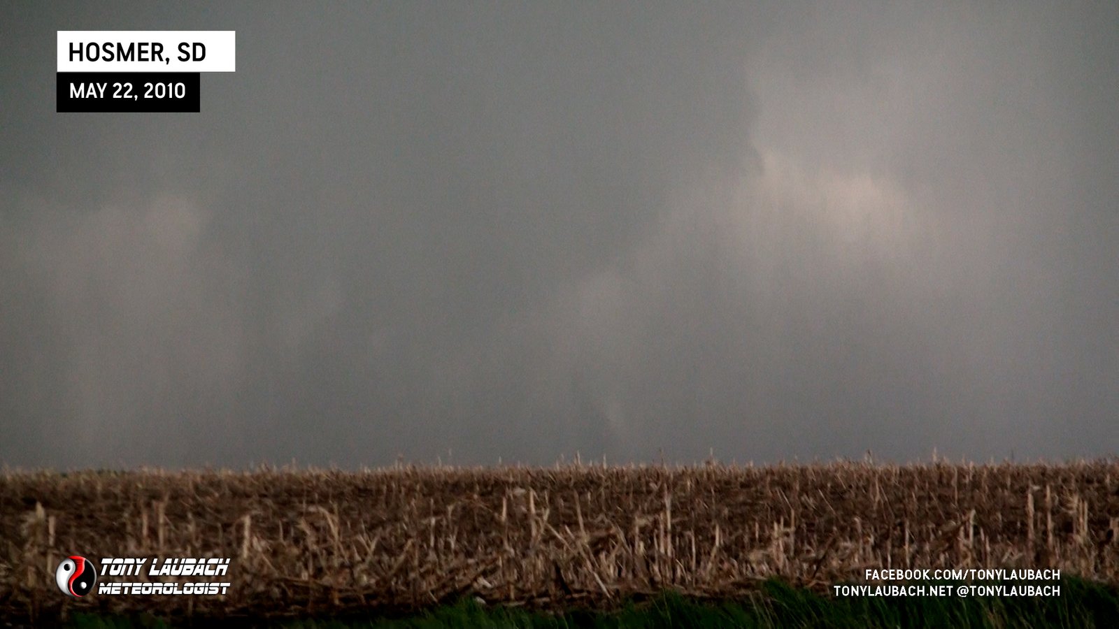
It wasn’t down long, enough where we could see darkened areas fully condensed to the ground, but as the rain started to clear, the tornado began to lift.

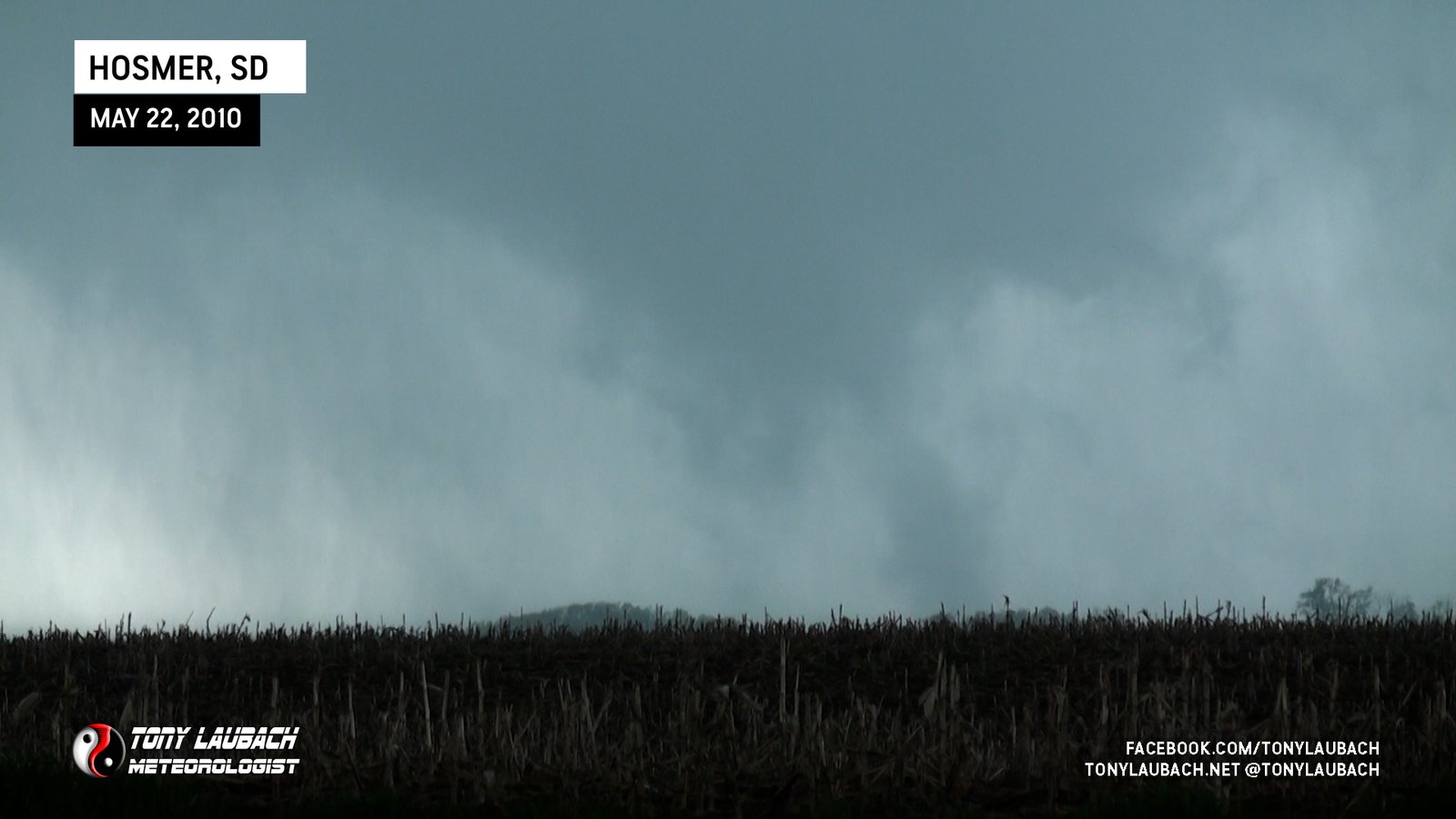
TORNADO #6 (ALSO SOUTH OF HOSMER, SOUTH DAKOTA)
A minute or so after that tornado lifted, a secondary area of circulation developed almost behind the initial Hosmer tornado, this one a little less organized, but more obvious with the ground contact.
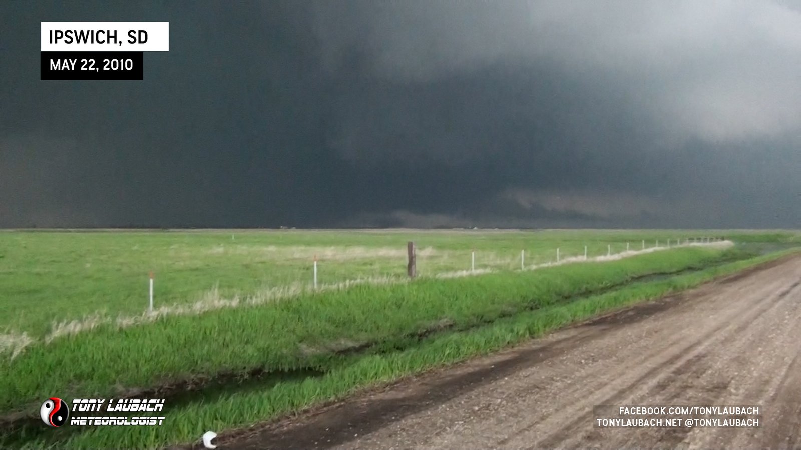
TORNADO #7 (IPSWICH, SOUTH DAKOTA)
We continued east, stopping near Roscoe to observe a suspicious area off to our northwest. Rain wrapping around with trees in front of it made it difficult to see if there was a tornado in progress, although there likely was. We were not able to obtain any visual that would confirm to us the tornado.

We passed the ‘town’ of Beebe eastbound on US-12 and with a lot going on to our northwest, we wanted to try and set up ahead of the storm. But it was moving so slow, we didn’t want to go all the way to Ipswich (which we were not 100% sure was paved anyway), so we opted to try 353rd Road north, which became immediately evident that it would not suffice for intercepting as it was somewhat well packed dirt that would likely go to a thick mud in any precip. We drove about half a mile north on the road and stopped as we continued to monitor the rain-wrapped area to our northwest.
As we were trying to see into the storm, obviously much further away than we should’ve been, Ed spotted a needle-nado that had emerged from the poor contrast of the low-light precip to our northwest. We radioed in the tornado report and watched it for a good 3 minutes before it roped out.
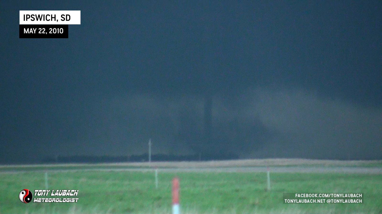
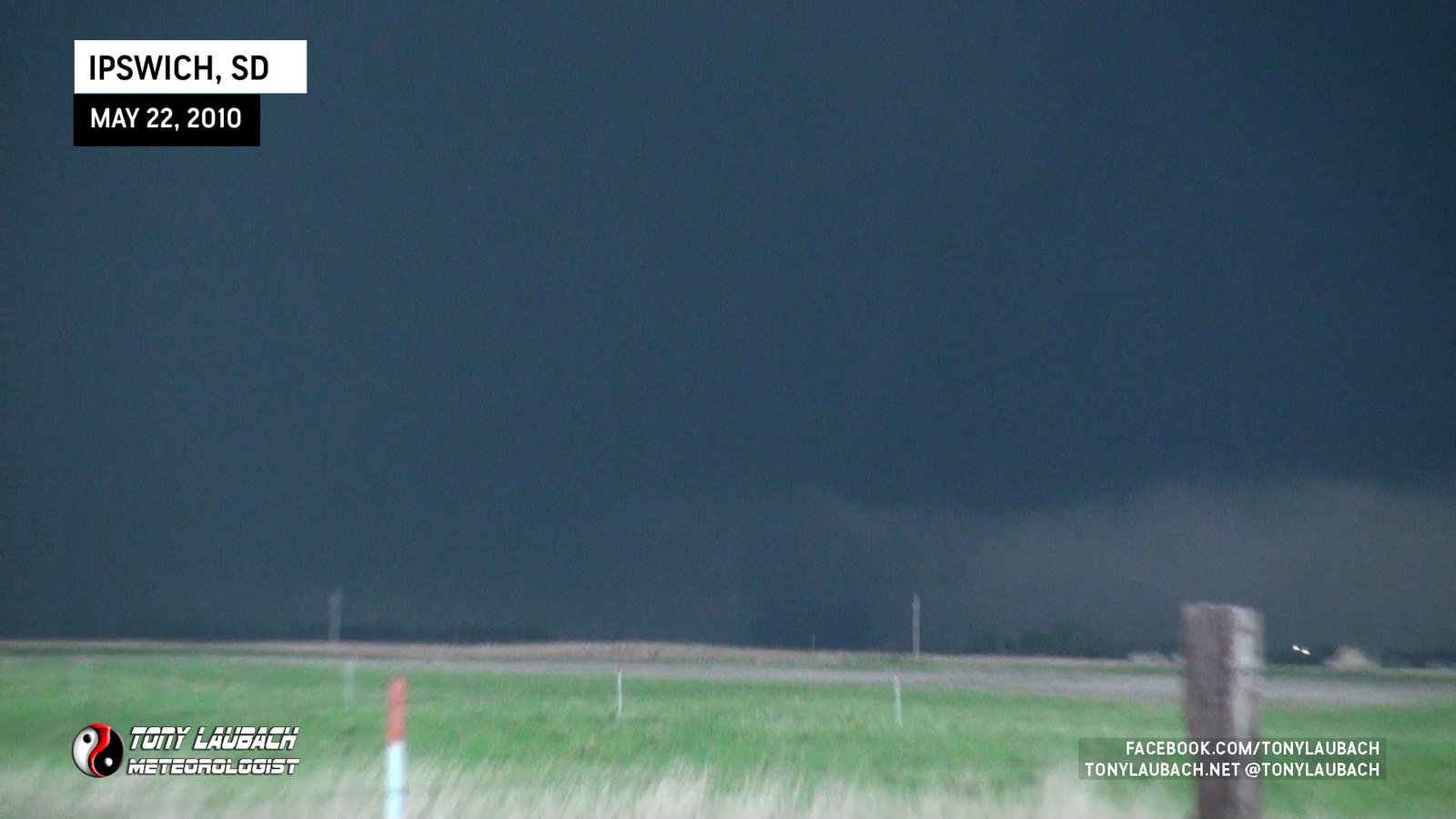

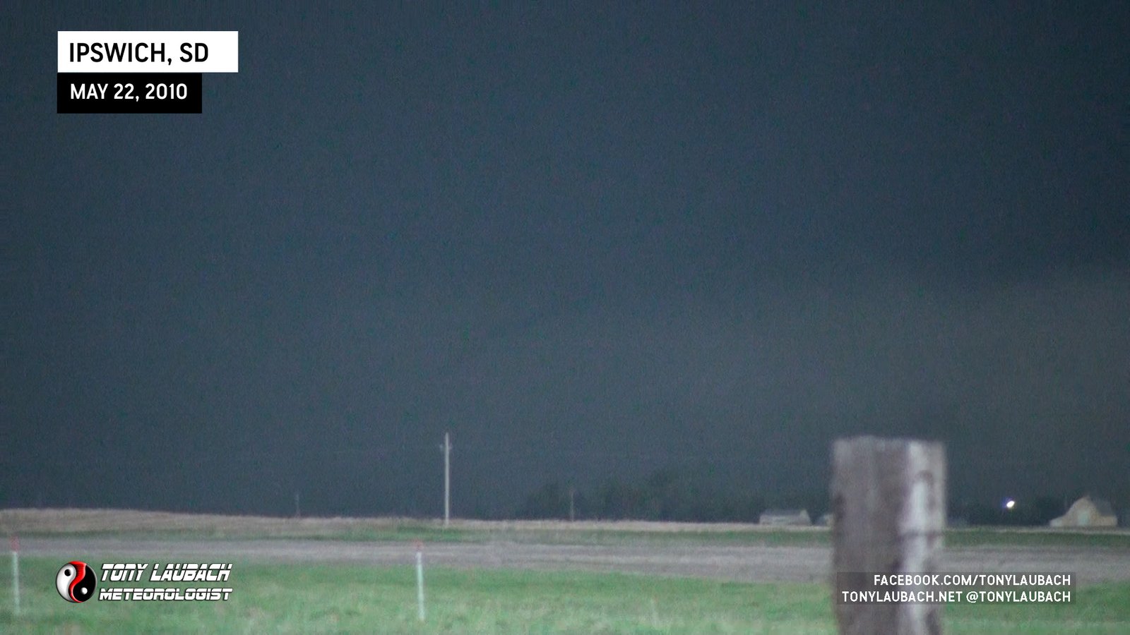
We assumed this to be a satellite of a larger tornado we couldn’t see. As mentioned, we had gotten pretty far ahead of the storm as paved road options were limited off US-12 and were not suitable for mesonet deployment. This tornado would ultimately be the last we would see.
END OF CHASE
Other cells had begun to form off to our south, and we were seeing a transition to more of a clustery line of storms as opposed to the isolated supercell we had been tracking for several hours. We stopped briefly at Craven Corner at the junction of US-12 and SD-45 North to observe an area that had some rotation back to the west, but never fully organized.

With the cluster becoming dominate, we decided to call it a chase, heading east to Aberdeen, South Dakota to regroup for the night and soak in the absolutely incredible day we had just experienced.
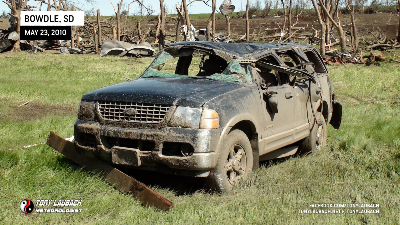
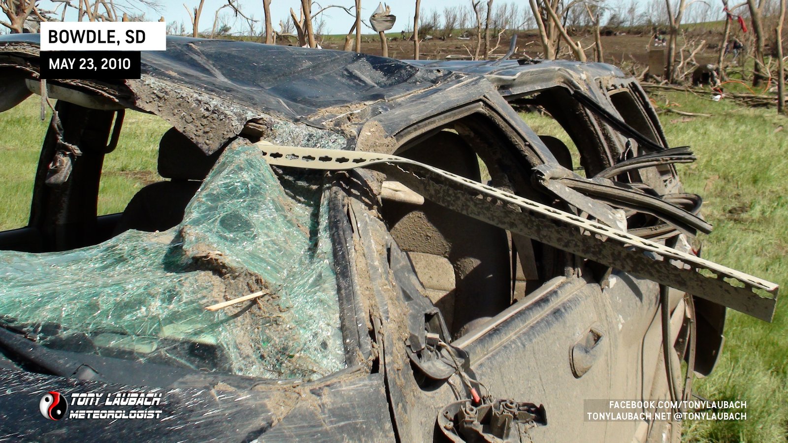
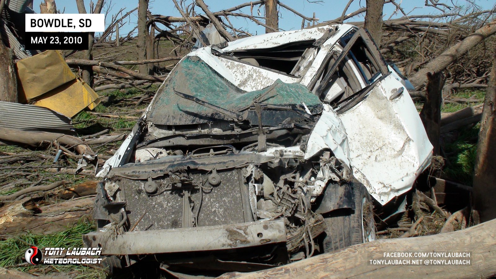
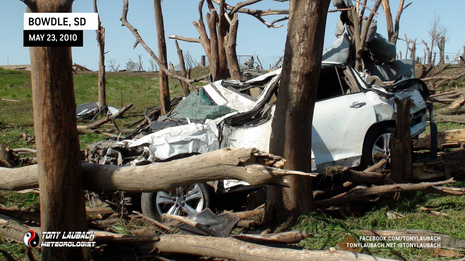
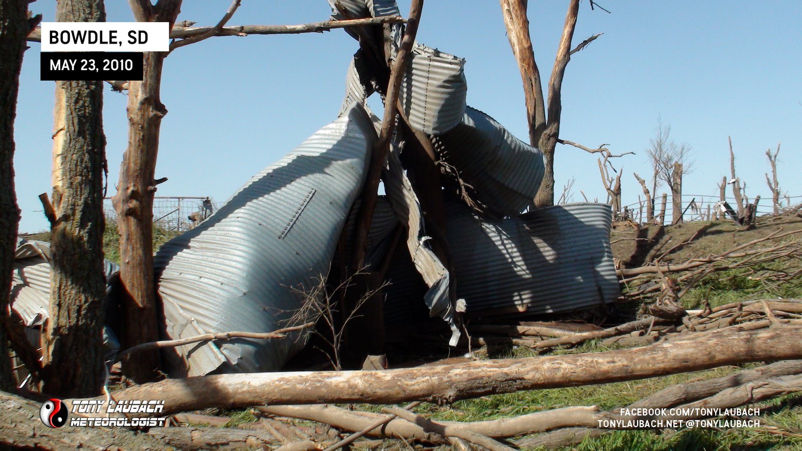
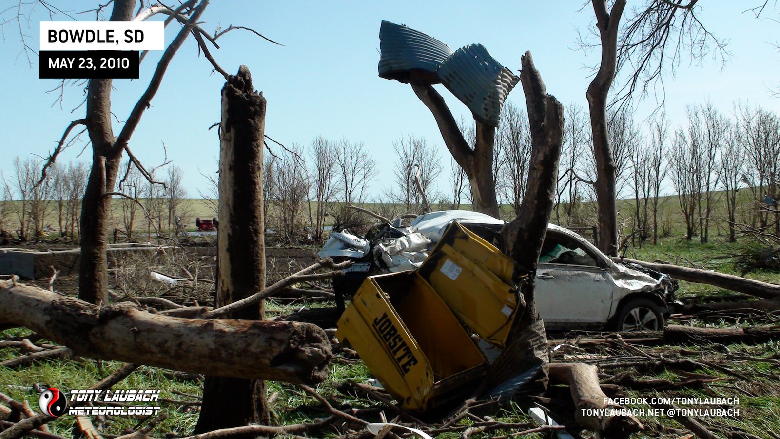
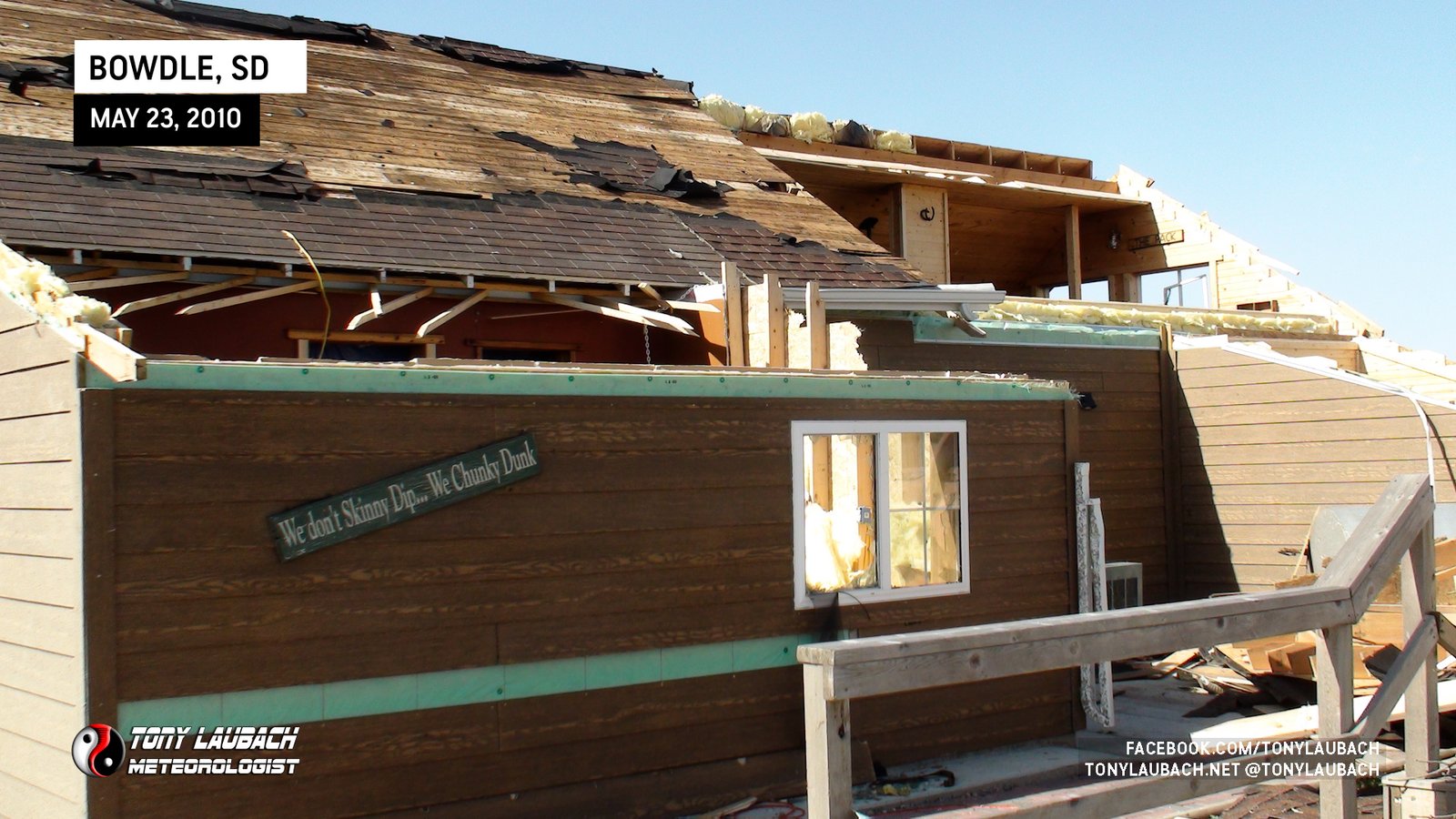
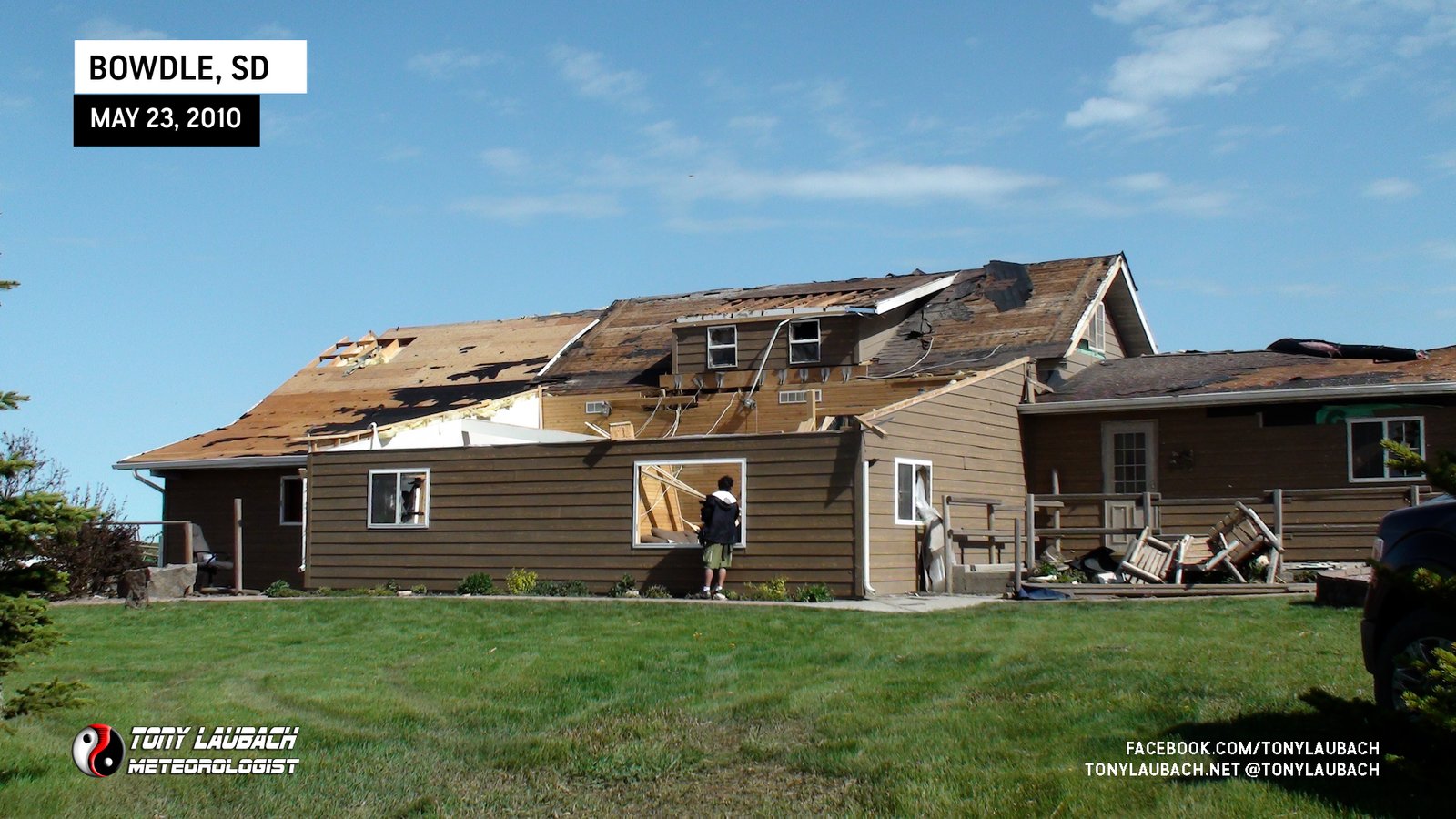
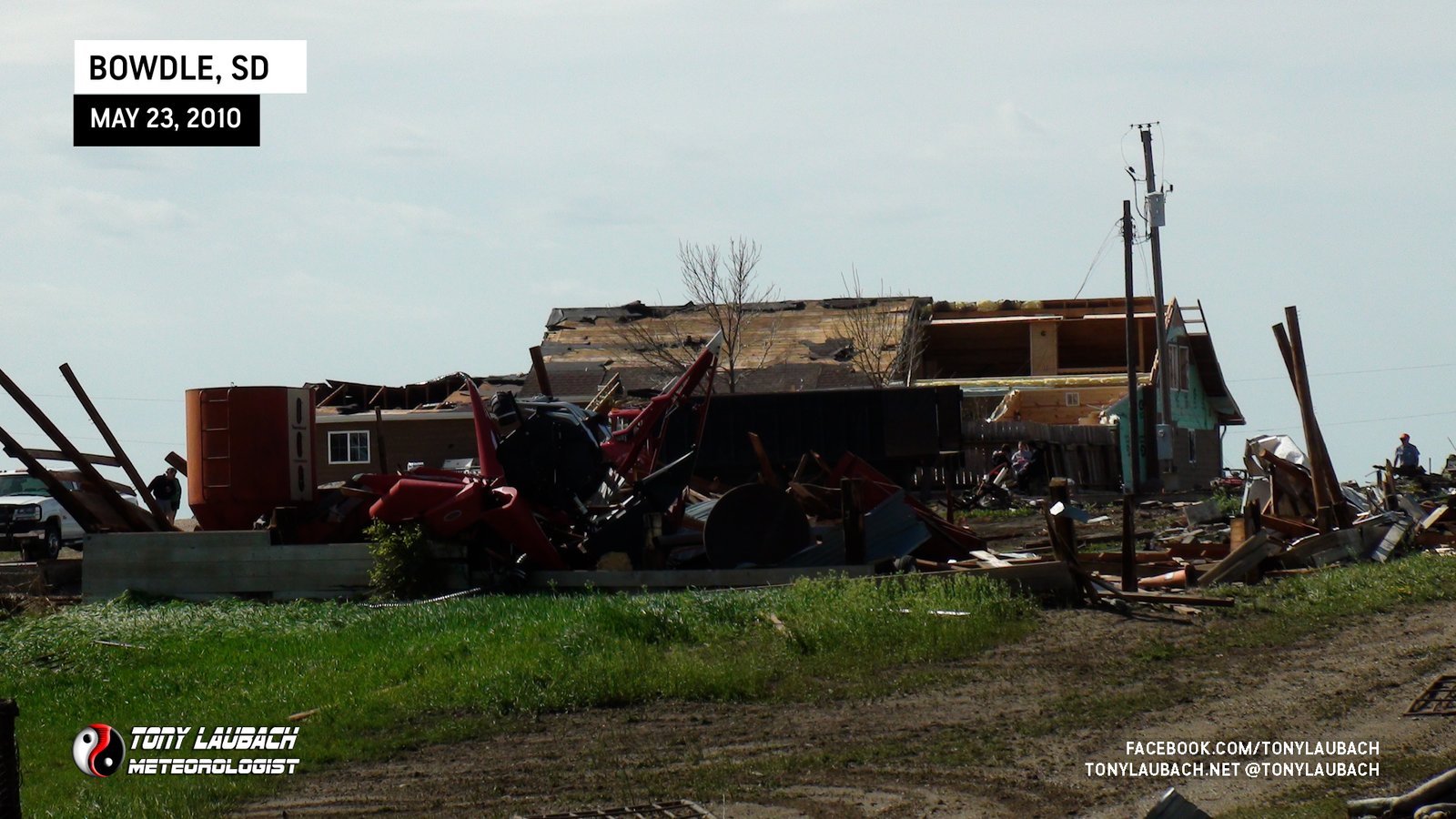
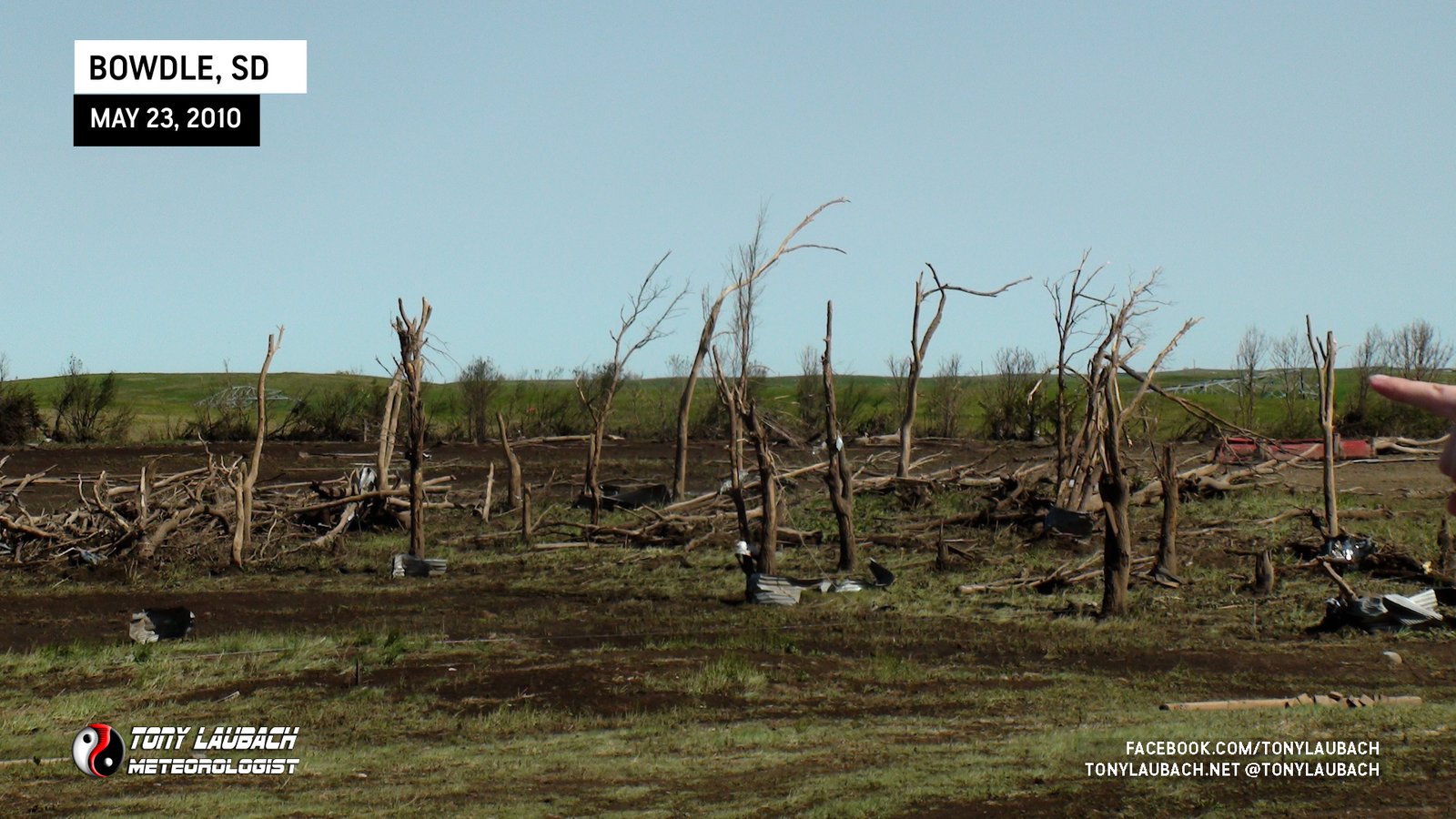
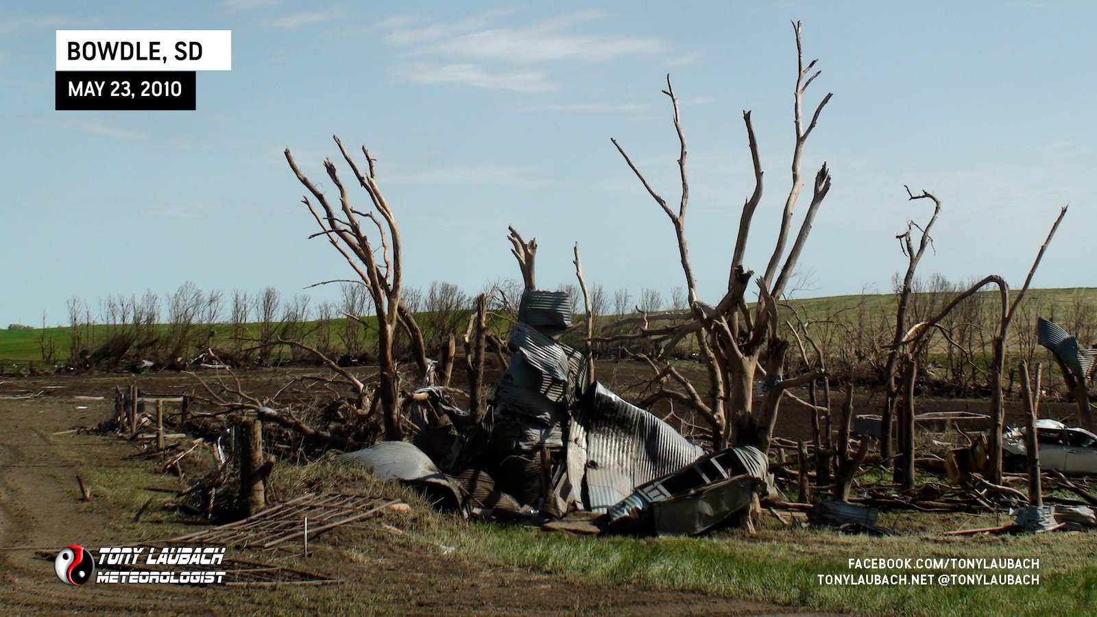
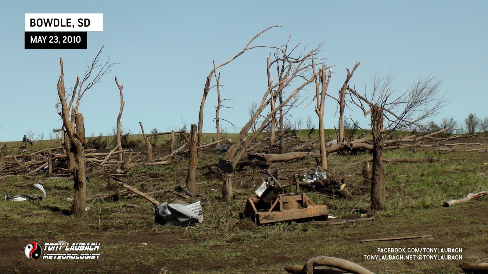
THE DAMAGE SURVEY (May 23)
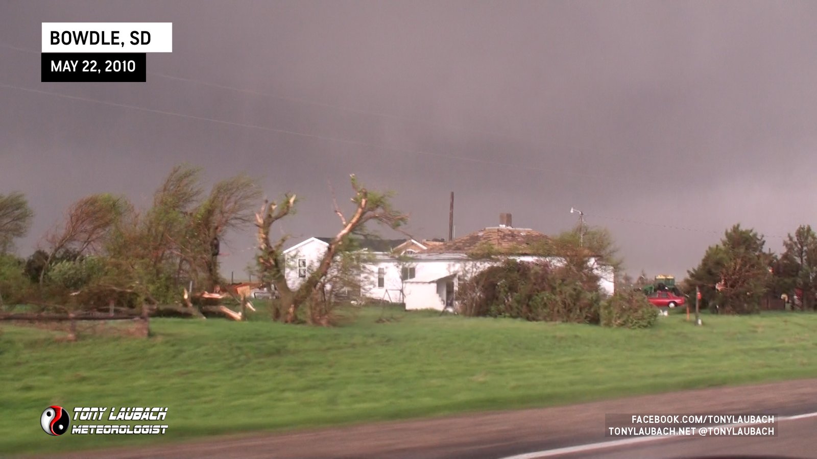
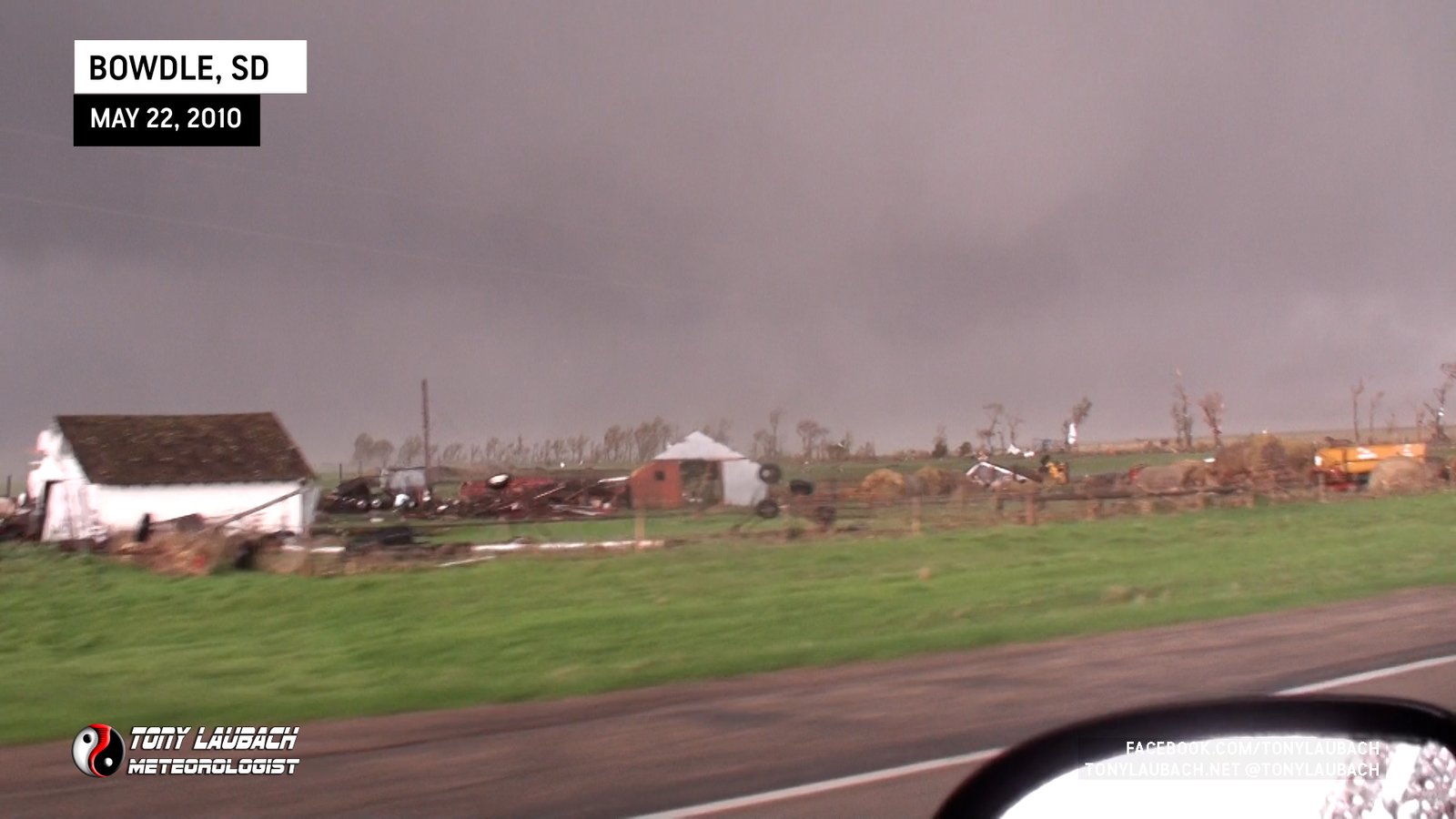
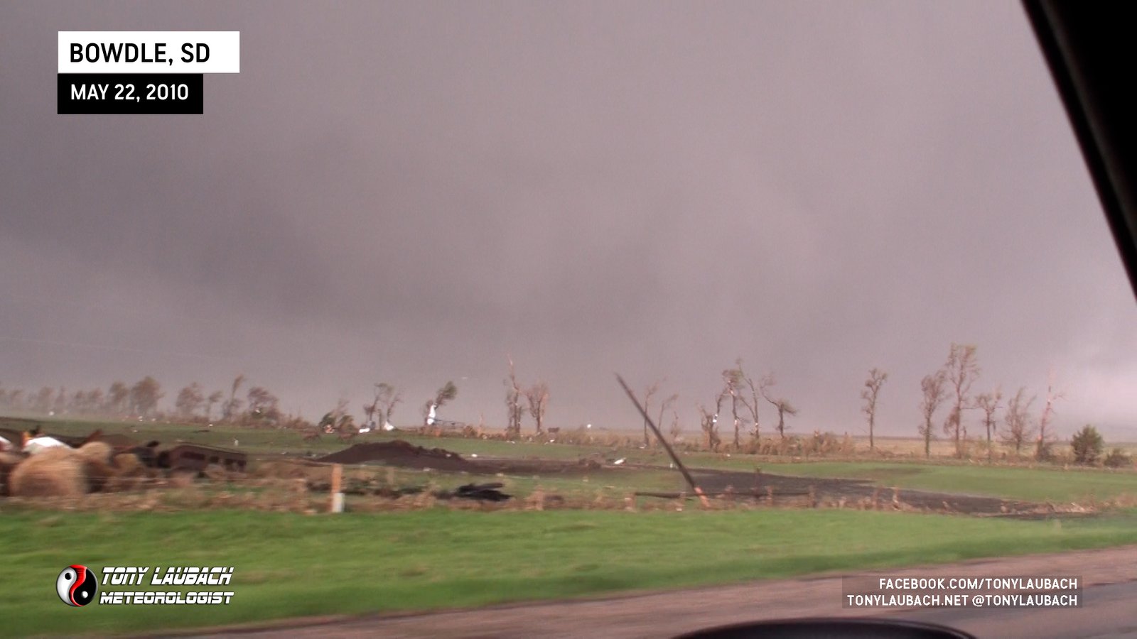
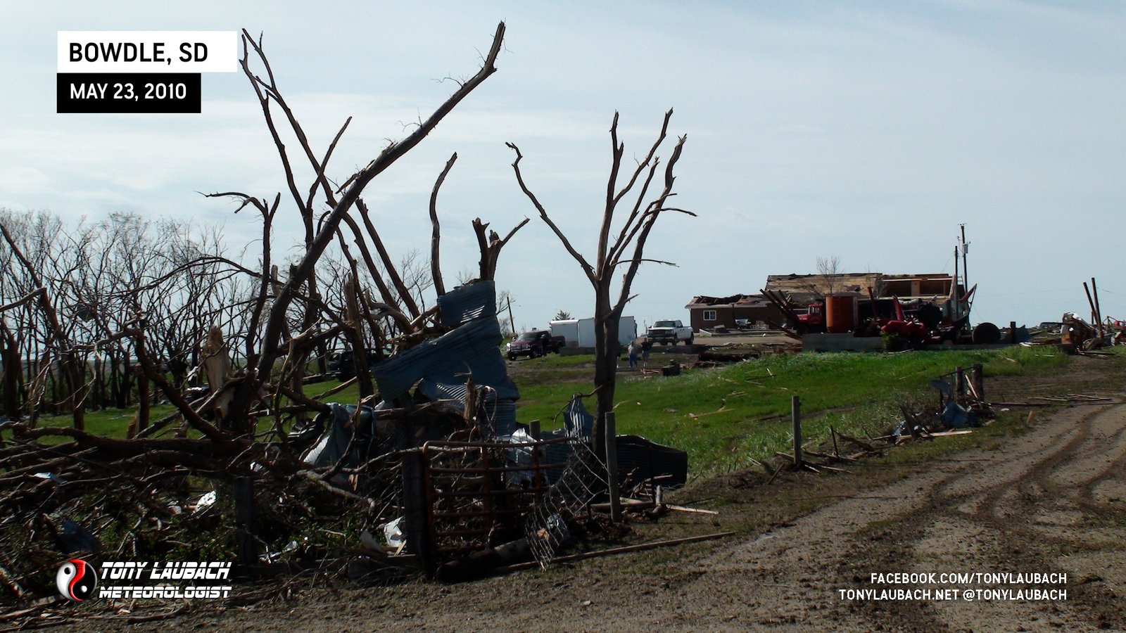
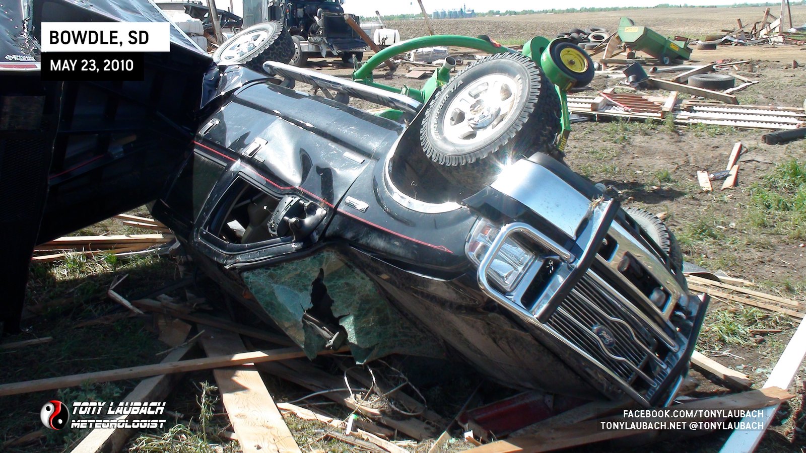
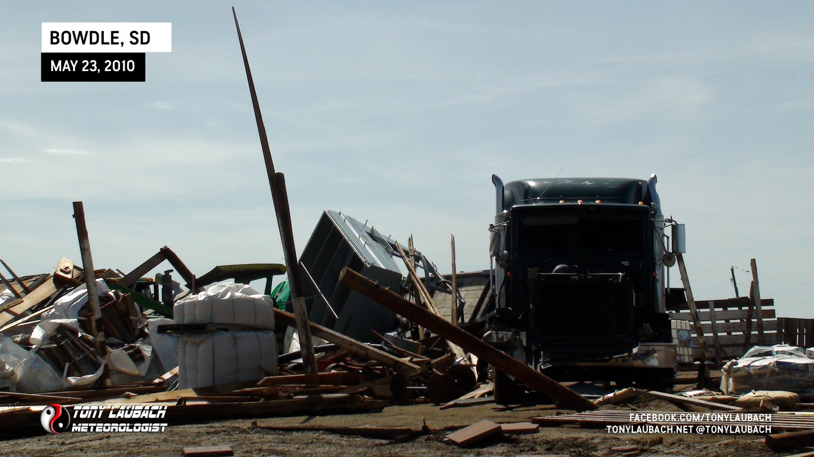
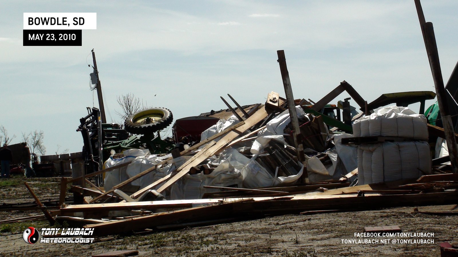
We joined the NWS Aberdeen office to take part in their damage survey of the Bowdle tornado; Discovery Channel was also along as they wanted to see the aftermath. We documented damage around the area for several hours, surveying various damage indicators. The office would ultimately rate this tornado a strong EF-4, although it would’ve been an EF-5 had it gone through town.
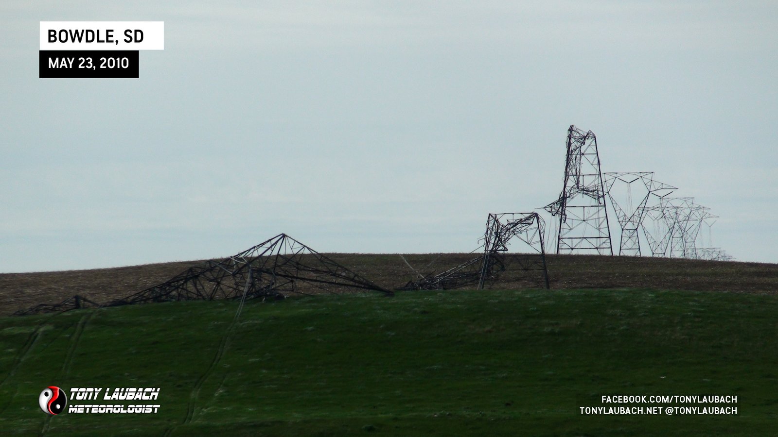
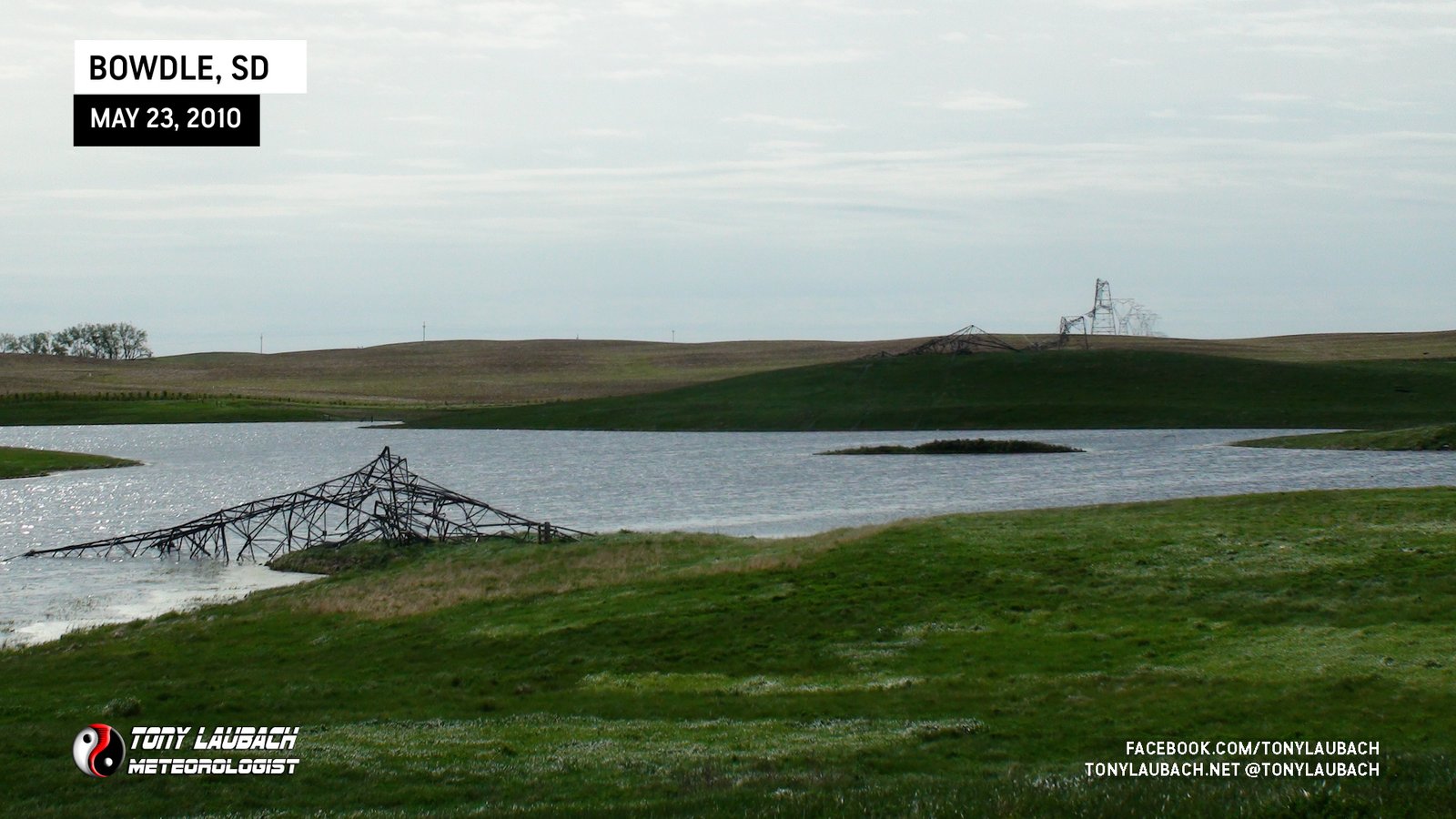
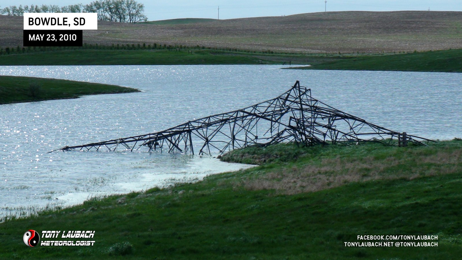
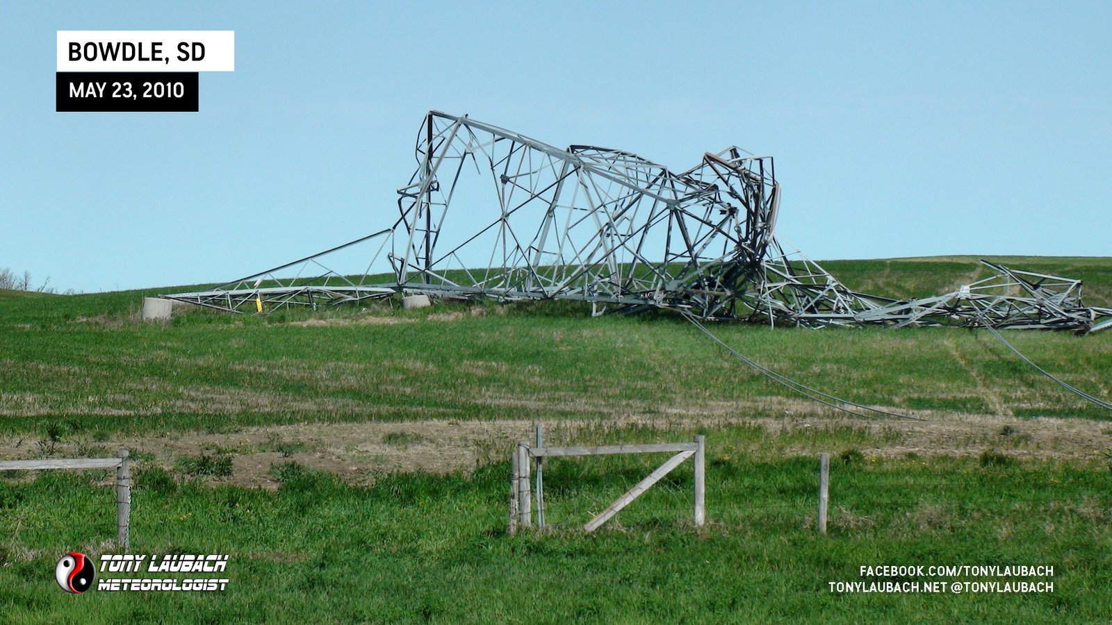
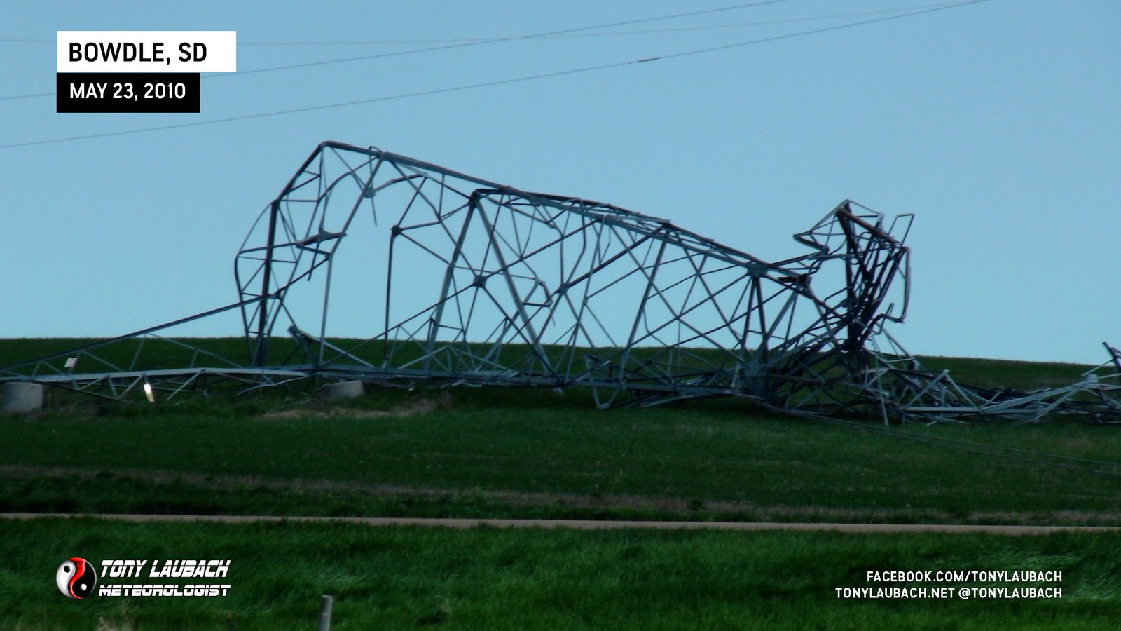
North of town where the EF-4 damage was found, we heavily surveyed and documented the property which was in that tornado for several minutes as it had slowed significantly over this area. The damage was impressive, some of the sights were unreal to see close-up.


CONCLUSION
For me, this was one of the most incredible chases I’ve ever had to date. Obviously the Bowdle EF-4 was the headliner of this seven-tornado day, likely one or two more if you count the couple times we were watching VERY suspicious ongoings toward the latter half of the chase. But on film, we caught seven.
For TWISTEX, this was a banner intercept day. We had multiple mesonet deployments, plus Tim’s probe deployment. Many papers came out of this data set, including one you can read here (as long as it remains up). This was easily the highlight chase for us in Season 4 of Discovery Channel’s ‘Storm Chasers’ series for us in our second season with them.
Overall, an easy chase to put in a top spot. Just an incredible South Dakota day!