July is my slowest warm-weather chasing month of the entire year… it’s usually my annual intermission; middle of the year, comes in fresh after a busy chasing season, and often requires little mileage investment for anything i do motivate myself to chase. By the time I hit the first week of July, I am pretty wiped after the main brunt of the chasing season, which I am usually all-in from March through June, so after 4 months and tens of thousands of miles, I am happy and content to pack it in, catch my breath, remember what real life is like, and keep any chasing I do pretty close. This is also the month work-wise where I take my annual vacation, clear out all comp time, and basically take as much of the month off as my time allows. It’s my summer vacation, literally and figuratively. The severe weather season shifts way up north, often into Canada, which while cool, is not high on my list of things I really want to do. By this time in the year, after 4 months of virtually non-stop chasing, the LAST thing I want to do is drive to a different country. I try to limit myself to day trips, something I can be out and back on in a single run, occasionally I will even take an overnight stay and come home early the following day. But hauling 700-miles or more one-way for a summer time chase doesn’t even begin to register with me.
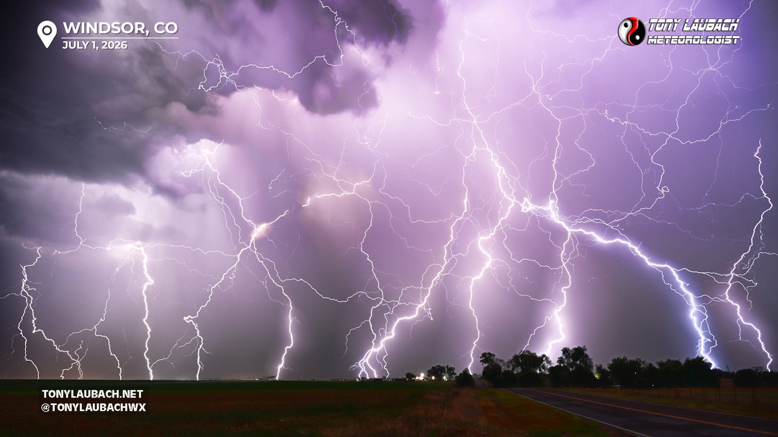
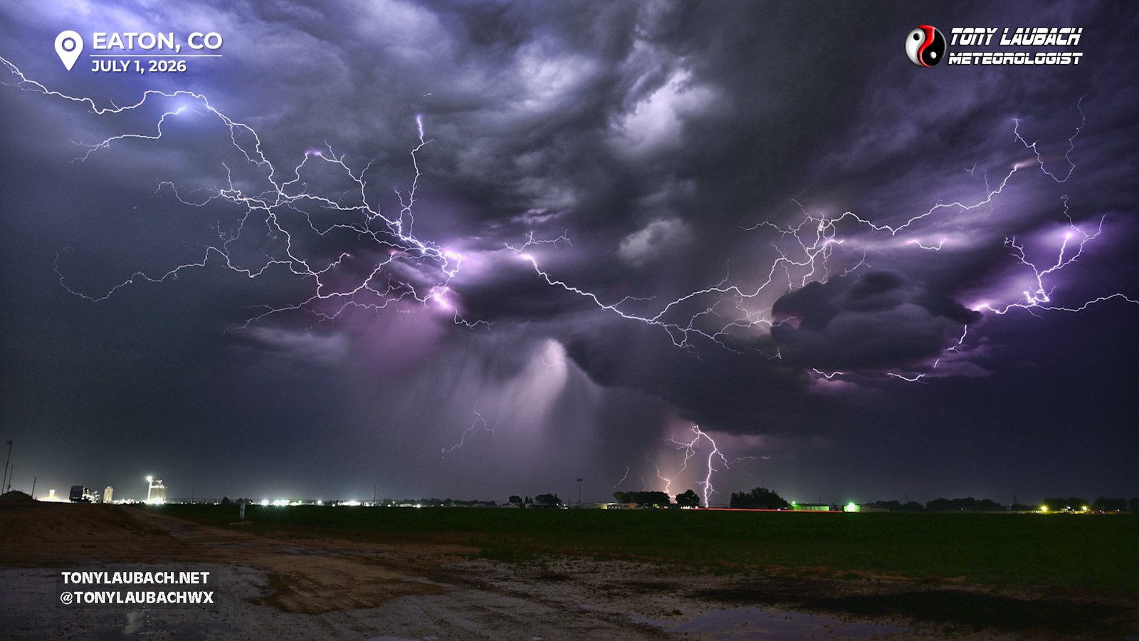
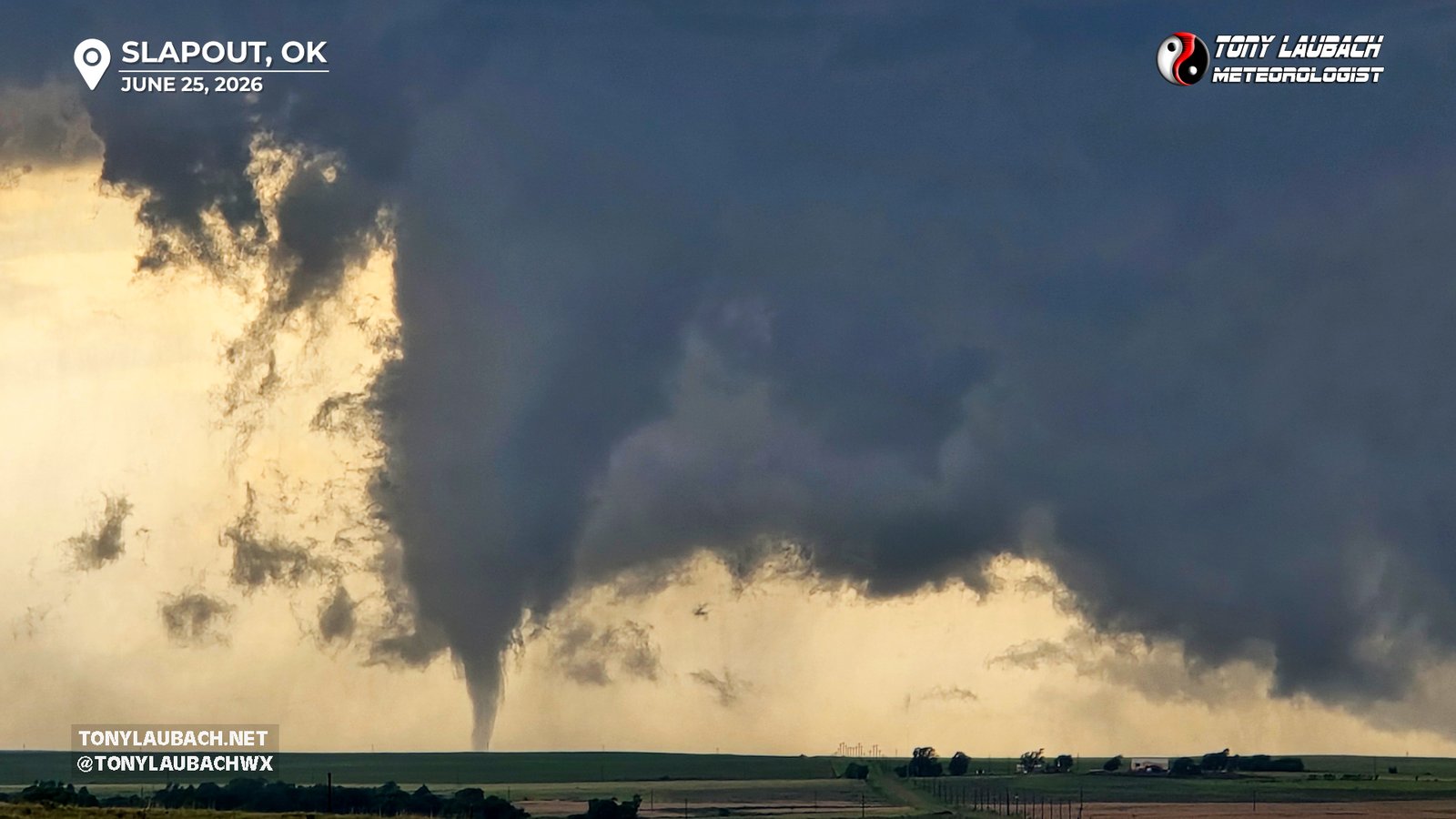
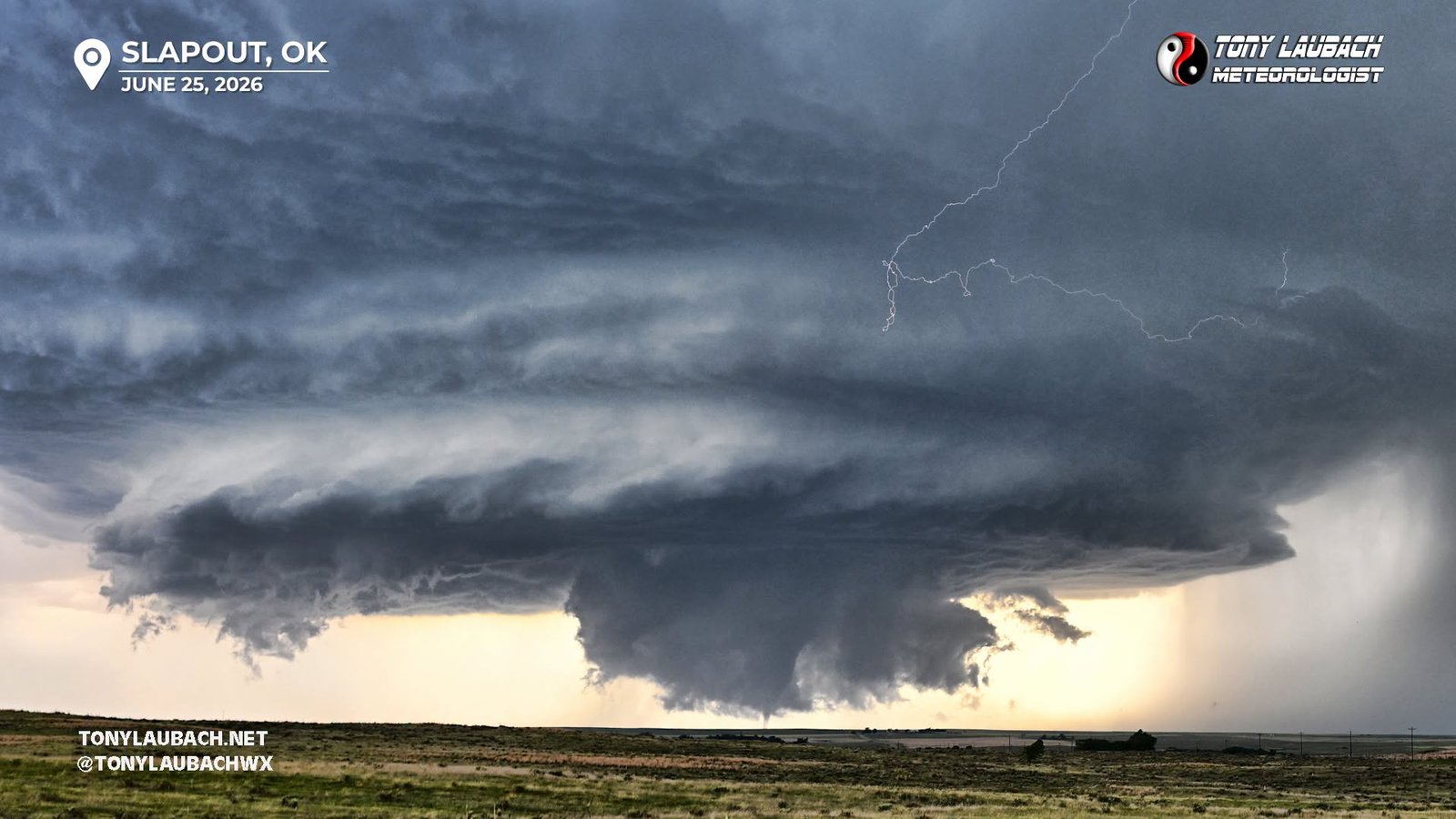
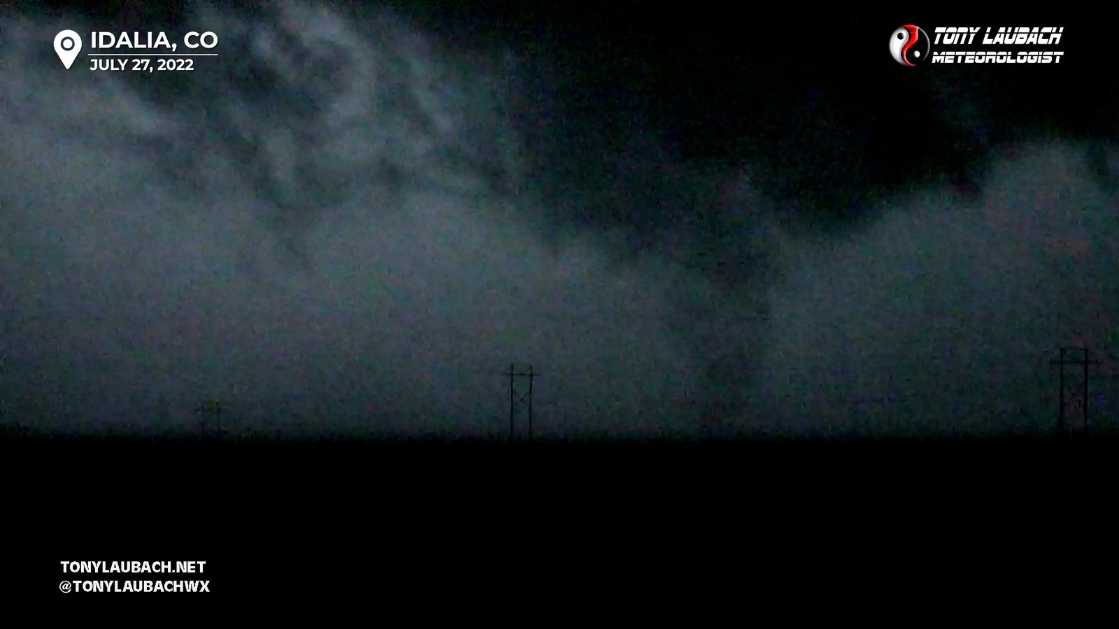
July is tied for second for least amount of tornadoes in a given month. While January remains at zero, July sits with September and December with only two tornadoes seen that month, and certainly last of those three for quality tornadoes. One of those the brief tornado from the Wheat Ridge storm of 2009, the other pictured above on a late evening chase in eastern Colorado that I was only able to snag one shot of thanks to a well positioned lightning flash. July has seen some amazing storms, though, so its not without its fanfare, but most of those chases remain pretty close to home, maybe extending into the bordering states a bit. But typically I am not feeling a big investment in mileage this time of year. Lightning and flash flooding typically are the main plays for me; tornadoes clearly are not terribly high on the list. And given the banger setups are rare, even when factoring in some extra miles, I just don’t have it in me to take 3-4 days for a one-and-done setup. Anything I can get close to home will typically suffice.
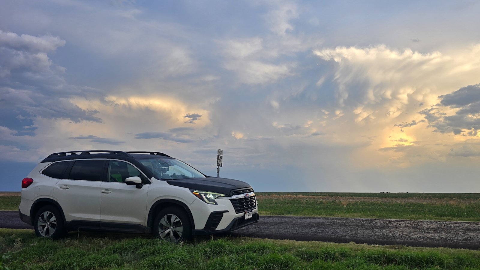
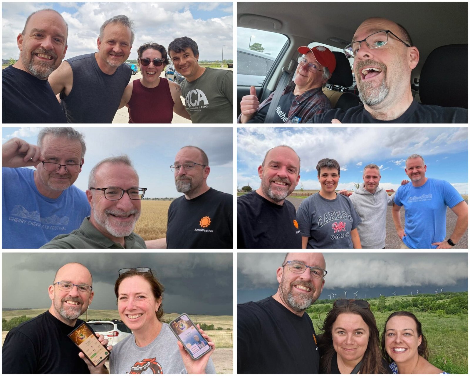
I just returned from a short, fairly local mini-vacation. Usually we do a larger trip this time of year, and the last few years, has often been planned around Pokemon Gofest, which typically happens in July. But with the 10th anniversary being this year, everything moved to June (we did GoFest in Chicago first weekend of June). Global GoFest is this coming weekend, which I will play locally here in Denver, but that doesn’t require a huge time investment. In past years, we’ve scheduled our vacation around this event, having gone to the northeast a couple years in a row, and last year, seeing as GoFest was in New York for the third year, we opted to make a long southwest road trip in its place. This year, we did a few days near Colorado Springs, as we’ll spread multiple long weekends out through the year, including a potential northeast trip for a Pokemon event in late September (barring tropical activity that weekend). Thus, a staycation of sorts, with a few things slated in.
July usually also sees my post-season vehicle maintenance; obviously after tens of thousands of miles rolled, there’s a lot to catch up on, so I typically find a day to leave that at the shop to get minor repairs, the maintenance, etc all done to get the car back to zero. I also get my happy ass in the shop for annual doc stuff. So its just a good time to get everything caught up. Most importantly, I can be home for a bit. I had a six week stint (overlapping/including Chicago) where I was home for a total of six nights. It’s a long time to be away. So it’s nice to be home more than away, even with vacations factored in. It is a total recharge in so many ways, and I welcome it every year.
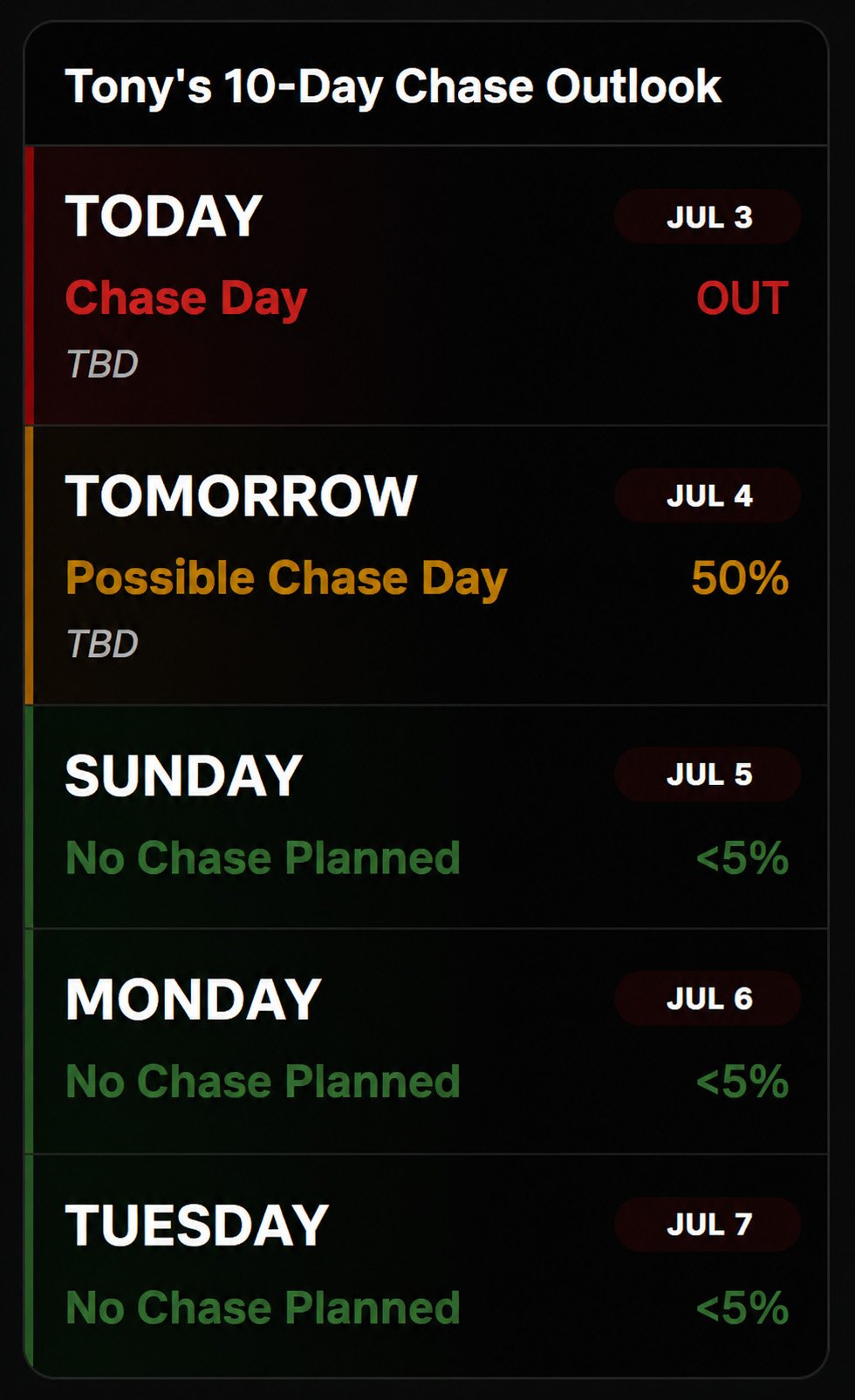
Of course, if there is something local to chase, I will venture out. Yesterday I could’ve been out, but that was the return home day. Ironically enough, I missed a landspout tornado by about 30 minutes, it spinning up as we were passing through Denver. Would’ve been a fun, accidentally-into bonus, but it was not to be. There was severe weather out east, and apparently a little storm over the house in the wee hours of the morning I slept through. And today offers SOME storm chances, albeit lesser than yesterday, so I wouldn’t rule out a backyarder, but things heat up and quiet down locally into next week. The big car appointment day is on Monday, so I will feel better about taking any significant trips after all that is caught up to speed. Otherwise, I will just enjoy the week off close to if not at home, and see if anything inspires me to haul some cameras out east.