
TONY'S CAREER TORNADOES
A List of My Best Tornado Chases
FILTER THE TORNADOES
Filters
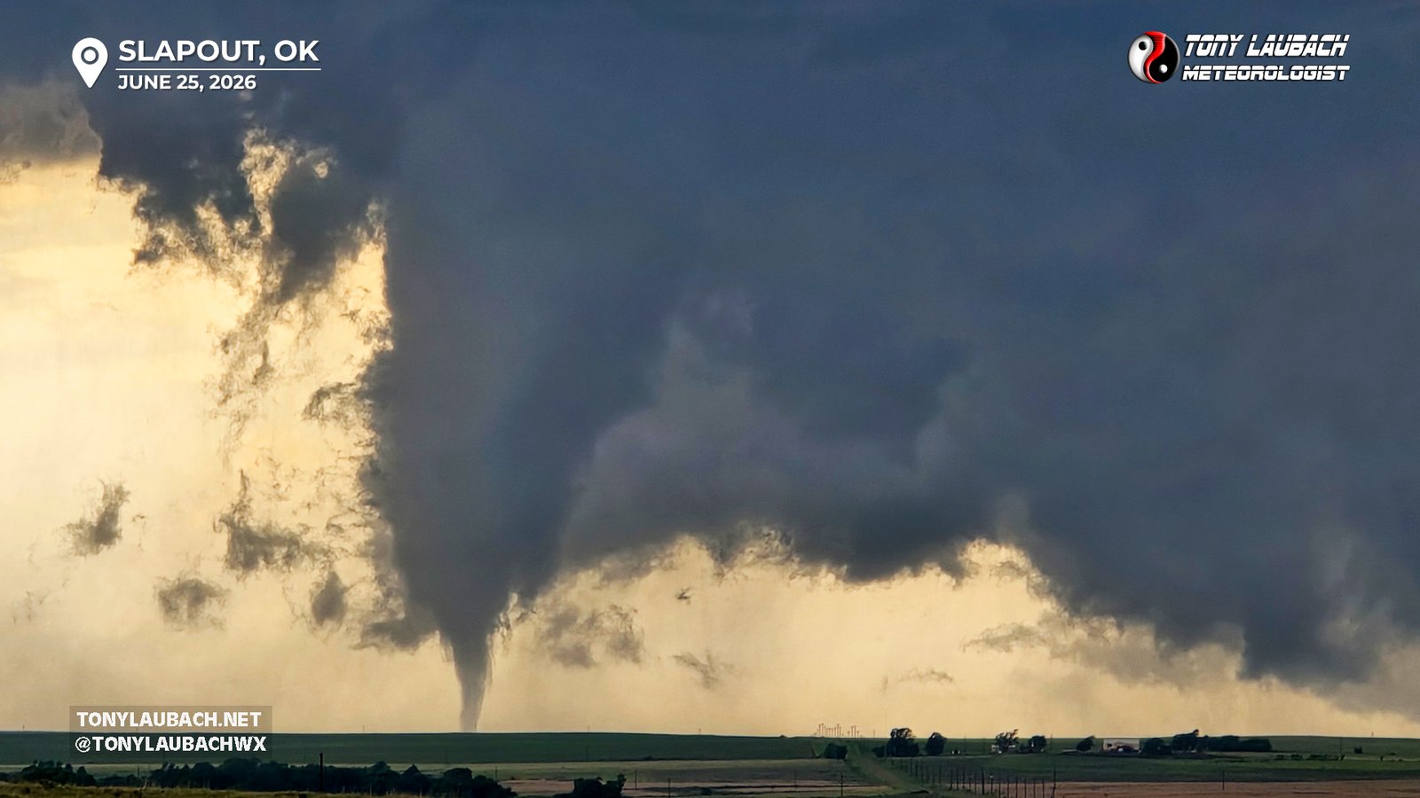
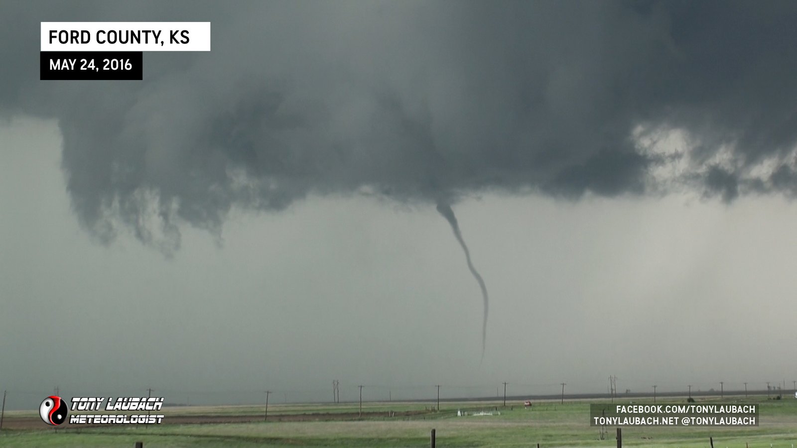
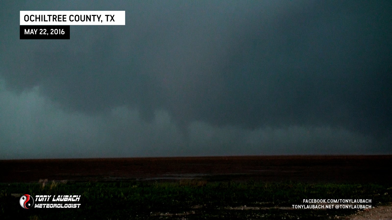
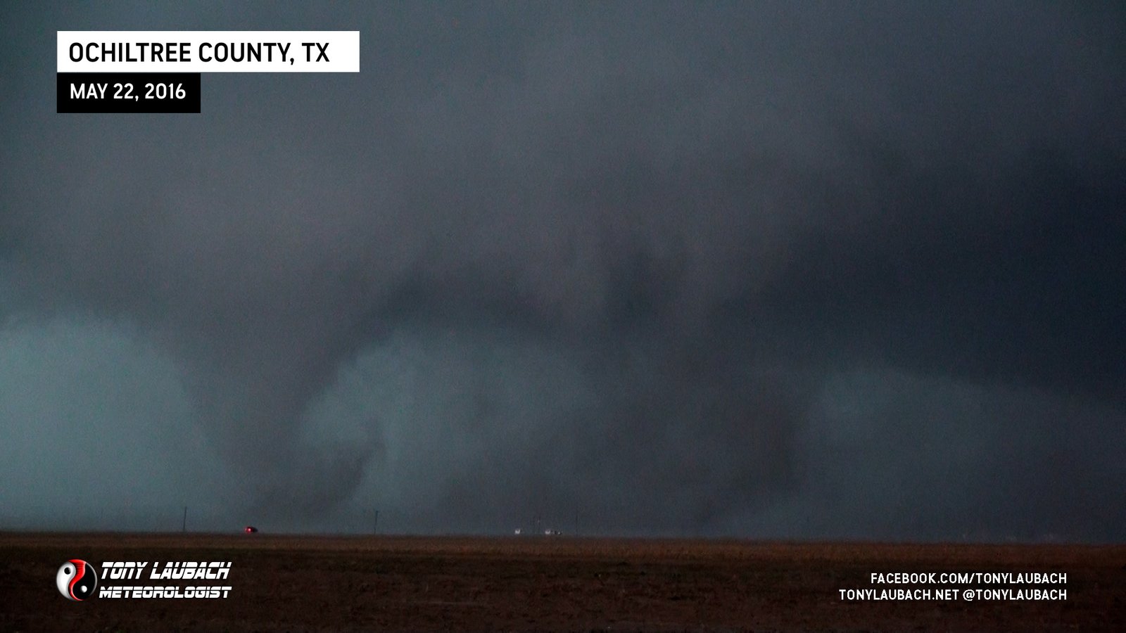
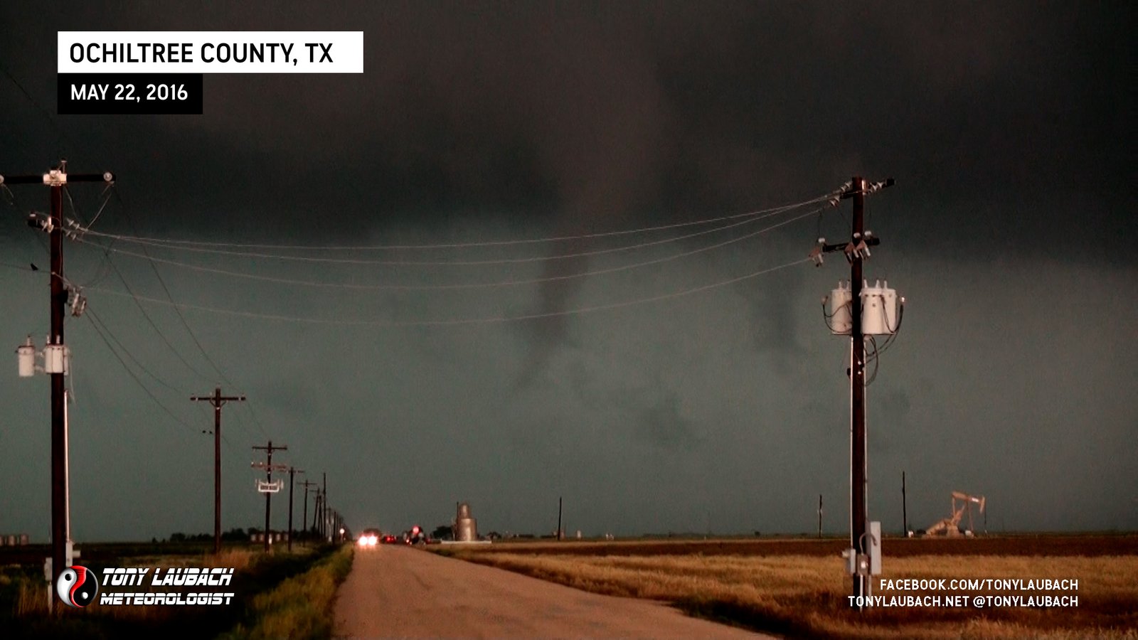
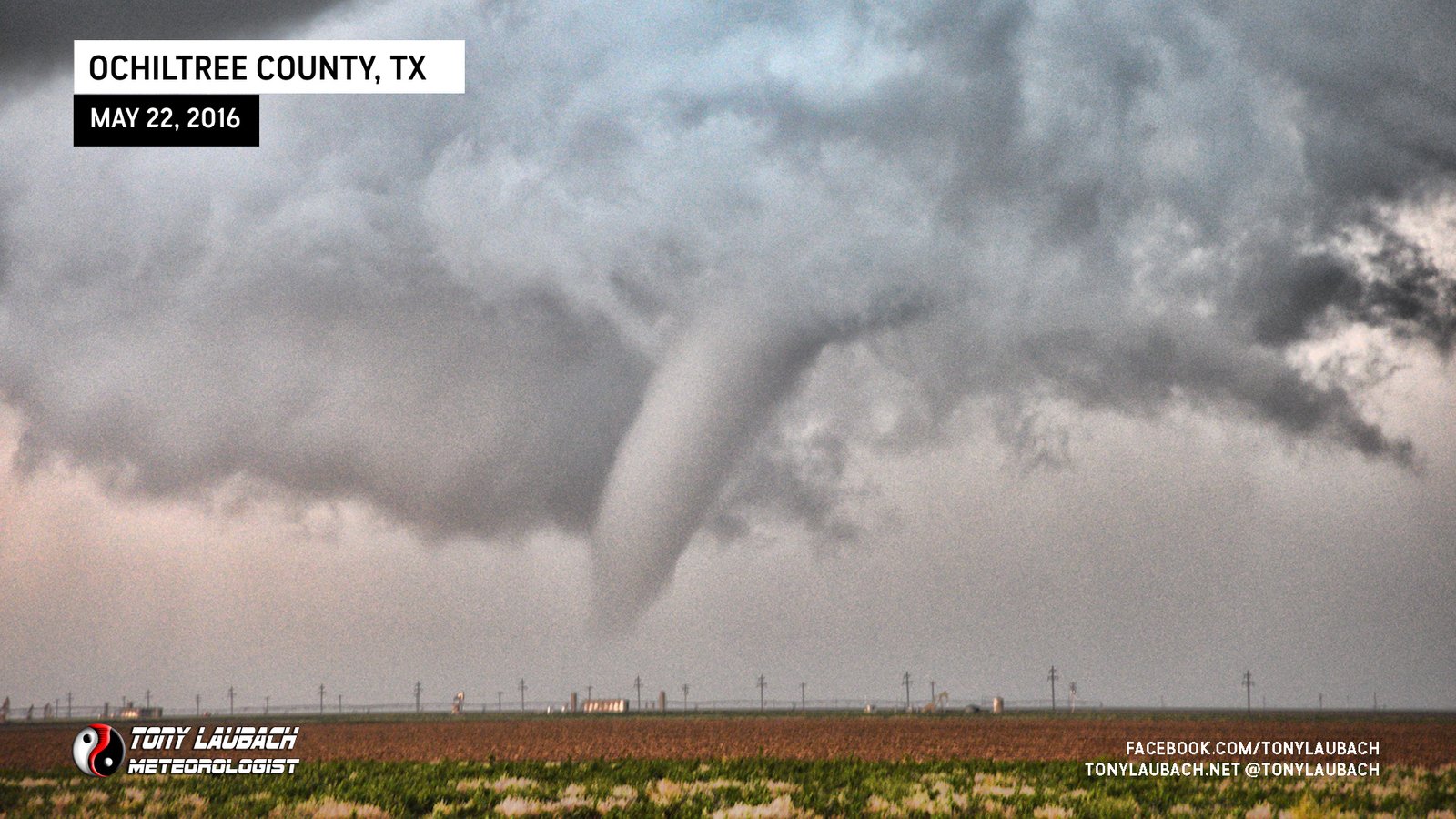
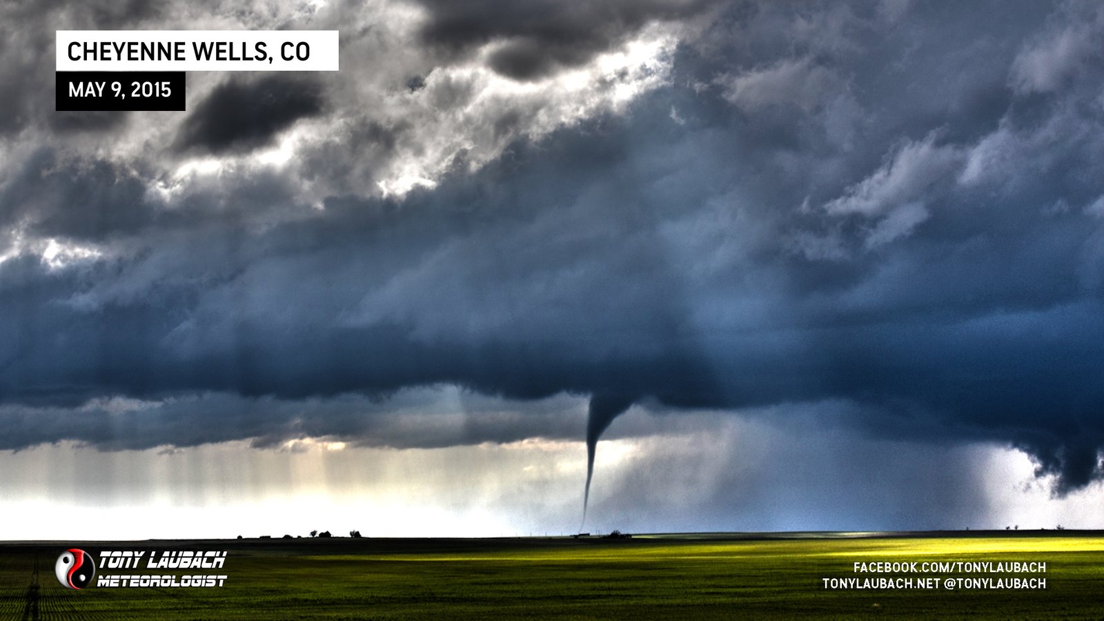
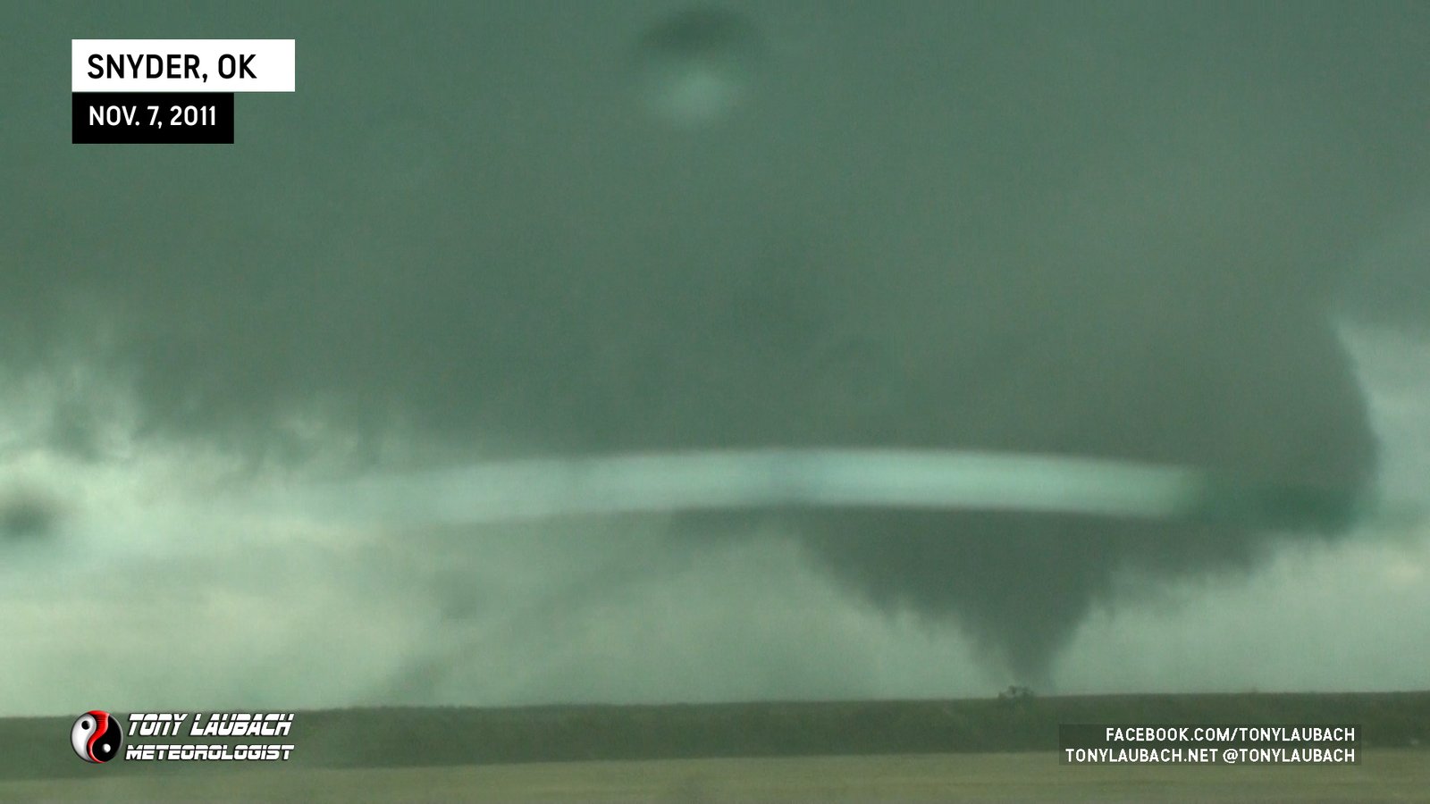
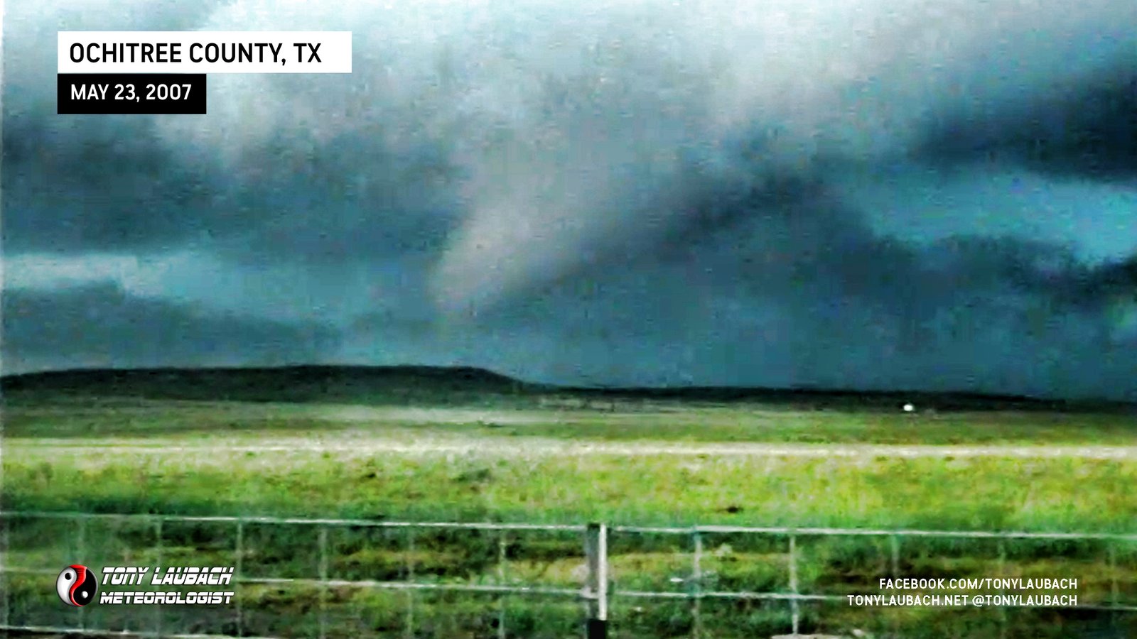
Likely second tornado from the Beaver County supercell; several minutes after initial tornado lifted, new circulation and funnel formed.
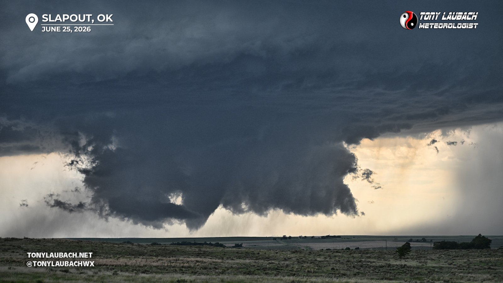
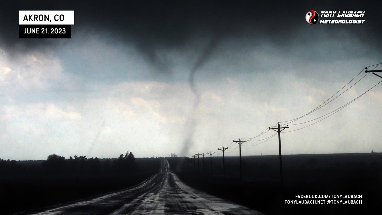
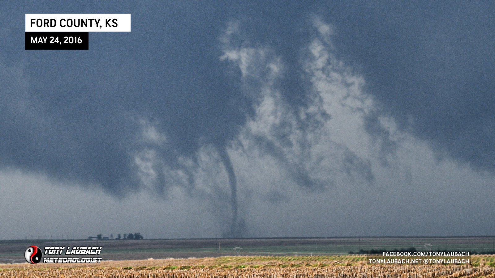
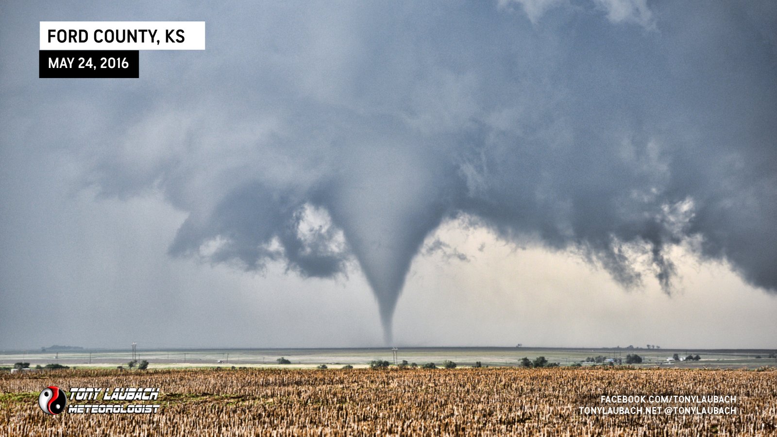
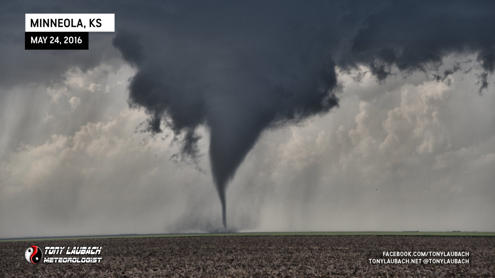
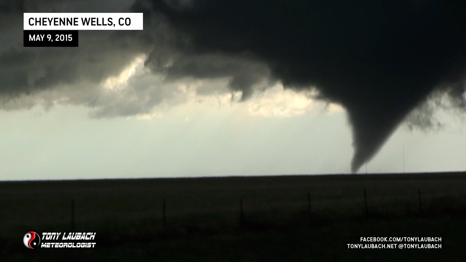
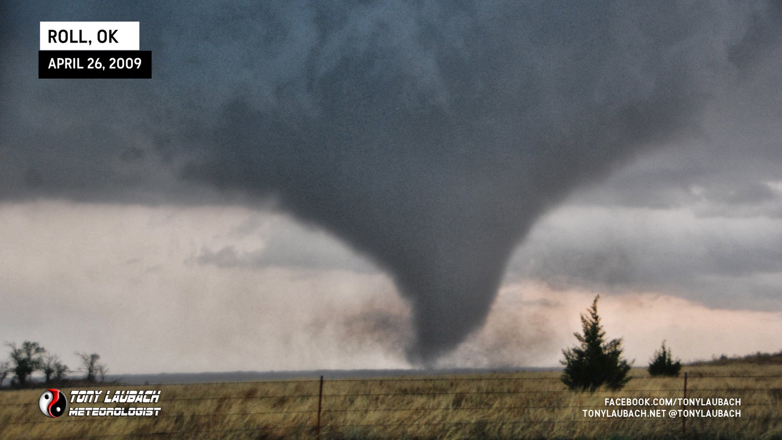
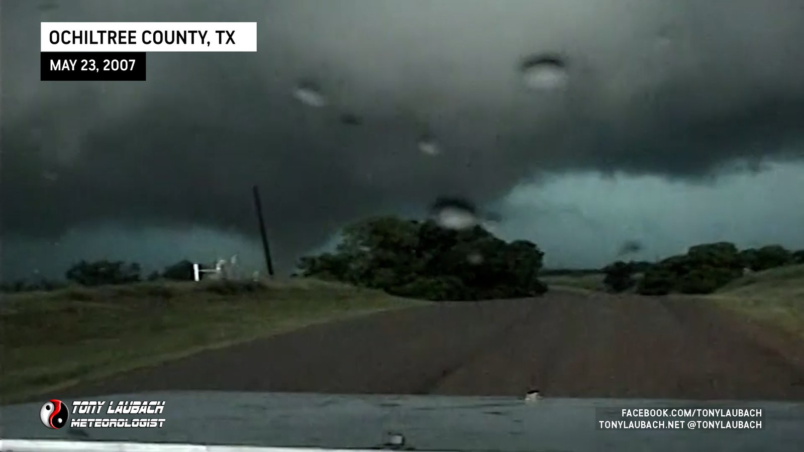
First tornado touchdown from the Beaver County supercell; pristine view straight west from northwest of Slapout.

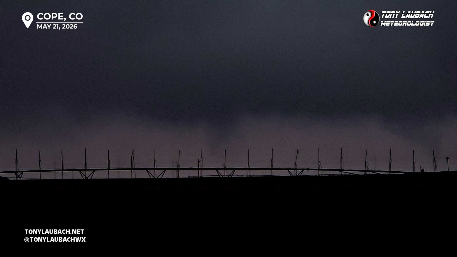
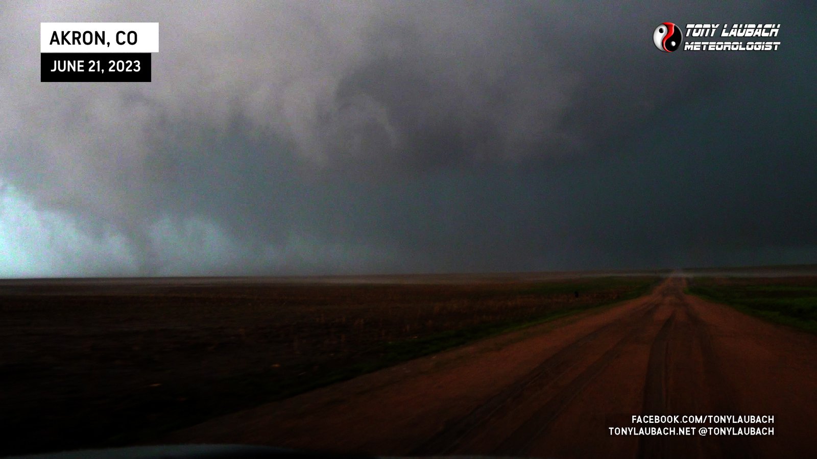
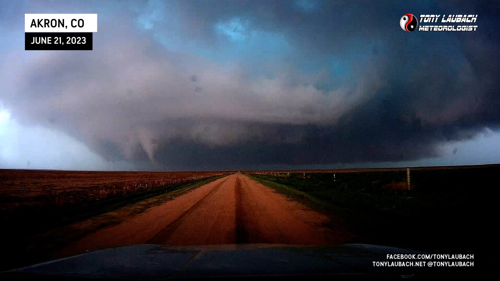
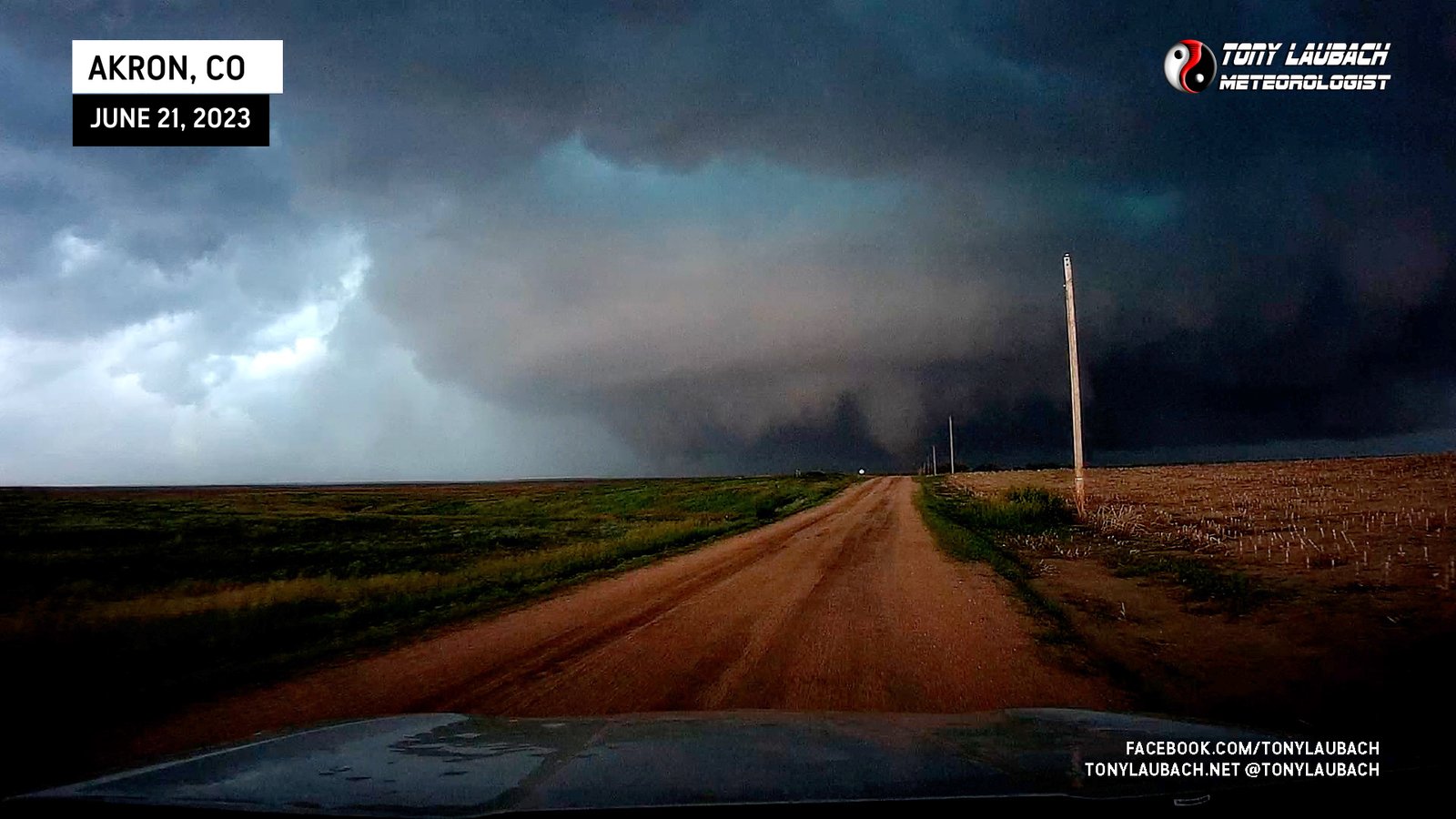
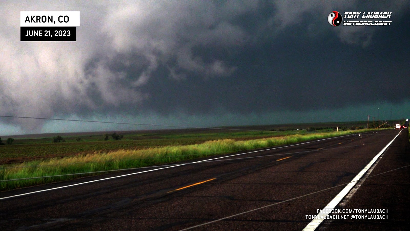
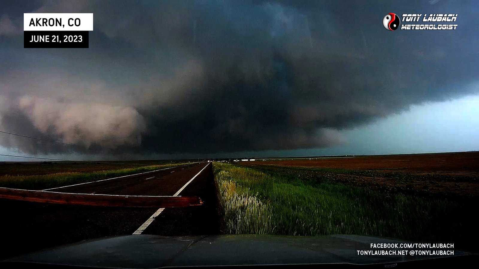
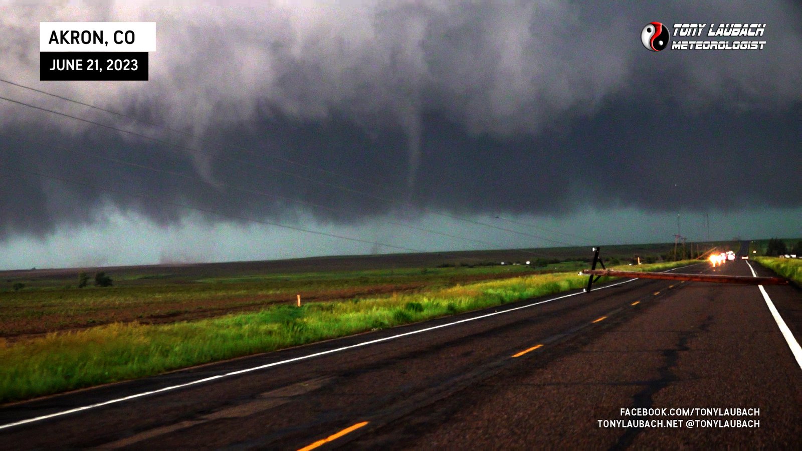
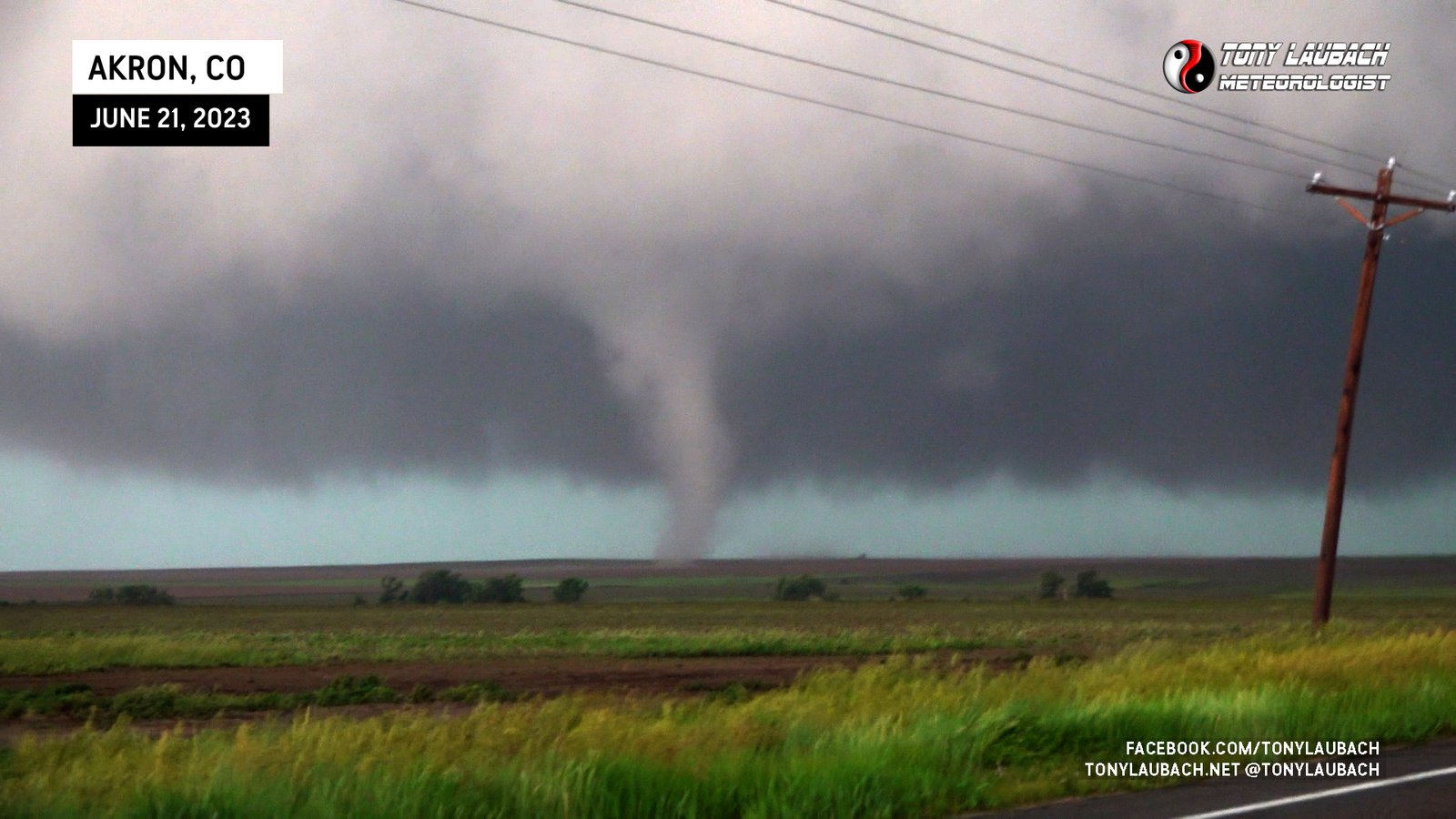
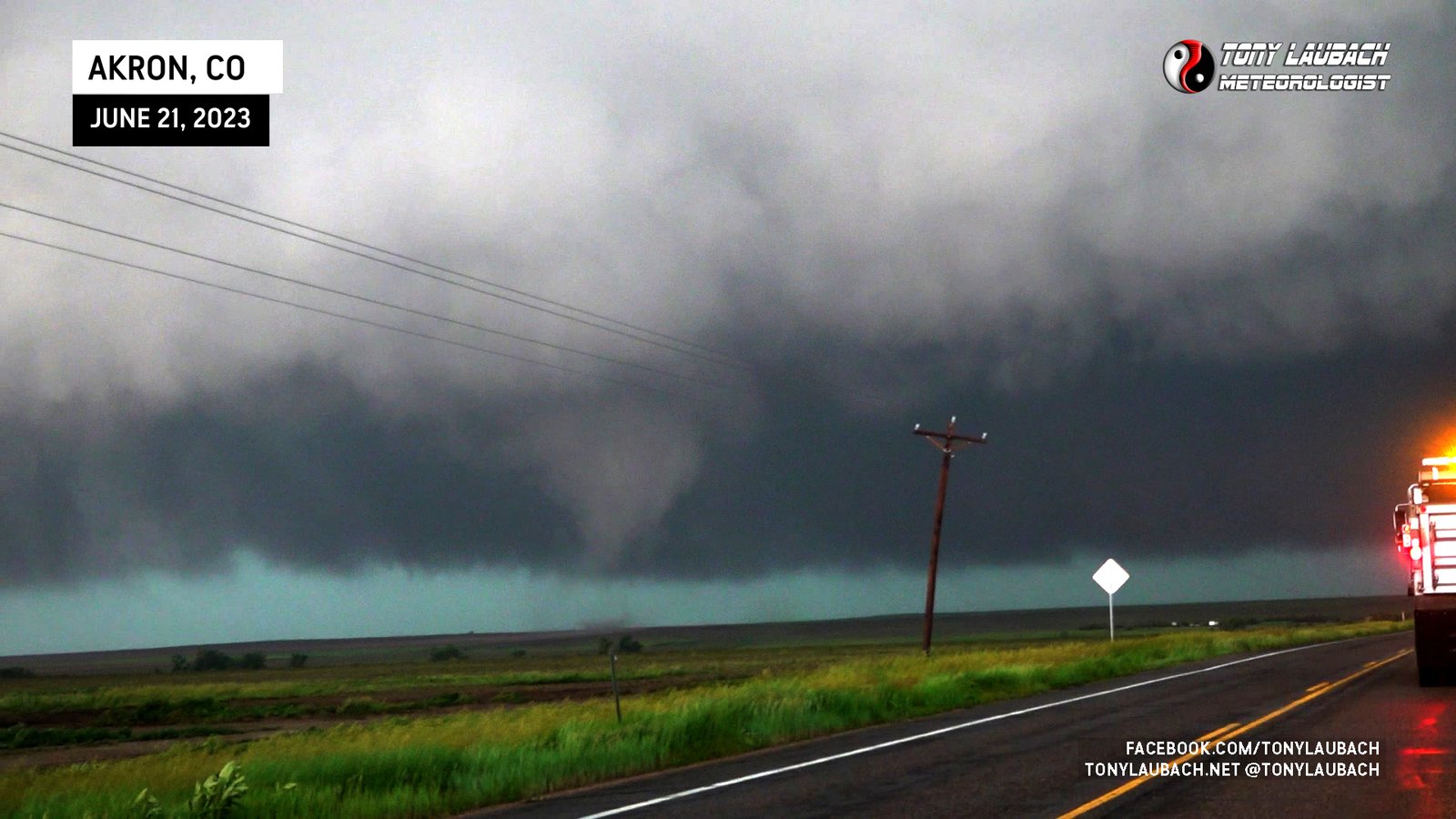
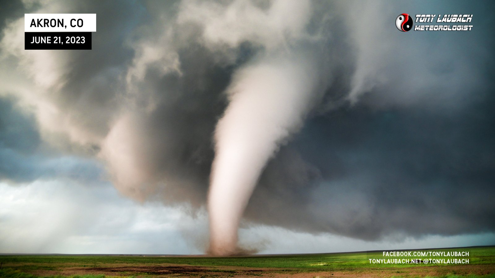
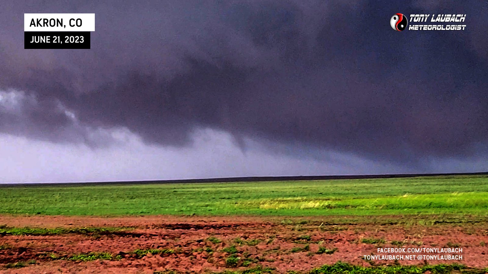
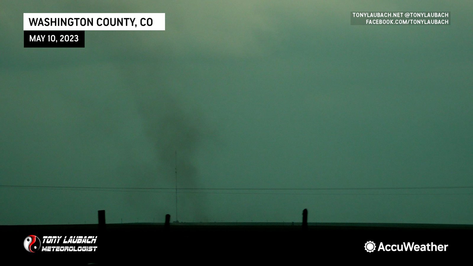
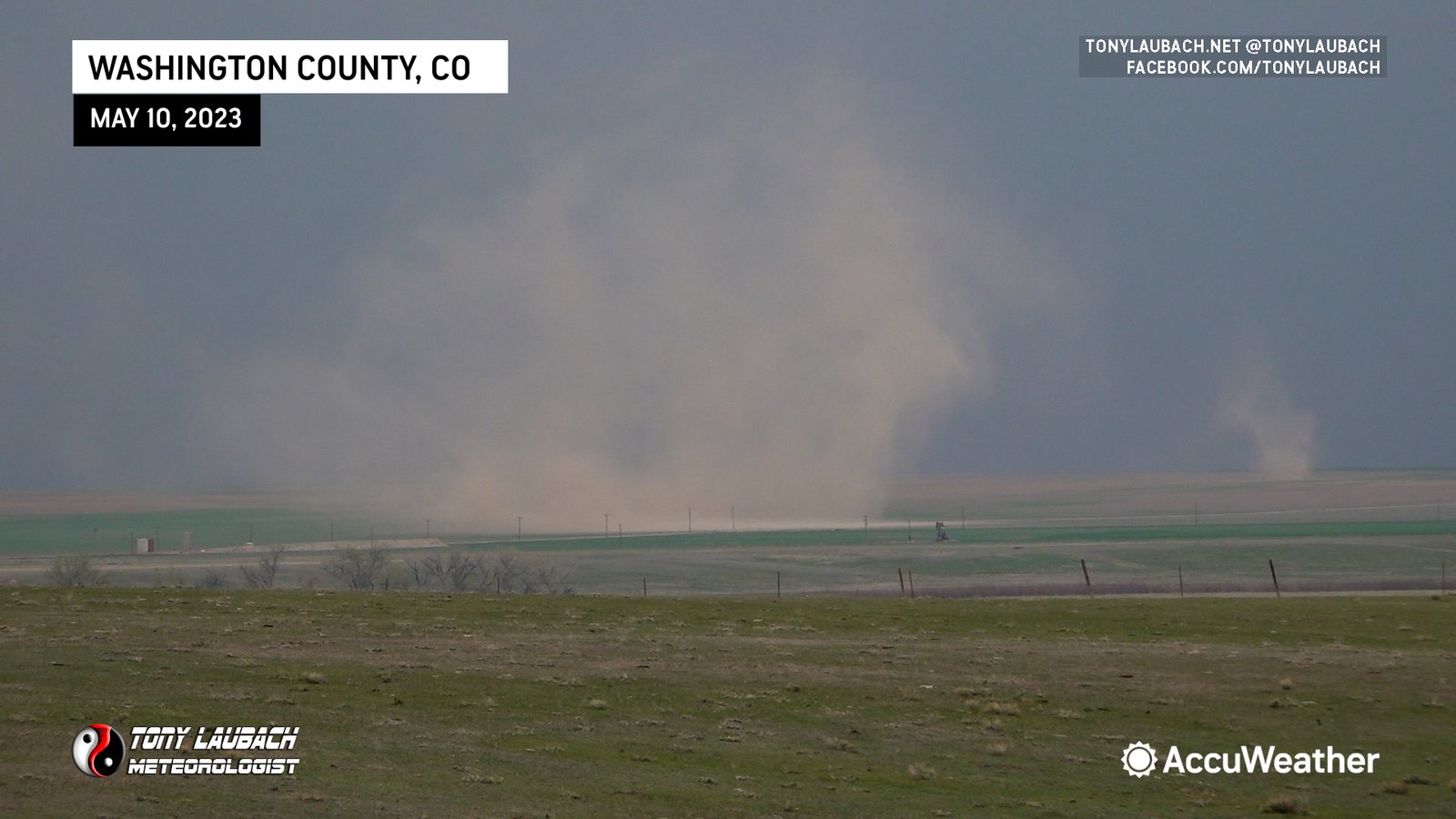
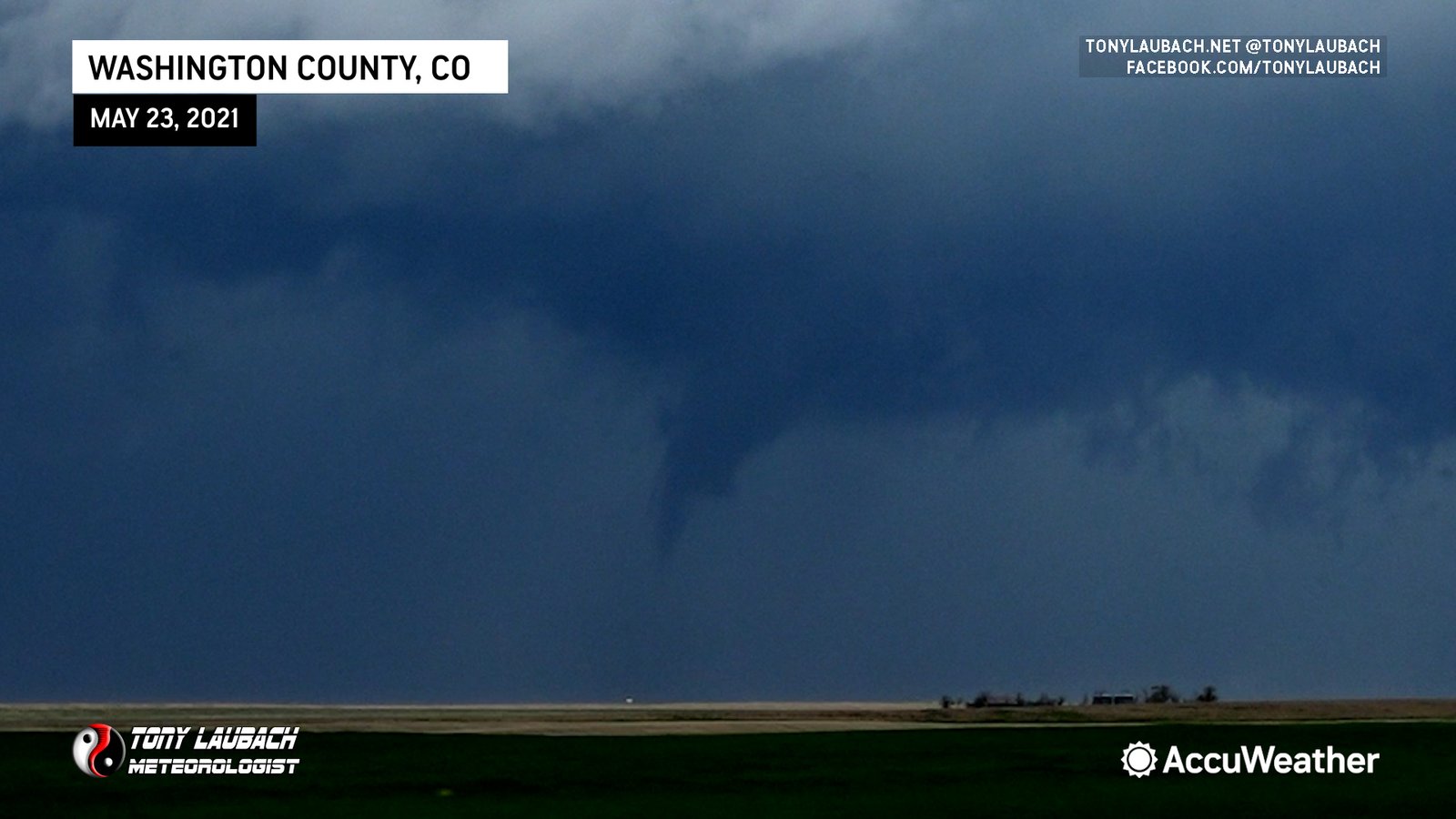
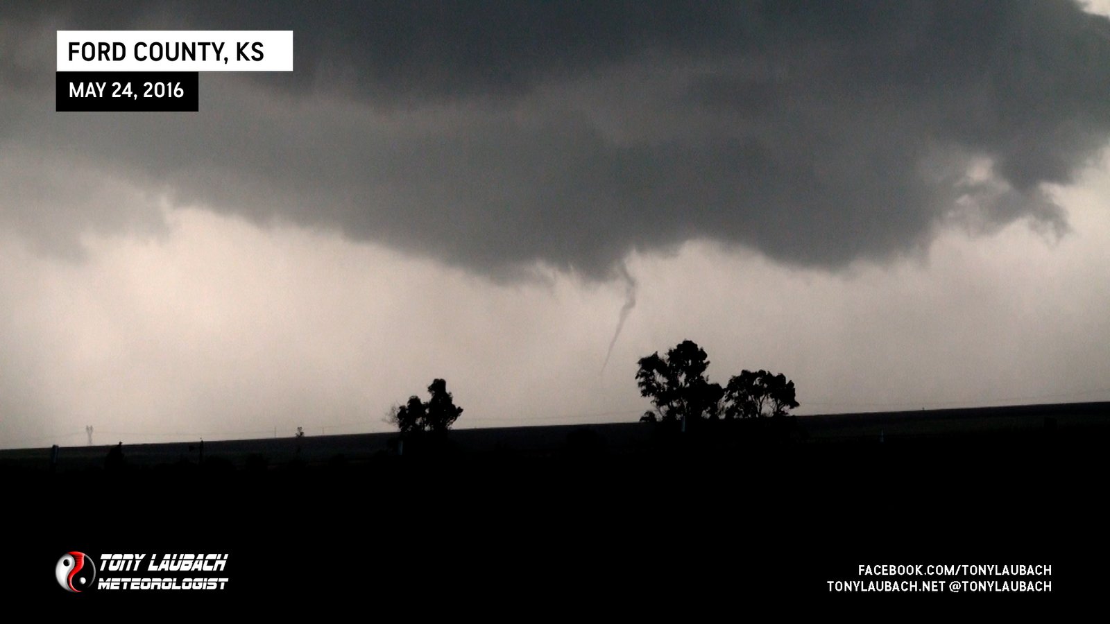
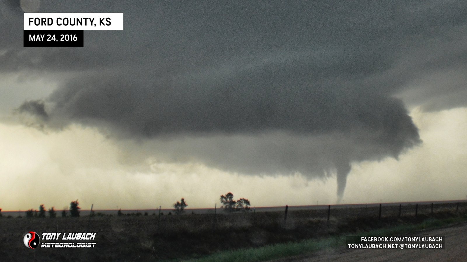
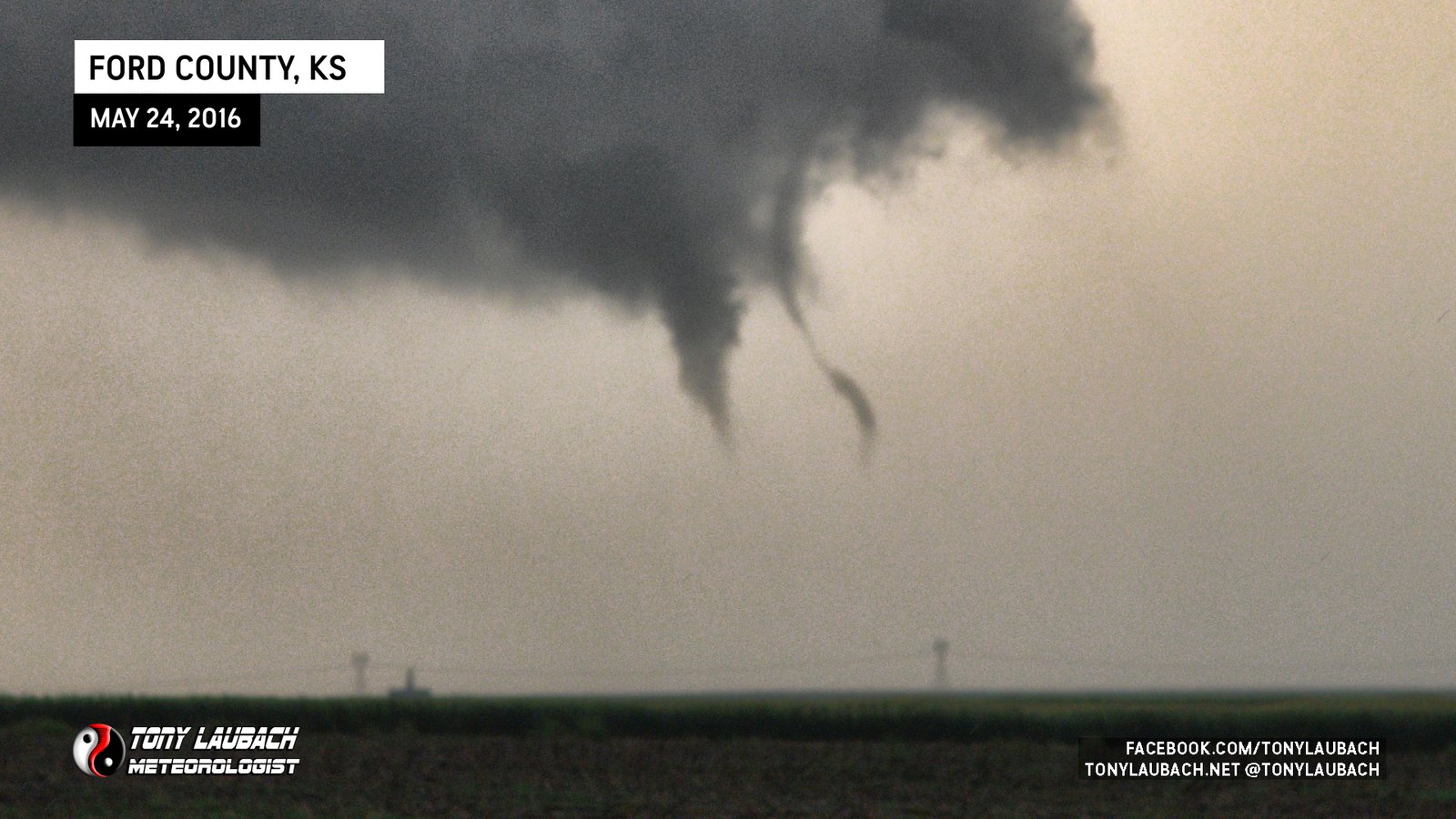
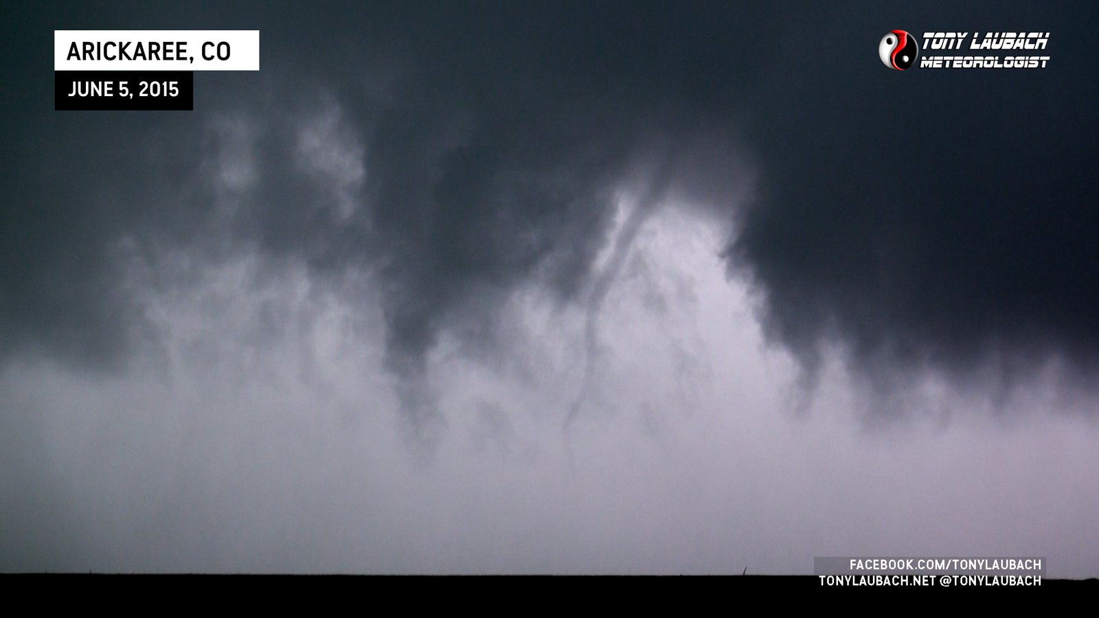
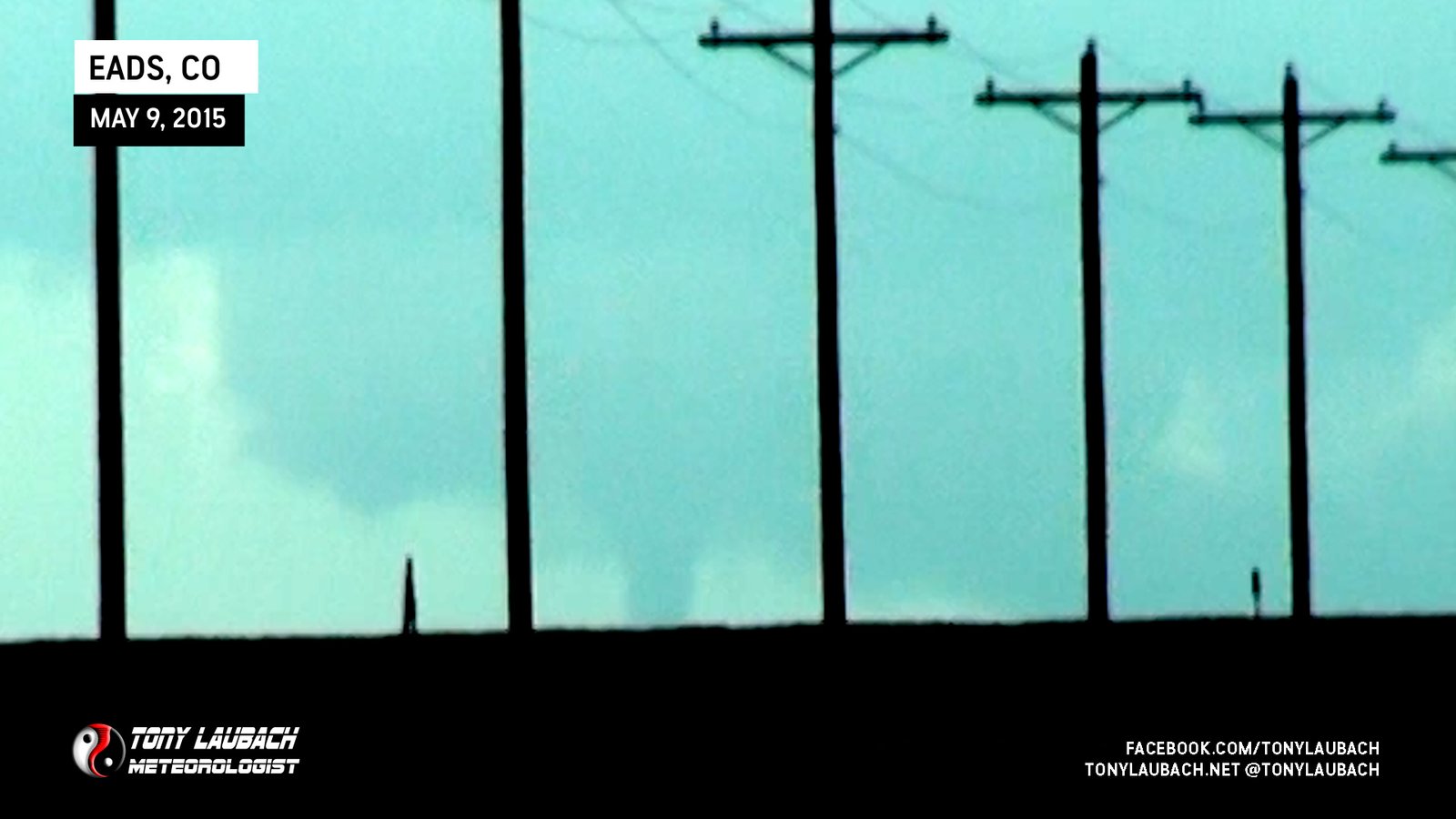
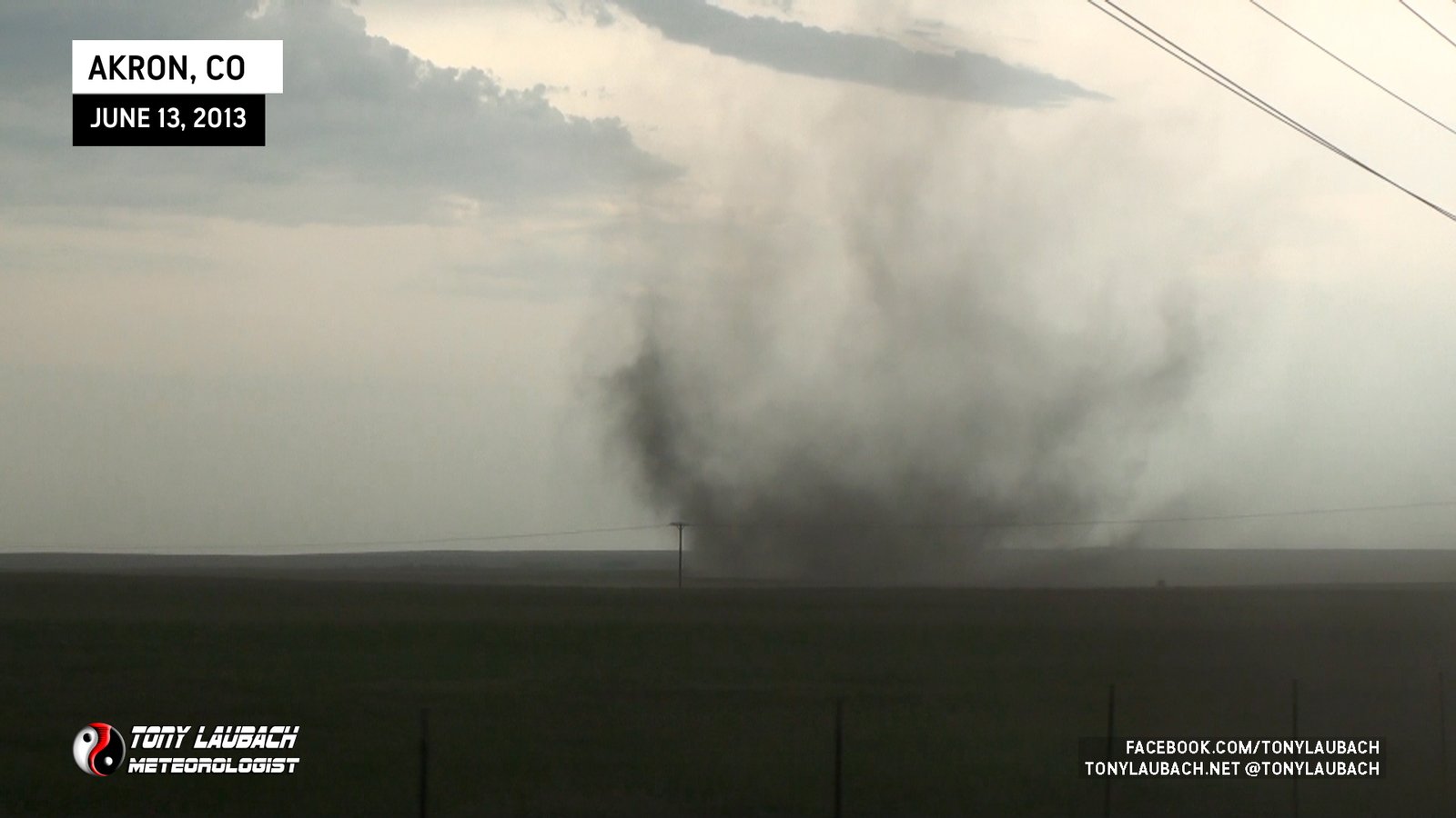
Low-contrast views of a potential tornado confirmed by others southeast of Akron, Colorado
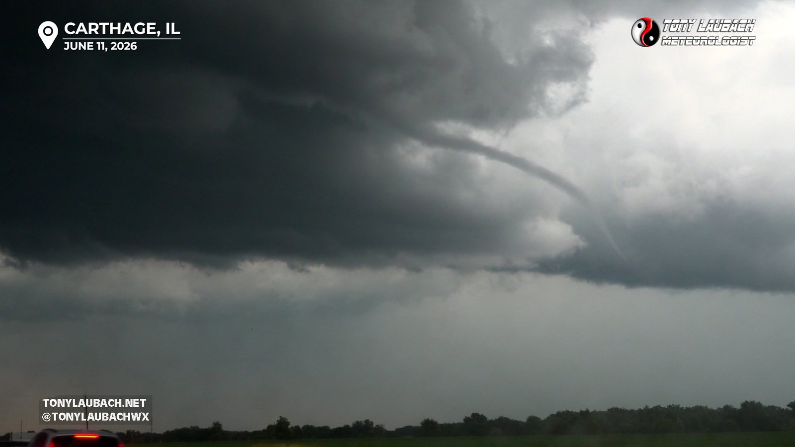
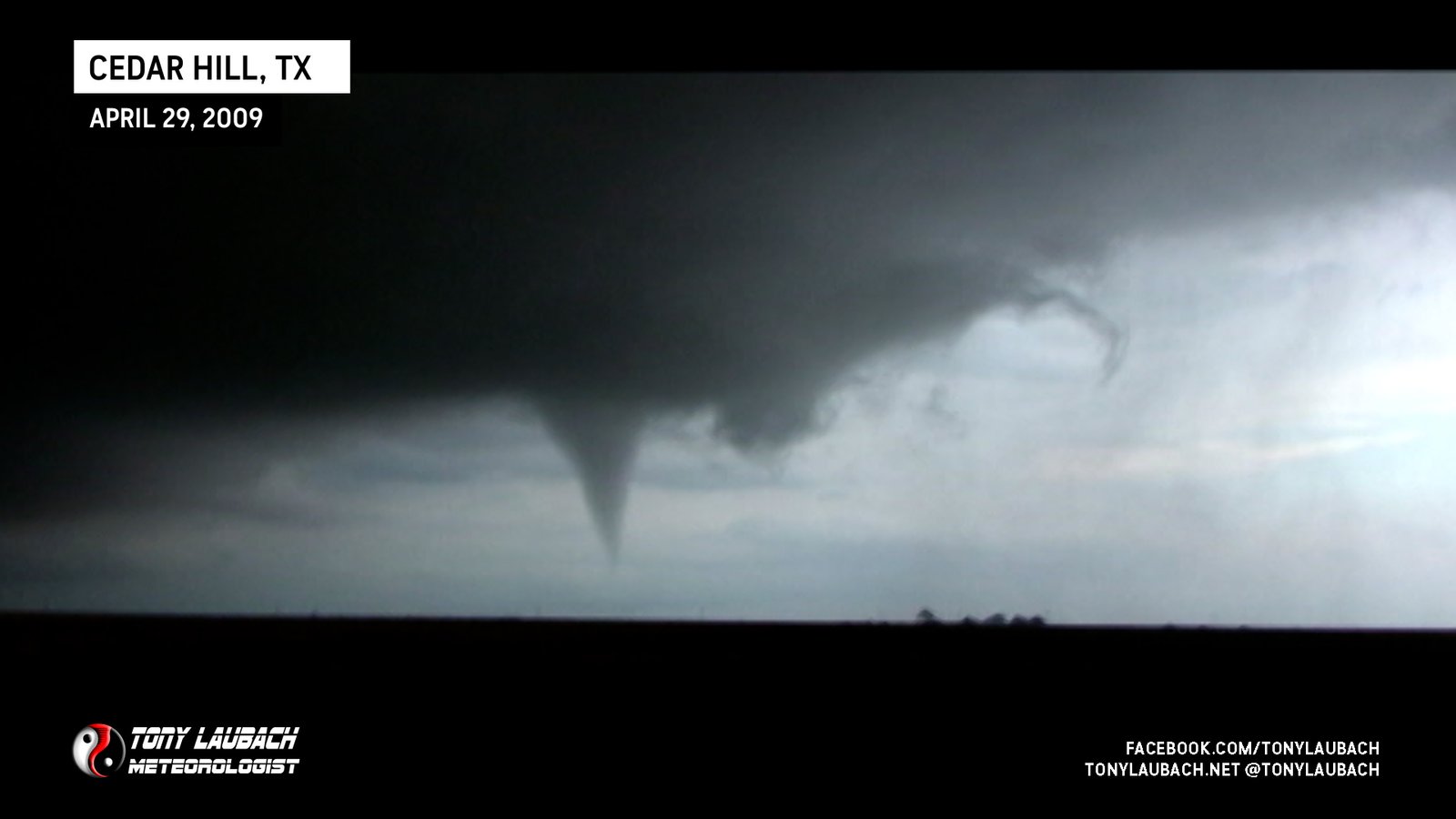
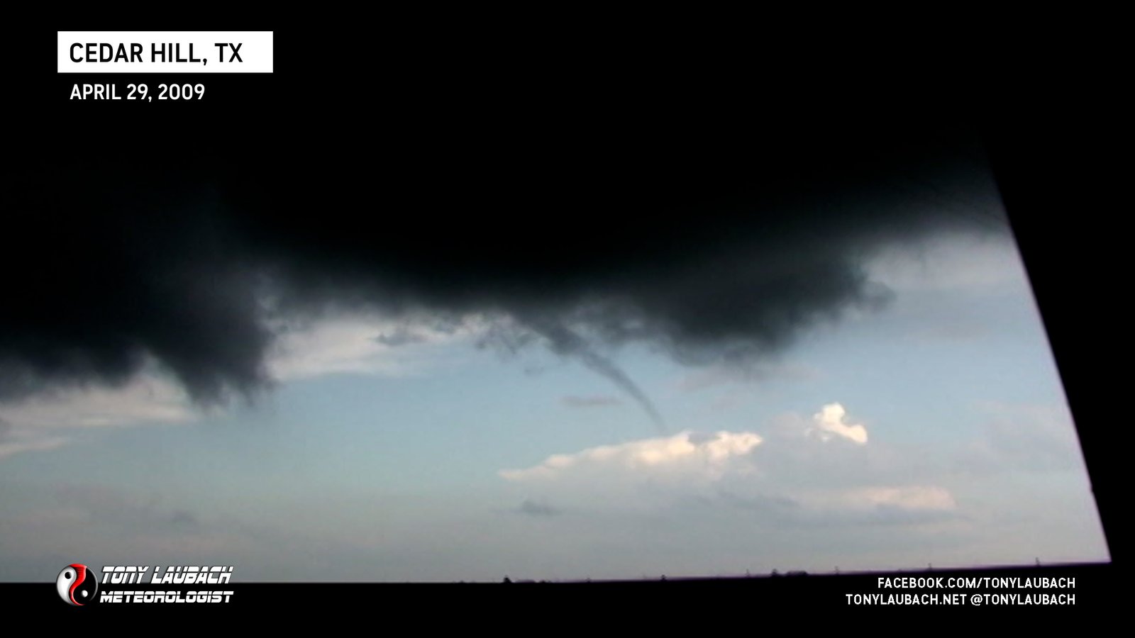
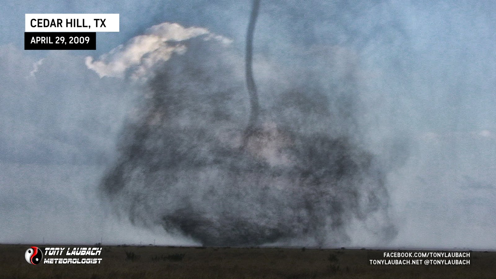
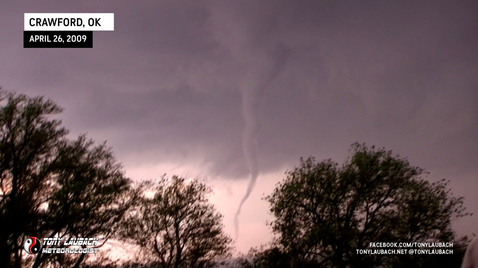
Ropey, brief tornado touchdown east of Carthage.
Quick photo of a brief tornado touchdown northeast of Unionville, moments after third tornado, viewed looking north from US-136 east of town.
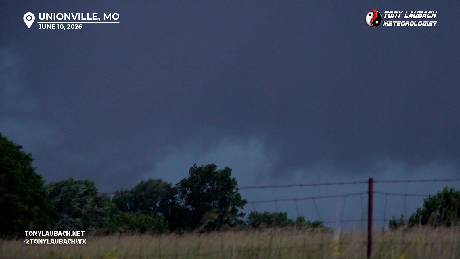
Brief tornado northeast of Unionville, emerged from behind trees before dissipating. Viewed from US-136 looking north.
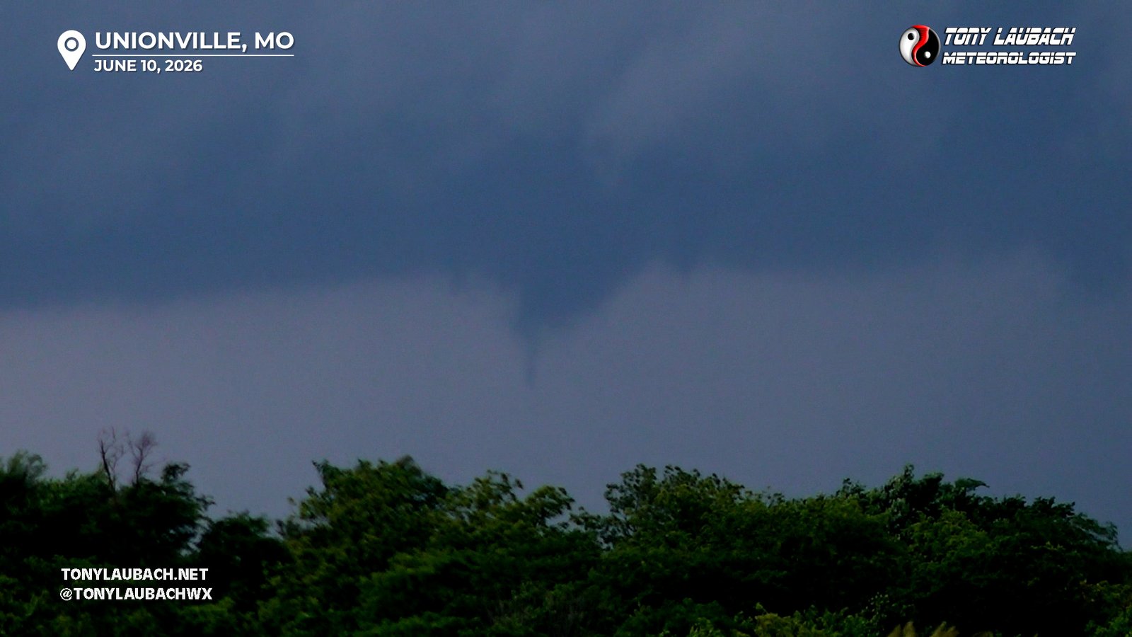
Brief satellite tornado of larger Unionville tornado; fully condensed off-camera to the left and only captured funnel.
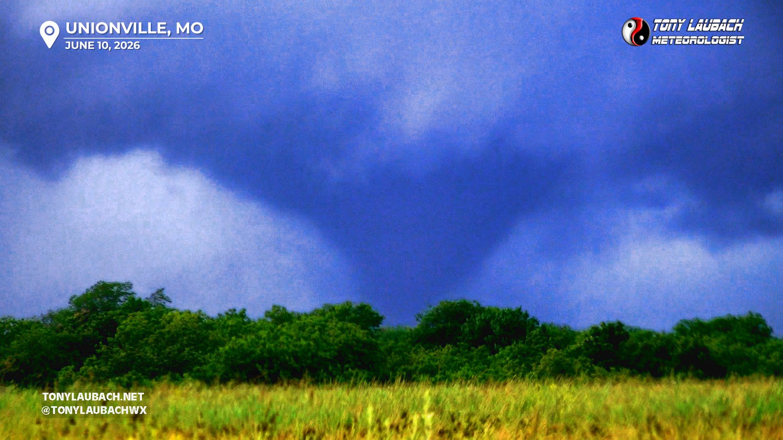
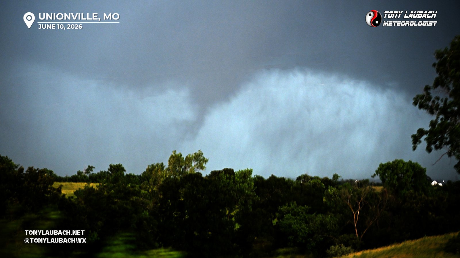
Large tornado, on the ground for about 10 minutes, aired live on AccuWeather; seen from MO-5 south of town.
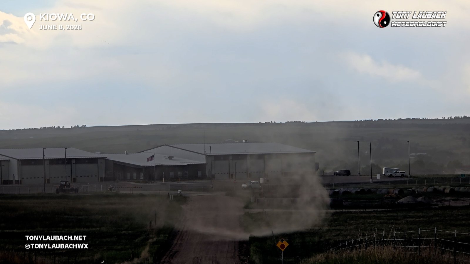
Brief spin-up beneath cinnamon bun swirl overhead; briefly touched down on the east side of Kiowa on CR-134 on the north side of CO-86 at 4:26pm.
Brief, weak low LCL multi-vortex; intermittent touchdowns beneath low, rotating cloud. View from CR-MM/CR-10 looking west along CR-MM.
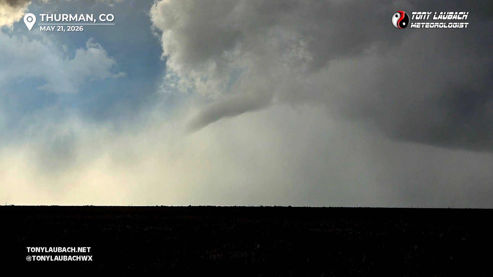
Brief touchdown as confirmed by other chasers; nice rope-out. Viewed from CR-NN/CR-0 Southwest of Thurman looking west.
Got multiple, low-contrast views early and at its strongest, most imagery came when rope-out exposed itself from dust and RFD.

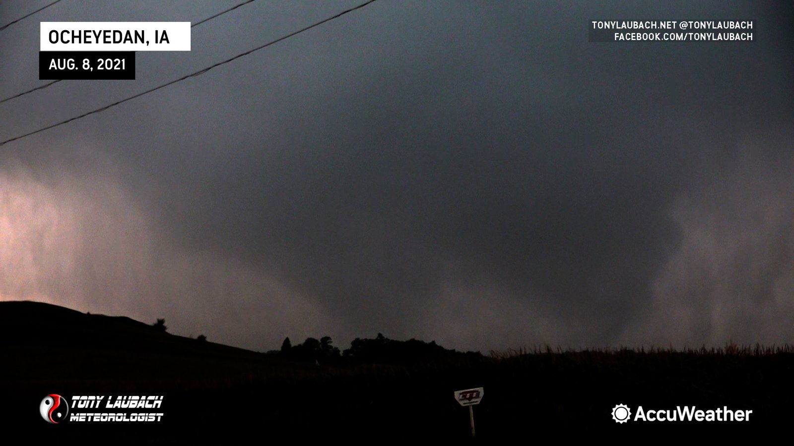
Was ‘involved’ with a broad, rain-wrapped tornado along 220th St north of US-20, multiple ground condensations noted as I was on the eastern edge of it.
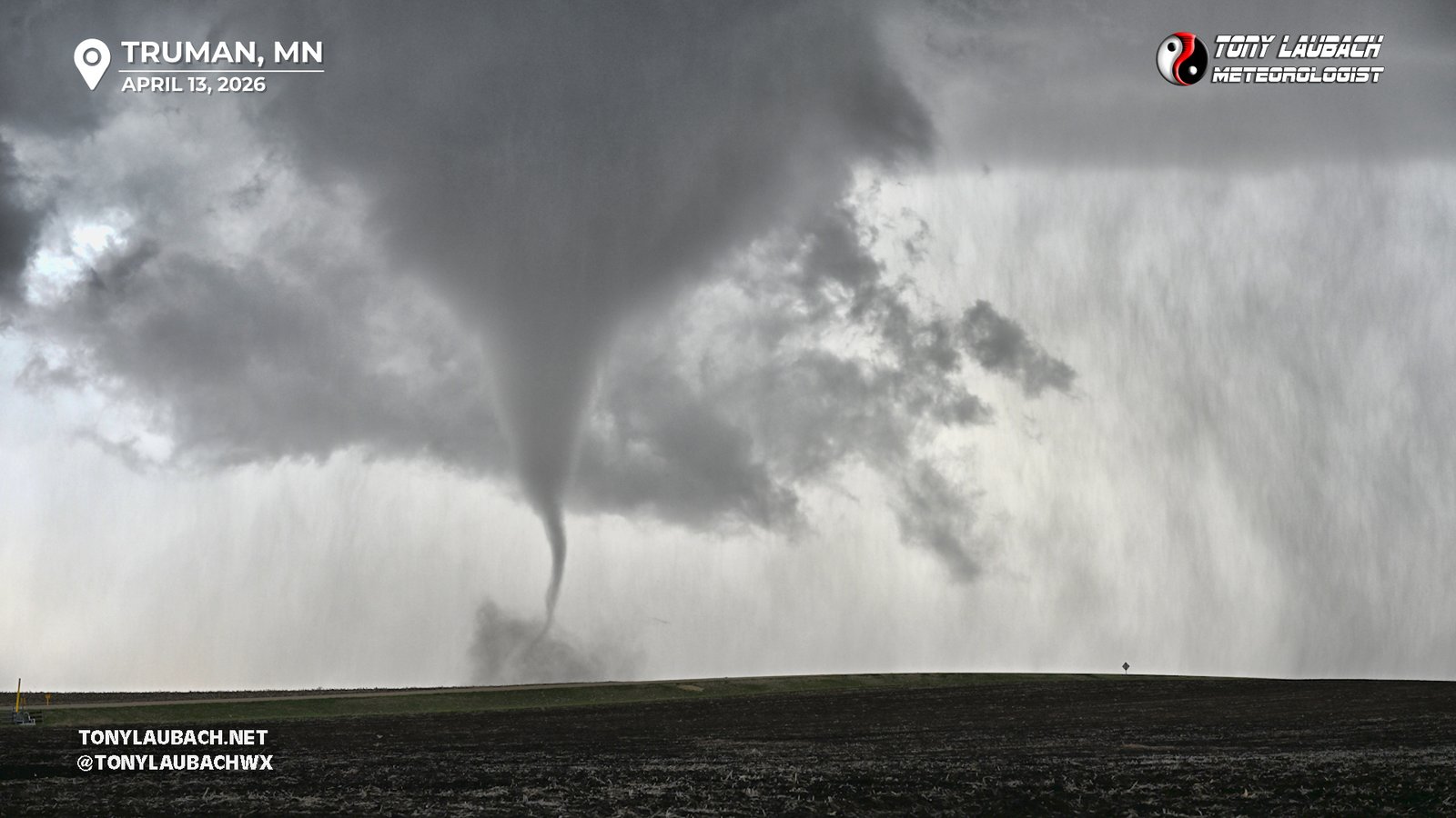
Second touchdown of parent circulation east of Truman, several minutes after original one lifted, would lose visibility as it moved northeast (515pm-540pm)
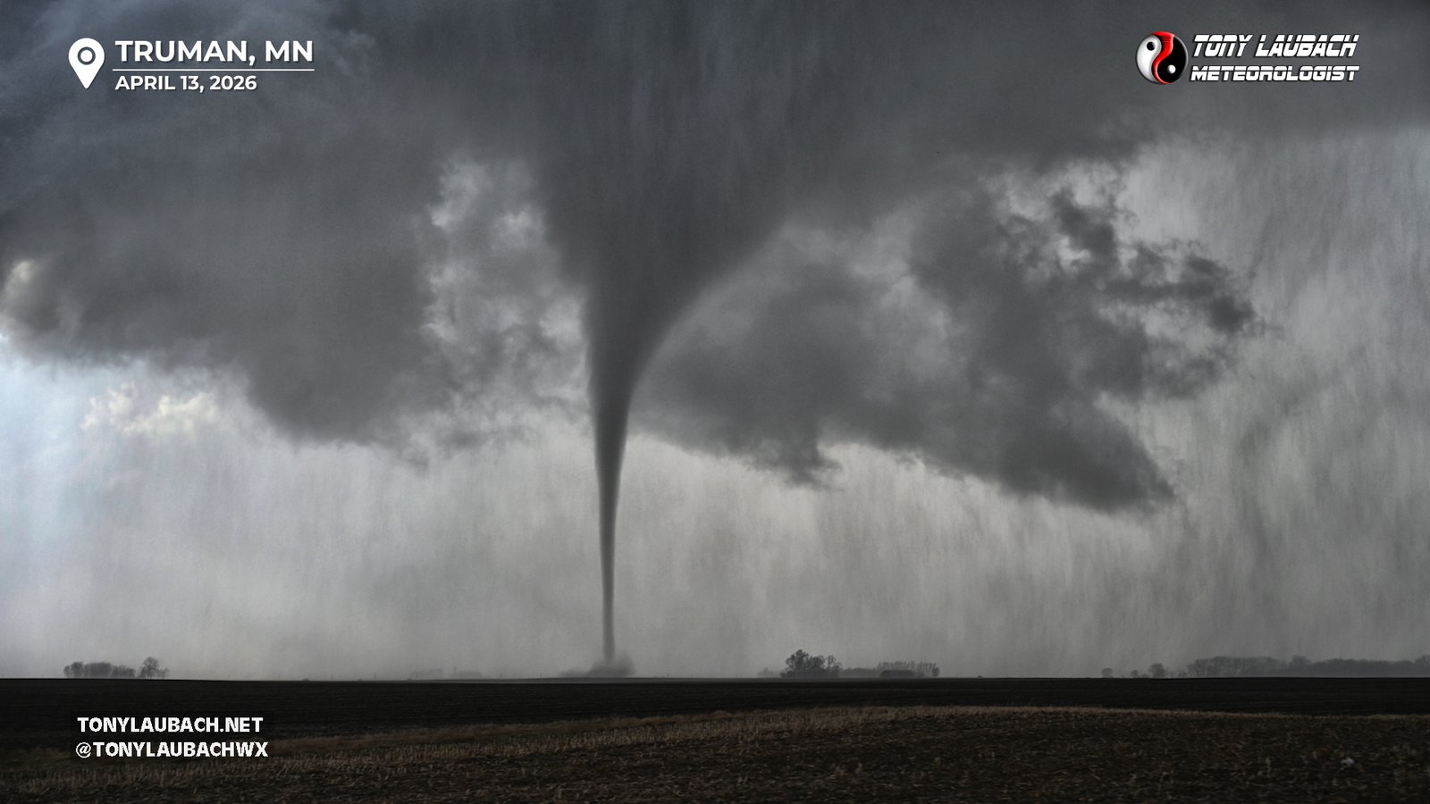
First touchdown of parent circulation, briefly fully condensed before lifting. No ground contact visible after it lifted (512pm-513pm).
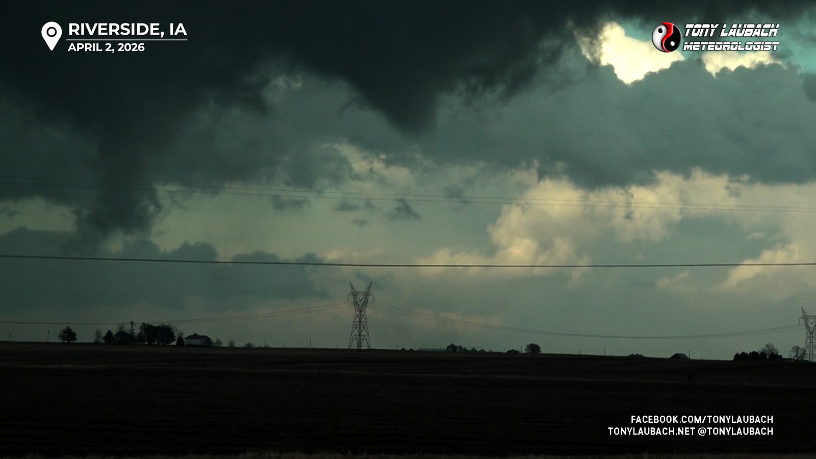
Brief tornado aired live on AccuWeather for entire 5 minute duration; looking east/northeast along IA-22 approaching Riverside.
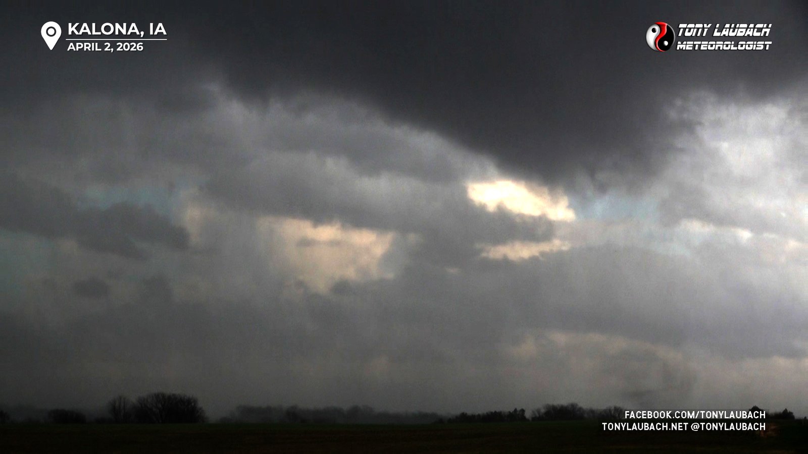
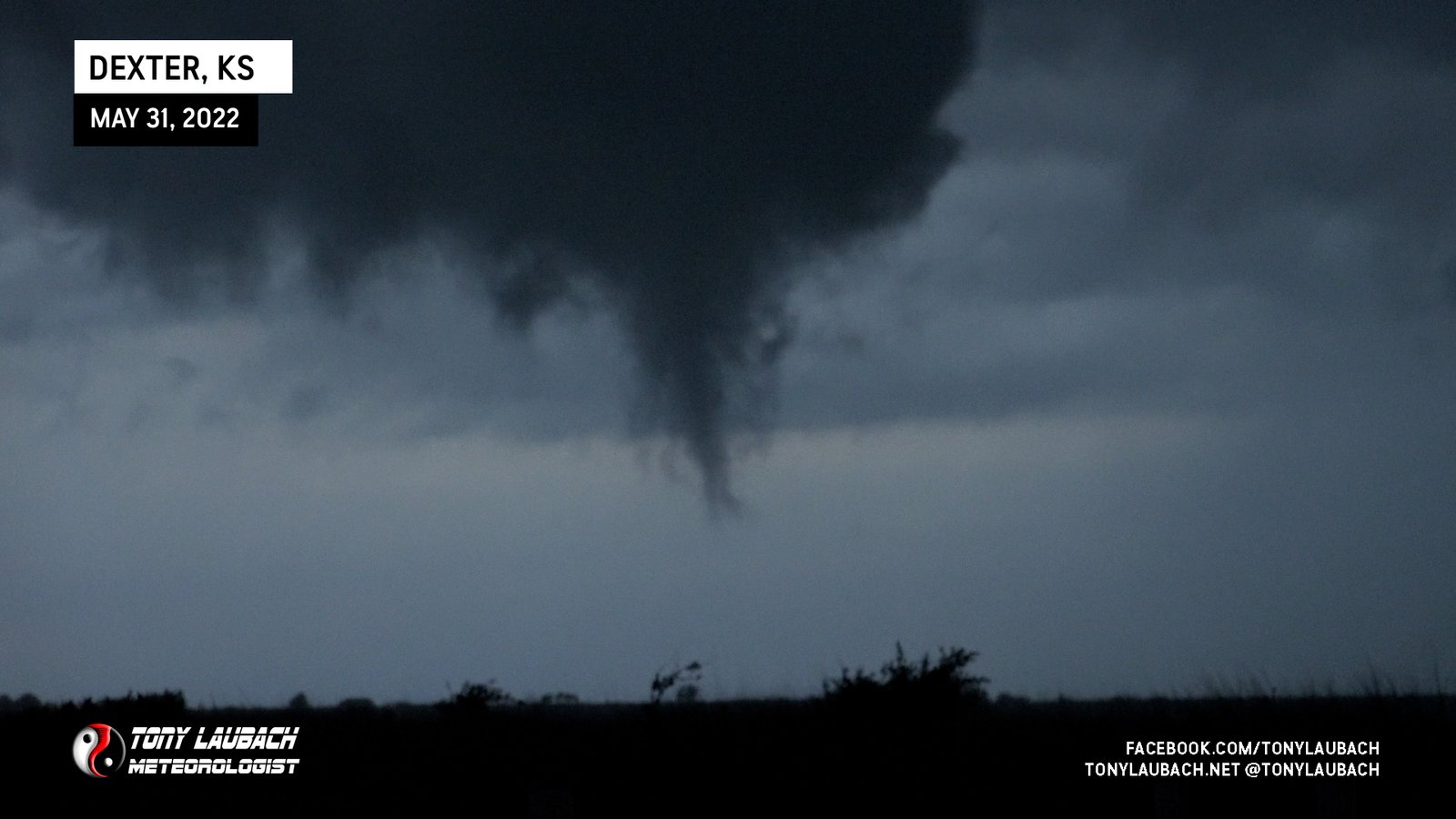
Brief tornado south of Kalona, Iowa viewed from IA-1 looking east.
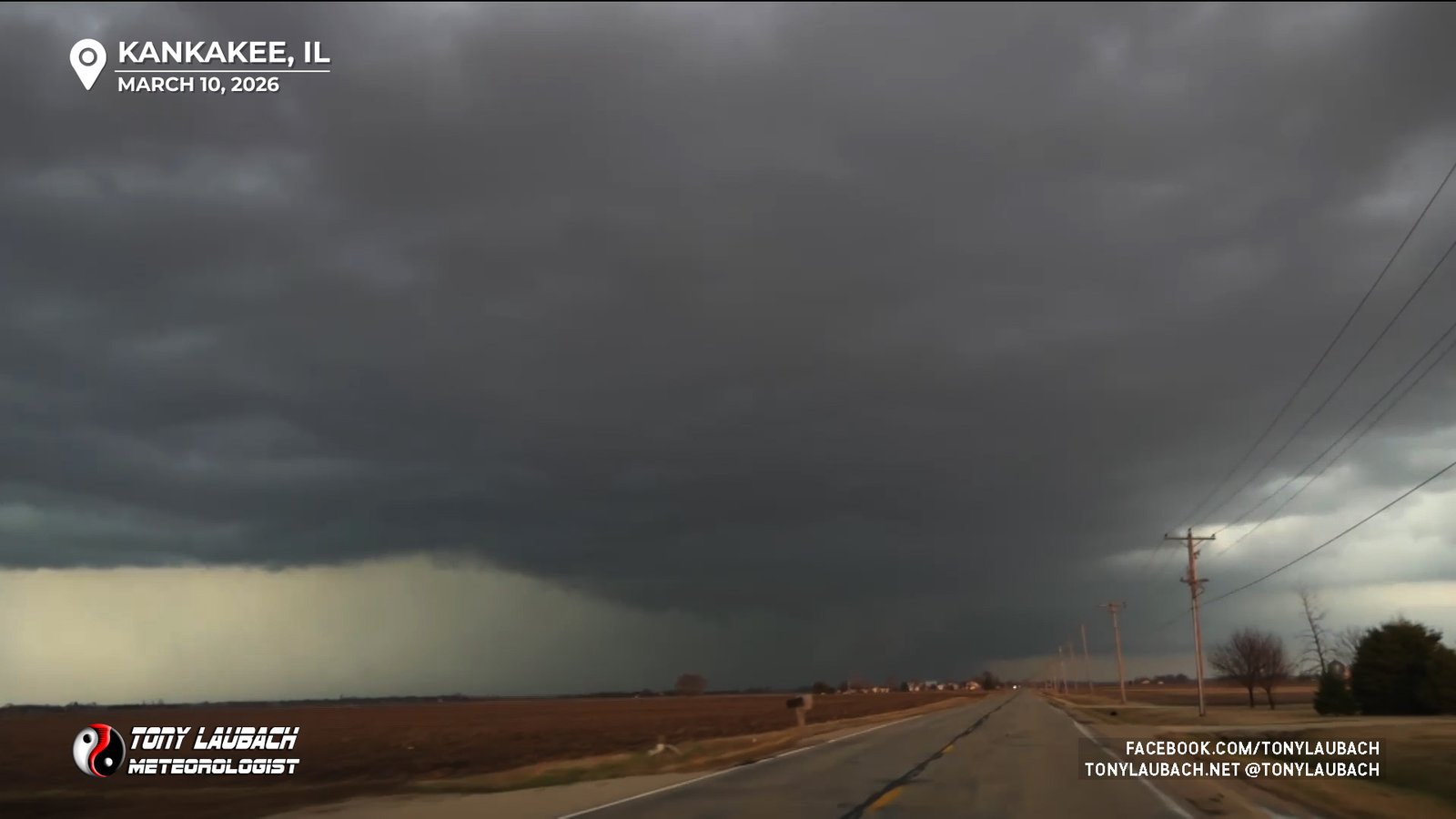
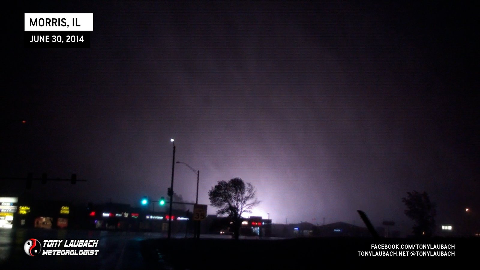
Brief view from the west as I approached the south side of Kankakee; unable to pursue beyond town.
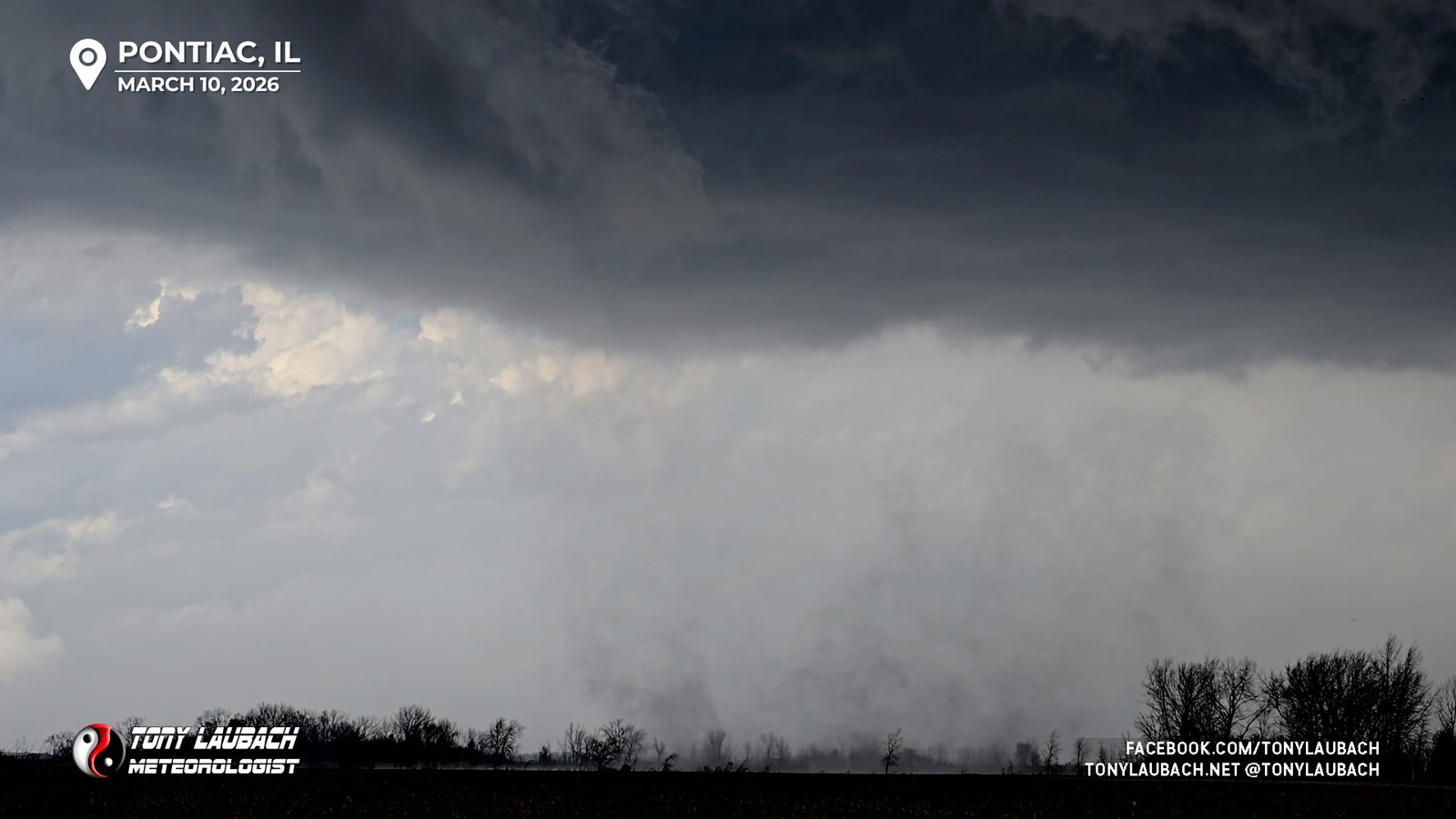
Tornado spun up beneath rapid rotation northeast of Pontiac; would cross in front of me on Old Route 66 northeast of town.
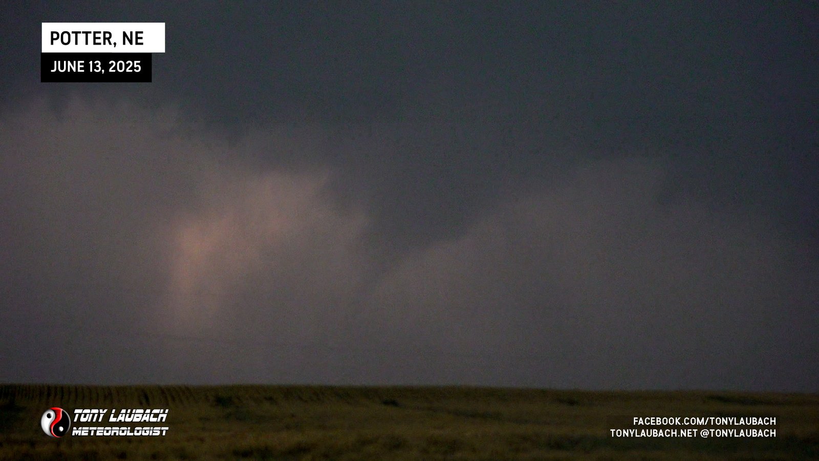
Intermittent touchdowns of a weak tornado north of Potter, Nebraska viewed from the east.
Brief Landspout Under Developing Storm South of I-80

Initial Stages of Strong Tornado, Experienced at Abandoned DQ; Do not have imagery as developing tornado moved southeast out of sight.

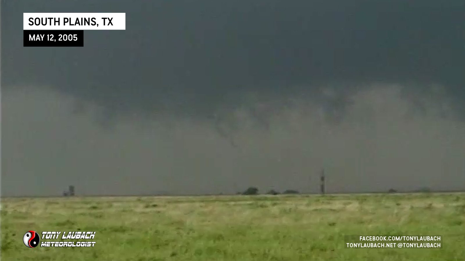
Satellite tornado ongoing to the east of the larger wedge northwest of Lubbock.

Large wedge tornado documented northwest of Lubbock.

Wedge after Morton, assumed at the time it was the same tornado; damage surveys indicate this being a separate tornado.

Brief spin-up, likely satellite spin-up on south side of larger circulation; aired live on AccuWeather Network.

Fully condensed satellite tornado during main Morton tornado, captured on video and photo.

Brief spin-up, satellite vortex of main wedge that spun up and moved east across my field of view.

Incredible dusty wedge tornado near Morton, Texas viewed from the south and southwest.

Landspout-looking tube near the TX/NM border, likely on the New Mexico side.

Dusty small tornado north of the highway east of Lingo.

While eastbound, caught rope-out of this tornado looking west across the TX/NM border.

Brief Spinup Viewed From South of Akron

Long-Lived Tornado, initially viewed from south as I approached on CO-63 as it was a wide, dusty barrel before going all pretty on us.

Long-Lived , spout-looking thing viewed from south of Merino, likely multiple touchdowns of same circulation.

Intercepted on I-70 near Grinnell, on the outer edge of the debris field as it crossed. Video went absolutely viral.
Saw the initial touchdown of this tornado as we got onto K-95, but road was in a canyon and we missed the rest of this tornado’s life.

Brief spin-up on the north side of Scott Lake.

Long-track wedge tornado documented along US-83 before moving out of sight and dissipating west of the highway.

One of two twins, this one dissipating while the other became the long-track wedge.

First tornado of the Scott-Grinnell supercell, viewed from a few miles north of Scott City.

Brief glimpse looking northwest from the western side of town.

Documented entire, short lifecycle from south side of Benton. Aired live until it lifted before reaching I-55.

Documented entire lifecycle, filmed it crossing I-55 from overpass, aired live on the AccuWeather Network.

Aired live on AccuWeather, brief touchdown and lifted before the larger Blodgett tornado.

Long-lived landspout, documented entire lifecycle while stopping several times on approach to it.

Viewed from north of North Platte, storm’s third landspout and my second sighting of the day, a brief tornado.

My first tornado viewed on the day. This was the end of the second landspout produced by this storm.

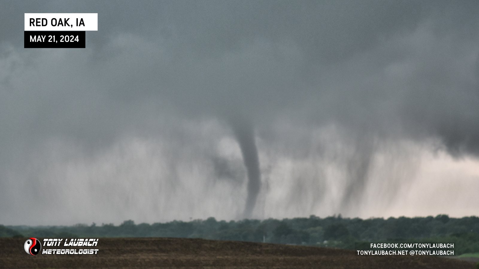
Large tornado documented at dusk near Tabor, Iowa, looking south.

A second landspout churns up north of US-30 while southern landspout was ongoing.

Landspout spins up beneath rotating clouds on the south side of US-30.

Large tornado viewed from US-259 at Trail Road, south of Lone Star, Texas.

Remnant, rain-wrapped circulation crossed I-59, likely very near to just south of us. Tornado likely diffuse, but circulation very evident.
Viewed from Antioch Baptist Church looking north/northeast, again with terrain hindering a full, unobstructed view. (Video still: Ed Grubb)

Terrain and trees blocked our view, but we observed the area of rotation and the top part of what was a confirmed tornado.

Long-lasting dust whirl under rotating wall cloud shortly after whimpnado.
Multiple, brief touchdowns, never fully condensed as the circulation moved quickly east to my south.

Landspout north of Deer Trail, lasted over 5 minutes and drifted west; saw from US-36 looking north.

Captured a low-contrast waterspout off the beach near Myrtle Beach, SD during Hurricane Debby.

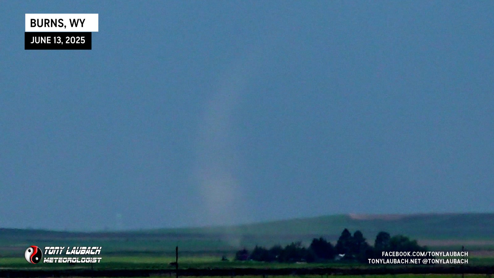
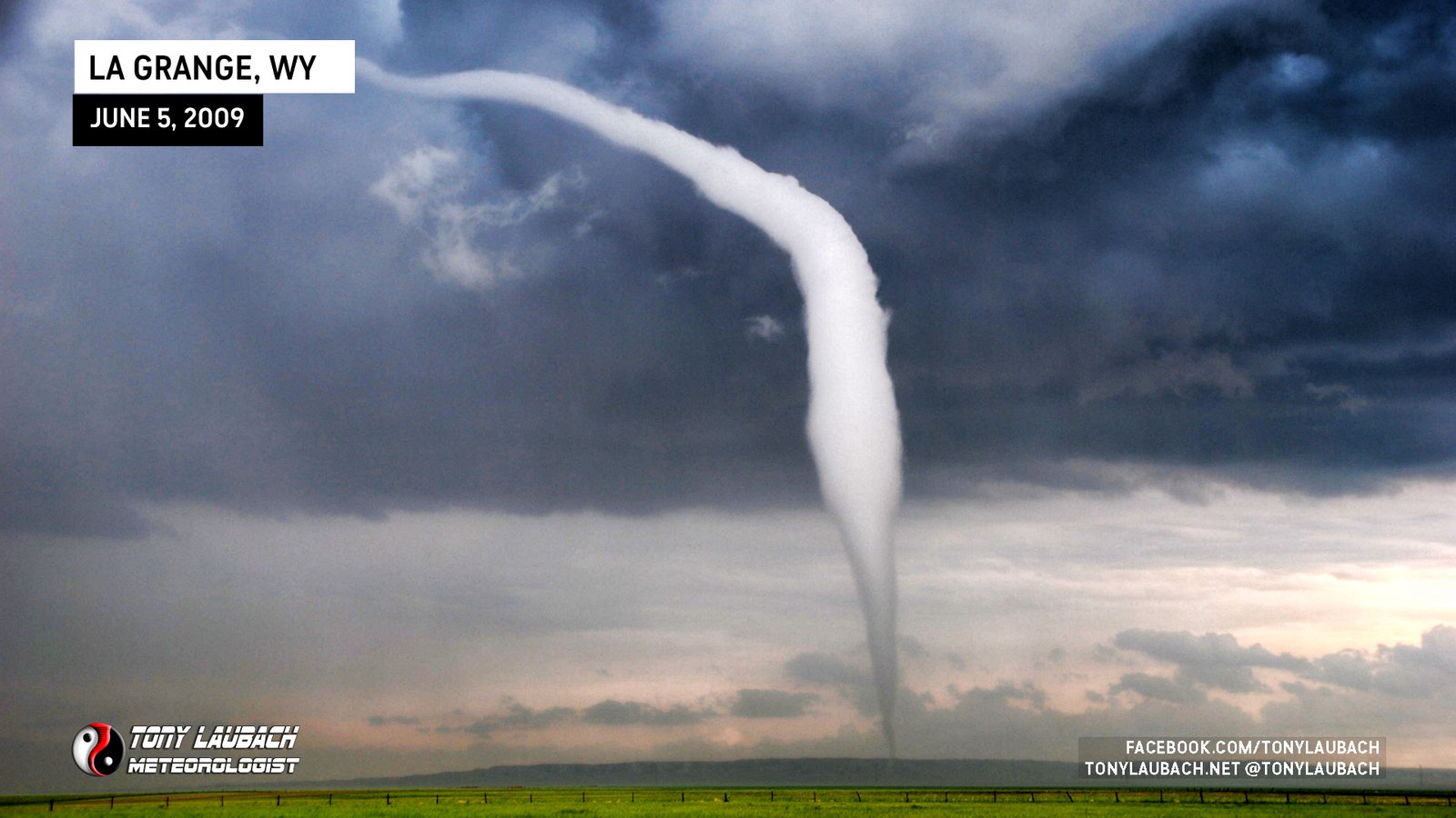
Distant view of tornado looking east from WY-313, photo snapped while driving.

Rain-wrapped tornado, viewed briefly to my north/northwest while northbound toward KS-2.
Brief touchdown behind me, lifted as I was stopping to get video and did not get turned around in time.

Distant shot looking north from US-34 south of Prescott as weak tornado moved northeast away from me.

Watched from US-34/Birch Ave north of Nodaway looking east toward Brooks/Corning, aired live on AccuWeather. Early stages of the Greenfield tornado.

Aired live on AccuWeather as tornado crossed US-34 east of Stanton, damaging property on both sides of the highway.
First of three tornadoes aired live on AccuWeather, looking back to the west at fully condensed cone.

Nubby funnel spins up dust as I backed out to clear the large hail wrapping around.

Brief QLCS tornado moving into Newton, powerflash documented on dash cam. Radar confirmed rotation west side of Newton.

Landspout that developed on the forward end of a slow moving HP supercell.

Remnants of EF-U Tornado Crossing IA-141 at US-59 east of Buck Grove; circulation passed directly in front of us.

Originally thought this was the same tornado as Defiance wedge, turns out (again) that this was a different tornado that developed on the heels of the original one.

DOW Measured Wind Speed of 224MPH; Wall-to-wall live on AccuWeather for nearly 30 minutes.

Very close encounter on the other side of Soldier of a strong, but visually disorganized tornado.

Low contrast view of a tornado to our distant south, sighted by Ed as we got outside of Soldier.

Another large wedge intercept near Wolbach, originally thought it was the Elba tornado, but it was a new one. Intercepted about a mile south.

Large wedge tornado, intercepted from the south; super-close intercept north of Elba.

First tornado of the event, a quick touchdown that lifted as it crossed the road in front of us.

Wide funnel briefly touches down southeast of Yuma for the day’s fourth tornado.

Brief touchdown to my northwest, southeast of Yuma.

Large dusty tornado morphed into photogenic tube on what of the most unusual tornado paths I had ever seen. Did live stand-up in front of this tornado, first one ever.

Dusty spin-up ahead of larger, long-lived Yuma tornado.
Saw from I-25, Exit 39 looking distant southwest; had just done a selfie with Ed Grubb and Tim Marshall.
Missed the first half of the tornado, but was able to get positioned to the east and viewed the incredible rope-out!
Low-contrast view of the brief tornado that touched down south of the larger Gering tornado as I was exiting town after the hail.

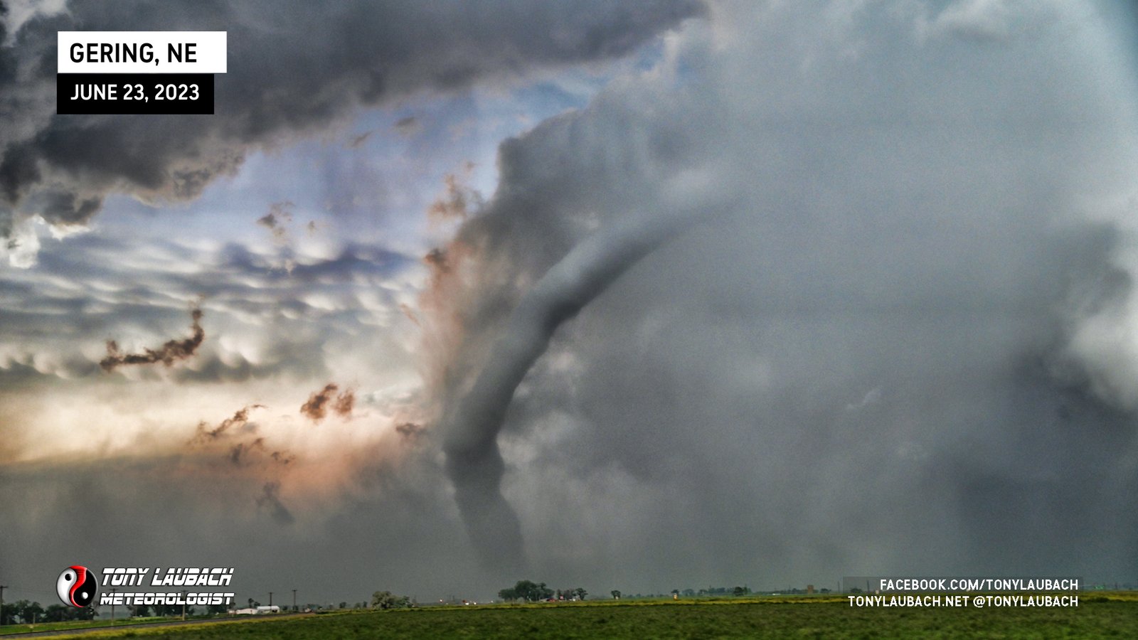
One of the better views of tornadoes I had on this day, the fifth tornado and first I saw in Nebraska.
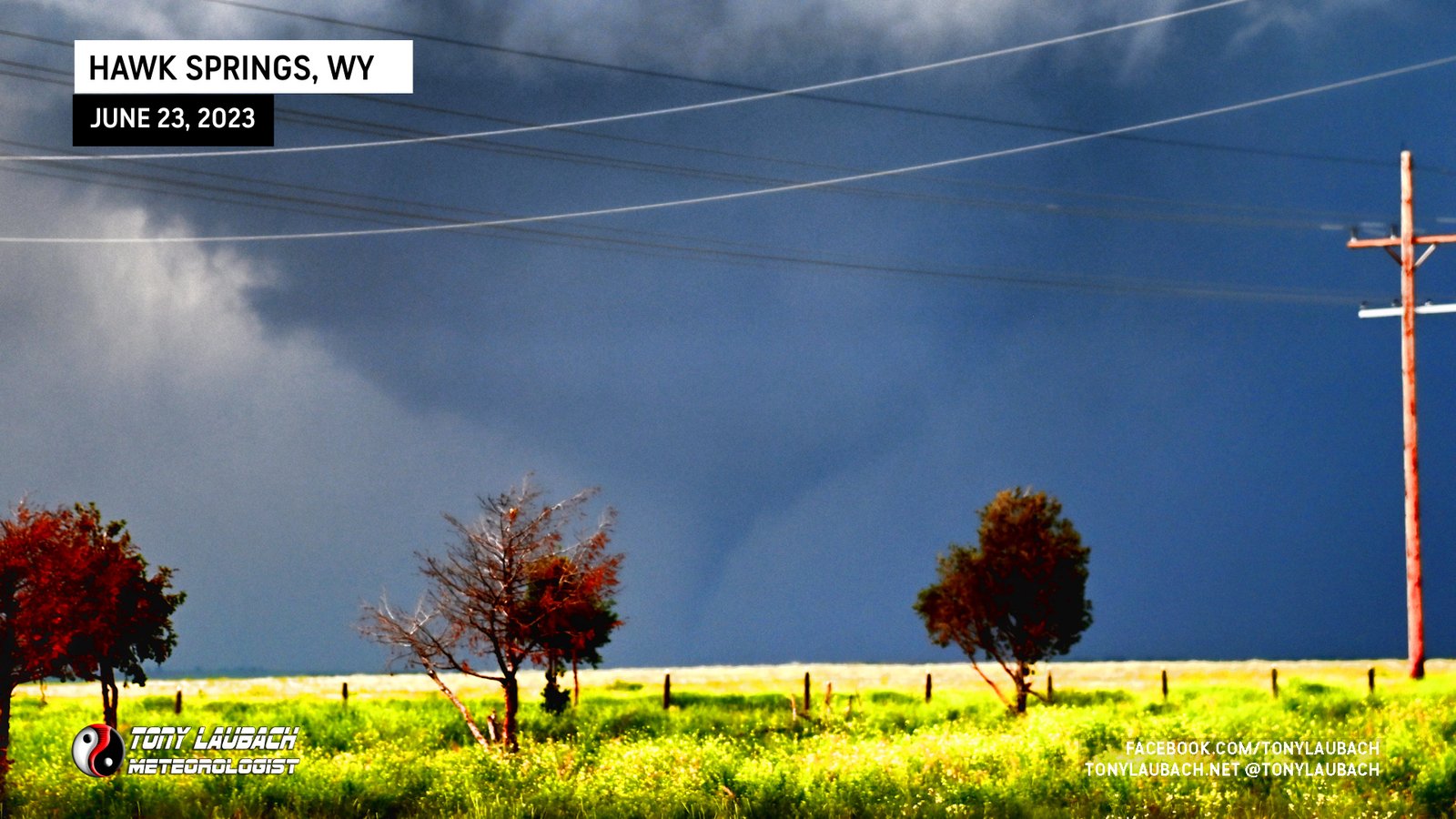
Distant view of the Hawk Springs tornado as I had repositioned way east to keep ahead of the chaser congo line.

Third tornado of the day, aired LIVE on AccuWeather from Hawk Springs looking back to the west.
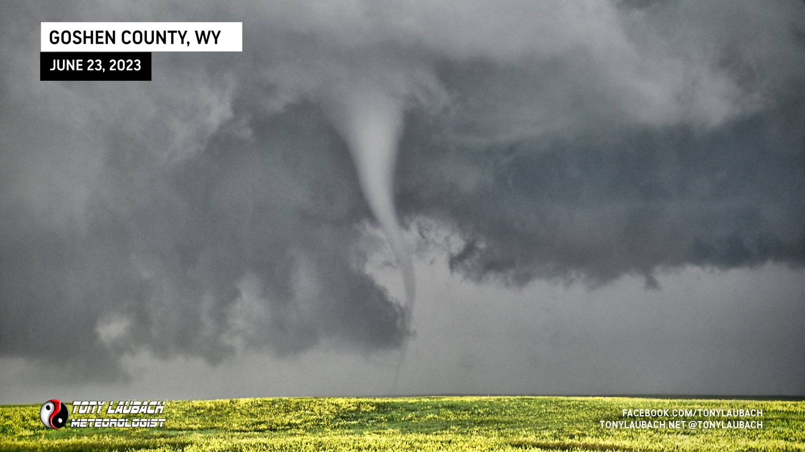
Gorgeous, small tornado viewed from east of Chugwater.
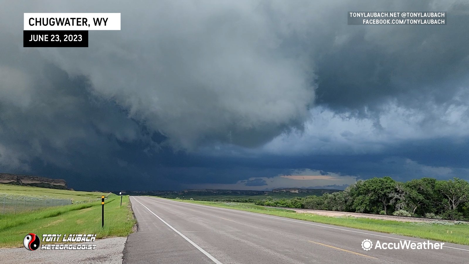
Developed over me northeast of Chugwater. Saw bowl funnel as it approached WY-321, but was unable to get shot as tornado fully formed due to terrain and structures. Initial touchdown may have happened over me while proceeding south on highway.

Viewed Highlands Ranch Tornado from near E-470 looking west. Chase partner, Ed Grubb, captured better still, albeit pretty weak given our location.

Long-lived multi-vortex tornado; multiple transitions during my 10-minute viewing; aired LIVE on AccuWeather!
The last tornado I would see during the carousel sequence prior to the development of the long-lived multi-vortex.
Another tornado circles around the western edge of the meso as I proceed north on CR-BB.
My first tornado after working my way over to County Road BB (16th on the day), looking north at career tornado #400.
Another touchdown during the carousel sequence as I continue to back south.
New spin-up occurs as I start to retreat back to the south, caught on dash-cam.

A wider, non-condensed ground circulation spins up east of the mini-wedge.
A mini-wedge, the largest and most impressive tornado during the carousel sequence.
The western-most of two brief touchdowns west of the highway looking north.
The eastern-most of two brief touchdowns west of the highway looking north.
Another tornado touches down west of the highway looking north.

Skinny, rope tornado briefly touches down east of CO-63.
Another touchdown west of the highway on my north approach.

First tornado I saw during the carousel sequence looking north along CO-63.

Tornado further back/behind the larger satellite during the triplet phase.
The larger of the two satellite tornadoes associated with the main white tornado.
The main tornado in the twins/triplet sequence that I documented from birth to death from less than 200 yards to the south along CO-63.
Brief touchdown to my north while I was editing video from the first tornado.
The initial tornado of the Akron outbreak, a ropey tornado that crossed immediately to my south across CO-63 and did no damage.
Brief touchdown to our north, confirmed by other chasers.
Saw out my back window while feeding the cats at home. Got one blurry shot as I got greedy and tried to get close.
Brief touchdown, chase partner, Rochelle, has documentation of the touchdown to our west.
This the most “tornado” of the tornadoes of the day, but still couldn’t get a complete tornado from it. This was the fourth, and adding them all up barely equaled one.

Largest, most visually ‘real’ looking tornado of the day, but of course I was north of it staring through a big rain core.
Another wispy birdfart, but another notch making the second of the day, even as they barely equaled half a real tornado.
Wispy-looking piddle-bucket made multiple attempts to be something other than a birdfart, but did ‘condense’, if you will, a couple brief times.
Satellite of a larger tornado to the southeast hits me head-on, fortunately was not strong and only popped my ears.
Large, close-range intercept of wide, dusty landspout; circulation was almost directly overhead.
Another landspout encounter southwest of Akron during this spout-fest day.
Larger of the two was a landspout as I observed a small funnel above this, could not confirm the smaller one further away.
Dash-cam catches moment a tornado hit a church up the street from us. Remnant circulation would pass near us on its short path through town.
Large funnel with faint, low-contrast swirlies beneath it.

Brief, weak multi-vortex with multiple brief touchdowns.
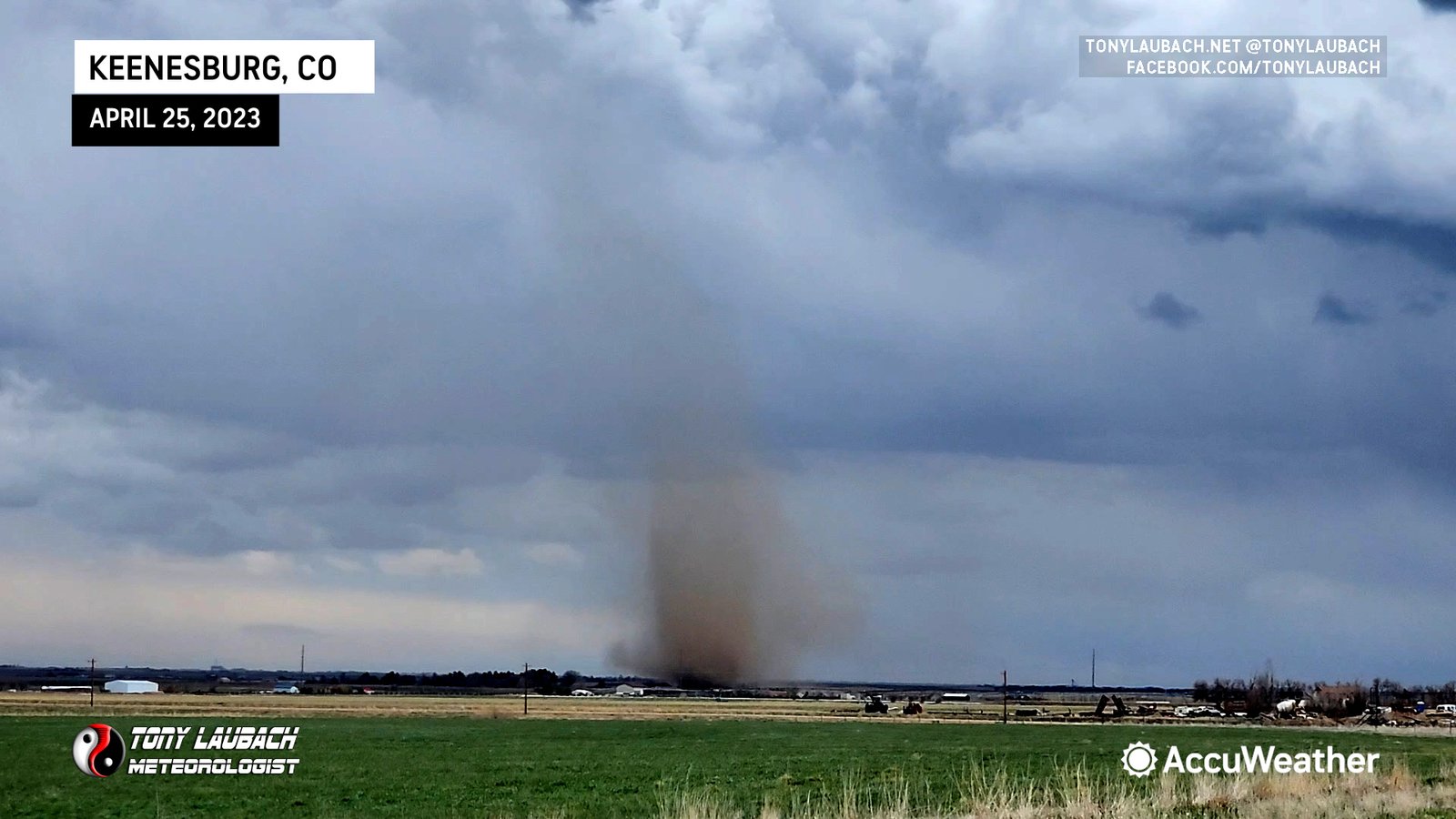
Long-lived landspout south of Keenesburg, viewed after sampling the hail core in town.

Brief, fully-condensed cone tornado, aired live on AccuWeather.
Top 5 tornado intercept, massive tornado we documented from birth til it raced northeast out of sight, crossing the road in front of us by about half a mile.

Power flash illuminated the funnel in tornado’s final seconds, looking north toward Yukon.
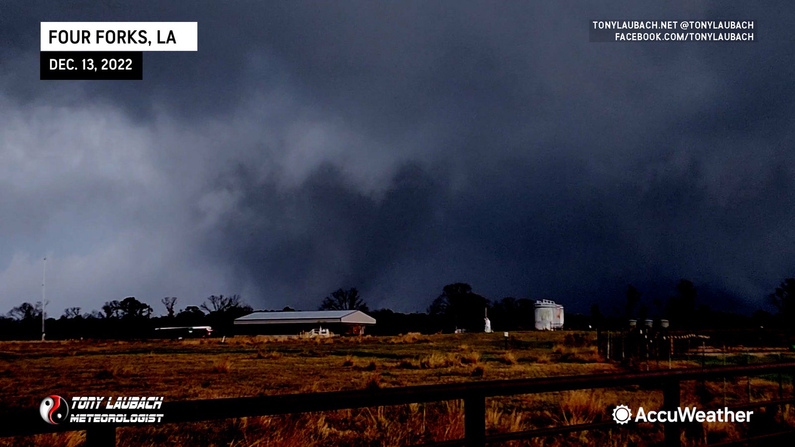
Observed Large Tornado Near Four Forks (First LA Tornado)
Documented top half of a large tornado, confirmed via multiple other sources (including other chaser drone).

Large, Strong Tornado South of Sulphur Springs
Nighttime wispy tornado north of US-36 viewed from west of Idalia.
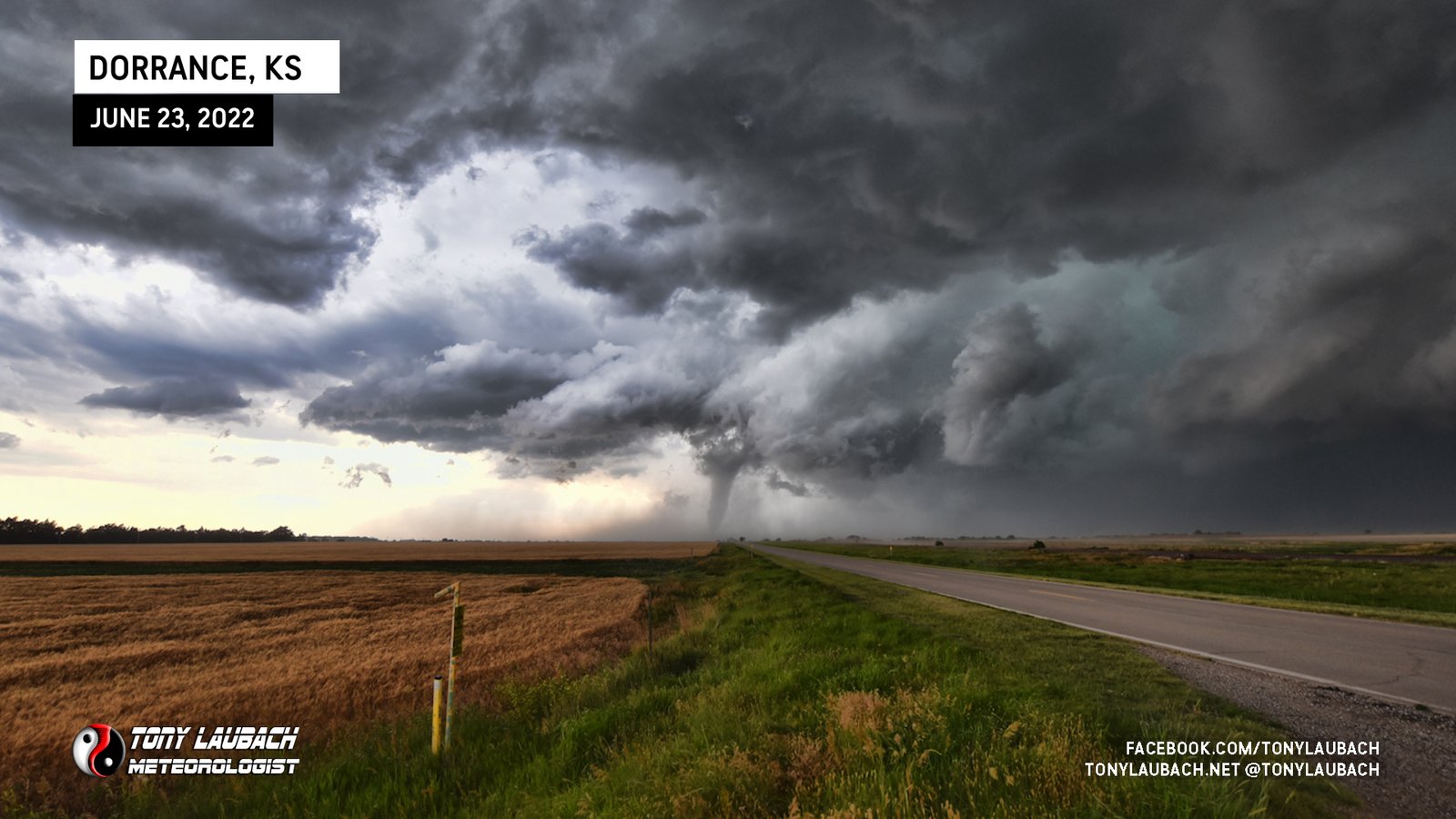
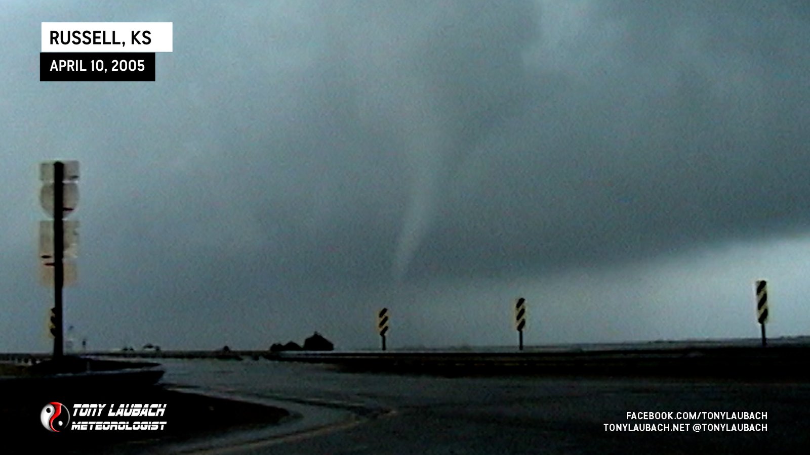
Looking back to the west from near Dorrance as tornado emerges from rain.

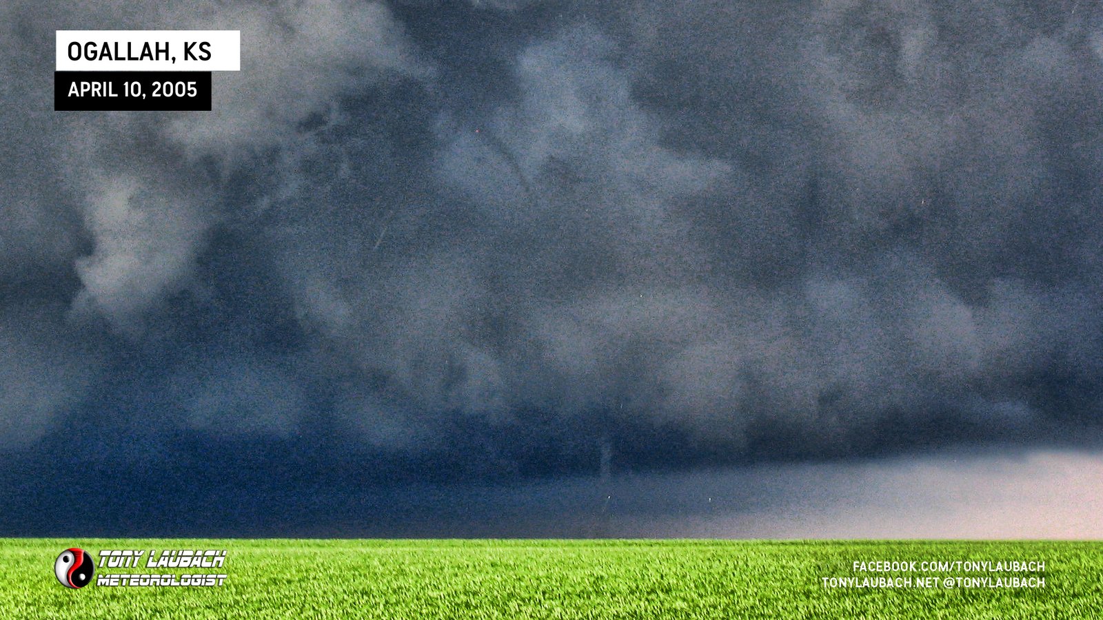
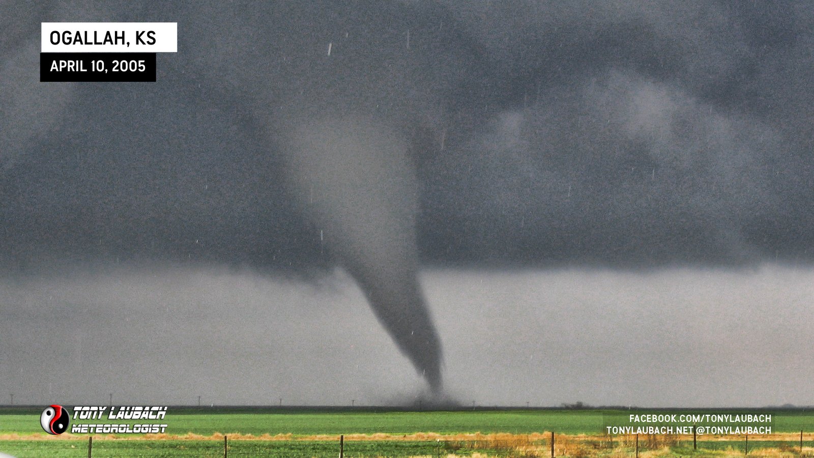
Funnel observed touching down northeast of Bunker Hill from center median of I-70.
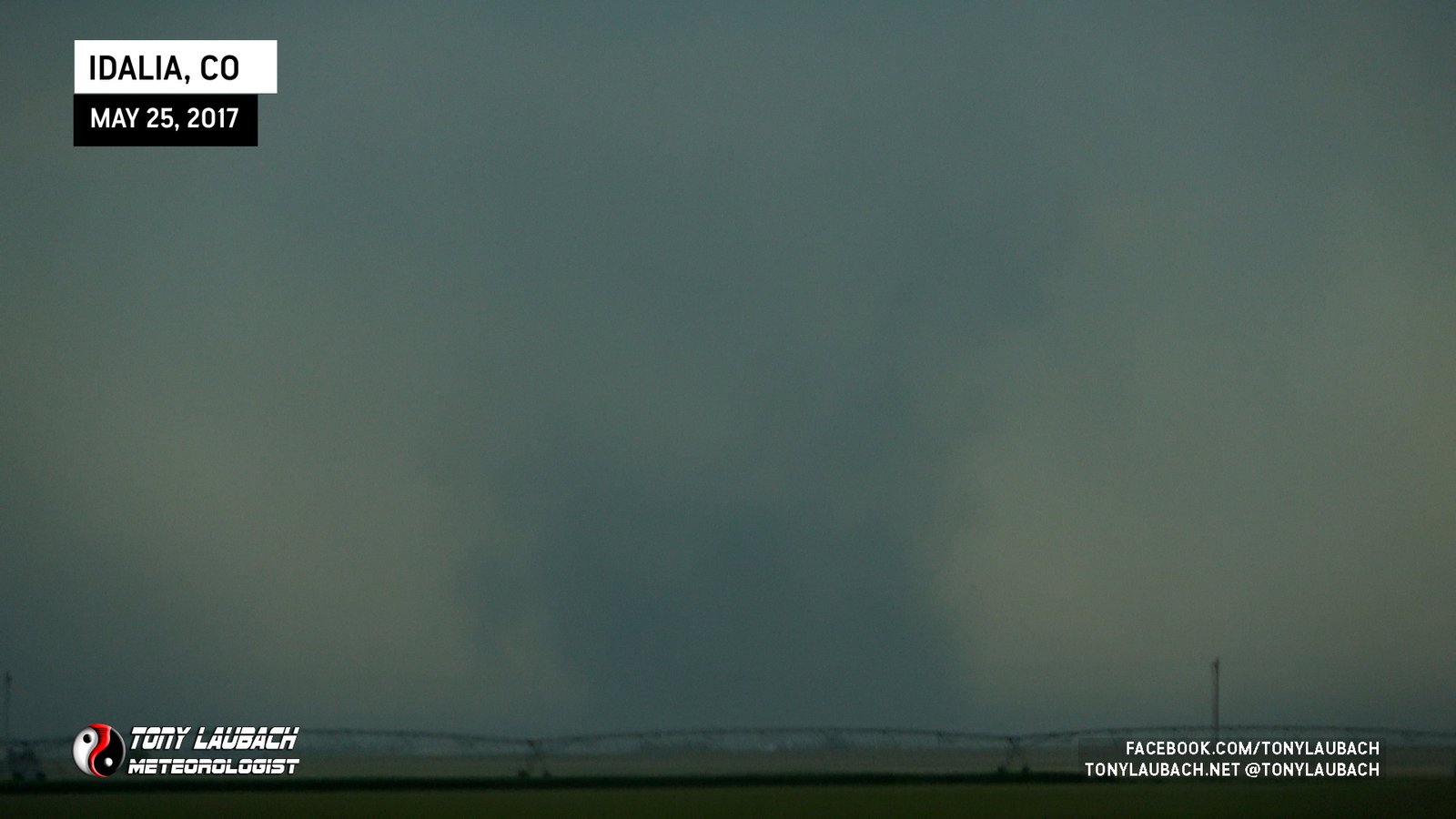
Landspout south of Idalia viewed from US-36 near Idalia.
Wispy spin up beneath funnel, briefly touched down kicking up ever-so-enough dust.

Brief spin-up beneath (to the left) of small funnel protruding from clouds near Mission.

Wind farm tornado, documented entire lifecycle of this event.
Landspout viewed from US-83 looking west from south of Paducah.
Video of funnel from I-70 looking southwest; ground circulation confirmed by multiple chasers with closer, better views.
First major Iowa tornado, most visually impressive in the state to date; looking back to the west from too far away.

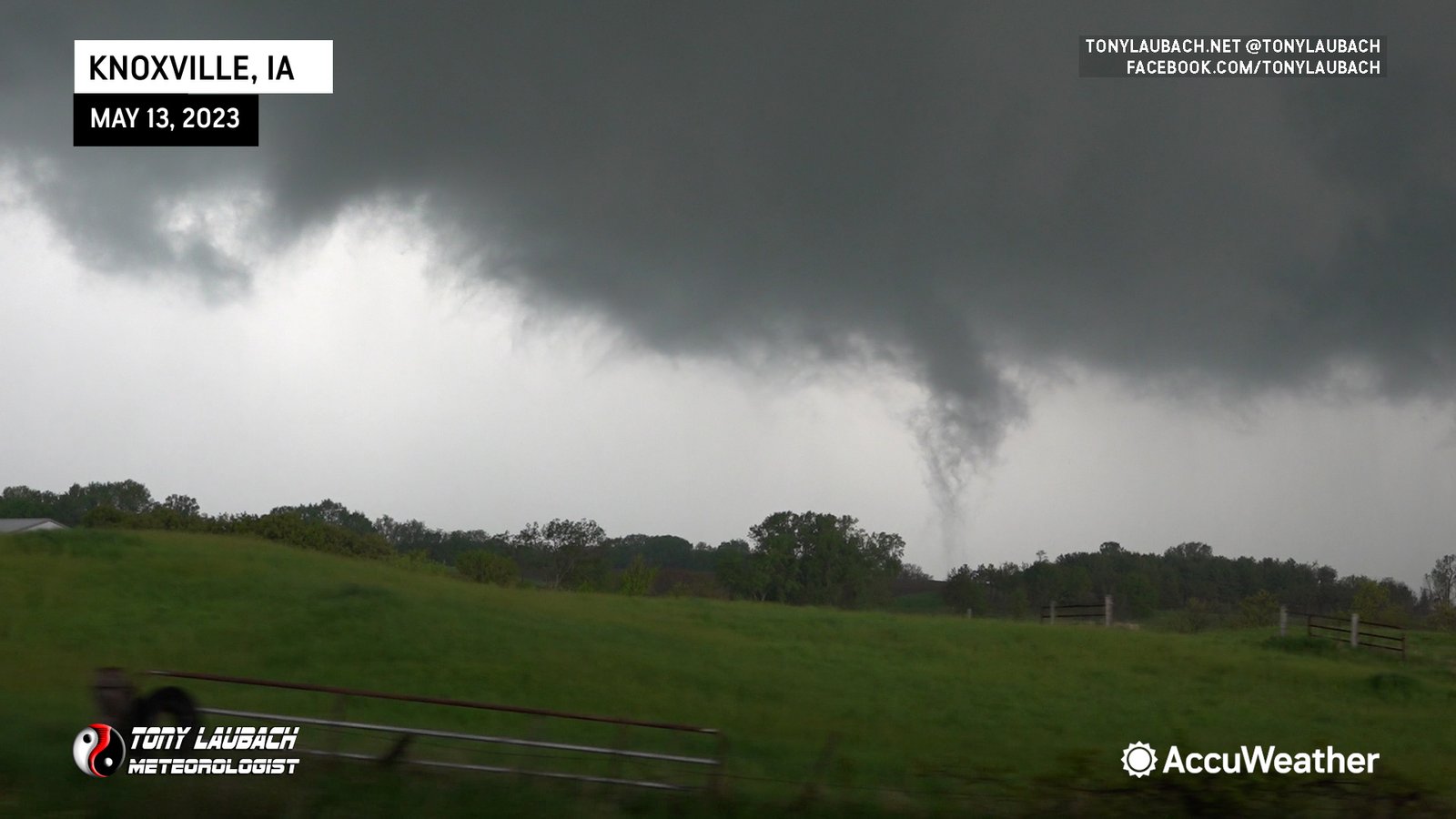
Viewed from I-40 ‘Overlook’ Rest Stop south of Knoxville looking northwest; early stages of Piney tornado.
QLCS tornado south of Cimarron looking north along K-23. Video still from Ed Grubb in passenger seat.

First tornado I aired live on the AccuWeather Network just over 3 months after starting; unofficially the first live aired tornado of the network.
Originally thought this was extension of the Sycamore tornado; was surveyed to be brief tornado after Sycamore ended.

Best documentation of the entire event, long-lived, photogenic tornado moved slowly right to left across my view from the north.
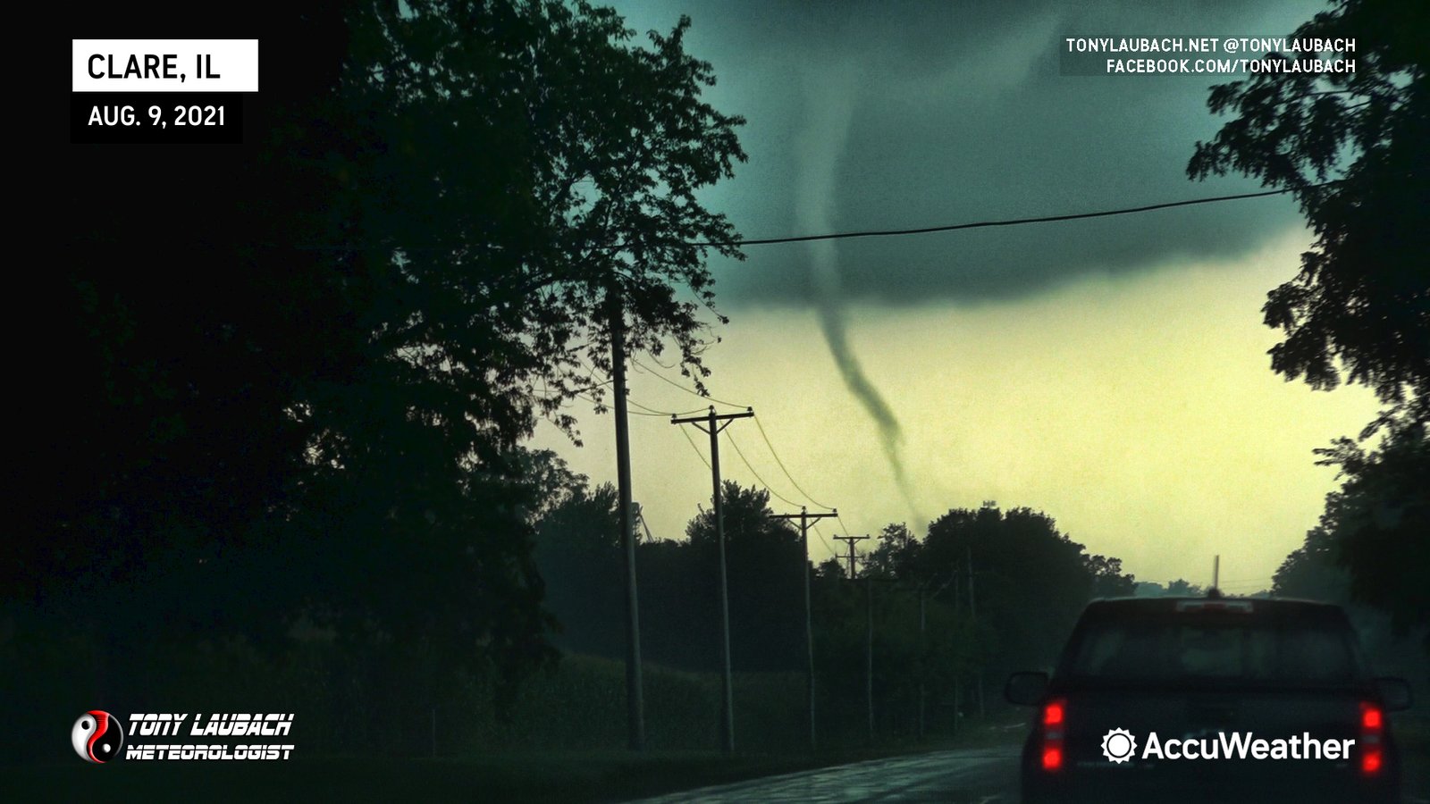
Viewed while westbound on IL-64 south of Clare in a short chaser congo line.

Stationary viewing looking north as it eventually would wrap in rain.

Brief touchdown viewed from the west.
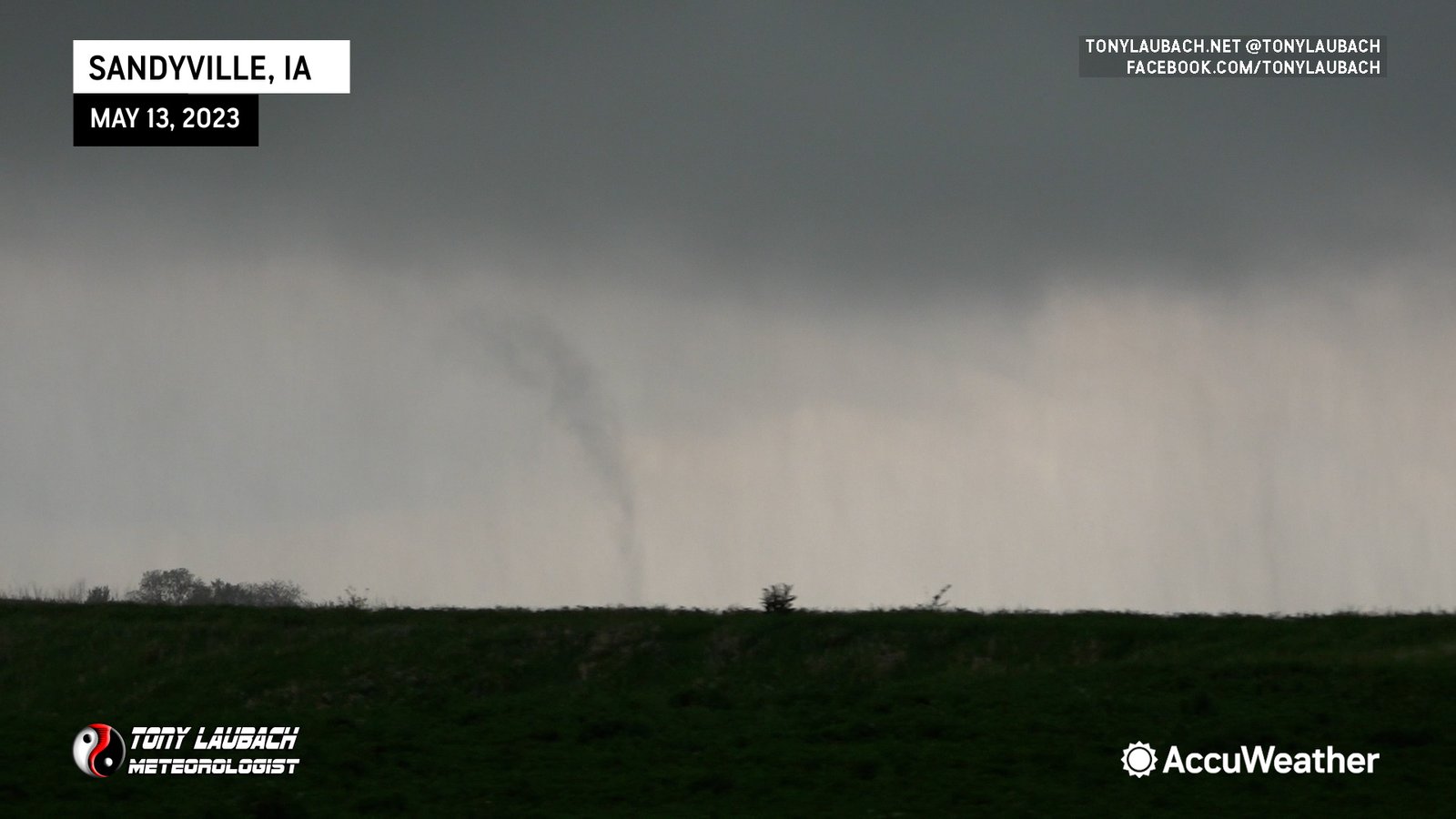
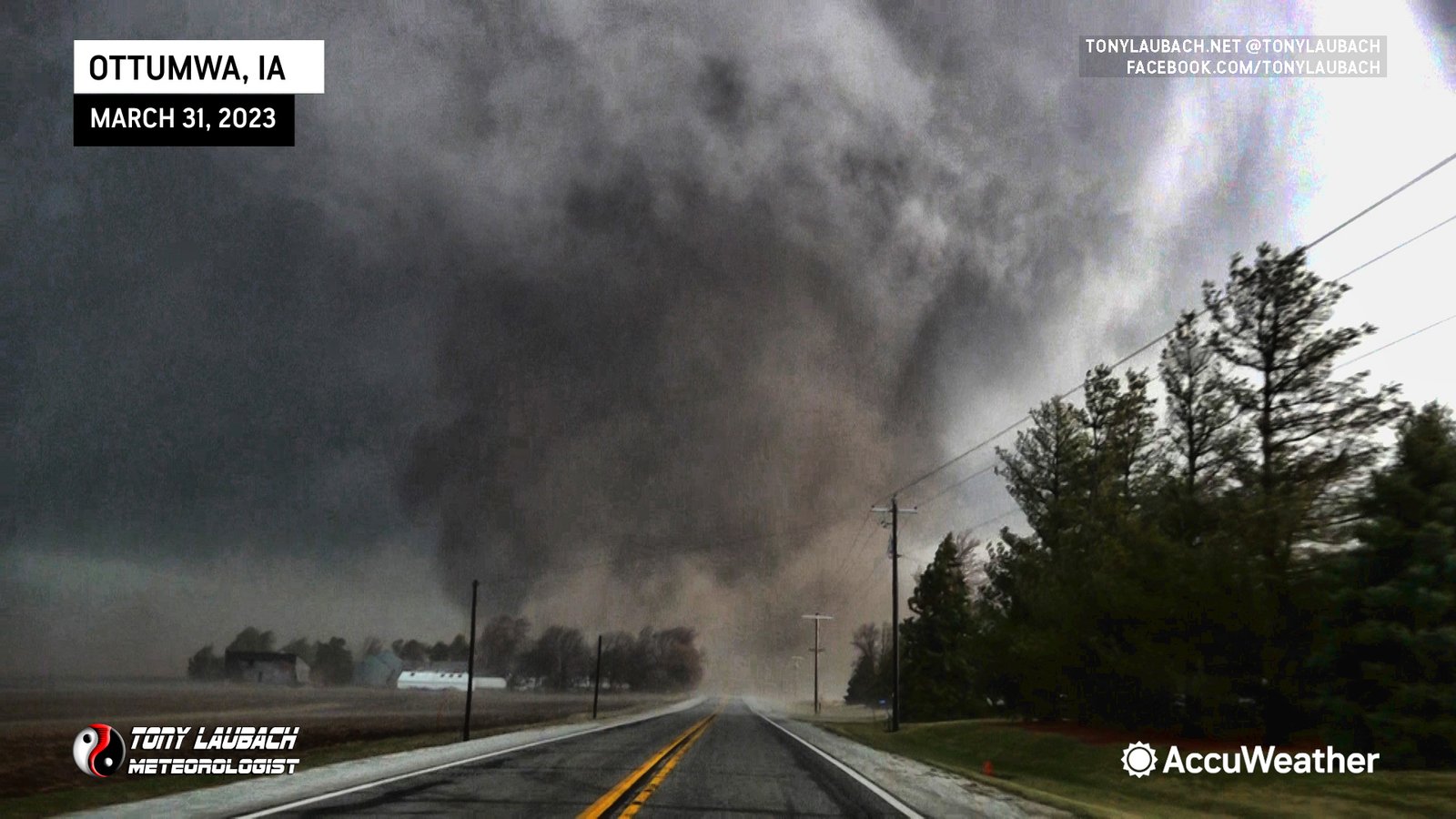
It took over 20 years, but this was my first legit Iowa tornado; buried in the rain, but completely visible.
Closing Day/Move-In Day Tornado! Dania spotted from our porch as funnel and we would watch nearly 30 minutes of this record-tall landspout less than 2 hours after closing on our new home.
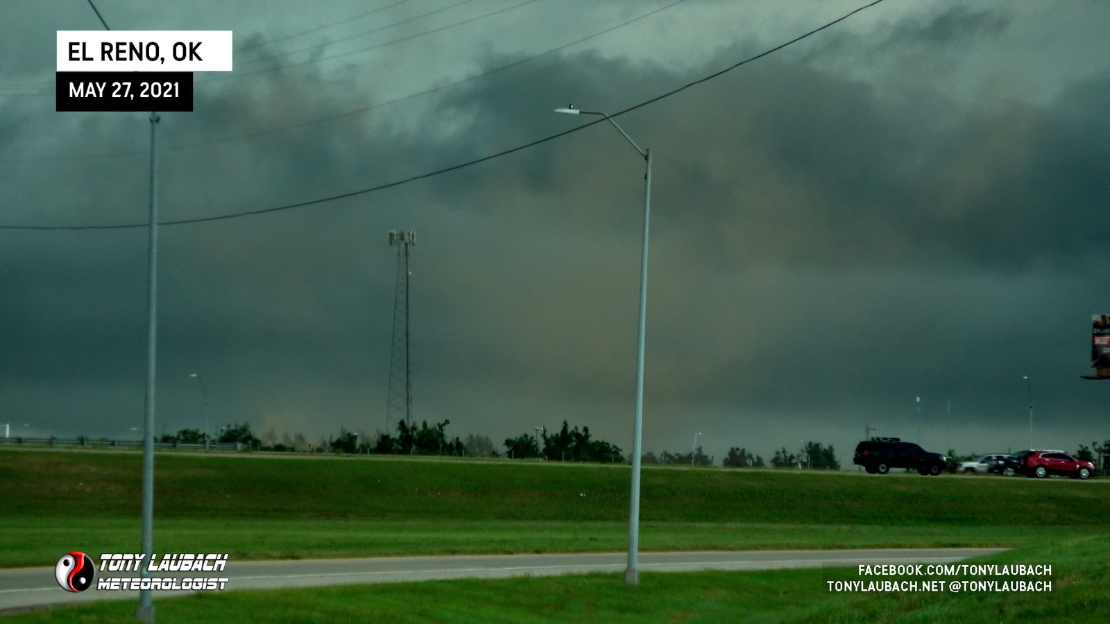
Brief, dusty spin-up outside El Reno near I-40.
First Colorado tornado of my second stint there; saw about 24 hours after moving back south of Akron along CO-63 looking west.

Third and final landspout of the day, most defined and closest view of one I saw.

Second landspout of the day, viewed a little closer form the north along CO-59.

First spout of the day, viewed from distant north from CO-59.
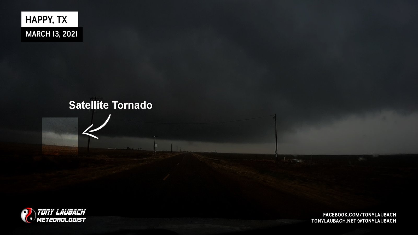
Likely satellite tornado of the larger wedge that rotated in behind the main tornado.
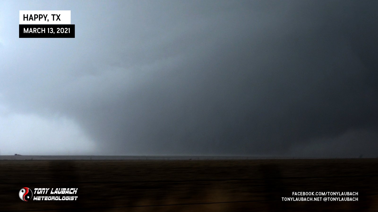
Massive wedge I caught the birth of west of Happy and documented til it moved northeast out of my site after I was temporarily immobilized by RFD and slick roads.

Terrain blocked my view of the ground, but several chasers (including ‘Tornado Tim’) were able to confirm and document ground circulation. My only LEGIT Covid year tornado.
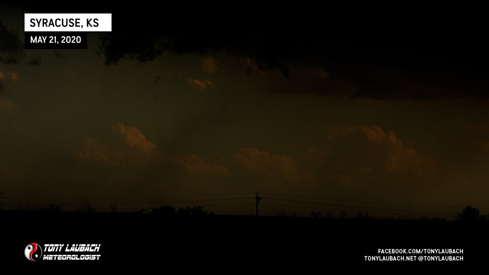
Low-contrast view of weak landspout south of Syracuse, viewed from the north along US-400. Thank God this wasn’t the one tornado I had to lean on for 2020.
Nighttime video-grab of well defined tornado looking north after sunset.

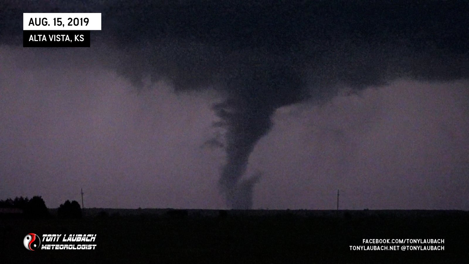
White cone, briefly touched down to my east north of Alta Vista.
North of Bethune, viewed briefly along I-70 eastbound while mobile, no imagery.

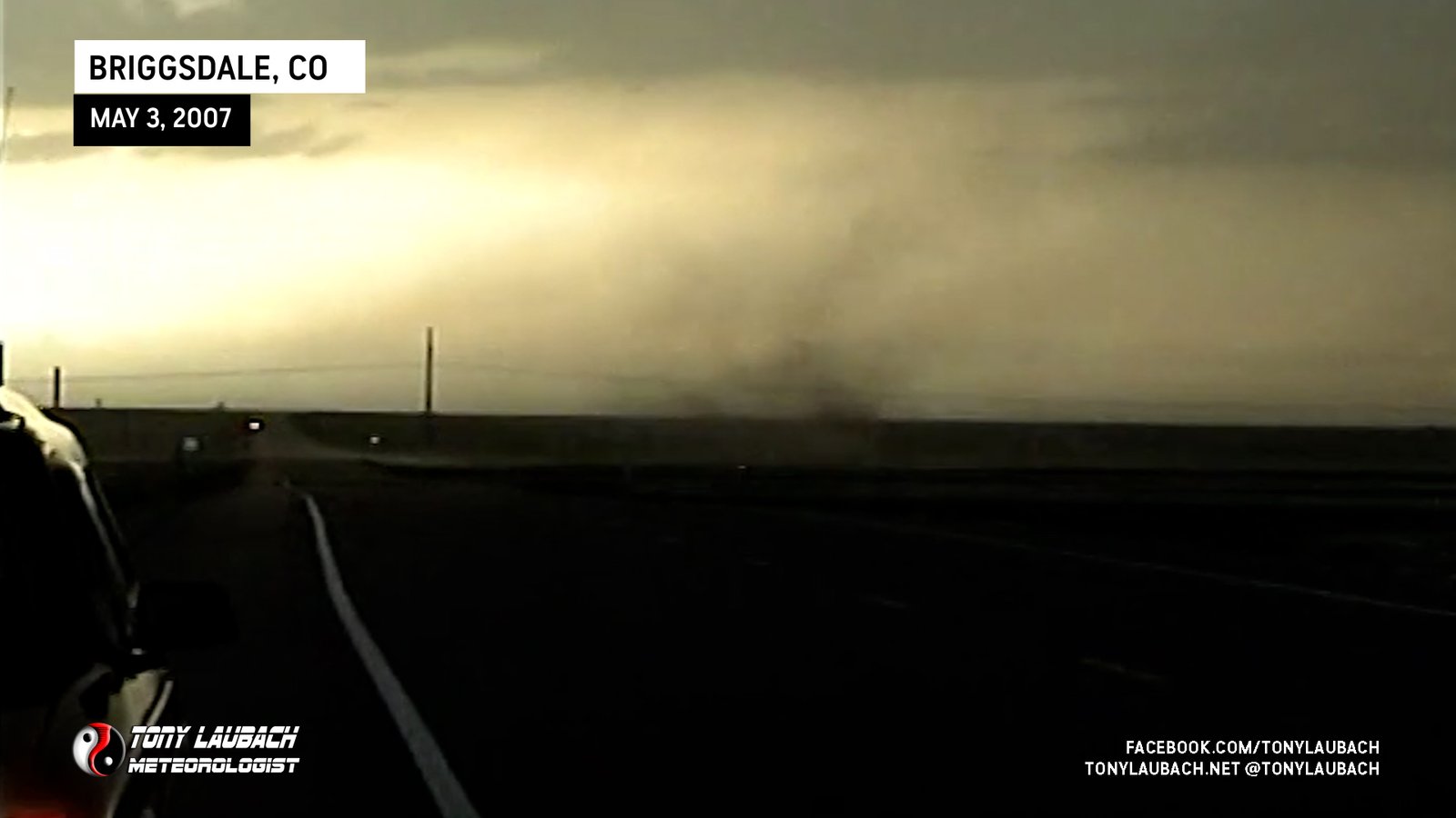
One of the biggest surprise tornadoes of my career; caught after hundreds of chasers vacated the area on what was a busted 10% in Colorado.

Caught a brief view of the early part of the nighttime Lewis tornado, lightning was not doing me any favors to bring it out.
Captured funnel and brief touchdown near the KS/NE border north of Atwood as supercell became prolific tornado producer in Nebraska.
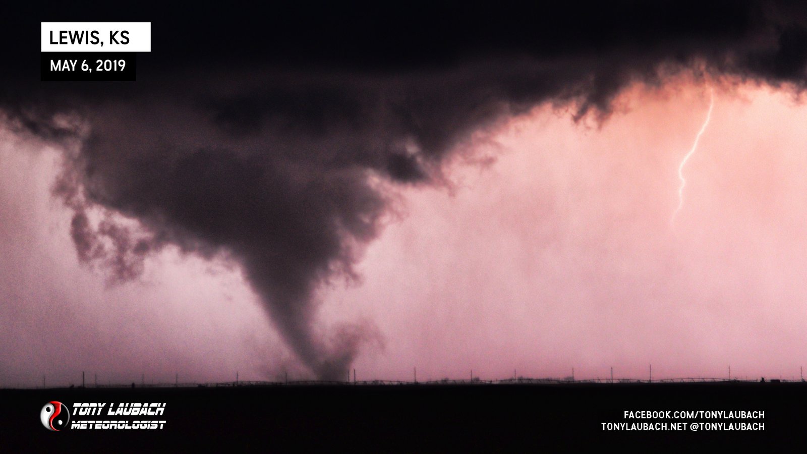
One of my favorite all-time tornado photos I snapped; gorgeous pink backlighting near Lewis.

Large tornado wraps in rain south of Alden

Brief needle-nado near El Dorado, Kansas.
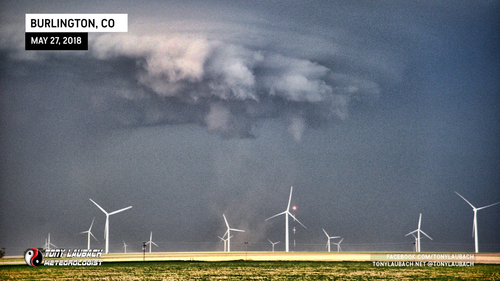
Tornado visible looking north from I-70 east of Burlington.
My first tornado as a Wichita resident; aired Live on KAKE-TV two months after starting at the station.
Sleek, black tornado off to immediate west, documented from birth to rope out.
White tornado due north of me, caught the rope-out after clearing a hill.
Incredible photogenic tornado that developed just south of the state line and moved into southern Wyoming. Did a recorded standup in front of this tornado.
Dusty looking tornado looking east from US-36 as tornado moved east toward KS state line.

Slender, photogenic tornado south of McLean, Texas.
Witnessed brief touchdown looking north along US-62, unable to get imagery while driving and low contrast.

Intermittent touchdowns of weak tornado outside Bula, Texas.
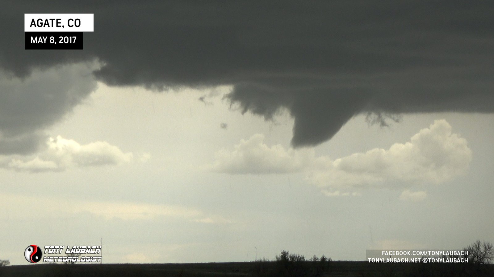
Viewed long-lived funnel (~14 minutes) from I-70 near Agate with intermitted touchdowns confirmed by other chasers closer further south.
The nighttime intercept of the tornado that mowed through Perryville and crossed the river into IL where I documented it along IL-13/127.
Nighttime tornado, captured on video thanks to lightning illuminating fully condensed tornado.
Briefly viewed from Fairbury, looking north toward Pontiac; no imagery.
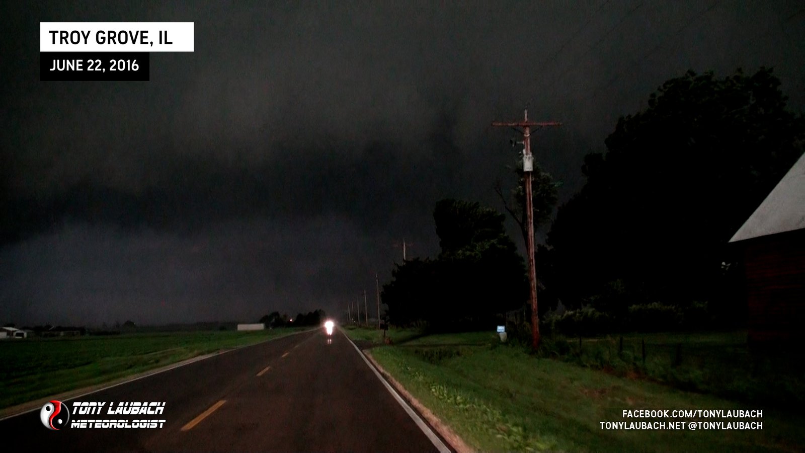
Looking south along E 4th Road toward Troy Grove as not-fully-condensed tornado moves left to right across my vision, getting rain-wrapped as it moves east.

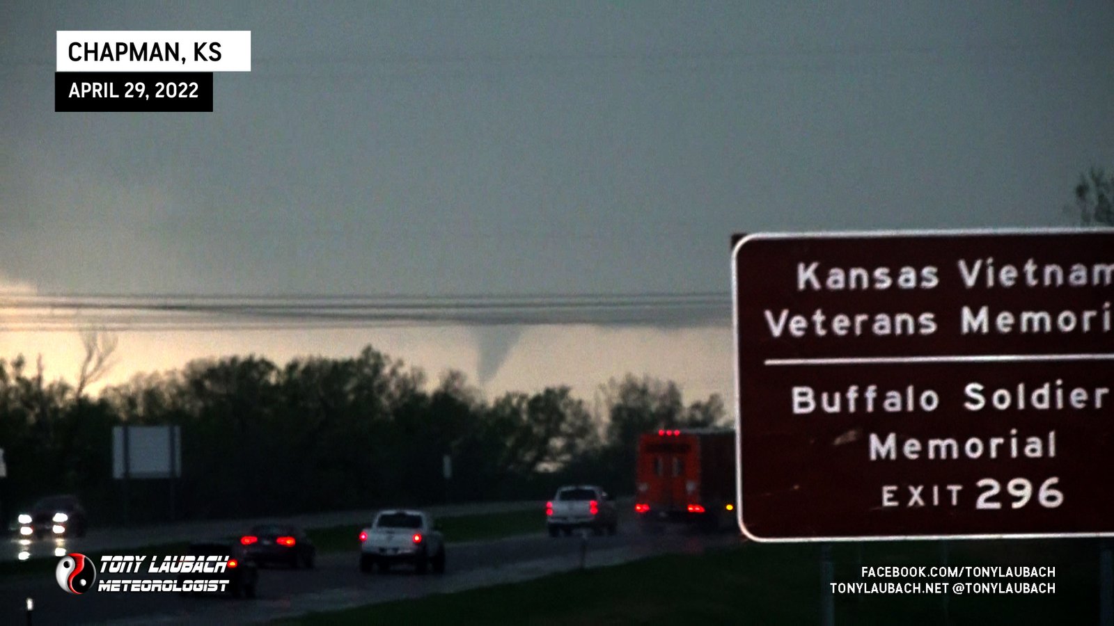
Incredible, long-track tornado we tracked for nearly half it’s 90-minute lift along I-70 from roughly Abilene to Chapman.
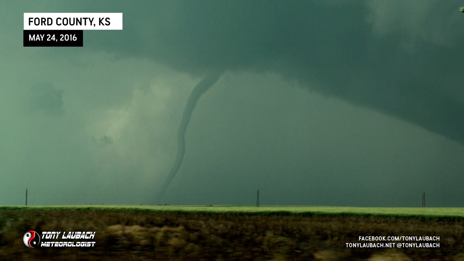
Twelfth and final documented tornado of event, brief needle touchdown during and to the west of the eleventh.
Eleventh tornado, multiple touchdowns from parent circulation/funnel north of DDC.
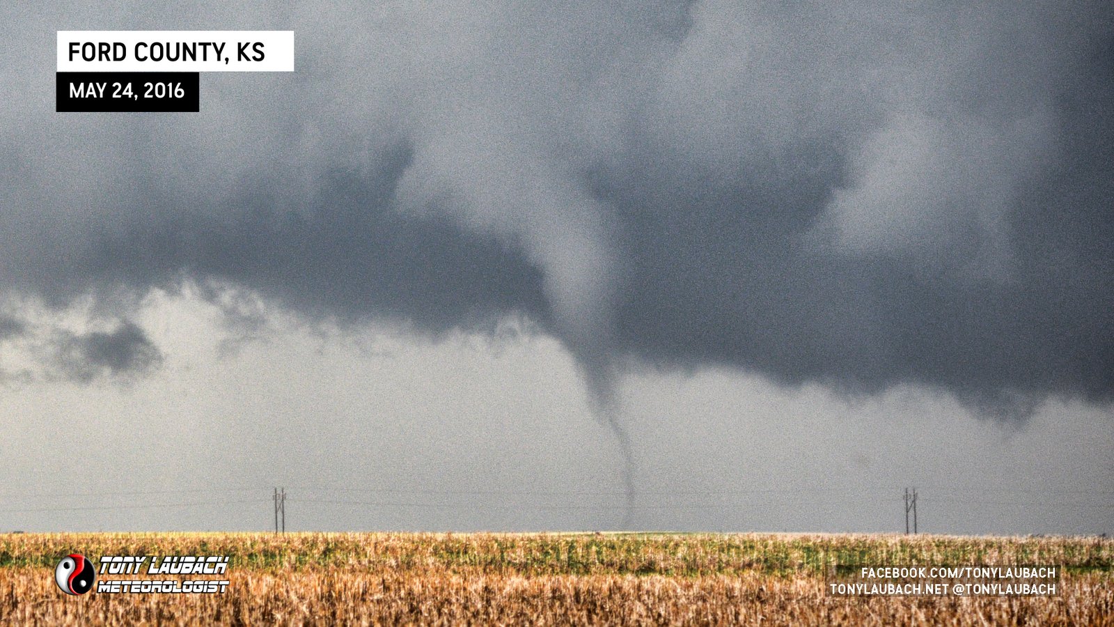
Tenth tornado, quick twins, this one briefly hitting the ground before rotating off and dissipating.
Nineth tornado, new cone tornado developed during the long rope-out of the main Dodge City tornado.
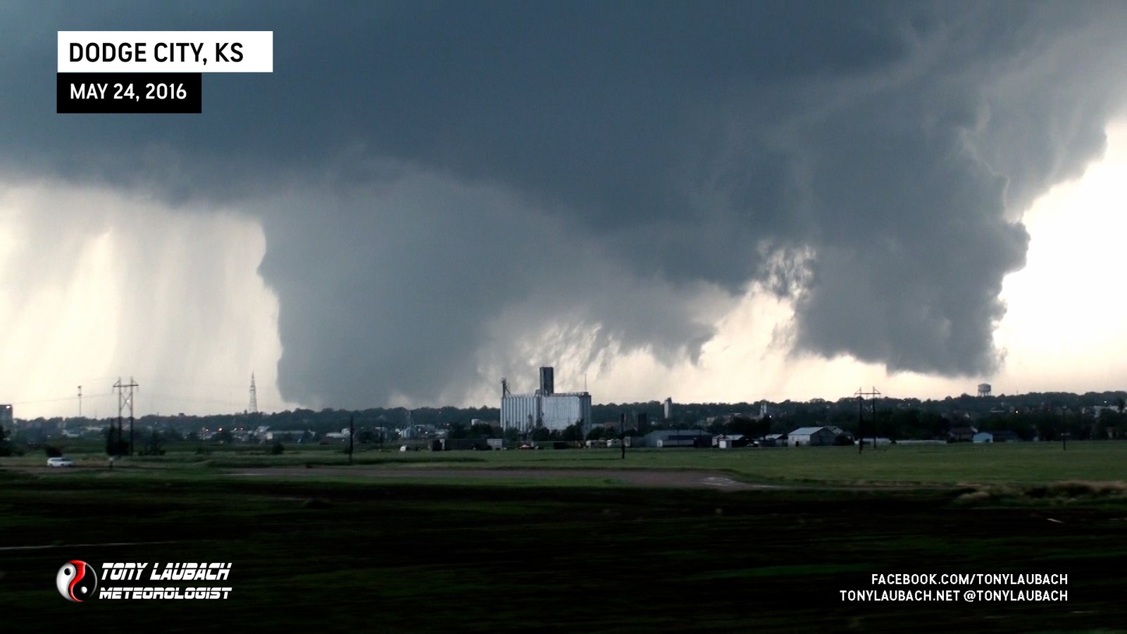
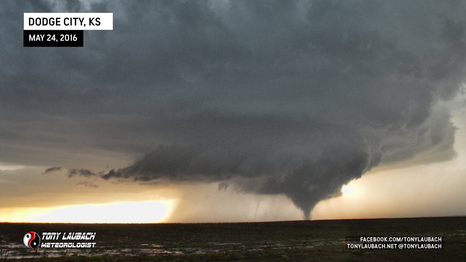
Eighth tornado, the main Dodge City EF-2 viewed from US-283 as we passed through the east side of town.
Seventh tornado, believed to be separate from 4th which roped out a few minutes earlier before this came down. Unable to get stationary shots as we were dealing with clogged, mud roads.
Sixth tornado, a new satellite while northbound on 110 Road; stopped for photos on side of road.
Fifth tornado, snaky satellite during the fourth; likely during the notable ‘triplet’ phase, but no documentation of the triplet, so that did not count.
Fourth tornado, the one I posed in front of thinking it was my 300th; I was wrong (it looks better than 300 and 301 anyway). Haha
Third tornado of the event, a very brief, non-condensed spin-up while first tornado begins rope-out.
Second tornado of event, brief rope while first was still ongoing. This was technically my 300th tornado.
Initial tornado of the event; documented entire lifecycle, witnessed at least 2 other tornadoes during this one.
Brief needle-nado to finish the day with.
A second vortex touches down, briefly a couple fat twins.

Fat tornado gets organized, longest duration tornado of the day.
Disorganized funnel, but multiple, brief dust whirls spotted beneath it.
First tornado of the day, viewed from distant east.
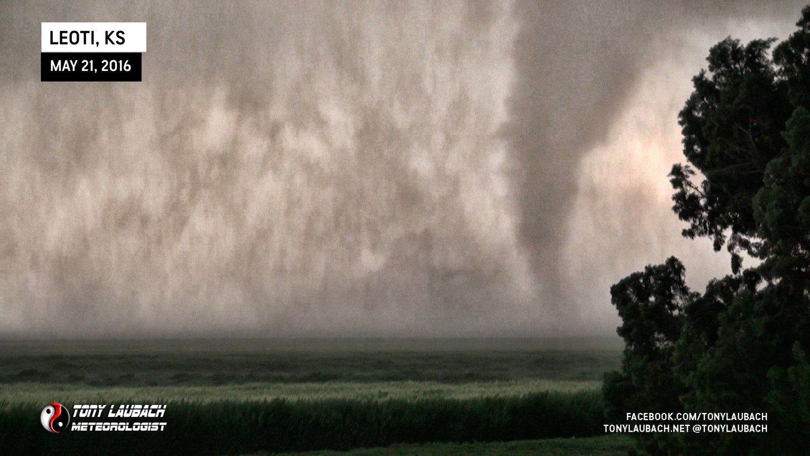
Second tornado a few minutes after first, K-25 between CR-D and CR-E looking southwest.
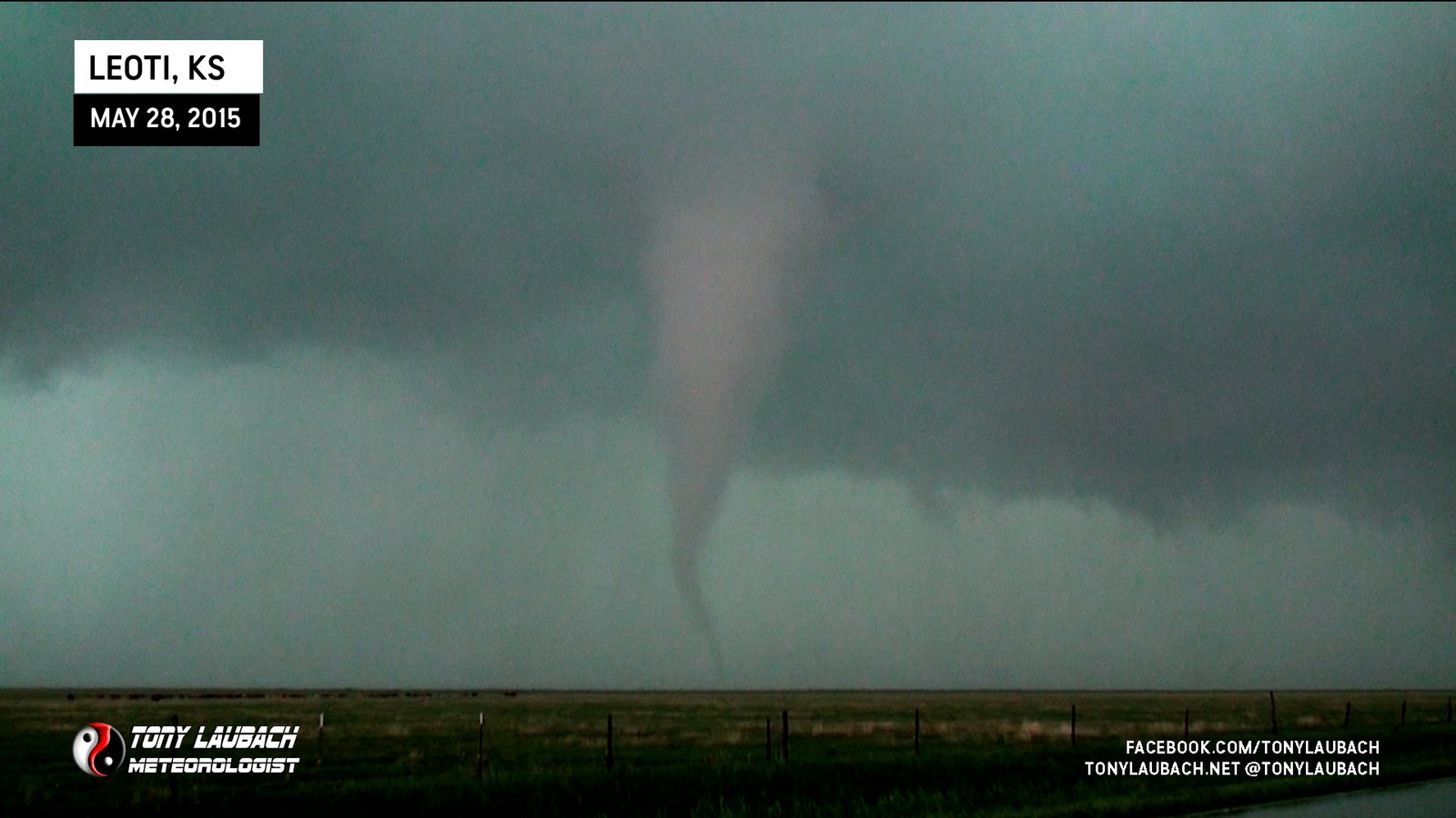
K-25 between CR-D and CR-E, looking southwest from north of Leoti.

Viewed from southeast of Wray looking north, was a bit further away than I would’ve liked, but still a great view.

Large, dusty tornado 200 yards west of me on CR32 south of Wray; super cool intercept.
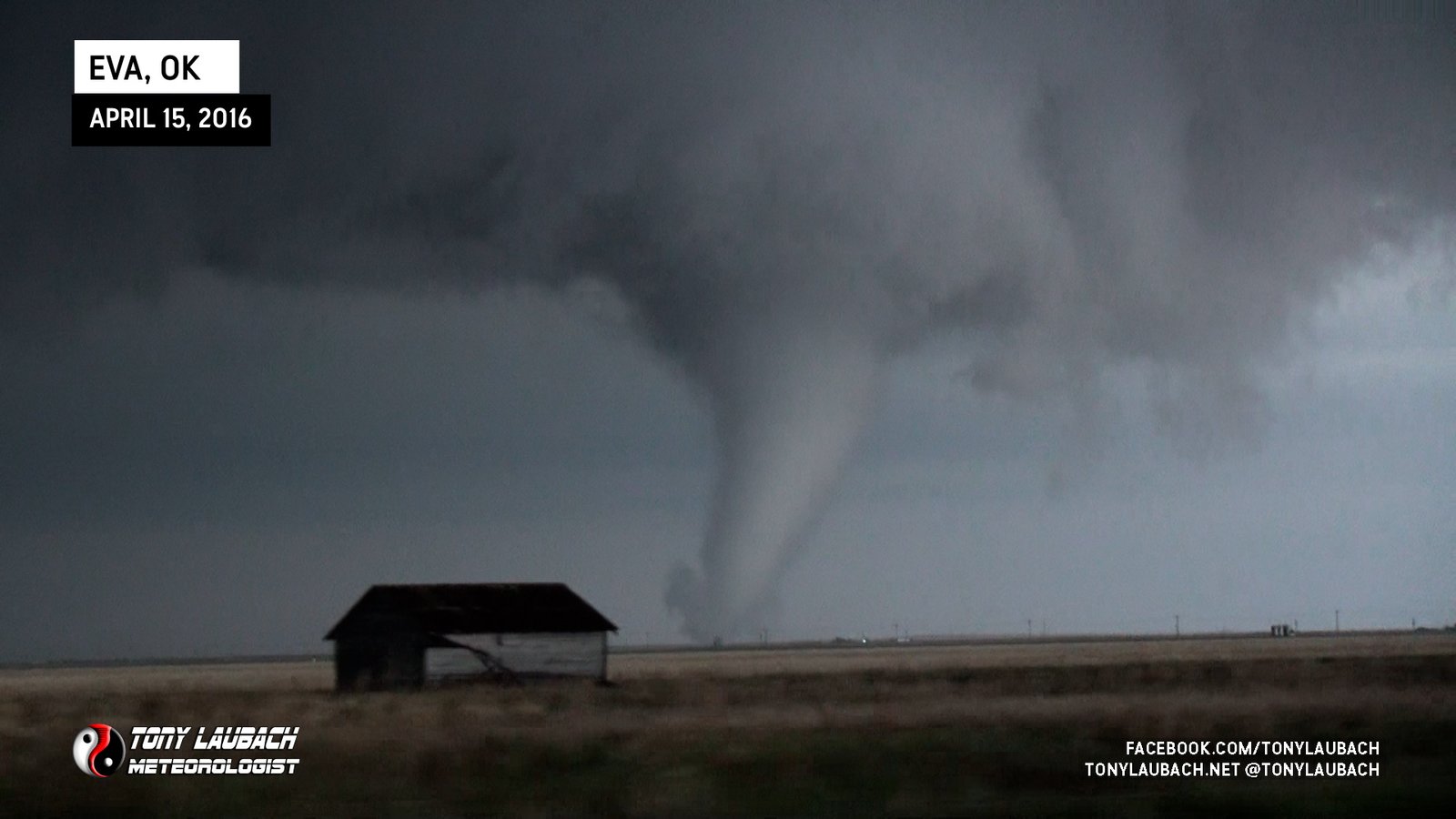
Large white cone north of US-412 near Eva.

Crossed E0180 Road southwest of Eva
Saw after dark on my approach to Hartselle; power flashes gave a couple quick glimpses. No imagery.
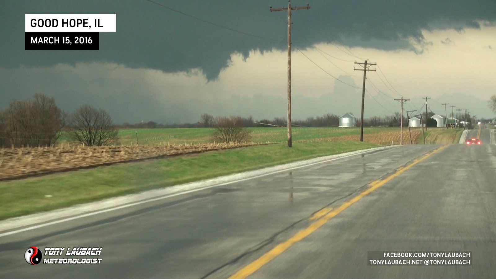
Witnessed initial touchdown of looking northwest from IL-9 west of Good Hope before storm outran us to the northeast.
Saw initial stages in lightning flashes while northbound on K-23 after losing visual of the first tornado (likely had dissipated). Tornado flipped semi on US-54, blocking me from following.
Satellite of the larger wedge viewed from US-54 between Plains and Meade from the southwest. Likely caught funnel in lightning flash; video timestamps match timing of satellite in reports.
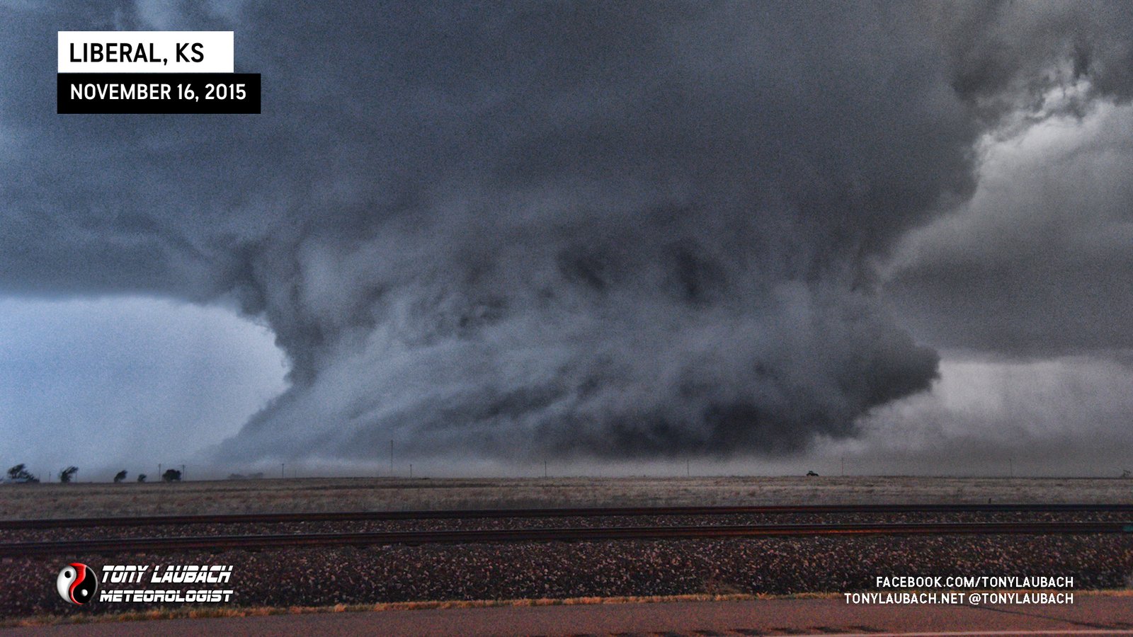
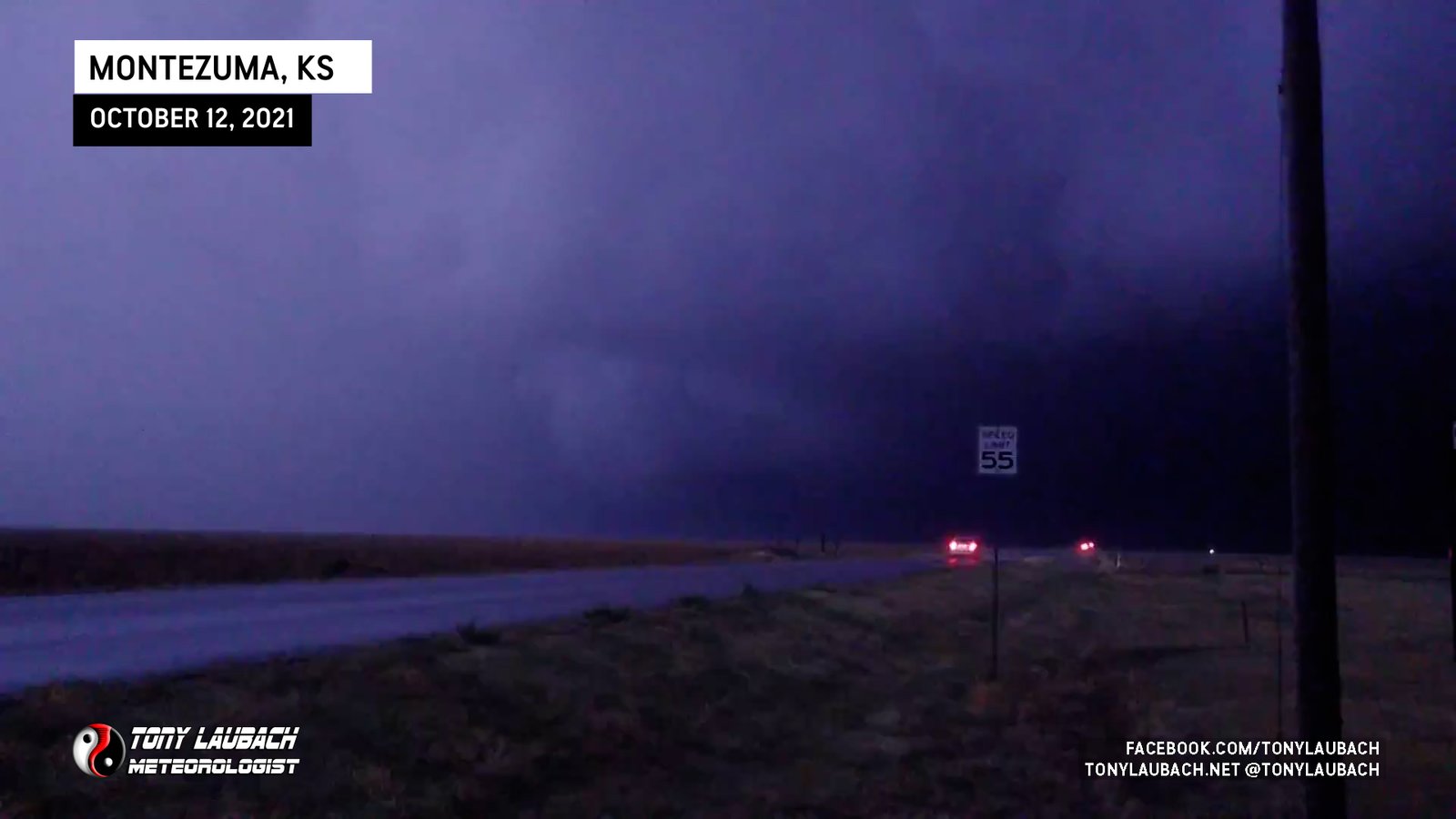
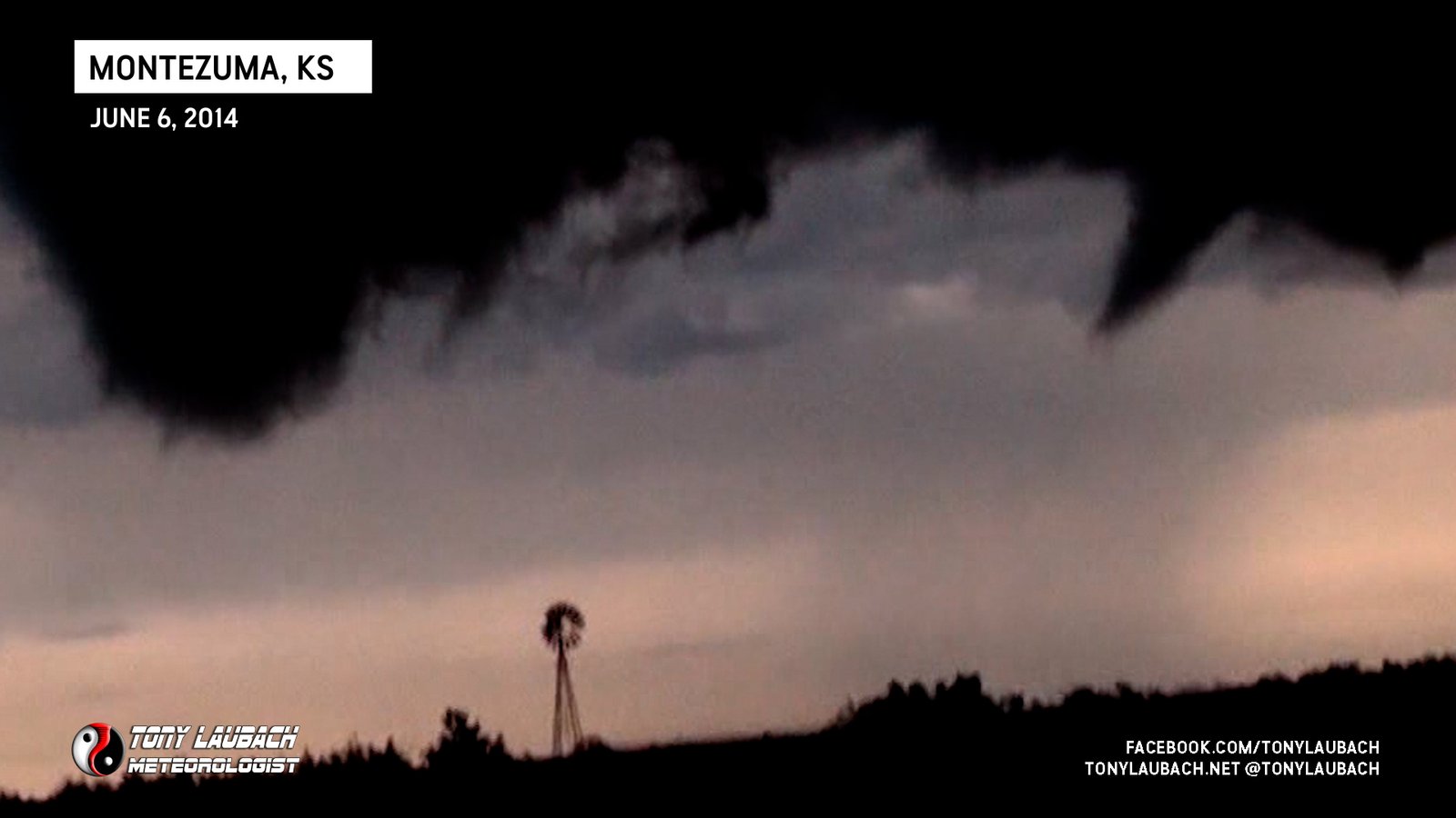
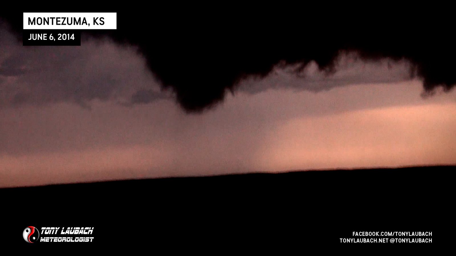
Long-lived wedge tornado that moved from near Liberal to near Montezuma in southwest Kansas. I documented/witnessed the entire lifecycle.
One of the cooler-looking tornadoes I’ve seen; a skinny translucent rope that hypnotically danced across the landscape.
Rope satellite tornado caught as larger tornado was ongoing to the north.

Much larger, longer lived tornado southwest of us along CR-NN south of US-36.

Brief touchdown southwest of CR-NN/CR-8 looking south.
Fleeting glimpses of large tornado near Parker from well to the northeast early in the afternoon, no imagery.

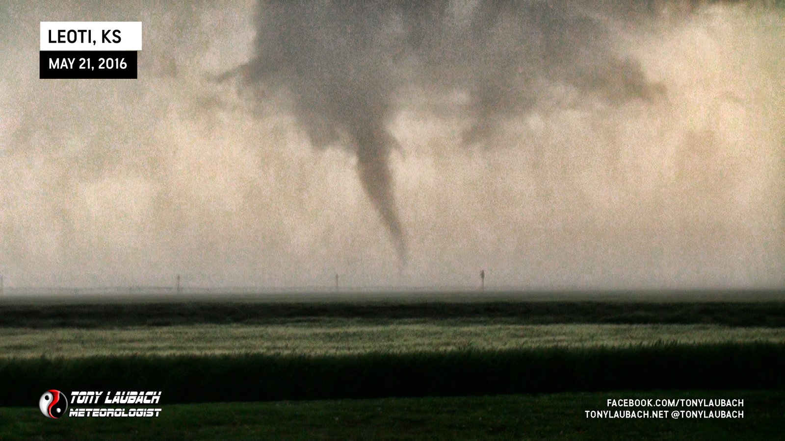
Massive rotating wall cloud, but funnel northeast of that briefly touched down east of K-25 south of Leoti.
Separate, longer-lived tornado about 5 minutes later along K-25 south of Leoti.

Brief needle tornado touches down west of K-25 south of Leoti.
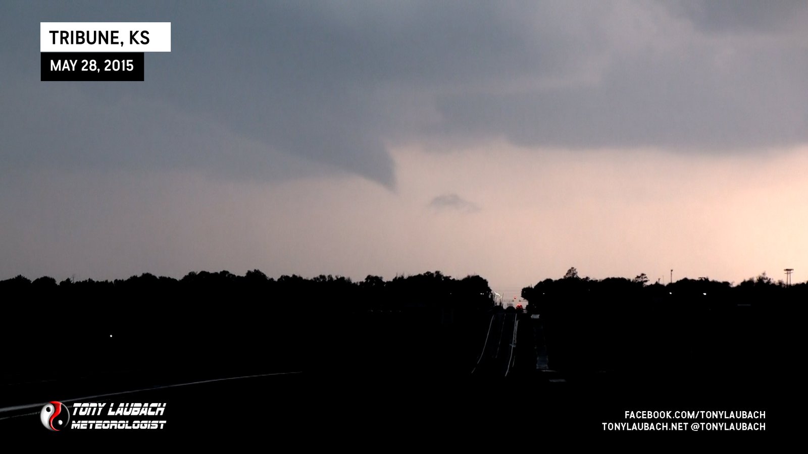
Brief touchdown reported as we viewed large funnel from north of Tribune. Ground contact blocked by town/trees.
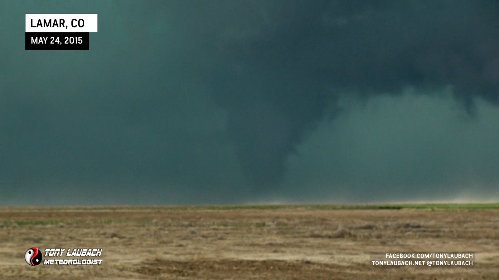
Large, rotating cone south of Lamar, Colorado.

Long, skinny funnel west of Hoyt viewed from CO-52 looking south during rope-out stage of reported tornado.
Caught just west of Cheyenne Wells as a tornado briefly touched down south of US-40.
So picturesque, sunrays pass in front of slender, dark cone with a beautiful green foreground. Favorite tornado of the day!
Large, long-track tornado viewed from US-385 looking west; viewed for about 10 minutes as it slowly moved northeast toward the highway.
Viewed from across the border along KS-96 looking west at 47 miles away; the furthest (by far) I’ve ever seen a tornado!
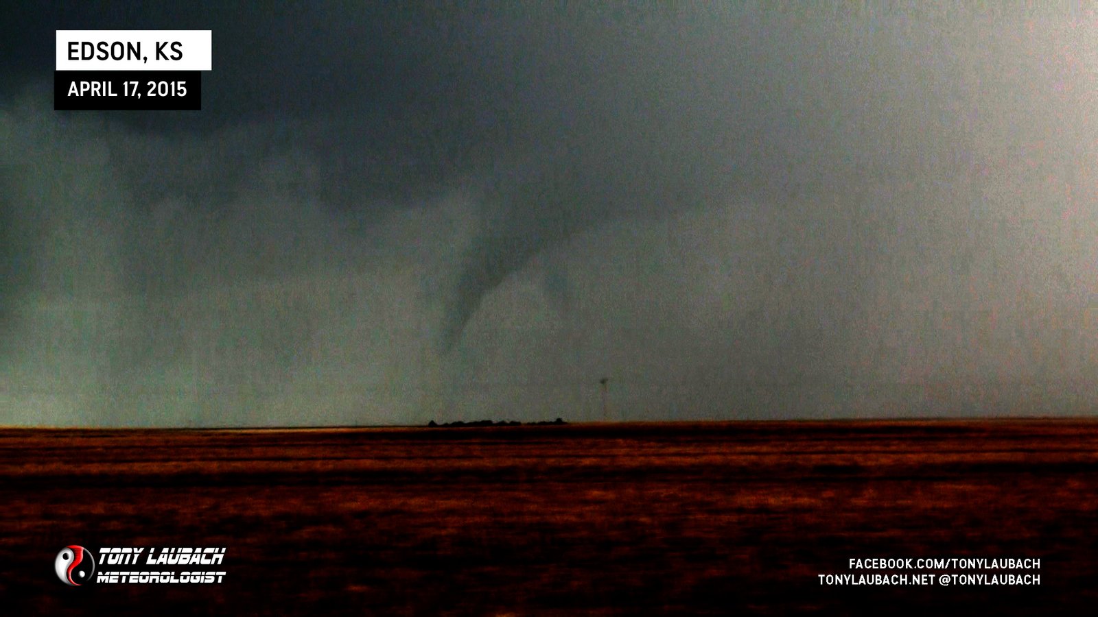
Brief tornado south of Edson viewed along I-70 looking south.
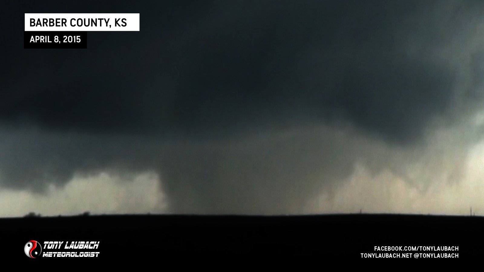
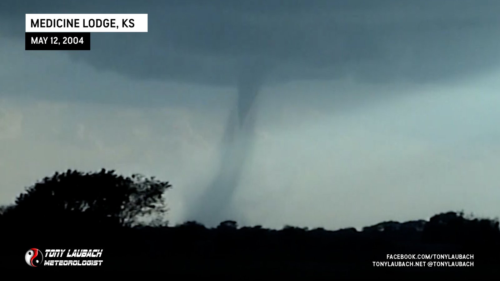
Quickest wedge I had ever seen; looking south of US-160 southwest of Medicine Lodge.
Saw power flashes illuminate likely tornado northwest of town, storm eventually pushed into town as tornadic circulation was overtaken by powerful outflow.

Other chasers with an unobstructed view confirm this piddly funnel had a ground swirl west of Panama. Second Iowa ‘tornado’…

Documented From NE-9 Looking West Toward Wakefield

The eastern twin; larger of the two after it crossed north of US-275.

The western twin; primarily documented along US-275 from west-to-east north of Pilger.

Massive, long-track EF-4 tornado documented along NE-57 to US-275; the ‘forgotten tornado’.

Brief touchdown prior to the long-lived Stanton EF-4 monster.
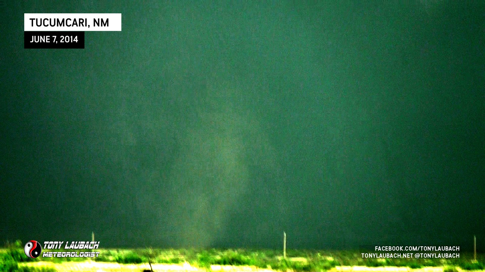
About 10 miles south of Tucumcari/I-40 from northbound NM-209, brief dust whirl under tightly rotating clouds just west of the highway.
Skinnier, shorter-lived funnel of the twins, intermitted dust whirls kicked up beneath it. East of Montezuma and north of US-54.
Fatter of the twin funnels, likely responsible for knocking down power poles on US-56 at 14 Rd east of Montezuma.
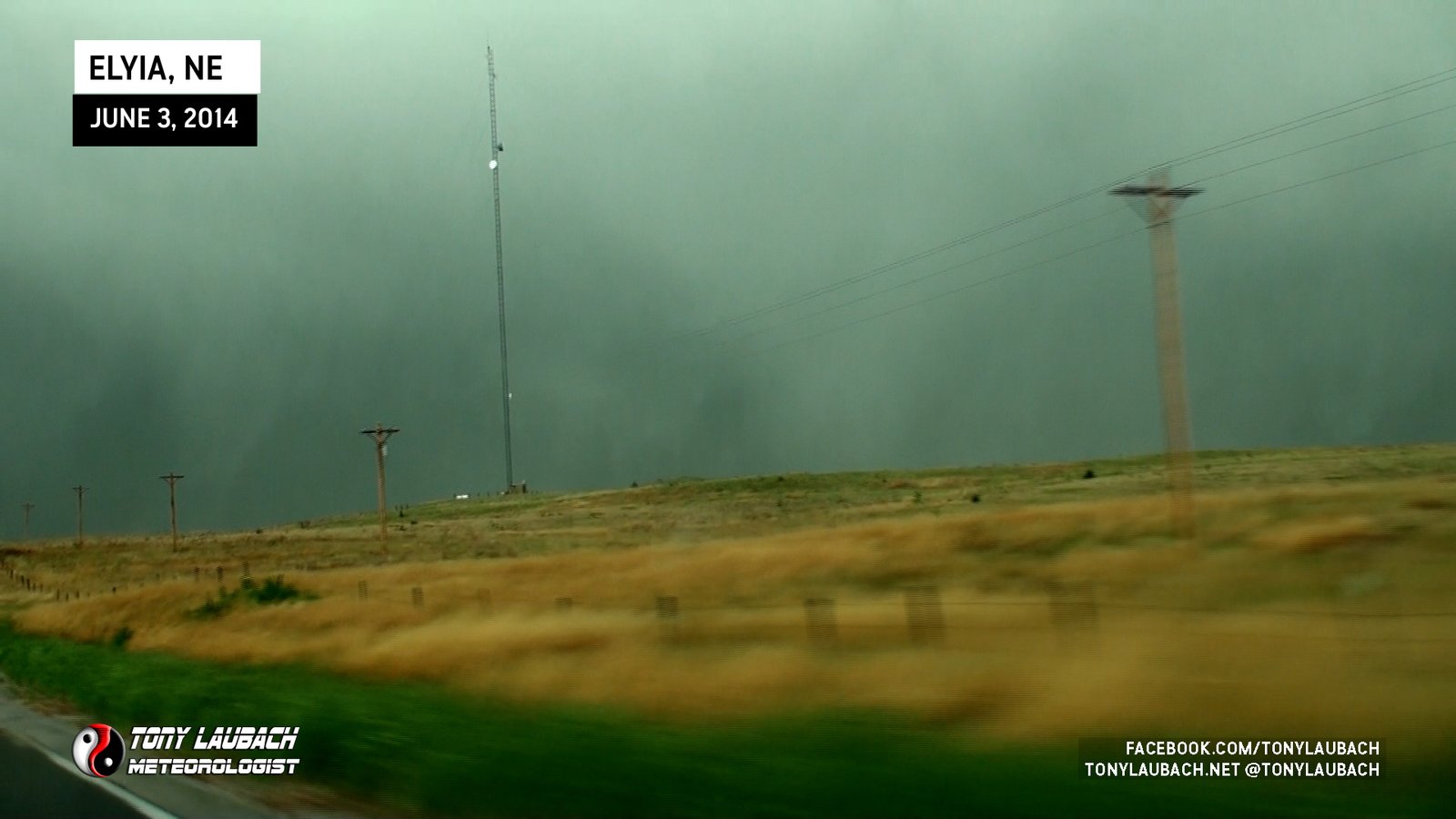
Rain-wrapped view of possible tornado looking northwest along NE-11 north of Elyria.

Saw from distant south, not greatest view. Documented damage done to homes by this tornado afterwards.

Massive wedge we saw east of Marshall, lost view as it wrapped in rain and experienced an incredible RFD.
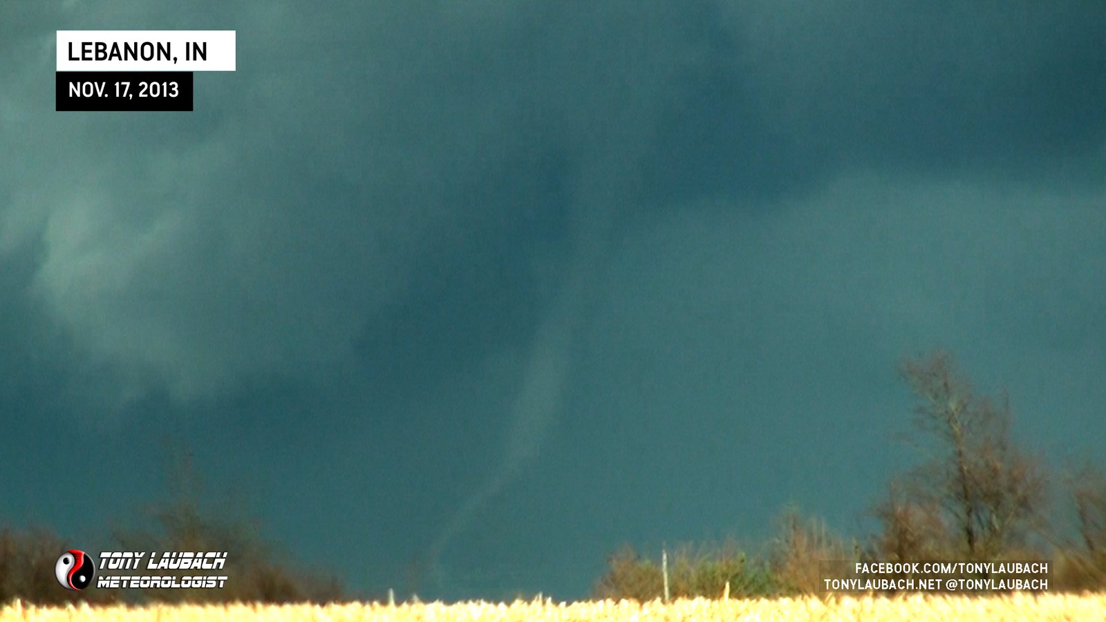
Viewed tornado immediately after Starbucks tornado until it roped out up near Waugh, looking northeast from W200 S at IN-39 south of Lebanon.

Viewed Lebanon tornado as it damaged Starbucks from IN-75 south of Advance looking northeast.
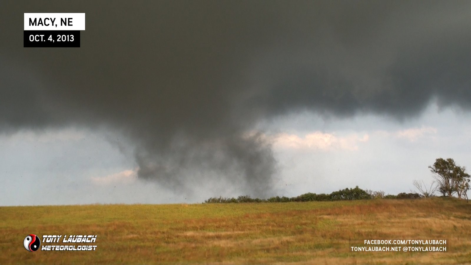
Watched this tornado shred trees and homes in Macy, then it crossed US-75 in front of me and I followed it to the river where it crossed into Iowa never to be seen by me again.
Weak landspout tornado viewed north of Akron along CO-63.
Briefly viewed a satellite tornado of the main twister south/southwest of El Reno prior to crossing US-81.

The darkest day in storm chasing; the widest tornado on record (2.6 miles) took the lives of Tim Samaras, Paul Samaras, and Carl Young.
Had brief view of rain-wrapped tornado on southwest side of Wichita; was unable to get imagery before I lost view on KS-42.
Best captured tornado of the day for me, the third in this set southwest of Wichita.

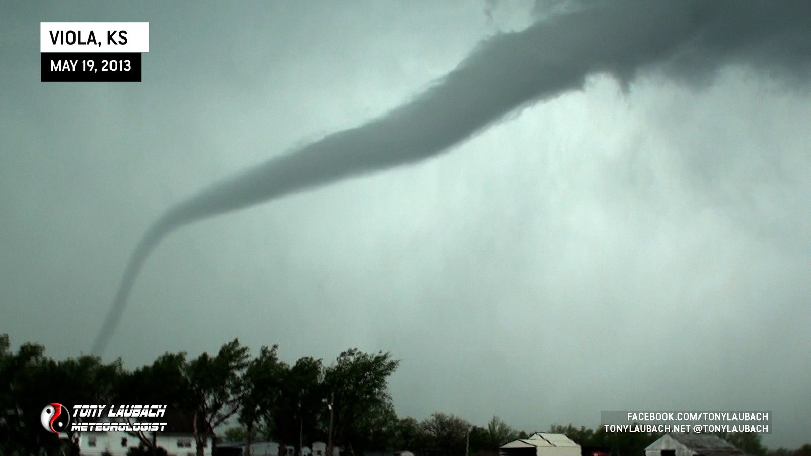
Brief touchdown of weak tornado near Viola, streamed/aired live in KWCH.
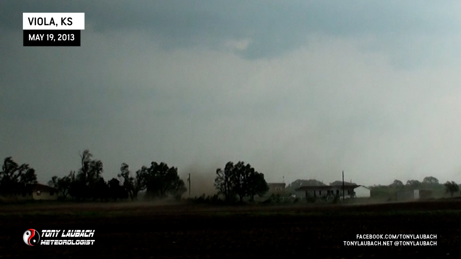
Brief touchdown of small, weak tornado over a residence near Viola.

Beautiful pink-illuminated cone, saved what was otherwise gonna be a frustrating chase missing Rozel.

Multi-vortex tornado north of Brownell tossing debris, viewed from K-4 looking northwest.

Powerflashes documented from weak tornado on southwest side of Lawton.
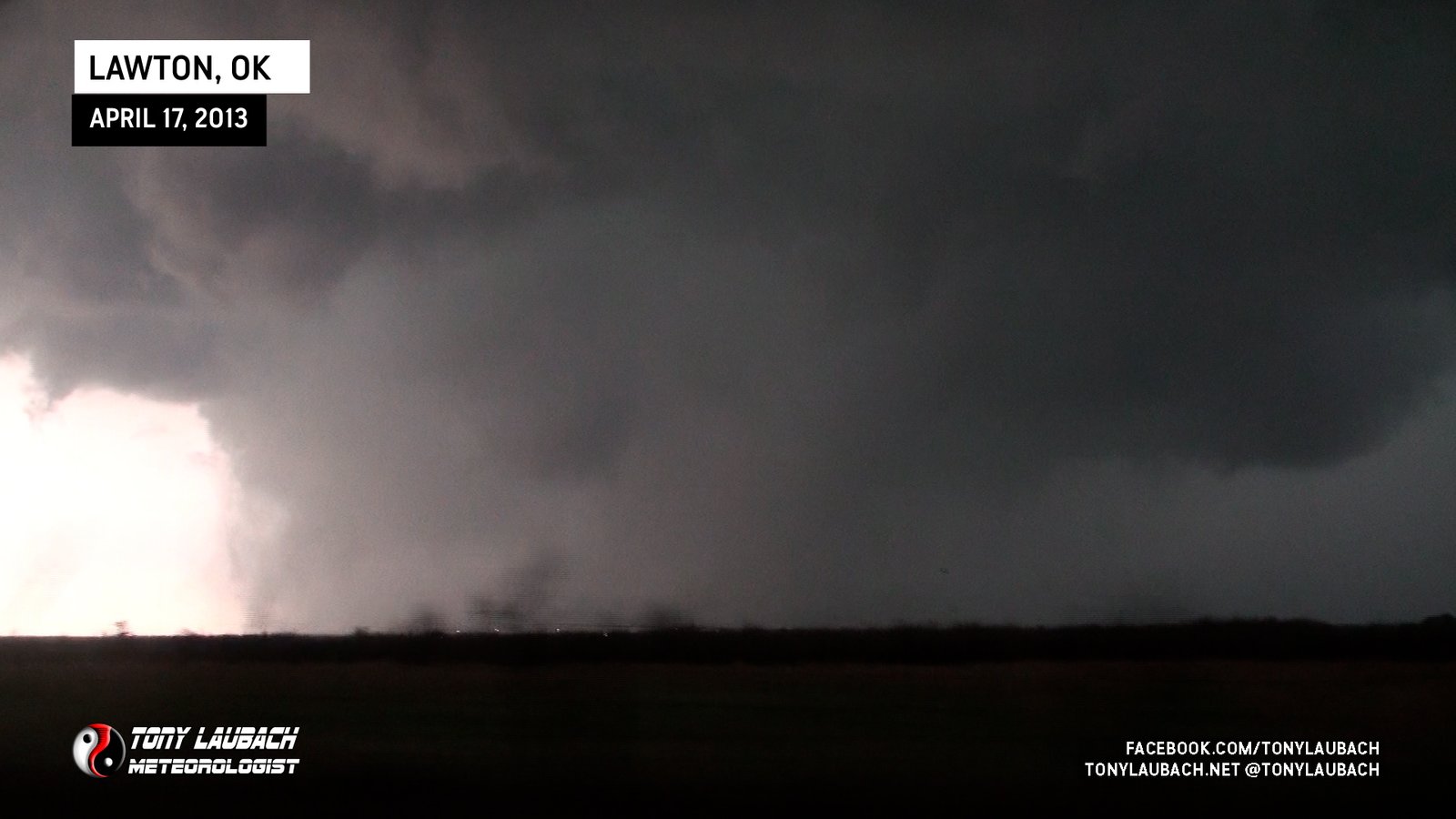
Brief touchdown southwest of Lawton, buried heavy in precip.
Only tornado I ever saw with a Pizza car topper on my ride; took a mid-afternoon lunch and nabbed a tornado and was back in time for dinner rush.

Landspout seen from Colorado looking north toward Lorenzo, Nebraska.
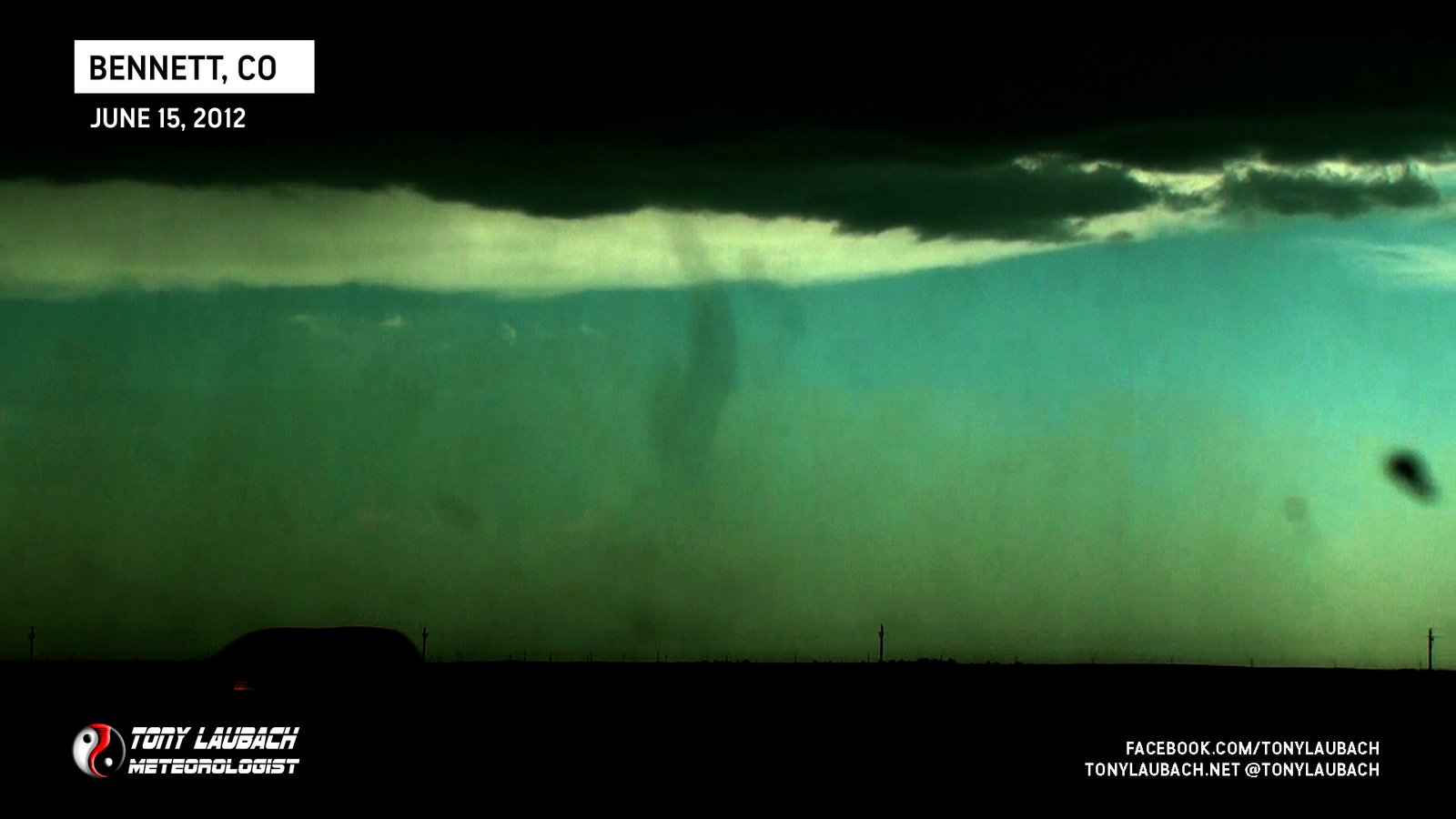
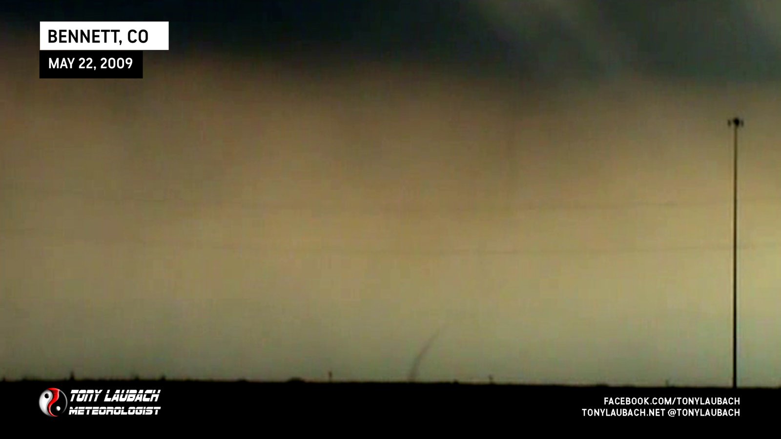
Low-contrast landspout spotted from I-70 looking northeast toward/north of Bennett.
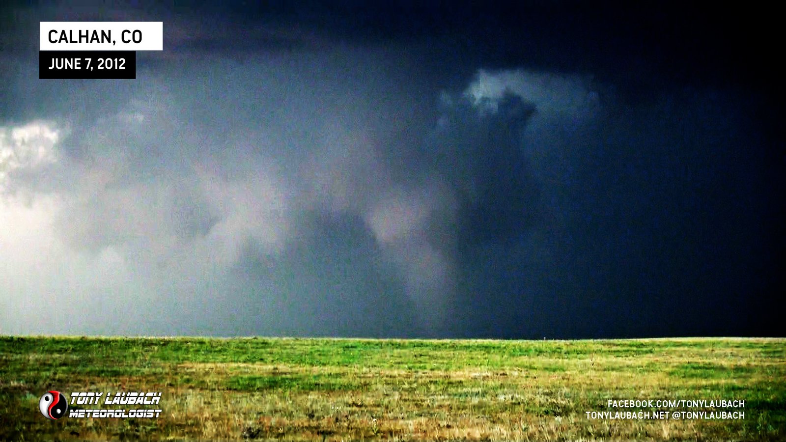
Viewed from US-24 near Calhan looking north at a low-contrast but very apparent tornado in progress.

Well-defined landspout southeast of Burlington close to the CO/KS state line south of I-70.
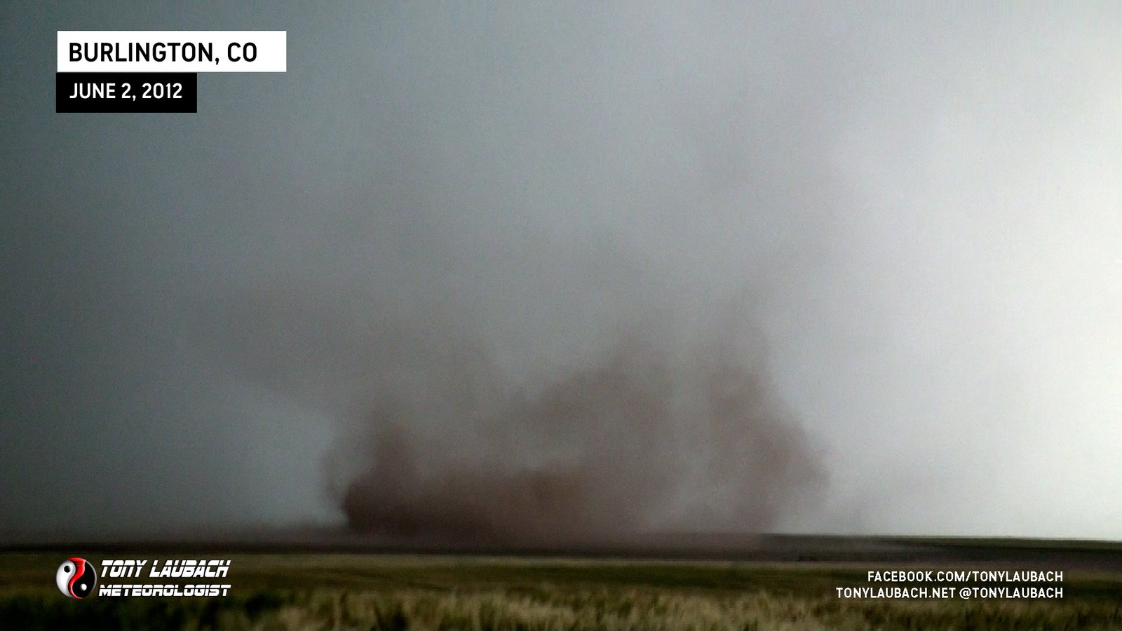
First landspout tornado witnessed southwest of Burlington, Colorado.

After La Cross Tornadoes, twins touch down north of Loretta, illuminated by lightning. This will be for the left tornado.
After La Cross Tornadoes, twins touch down north of Loretta, illuminated by lightning. This will be for the right tornado.
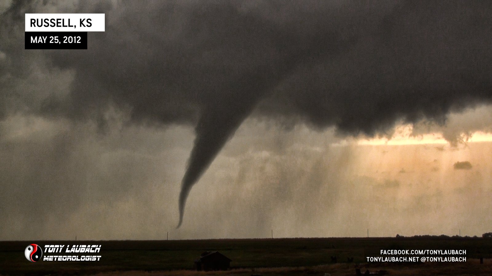
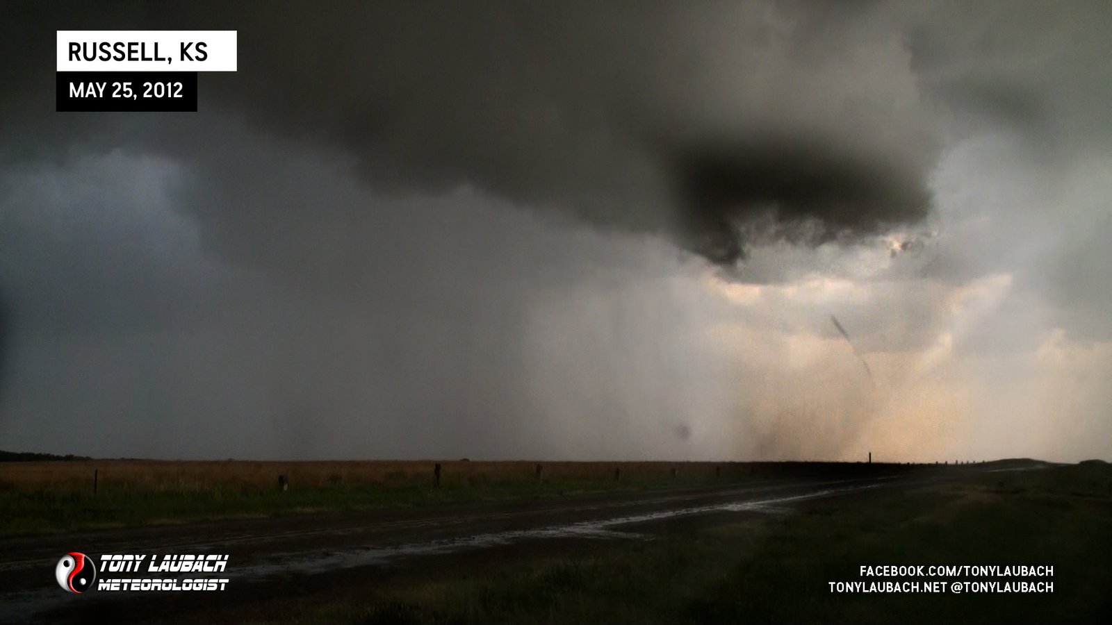
Long-lived, very photogenic, and nearly stationary tornado southwest of Russell, aired entire tornado live on KWCH.
Brief tornado with quick rope-out southwest of Russell.
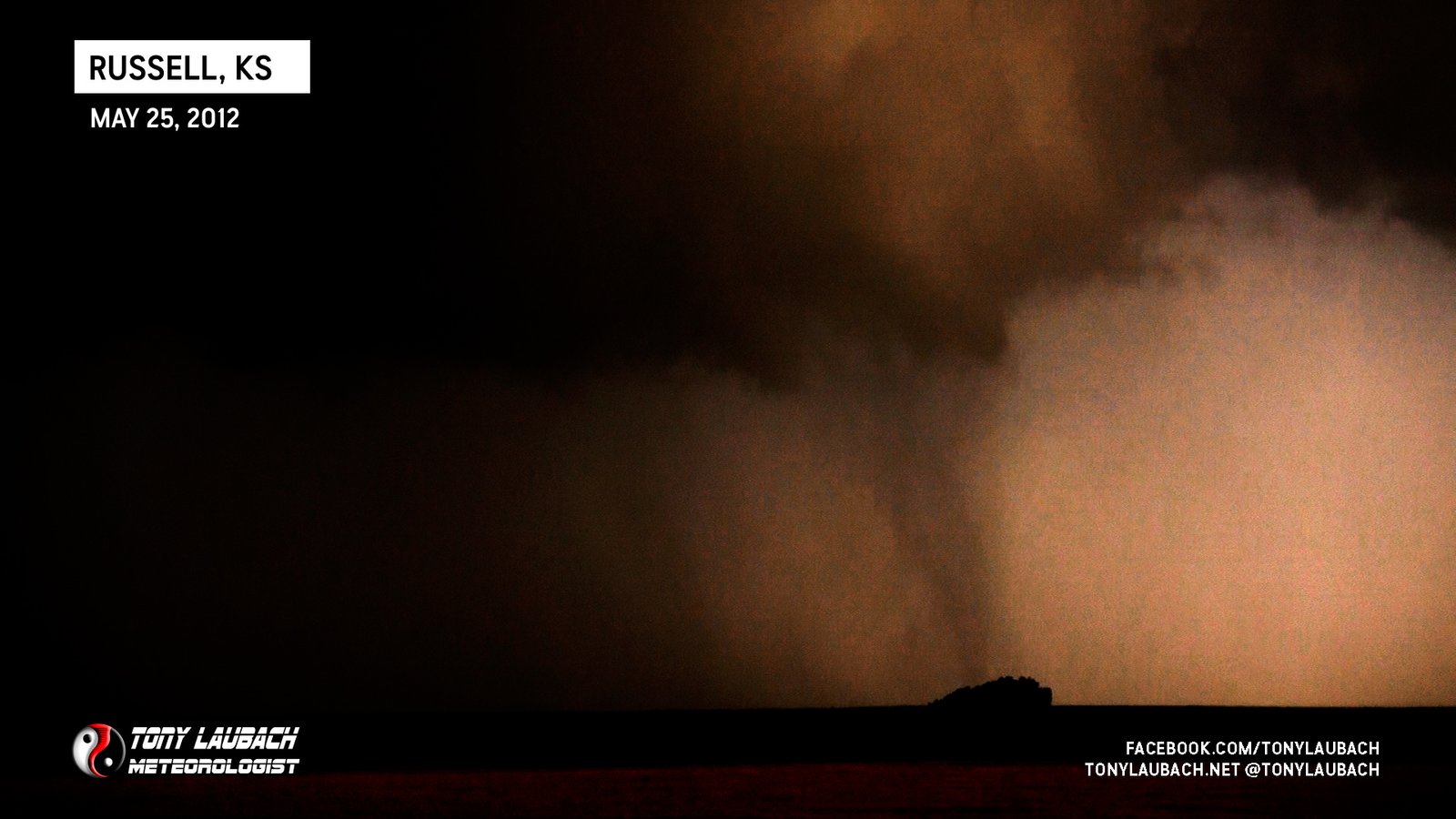
Translucent-looking funnel looking west from south of Russell.
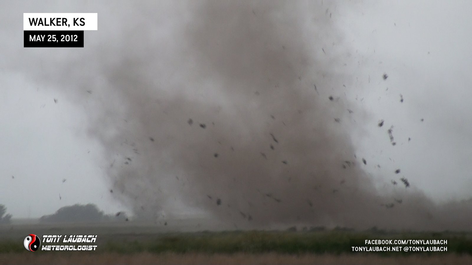
Dusty tornado destroys chicken house to my immediate south as I was south of Walker.

Large, semi-long-lived dust bowl under rotating clouds, tornado never fully condensed.
Likely the ‘Wind Farm Tornado’ viewed from the northeast.
Nighttime tornado we saw by accident on I-135 after dinner in Salina; no imagery from this tornado.

Long-time favorite tornado, followed up Solomon Road as it was to our west.

Brief tornado touchdown on/near I-70 east of Salina, viewed from near the Ohio Street Exit as traffic was halted.

Satellite tornado viewed immediately after turning north on 22nd Road toward Galt (satellite visible on left side of wedge).

Massive wedge tornado, viewed from Mitchell to near Lindsborg, lifted shortly before Salina.

Viewed From K-96/CR-320 on the south side of Timken.

First tornado of this event, viewed from distant east.

Viewed tornado on way into town as it was just north of I-40; urban obstructions prevented full view.

Brief view of tornado near the reservoir on approach to Shawnee.
Slender funnel briefly touches down just outside of Woodward.
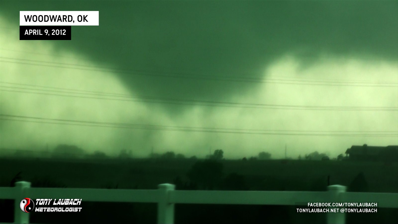
Large, truncated tornado near Woodward.
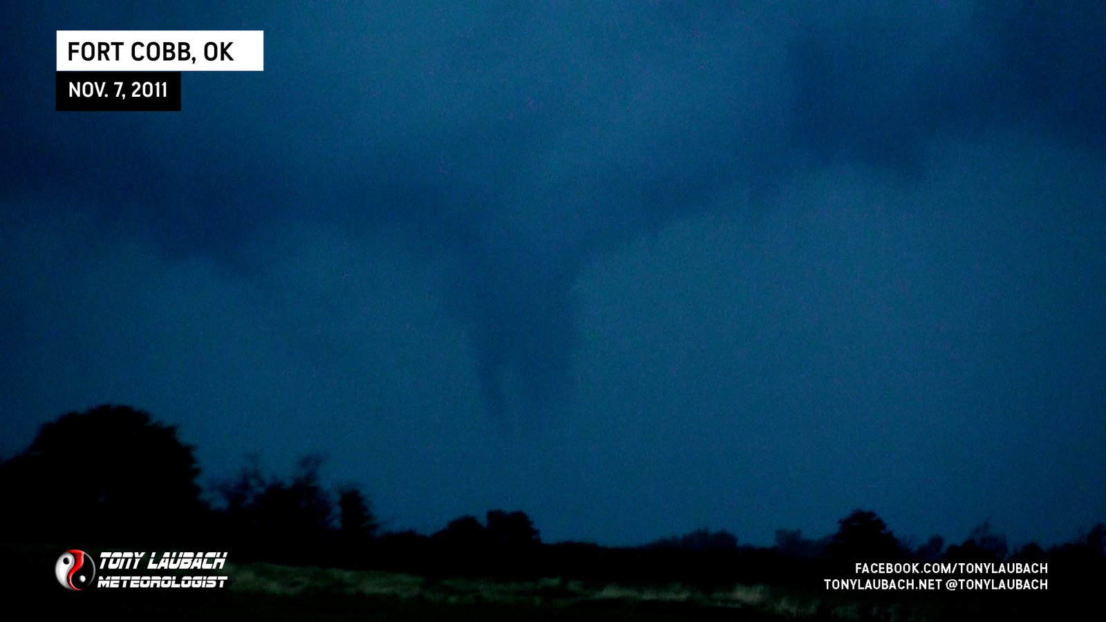
Caught end of what is presumed to be the tornado that moved west and north of Fort Cobb.
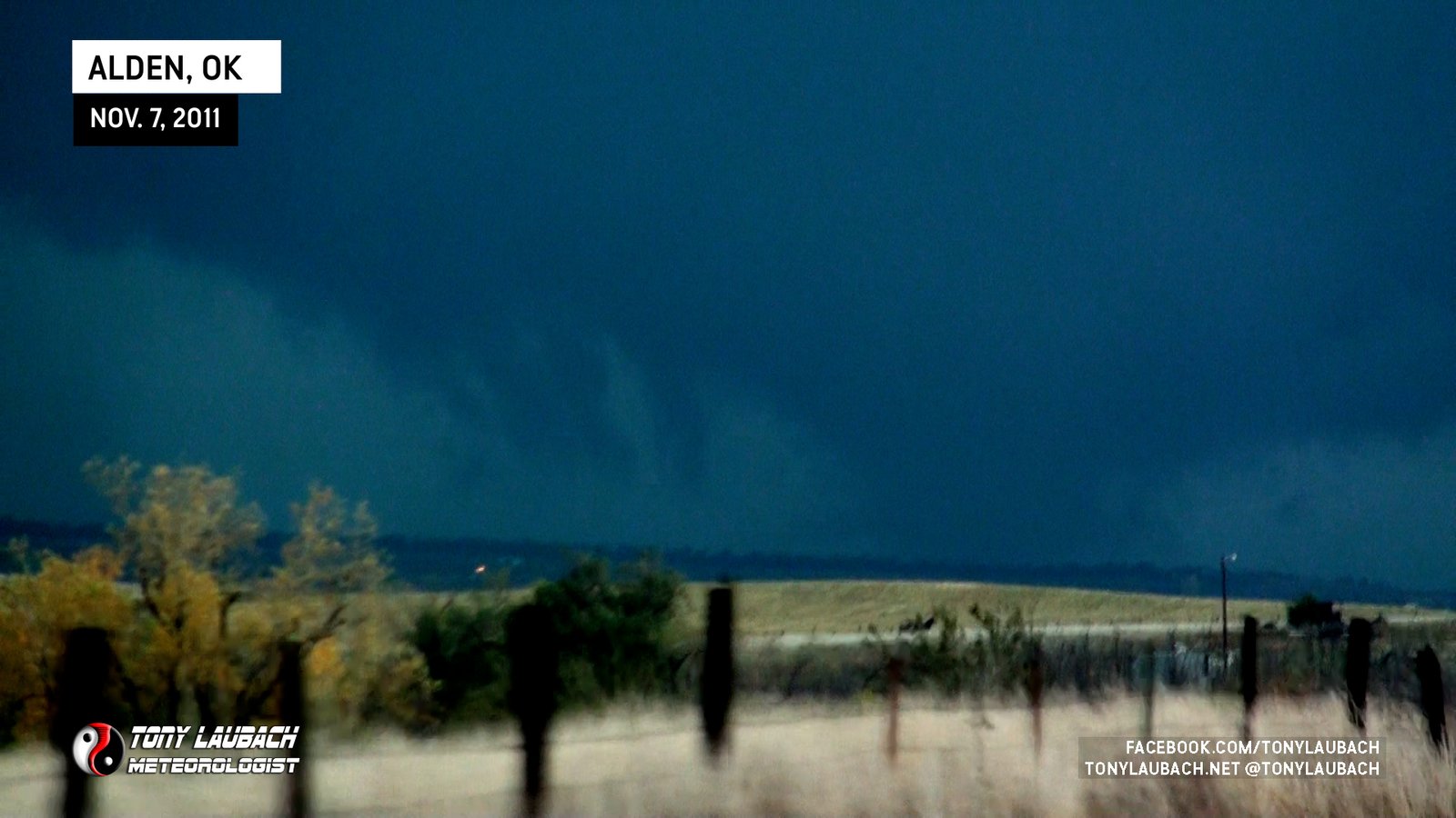
Multi-vortex/wedge tornado observed looking north toward Alden, Oklahoma.
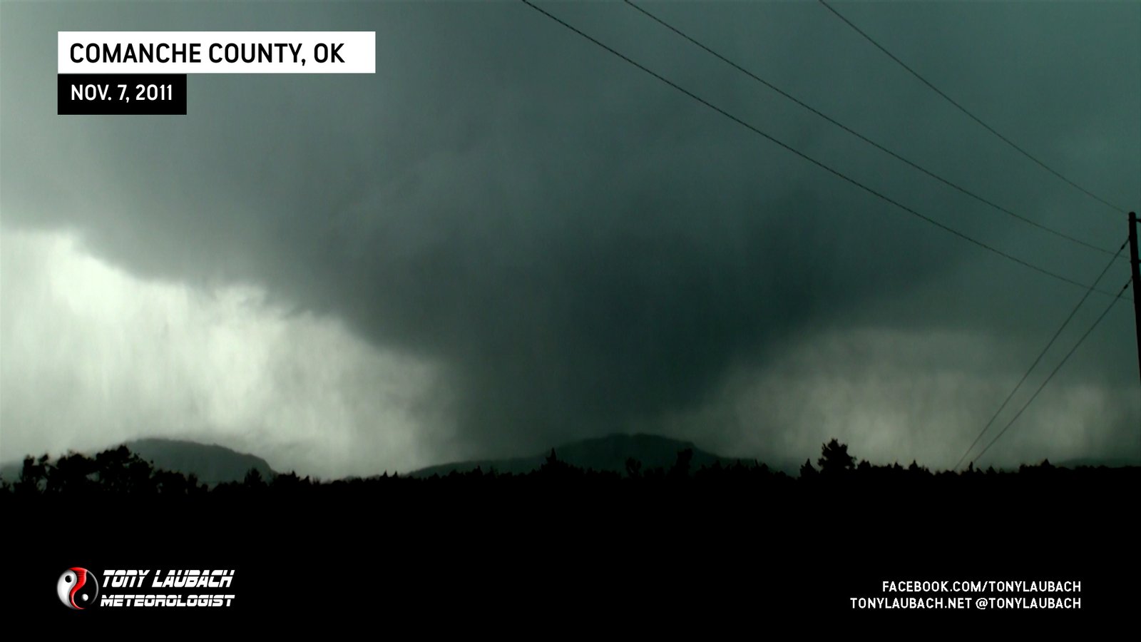
Incredibly close encounter on OK-49; Multivortex tornado moved northeast into Wichita Mountains.
Brief touchdown, viewed from E1570/N2300 looking southeast.

Landspout tornado crossing US-36, very tall dust column beneath short funnel cloud.
Brief landspout just outside of town.

Close intercept on Antelope Road from the south; my last tornado with TWISTEX.
TWISTEX group briefly saw a tornado north of Elm Creek while northbound on US-183 before it wrapped in rain; no imagery from our vehicle.

Viewed from south of Elm Creek

Long, thick rope-out of tornado we came upon in southwest Nebraska south of Imperial.

Caught reported tornado on the far east side of town on dash camera as we rolled into town on US-20 from the west. Was 6th consecutive chase with a tornado.

Viewed while northbound on NE-11 south of Atkinson while behind TIV vehicle. Camera captured remnant RFD after tornado lifted before crossing road.

Observed while eastbound on US-70 in downtown West Memphis looking east. Observed damage moments after this shot. Was 5th consecutive day with a tornado.
My 200th career tornado intercepted along side Ed Grubb and Paul Samaras; us getting pictures with this tornado south of town.
Began as a crazy-looking multi-vortex before morphing into a strong cone that narrowly missed a casino on its way to the lake where it turned from black to white over the water.

Insanely beautiful funnel directly overhead touches down with an almost landspout-like appearance.

Long funnel overhead briefly stirs up dust near Canton, Oklahoma.

Stout, white funnel veiwed from OK-10 east of the town of Oaks.

Viewed from OK-10 south of Lowrey looking north. Rotating wall cloud had brief ground-circulation to our north.

Sporadic view of funnel and ground circulation through trees of the Peggs, OK tornado looking north.

Captured tail-end of the tornado north of Leliaetta while northbound on US-69; funnel on dash cam as it lifts east of highway.
Viewed from south of the lake, blocked by trees on approach from the south and when we had clean view, funnel had lifted.

Partially blocked from view, captured top-half of funnel from I-70 looking north.
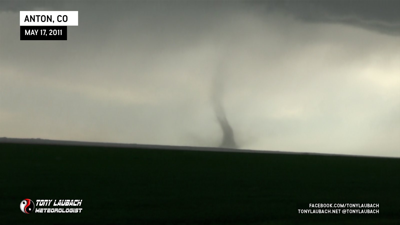
Long-lived landspout outside Anton, Colorado.

First observed on AL-5 north of US-82; Crested hill after tornado crossed highway, dash cam caught glimpses through trees.

Likely start to Tuscaloosa tornado, viewed from AL-14/CR-119 area.

Caught the end of this tornado along AL-14 south of Aliceville.

Violent-looking white stovepipe, viewed from Gillespie Road area outside Macon.

Long-lived cone viewed from distant east looking back to the west.

Tornado briefly viewed sporadically while navigating through town.

Paul Samaras coined the phrase, ‘Pencil D*ck Tornado’ on this one as we filmed it looking north.

Multi-vortex tornado crossed to our immediate north on US-283 as Tim in his ‘Probe’ vehicle drive right up to circulation for deployment.

Wispy, white funnel touches down near the ridge to our west with distinct dust whirl.

Fairly long-lived cone to our west over hilly terrain.
Saw the power flashes early in the tornado’s life prior to it hitting STL Airport.

Large, photogenic spout after the barn destroyer.
Picturesque tornado, destroyed barn with debris flying into power lines. Best Colorado tornado to date for me.
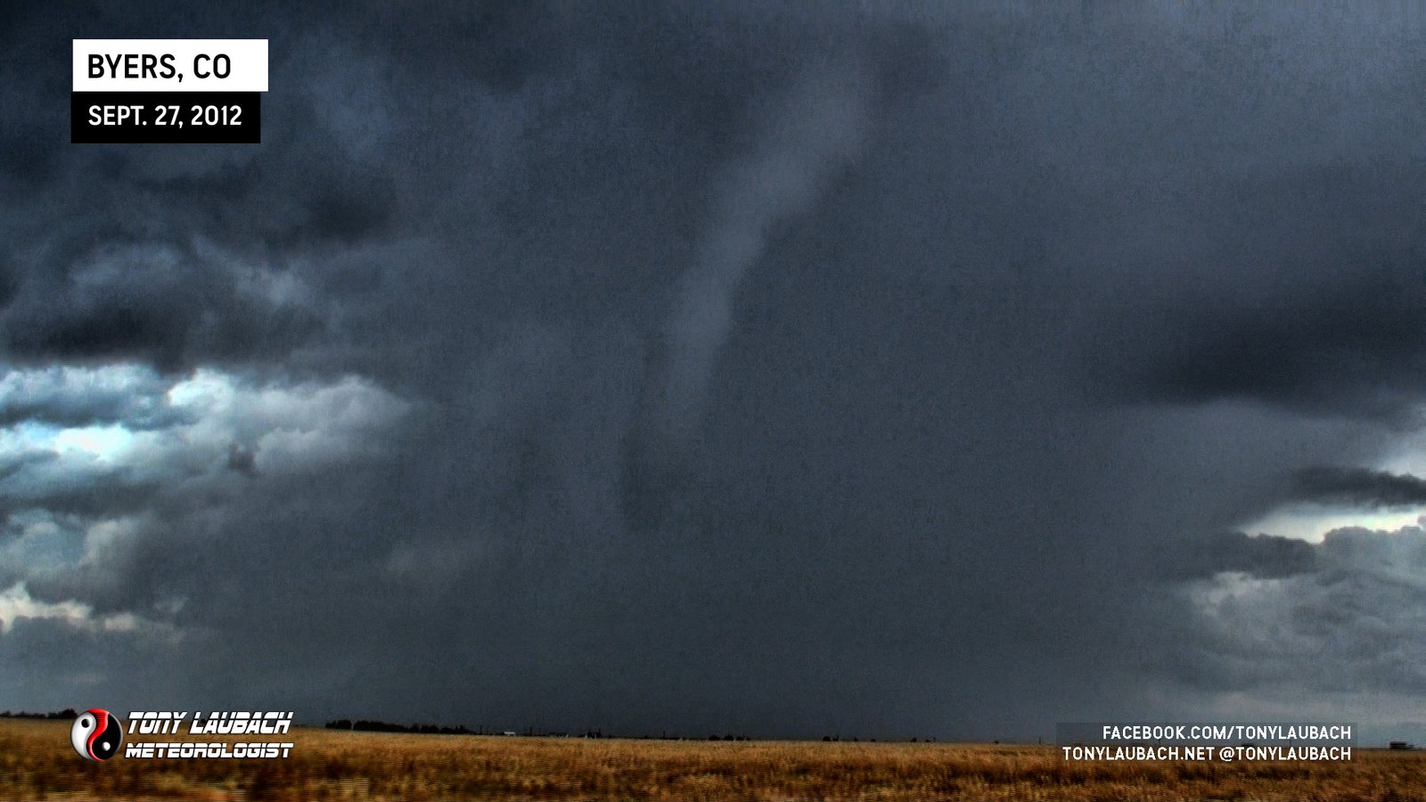
Initial landspout, viewed from west of Byers looking southeast toward Deer Trail/Agate.
Brief tornado seen from US-34 west of Akron.

Brief view of likely satellite of stronger Wadena tornado.

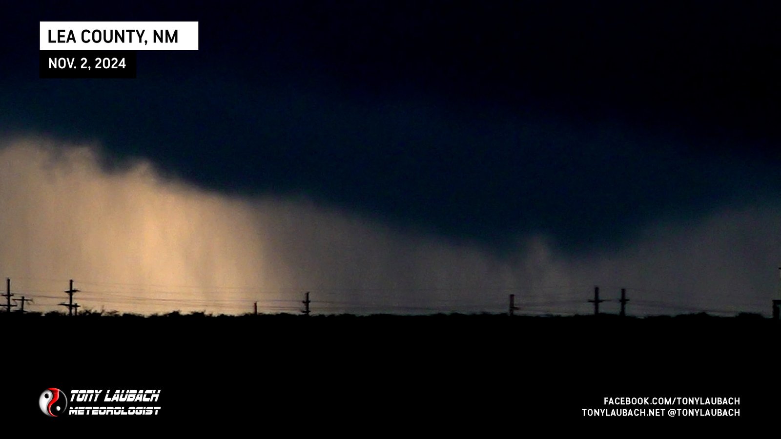
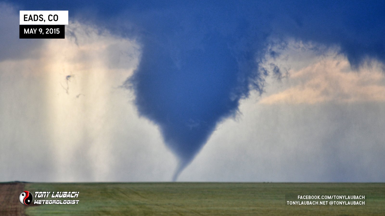
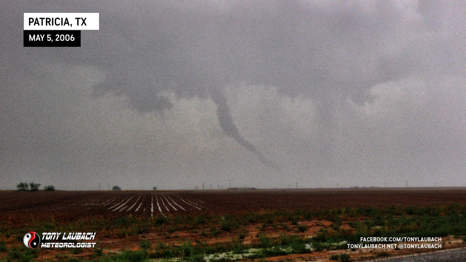
Large tornado touches down a couple miles due west of us outside Slapout.

Multi-vortex tornado to our south that vanished into the rain.

Cone tornado noticed by ‘Eagle-Eyed Ed’ that was well to our south, but were able to capture on video.

Debris swirl beneath white funnel near CR-3h and CR-36, circulation passed directly over us.

Fat, white funnel with light ground circulation north of Genoa, viewed from I-70.

Brief spin-up near MM367 on I-70 east of Limon; small funnel observed over ground swirl.

Final tornado of the day, multi-vortex touchdowns directly over ND-49 beneath very low cloud base.

Brief spin-up crossed west-to-east across ND-49 to our immediate north; ground swirl beneath persistent rotation.

Caught end of Sioux-Grant County EF-1 tornado while northbound on ND-49 south of the county line.

Viewed from just north of SD/ND state line on ND-49; first ever North Dakota tornado!

Rain-wrapped view of second Shadehill area tornado looking north along SD-73. Confirmed by probe vehicle further up.

Obstructed view of brief tornado touching down west of SD-73 between Meadow and Shadehill looking north.

Large tornado that crosses SD-73 to our north as initial tornado was still ongoing to our west; this tornado destroyed a rural school near Meadow.

Satellite tornado touches down intermitted for several minutes around initial tornado we observed on southbound SD-73.

First tornado we saw as we crested hill along SD-73 moments after turning south from SD-20; various sizes and shapes.
Long, thin needle, likely satellite of larger tornado we could not see, looking distant northwest.
Weak, multi-vortex tornado viewed from the east.
Brief, semi-large cone buried within rain, looking west.
Truncated cone, witnessed while eastbound on US-12
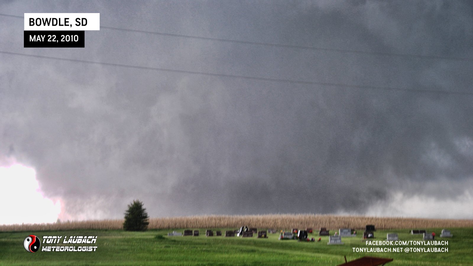
Incredible TWISTEX intercept north of Bowdle; including Tower Probe Deployment and multiple mesonet sweeps.
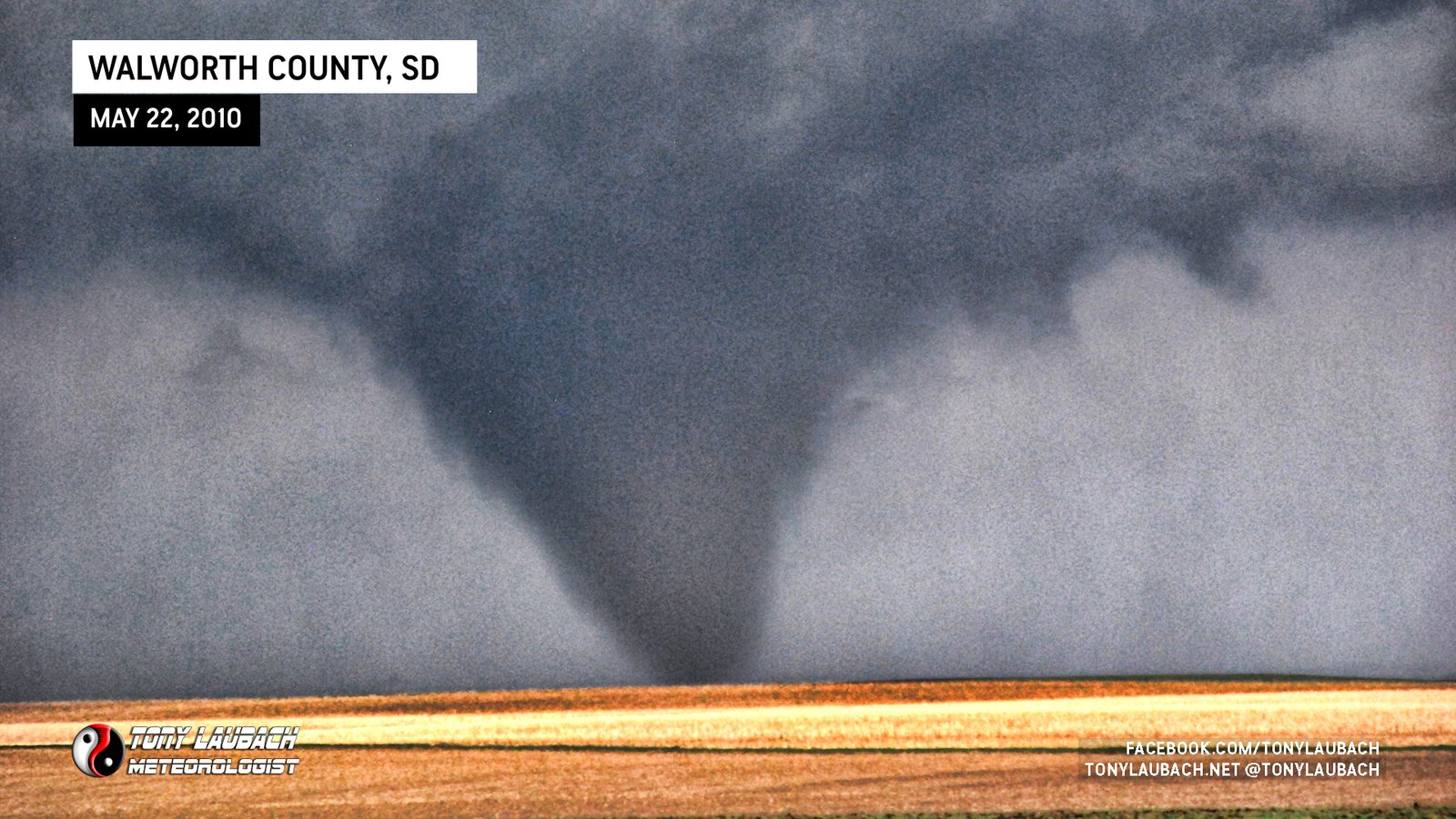
Stout cone tornado to our east.
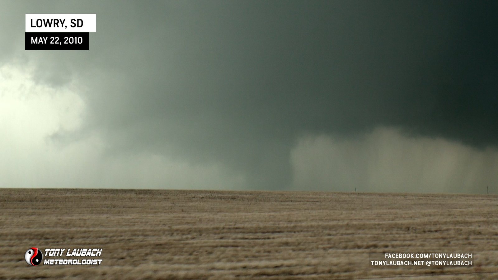
Large tornado viewed looking back to the west from 315th Avenue.

Low-contrast multi-vortex tornado viewed from north of Kingfisher, Oklahoma.

Large, low-contrast tornado north of TX-152 looking northwest from east of Dumas.

Brief spin-ups on/slightly north of TX-152 east of Dumas, did fully condensate briefly as well.

Brief touchdown of a tornado west of Dumas looking west/southwest along US-87.

Documented the remnant dust of a rope tornado the touched down on the northwest side of Odessa south of Goldsmith.

Large tornado viewed at a distance; logged in official reports as TWISTEX.

Sang ‘Happy Birthday’ to Carl while watching this tornado; logged in official reports as TWISTEX.

Video of initial funnel of the Bessie tornado viewed looking north along US-183 before it moved northeast out of view.

Witnessed anti-cyclonic tornado briefly touch down and remove roof from local casino seconds after RFD overtook us and blocked initial tornado from view along US-177.

Viewed initial touchdown of long-track tornado east of Marland from US-177 looking immediately east of us. Powerful RFD overtook us and blocked tornado from view.

Brief tornado touches down northwest of Medford, viewed looking northwest from OK-11 and CR-970 one-mile east of Medford while large EF-3 was northeast of us.

Saw left edge of large tornado northeast of Medford as we were approaching Medford on OK-11 moments before brief tornado touched down.
Likely intercepted remnant circulation of the Diller tornado along US-136; mesonet measured small pressure drop.
Deployed on this tornado south of Scott City on US-81; Probe vehicle has video as our view was very low contrast.

Video still of distant tornado around sunset, looking north.

Observed a large, rain-wrapped tornado about 5 miles west of Lakin, watched circulation cross US-400/50 before briefly coming into view as it ended.
QLCS tornado spins up ahead of damaging storm complex during tornado warning; viewed in powerflash from I-70 near Wadsworth looking west/southwest.
Observed during fuel fill-up at end of chase, no conclusive imagery from our team; others confirm.
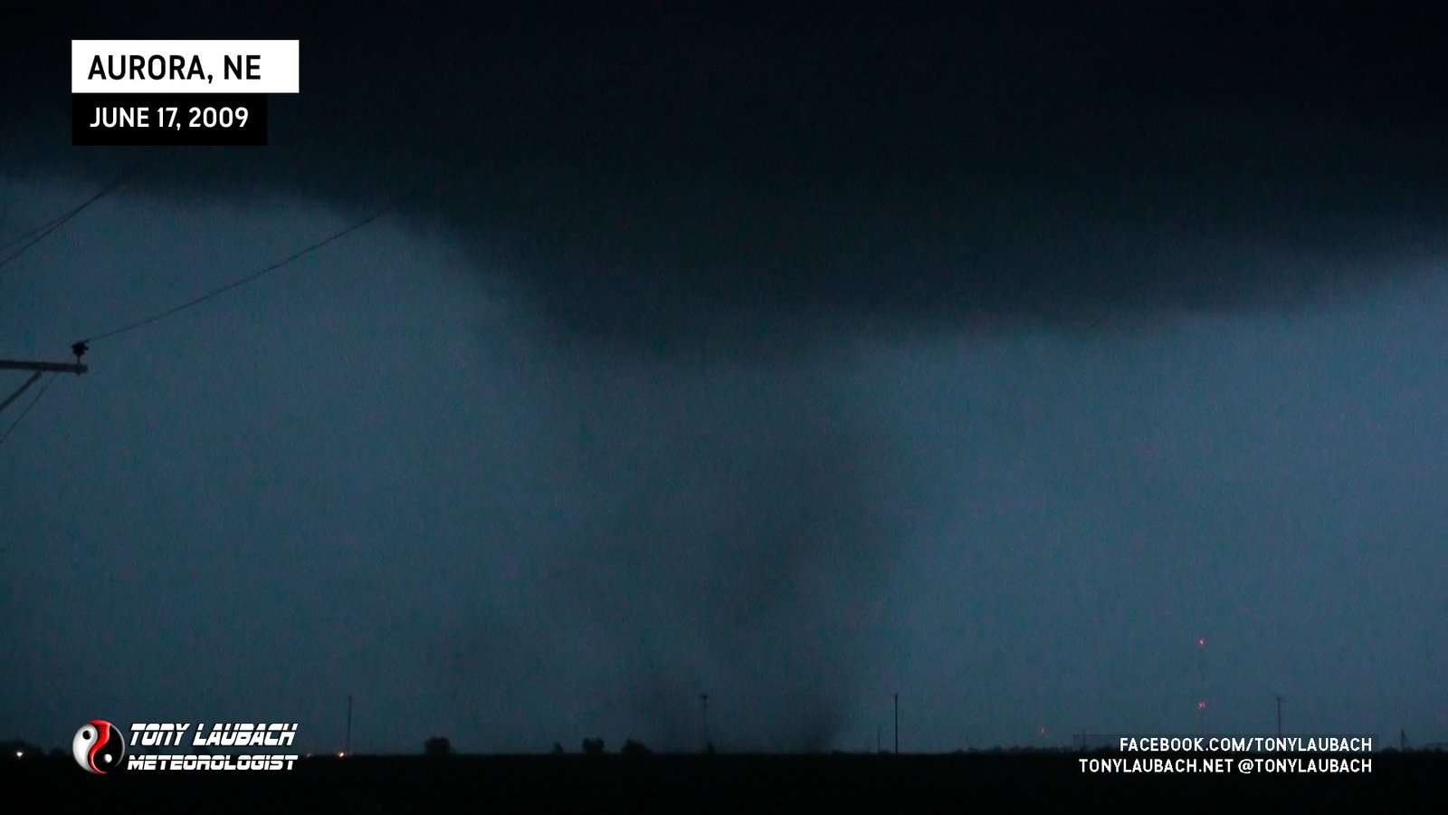
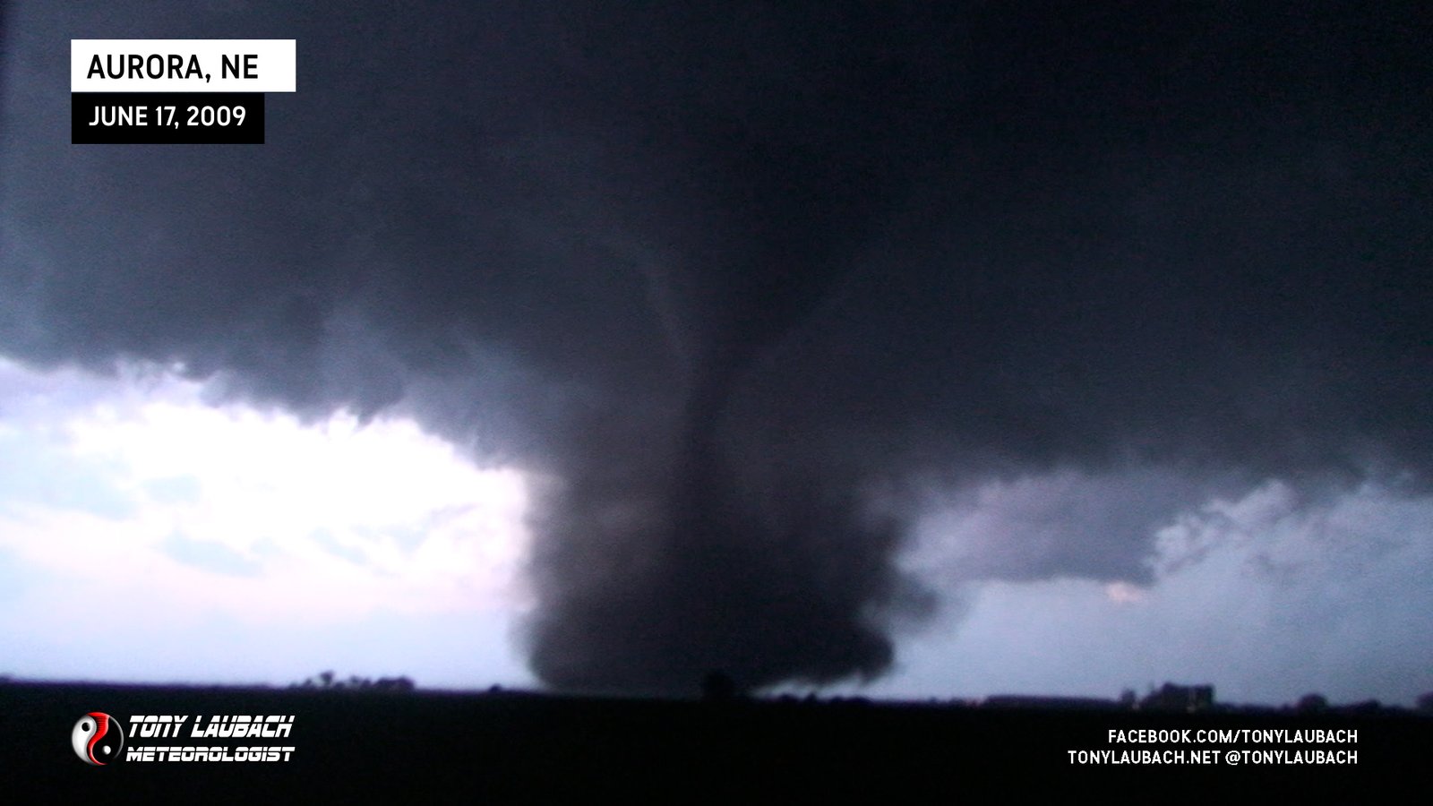
Likely satellite of Aurora, diffuse weak tornado spins up during main Aurora rope-out.
Large, Longtrack Tornado, Successfully Deployed on by Tim’s probe and our mesonets. Featured as our season finale tornado in ‘Storm Chasers’.
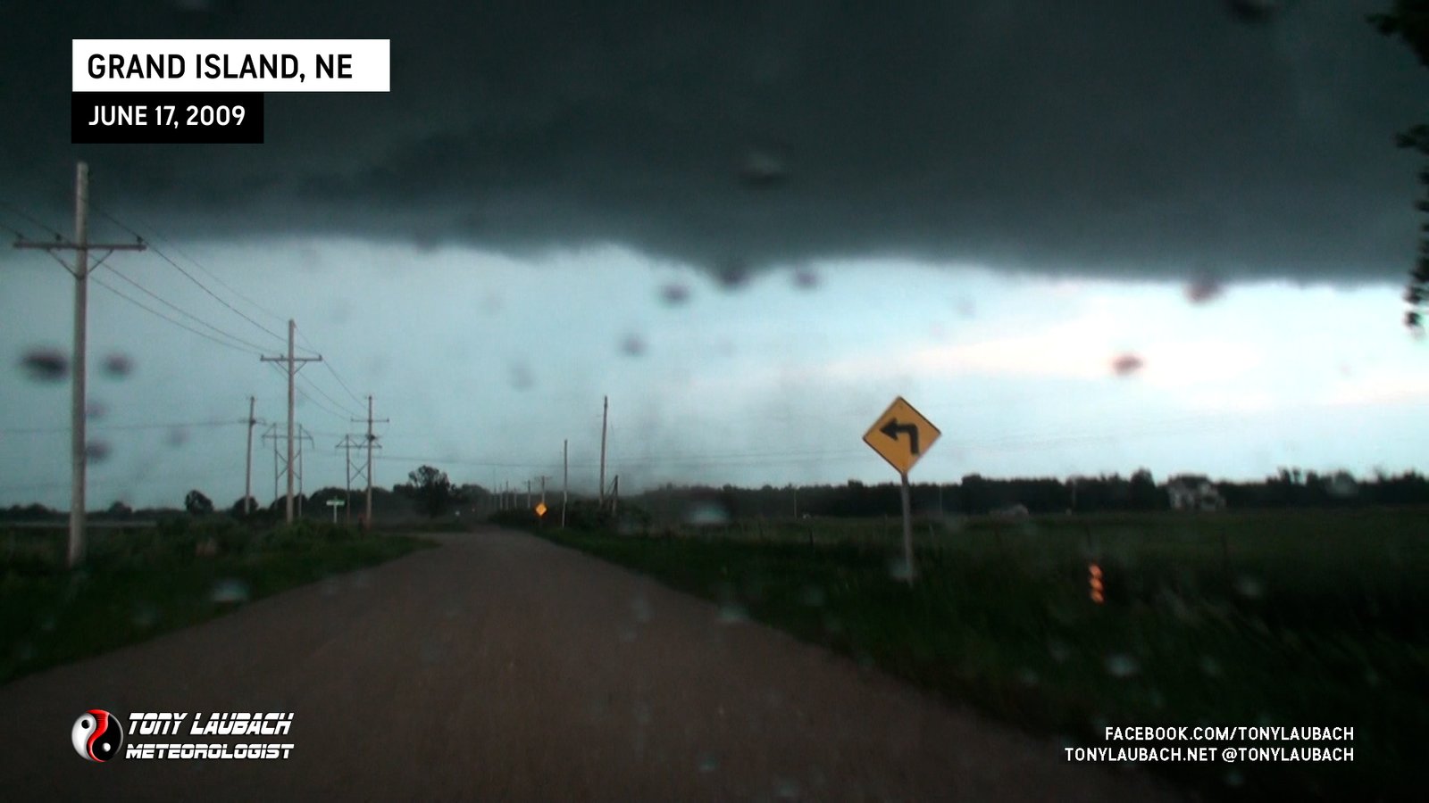
Brief touchdown immediately to our east on the southeast side of Grand Island.
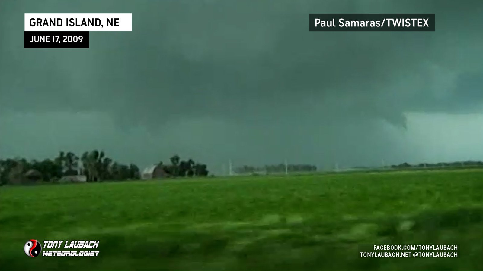
Brief tornado hit and knocked down two trees to our immediate north; video still thanks to Paul Samaras.
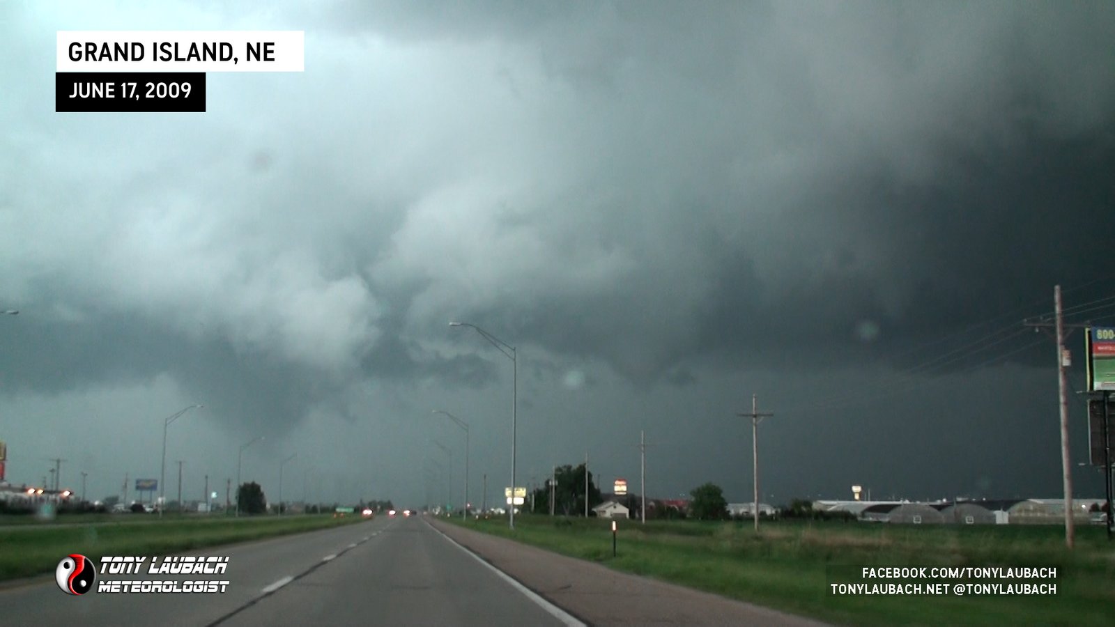
Funnel touches down on south side of Grand Island ahead/north of us on US-281.
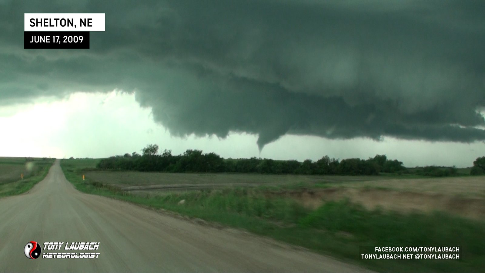
Caught while on approach to it, would lift as we arrived closer to it on a dirt road northwest of Shelton.
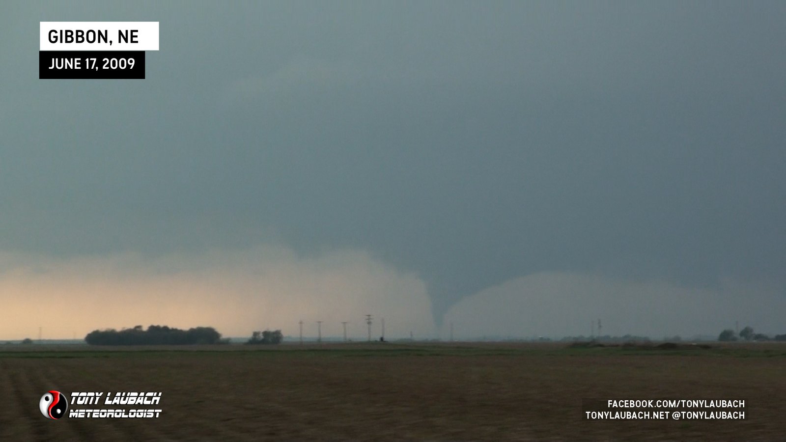
From north of Gibbon, Nebraska looking far distance west. First tornado of the event.
Caught tail end of Lone Elm EF-1 as we approached, but no media captured by anyone in M3 vehicle.

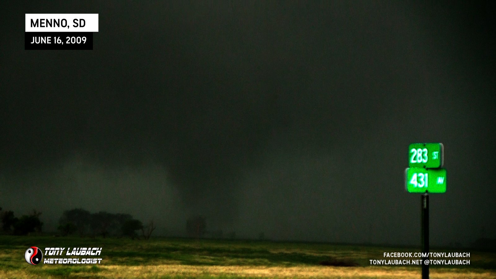
Ed and I ‘Self Deployed’ the mesonet into a broad, rain-wrapped circulation east of Menno with our mesonet recording a small pressure drop. Probe vehicle still had eyes on main tornado, so we assume this to be a satellite.
Caught the early stages of a large tornado that developed to our north, retreated south toward town immediately after sighting.
Brief tornado viewed from near Pritchett looking south as heavy hailcore overtook us. No imagery.

One of my favorite ‘Discovery-era’ tornadoes; part of ‘Storm Chasers’ episode focused on this tornado. “This was MY tornado”.
Long-track, well documented tornado from initial touchdown til rope-out.
Landspout with smooth spin-up and dissipated from ground to cloud.
Viewed from Highway 6 looking east, caught initial stages before moved out of view to our northeast. No imagery from my cameras.

Tornado day after my last final for my Met degree. Viewed from east looking west along MO-6; stopped at Novinger Baptist Church and narrowly escaped as tornado overtook the town.
Larger satellite cone tornado that formed shortly before main tornado rope-out.
First satellite tornado, a rope we saw east of the main tornado. Brief touchdown mentioned in report with the main tornado.
Large tornado I took my first picture in front of; also won 2nd place in Redskins fan contest for this as I was in an Art Monk jersey. Most incredible rope-out phase!
First brief rope tornado touched down behind us while we were eastbound on FM-2286 east of South Plains. No imagery from M3 vehicle.
Second tornado from this supercell came down as the first tornado roped out.
Ropey-looking tornado we witnessed from US-283 looking southwest.
Brief tornado spun up directly in front of mesonet vehicles, captured on dash cam.
Brief view of weak tornado, looking north from 300th Street north of Emery.
Witnessed what we believe to be a new tornado that developed northeast of us during the impact sequence. Lightning illuminated, no imagery.
Satellite tornado touched down in field to our south and moved north over our mesonet vehicles; video captured on dash cam and by other chasers.
The initial stages of the long-track wedge that would move near Jewell, this as the carousel ceased and a single parent, multi-vortex ground circulation took hold and fully condensed.
Crew caught low-contrast view of a likely tornado to our southeast while the carousel was ongoing. No imagery from M3 vehicle.
Final carousel tornado in the Glen Elder sequence before the larger, long-track wedge fully developed.

Stout cone touches down from parent circulation as satellites cease during this portion of the event.
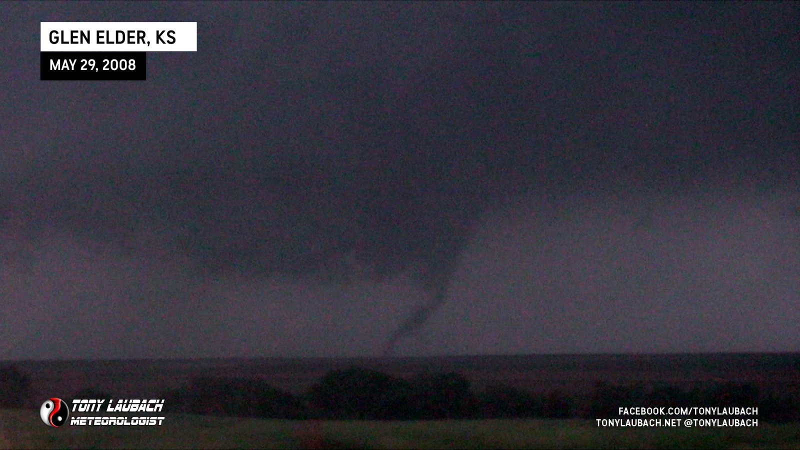
Glen Elder carousel sequence; fifth vortex to touch down around developing parent circulation.
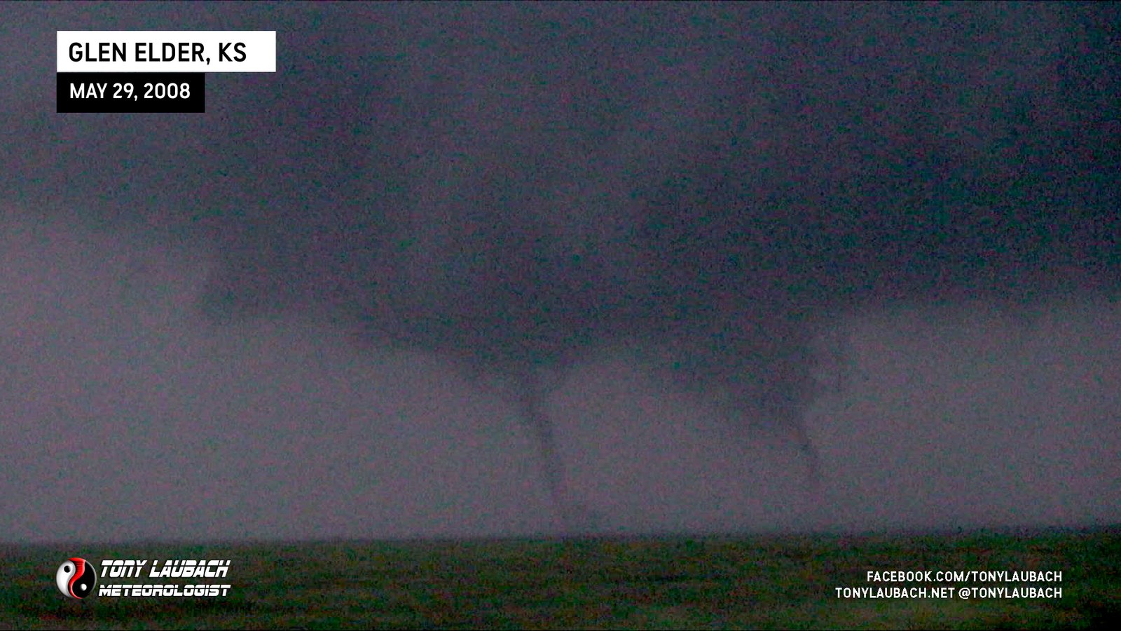
Glen Elder carousel sequence; brief twin moment where two funnels came down. This tornado covers the funnel on the left.
Glen Elder carousel sequence; brief twin moment where two funnels came down. This tornado covers the funnel on the right.
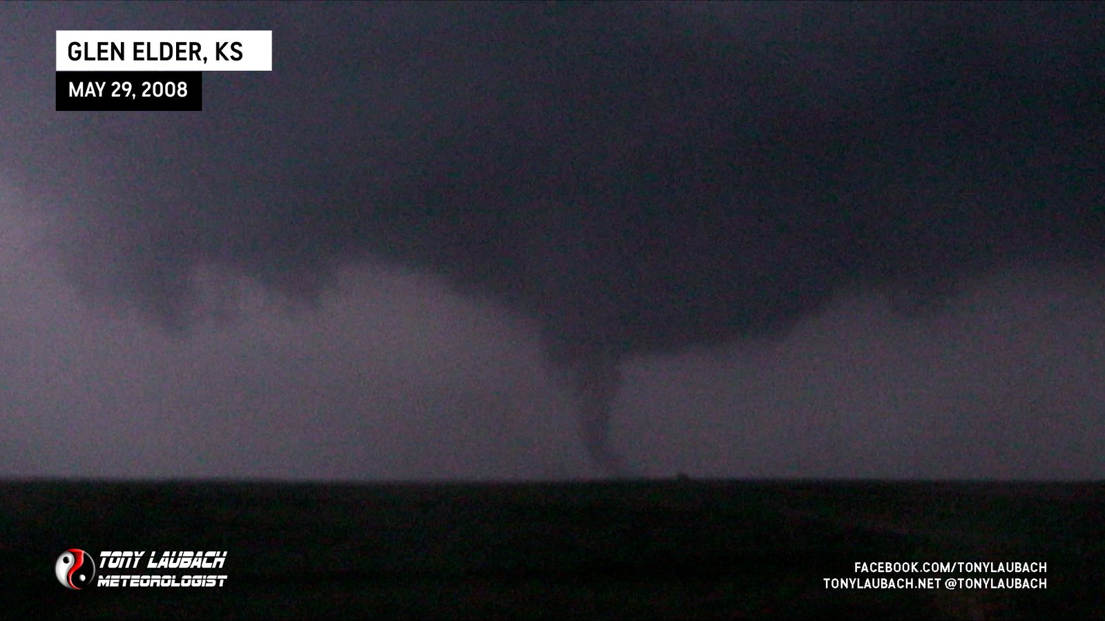
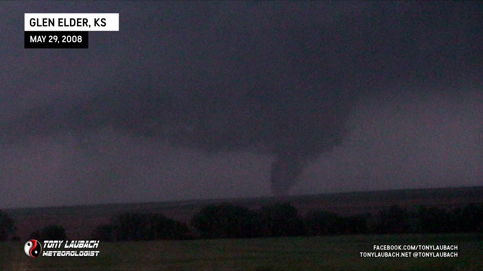
Glen Elder carousel sequence; second vortex to touch down around developing parent circulation; counted as 100th career tornado.
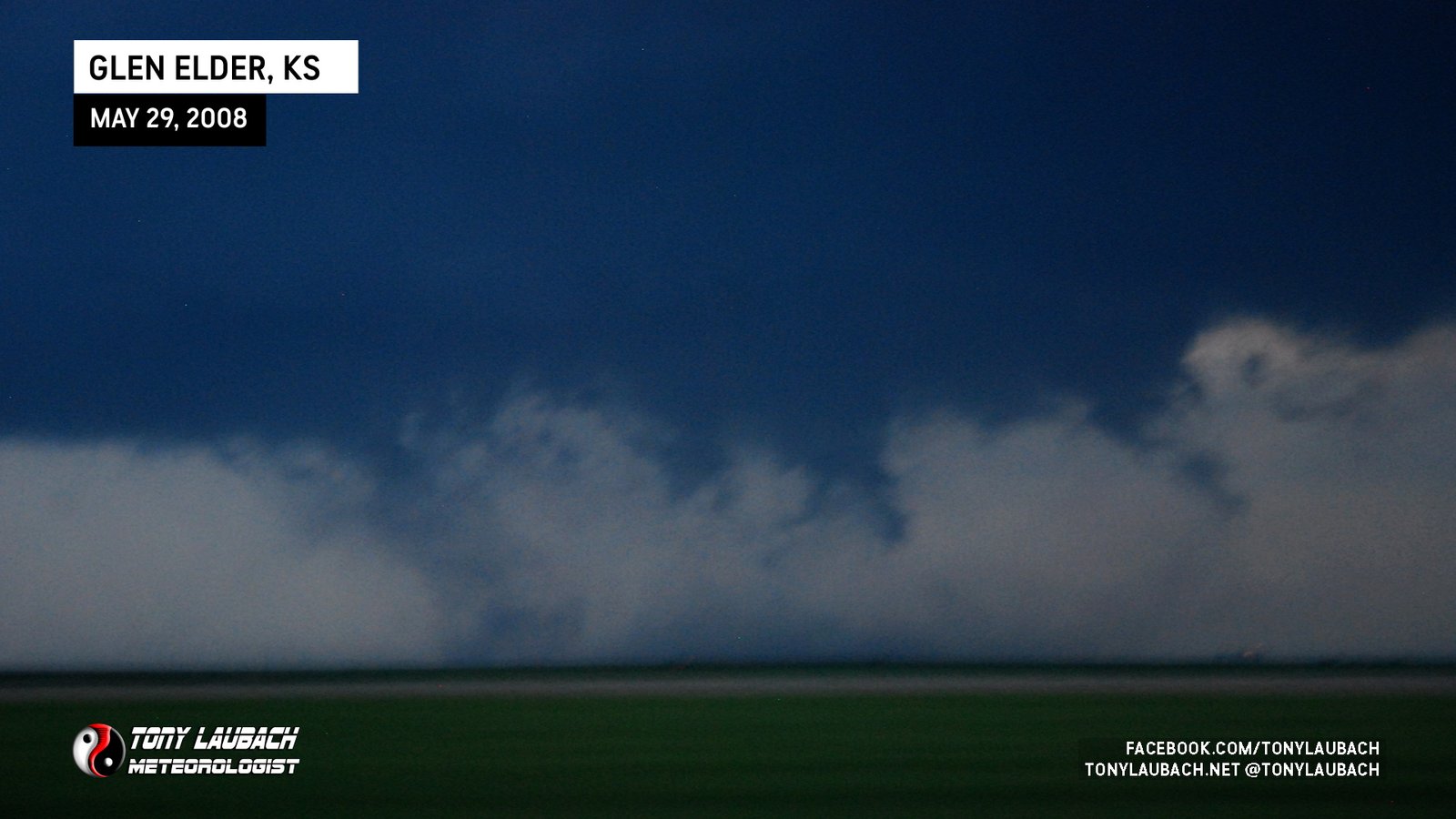
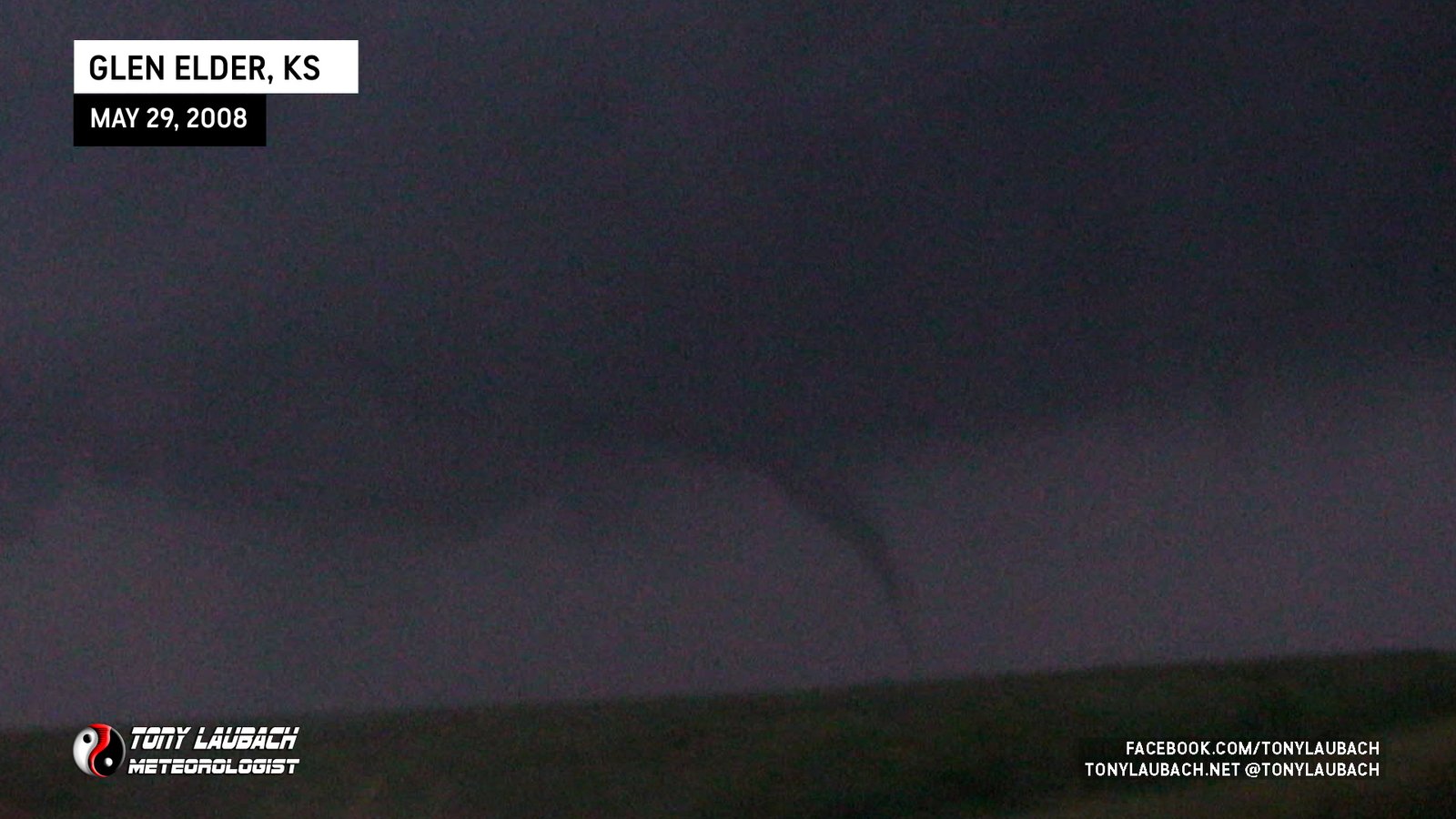
Glen Elder carousel sequence; first vortex to touch down around developing parent circulation.
My first big probe deployment; Ed Grubb and I in M3 were about 200 yard south of the tornado as it crossed the highway to our north.
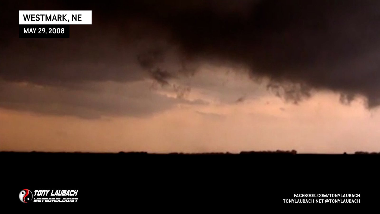
Final tornado of the ‘Kearny sequence’; viewed to our south briefly as we exited I-80 to follow the Kearney tornadoes. No images.
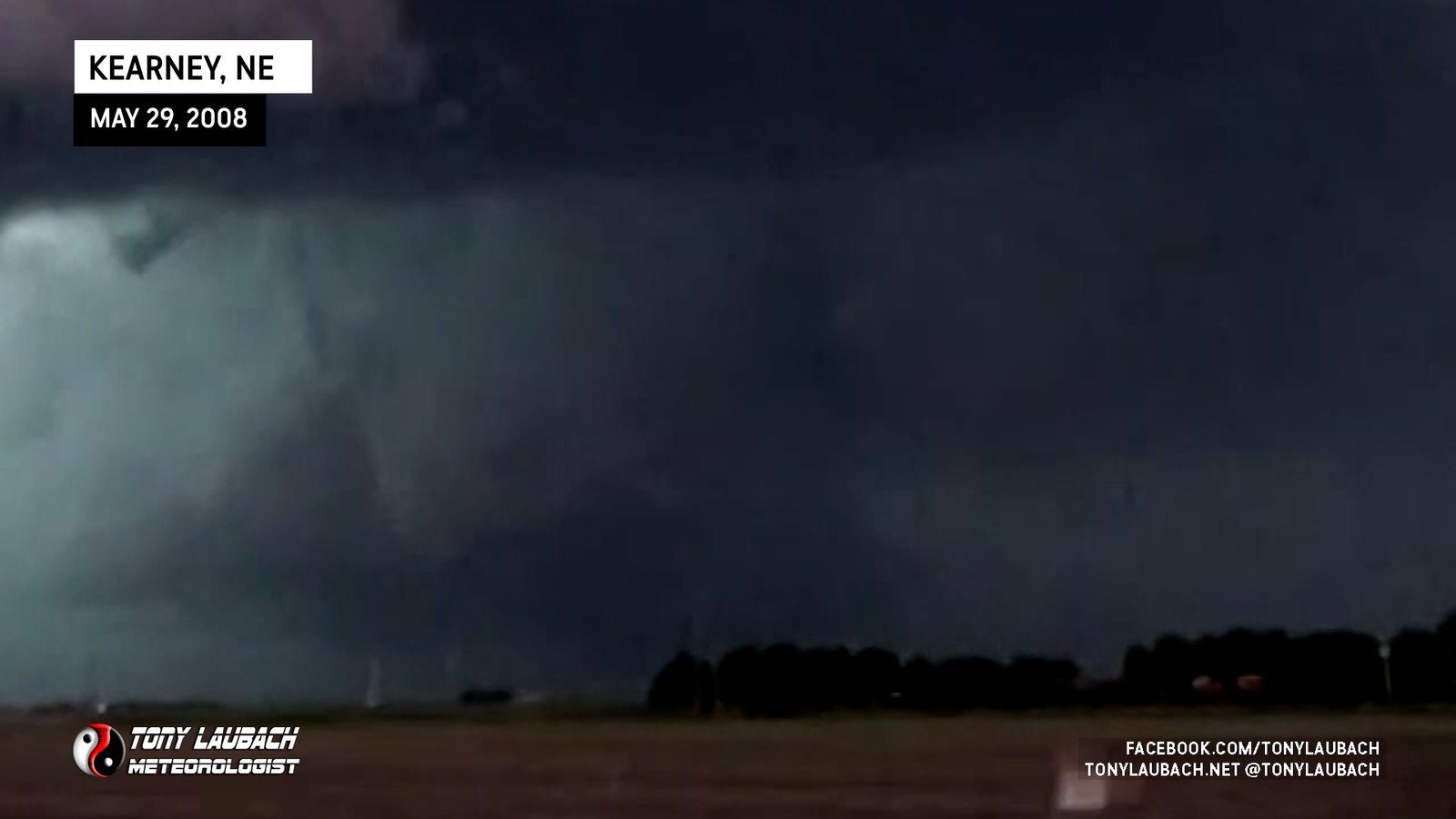
Large tornado viewed from distant southwest as it was on the north side of Kearney. Ongoing along with small tornado we witnessed earlier on I-80.
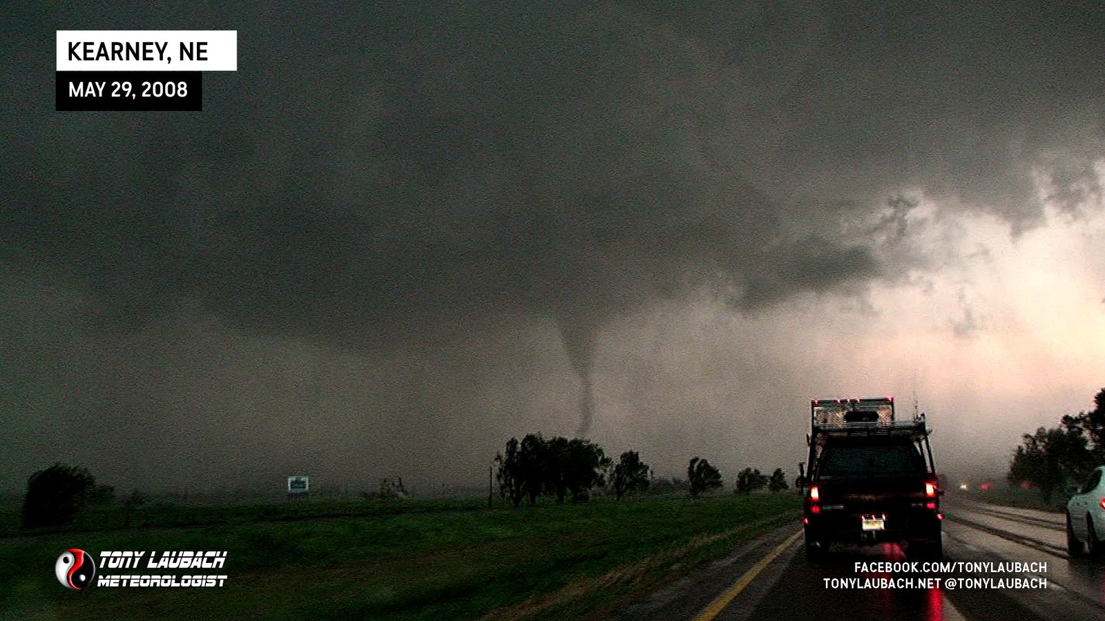
Tornado visible just north of I-80 on west side of Kearney, damage observed in immediate wake.
Were southwest of a weak tornado that would touch down sporadically south of Elm Creek; we never saw it fully condense, more just an occasional dust whirl under rotating clouds.
Brief landspout viewed from K-96 looking north, no imagery from my vehicle.
Southeast of La Cross, viewed briefly looking east from US-183; no imagery from my vehicle.
Caught tornado south of Ellis from I-70, rain-wrapped but briefly visible with power-flashes evident. No Imagery.

Distant view of large, EF-4 tornado crossing I-70; using Tim’s shot as he was closer, we had terribly contrast from the east.

Brief satellite spin-up, viewed as it developed in the field west of the road and moved directly across the road in front of us before dissipating east of the road.
Massive wedge viewed from the south looking north.
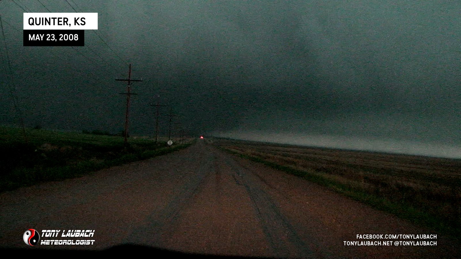
Large cone (likely satellite of larger wedge); Viewed from Quinter while ‘Lost’ in town; no imagery.
Satellite tornado briefly touches down north of main tornado.
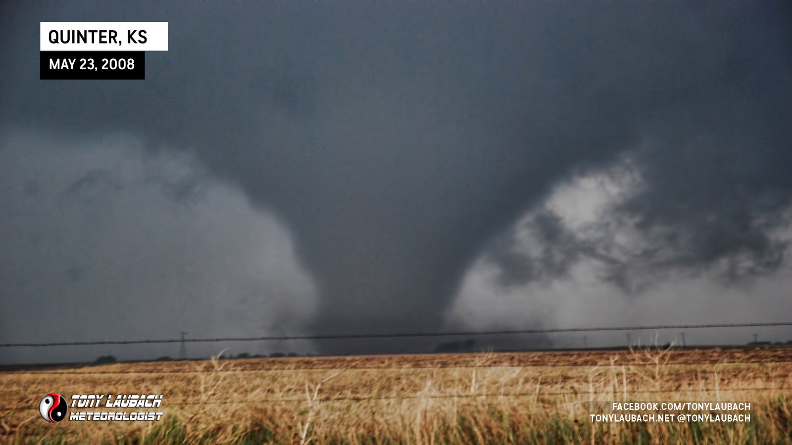
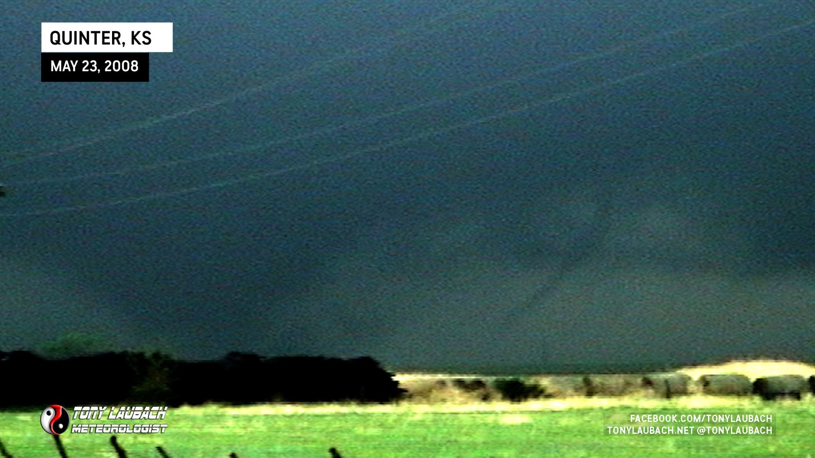
Large tornado viewed from south of Quinter (first Quinter), dissipated rapidly before reaching I-70.
Dark cone touches down south of I-70 to our immediate west, vivid lightning striking all around us.
Tornado crossed I-70 to our immediate west, hard RFD blasted us as tornado moved north of I-70.

Brief spin-up south of I-70 as we were eastbound toward Collyer from Quinter.
Brief touchdown observed south of I-70 enroute to the interstate.
Caught tornado as it formed, then slid into ditch where we watched from til it moved out of sight. Eventually drove ourselves out.
Brief touchdown over Broken Bow Lake; mmesonet vehicles recorded slight (~4mb) pressure drop as meso passed over us on US-259. No imagery.
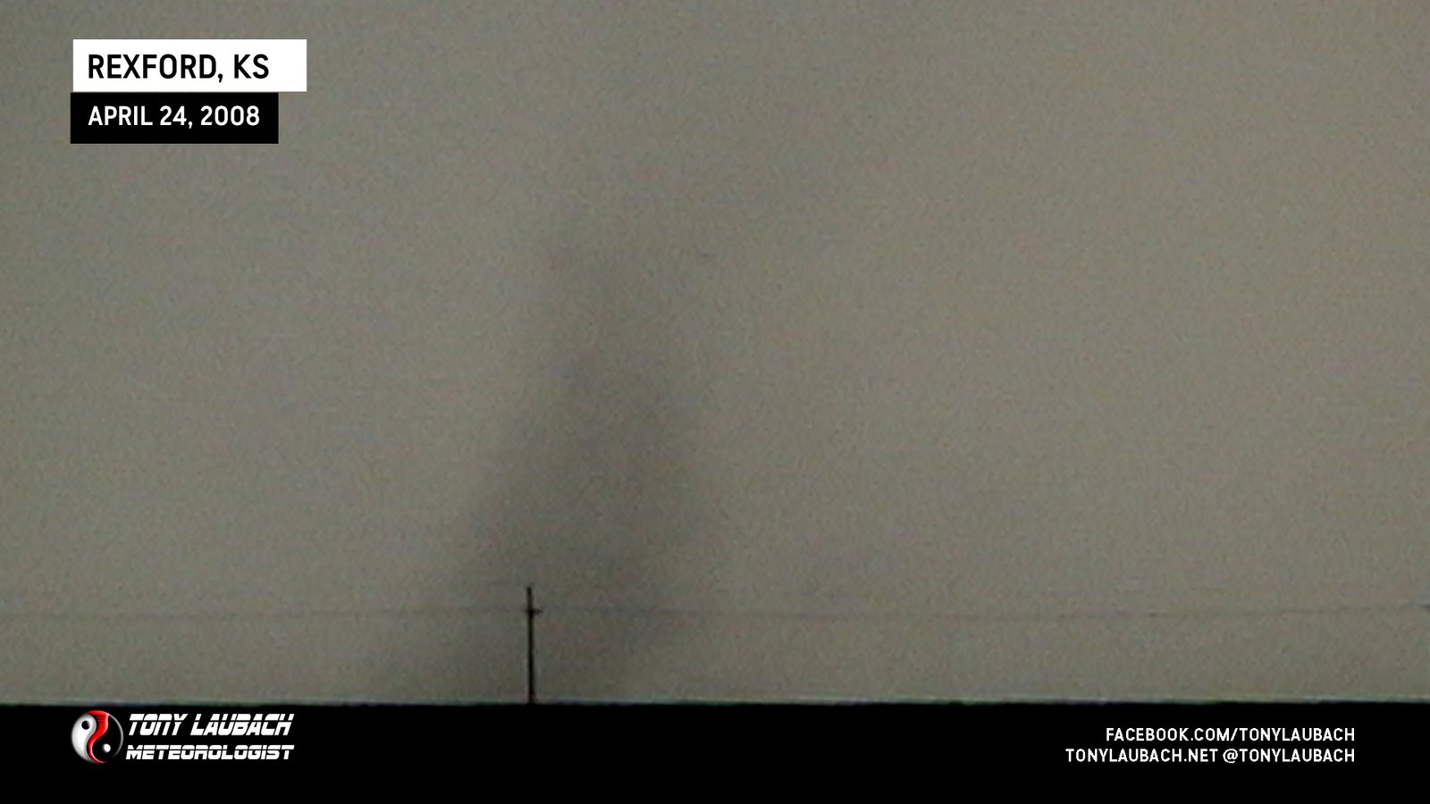
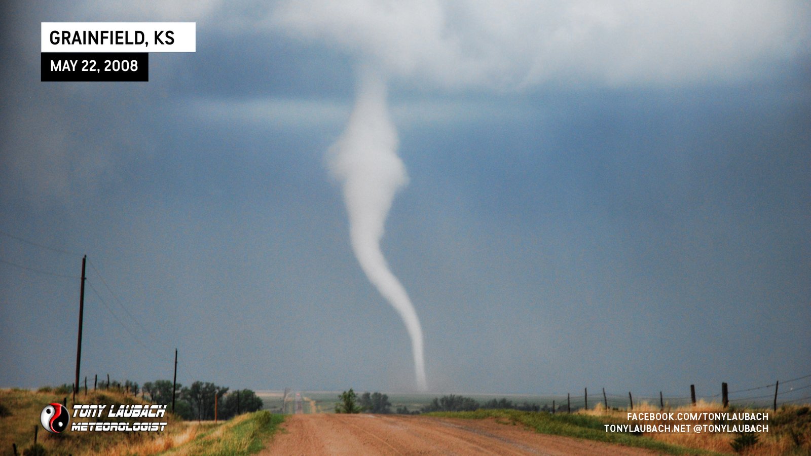
Brief spin-up, possible landspout outside Rexford.
Looking north from US-183 south of Breckenridge, flipped semi blocked our route and tornado quickly moved out of sight to the northeast. No imagery.
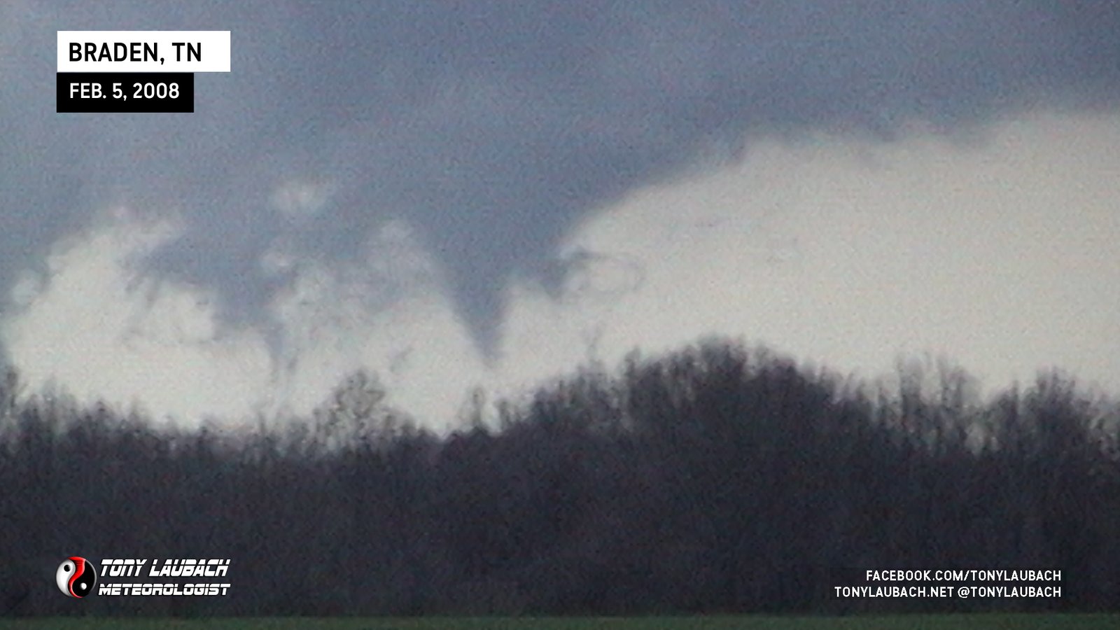
Long-lived funnel briefly touched down north of Braden, viewed from US-79 looking north.

Wide, weak dusty tornado, early in Super Tuesday outbreak, viewed from near Gallaway looking west.
Low-contrast view as we got into Wisconsin Rapids behind the massive hail, no imagery.
Brief tornado viewed from SD-44 south of Interior, looking east. No imagery.
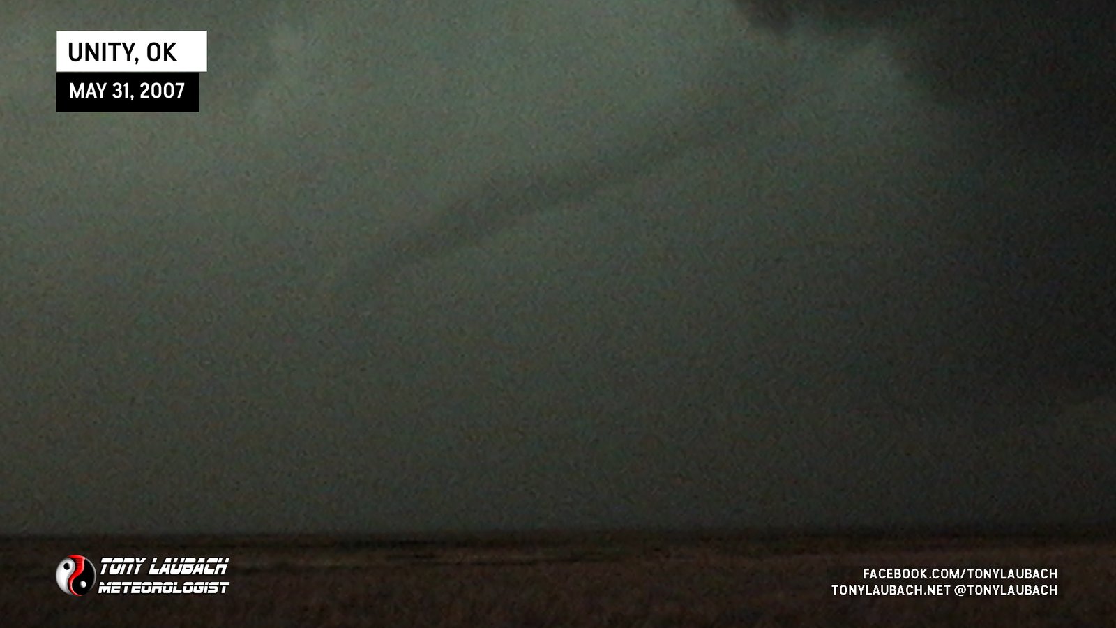
Rope tornado viewed between Eva and Guymon along US-412/64 near Unity; part of Roger Hill’s tour.

Large funnel/brief touchdown viewed from 1 mile north of Eva looking north; part of Roger Hill’s tour.
Brief tornado spins up shortly after first tornado lifts.
Surprise tornado while sitting with Tim south of Perryton, the first of two in this area.
Intercepted a slow-moving tornado near Hill City riding shotgun with Tim Samaras.
Tornado we almost got caught up in south of Great Bend; turned around when we realized we were basically right next to it near 200th Street on US-281.
We believe this was the circulation of a smaller tornado that came down as the wedge was ongoing. We had multiple sightings in the lightning flashes.
Wedge tornado spotted west of St. John looking west from US-281.
Brief satellite tornado observed while navigating mud-covered northbound road north of US-50. No imagery worth a darn.
Low-contrast cone tornado viewed looking north.
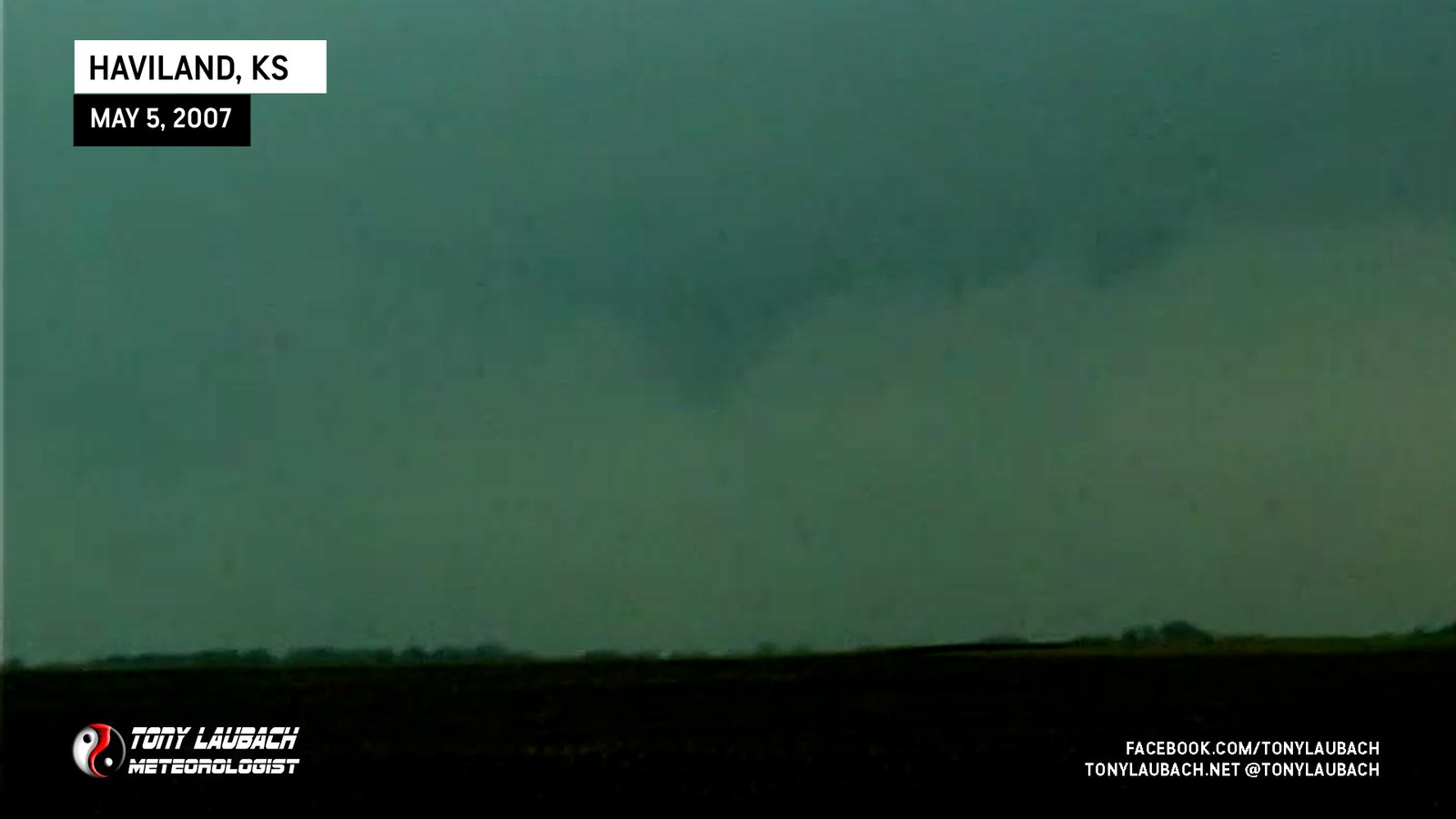
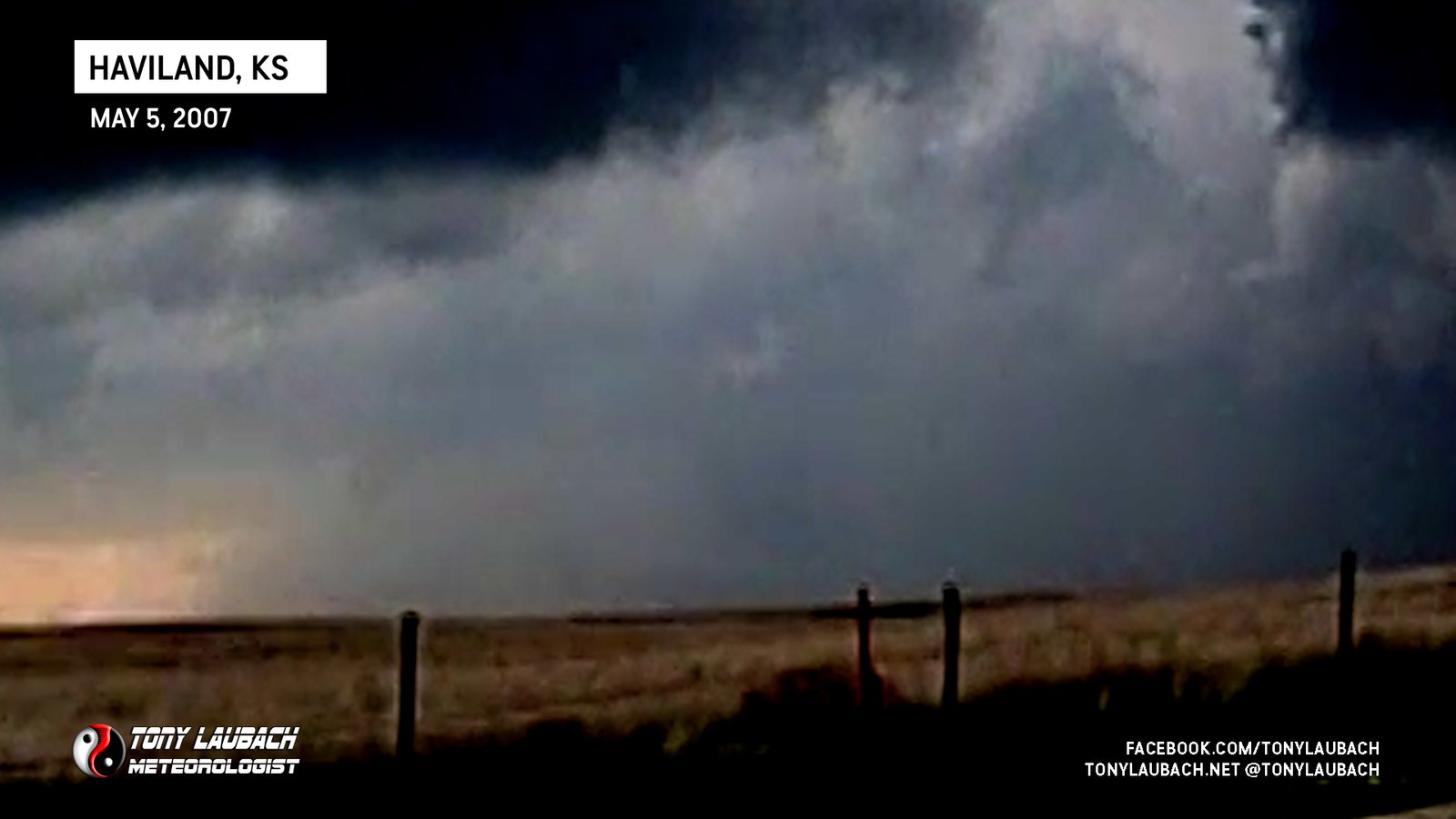
Caught final moment of tornado that approached Haviland from the south, dissipated prior to crossing US-50.
Brief spin-up, likely landspout as dust whirl was under rotating clouds.

Brief touchdown after probe deployment southwest of Nickerson, Kansas.
First time being part of a probe deployment; successful intercept of weak tornado near Sterling, Kansas.
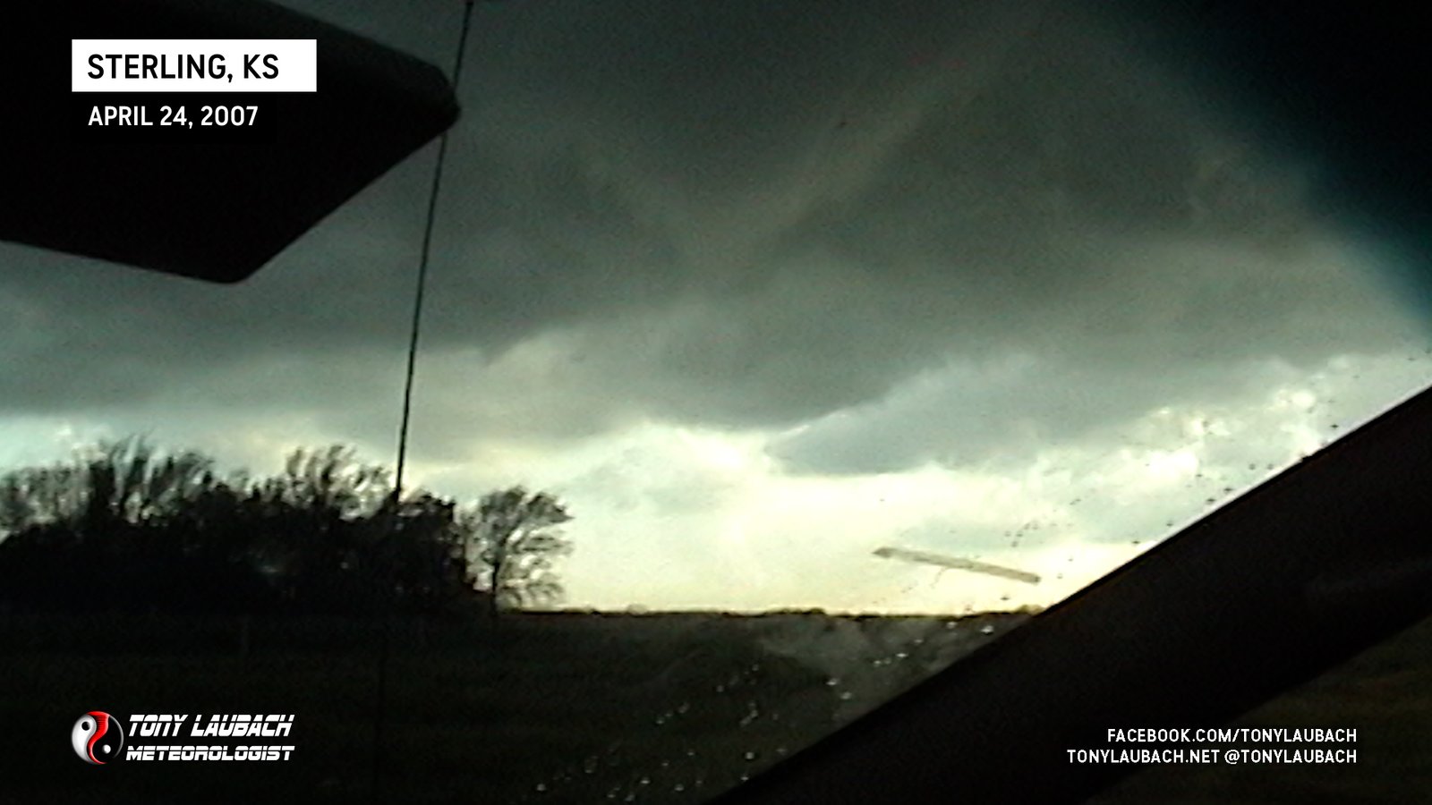
Brief spin-up north of Charters Corner near Sterling, Kansas.

The first tornado I saw with Tim Samaras, a narrow needle-nado viewed from the south along US-160
Viewed from near Sunray looking south, no imagery from anyone in the group.
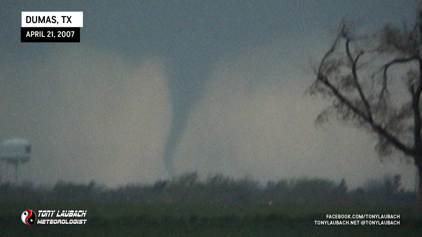
This was the tornado that went on to hit Cactus, viewed from west side of Dumas looking west and northwest.
Distant look from south of Dumas looking west toward Boys Ranch-Channing Tornado
Brief tornado, looking distant west from south of Dumas (Did Not Make Reports)
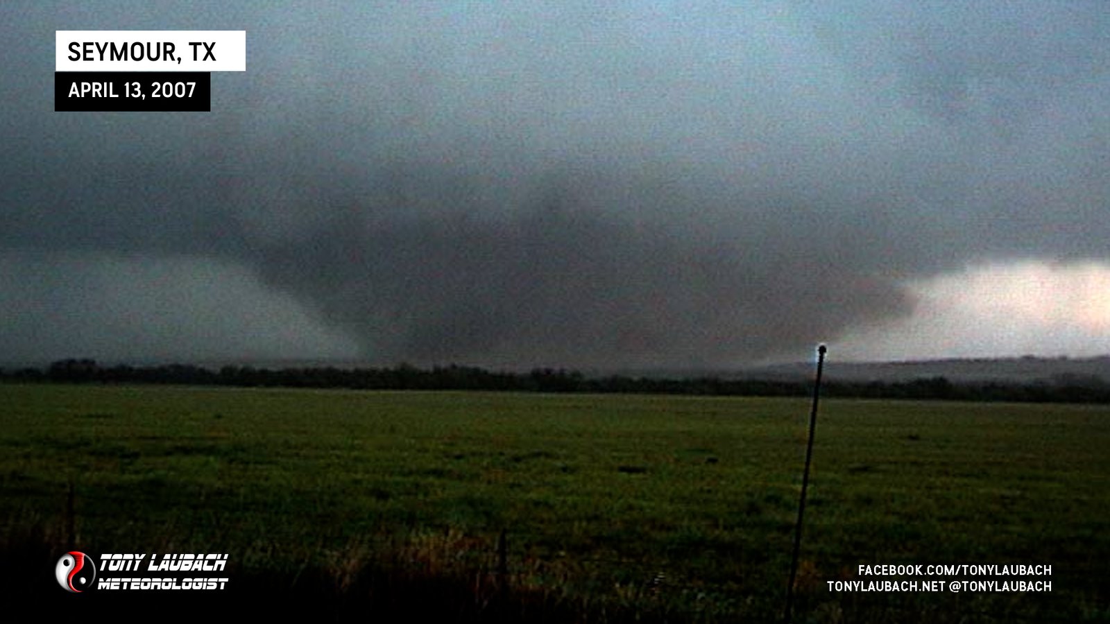
Large tornado developed to our immediate north on US-183 and grew into a large wedge near west/south of Seymour.

My first ever February tornado, viewed from near I-40 in McLean.
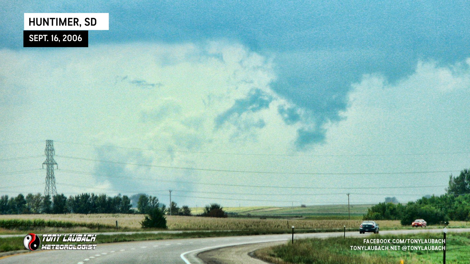
Remnant ground circulation from last tornado of the event east of Huntimer, viewed from distant south along I-29 north of Sioux Falls.
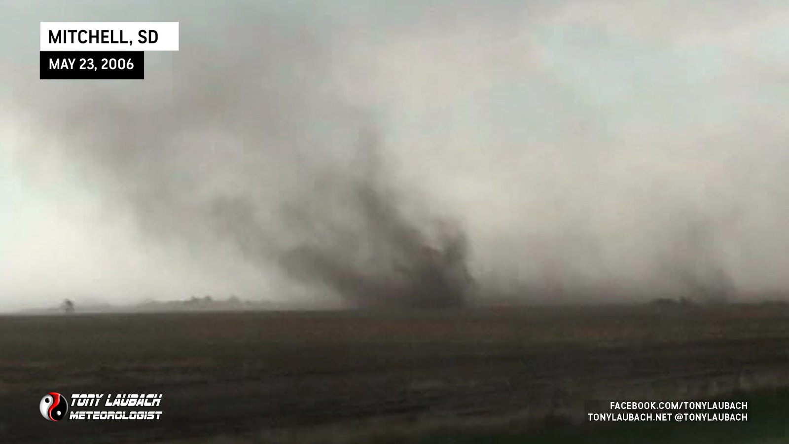
Likely landspout, fairly long-lived ground circulation beneath cloud-based rotation.
Caught the rope-out of this tornado riding shotgun with Scott Currens after my chase vehicle was destroyed by baseball hail earlier on that same storm.
Viewed looking north from TX-70 north of Rotan; tornado touched down while mobile and proceeded to lift once we stopped and got cameras out.
Brief touchdown after sunset viewed looking north from US-160 east of Kim, Colorado.

Landspout tornado viewed from the north.
Brief view of large tornado as it moved south of US-82 as we were just east of Benjamin. Video from this day has been lost, no imagery.
Looking distant northeast from north of Benjamin at low-contrast tornado. Video from this day has been lost, no imagery.
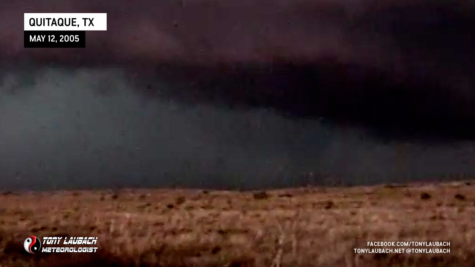
Looking northwest from FM-1065 about 6 miles south of Quitaque looking northwest; tornado BARELY visible on right half of frame.
Looking west from near South Plains at a skinny, ropey funnel that briefly touched down (confirmed via others practically under this).

Saw from a distance, looking east. Video still from old DVD pull as original video is no longer available.
Witnessed as we exited I-70 at Exit 180, looking northeast.
Brief view from Northbound K-147 south of I-70 looking east.
Beautiful white cone tornado over open fields documented from the west as 1-inch hail fell on us.
My first ‘waterspout’ as the tornado touched down on the reservoir and moved over land as we approached from the south.
Landspout viewed from E-470 near Quincy looking toward I-70.
Brief landspout viewed while enroute to filming area of second tornado, no imagery obtained.
Viewed rope-Out after late arrival. Do not personally have imagery of this encounter.
Viewed from Kansas Turnpike looking west, poor contrast no imagery.
Saw after the final tornado of the Conway Springs sequence, was enroute to Wichita via US-81.
Touched down to my west as I was moving north along Hwy 81 out of Wellington.
New tornado develops and is the longest of the sequence, morphing into various forms as it churns away. My first national-aired tornado video.

New tornado forms to the left as the other tornado dissipates, yet continues to produce ground circulation.
After initial tornado dissipates, a new funnel/tornado forms beneath parent circulation.
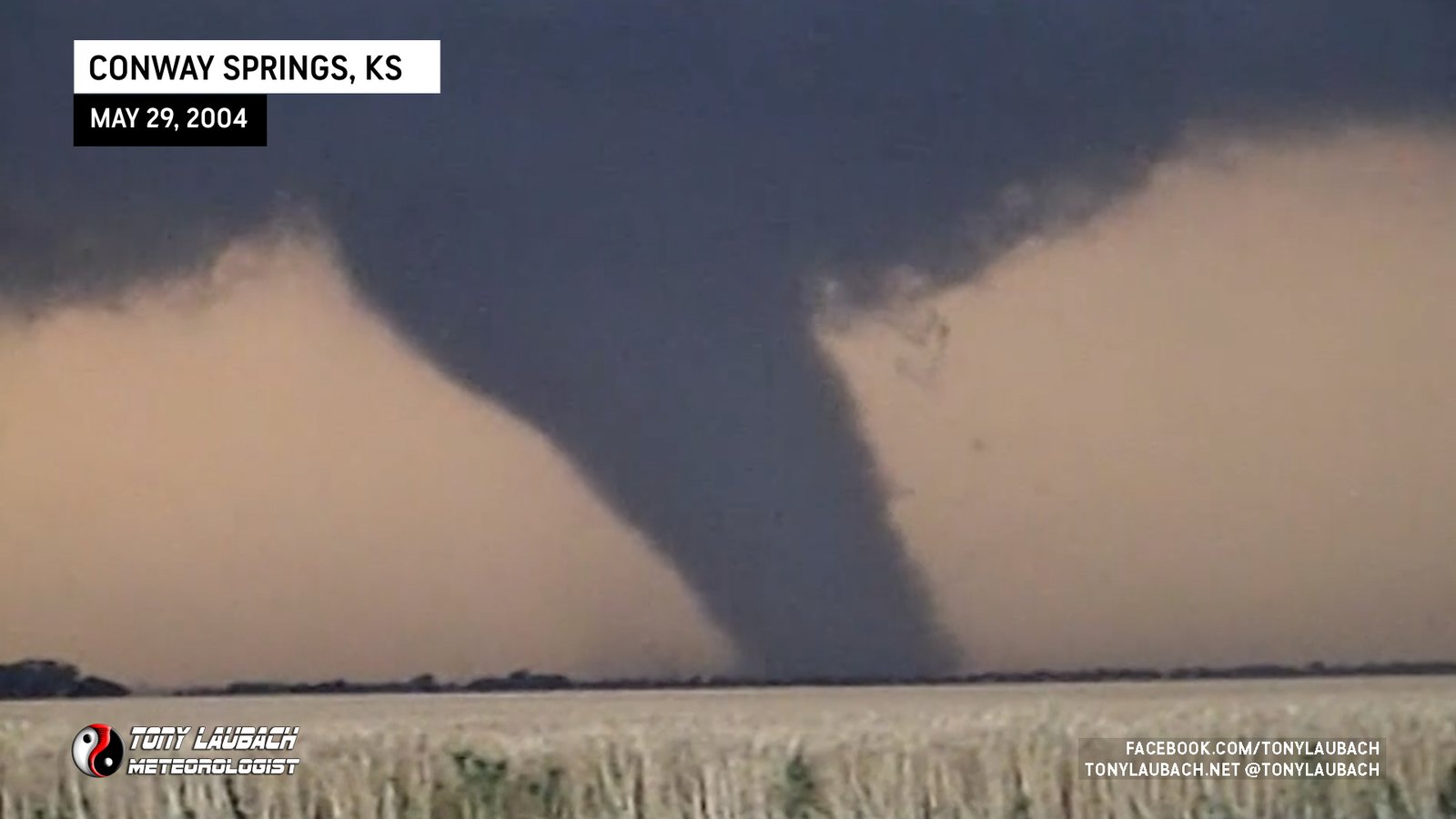
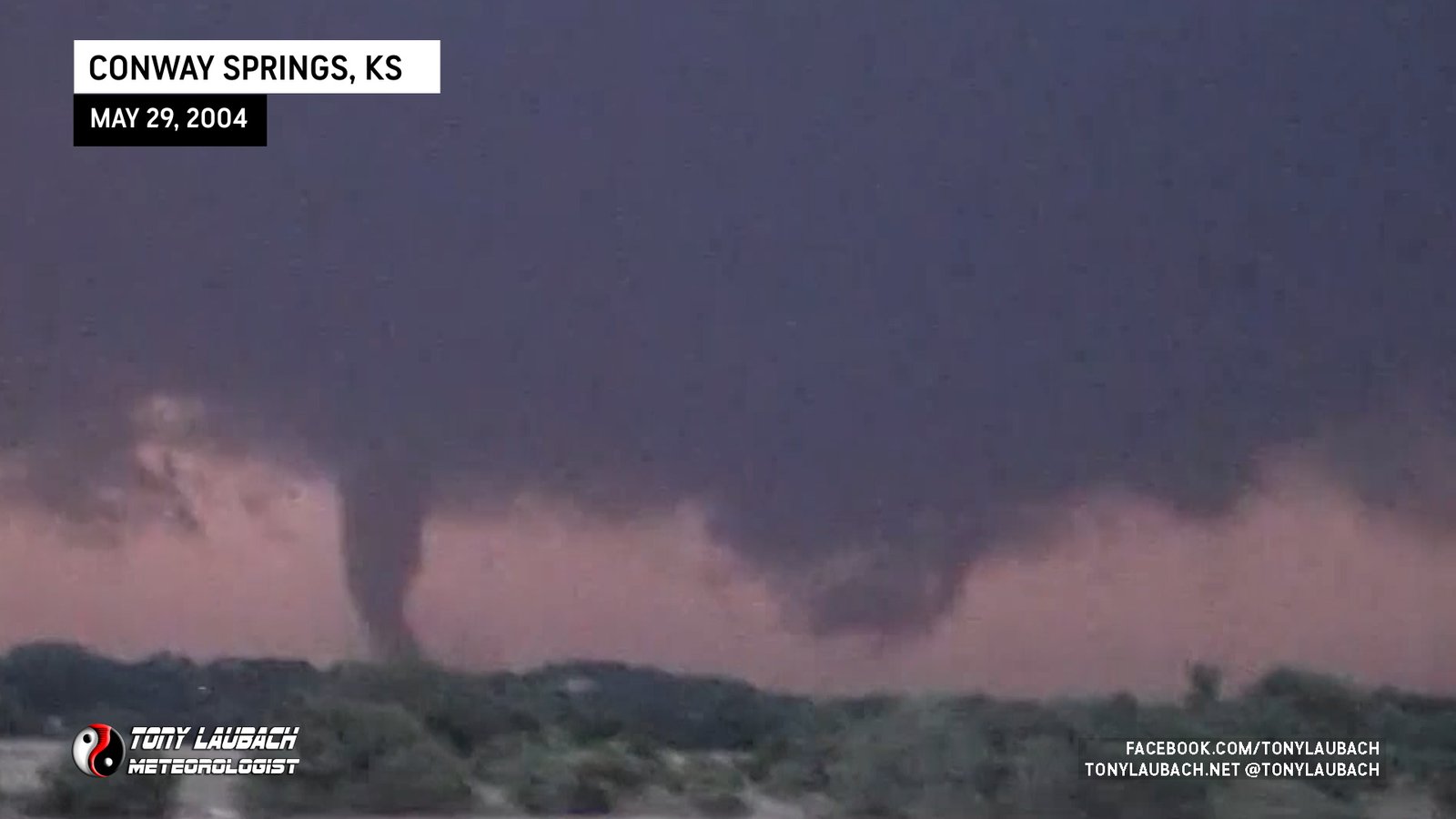
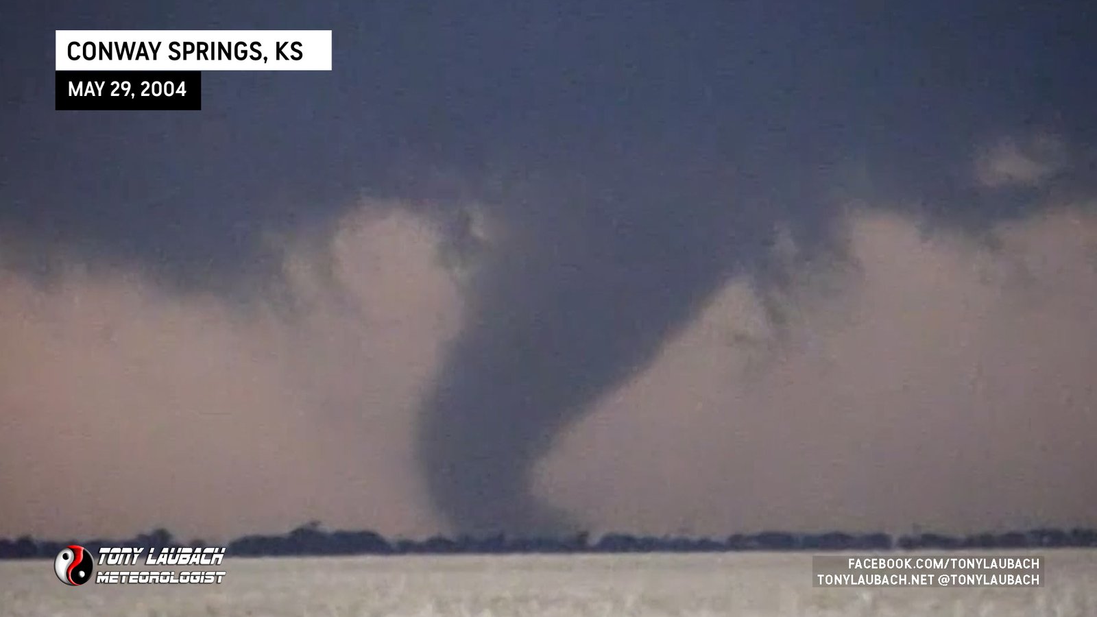
First of the Conway Springs sequence; stout funnel drops from wall cloud.
Larger satellite tornado that touched down directly on US-160 and quickly lifted as it rotated toward main wedge.
Satellite tornado that developed on the south side of main wedge and rotated out of sight.
Dusty Wedge I Viewed Looking Due West On US-160
The second of two satellite tornadoes developed. This one to the left as tornado #3 began to rope out.
Satellite tornado, brief touchdown from the initial larger tornado.
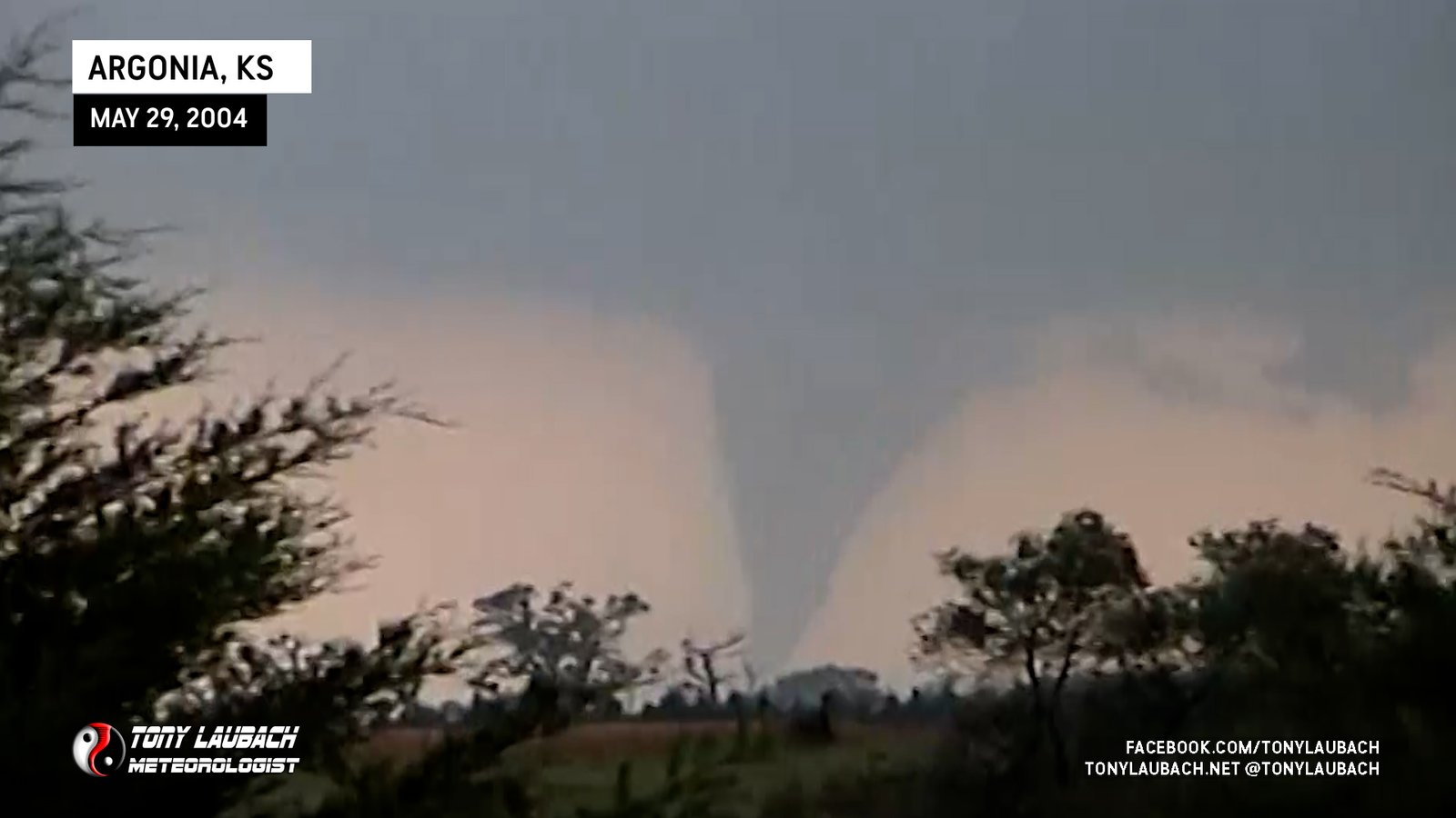
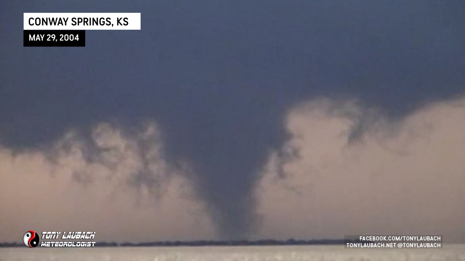
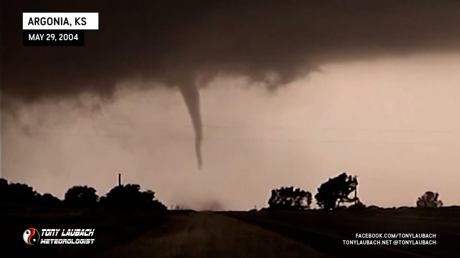
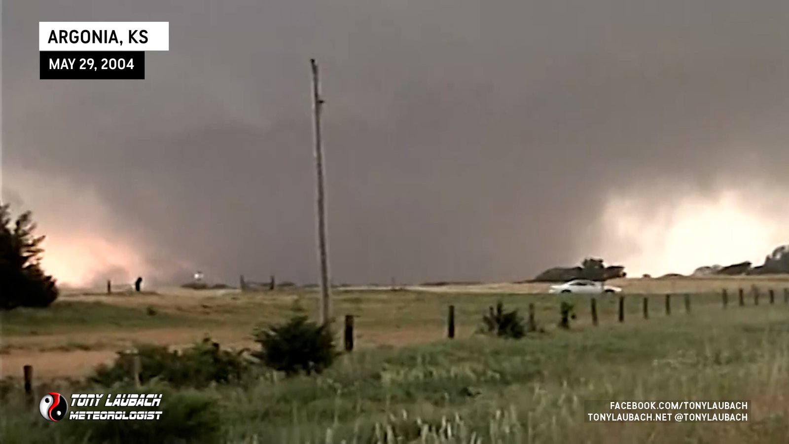
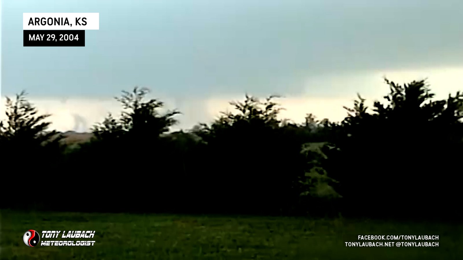
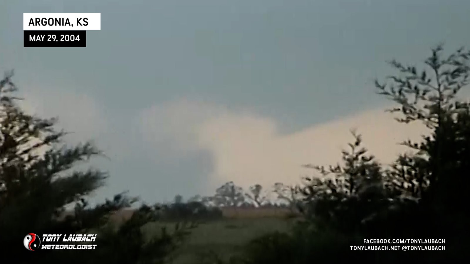
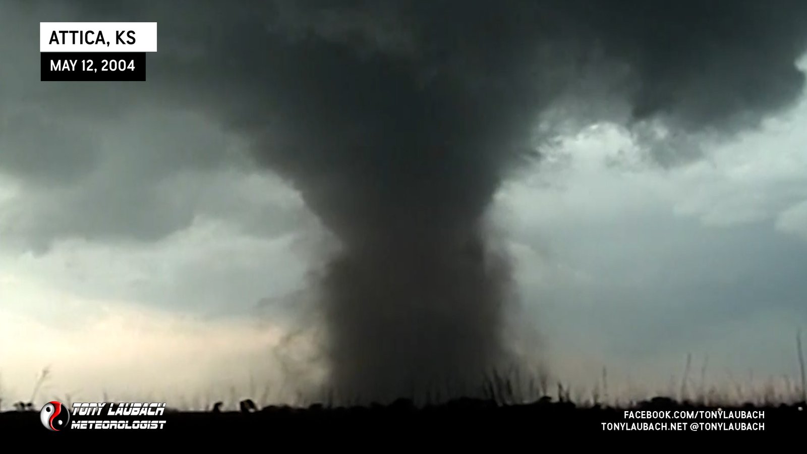
Large tornado east of Attica, Kansas looking west from north of Argonia.
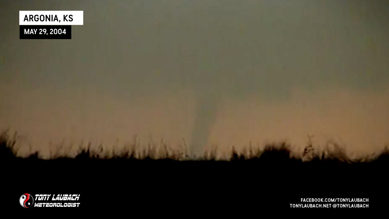
Looking west from 2 miles south of Argonia, Kansas
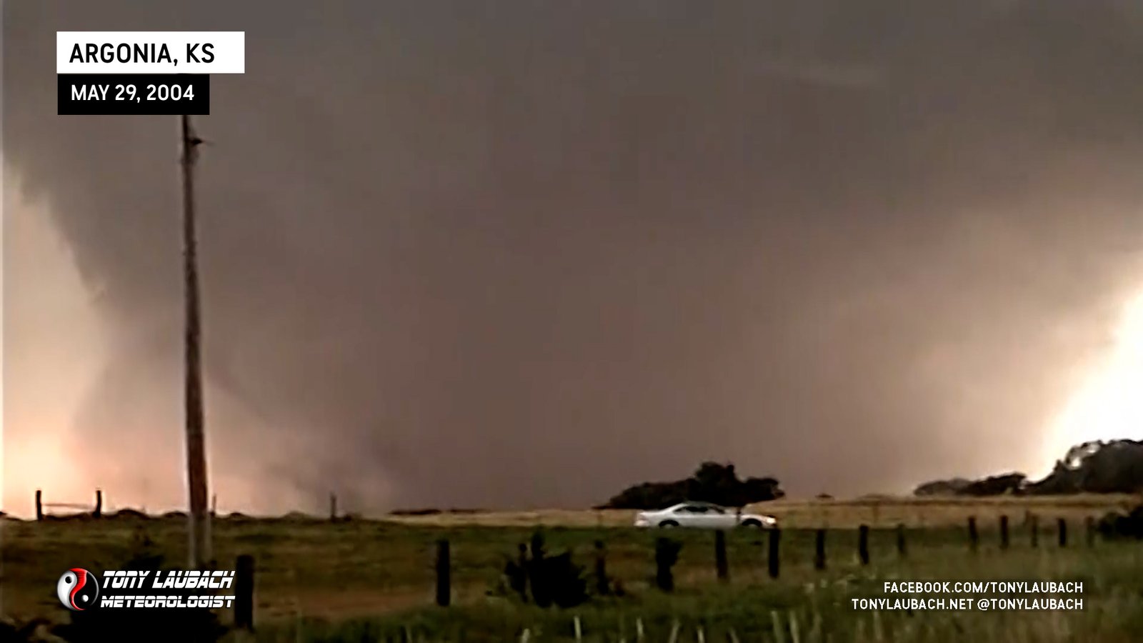
Touched down to my west as I was repositioning to the north. No images of this tornado while trying to get a little closer to the action.

Large, after-dark tornado seen from the southwest along side Warren Faidley.
Narrowly Avoided On K-2, Hit Chaparral High School
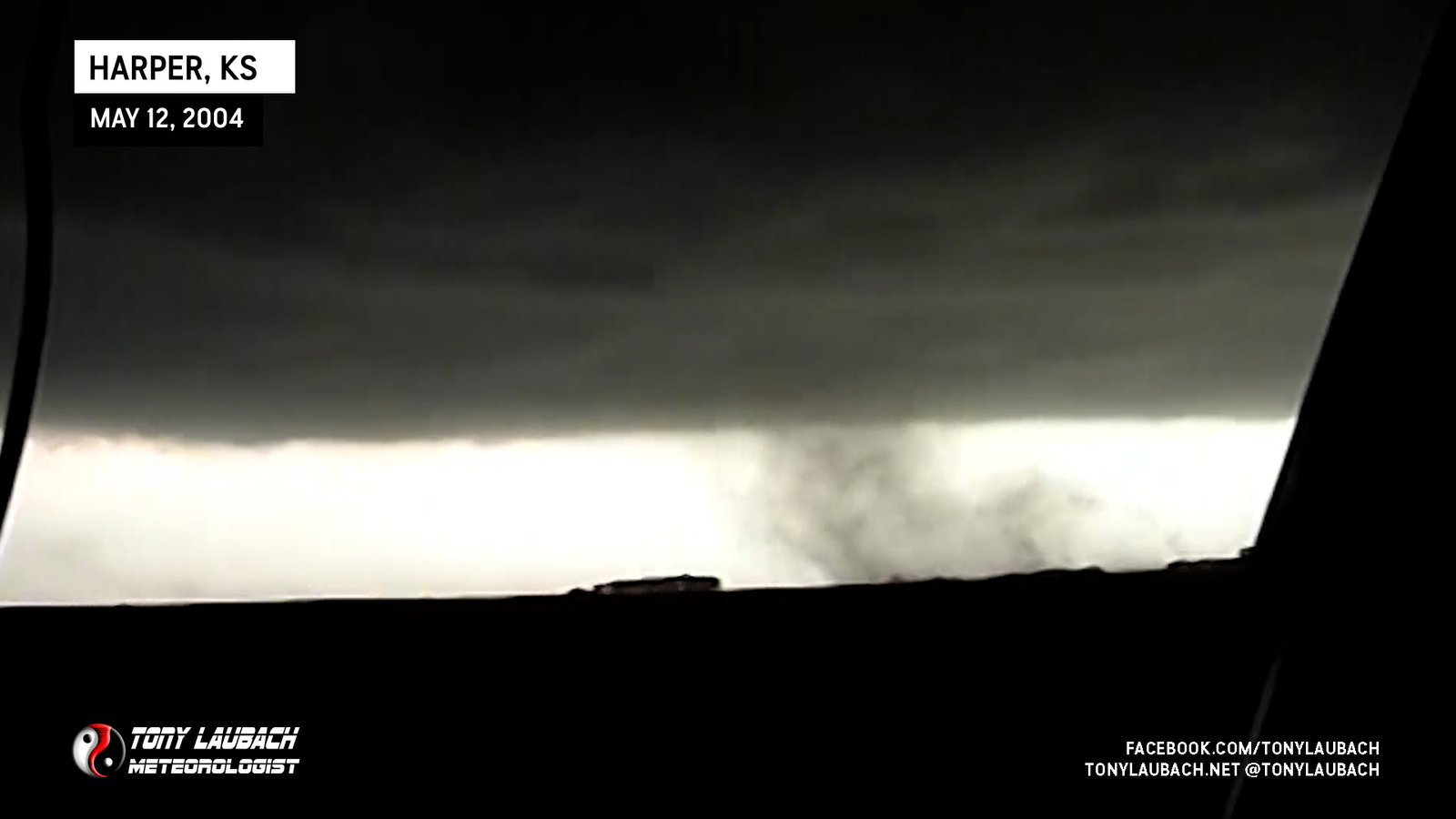
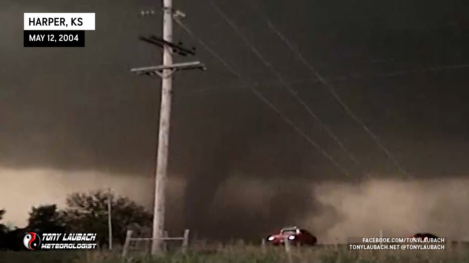
5th tornado of event; southwest of Harper, KS just south of Hwy 160. Just east of where tornado #4 touched down.
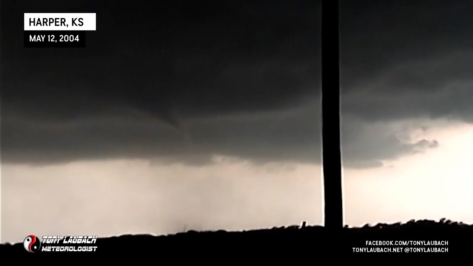
Brief Dusty Whirl South of US-160
Large tornado documented from birth to death as it slowly crossed US-160 and destroyed a home on the north side of the road.
West of Attica, Kansas on Hwy 160; Brief dust swirl on the ground beneath rotating base prior to main Attica tornado. No images.
First tornado of this outbreak viewed from the east.

Double funnels, fat one touching down briefly.
Brief tornado touches down behind the rain core.

Viewed from US-183, looking northwest. Pretty crappy view, but it’s there!

Caught glimpse as we were northbound on NE-47, but tornado lifted before we could stop. Image of remnant tornadic circulation.
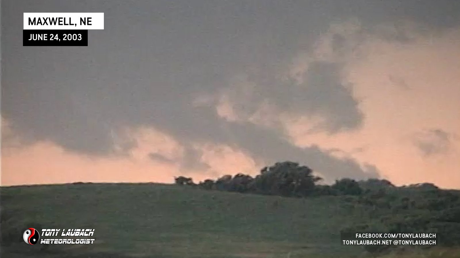
Caught rope-out of possible larger tornado blocked by terrain from our view north of Maxwell.
Saw While Approaching Guymon Via US-54 From Southwest

Satellite tornado of the larger wedge that I did not see in realtime. This was my first tornado in three years, and my first tornado on a legit storm chase.

Wedge tornado I did NOT see in realtime and only discovered years later in video as I only noticed the satellite in my excitement over seeing my first tornado in three years.
The Crossroads Mall tornado, saw in a power flash after dark as I was northbound on Eastern Ave.
My first ever tornado on my first ever storm chase!!!