
2004 Storm Chase Logs
2004 Season Statistics
TOTAL MILES:
15,403
TOTAL CHASES:
23
TOTAL TORNADOES:
28
TORNADO DAYS:
5
TORNADO AVERAGE:
0.217
TOTAL SPOTTER LOGS:
3
TOTAL ALL LOGS:
26
1K CHASES:
6
2004 Chase Logs
2004 Statistics
TOTAL MILES:
15,403
TOTAL CHASES:
23
TOTAL TORNADOES:
28
TORNADO DAYS:
5
TORNADO AVERAGE:
0.217
TOTAL SPOTTER LOGS:
3
TOTAL ALL LOGS:
26
1K CHASES:
6
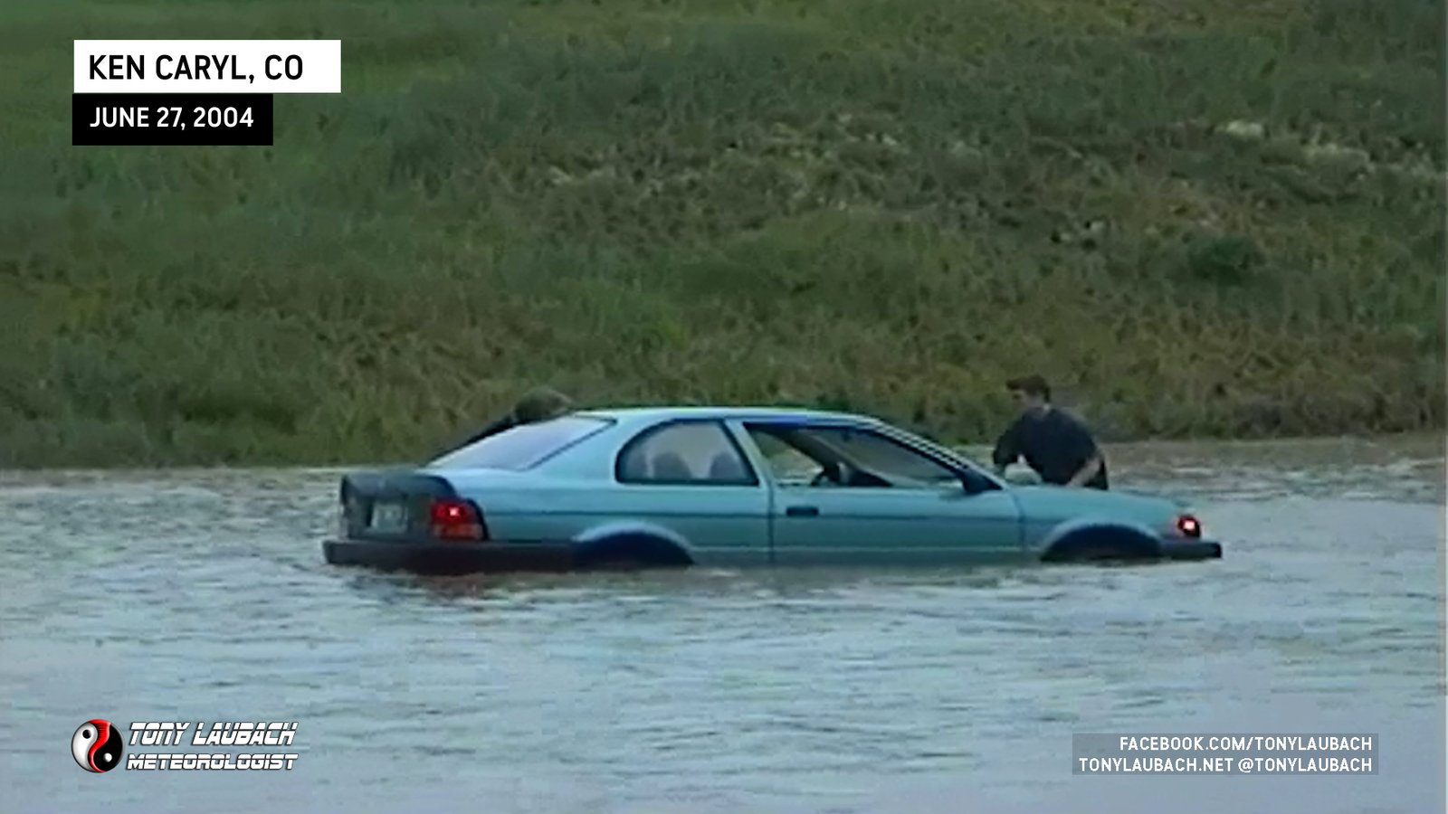
Chase Log: June 27, 2004
Northeast Colorado (52 miles)
Second day in a row of significant flash flooding in southwest Denver, this time Ken Carly Ranch saw the worst as a nearby creek overflowed onto area roads.
• TORNADOES: None
• MAX HAIL: None
• FLOODING: Observed
• Lightning Imagery: Not Captured
Full Write-Up
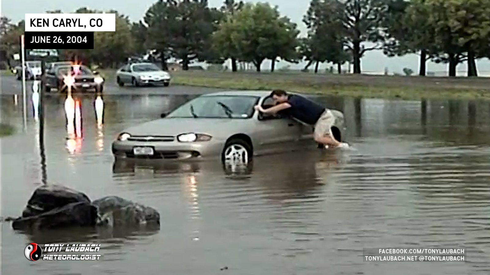
Chase Log: June 26, 2004
Northeast Colorado (33 miles)
Torrential rains flood streets near Ken Carly Ranch stalling out nearly a dozen vehicles that attempted to drive through the flood water.
• TORNADOES: None
• MAX HAIL: None
• FLOODING: Observed
• Lightning Imagery: Not Captured
Full Write-Up
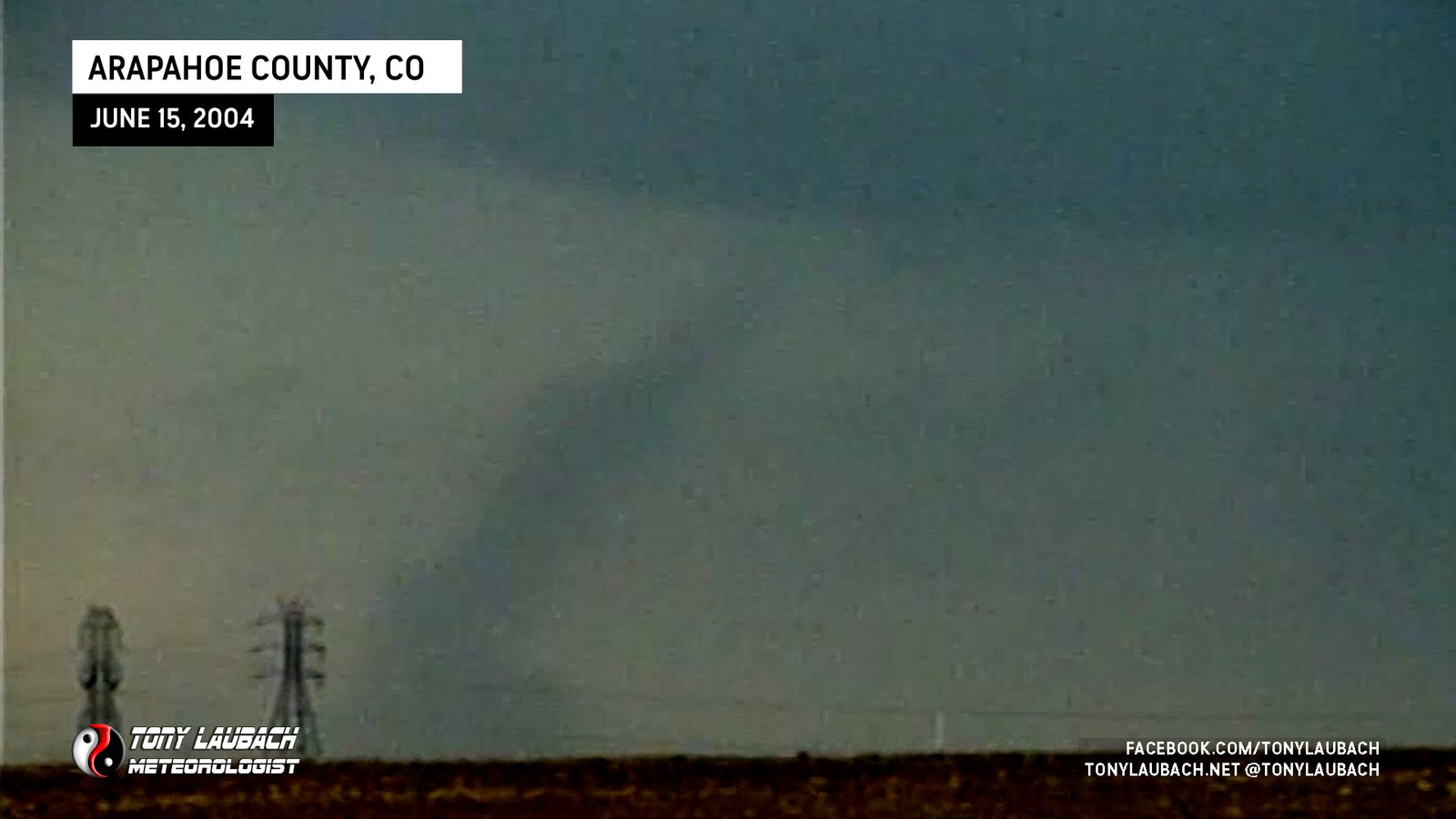
Chase Log: June 15, 2004
Northeast Colorado (158 miles)
Hoped early storms near Denver would provide me some action before I had to return to town, and they did in the form of two landspouts east of the metro.
• TORNADOES: 2
• MAX HAIL: None
• FLOODING: Observed
• Lightning Imagery: Not Captured
Full Write-Up
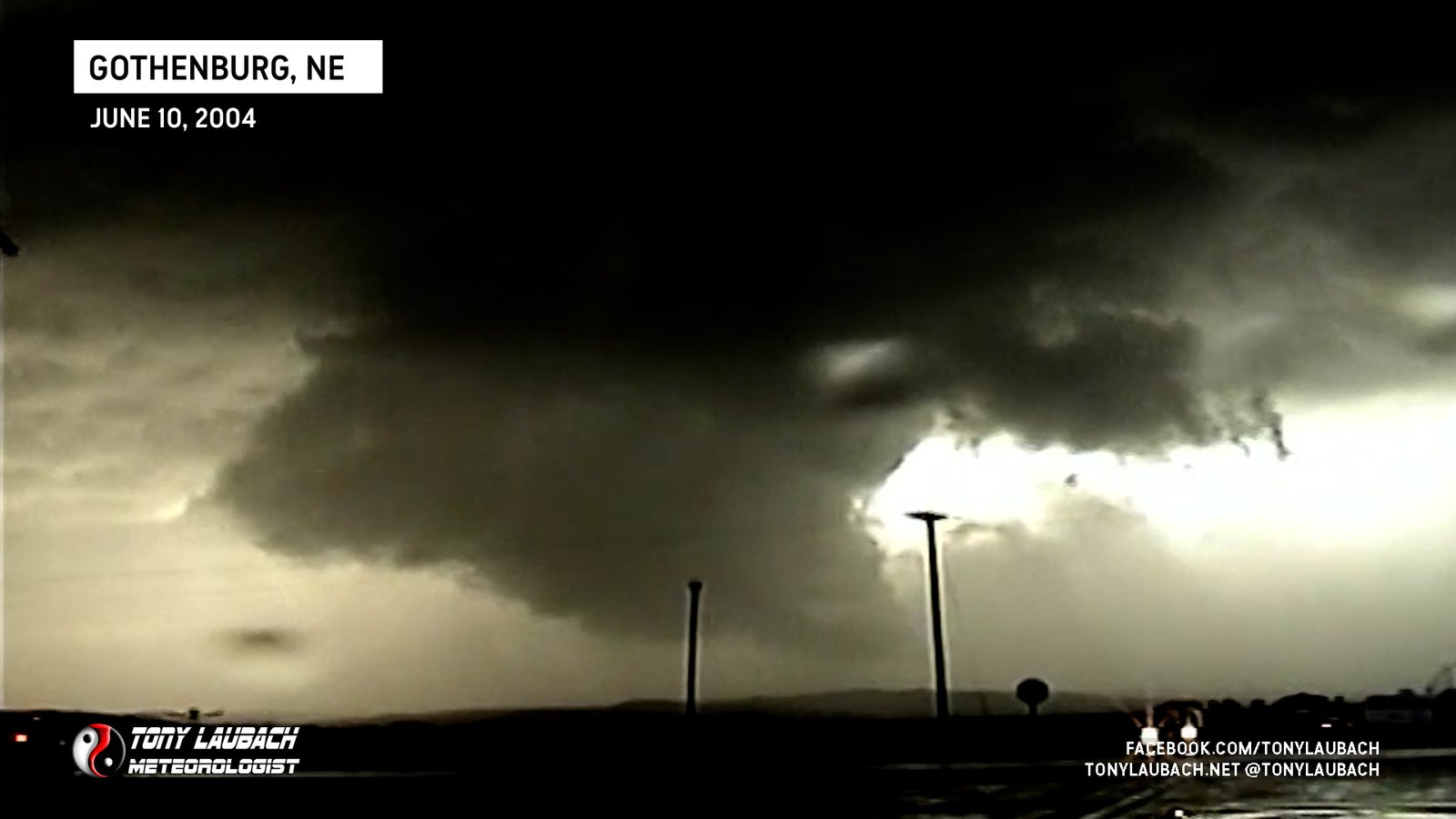
Chase Log: June 10, 2004
Southwest Nebraska (679 miles)
Piddled around too long at the North Platte library and caught the last moments of the Big Springs tornado, then followed storms east on I-80 til sunset.
• TORNADOES: 1
• MAX HAIL: None
• FLOODING: Observed
• Lightning Imagery: Not Captured
Full Write-Up

Chase Log: June 9, 2004
Northeast Colorado (327 miles)
Intercepted a hail storm in west Denver, then trailed storms into eastern Colorado where I documented tornado damage along I-76 in Sterling.
• TORNADOES: None
• MAX HAIL: 1.25"
• FLOODING: Observed
• Lightning Imagery: Not Captured
Full Write-Up
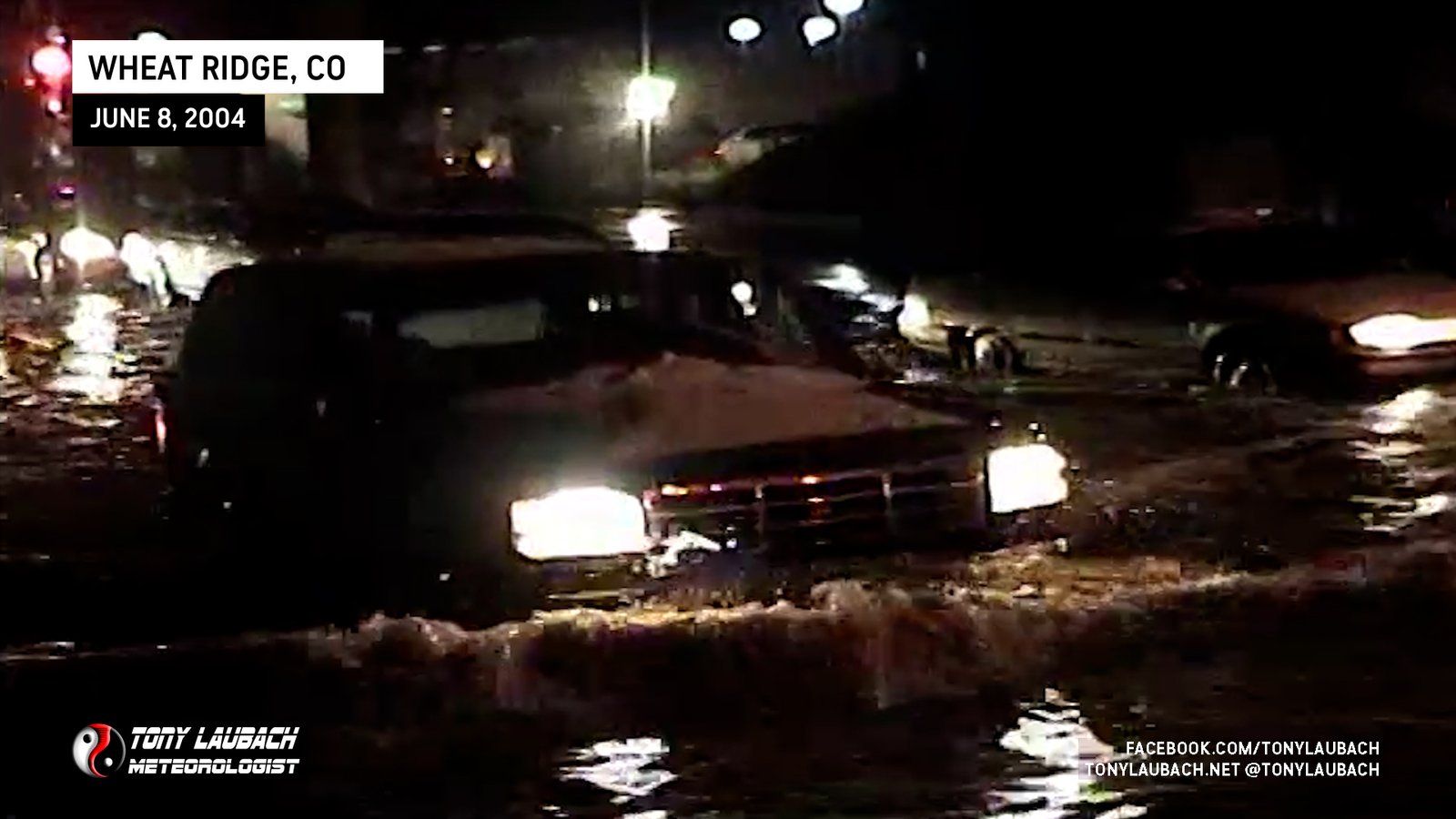
Chase Log: June 8, 2004
Northeast Colorado (277 miles)
After busting on my chase east of the Colorado Front Range, I returned home to Denver to get on a severe storm that flooded streets in Wheat Ridge.
• TORNADOES: None
• MAX HAIL: 0.88"
• FLOODING: Observed
• Lightning Imagery: Not Captured
Full Write-Up
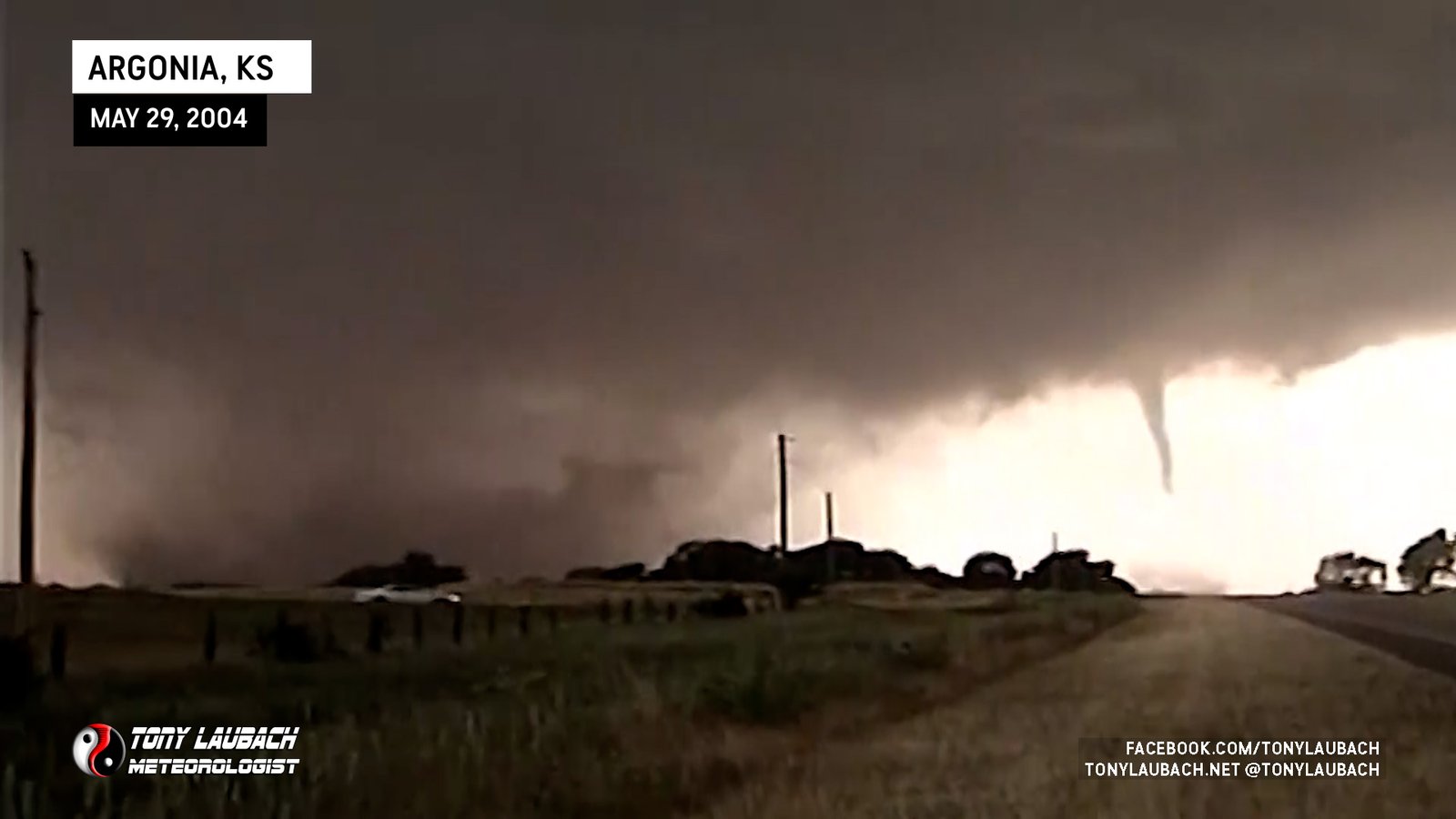
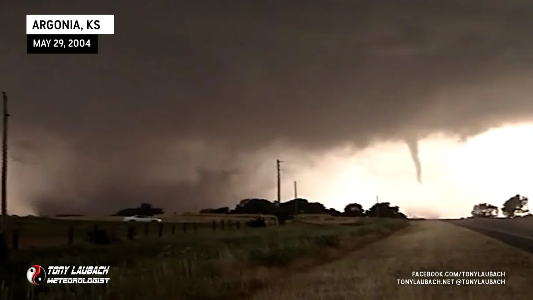
Chase Log: May 29, 2004
Southern Kansas (1,417 miles)
For nearly 20 years, this was my number 1 chase! Over a dozen tornadoes across southern Kansas, including the Conway Springs sequence which included my first ever nationally televised tornado video!
• TORNADOES: 15
• MAX HAIL: 1.00"
• FLOODING: Observed
• Lightning Imagery: Not Captured
Full Write-Up
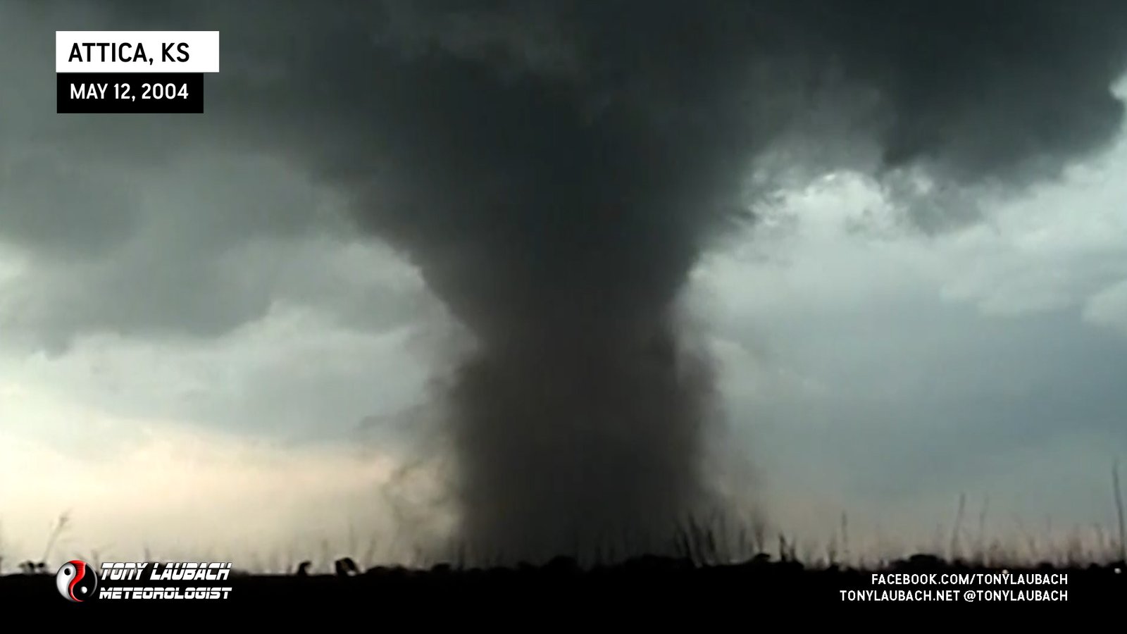
Chase Log: May 12, 2004
Southern Kansas (386 miles)
My first big tornado chase day! In total, I documented 7 tornadoes across southern KS, including the Attica F-2 and a nighttime F-4 with Warren Faidley. My breakout season was well underway.
• TORNADOES: 7
• MAX HAIL: 4.00"
• FLOODING: Observed
• Lightning Imagery: Not Captured
Full Write-Up
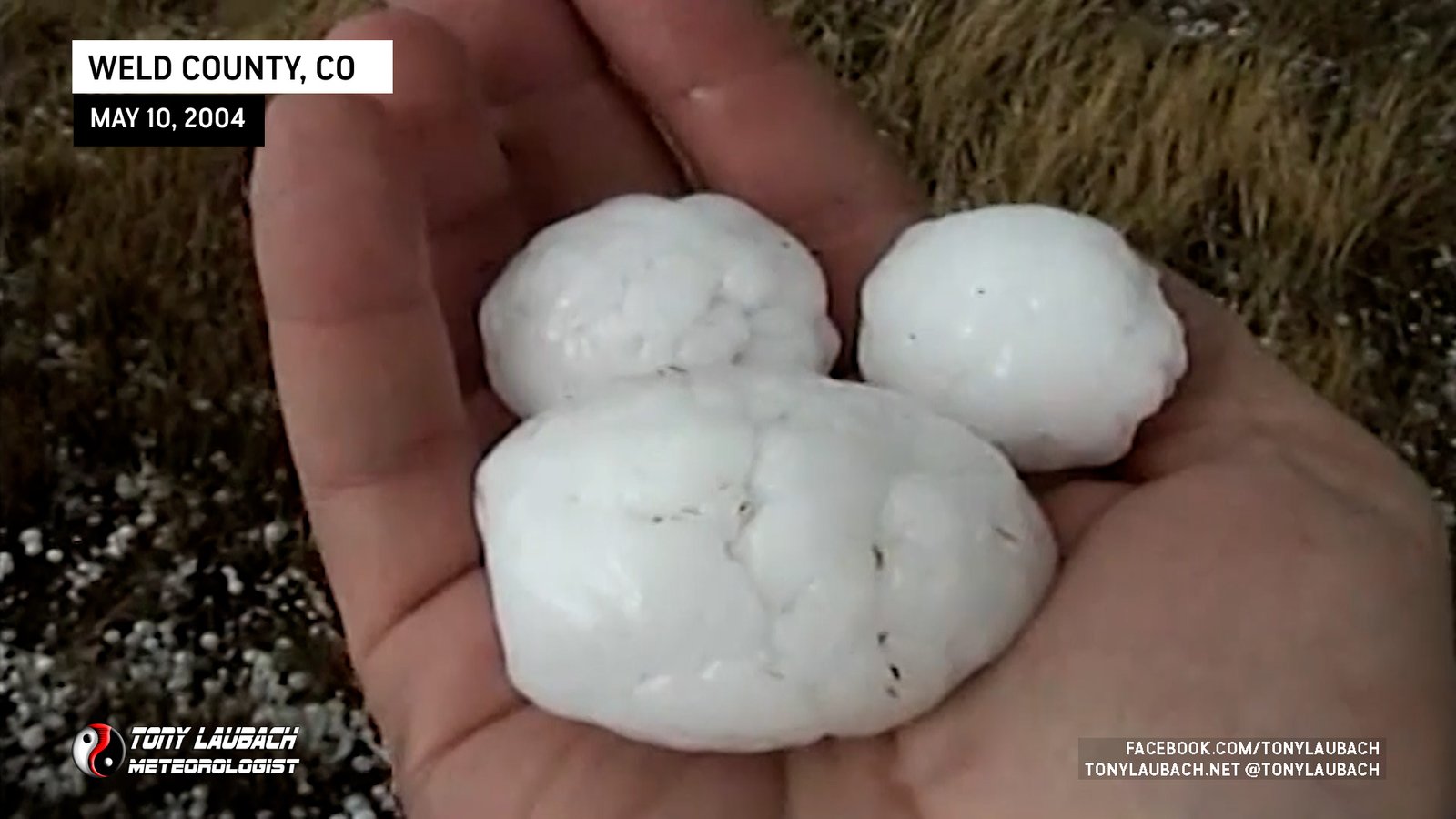
Chase Log: May 10, 2004
Northern Colorado (291 miles)
Intercepted a pretty hefty hailer in extreme northern Colorado, but not chasing the DCZV near Limon cost us multiple photogenic tornadoes.
• TORNADOES: None
• MAX HAIL: 2.00"
• FLOODING: Observed
• Lightning Imagery: Not Captured
Full Write-Up
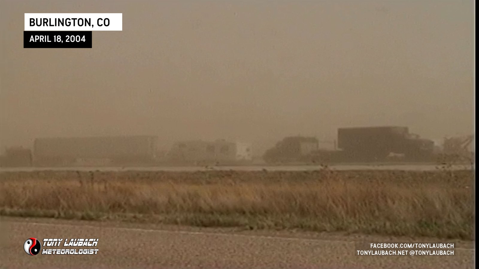
Chase Log: April 17, 2004
Western KS/Eastern CO (1,075 miles)
A chase of convenience turned to a bust, and my trip home the following day was delayed due to a massive dust storm on I-70, and a trip to the ER upon arriving home.
• TORNADOES: None
• MAX HAIL: None
• FLOODING: Observed
• Lightning Imagery: Not Captured
Full Write-Up
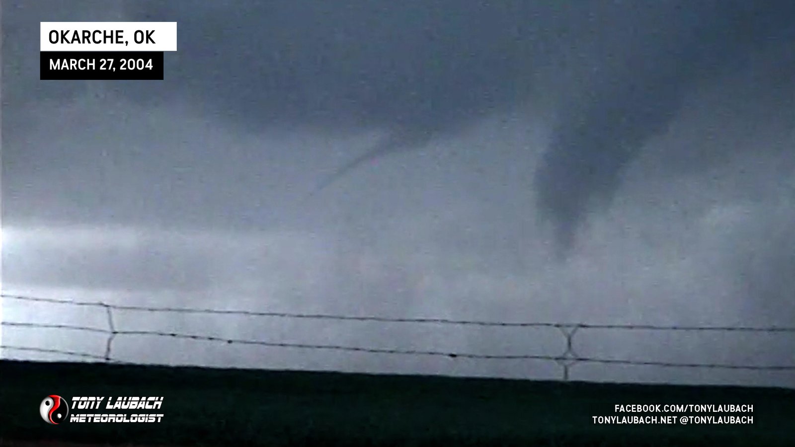
Chase Log: March 27, 2004
Central Oklahoma (1,557 miles)
Bailed on a severe weather conference in Iowa to haul down to Oklahoma and intercept three tornadoes on a beautiful supercell west of Oklahoma City.
• TORNADOES: 3
• MAX HAIL: 1.00"
• FLOODING: Observed
• Lightning Imagery: Not Captured
Full Write-Up