Woke up in Sherman, Texas and milked the checkout as long as I could before I departed shortly after the noon hour. It wasn’t even an hour later north of Gordonville, Texas that I was under a hailer. I made the northbound approach on US-377 out of Whitesboro, stopping briefly on the south side of the Red River in Gordonville, Texas to get a few shots of the approaching storm.
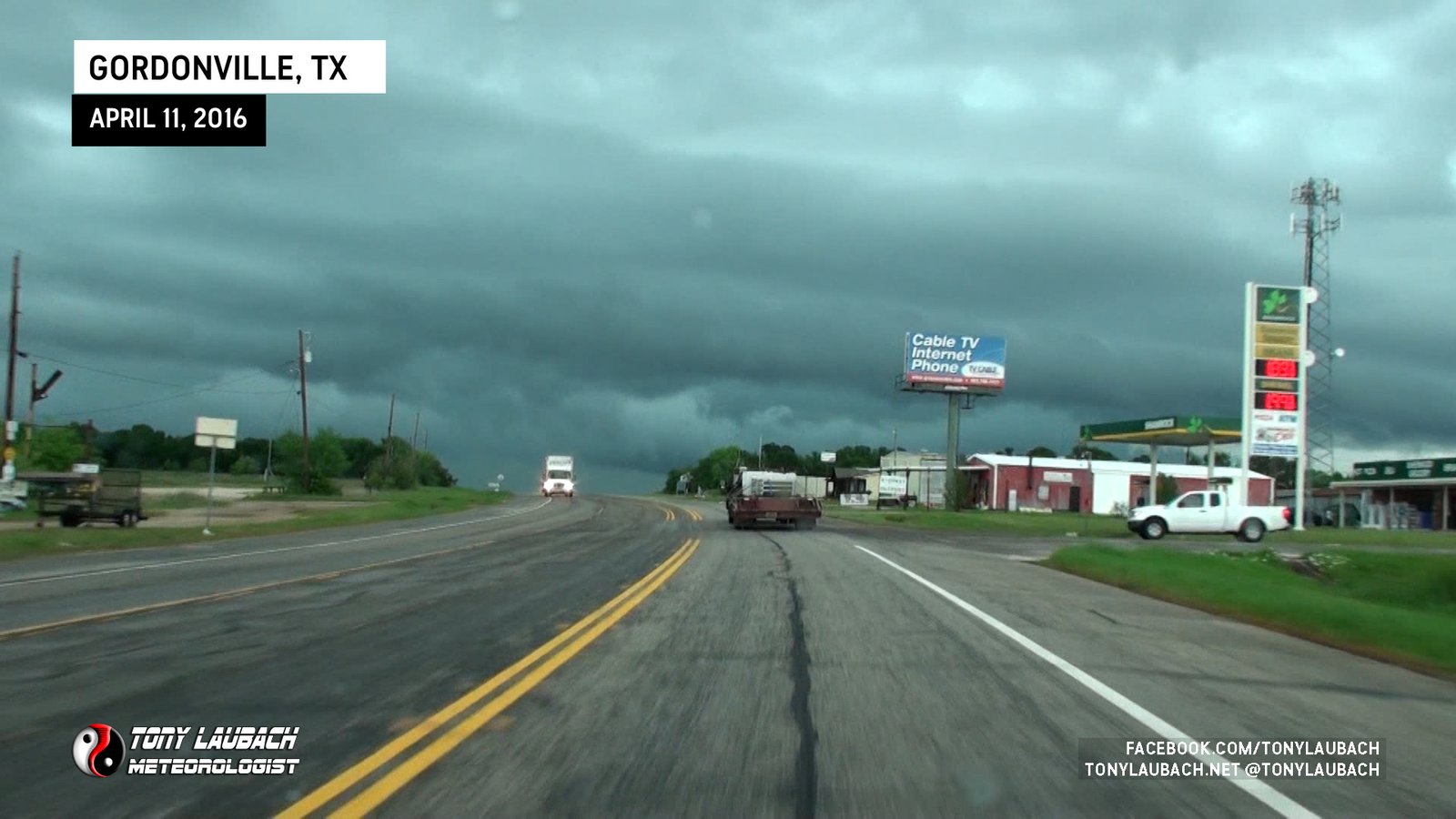
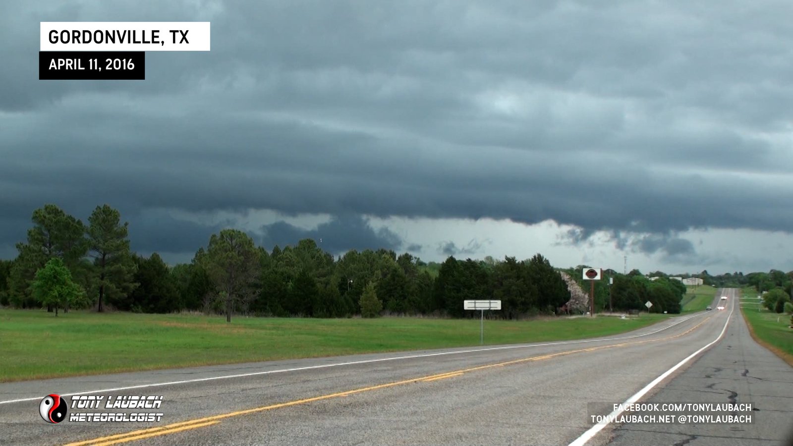
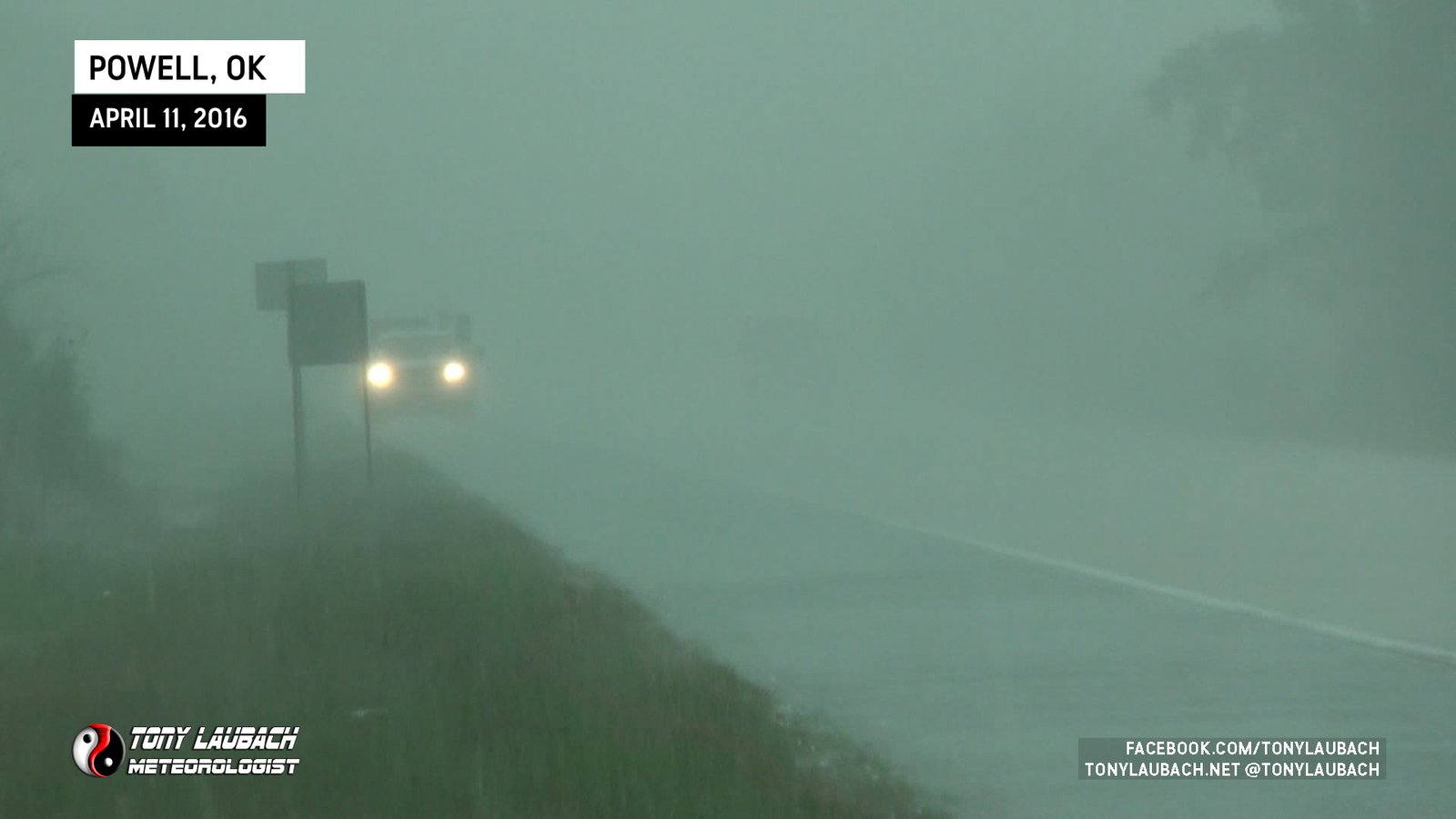
The storm was on a path that would slide it just north of Gordonville, so I was forced to cross the river into Oklahoma, stopping about 5 miles north of the river just east of Powell, Oklahoma where I took on the core.

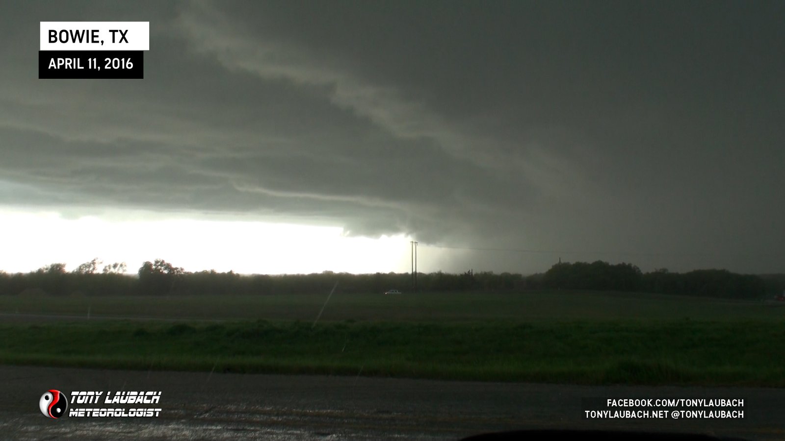
It was a nice appetizer to what was to come. After the core ceased, I quickly edited the video and sent it out before busting back across the river into Texas, eyeing my second storm intercept off to the west. I jumped back down to Whitesboro, then west on US-82 to St. Joe, then cut southwest in front of the approaching storm along TX-59 through Montague heading down toward Bowie.
The storm was tornado-warned, and that was kinda my focus initially. But as the storm was hauling southeast, I wasn’t observing anything I considered remotely tornadic. But it was moving fast, and I couldn’t sit too much long.
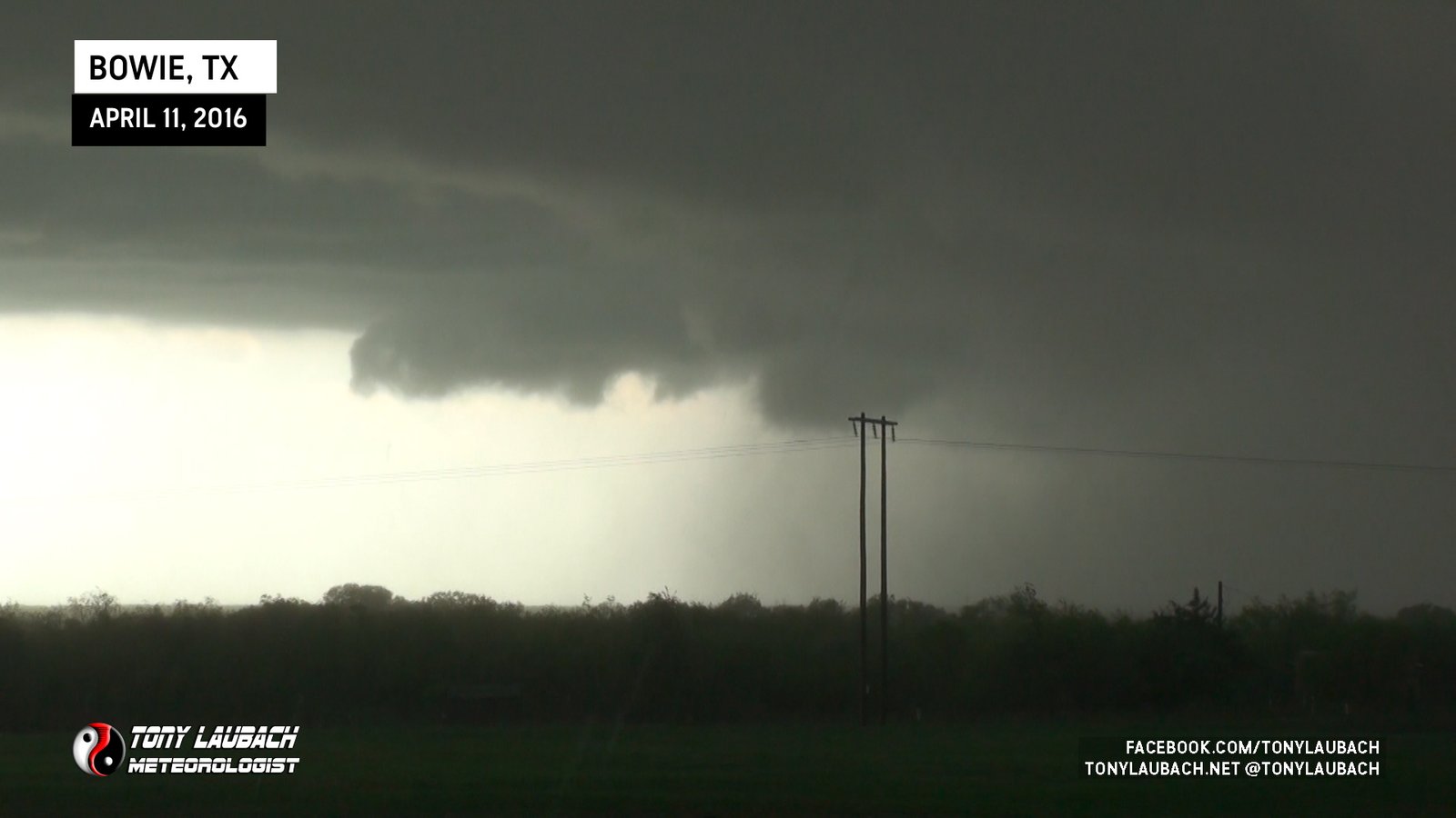
I let the leading edge of this storm hit me, and it was mean. Winds were easily over 60mph, and there was some concerningly big hail coming out of the leading edge of this. To me, at this point, I assumed this storm to be too outflow dominate to produce tornadoes, so my focus was shifting to the hail. Unfortunately at the time, I had pushed too far from the town of Bowie to get to any cover as the storm was already overtaking me, so I jumped quickly onto TX-101, which paralleled US-287 allowing me better opportunity to get under cover as opposed to being on the limited access highway.
Turns out, I would’ve been fine taking US-287 as I rolled southeast through Fruitland and eventually into the town of Sunset, where there was a gas station. I decided that would be where I make my stand.
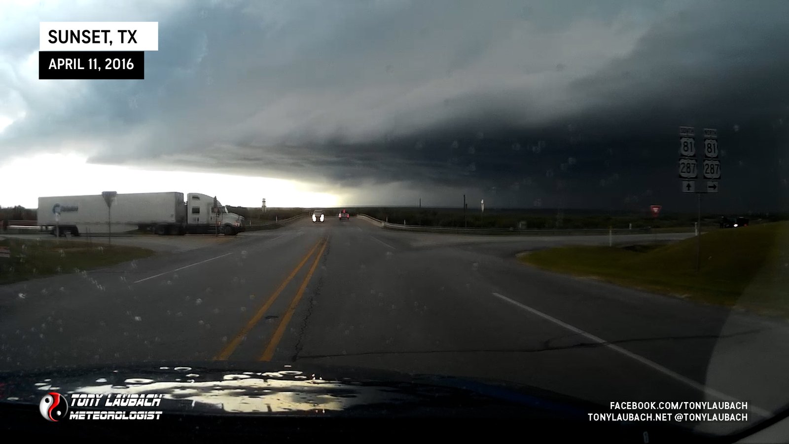
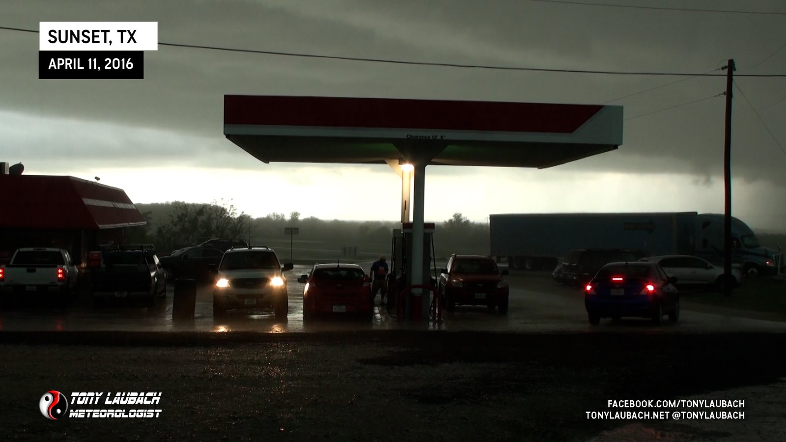
Knowing what was coming and the clear intensification showing on radar, I wasn’t in a huge hurry to get directly under the canopy. Given the winds this thing had, I figured downwind would be a safer bet as a lot of the hail would probably be coming in sideways, so getting on the southeast edge of the canopy would probably serve me better.
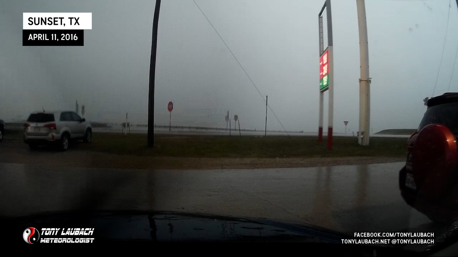
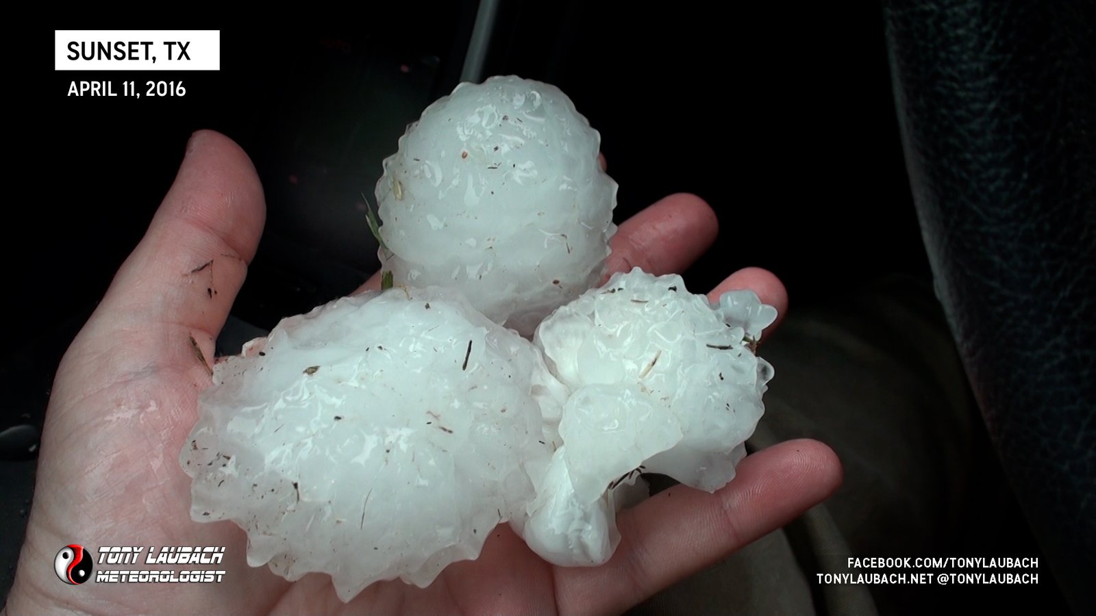
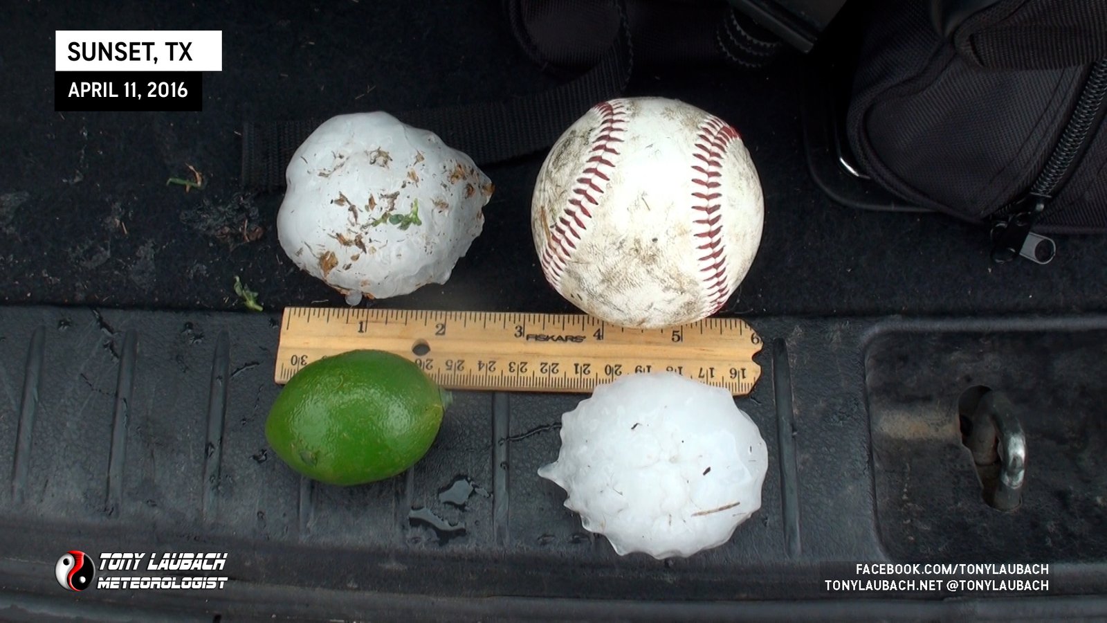
It wasn’t too long til literal HAIL was unleashed. The storm pushed in, and pretty much as expected, wind-driven baseball hail overtook the gas station. Within minutes, most vehicles parked there, including those directly under the canopy, were being absolutely slaughtered. You could hear the glass breaking over the sound of the hail as window after window broke.

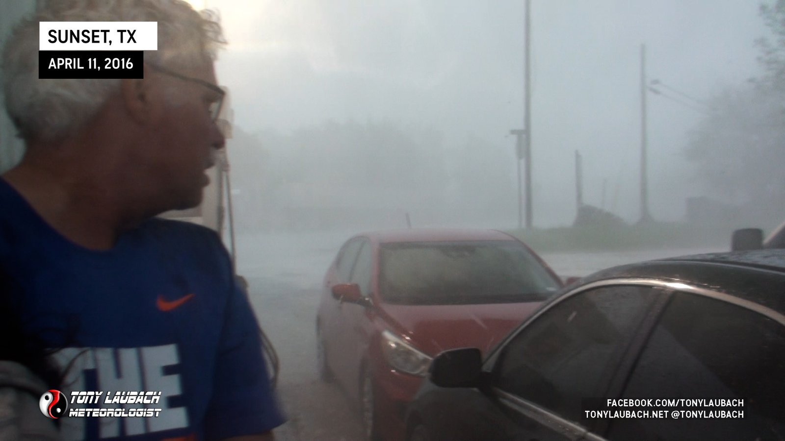


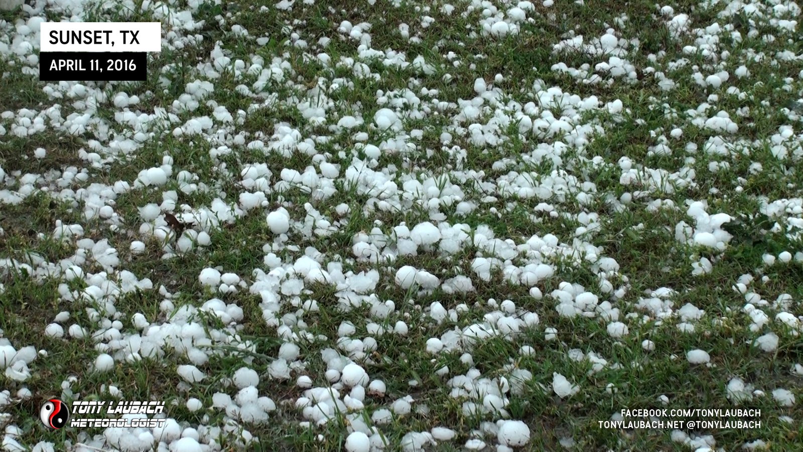
The hail was unrelenting, going on for nearly 15 minutes. And so much of it, not just the huge stuff, but ground-covering amounts that were consistently golfballs or bigger.
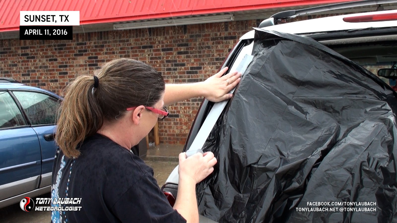
As the storm started to wind down and move on, folks began to come out an assess the damage to their vehicles. By my count, only four vehicles in the lot, including my own, escaped with no damaged windows. Many other vehicles pulled into the station after the hail, many of them caught in the open when the storm came through.


Fortunately the gas station was equipped with trash bags and duct tape, and several folks there did their best to try and seal up their windows as many had to move on to their original destination.
After documenting the scene and assisting a couple folks get situated, I headed out, my vehicle unscathed as the downwind side of the awning proved to be the best place to be. Not long after I hopped on US-287 southeast, I came across a ironic site. There was a vehicle parked on a side road with the windshield totally smashed out. I stopped to check on the driver, a lady who was rather jovial and was actually poking fun at the whole situation. She was fine, and was waiting for a co-worker to arrive. While she didn’t want to be on camera, she graciously allowed me to take a picture of her vehicle, to which I had to ask if she was insured…


That’s pretty much it… this storm would go on to impact the northern suburbs of Dallas, particularly the Wylie suburb with grapefruit sized hail. I followed behind it via US-380 east, but never caught back up to it. I pretty much had called it a day by this point, continuing to I-30 and eventually into Arkansas where I bunked down for the night before finishing my drive back home to southern Illinois the next day.
Over the years, I’ve definitely come to realize how difficult it is to perfectly intercept a massive hail core. Either the timing is off, the biggest part of the core misses you, or it just dies before it gets to you. This was the perfect intercept where I was able to obtain cover and document the heaviest part of this storm. Getting the peek into it in Bowie gave me the insight on the downwind idea, which proved to be valuable as it saved me from taking the wind-driven baseballs. Fortunately no one was injured despite the incredible amount of broken glass, and I did take the time to make sure that was the case.
Any regrets on not taking this in Wylie? Eh… Hindsight is always 20/20, and obviously for me there was no way I could stay ahead of this storm to make it into Wylie, and certainly I’d have no way of knowing that this storm would further strengthen like it did. So given the circumstances I was in, I can’t say I regret anything, although it would’ve been quite the experience to be under grapefruits, that’s for sure.