
Made the Carterville-to-Garden City haul the day before, waking up and pondering my chase target for the day. I opted for the Garden City bunk-down as I had two targets in mind for today; my number one being southeast Colorado and what I considered to be the ‘lesser target’ across the Texas Panhandle (70/30 for odds), so Garden allowed for quick, east access to either. Getting in the night before, I was leaning heavily toward southeast Colorado, but when I got up in the morning, I was starting to put some more weight to the southern target. I stalled around Garden City, and flip-flopped myself to the southern target, eventually heading south out of Garden.

As I made my way south, my excitement for the day continued to grow. I crossed through the Oklahoma Panhandle, stopping at the border in Texoma. An SPC mesoscale discussion went out mentioning a tornado watch was coming for the area. The vibes were building with me, and I definitely was feeling I had made the correct choice between my two targets. My initial target storm was southwest of me toward the Dalhart area. I directed myself southwest on US-54 and got on the storm south of Dalhart.

With the storm not looking particularly tornadic at this moment, I went into ‘Hail Boy’ mode, rolling back into the town of Dalhart to get under the core of this slow moving storm. As I arrived into the city limits from the southwest on US-54, I was immediately greeted with the hail.

Hail-size reports/expectations via the warning was impressive, enough to where I wanted to find myself some cover in town. I knew it would be a ride as the storm was moving slow. Before too long, quarters grew to golfballs, and this storm UNLEASHED a mad fury of hail right over the city.


The core of this storm sat over the city for over 30-minutes, bringing multiple waves of hail varying in size from pocket-change up to 2-inchers. Street flooding also became a problem as the combined barrage of hail and rain was too much for city drainage to deal with.

As the storm SLOWLY made its way northeast, it finally released Dalhart from the massive core that had parked itself over town. Streets were flooded, the ground was covered with a large amount of hail, and it was just a big mess left in the storm’s wake.


I spent a decent bit of time documenting the aftermath there in town knowing the storm would be an easy catch as it was running perfectly along side US-54 to the northeast. I hopped back on US-54, catching back up with the storm as I rolled up toward Stratford. The storm definitely started to look more tornadic at this point. A well developed RFD cut and wall cloud began to really spice things up as the view into the storm really cleared up verses the more HP nature of it further southwest.

I continued north out of Stratford via FM-2677, crossing the border into Oklahoma and continuing north on N0531 Road. Unfortunately as I ventured north on a series of country roads, pavement gave way to rain-slicken mud, and I put the All-Wheel-Drive on my Subaru to work.

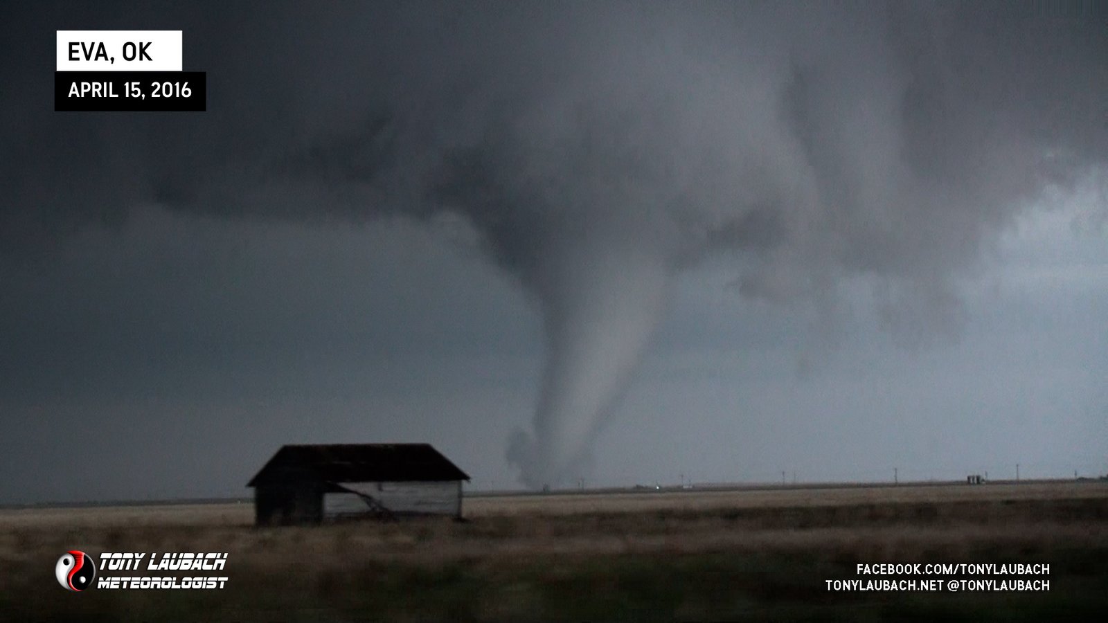
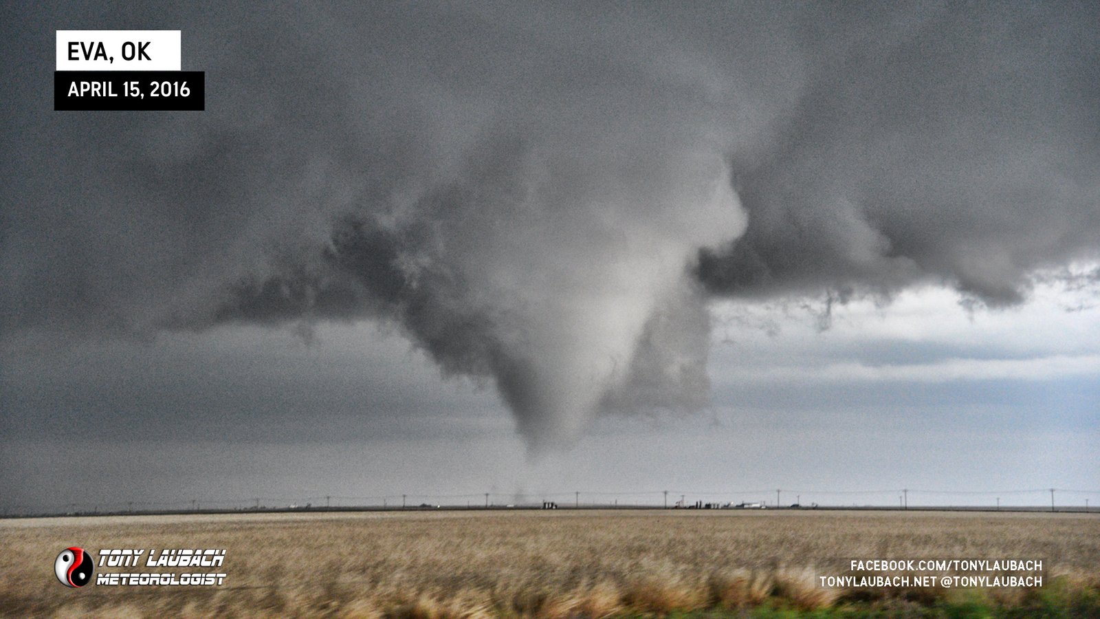
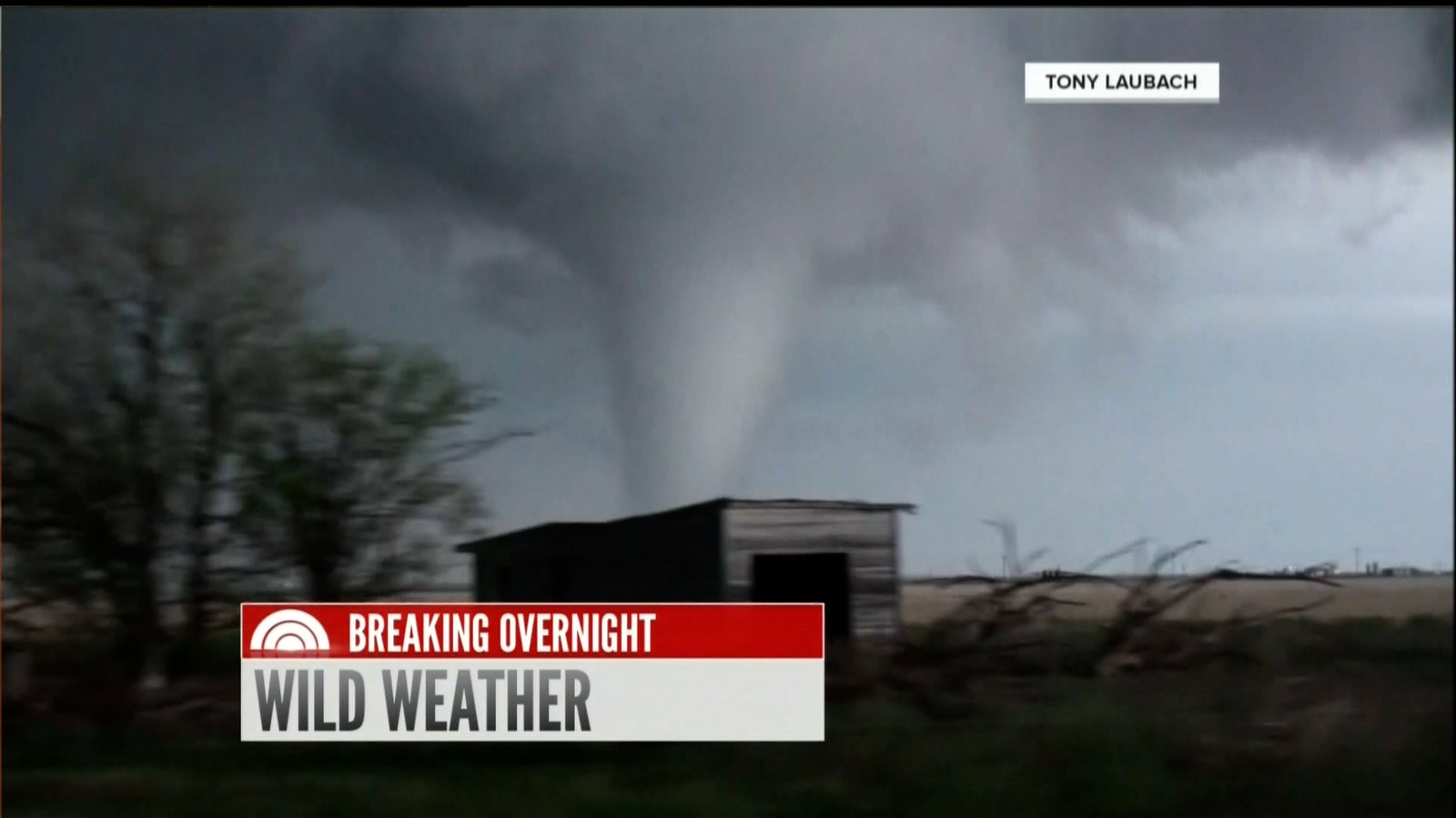
By this point, the business end of the storm, wall cloud and RFD, had crossed my path and were now to my east. I had a clean view as I was fish-tailing my way north along NS 54 Road. I was literally now due west of the wall cloud, which was developing a funnel. I opted for my text eastbound turn at EW 21 Road, still mud, but a direct shot at the funnel.

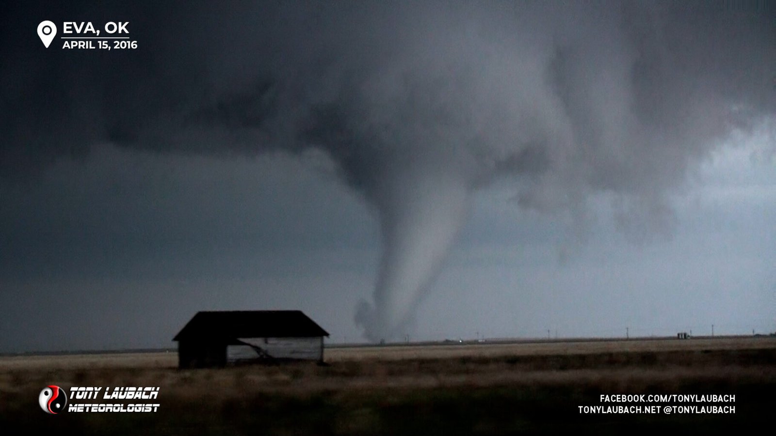
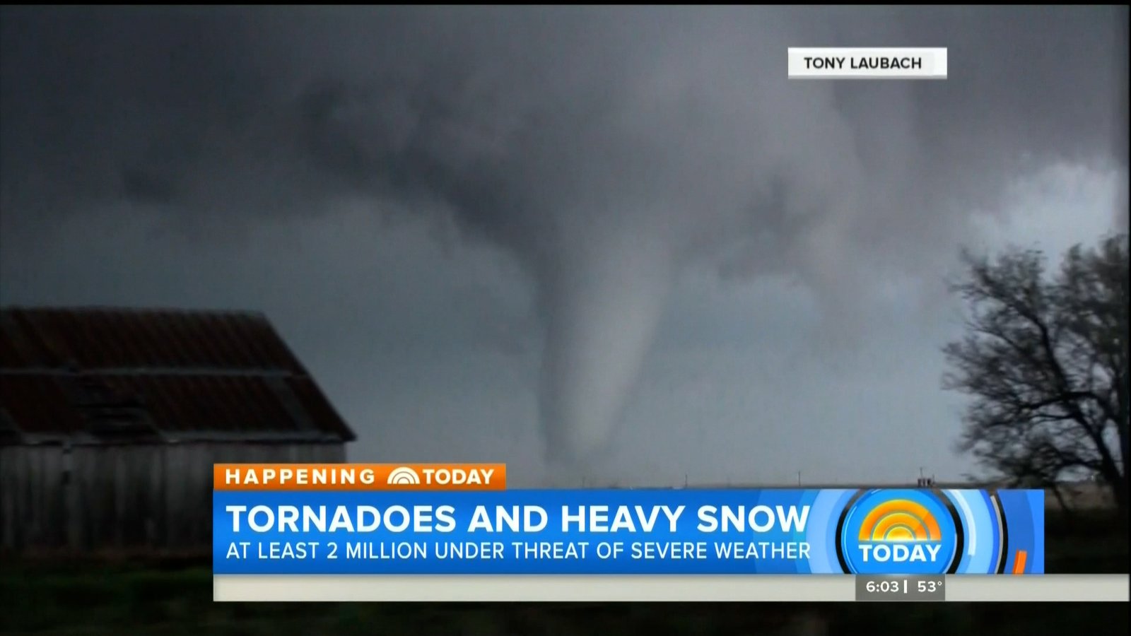
I didn’t get more than a quarter mile or so east when the funnel reach down; BOOM, tornado!

The road was rough, the heavy core definitely giving my AWD it’s due. The vehicle in front of me was holding its own, and honestly was probably keeping my speed in check as it would’ve been easy to try and push it down this road.


The tornado would be on the ground only for a few seconds, an impressive looking, blink and you miss it kinda tube. The funnel retracted as the wall cloud passed over the road in front of me.

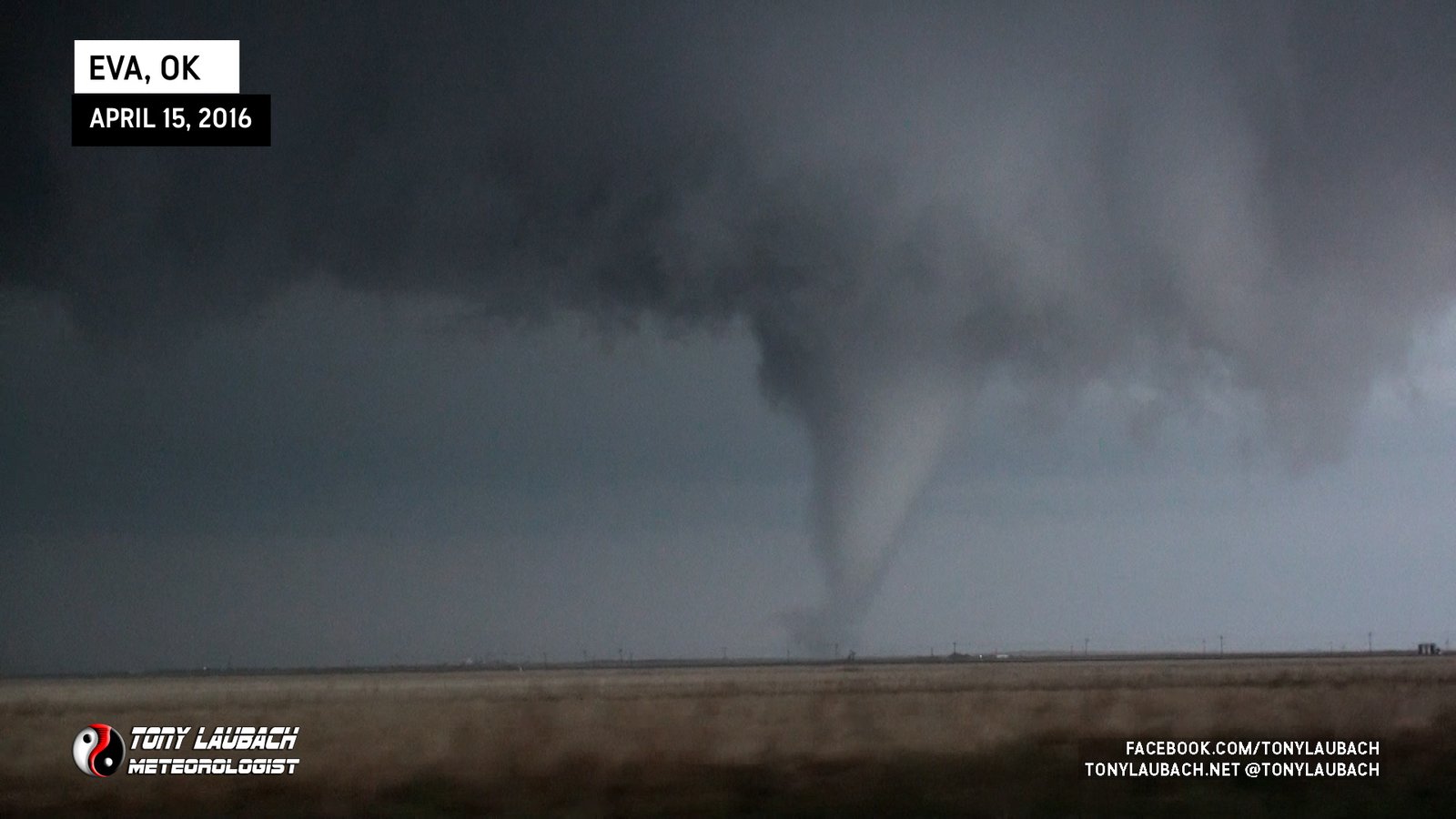
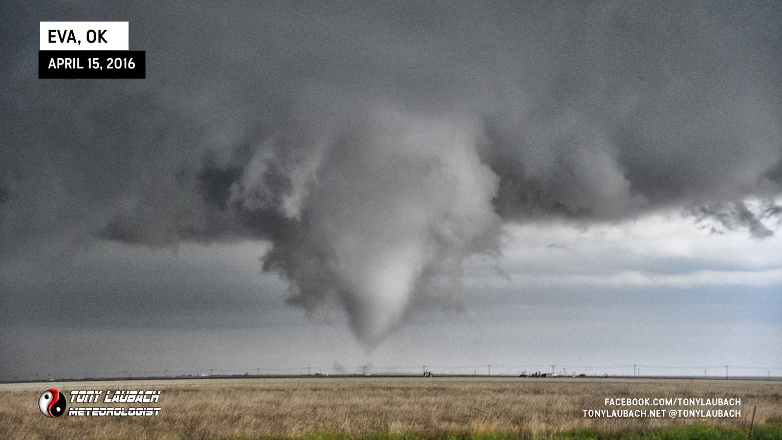
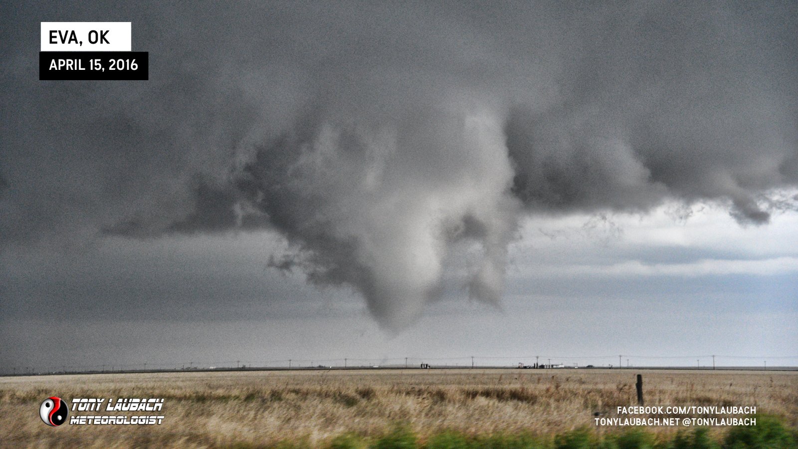
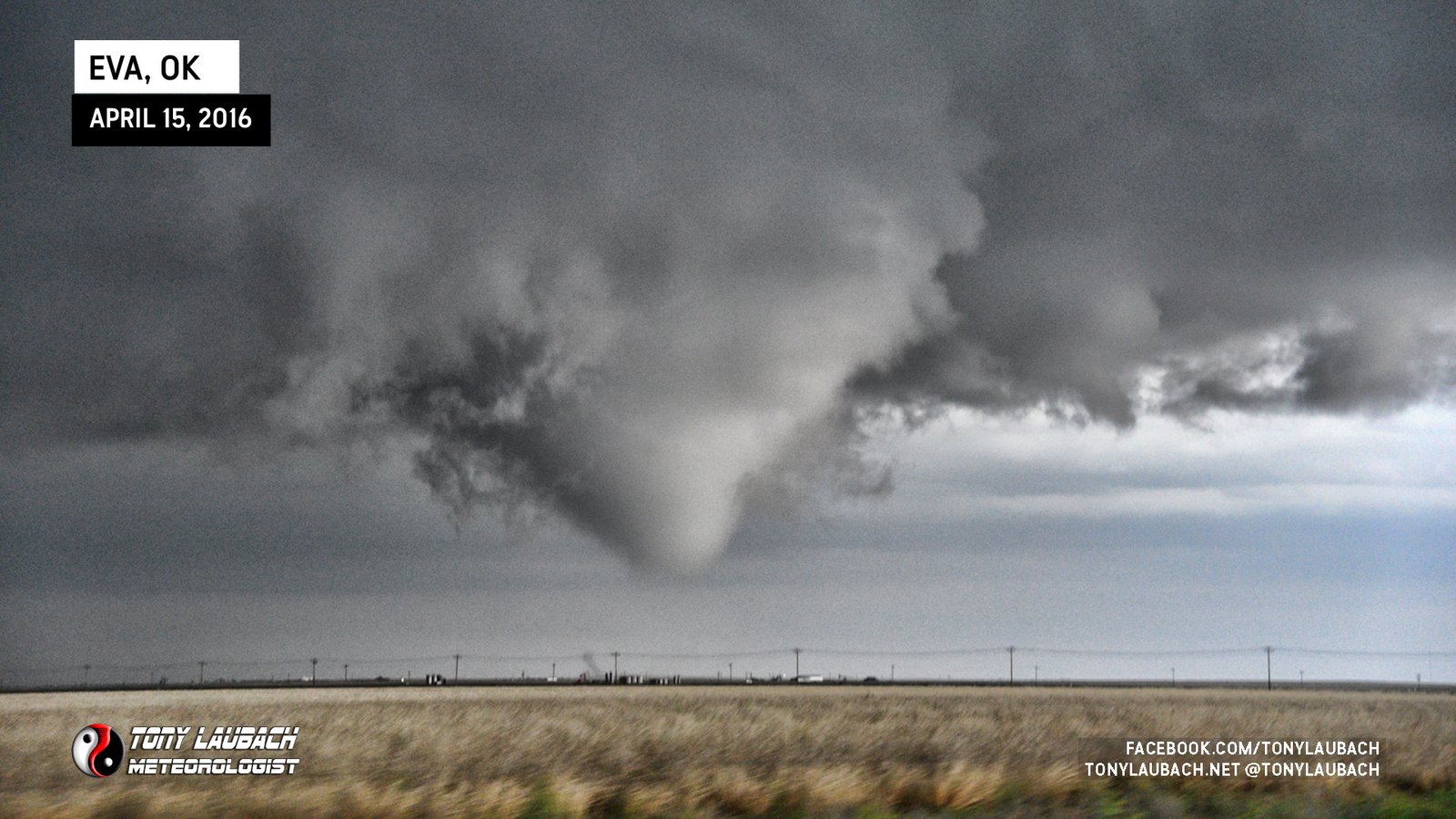
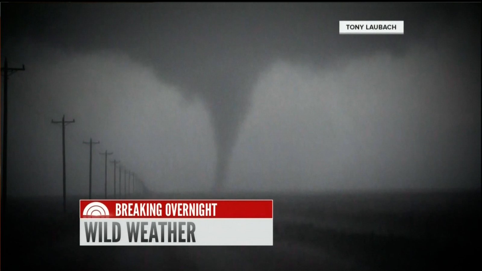
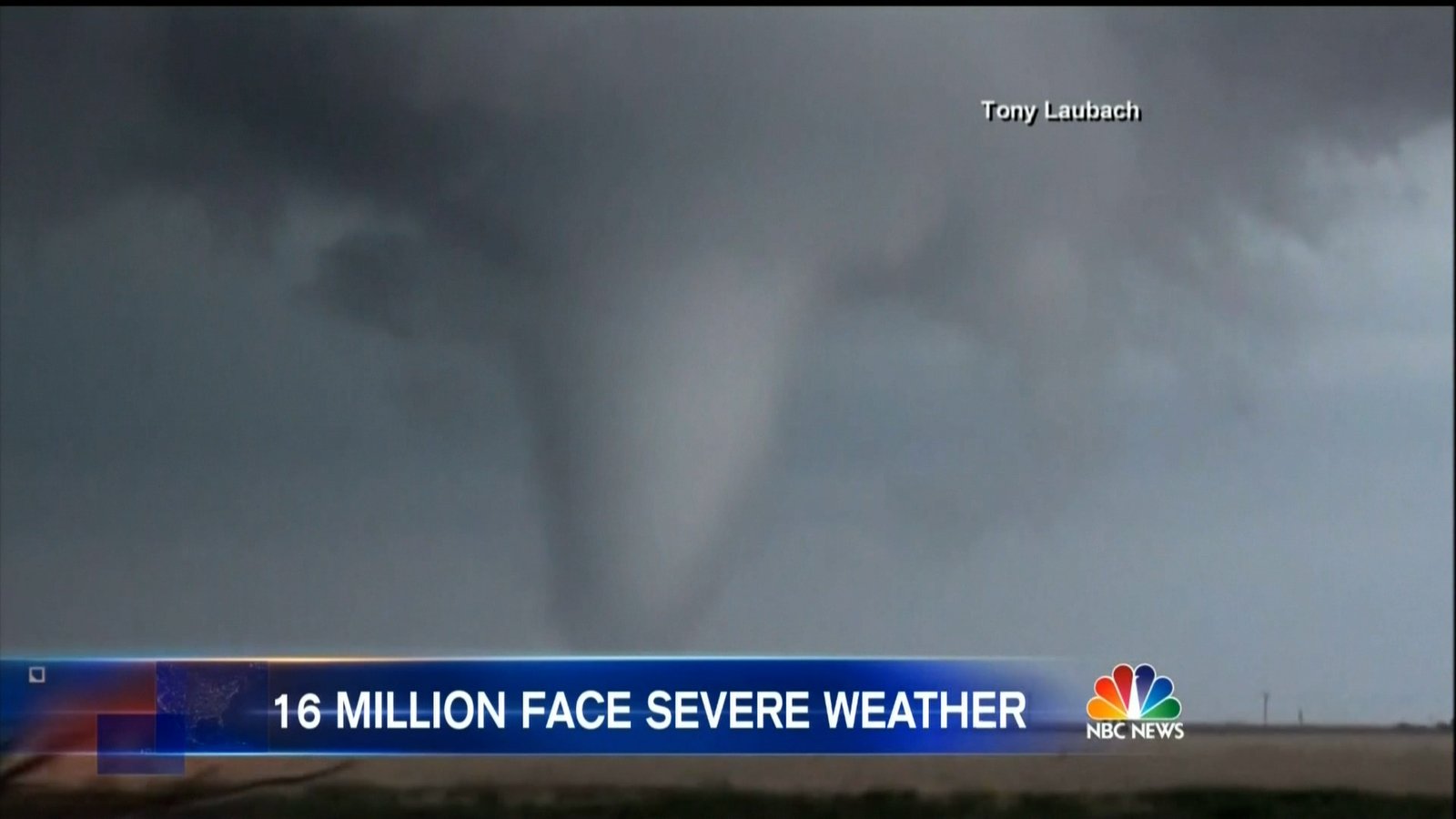
I continued east on this slopfest of a road, eventually getting lined up immediately south of the wall cloud that was reorganizing another tornado attempt to my immediate north. Soon another funnel would start to poke down, and quickly became tornado #2.

Better lighting from directly south offered a different vibe to this tornado, which held down a bit longer than it’s previous sister. It grew in size, impressively so as I slip-n-slid my way east.
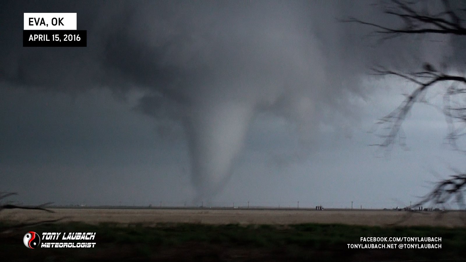
Still on the move, I opted to drop the video camera and try for a few photos as the funnel started retracting while remaining in contact with the ground.
About the time the tornado finally began to lift, I found me a northbound route to get myself off the slopfest and onto the pavement of US-64/412. By this point, I was getting a little blocked by the wrapping precipitation, losing visual of the wall cloud as it reportedly put down another tornado north of the highway.

I stopped to edit out some video, then continued east on US-64. As this storm was now moving up into Kansas, it was pulling me further away from my target for the following day, so I ran myself over to Guymon, Oklahoma where I fueled up and grabbed a bite to eat, before making the run back southward to Shamrock, Texas along I-40 where I bunked down for the night.
This was a super sick chase, in my opinion. And really, you can’t ask for better. Neither tornado was down exceptionally long, but both certainly gave a short window to where they looked pretty darn good. And of course, both the ones I saw remained over rural areas, which is always best. Proves you don’t need an hour-long show to get some good imagery. And of course, you can’t forget the awesome hail intercept off this storm earlier in Dalhart. That was a show all on it’s own, so I went to bed thrilled with my choice to play south and even more so to own a vehicle that allowed me to stay with those tornado on very difficult road conditions. All-in-all, a fantastic chase!