


After a busted day in northern Illinois, I wound up in Champaign the night before where I awakened to large moderate risk/15%-hatched-tornado to my south, encompassing an area I use to call home during my stint as the WSIL Weather Warrior. It’s always a treat to come back to this area, albeit on much calmer circumstances. My morning social media update hit the nail on the head as it’s unusual I am there just cause and often find myself in the region thanks to bad weather. Remember folks, I don’t control, I just follow it.
With a pretty easy idea where I was going, I packed up and departed Champaign, heading down I-57 toward Mt. Vernon. I was considering a couple areas; one on the east side of St. Louis (to catch anything coming out of Missouri and to avoid any traffic issues in the metro on a Friday) and one further southwest into the Missouri Bootheel. I figured Mt. Vernon was a good stop for me as it allowed me a straight shot west toward St. Louis via I-64 or continue south and west into my old stomping ground along Highway 13.
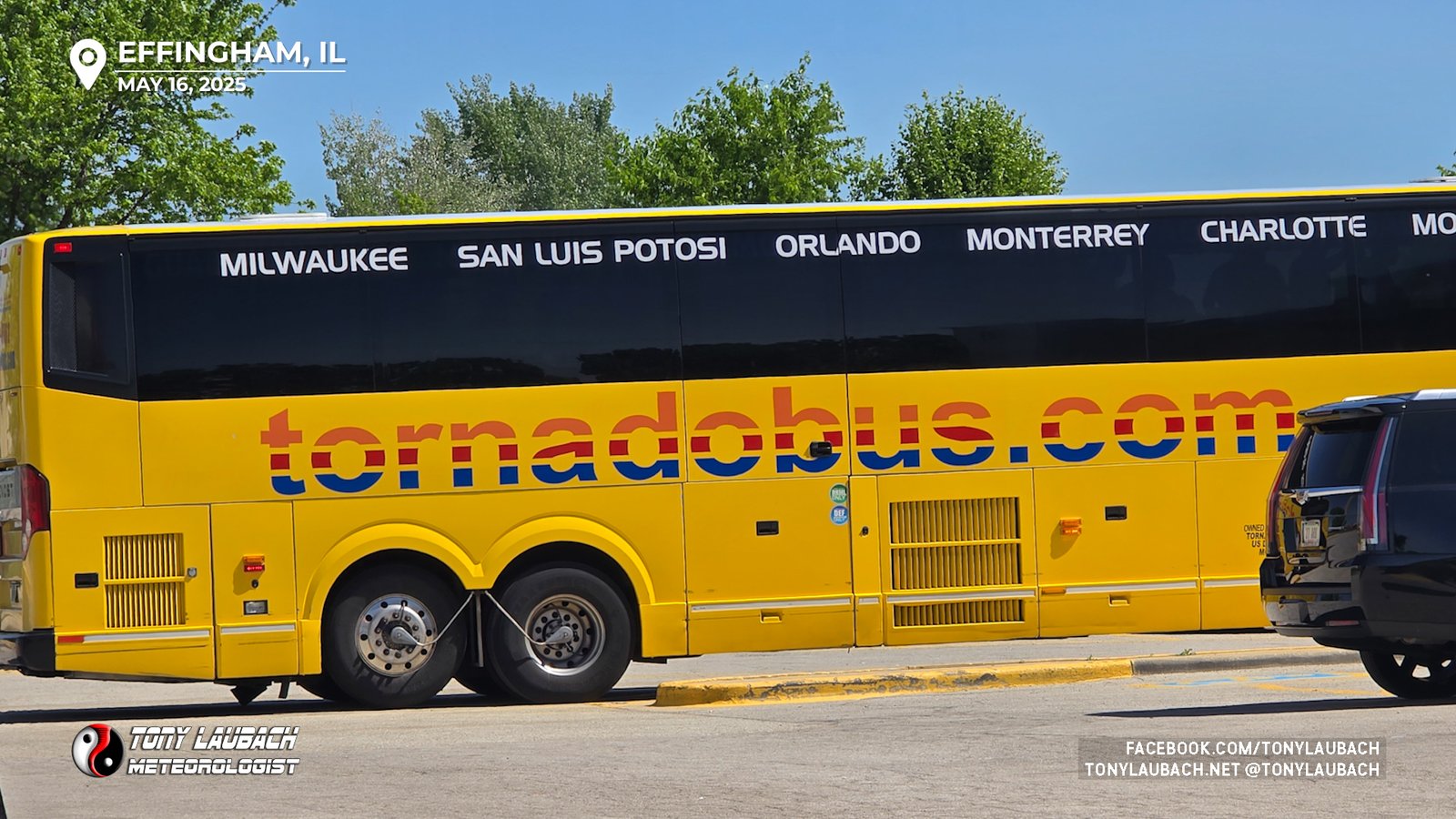
When I got to Mt. Vernon, I remembered there was no Love’s there, and I get a 10-cent discount on gas, so I proceeded another ten miles to Ina where there’s a Love’s on the east side of the interstate. I figured the extra ten minutes wasn’t going to kill me, so I rolled into the Love’s a few minutes ahead of 1pm.
Storms were already starting to fire across central Missouri, and things were taking off pretty rapidly. After the fuel up and getting the windows cleared and ready, I sat around and waited to see which of my two areas was going to look the best. And shortly before 1:30p, I made my choice…
My usual ‘river attack’ involves staying on the EAST side of the river, let the storms cross and work with them without the hindrance of trying to find a river crossing. In this area, I get four choices to get across; southern St. Louis on I-255, Chester on MO-51, Cape Girardeau via IL-146, or down I-57 heading to Sikeston. Decent choices, but still spread out, and getting into Illinois takes a bit to get out of the trees, so there’s no real ‘straight’ shot across, so it can be time consuming. But, the area along I-57 offers the best WESTERN play because the open areas do extend a while to the west before you get into the Ozarks, so if you’re playing the west side of the river, you have a little time to play before you have to cross over. All that was factoring into my head as I was deciding what to do. But I was also kicking myself to get moving and not SIT there and keep waiting.
So initially my play was going to the IL-13 route with the Cape crossing; the northern cell was making a bee-line for the Murphysboro-Marion area, so my initial thought was to head down there and catch it as it neared the river. What I didn’t realize when I was about to leave was these storms were moving much slower than I was anticipating, so I was way ahead of myself.
I decided to head straight west out of Ina; figuring I could give the northern play about 20-30 minutes as I made my way to US-51; the thought was when I got there, I could continue with my plan or head north if those storms looked enticing. I still had a lean up that direction as the terrain would offer better options there then further south into Illinois where things get dicey south of IL-13.
And when that junction came, the southern cells were looking too good to ignore, and I was literally right there. So I hopped south on IL-51, intending to head west on IL-13 out of Carbondale to make a play on that northern cell. When I got to Carbondale, the realization began to set in that I was over-estimating the storm’s forward speeds, and/or they slowed down. I started doing my usual Tony-Mapping, and the southern cell, which looked MUCH better even as BOTH were carrying active tornado warnings, was going to pass north of Poplar Bluff and move into that sweet spot in southeast Missouri. The question was can I beat the storm to the I-57/I-55 junction? If I could get there before it did, I had a solid chance of getting some time with it.
So a quick Carbondale stop near my Graduate School Alma mater at SIU and I traced my routes; if I took US-51 down to meet I-57, then run it over to Sikeston, I would have a 15-minute window based on current speeds. I went for it, diving straight south out of Carbondale, catching I-57 in Dongola, then making the slow curve southwest toward I-55.

I got the river/border-crossing with plenty of time to spare, Sikeston was going to be an EASY get before the storm, which had just crossed north of Poplar Bluff. I figured not only would I beat the storm to I-55, I was probably going to have ample time to really line myself up with the storm there along I-55 south of Cape.

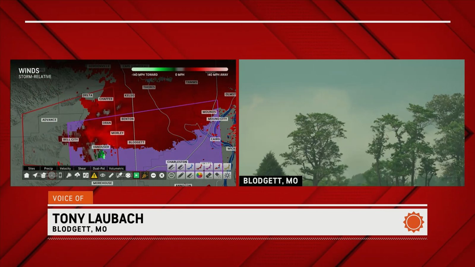
It was about another 20 minute haul from Charleston to Sikeston, and my plan was to hit the interstate and find an exit in line with the hook of the incoming storm. My map showed there was a frontage road of sorts, Highway H, which ran parallel with I-55 on the east side from Miner for several miles before crossing to the west side south of Blodgett. I decided to utilize that as I had pretty decent views to the west at the approaching storm. It would also allow for more stops and maneuverability verses being on the interstate itself.
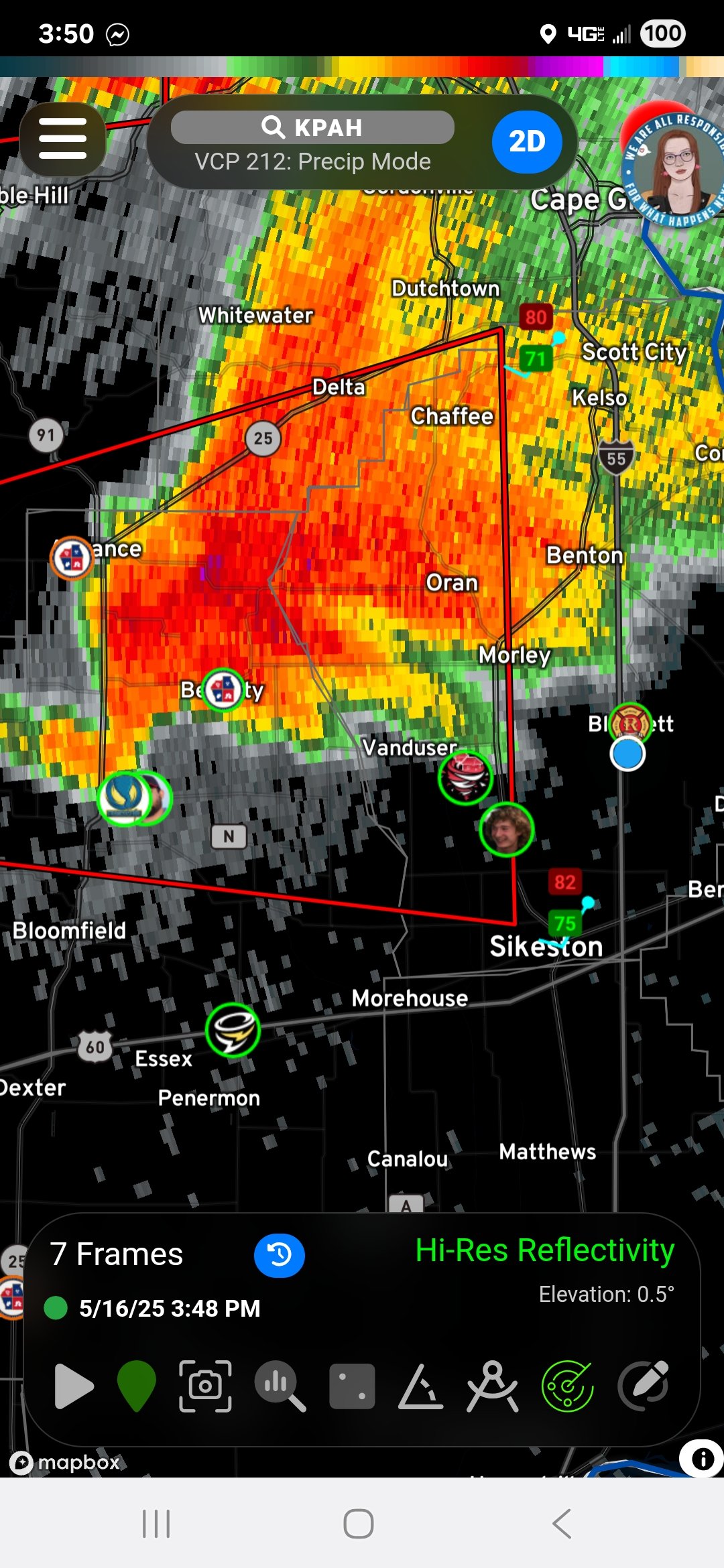
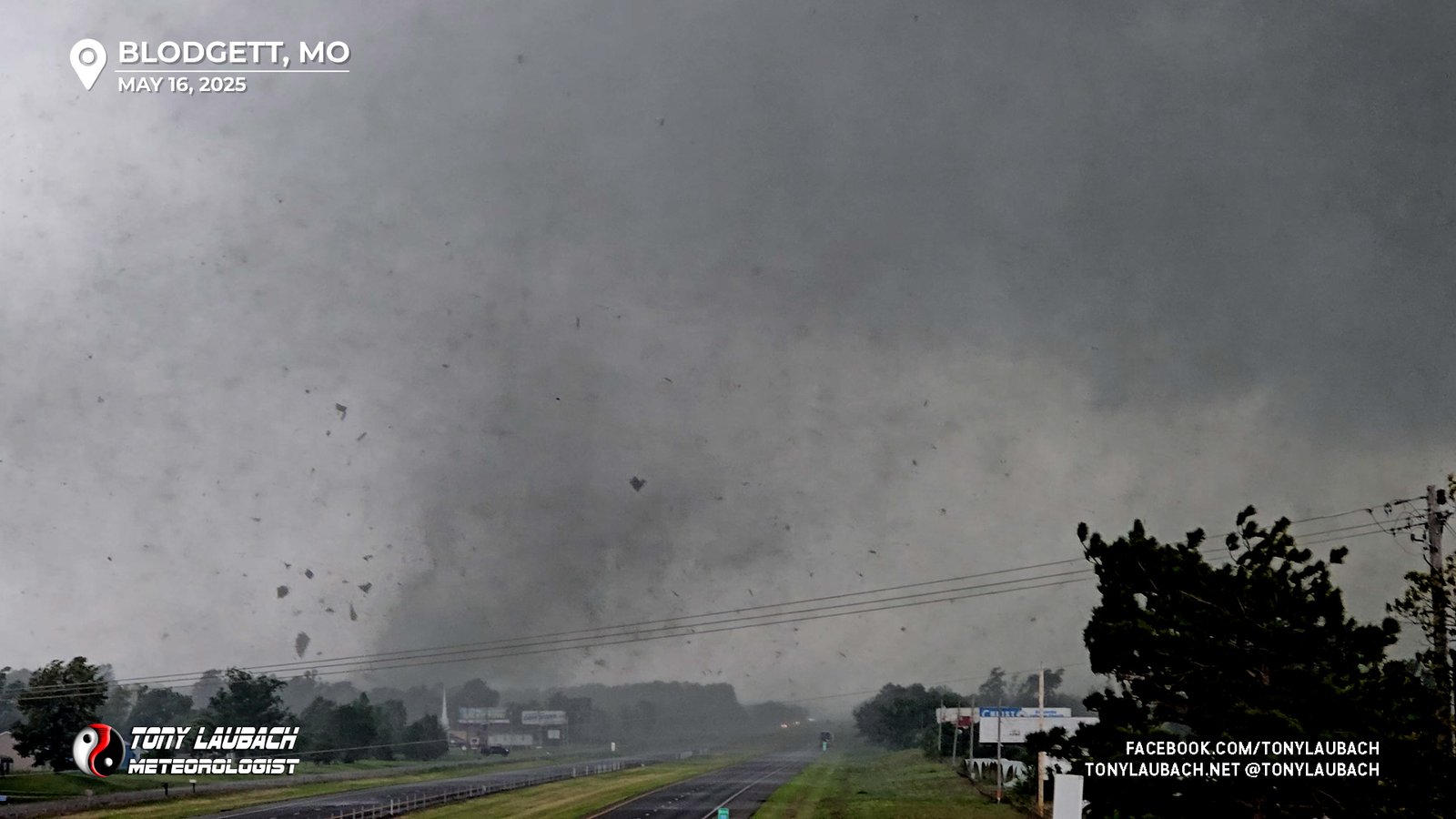
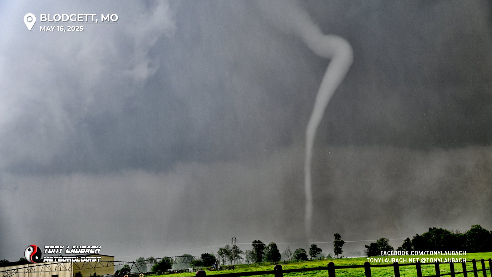
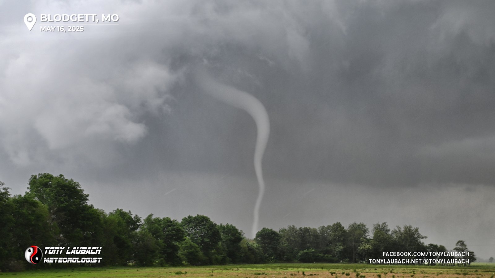
I set myself up north of Minor near a church south of Haywood City, finding a clearing in the trees to look west. It took about 5-10 minutes before the base of the storm really came into view, and it wasn’t long when a snaky little funnel poked down and next thing I knew, I was looking at my first tornado of the day. It timed out very well with my first live hit, and we were rolling live on the network as this tornado touched down, lifting a few minutes later.
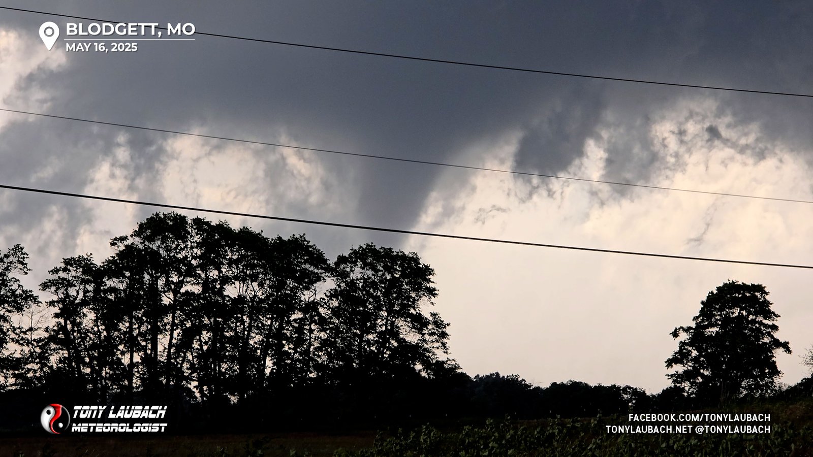
It was about here when the funnel ceased to be visible and ground circulation started to wane. Cloud-based rotation remained very evident, but I could no longer confirm ground contact. When the storm kinda ducked behind some terrain, I decided to move a bit north to get into better intercepting position. Between the breaks in the trees, I could continue to see the cloud-based rotation, but no ground contact. This lasted about 4-5 minutes. During that time, I was semi-frantically seeking a place to set up to watching this thing cross the interstate. I had briefly taken Highway H over I-55 to set up along the east side of the interstate, but the gap between the interstate and H was pretty lined with trees, so I decided to hop BACK over I-55 and perch there on the west side.
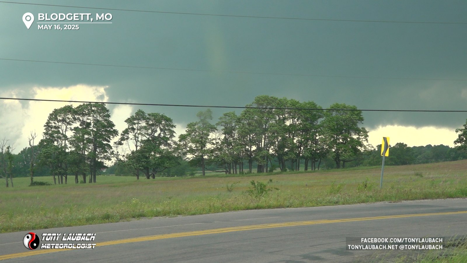
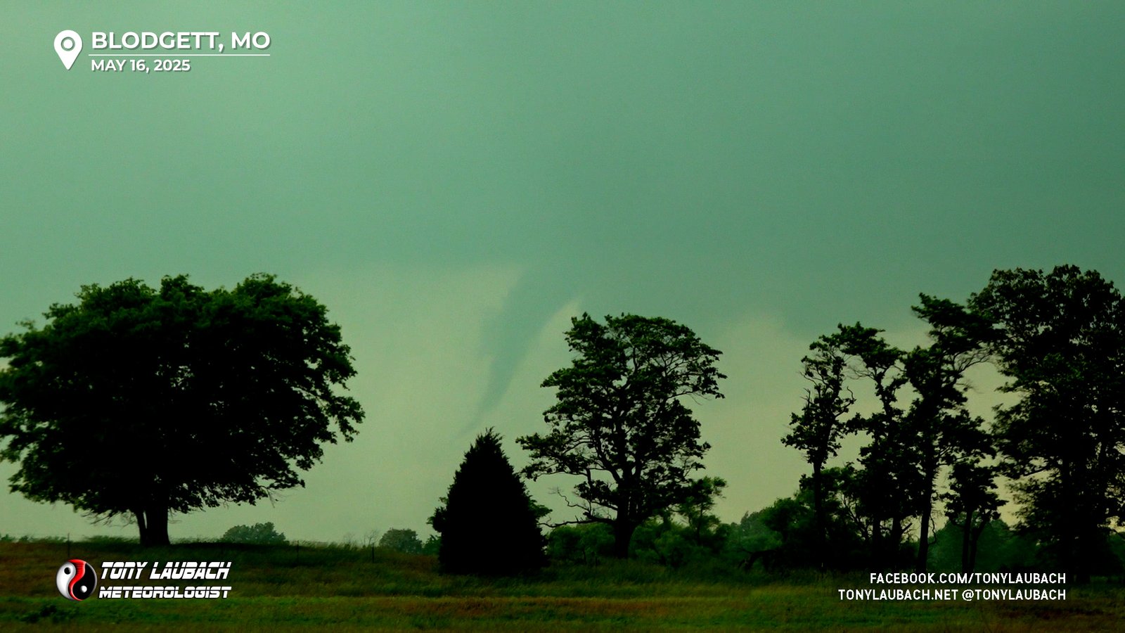
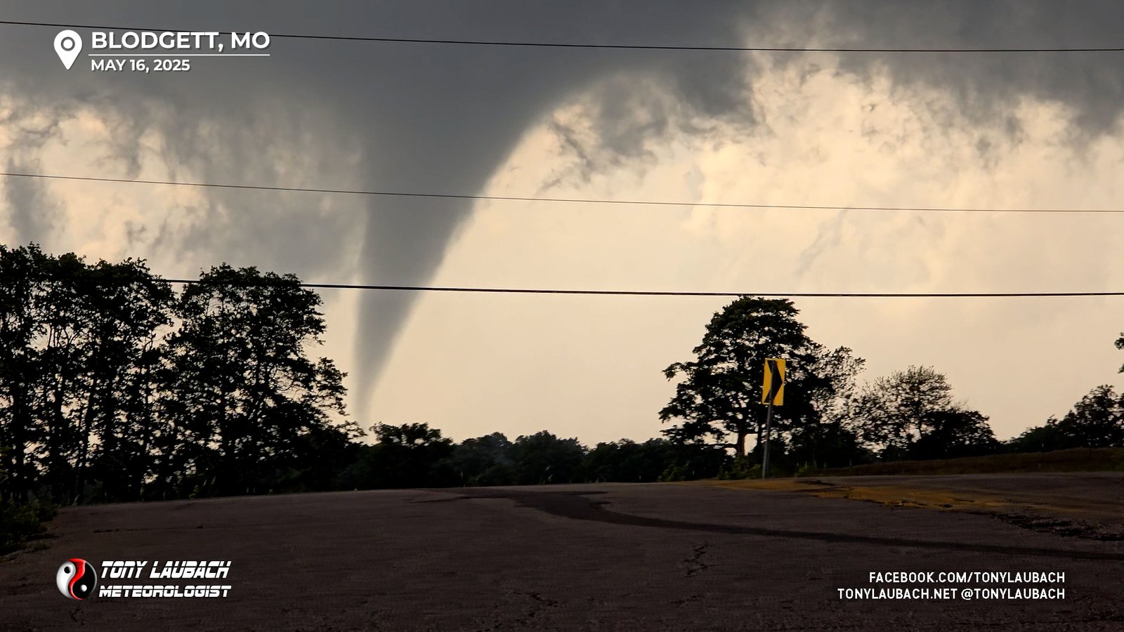
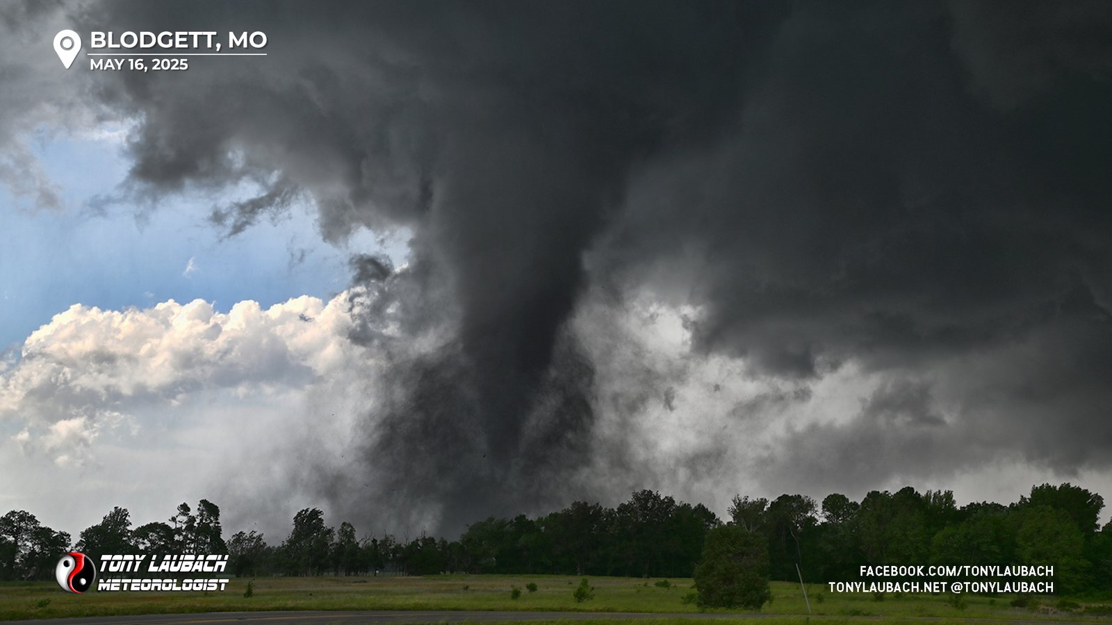
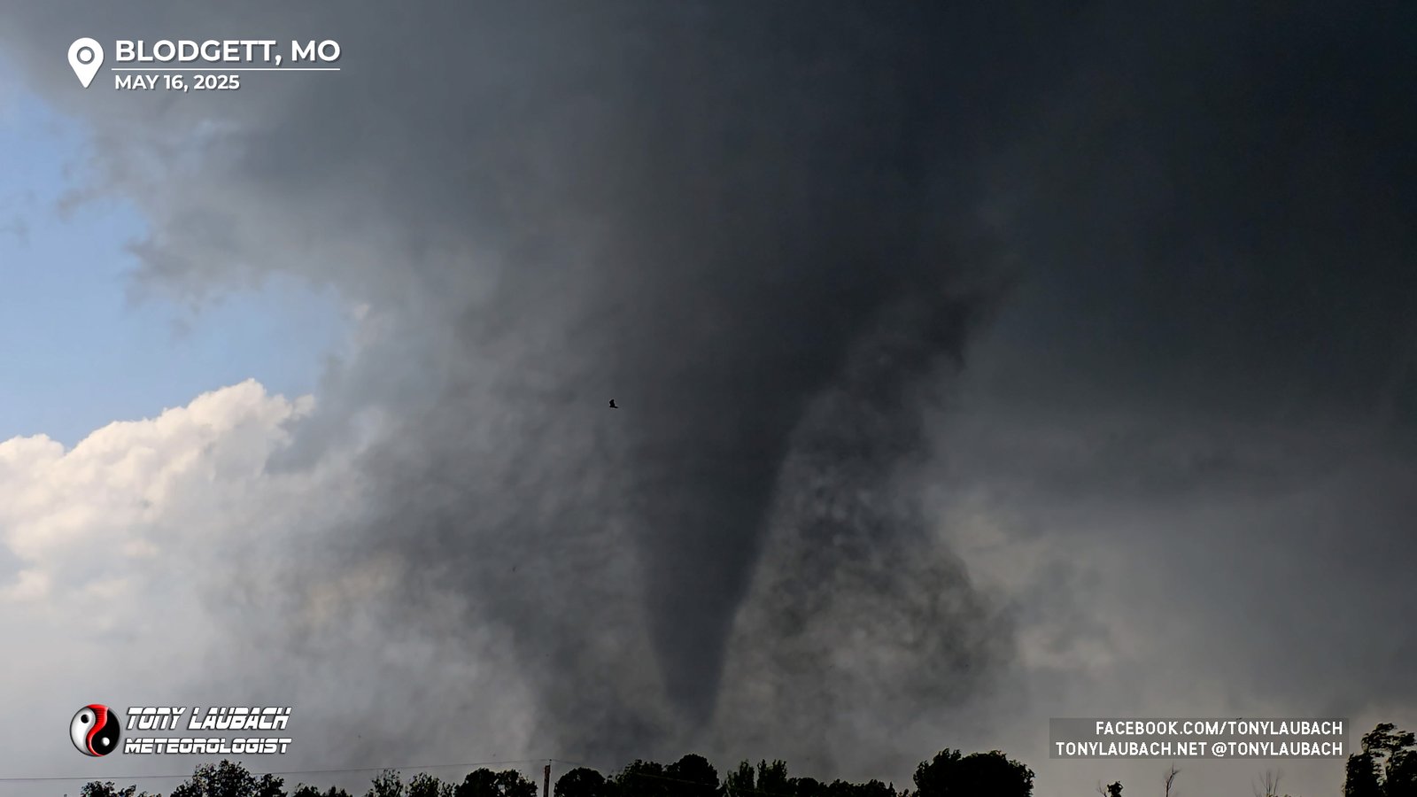
Still no tornado evident, but things changed quick! After that five minute lull where again, I could NOT see any ground circulation even between the tree breaks, a large funnel descended and quickly we had a new, and visually quite strong-looking tornado.
We broke back into live coverage as I struggled to figure out how to frame this up. Unfortunately the setup in my new car was very basic, co I was forced to point the car in the direction of the tornado with the limited angle allowed by my windshield. And there weren’t many safe places to pull off with that west view and the few cars that were around were choking off options.
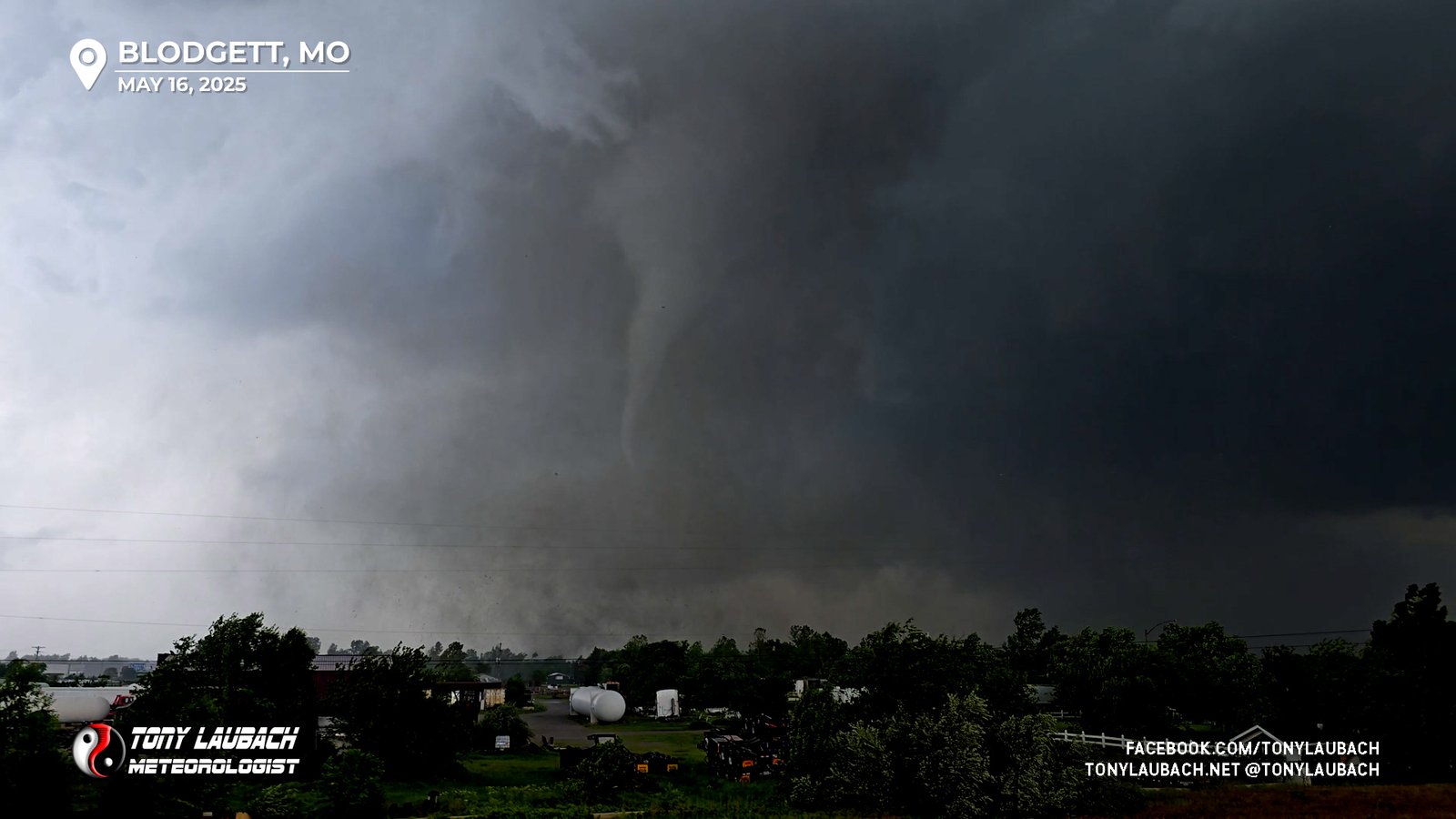
Finally, I just decided ‘to hell with it’, turning onto Outer Road and parking as far on the sloped shoulder as I could get myself off the road from; it wasn’t the best, but everyone in the immediate vicinity, some likely other chasers, had all stopped to take in the show, so I was not worried about blocking anyone’s route. And fortunately, while parked at a fairly steep sideways angle, was able to set up for an AMAZING shot.
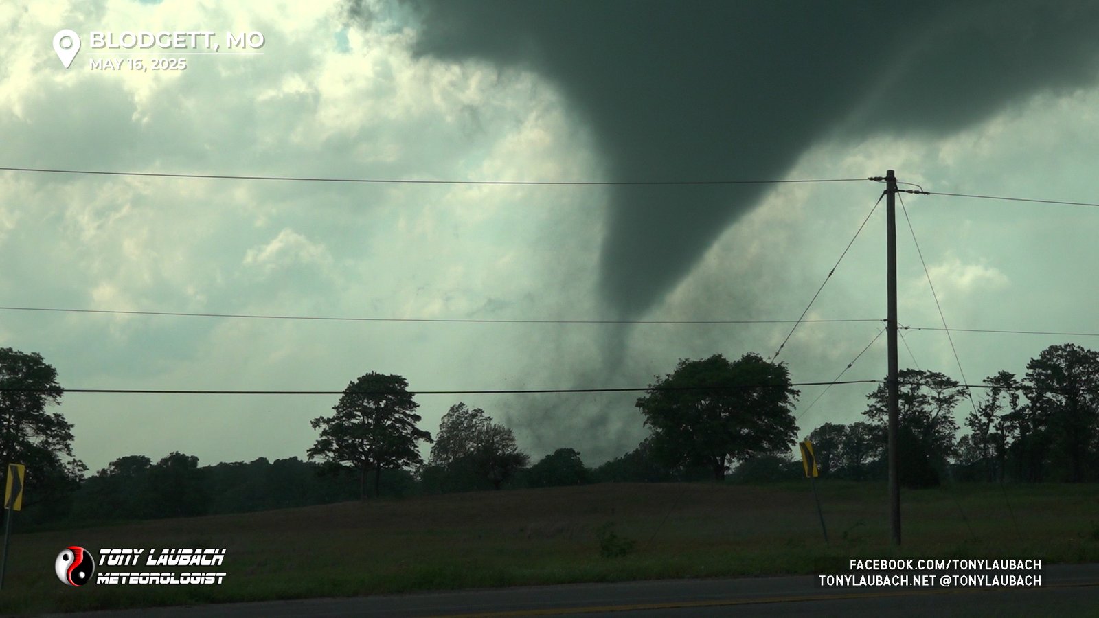
With a stable view and a tornado moving slowly enough to stay in frame of the live camera, I immediately grabbed my Nikon for some good photos, all the while continuing to narrate the tornado as it pushed its way closer to I-55 and me.
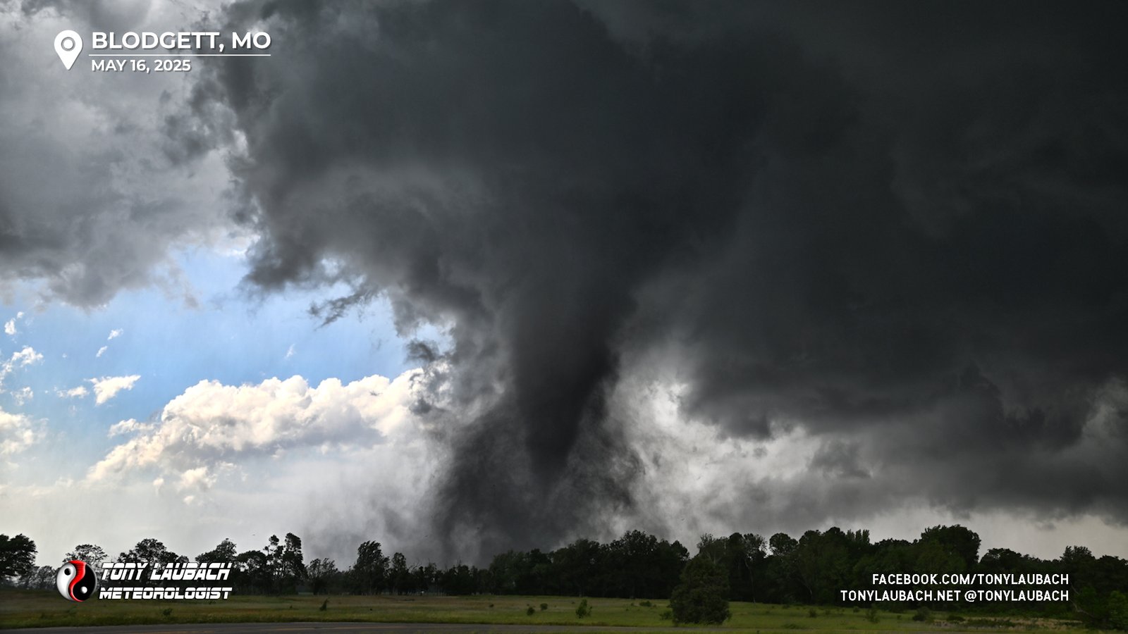
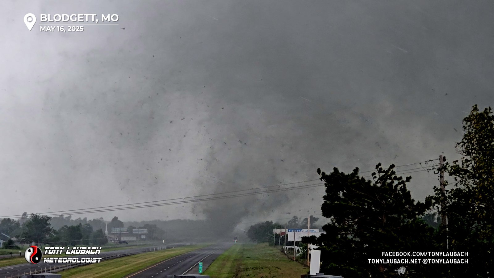
Unfortunately about this time, the tornado was likely approaching one its strongest points, and this became apparent when debris began to fill the sky around the base of the tornado.
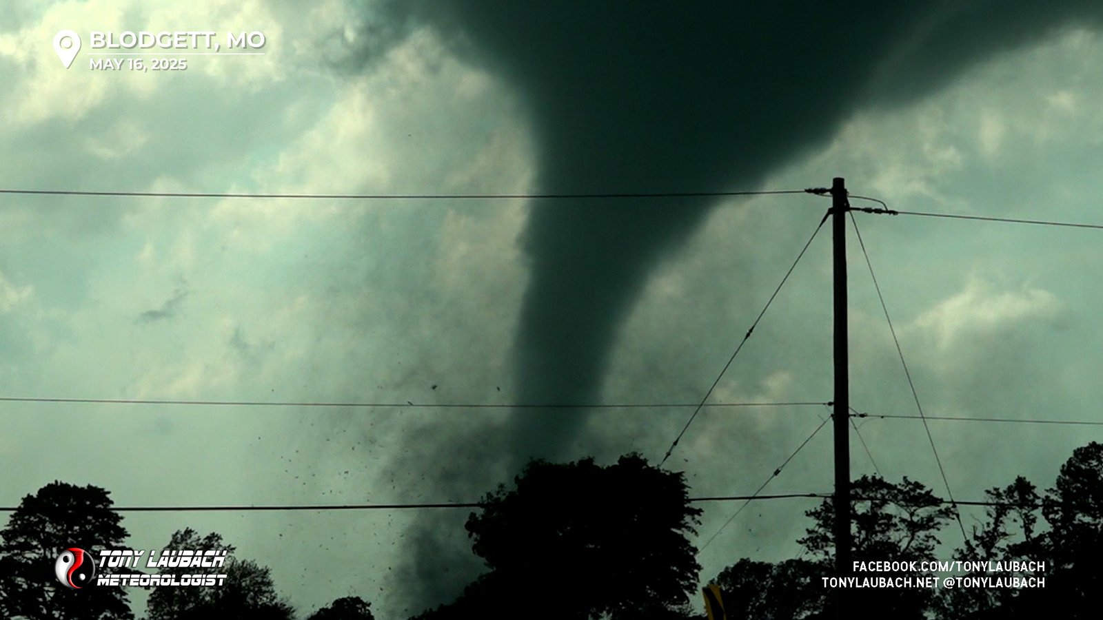
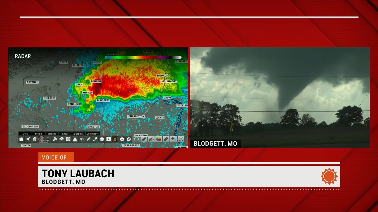
With the tornado approaching the interstate, it was quickly apparent this was going to occur north of me. My earlier back and forth over I-55 had put the overpass as an option for me, despite not having a real good place to pull off. But that was my idea, take the elevated view and move with it after it crossed.
I positioned on the overpass, about a mile south of where the tornado was going to cross. As I slowed to a stop, I aimed my camera out the window, zooming in tight as the tornado, littered with debris, raced over all the lanes of I-55, tossing large pieces of debris across the highway.
As soon as the tornado cleared I-55, I immediately got moving, fully crossing the interstate. Immediately after dropping off the overpass and just before Highway H turns back north, there was another eastbound county road, CR-528, so I opted to take it east, trying to keep up with the tornado. I had a pretty decent shot east heading back toward the river, so I anticipated on sticking with this eastward routing as long as the tornado was going.
As I moved east, only about a mile, it was becoming evident the tornado was getting into it’s final rope-out stages. I opted not to stray too far east, setting up with a decent view to observe and live report on the rope-out of this tornado.
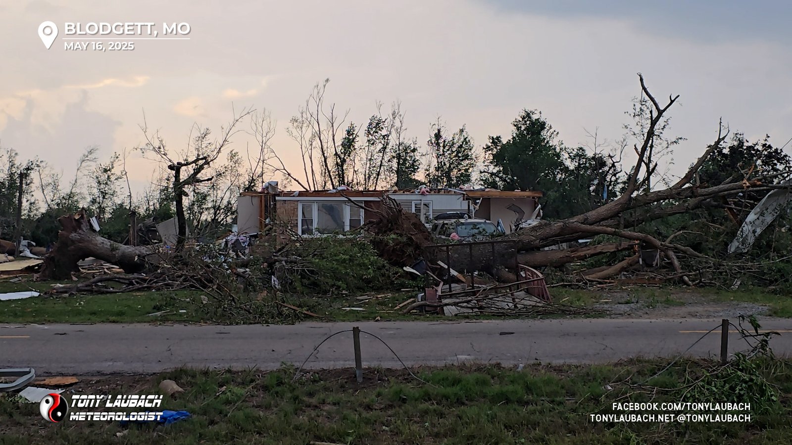
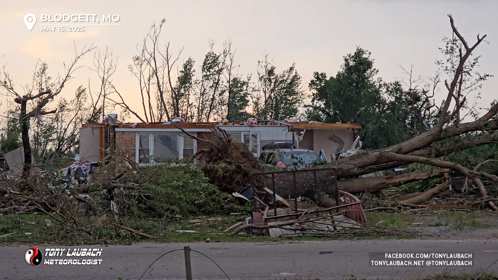
Having not ventured too far from the interstate crossing point, I quickly returned back to the area to find emergency crews were right on it! Already on scene and taking care of folks. I met with a lady whose home was spared and barely missed being hit by a fallen tree. She was fine, hid out in her pantry as the tornado just missed her house a couple hundreds yards to the north. No one in this area was injured. I was unable to get north to the path due to all the down trees.

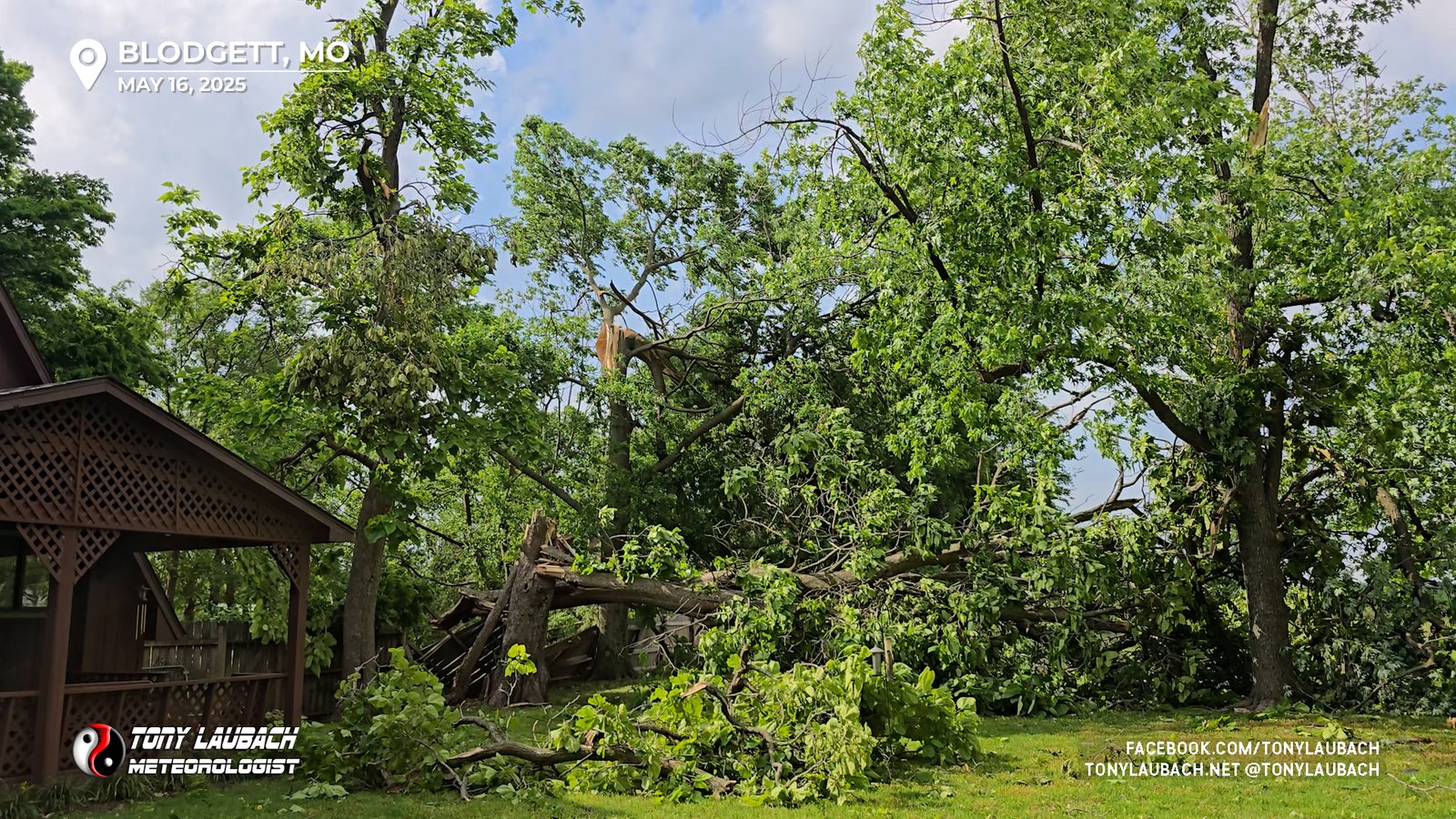
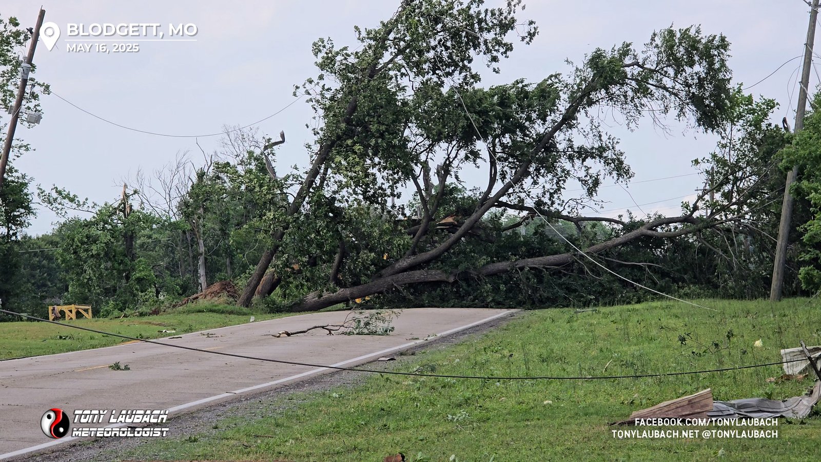
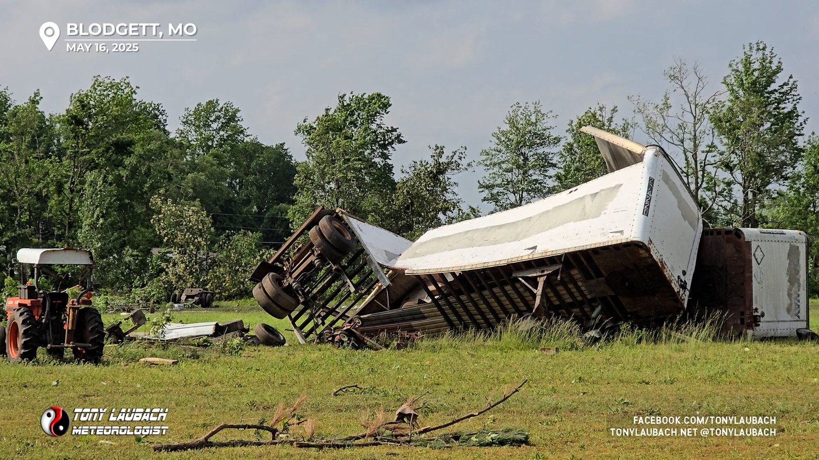
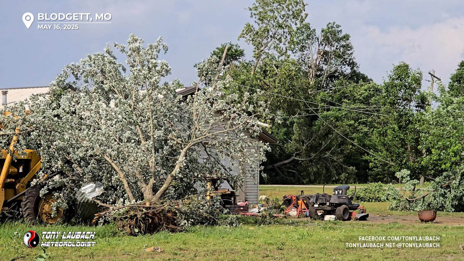

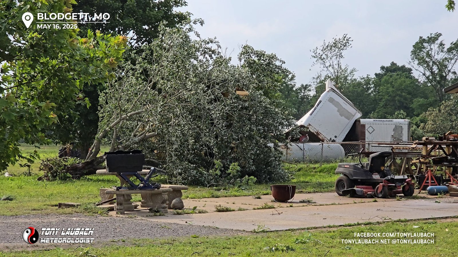
Obviously there was extensive damage on the east side of the interstate as there was heavy debris in the air as the tornado approached the interstate. One home in particular that I could see from the interstate took a pretty hefty shot from the tornado.
I had another live hit coming, and I was obviously in an area without power, so I retreated to Sikeston to set up for the hit; editing the damage video and getting ready to do the hit.
As I completed and broke down from that hit, I was faced with a decision. There was a storm to my north that was taking aim on the IL-13 corridor with a bead on Murphysboro. Another storm to my west was also getting going, which would be the EASY intercept. I looked at my routing to see if there was a chance I could beat the northern cell to Marion from where I was in Sikeston. I had about 80 miles to Marion from where I was at, meaning I could probably get there in just over an hour. I felt a little uncomfortable with that idea, feeling like I would be cutting it close. By this point, the storm had just moved past Perryville, which on a line to Marion is about 50 miles; and the warnings were 50-60mph on forward speed, so I calculated I’d be about 10-15 minutes too late.
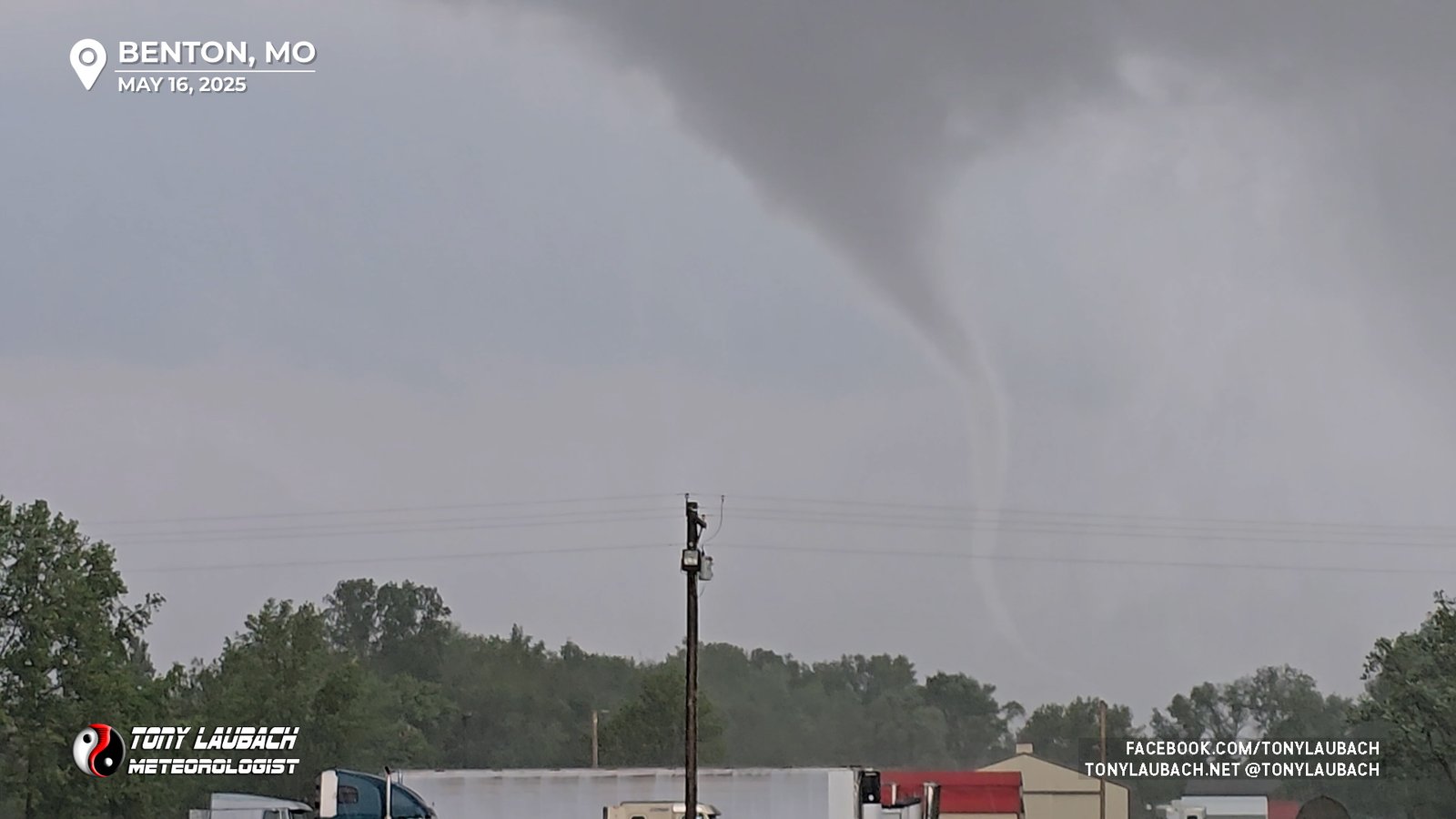
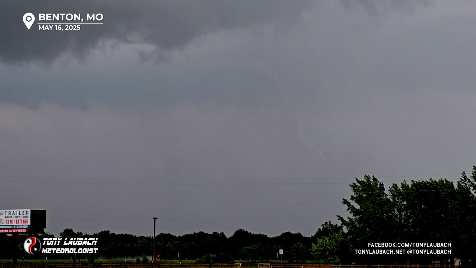
So, I opted to hang close to the area, get a quick recharge and watch the next incoming storm. It was hooking pretty good on radar, and despite my concern of it moving over the same path as the storms a couple hours earlier, it was holding its own. I needed to put about 20 miles north to get in view, so I headed up I-55 to the Benton exit, and set myself up in a parking lot off CR-401 on the south side of Benton, right up next to the interstate. I didn’t have to wait long as the business end of the hook came into view just off to my southwest.
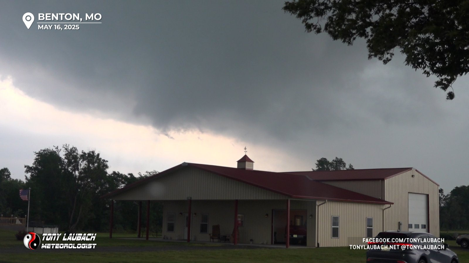
This area went from semi-unimpressive to its-gonna-tornado very quick, and with the crew back at the network on the line, I informed them we were about go a third time.
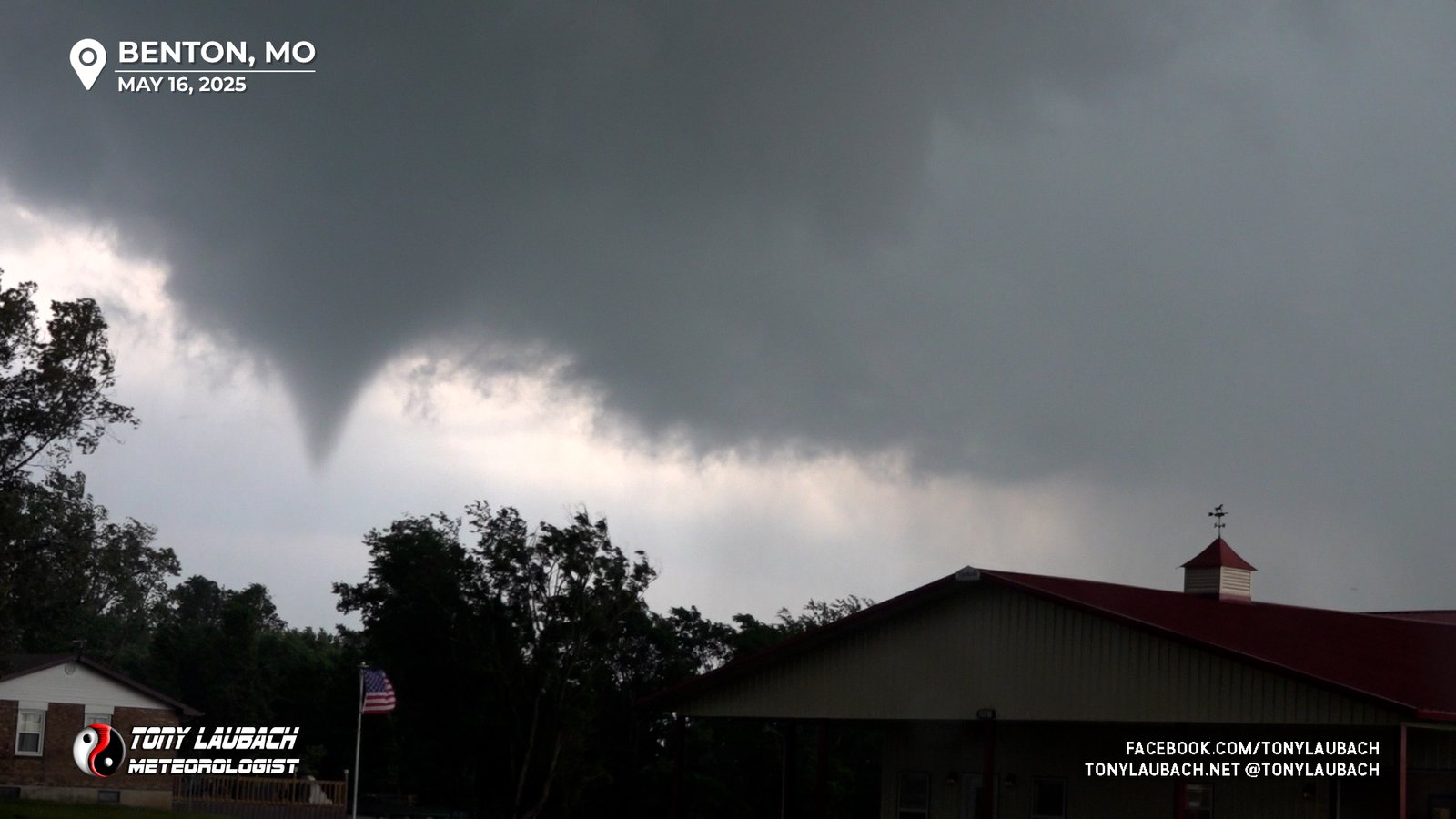
I repositioned a bit further off the road, backing up to a trailer retail place of some sort. As I was spinning around to get set up to point my car due north, the tornado touched down, coming into view as I settled on my spot.
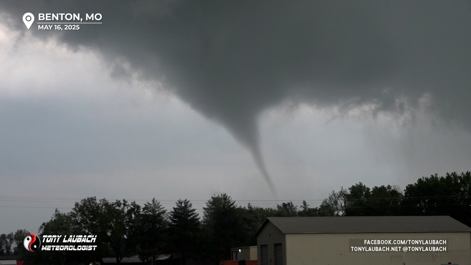
Contrast from the north looking south wasn’t the greatest, but the tornado was clearly in view as it approached I-55 south of Benton. Unfortunately this tornado was ongoing during a point where we couldn’t get on air right away, so by the time we got to me, the tornado was already beginning to dissipate. Still, it churned away for a couple minutes.
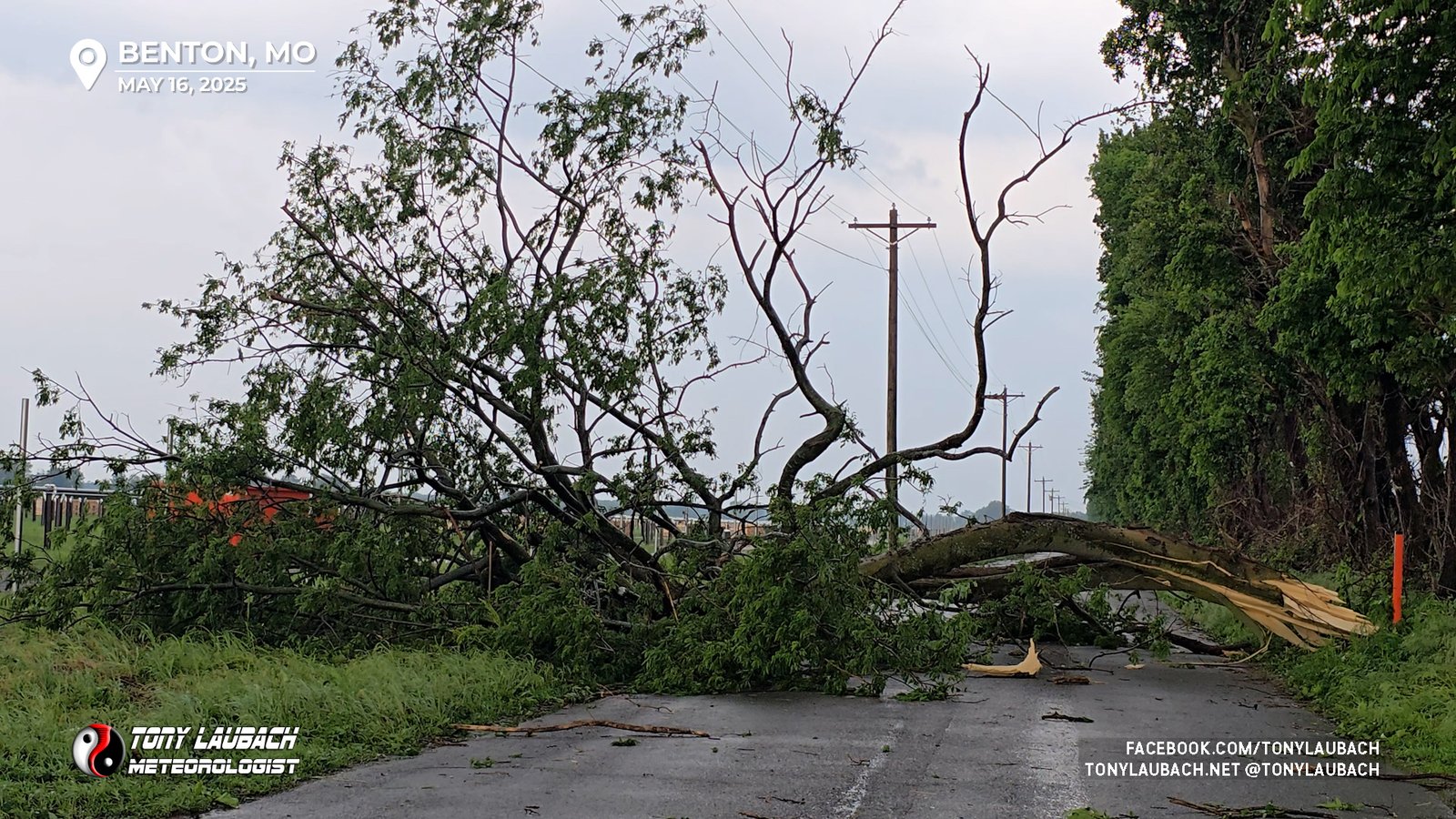
I proceeded south to see if there was any significant damage. I hadn’t observed much in the way of debris during this brief touchdown, but I did come across a large tree that was on the road.
While all this was going on, a historic tornado was ongoing south of Marion. Tornado Emergencies were in effect for a large tornado that would ultimately be rated a strong EF-4. This from the cell I opted not to chase after the Blodgett tornado. Hindsight proved I would’ve missed this, having been behind it by a good 10 minutes; one could argue that maybe I would’ve seen it from the west looking east, but I don’t regret my decision.
The Benton tornado was the last of the day, I wrapped up coverage in the area and began to plot my overnight stop. I had a pickup to make of my chase partner on Saturday in Oklahoma City, so I decided to saw off some miles between here and there, driving down to to I-40 and cutting over ALMOST to Little Rock, holding up for the night in Lonoke, Arkansas to make it a more manageable drive to OKC the following day.
Hands down, this was my “best” chase in this region. While the nighttime intercept of the EF-4 in southern Illinois back on February 28, 2017 was a big one, this beat that out in spades. Namely the day light, high-contrast intercept of the Blodgett tornado, not to mention the elevated vantage point I had of it as it crossed I-55. Obviously given my time in the Carterville area, I would’ve wanted to be on the Marion EF-4, but I made the play I did and certainly there are no regrets with that. This was probably some of the most dramatic tornado video I’ve ever put live on TV before, and again, we covered a majority of that tornado’s lifecycle and we did put all three I saw on live.
Looking back after the season, I would consider this to be the #2 chase of the year, it gets a little nudge because it was in my old WSIL DMA. And the Blodgett tornado was one of the top tornadoes I’ve seen, extremely high-contrast and very close. This day was definitely a top-tier chase.


