
TONY'S CAREER TORNADOES
A List of My Best Tornado Chases
FILTER THE TORNADOES
Filters

Close intercept on Antelope Road from the south; my last tornado with TWISTEX.

TWISTEX group briefly saw a tornado north of Elm Creek while northbound on US-183 before it wrapped in rain; no imagery from our vehicle.

Viewed from south of Elm Creek

Long, thick rope-out of tornado we came upon in southwest Nebraska south of Imperial.

Caught reported tornado on the far east side of town on dash camera as we rolled into town on US-20 from the west. Was 6th consecutive chase with a tornado.

Viewed while northbound on NE-11 south of Atkinson while behind TIV vehicle. Camera captured remnant RFD after tornado lifted before crossing road.

Observed while eastbound on US-70 in downtown West Memphis looking east. Observed damage moments after this shot. Was 5th consecutive day with a tornado.
My 200th career tornado intercepted along side Ed Grubb and Paul Samaras; us getting pictures with this tornado south of town.
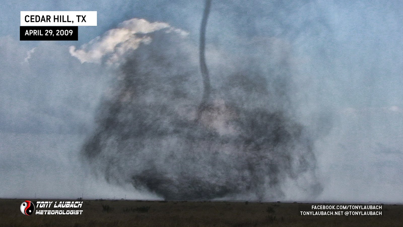
Began as a crazy-looking multi-vortex before morphing into a strong cone that narrowly missed a casino on its way to the lake where it turned from black to white over the water.

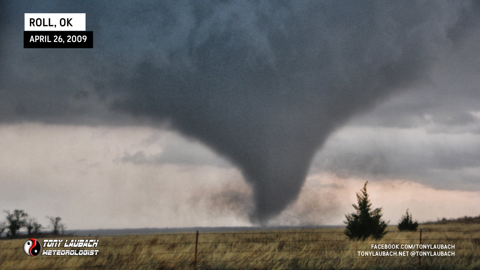
Insanely beautiful funnel directly overhead touches down with an almost landspout-like appearance.

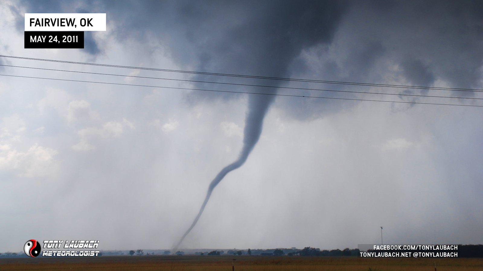
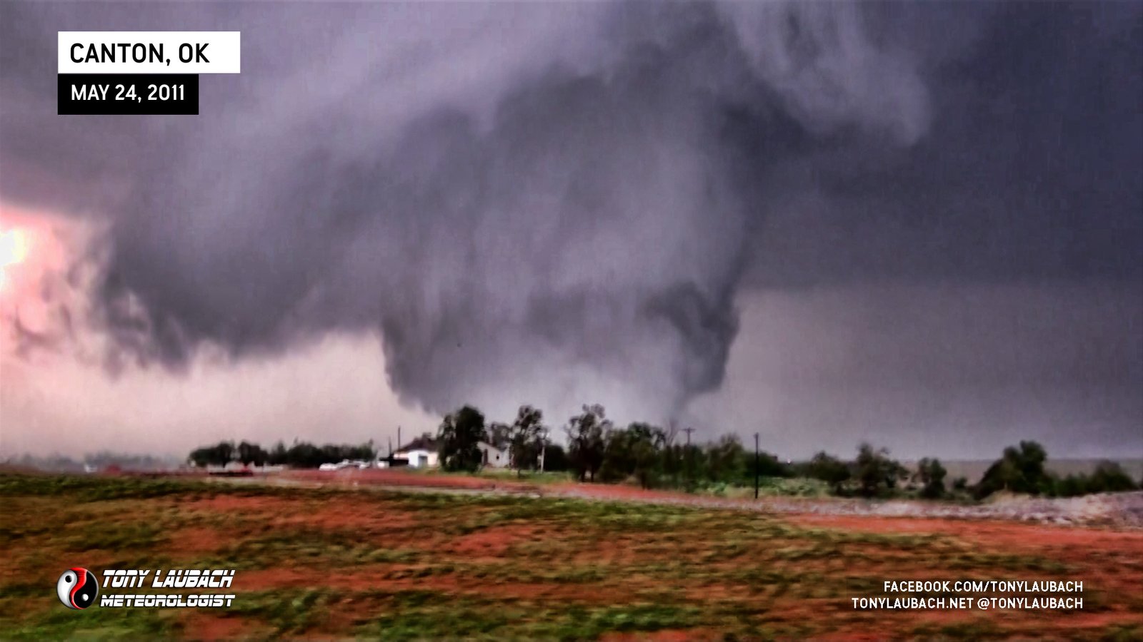
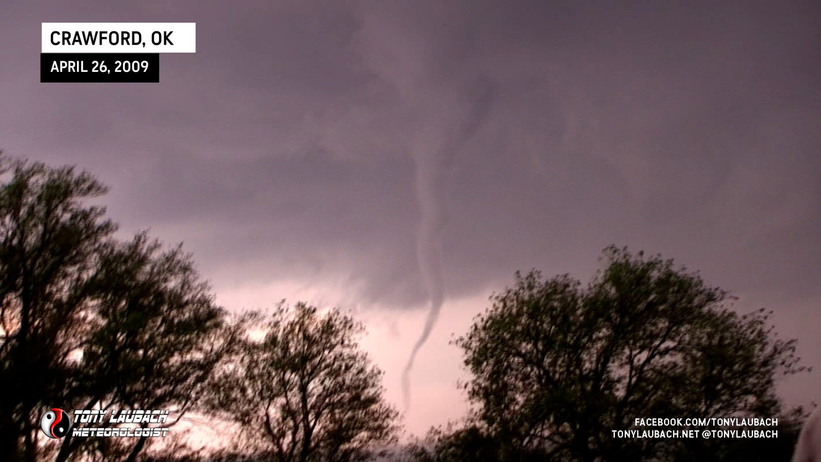
Long funnel overhead briefly stirs up dust near Canton, Oklahoma.

Stout, white funnel veiwed from OK-10 east of the town of Oaks.

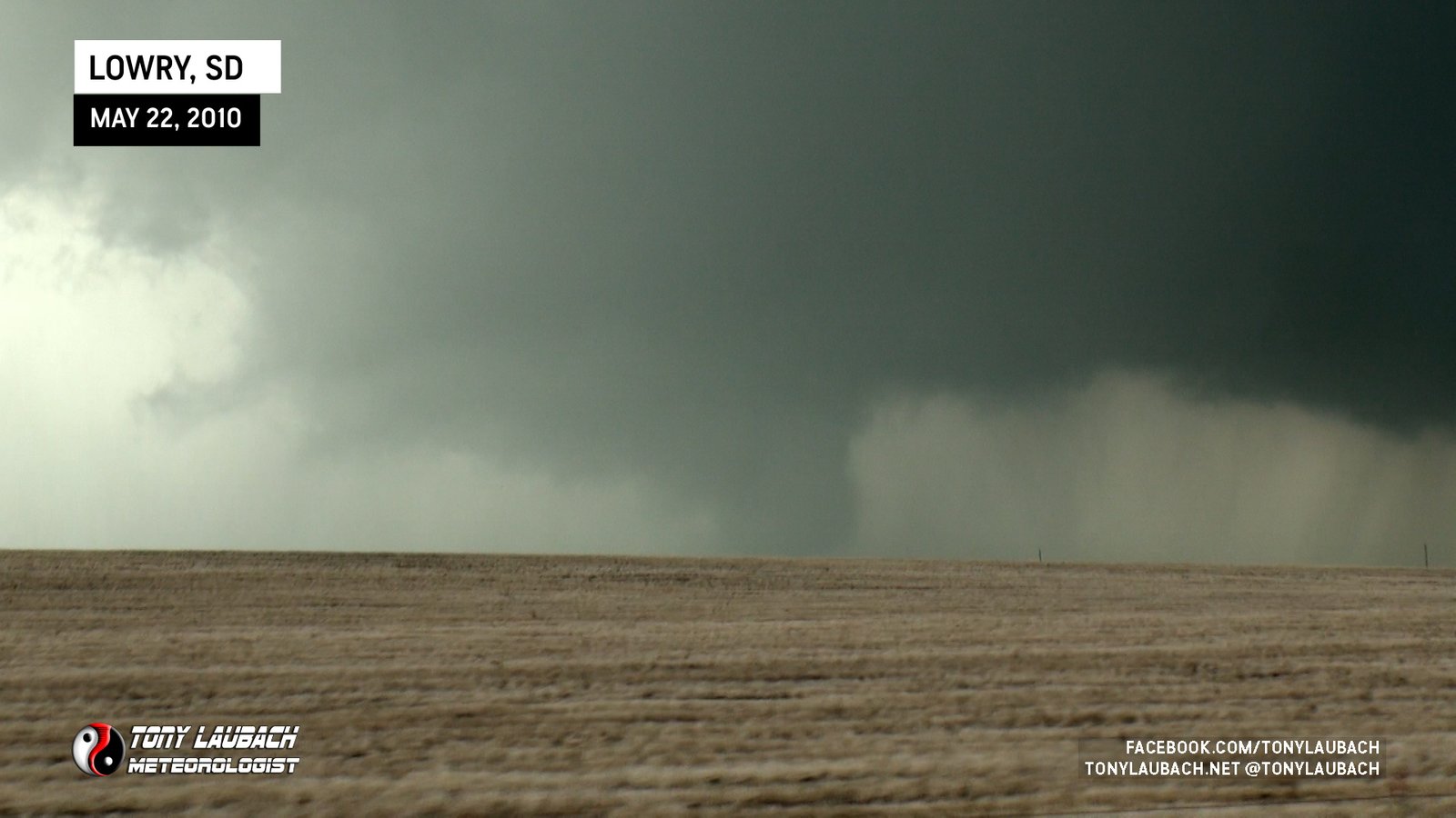
Viewed from OK-10 south of Lowrey looking north. Rotating wall cloud had brief ground-circulation to our north.

Sporadic view of funnel and ground circulation through trees of the Peggs, OK tornado looking north.

Captured tail-end of the tornado north of Leliaetta while northbound on US-69; funnel on dash cam as it lifts east of highway.

First observed on AL-5 north of US-82; Crested hill after tornado crossed highway, dash cam caught glimpses through trees.

Likely start to Tuscaloosa tornado, viewed from AL-14/CR-119 area.

Caught the end of this tornado along AL-14 south of Aliceville.

Violent-looking white stovepipe, viewed from Gillespie Road area outside Macon.

Long-lived cone viewed from distant east looking back to the west.

Tornado briefly viewed sporadically while navigating through town.

Paul Samaras coined the phrase, ‘Pencil D*ck Tornado’ on this one as we filmed it looking north.

Multi-vortex tornado crossed to our immediate north on US-283 as Tim in his ‘Probe’ vehicle drive right up to circulation for deployment.

Wispy, white funnel touches down near the ridge to our west with distinct dust whirl.

Fairly long-lived cone to our west over hilly terrain.
Saw the power flashes early in the tornado’s life prior to it hitting STL Airport.

Brief view of likely satellite of stronger Wadena tornado.

Large tornado touches down a couple miles due west of us outside Slapout.

Multi-vortex tornado to our south that vanished into the rain.

Cone tornado noticed by ‘Eagle-Eyed Ed’ that was well to our south, but were able to capture on video.

Debris swirl beneath white funnel near CR-3h and CR-36, circulation passed directly over us.

Fat, white funnel with light ground circulation north of Genoa, viewed from I-70.

Brief spin-up near MM367 on I-70 east of Limon; small funnel observed over ground swirl.

Final tornado of the day, multi-vortex touchdowns directly over ND-49 beneath very low cloud base.

Brief spin-up crossed west-to-east across ND-49 to our immediate north; ground swirl beneath persistent rotation.

Caught end of Sioux-Grant County EF-1 tornado while northbound on ND-49 south of the county line.

Viewed from just north of SD/ND state line on ND-49; first ever North Dakota tornado!

Rain-wrapped view of second Shadehill area tornado looking north along SD-73. Confirmed by probe vehicle further up.

Obstructed view of brief tornado touching down west of SD-73 between Meadow and Shadehill looking north.

Large tornado that crosses SD-73 to our north as initial tornado was still ongoing to our west; this tornado destroyed a rural school near Meadow.

Satellite tornado touches down intermitted for several minutes around initial tornado we observed on southbound SD-73.

First tornado we saw as we crested hill along SD-73 moments after turning south from SD-20; various sizes and shapes.
Long, thin needle, likely satellite of larger tornado we could not see, looking distant northwest.
Weak, multi-vortex tornado viewed from the east.
Brief, semi-large cone buried within rain, looking west.
Truncated cone, witnessed while eastbound on US-12
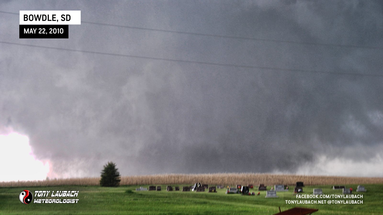
Incredible TWISTEX intercept north of Bowdle; including Tower Probe Deployment and multiple mesonet sweeps.
Stout cone tornado to our east.
Large tornado viewed looking back to the west from 315th Avenue.

Low-contrast multi-vortex tornado viewed from north of Kingfisher, Oklahoma.

Large, low-contrast tornado north of TX-152 looking northwest from east of Dumas.

Brief spin-ups on/slightly north of TX-152 east of Dumas, did fully condensate briefly as well.

Brief touchdown of a tornado west of Dumas looking west/southwest along US-87.

Documented the remnant dust of a rope tornado the touched down on the northwest side of Odessa south of Goldsmith.

Large tornado viewed at a distance; logged in official reports as TWISTEX.

Sang ‘Happy Birthday’ to Carl while watching this tornado; logged in official reports as TWISTEX.

Video of initial funnel of the Bessie tornado viewed looking north along US-183 before it moved northeast out of view.

Witnessed anti-cyclonic tornado briefly touch down and remove roof from local casino seconds after RFD overtook us and blocked initial tornado from view along US-177.

Viewed initial touchdown of long-track tornado east of Marland from US-177 looking immediately east of us. Powerful RFD overtook us and blocked tornado from view.

Brief tornado touches down northwest of Medford, viewed looking northwest from OK-11 and CR-970 one-mile east of Medford while large EF-3 was northeast of us.

Saw left edge of large tornado northeast of Medford as we were approaching Medford on OK-11 moments before brief tornado touched down.
Likely intercepted remnant circulation of the Diller tornado along US-136; mesonet measured small pressure drop.
Deployed on this tornado south of Scott City on US-81; Probe vehicle has video as our view was very low contrast.

Video still of distant tornado around sunset, looking north.

Observed a large, rain-wrapped tornado about 5 miles west of Lakin, watched circulation cross US-400/50 before briefly coming into view as it ended.
Observed during fuel fill-up at end of chase, no conclusive imagery from our team; others confirm.
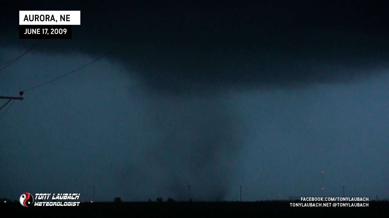
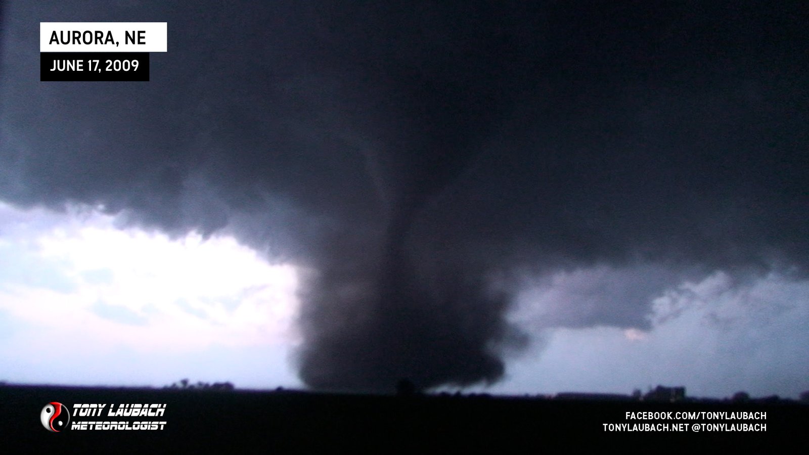
Likely satellite of Aurora, diffuse weak tornado spins up during main Aurora rope-out.
Large, Longtrack Tornado, Successfully Deployed on by Tim’s probe and our mesonets. Featured as our season finale tornado in ‘Storm Chasers’.
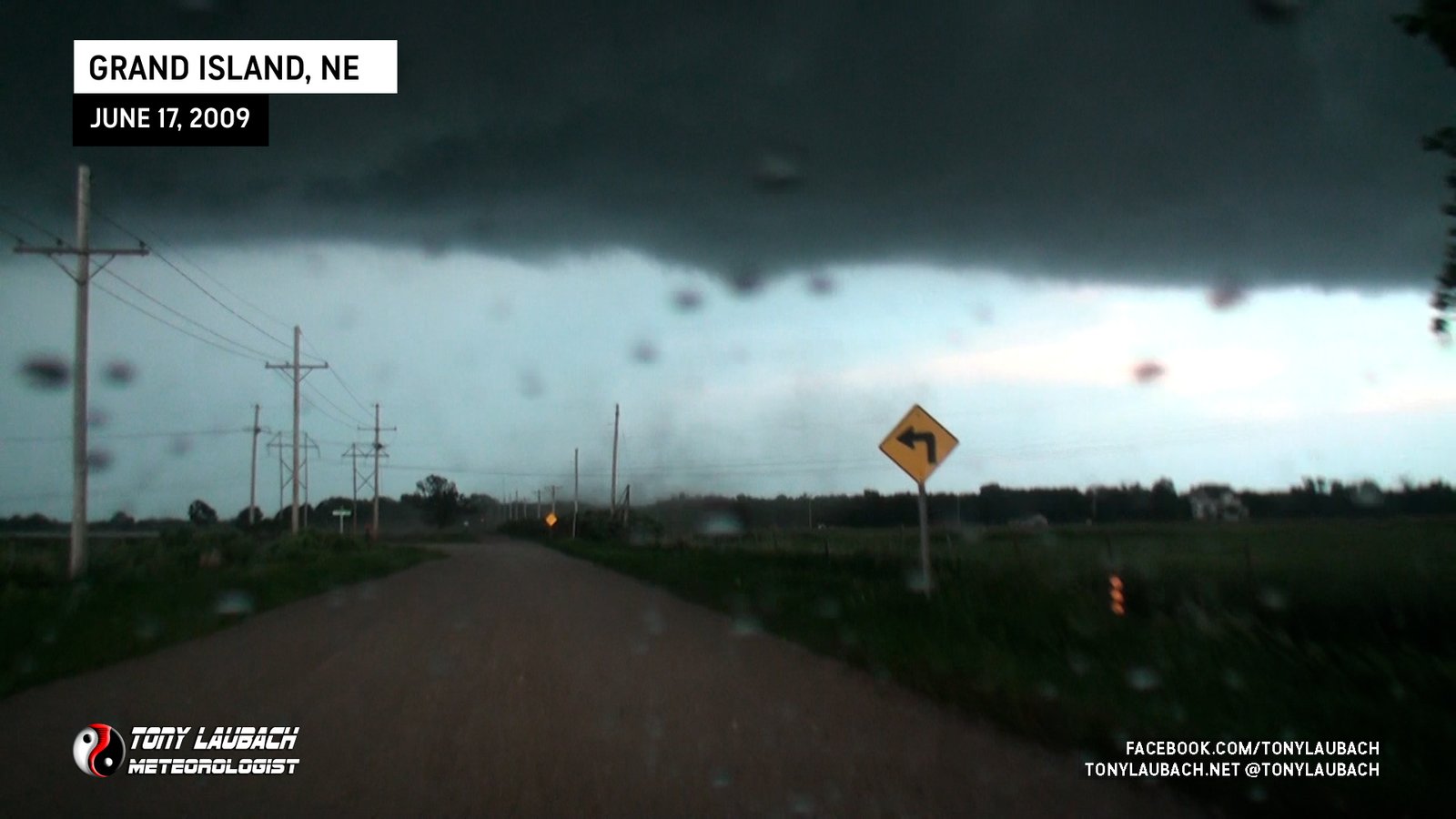
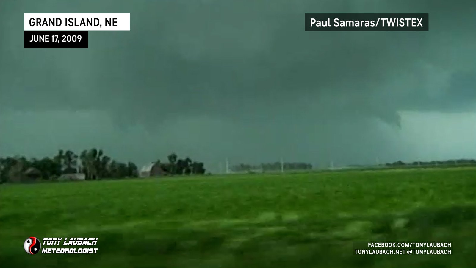
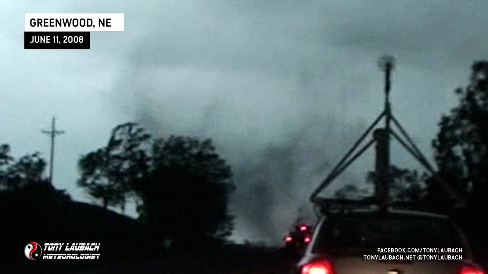
Brief touchdown immediately to our east on the southeast side of Grand Island.
Brief tornado hit and knocked down two trees to our immediate north; video still thanks to Paul Samaras.
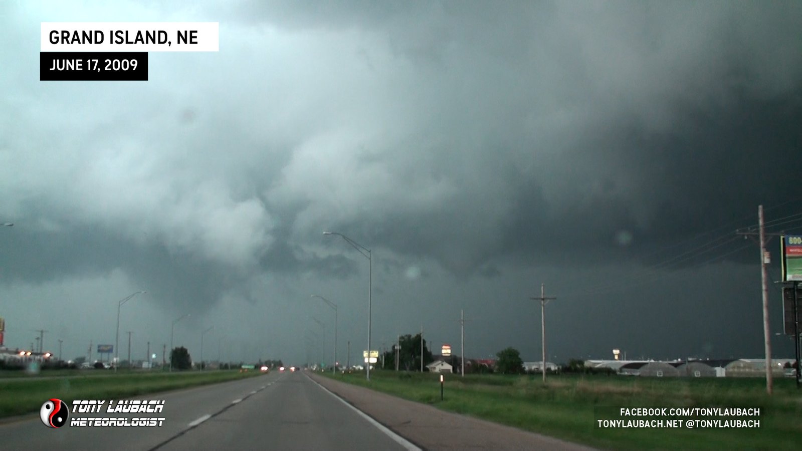
Funnel touches down on south side of Grand Island ahead/north of us on US-281.
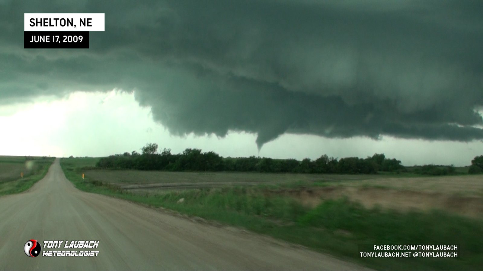
Caught while on approach to it, would lift as we arrived closer to it on a dirt road northwest of Shelton.
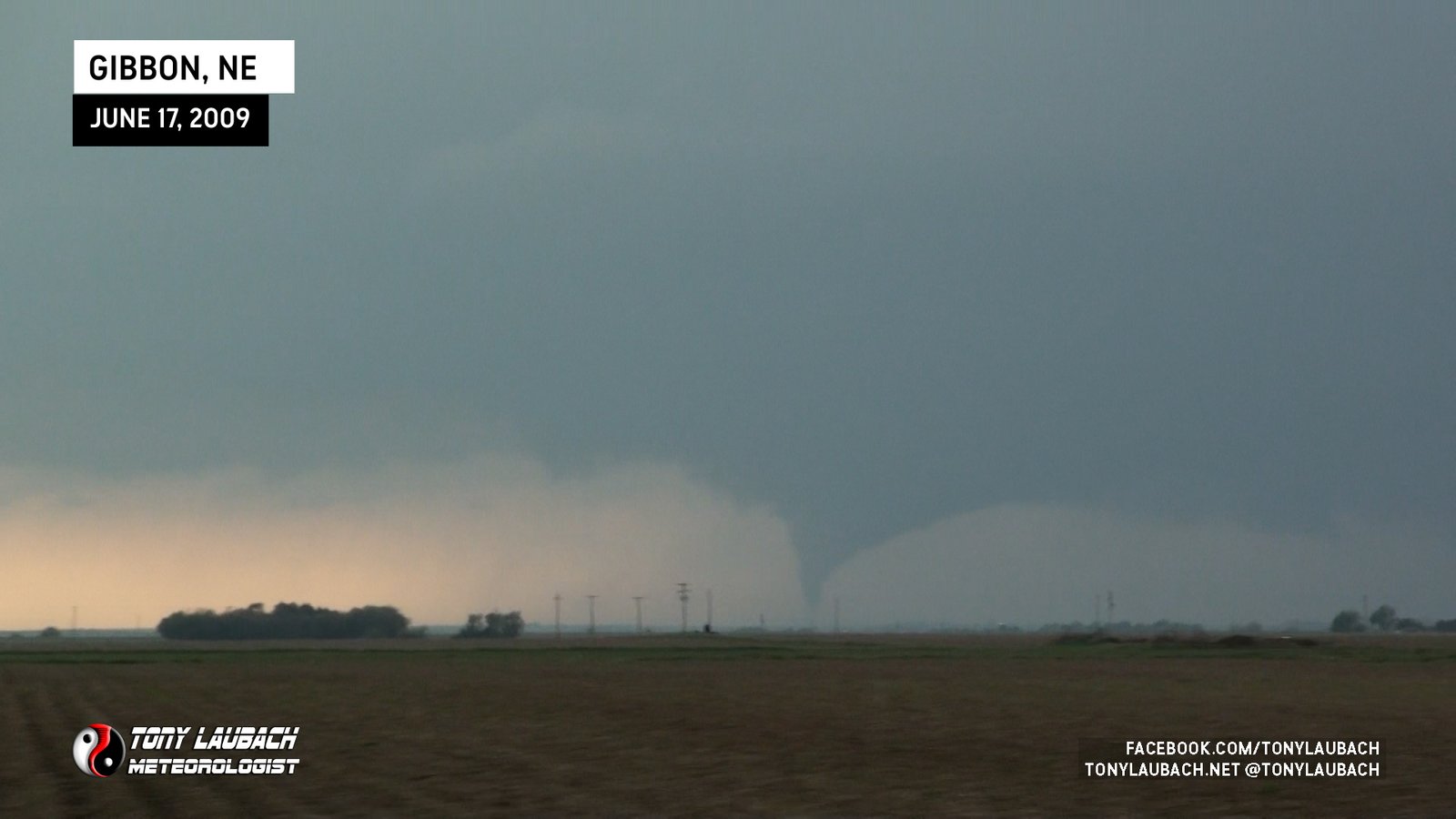
From north of Gibbon, Nebraska looking far distance west. First tornado of the event.
Caught tail end of Lone Elm EF-1 as we approached, but no media captured by anyone in M3 vehicle.

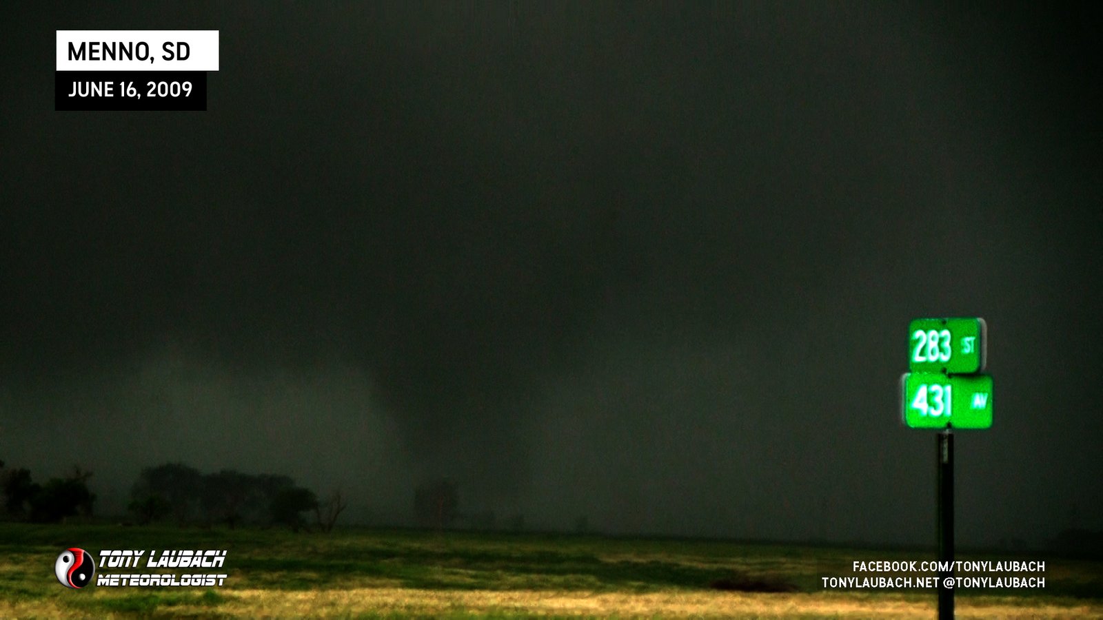
Ed and I ‘Self Deployed’ the mesonet into a broad, rain-wrapped circulation east of Menno with our mesonet recording a small pressure drop. Probe vehicle still had eyes on main tornado, so we assume this to be a satellite.
Caught the early stages of a large tornado that developed to our north, retreated south toward town immediately after sighting.
Brief tornado viewed from near Pritchett looking south as heavy hailcore overtook us. No imagery.

One of my favorite ‘Discovery-era’ tornadoes; part of ‘Storm Chasers’ episode focused on this tornado. “This was MY tornado”.
Long-track, well documented tornado from initial touchdown til rope-out.
Viewed from Highway 6 looking east, caught initial stages before moved out of view to our northeast. No imagery from my cameras.

Tornado day after my last final for my Met degree. Viewed from east looking west along MO-6; stopped at Novinger Baptist Church and narrowly escaped as tornado overtook the town.
Larger satellite cone tornado that formed shortly before main tornado rope-out.
First satellite tornado, a rope we saw east of the main tornado. Brief touchdown mentioned in report with the main tornado.
Large tornado I took my first picture in front of; also won 2nd place in Redskins fan contest for this as I was in an Art Monk jersey. Most incredible rope-out phase!
First brief rope tornado touched down behind us while we were eastbound on FM-2286 east of South Plains. No imagery from M3 vehicle.
Second tornado from this supercell came down as the first tornado roped out.
Ropey-looking tornado we witnessed from US-283 looking southwest.
Brief tornado spun up directly in front of mesonet vehicles, captured on dash cam.
Brief view of weak tornado, looking north from 300th Street north of Emery.
Satellite tornado touched down in field to our south and moved north over our mesonet vehicles; video captured on dash cam and by other chasers.
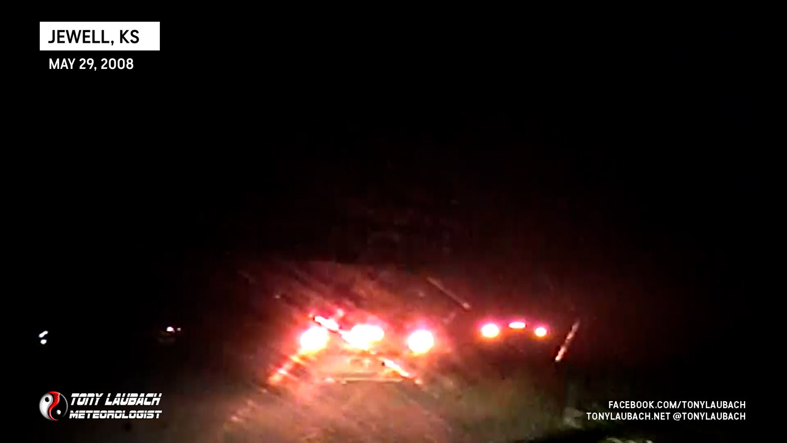
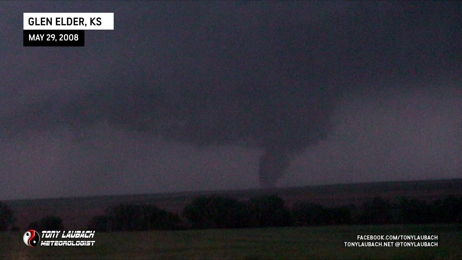
The initial stages of the long-track wedge that would move near Jewell, this as the carousel ceased and a single parent, multi-vortex ground circulation took hold and fully condensed.
Crew caught low-contrast view of a likely tornado to our southeast while the carousel was ongoing. No imagery from M3 vehicle.
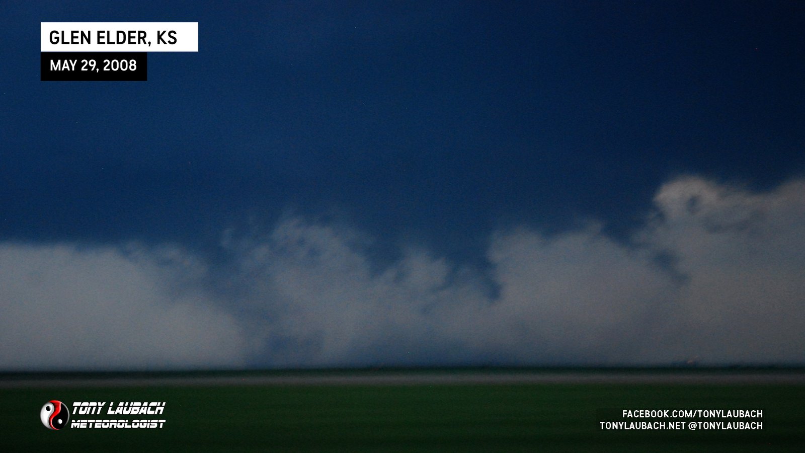
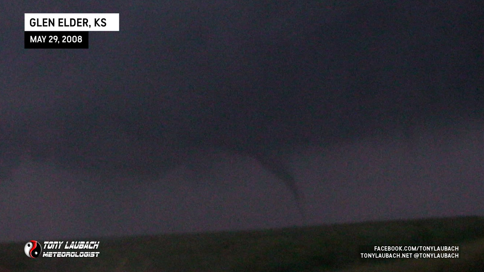
Final carousel tornado in the Glen Elder sequence before the larger, long-track wedge fully developed.

Stout cone touches down from parent circulation as satellites cease during this portion of the event.
Glen Elder carousel sequence; fifth vortex to touch down around developing parent circulation.
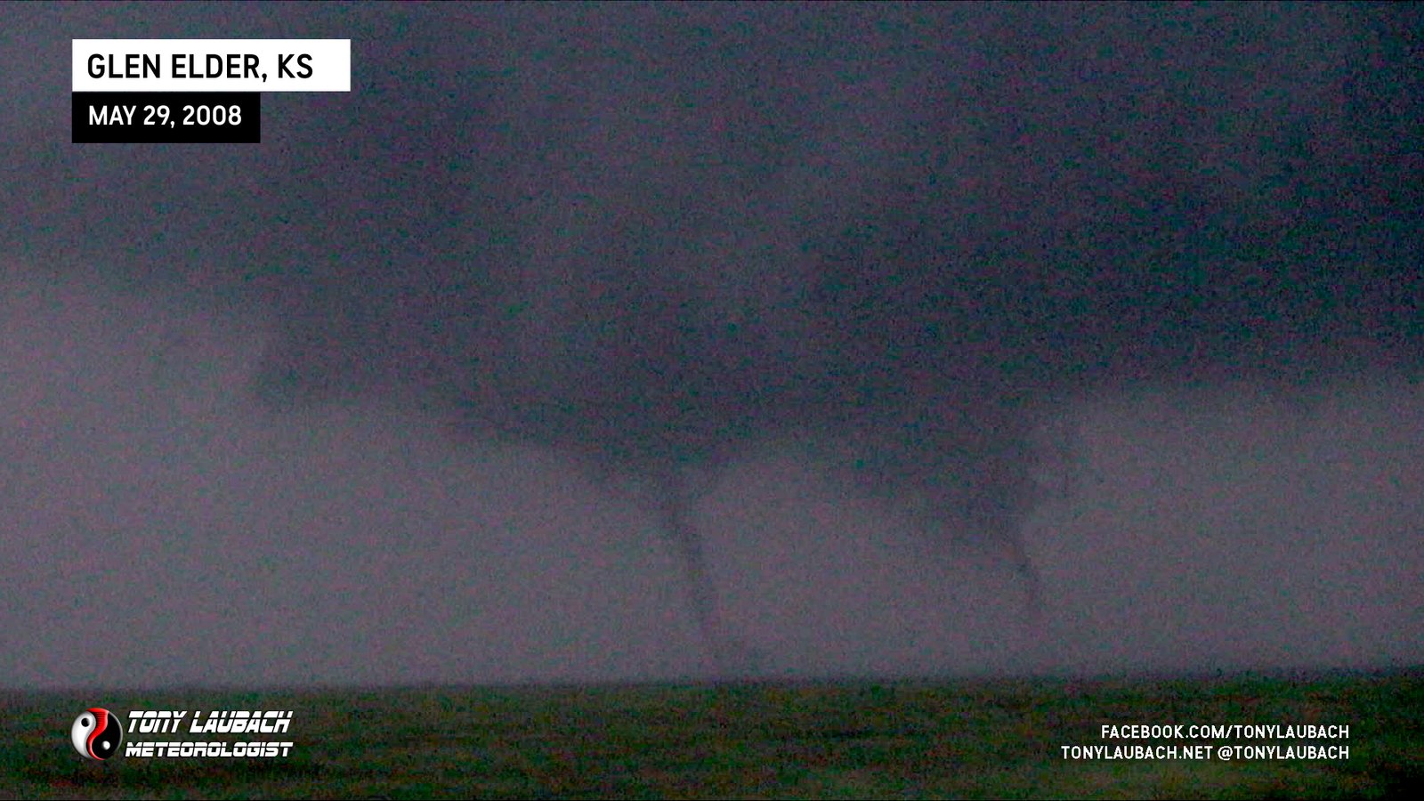
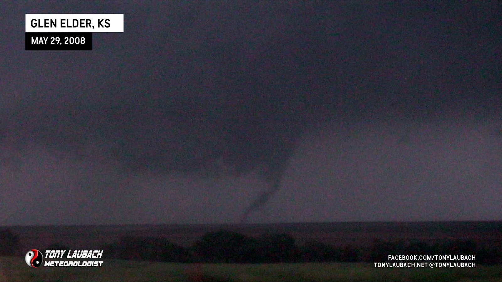
Glen Elder carousel sequence; brief twin moment where two funnels came down. This tornado covers the funnel on the left.
Glen Elder carousel sequence; brief twin moment where two funnels came down. This tornado covers the funnel on the right.
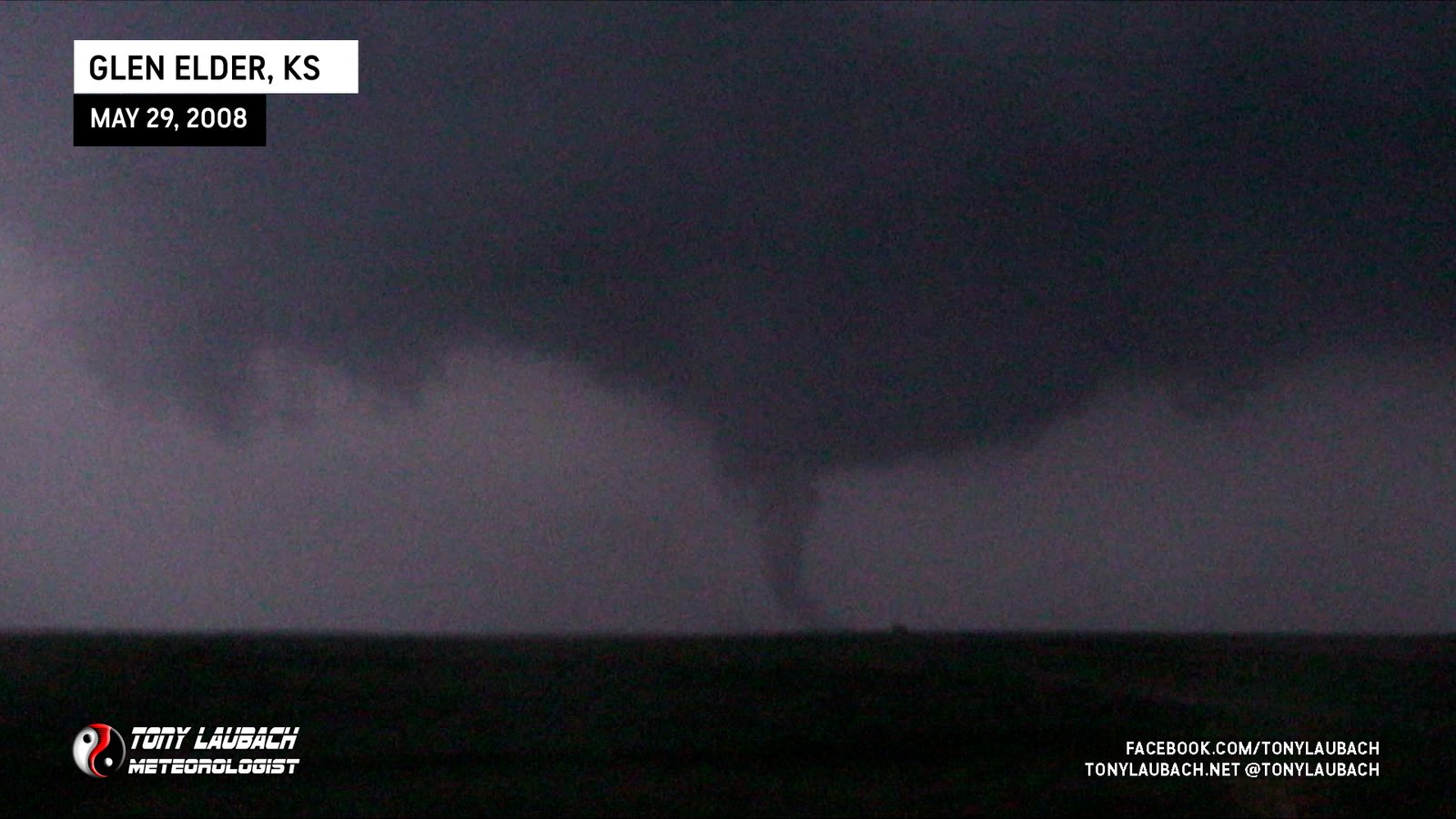
Glen Elder carousel sequence; second vortex to touch down around developing parent circulation; counted as 100th career tornado.
Glen Elder carousel sequence; first vortex to touch down around developing parent circulation.
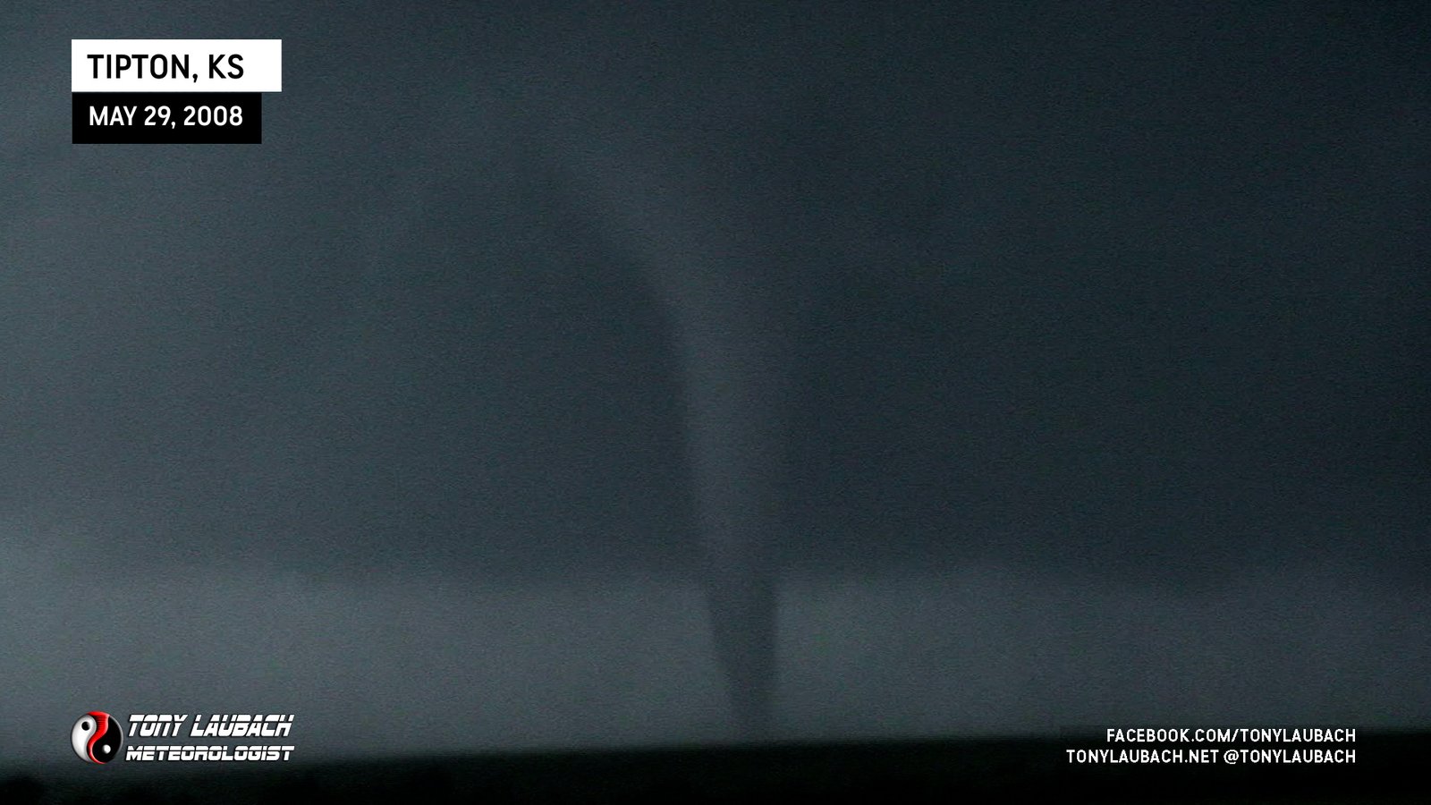
My first big probe deployment; Ed Grubb and I in M3 were about 200 yard south of the tornado as it crossed the highway to our north.
Final tornado of the ‘Kearny sequence’; viewed to our south briefly as we exited I-80 to follow the Kearney tornadoes. No images.
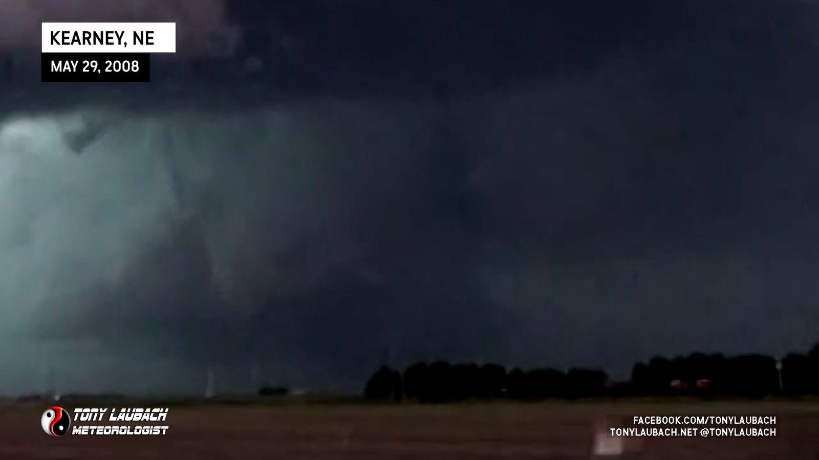
Large tornado viewed from distant southwest as it was on the north side of Kearney. Ongoing along with small tornado we witnessed earlier on I-80.
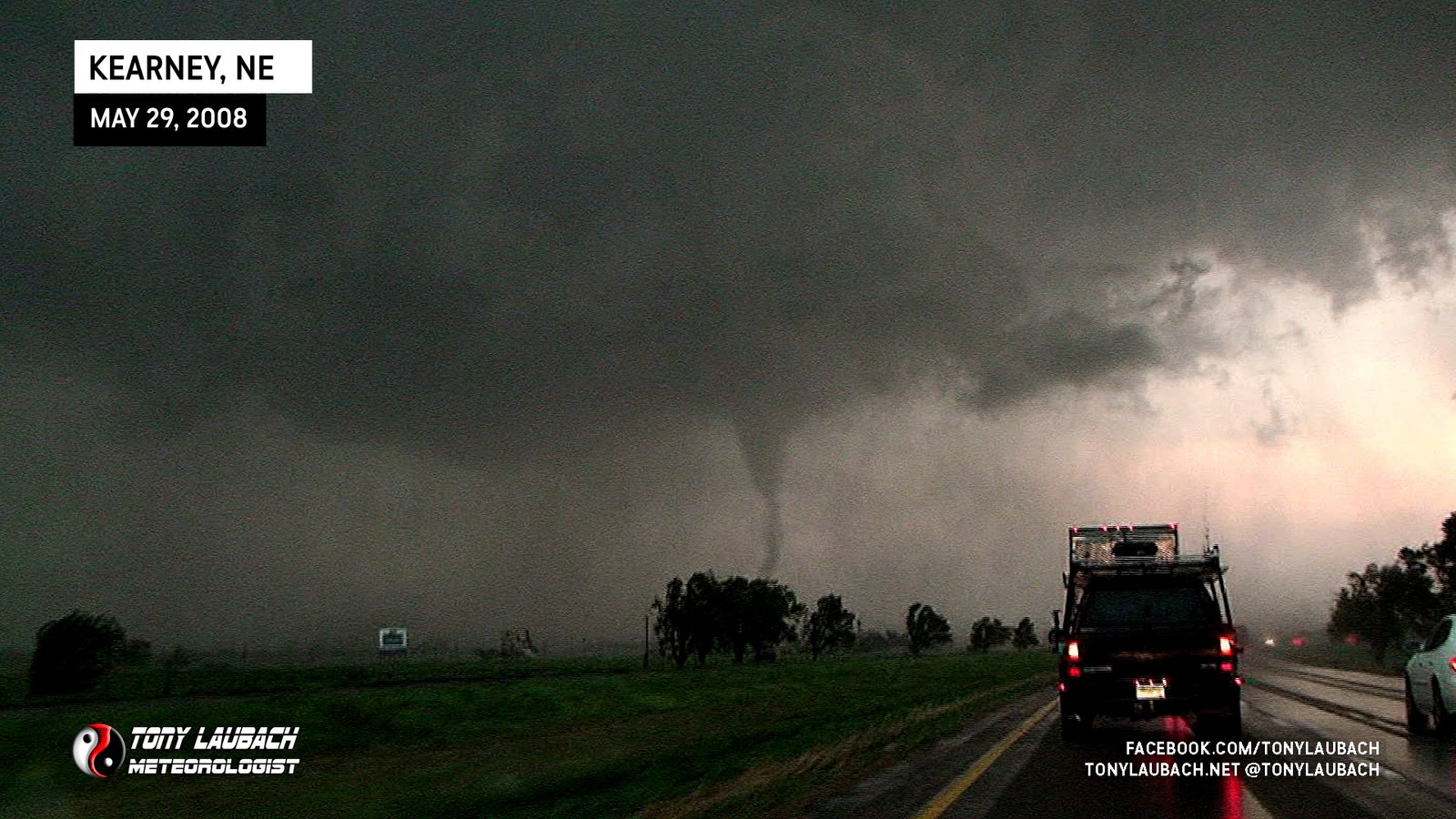
Tornado visible just north of I-80 on west side of Kearney, damage observed in immediate wake.
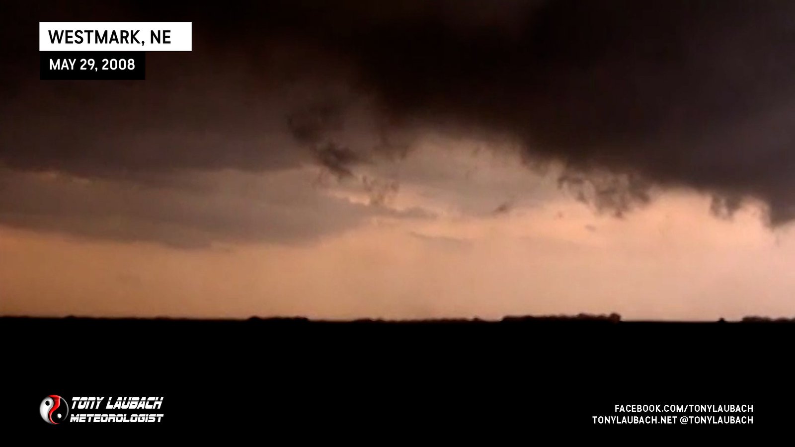
Were southwest of a weak tornado that would touch down sporadically south of Elm Creek; we never saw it fully condense, more just an occasional dust whirl under rotating clouds.
Brief landspout viewed from K-96 looking north, no imagery from my vehicle.
Southeast of La Cross, viewed briefly looking east from US-183; no imagery from my vehicle.
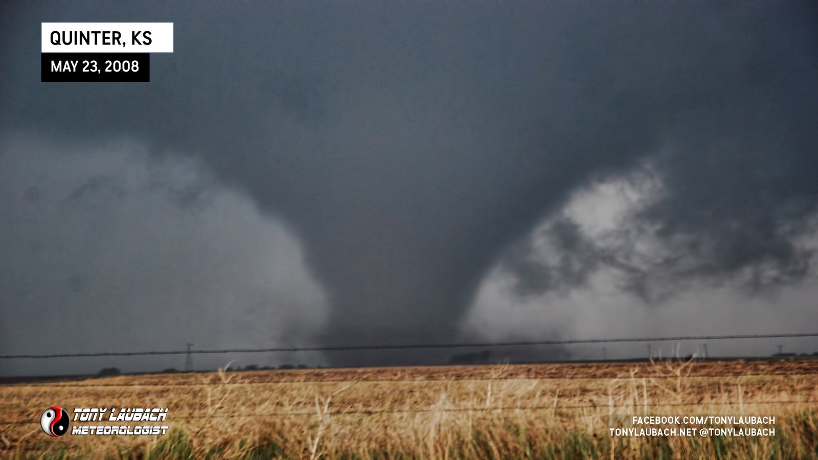
Massive wedge viewed from the south looking north.
Satellite tornado briefly touches down north of main tornado.
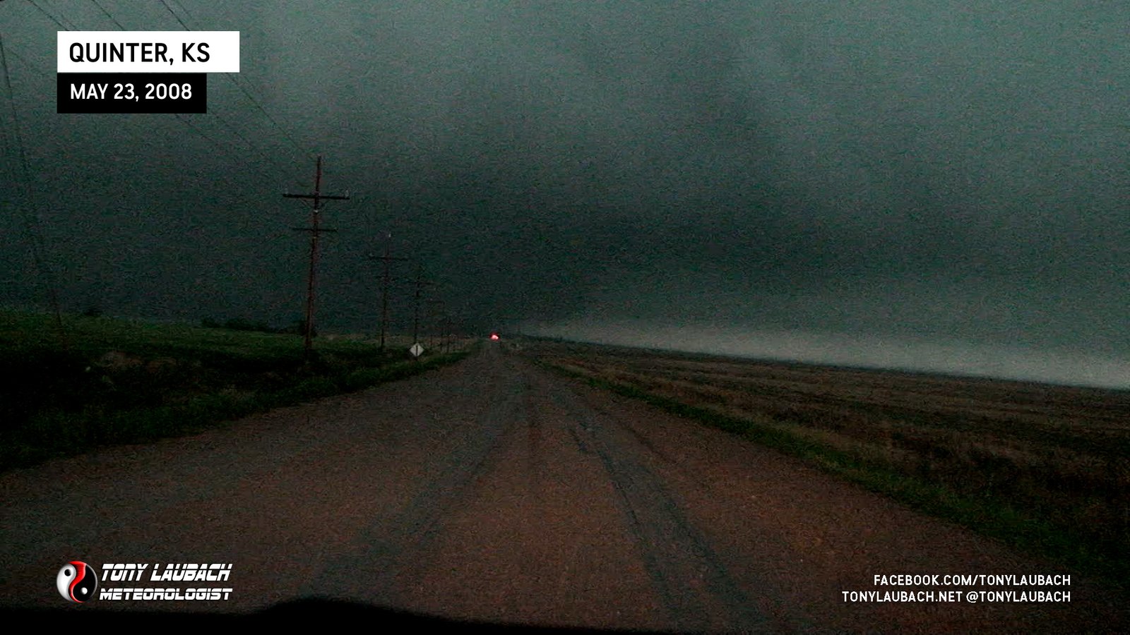
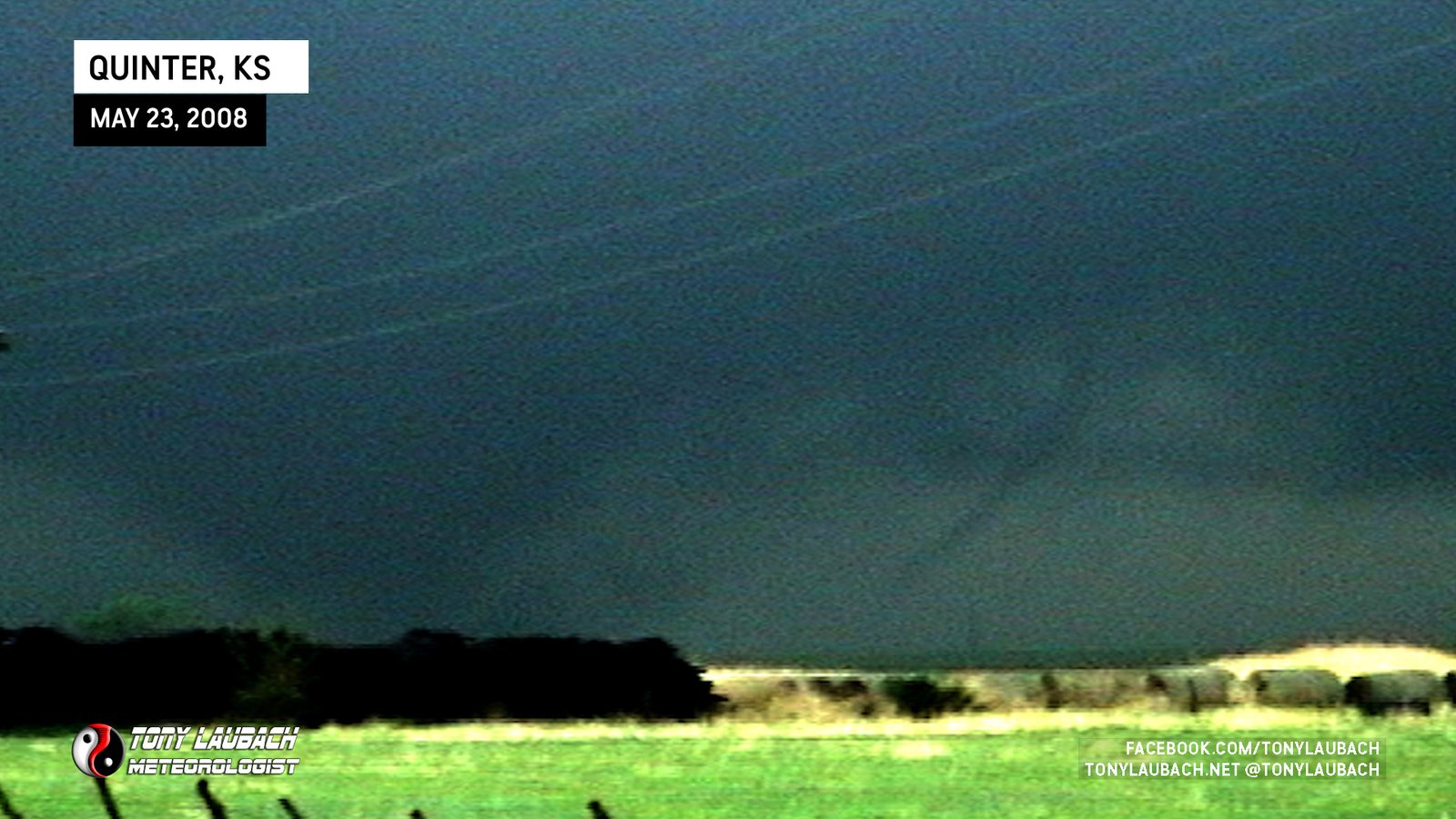
Large tornado viewed from south of Quinter (first Quinter), dissipated rapidly before reaching I-70.
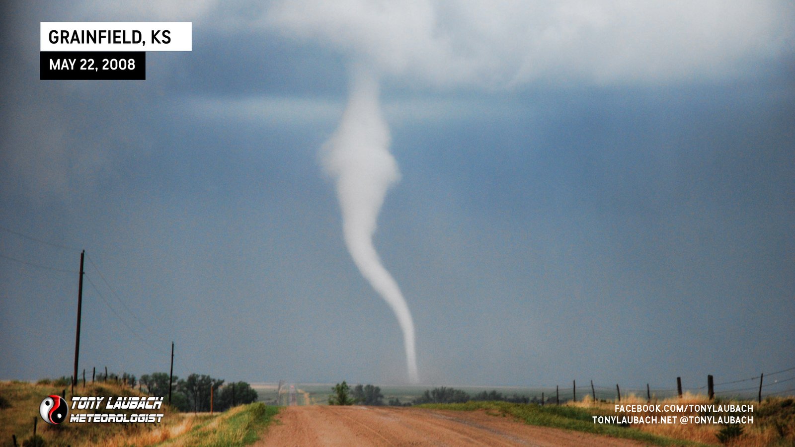
Caught tornado as it formed, then slid into ditch where we watched from til it moved out of sight. Eventually drove ourselves out.
Brief touchdown over Broken Bow Lake; mmesonet vehicles recorded slight (~4mb) pressure drop as meso passed over us on US-259. No imagery.
Brief tornado spins up shortly after first tornado lifts.
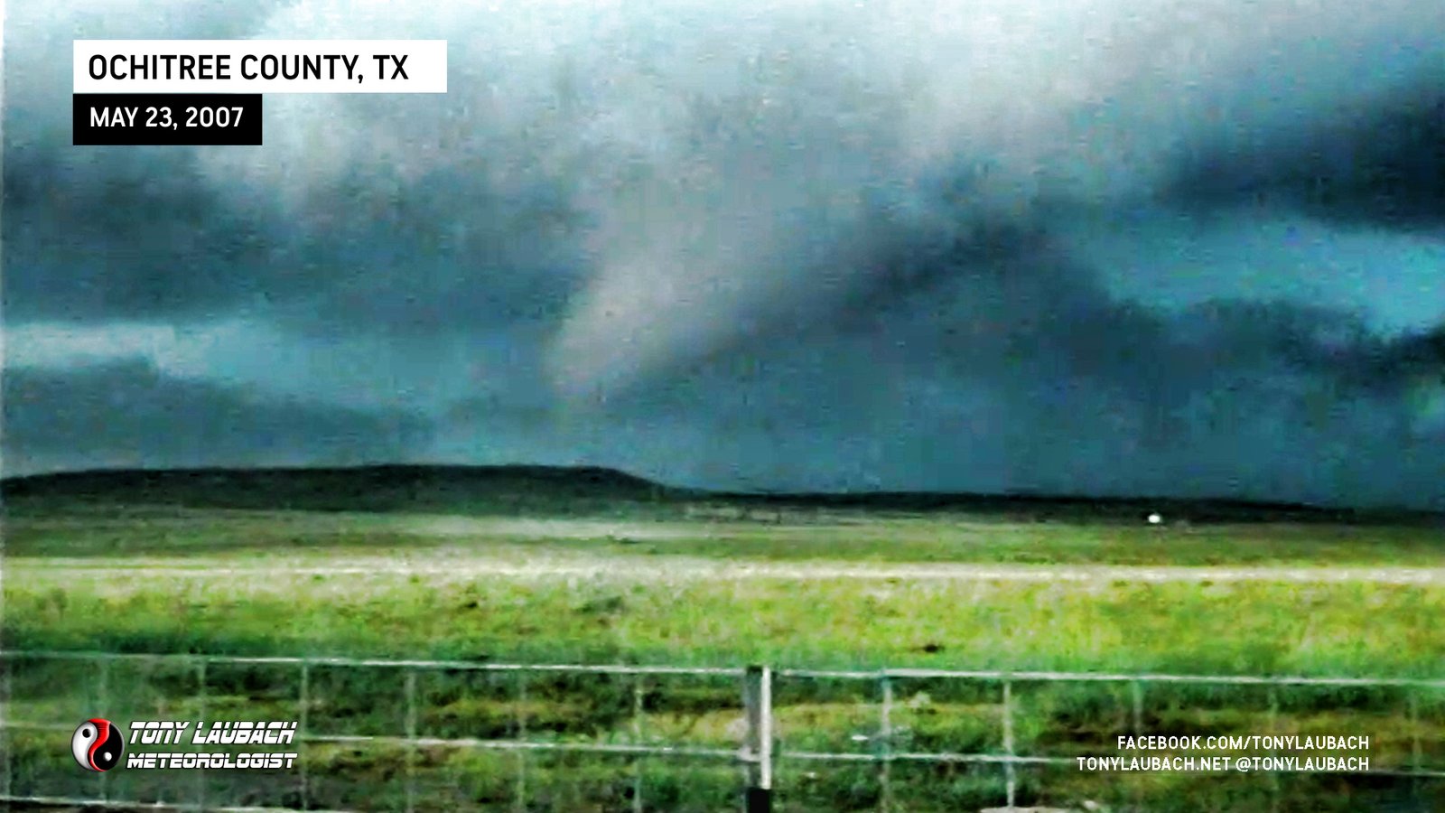
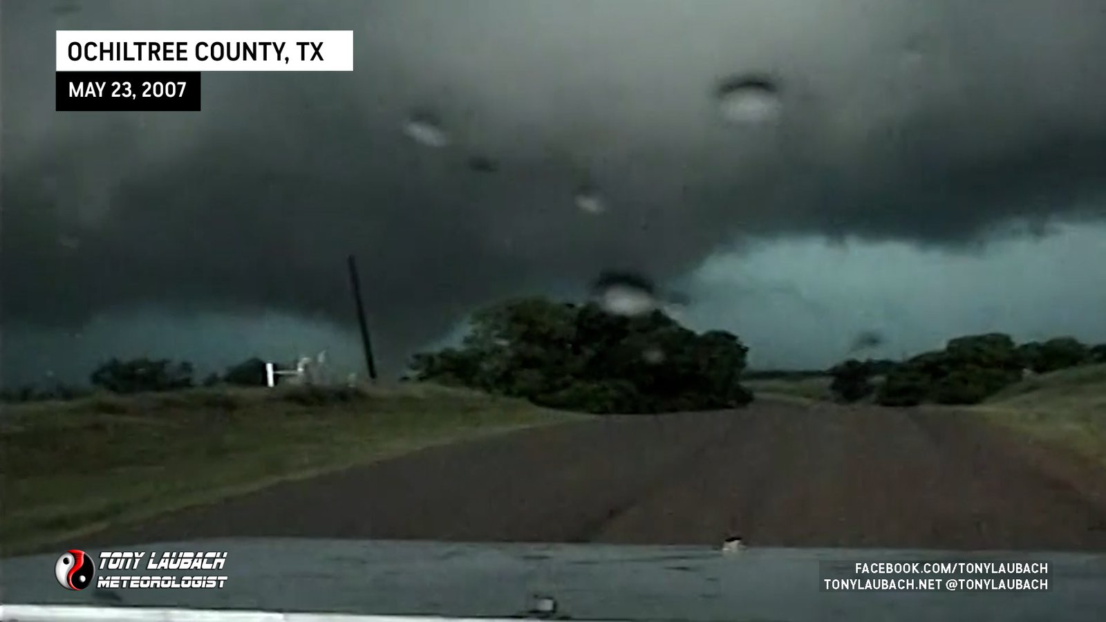
Surprise tornado while sitting with Tim south of Perryton, the first of two in this area.
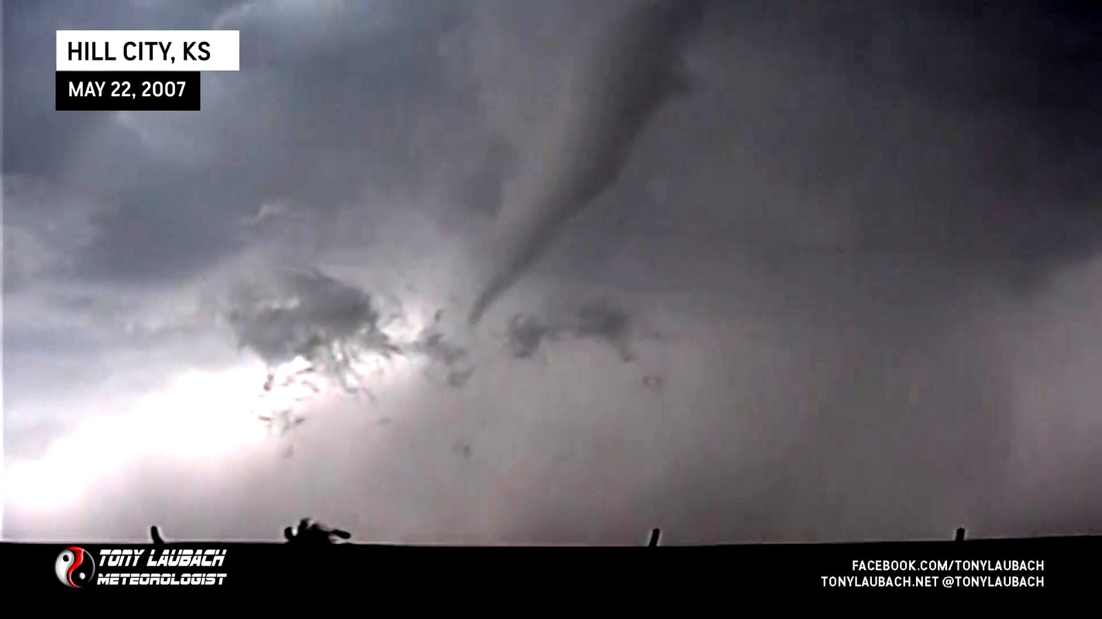
Intercepted a slow-moving tornado near Hill City riding shotgun with Tim Samaras.

Brief touchdown after probe deployment southwest of Nickerson, Kansas.
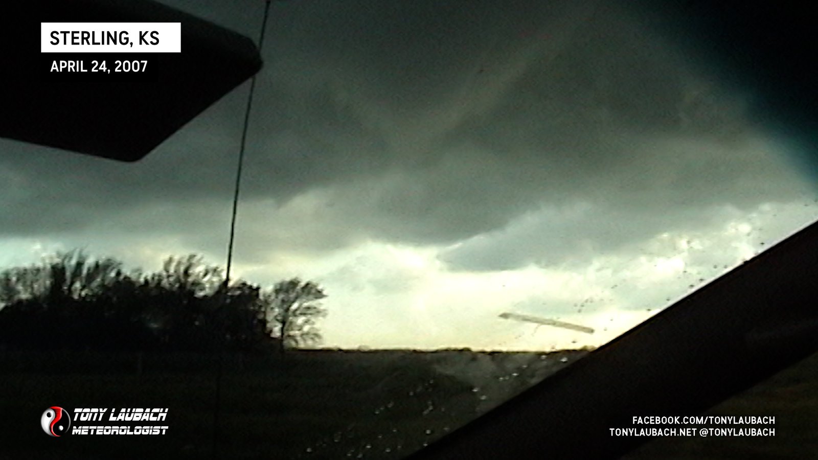
Brief spin-up north of Charters Corner near Sterling, Kansas.

The first tornado I saw with Tim Samaras, a narrow needle-nado viewed from the south along US-160