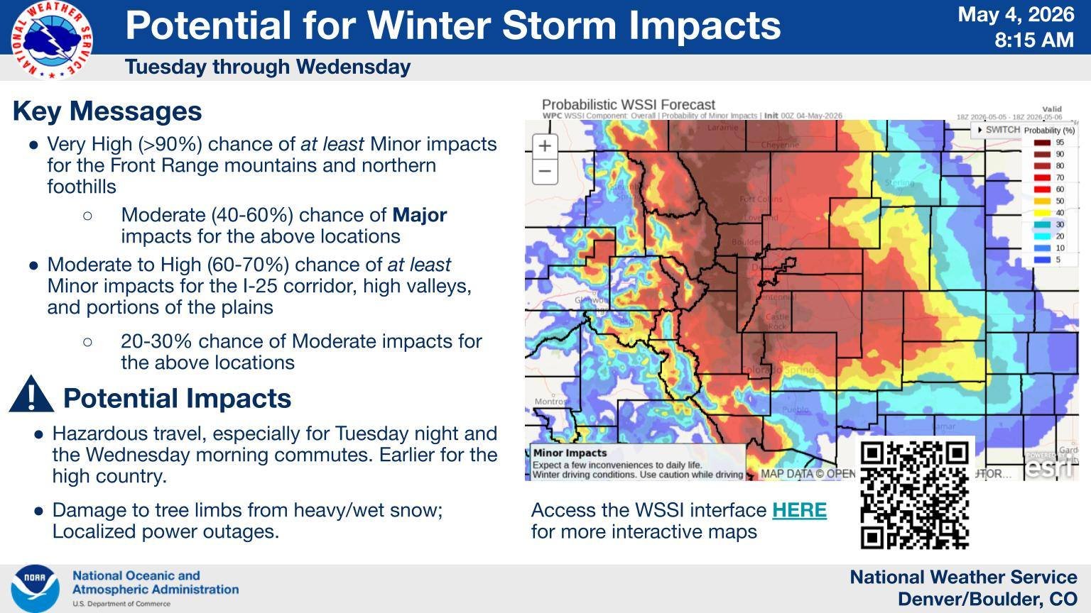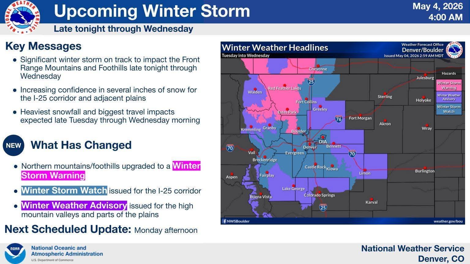
Snowstorm potential increasing as we near the event. Plenty of questions remain, with the biggest being how much snow falls along the Front Range and Plains. But everything seems to be coming together for an impactful snow event for northern Colorado starting Tuesday.
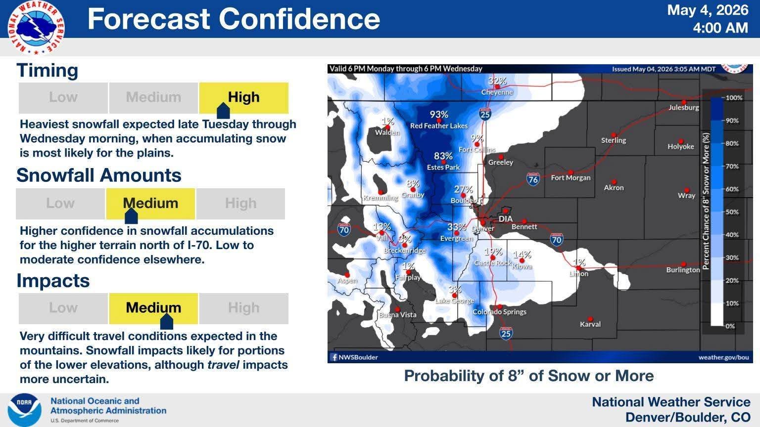
Mountains and Foothills oughta do very well, some locations at higher elevations picking up 2’+; foothills locations should come in near a foot in a lot of places. For lower elevations, Front Range and Plains, a lot of variables remains unknown which will impact snow totals. Many high-rez models cool us down quick on Tuesday, with changeover from cold rain to snow happening late afternoon; that would help increase our numbers a bit. The going consensus, and the one I am buying into, would have me think mostly rain all day, with the changeover happening after 7p Tuesday and snowing into Wednesday morning. How long it takes for that snow to start sticking and piling up will also factor into totals. Warm ground temps will likely delay any accumulation in the first hours of snowfall, but depending how heavy and quickly things cool, that could happen sooner or later. So yes, it’s possible it snows 10″, but only 6″ may accumulate. News stations, Social Mets, and various sources have a wide range of accumulation maps out there, so it’s a bit confusing for the normal person to really get a grasp on what is to come.
What is HIGHLY certain is the moisture; whether it falls as all rain, a mix, or mostly snow, lower elevations in northern Colorado look to do very well moisture-wise, which is the underlying important part of this storm. That’s gonna be a VERY nice dent in this ongoing drought. One I think will go a long ways into improving, or at least stalling out, the worsening conditions we have here. Hopefully this will be the first in a few solid moisture-heavy storm systems in the coming weeks.
My thoughts on the snow… well, it wouldn’t surprise me at all to see double digit totals along the Front Range west of I-25, including in the western suburbs of Denver. I think the airport, official location, will likely be in the 3-6″ range, with higher ceilings approaching 10″. As I mentioned in the previous entry, the largest snow for Denver came back in March with 8.5″; so while I don’t think we’ll hit that mark, it is certainly well within the realm of possibility we could, thus making this MAY snow event the highest of the season. The May snow event we had on the 20th back in 2022 yielded about 6″+ in the western burbs, with Denver officially logging 2.3″ inches, which I feel very confident will be exceeded this go around. I’ll be stationed in northwest Denver for this event as this looks to be a northern hit for the Front Range, but I will float around as needed.