
Wednesday is >95% for chasing… I remain in Columbia as I just decided to keep things simple as opposed to packing, moving, and unpacking; just keep my room and hang out. Maybe, just maybe I will lean my way east tomorrow, but given all I have seen, just about any target for Wednesday is easily well within range of here, so I may keep my home here and depart Wednesday morning.
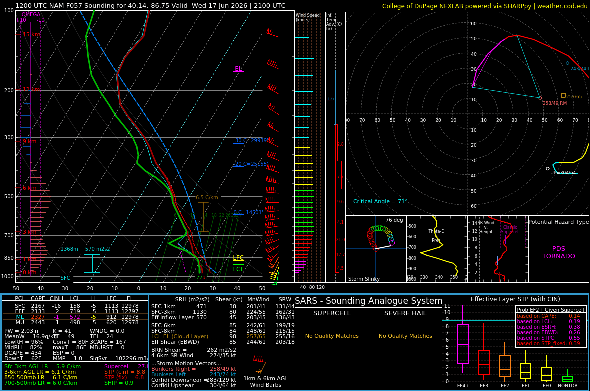
That being said, I am less than 20% for Tuesday, which continues to shift further north and east, and not looking great to begin with, so it was a long shot for me to do it, but grows longer as the drive to do so gets longer. Wednesday will likely be the sole day of this trip, and it certainly has all the earmarks of a significant severe weather day. March dynamics combined with June instability. On paper, it’s big. Just look at the sounding I pulled off the 12z NAM for central Indiana northwest of Indianapolis; likely very embellished by the model, but that’s some damn big numbers and a hodograph that can’t even stay on the page.
The big question remains, what is the storm mode? That’s gonna make the difference between tornadoes and damaging winds with embedded tornadoes. Still, the T-word is going to be a factor, just really depends on storm mode to determine how many and of what severity. This will be a widespread, impactful system regardless, likely stretching as far back as Kansas all the way into Indiana and Ohio. Storms will be moving to, you don’t get slow storm speeds out of March dynamics.
So yeah, all on track to be out Wednesday… will probably start to hone in on exactly where through the day tomorrow, and I’ll decide if I need to lean east tomorrow at all. So stay tuned.
Further out, just for mention, maybe back to some lower, yet worthy high plains setups into the weekend so something to keep tabs on as I return west after Wednesday.