
If I had a dollar for each time a chase began with ‘I am just going to run out to grab some lightning shots’ and suddenly turned into an epic story, I would be a very rich man. At least this time, I put on pants. By that, I mean I was already settled in at home for the night, freshly happy and fat after some homemade pizza and was in my PJs with zero, absolutely NO intention to even think about going out. But, when Ma-Nature wants to perform, she gonna do it whether you dressed for it or not.
So just after 10pm, storms began to fire across the area. A couple cells along a line extending northeast out of Greeley, plus a cell in the foothills west of Longmont, which appeared to be on the same line, got me off the couch, into some real clothes, and grabbing a couple cameras and my Bolt Hunter to head out. Typically in a situation like this, I would basically drive a couple miles to one of several overlook areas near my house, but a gut feeling plus the caffeine of a 7pm Doctor Pepper had me decide to put some actual effort and miles into the cause and I aimed myself for Eaton, north of Greeley, which set me up right on the eastern edge of this line and kept me in solid position should this line fill in. Despite the lack of intention behind heading out, there was some hints that storms MAY fire later and linger, so I wanted to not go the lazy route in case that did indeed become the case.
So off I went, heading up to Greeley, then north on US-85 to one of goto spots south of Eaton, close to the main highway, clean, flat view looking north over the town of Eaton, and a safe, easy pull-off with plenty of room to park and set up shop. I got there, storms were kind meh. The flashing was nearly constant, but nothing bolt-wise to show for it. I set up a camera, just in case one freak bolt would come out, but I knew it was a patience thing. Fortunately that 7pm Doctor Pepper was in my system, so the urge to be in bed wasn’t there, thus I waited it out.
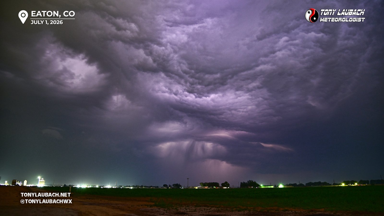
I don’t recall how long I was sitting here, maybe 20-30 minutes? But radar had showed the storm I was shooting drifting away to my northeast, and for a time, not showing too much behind it. A couple cells to the west, and I could see those flashes, but nothing that was overly impressive… yet…
But it was like Ma-Nature flipped a switch, and suddenly this invisible initiation line started to fill in, and what storms there were started to quickly intensify. This was visually evident initially by a much more constant stream of intra-cloud flashes, which then began to yield some cloud-to-cloud strikes, and occasionally a couple CGs. I started to ‘feel it, I recall saying that out loud a couple times, I just knew something incredible was fixing to happen.
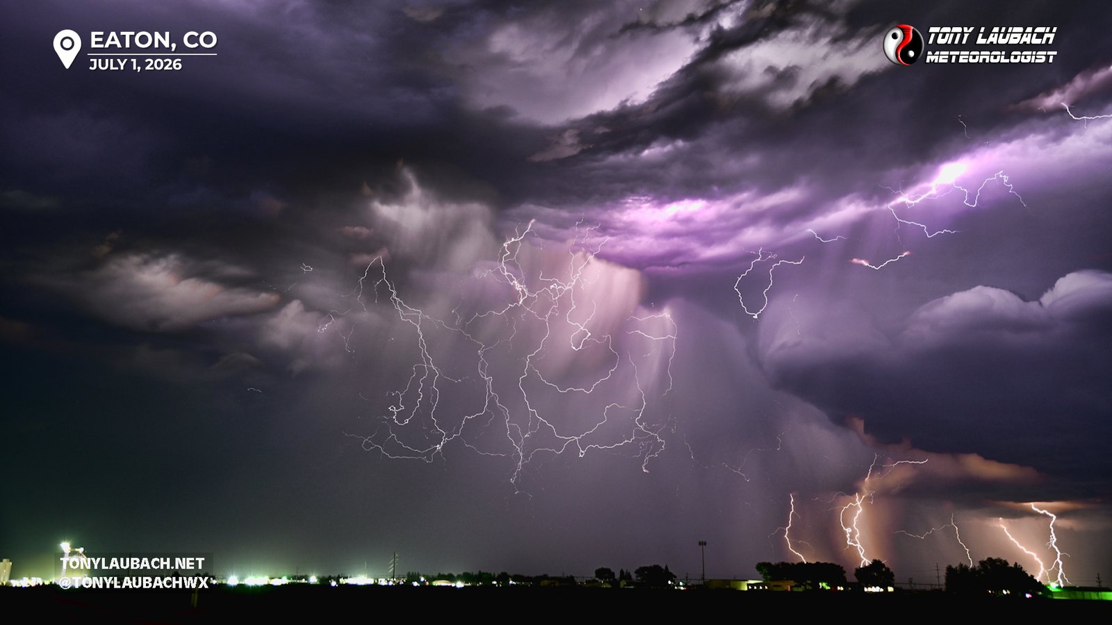
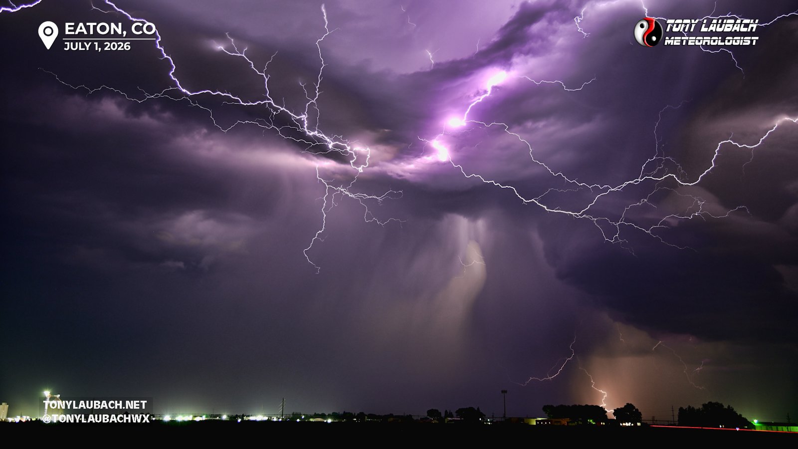
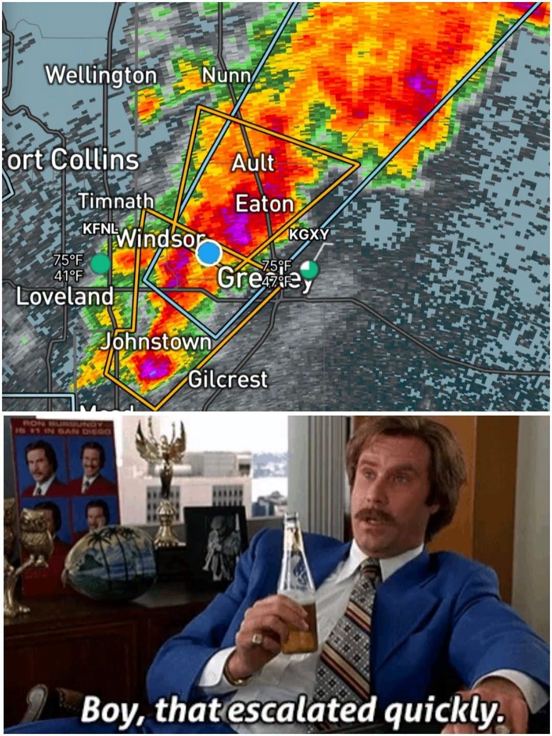
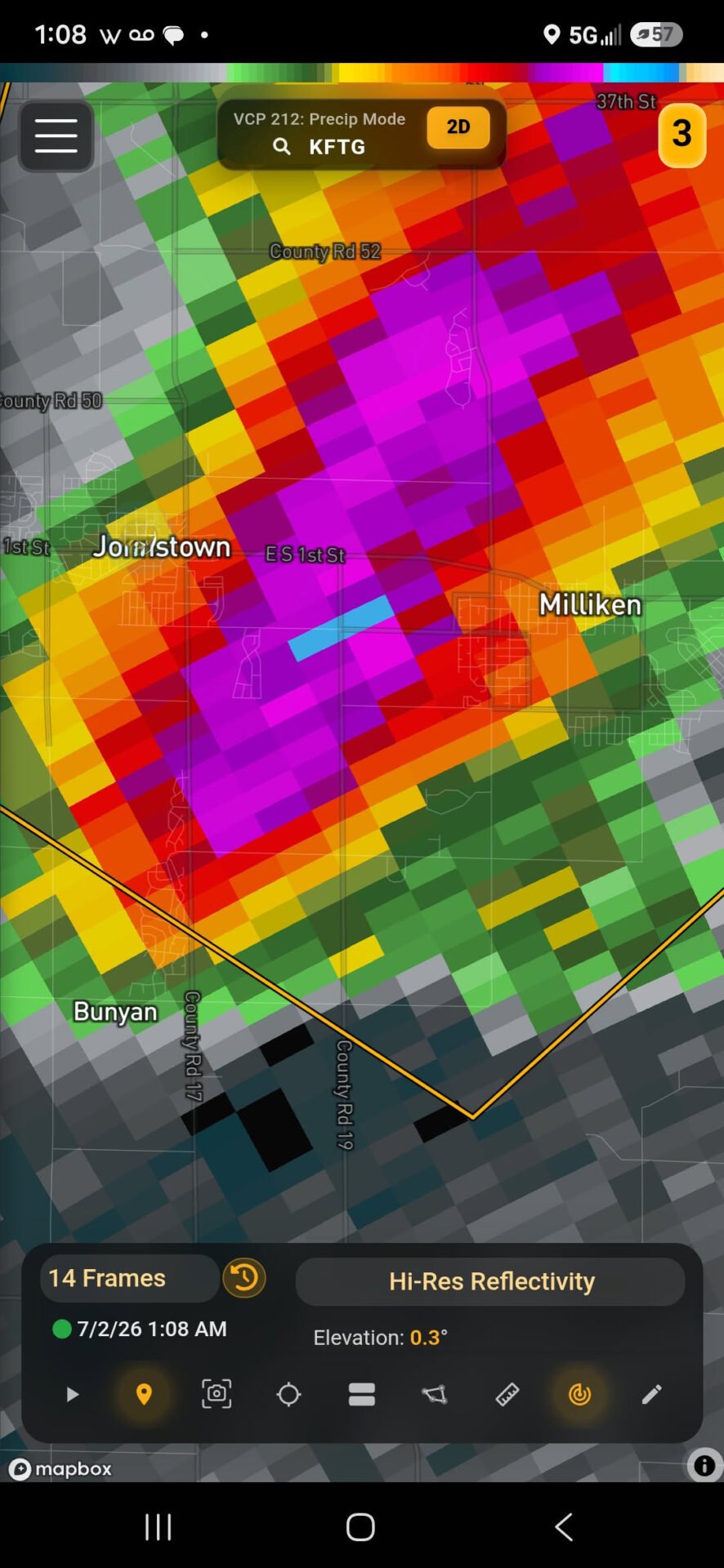
It was almost getting ridiculous… ALMOST… but a “problem” (yes, air quotes) quickly emerged. What was a very broken up, well spaced line of sub-severe storms had thickened up, and while not yet severe, you knew it was coming. Reflectivity began to show hail within the line extending southwest to northeast, and what was becoming on occasional big drop of rain began to steady up as the line filled in quickly a mile or so off to my west. With the cores themselves kinda moving northeast along the line, and the line itself barely moving slightly east, I figured my play was to try and cut through the line and get on the west side of it, which would keep me out of the rain, and with the slow push east, probably allow for a lengthy shoot. But, I needed to do that quickly, cause otherwise the hail was going to be a factor. So I loaded up, tossed everything in the trunk, and dropped a mile south to CO-392. As I got to the intersection and turned west, I got the severe storm warning alert. Fortunately, I was on the north side of the bigger core, but still managed to encounter some half-inch hail on my drive west.
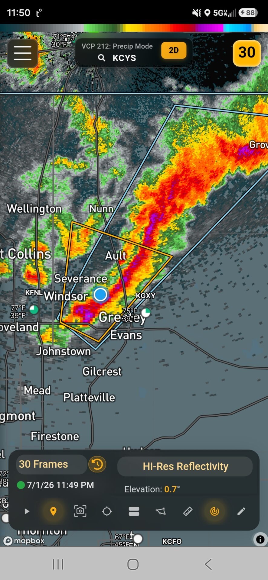
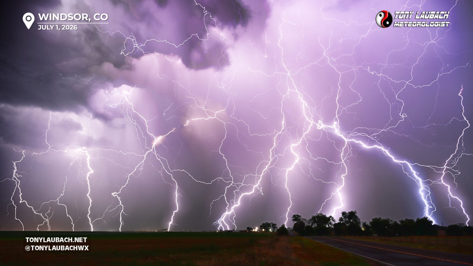
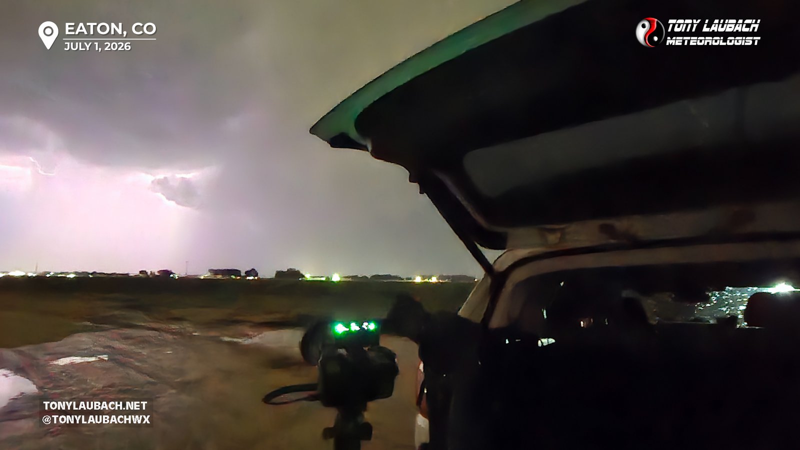
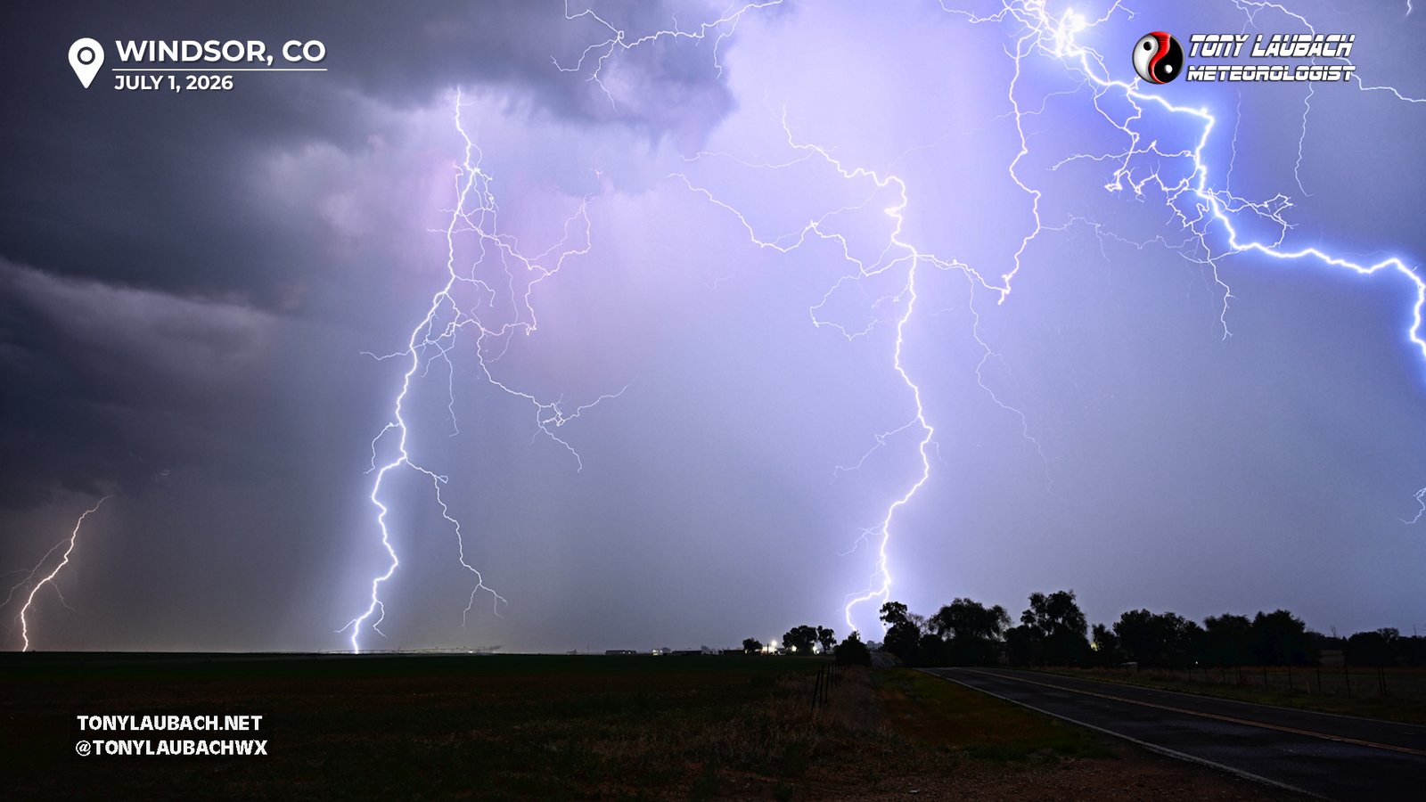
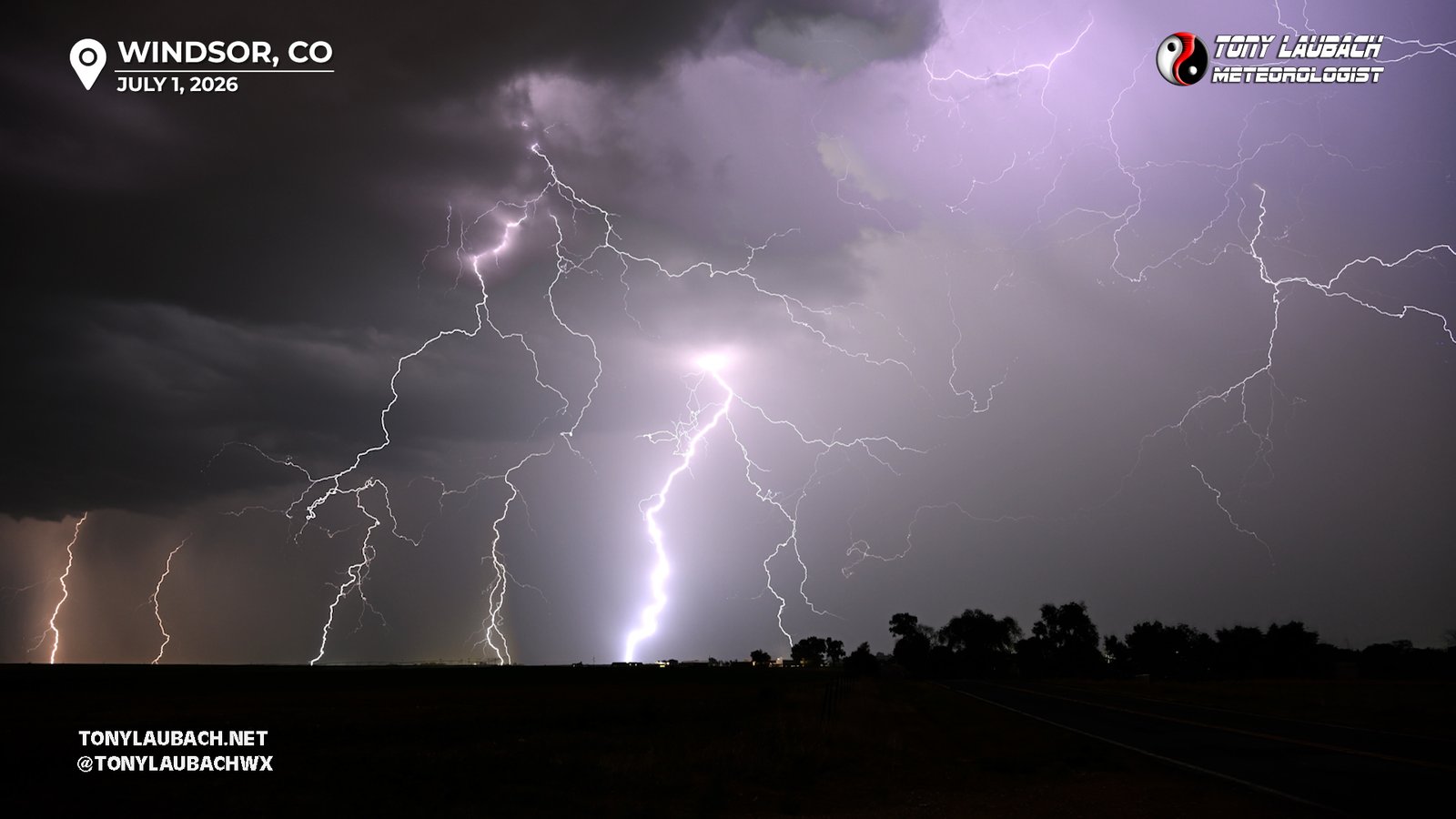
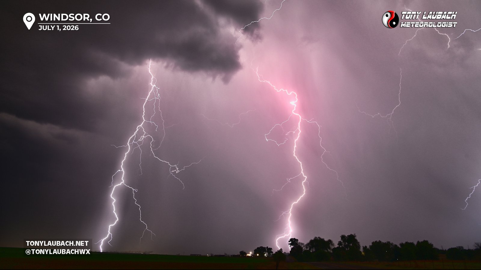
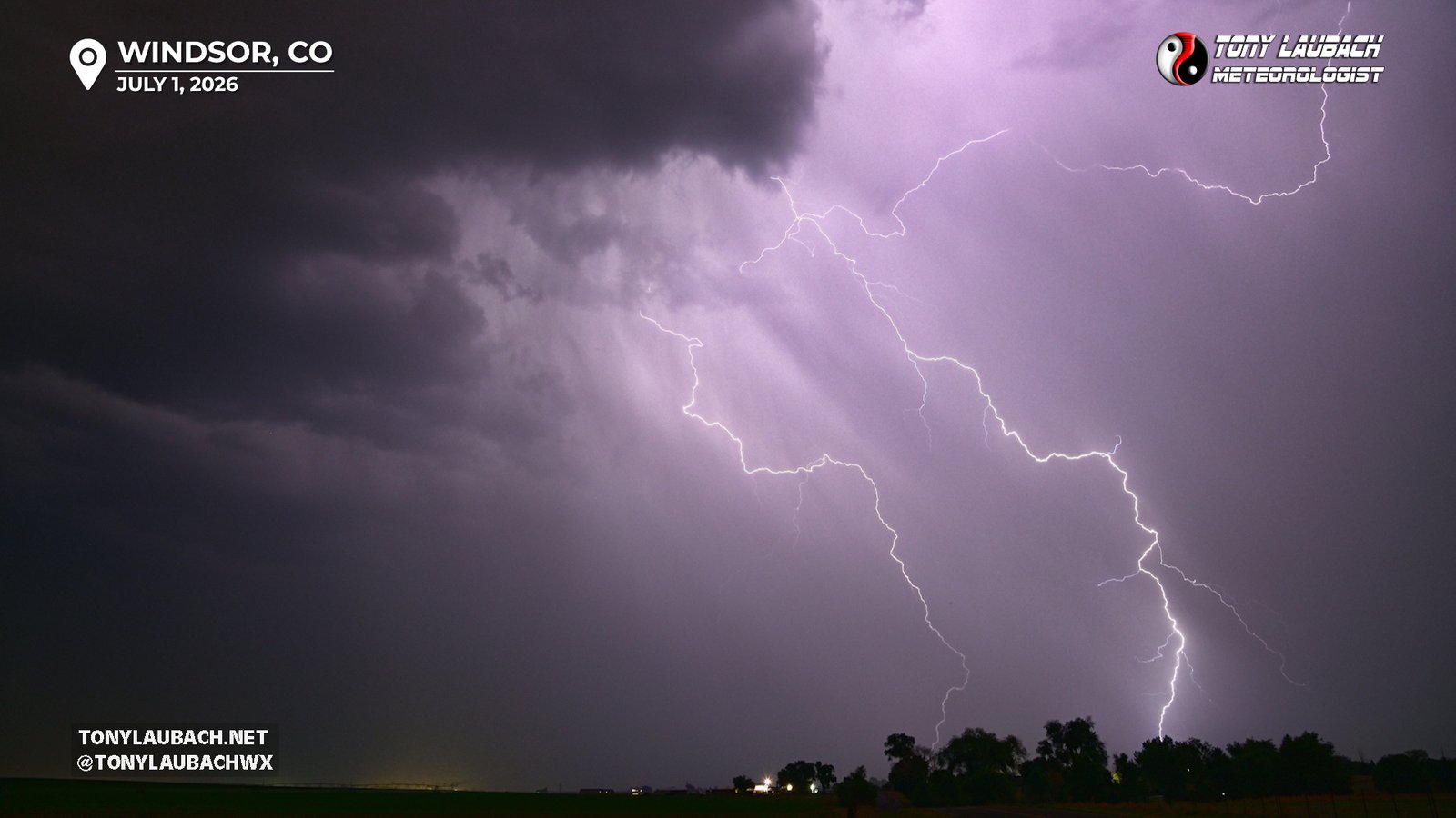
My plan was simple, clear the precip on the west side of the line and set up about a mile or so from when I hit clearing. Radar indicated Windsor was in the clean air, so I just felt like I only needed to get to the CO-257 intersection on the east side of Windsor. I would head north from there a mile or so and find a clear spot looking back to the east. On my trip through the core, I could see the vivid lightning strikes ahead of me, so I was VERY eager to get set up, knowing I probably was going to be well served. With not much fanfare, I made it to CO-257, turned north, went up and around the neighborhood and set up about a half-mile east on Weld County Road 70. And it was about to go down just as I thought…

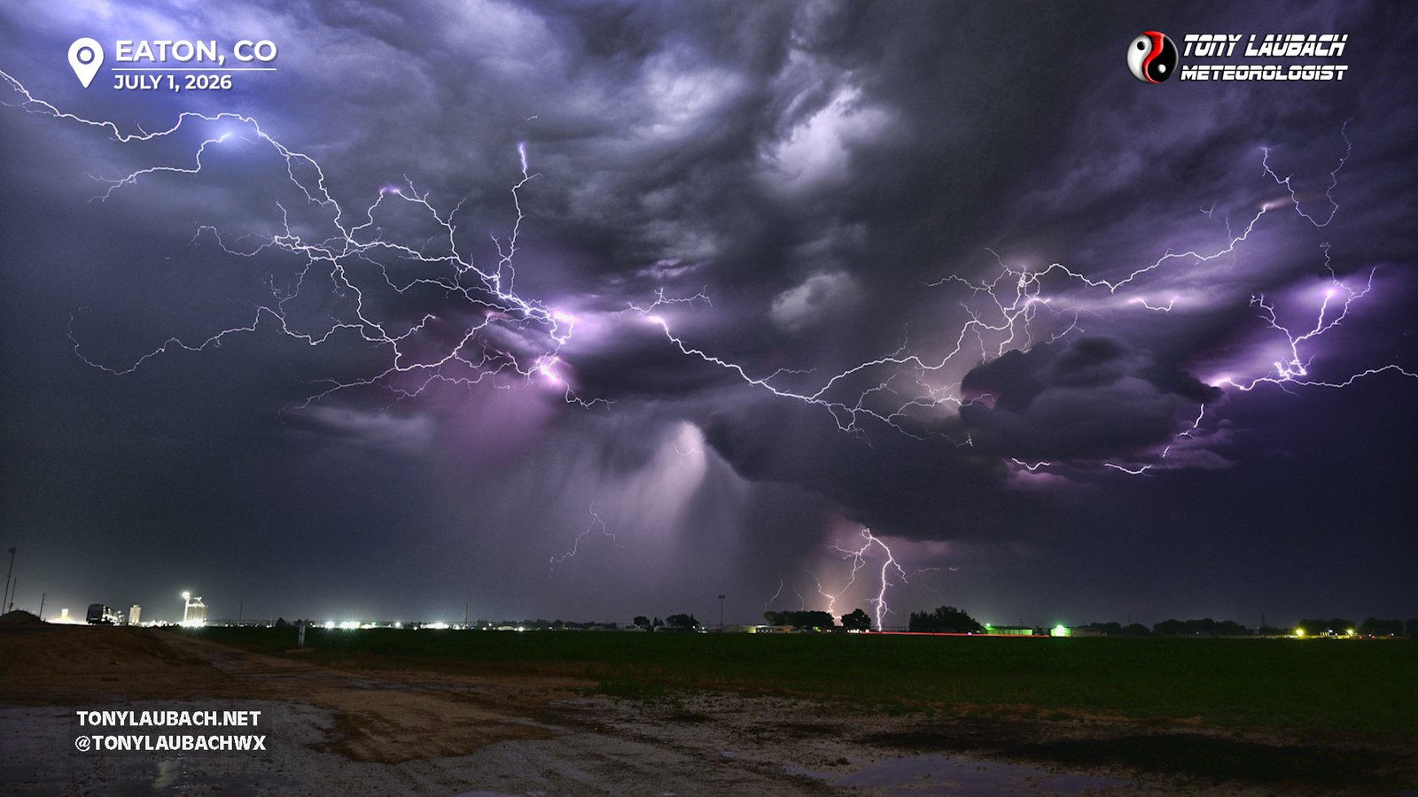
Literally every frame had a bolt in it; to the point where I had to step down the exposure time to account for it. The longer exposures were blowing out because of all the lightning, so I was well set to setup for stacking these images. Using 10 second-exposures at 24mm on both cameras, and stepping the f/stop up a few numbers, I was able to capture some incredible stacks. There was no need to even remotely zoom in, and even at 24mm, I missed some strikes. Even some of the solo shots turned out fantastic!
Unfortunately, my window here was much shorter than Eaton. And again, with some ‘air quotes’, a problem was developing to my south. While the main line continued to severe away to my east, it was getting fatter as my memory cards were getting fatter. And new cells, quickly hitting severe criteria, were developing rapidly to my south. My window was closing in the form of approaching rain and hail. And I had a choice, get BACK to the east and try and get in front; shoot further west, aiming for I-25 and points west to continue shooting, or what I ultimately ended up doing, and shifting my focus a bit, particularly since the southern edge of the line with the strongest core was now dangerous close to my house. While I told myself out loud I was still focused on lightning, I knew with the southern choice, I probably was going to be in nighttime hail mode. Once again, what started as simply going out to shoot lightning was about to escalate into ‘this is going be a night to remember’ territory.
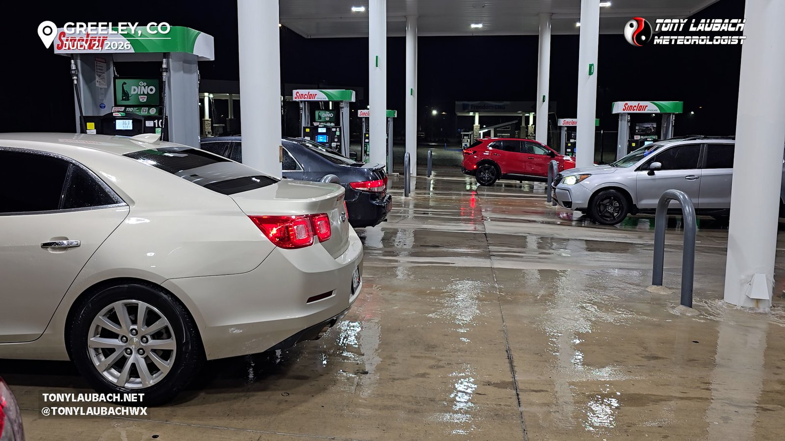
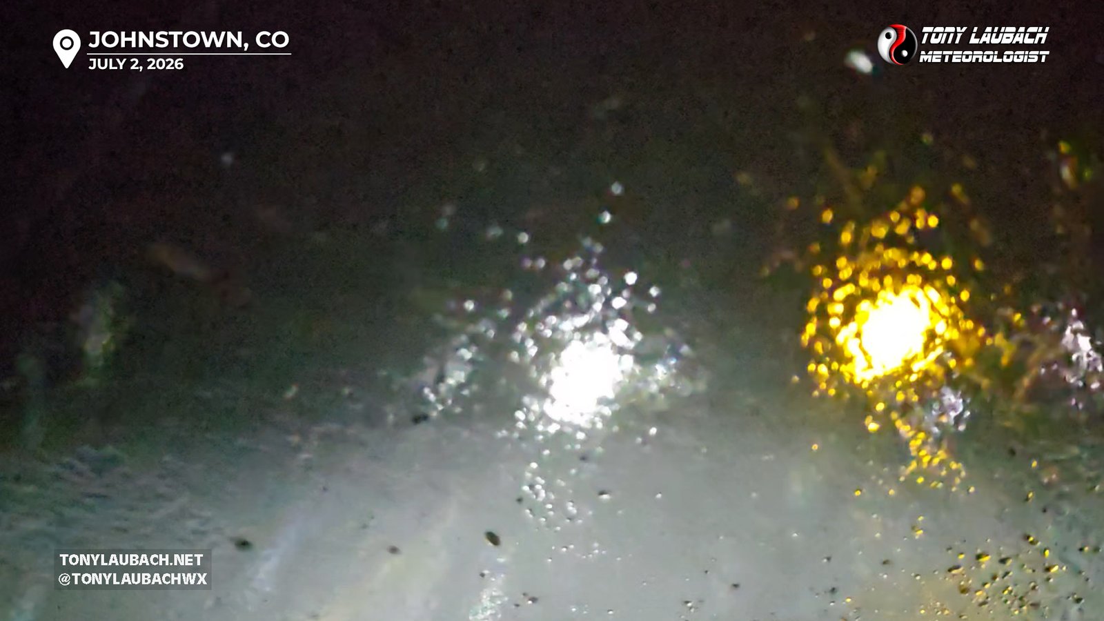
Johnstown was going to be the target, and lightning as the main goal finally left the brain. I got down to Business-34, then cut over to CO-257, which did get me into some sub-severe, but heavy hail and rain. I stopped to shoot a few news clips of folks who took cover at the gas station there at the main junction, then proceeded to continue south to Highway 60.
Fortunately for ME, the worst of the core was west of my house over toward Johnstown, so I cut over that way, and immediately was welcomed by the storm. Heavy rain and hail were hammering Johnstown, but nothing ‘severe’ in the hail department, mostly rain with plenty of smaller hail. It looked like the storm as a whole was TRYING to weaken a bit, as most of the heavier stuff seemed to be on the very tail-end of the line just south of Johnstown, but didn’t looked terribly impressive.
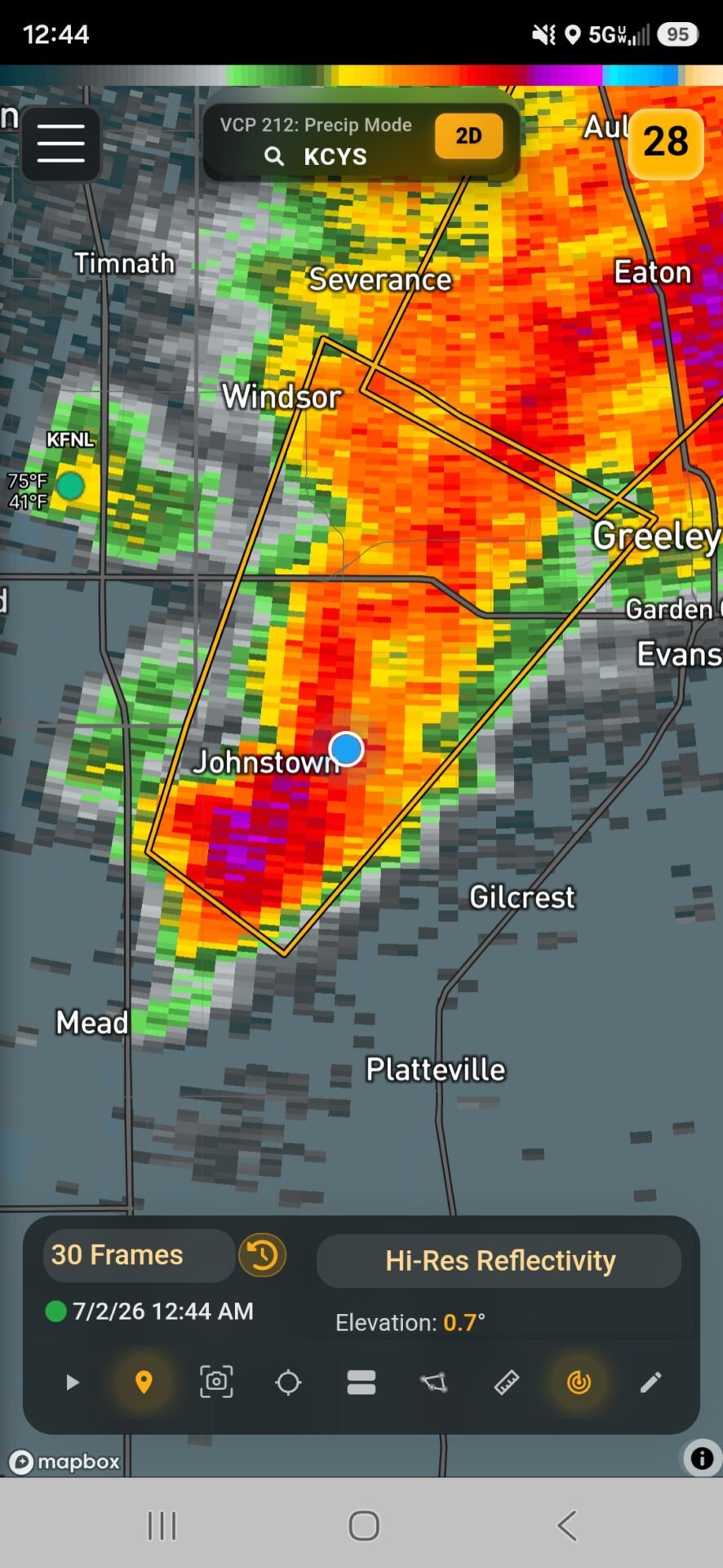
But this storm was only taking a breath, a very strong core was gathering, setting up over Highway 60 between Johnstown and Milliken, and again, seemed to be slowly pushing east. Given that, I was concerned my house was going to see some action, so I hopped back on my horse, shot through the strengthening core which was now filled with torrential rain and larger, albeit somewhat softer hail. I had to pull over a couple of times because it was so heavy, I couldn’t see the road in front of me, but eventually, after turning what is normally a 3-minute drive into about 10 minutes, I got to the east side of the core.
I finally fought my way through, getting into town with the rain easing, and the hail smaller, and lighter, but a bit more hard. With the storm ‘moving’ so slow, I knew I had time to get some hail here in downtown before it would get to my house, so that was my plan. With radar showing the core strengthening, I started to get concerned about the hail size getting a little ambitious, so I took to a bank ATM to cover up as the hail encroached on town. Another vehicle, presumably a local who didn’t have access to a garage, pulled in with me and we rode out the sub-severe, but heavy dose of hail coming out of the east side of the core.
Oddly, the core kinda started to retreat back to the east, the heavy hail subsided, and with only a few pennies left, I moved out of my cover and ran myself home. I’m not honestly sure why I did this? I was so close, maybe I needed to go to the bathroom? Maybe I remembered I literally left my wallet in my other pants? I pulled into the garage, thinking maybe the storm was still coming? But I was home all of like two minutes. And no, I didn’t go to the bathroom, no I still I didn’t grab my wallet… I literally walked inside to my office, turned around, and walked back outside to the car and hopped back in. The core, which was still raging, was just sitting between the two towns, oscillating gently between the two. Areas of Johnstown-proper on the south side were definitely taking a beating, but for the most part, this was a Highway 60 problem.
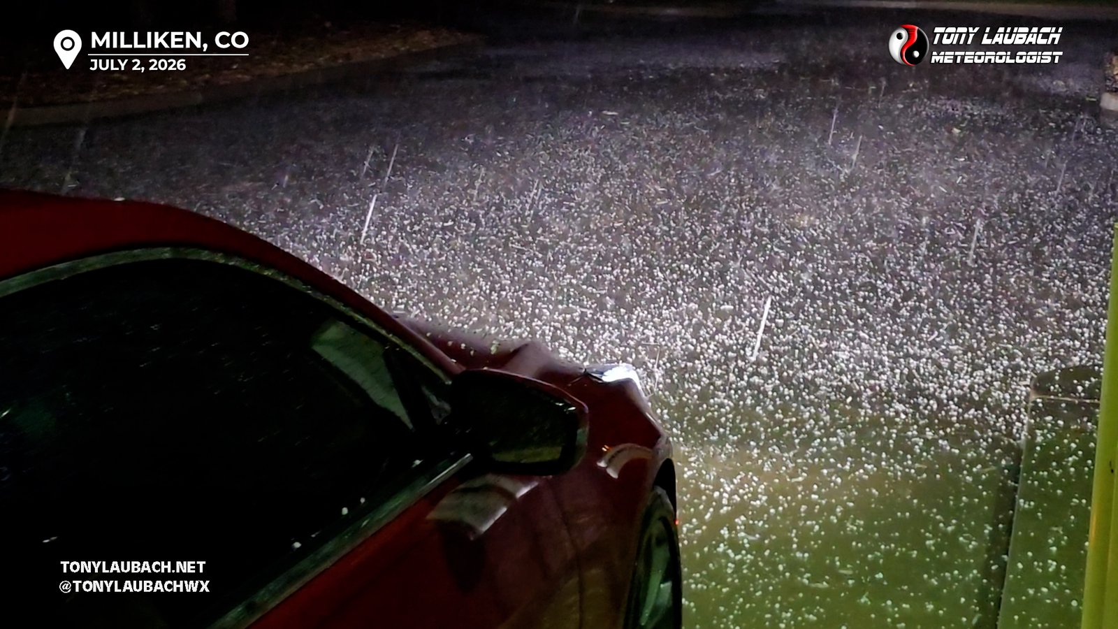
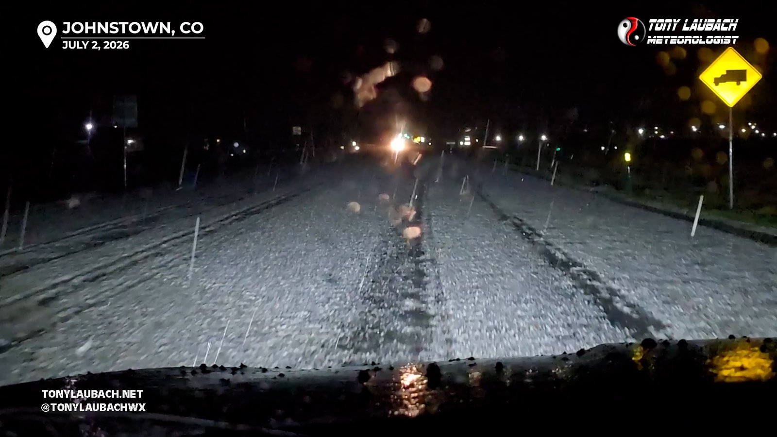
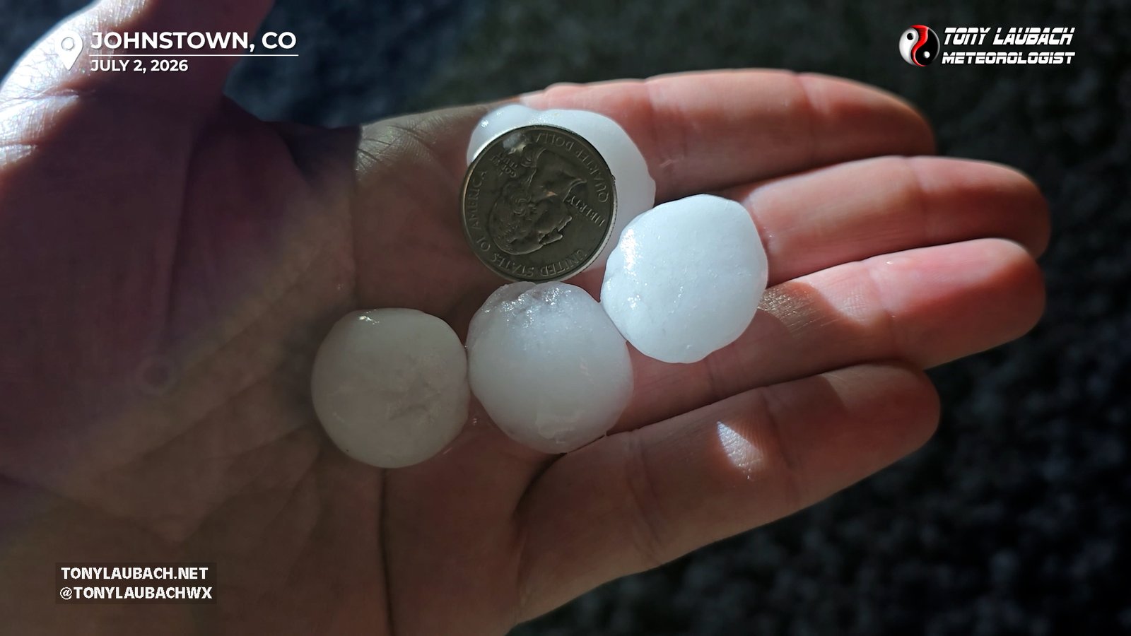
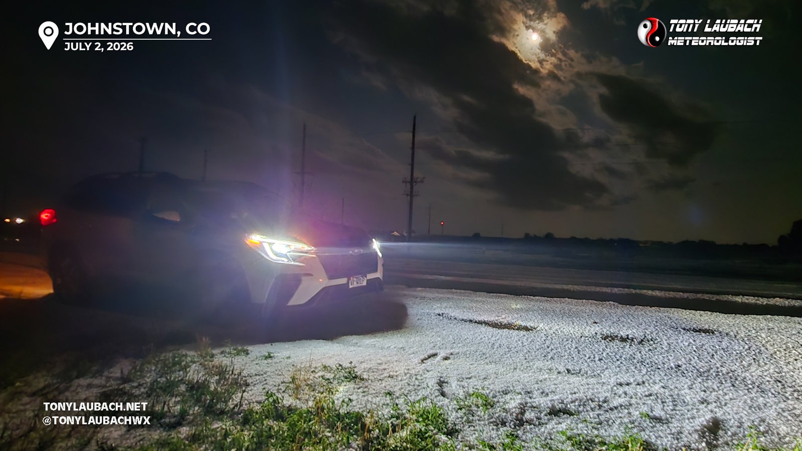
Highway 60 was a MUCH different scene now; the duration this core was sitting over the highway had dramatically altered the drive I had coming out a handful of minutes prior. It was now a snowstorm of hail, several inches of accumulation and the stones were now much more solid, and measured to 1.25″. We had a full blown hailer on our hands.
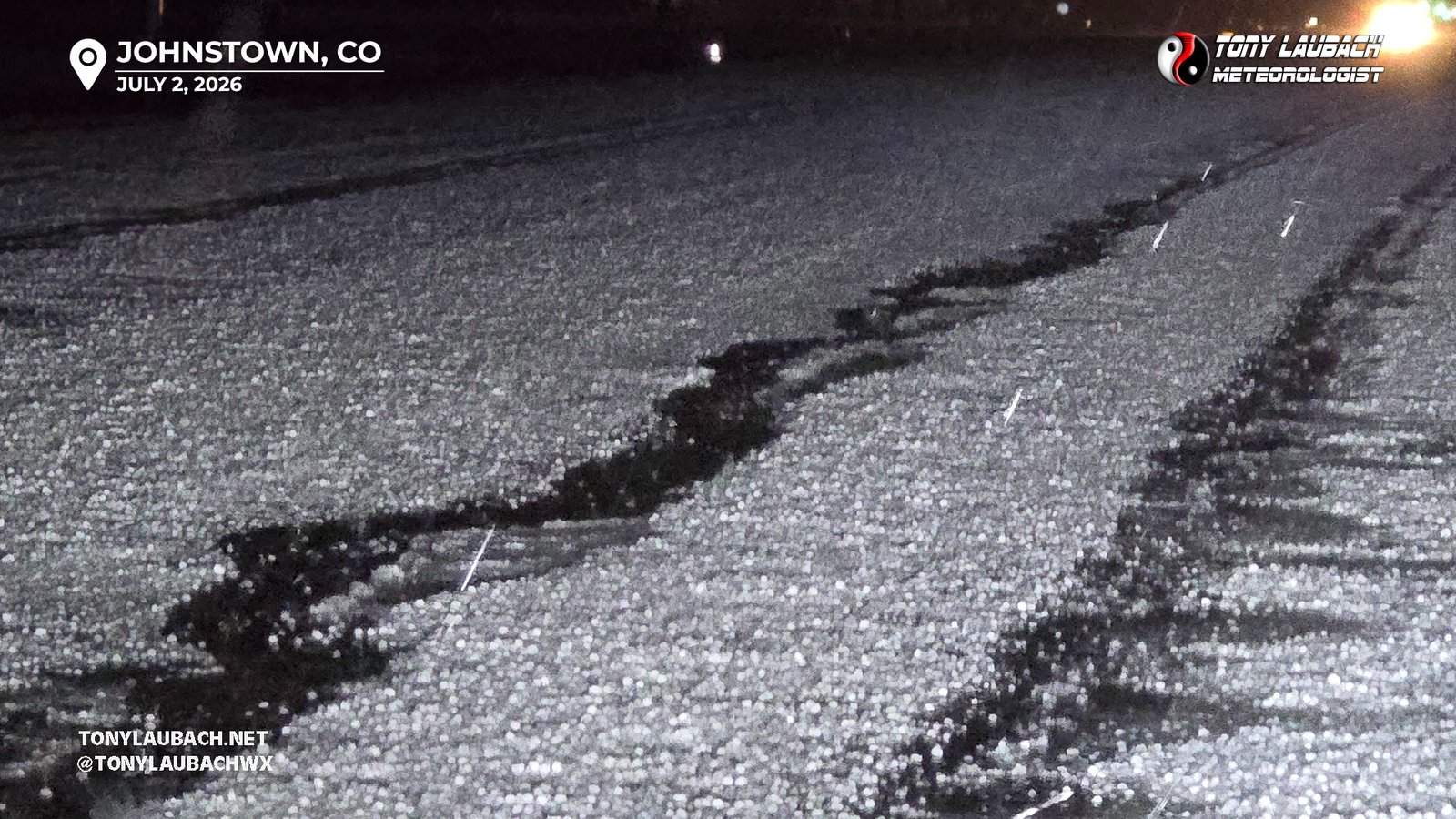
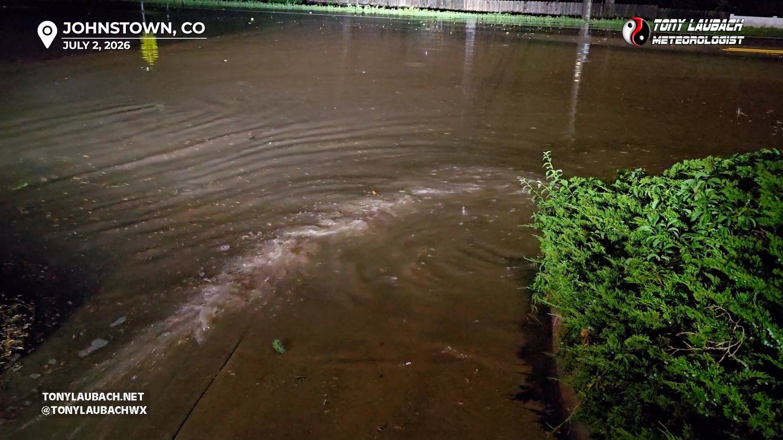
Obviously stopping several times to shoot video along the way, but the wierd behavior of this storm continued. The oscillation of the core, plus is pulses of strengthening and weakening, kept slightly shifting where the heaviest part would set up. A weakening of the core between me and downtown Johnstown allowed me to get back to the west into town and avoid the larger hail (which was being confirmed on social media by Johnstown residents posting shots of stones approaching golfball size). By now, the NWS had added a Flash Flood Warning to the Severe Thunderstorm Warning, and while not terrible in town, a few of the streets did have some water over them. Nothing impassable, and in most cases, usually only covered a larger portion of the road, but was definitely several inches deep of water.
As 2am neared, the storm FINALLY started to relent, the heavier parts of the core finally drifted north of the highway, and the storm was beginning to quickly weaken. I returned east on the highway to document the hail-coverage over the road, which was about a mile stretch from just east of downtown Johnstown to about am mile west of CO-257.
I wrapped up my evening chatting with a local Sherriff who was hanging around the area assisting any drivers that may’ve had some issues navigating the hail coverage and flooded roads that were definitely more problematic off the highway, where many were impassable due to high water. With the clock passed 2am, the storms finally weakening below severe levels, I decided my epic night was finally over. I had no real intention to transverse the back county roads in the middle of the night searching for flooding, but did take the back way home where I came across formerly flooded areas on the Milliken side of the storm. I rolled home right around 2:30am, and spent the next couple hours editing video for work and prepping photos for processing, finally crashing out about 5am. A funny note, as much as I wanted to sleep-in late (and was able thanks to technically being off from work), a couple Mormon girls came knocking on the door, waking me up to ask if I wanted to talk about Jesus (not making that up). Like no thanks, we had a thing last night, but thank you.
When I talk about why I love living in Colorado, it’s these types of events. Evenings like this are exactly why… so many of these types of stories began with “I was in my PJs”, and next thing I know, something crazy was happening. This may not quite have been on the level as the second costliest hailstorm in Denver history back in 2024 or the infamous Wheat Ridge storm of July 2009 where I literally was out til sun-up documenting damage (yes, in pajamas), but in terms of lightning, this ranks among the top. Certainly the hailer added a lot to it, but its rare when these things go down like this and the lightning was the best part.
Folks I ran into in the final weeks of my regular chasing season heard me say multiple times how a good lightning night was the one real thing missing from my season. And while I had a couple baby opportunities on the final couple chases, I hadn’t hit the level I wanted. Well, we can check that box off and formerly complete 2026 now; this night was nothing shy of epic. You’ve only seen a couple photos that this evening produced, there are nearly 700 frames between the two cameras, and I am sure I could add plenty more photos to the mix, but I at least got some of my early favorites. giddy doesn’t even begin to describe how the night felt, and I know it started to set in there south of Eaton when the storm started perking up, I just KNEW I was going to end the night happy, and boy oh boy even then did I grossly underestimate what was awaiting me in the hours ahead. And oh yeah, it turned into a storm chase, too! When I was done, I drove 7 minutes home, and it took that long cause I took the ‘scenic’ way back. Haha This was SORELY needed, I cannot state that enough, lightning has, and always will be, my absolute favorite thing to shoot, and when these opportunities go down, and I am able to get out and capture them, I will always feel like a kid on Christmas. Thank you to that 7pm Doctor Pepper for caffeinating me, unbeknownst to me what was coming later. And a pat on the back to me for NOT taking the lazy route and actually throwing a few miles to get into a good spot to shoot. I couldn’t be happier with the evening.