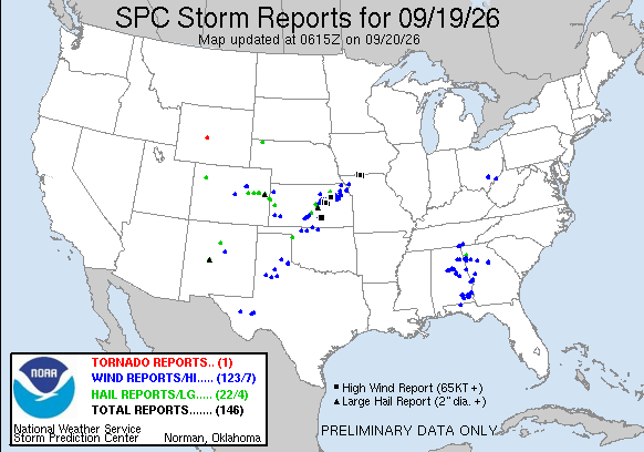

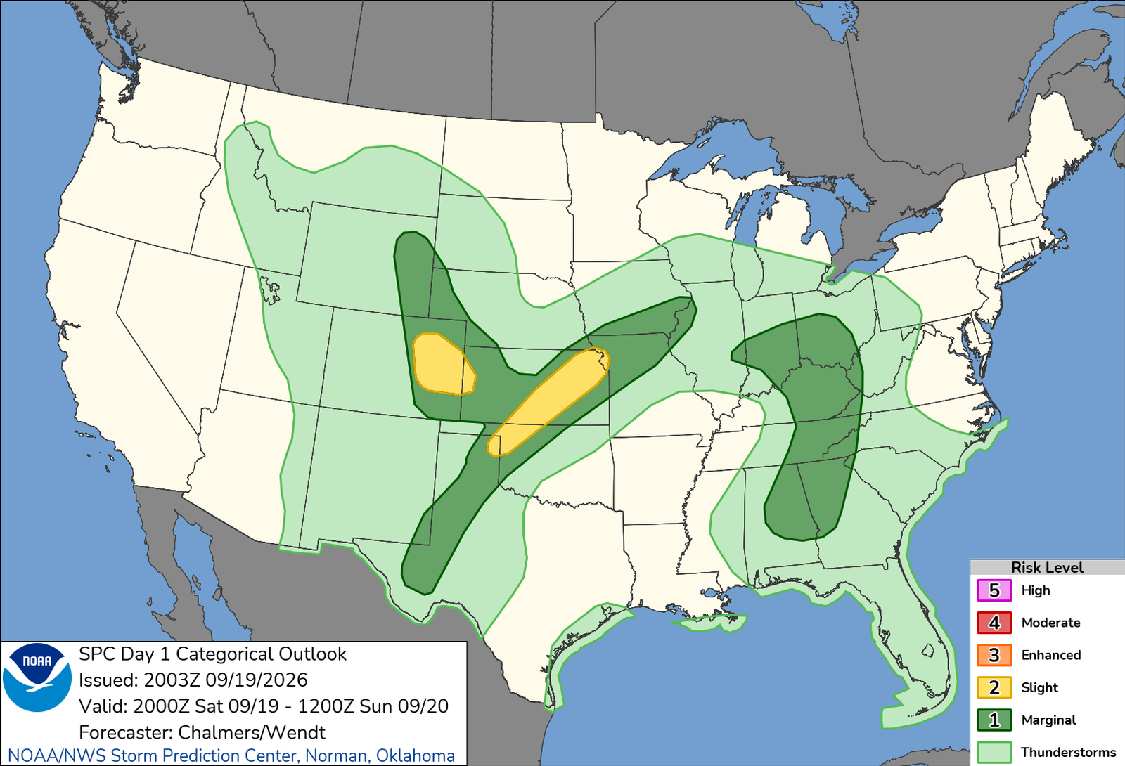
The weekend in eastern Colorado was looking inviting, a lot of CAMs showing solid supercell potential both Saturday AND Sunday. Motivation for either wasn’t particularly high given I wasted my last trip on a couple sub-par chase days, and the idea of sacrificing a big week of football wasn’t high on my list. Still, the setup was close, and honestly looked better than anything I saw the previous trip, so I had it on my radar.
Getting up Saturday morning, nothing big had changed. CAMs had put out a few runs that were not particularly great, but the general idea was Palmer Divide initiation by 3p with a solid meatball moving east along I-70 before becoming part of a line/cluster. I waffled back and forth, knowing I wanted at least ONE of the two days, and today seemed like the perfect fit as the college football slate wasn’t all that exciting compared to the Washington/Dallas game I had Sunday afternoon. So while partaking in the Buckeyes destruction of Kent State, I decided to just go, even if all I did was intercept the storm in Limon and come home, you owed yourself at least that much.
So about 11ish or so, I threw my camera bag in the car and in the same motion, headed out. I took my first look at radar and saw that storms were ALREADY firing, a weak line had formed near the Foothills and was pushing through Denver. The southern cell, down near Castle Rock, looked the strongest, so I decided Bennett would be my initial stop, see how the line evolves as it slowly moved across the Denver area, and adjust from there.
Arriving in Bennett, a few cores within the line of showers were pulsing up and down, fortunately one was doing so along I-70 in Denver, meaning I may steal an easy intercept near Bennett.
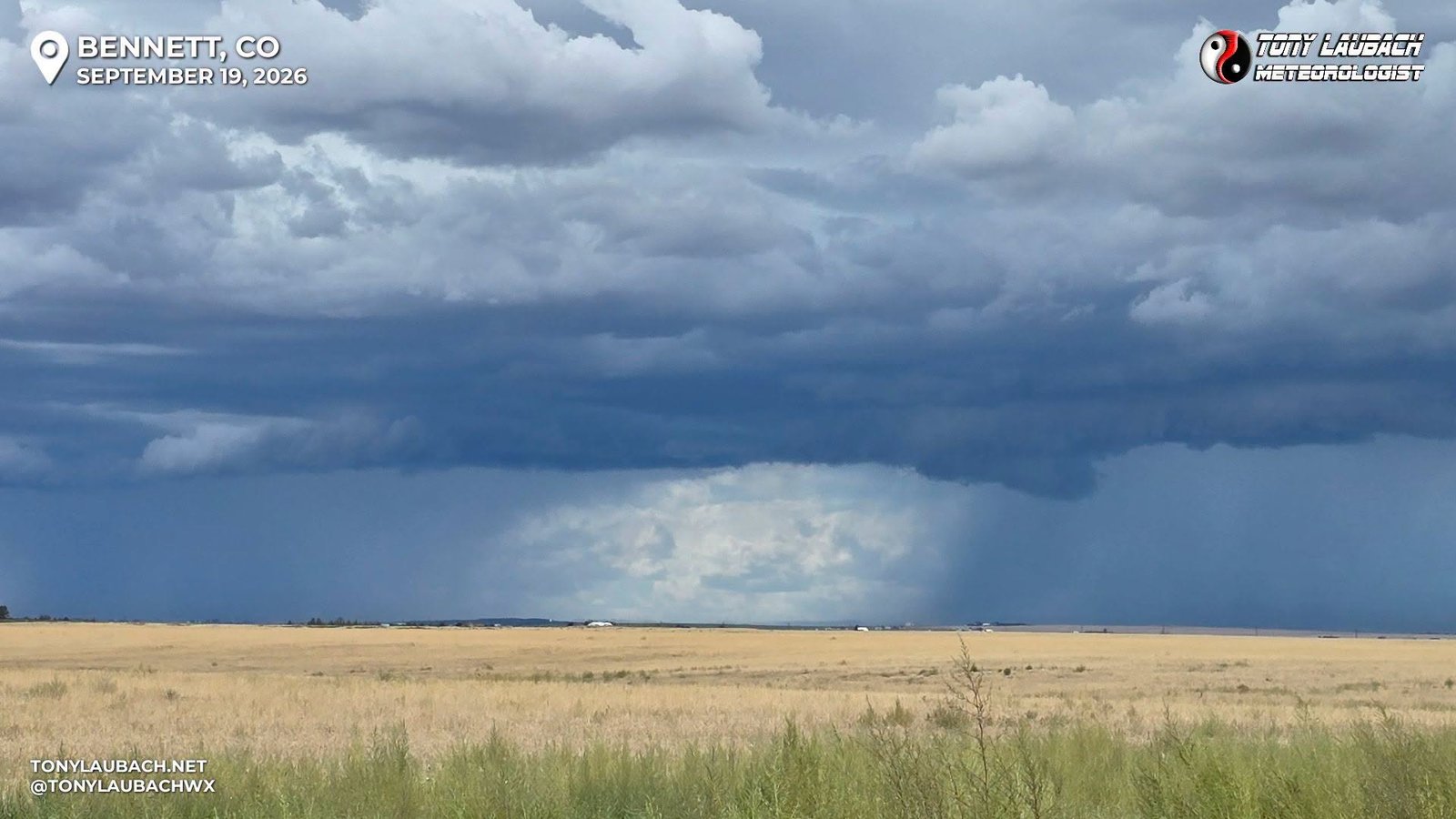
I stopped at Loves to top off, took some shots, and waited around for the precip to arrive. Some gusty winds ahead of the line were about as exciting as it got, so I opted to get east toward Byers. Meanwhile the southern cell was establishing itself, but was not easily reachable as it was basically over Kiowa-Bennett Road to my south, meaning if I took the best, most direct south route, I would end up coming in behind the cell and having to fight it out CO-86. So I arrived to Byers, the cell I was focused on was doing all right, but nothing terribly exciting.
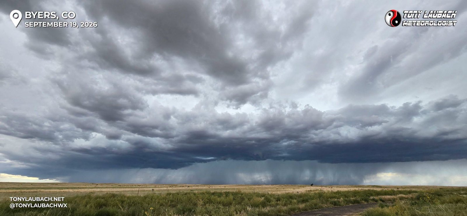
Again, took the brunt of sub-severe winds as the line pushed in, but the storm to the south continued to show, finally obtaining a severe warning. The northern part of the line I was dinking around with was not showing much, so it was time to take the southeast run down I-70 toward Limon, where I anticipated meeting the now severe storm.
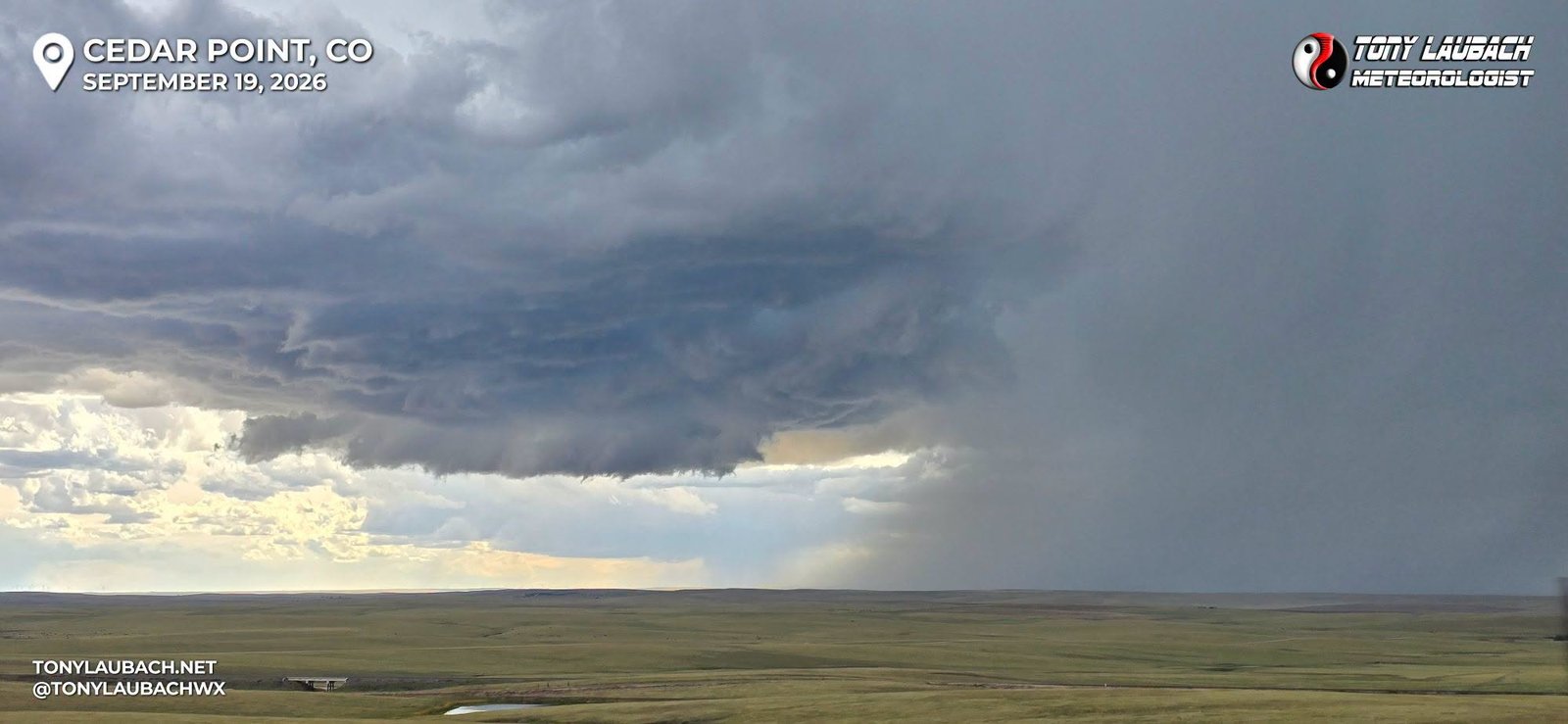
I changed up my plan from heading straight to Limon, getting off at the CO-86 exit and deciding to go test the core. While there was heavy hail on CO-86, most of the larger stones seemed to be just south of the highway, so I poked about 7-8 miles back west on CO-86 and got into the heaviest falling hail of this storm.
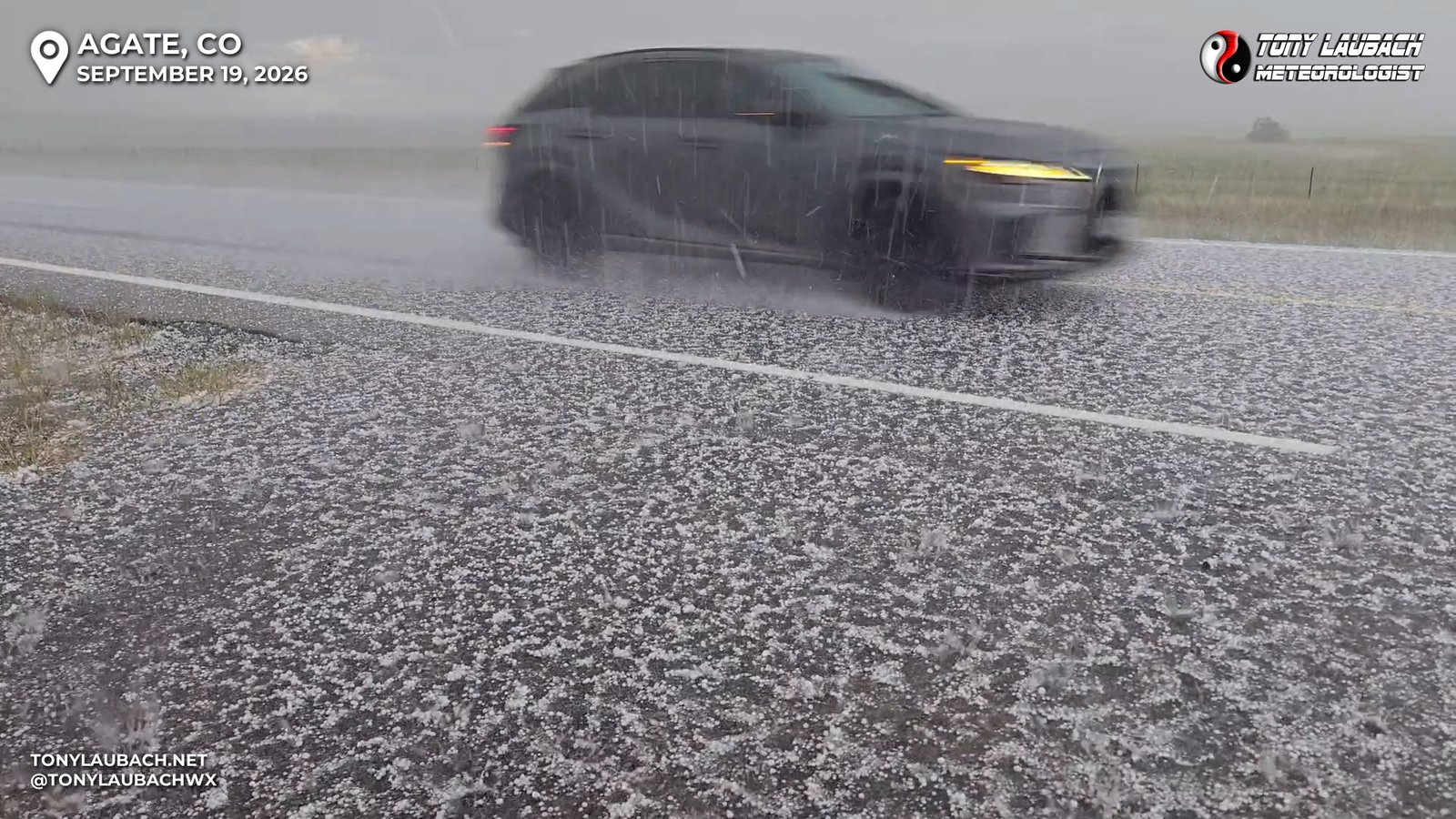
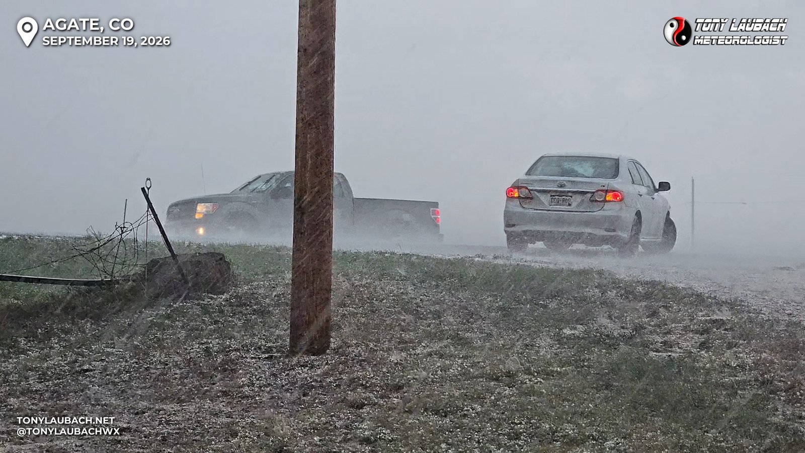
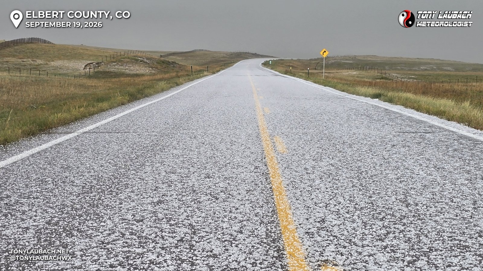
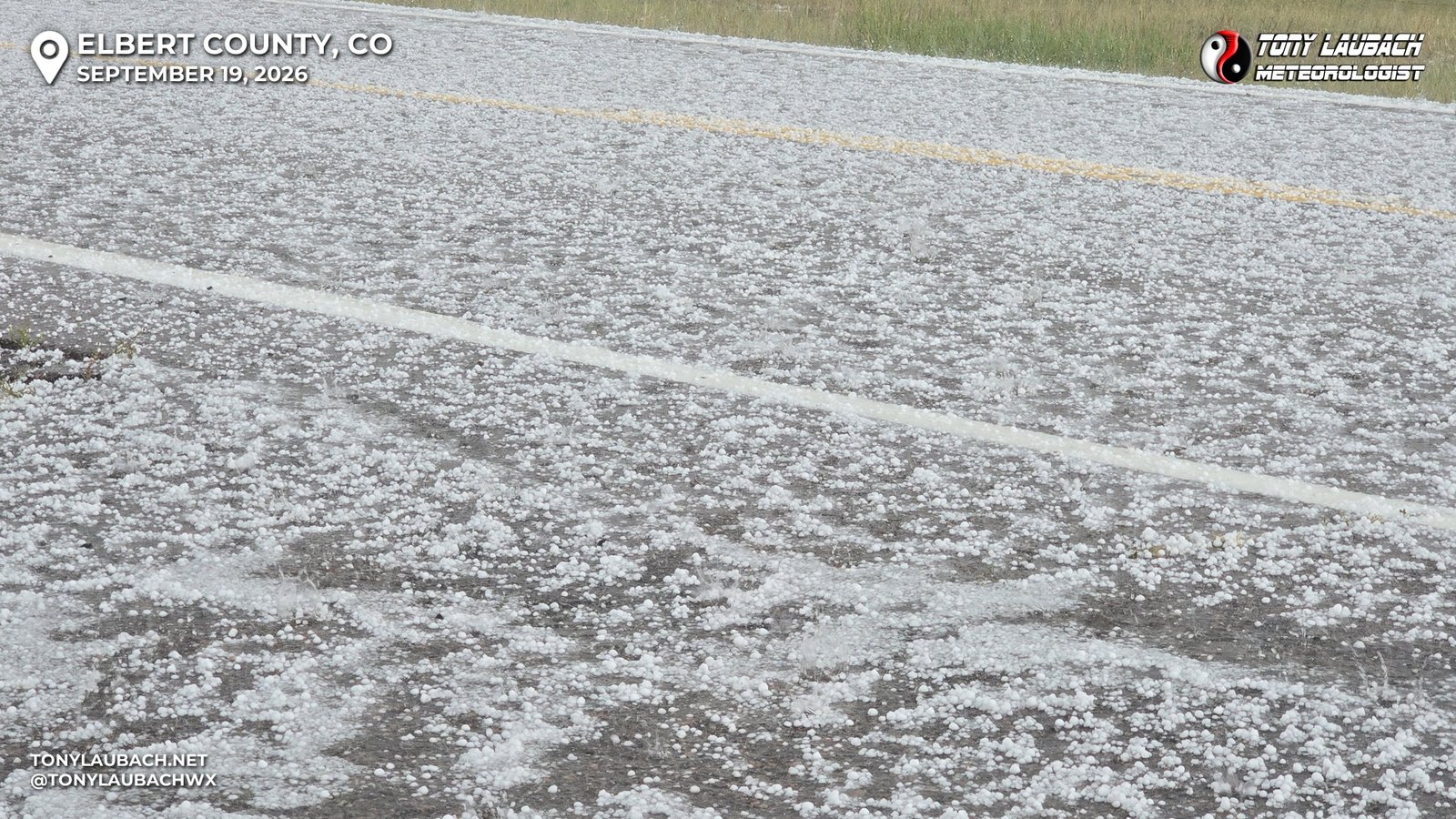
As expected, no BIG hail, a few stones approaching 1″, but it was a lot. I blasted back through the storm and headed into Limon where a cluster of storms had developed ahead of this. I figured maybe get some video in Limon, and honestly was gonna call it. With the multiple cores now blowing up, I figured this was the beginning of the end of the discrete cell as the models had depicted. I rolled into Limon on the heels of the first heavy core that went through, and stalled a few minutes awaiting the hailer I was previously in the midst of.
Well, the heavy core that went through Limon ahead of me became the dominate cell as the original hailer had kinda faded into the weakening cluster. A HUGE core had blown up just east of Limon right over the interstate! I abandoned the “call it a day” plan after the great hail intercept and decided to test the icy waters of the core on I-70.
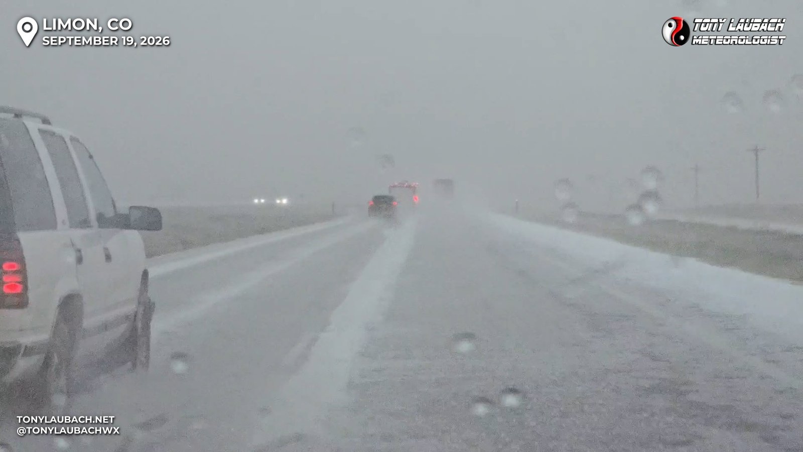
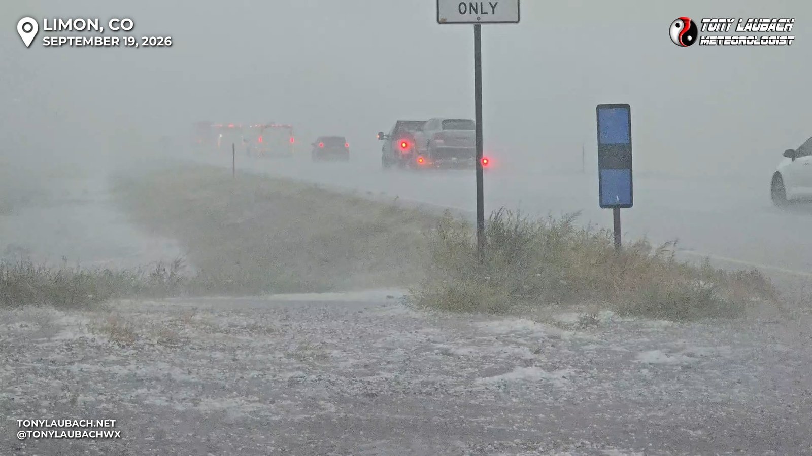
I estimate the hail was 1-1.25″, and largely pretty soft. Most of the bigger stones were splatting on the windshield over bouncing, while the smaller hail had more impact pepper to it. I filmed around the interstate, taking video of the wintry-looking scene. I stayed in the core to the next exit, Genoa, where I poked into town to document the hail aftermath.
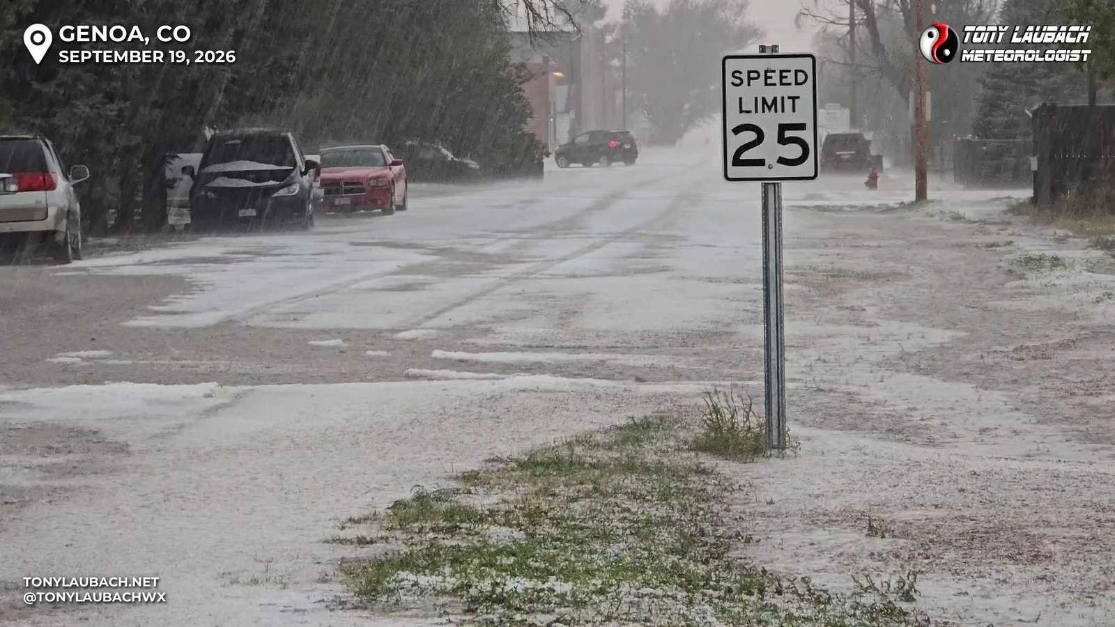
So NOW I go home, right?? haha Nope… and yes, I gave it a thought… again, I felt more than accomplished, had definitely ‘won TV’, and was debating on how many times I could film similar hail-winter scenes. But… I am a storm nerd, and this storm was moving VERY SLOW, and continuing to just unload on I-70. One more exit, I thought… and I got back on eastbound I-70 and moved east, fairly quickly. And even as the radar showed a very PINK/PURPLE core over the highway, the hail wasn’t terribly bad. Heck, even the rain was lighter than expected. Suddenly, I figured I could get ahead of this thing, and maybe add some structure shots to the cause.
So, I pushed on, and continued east with no real plan as to where to stop. Structure behind me wasn’t terribly exciting, and I wanted to put a few exits between me and the storm to see if a wider view would change that. A couple brief exits to look, then further down the line. As I approached the Vona exit, a small storm had developed north of the interstate that wasn’t terribly exiting… except that it had fired on a boundary. I happened to glance north and what do I see?
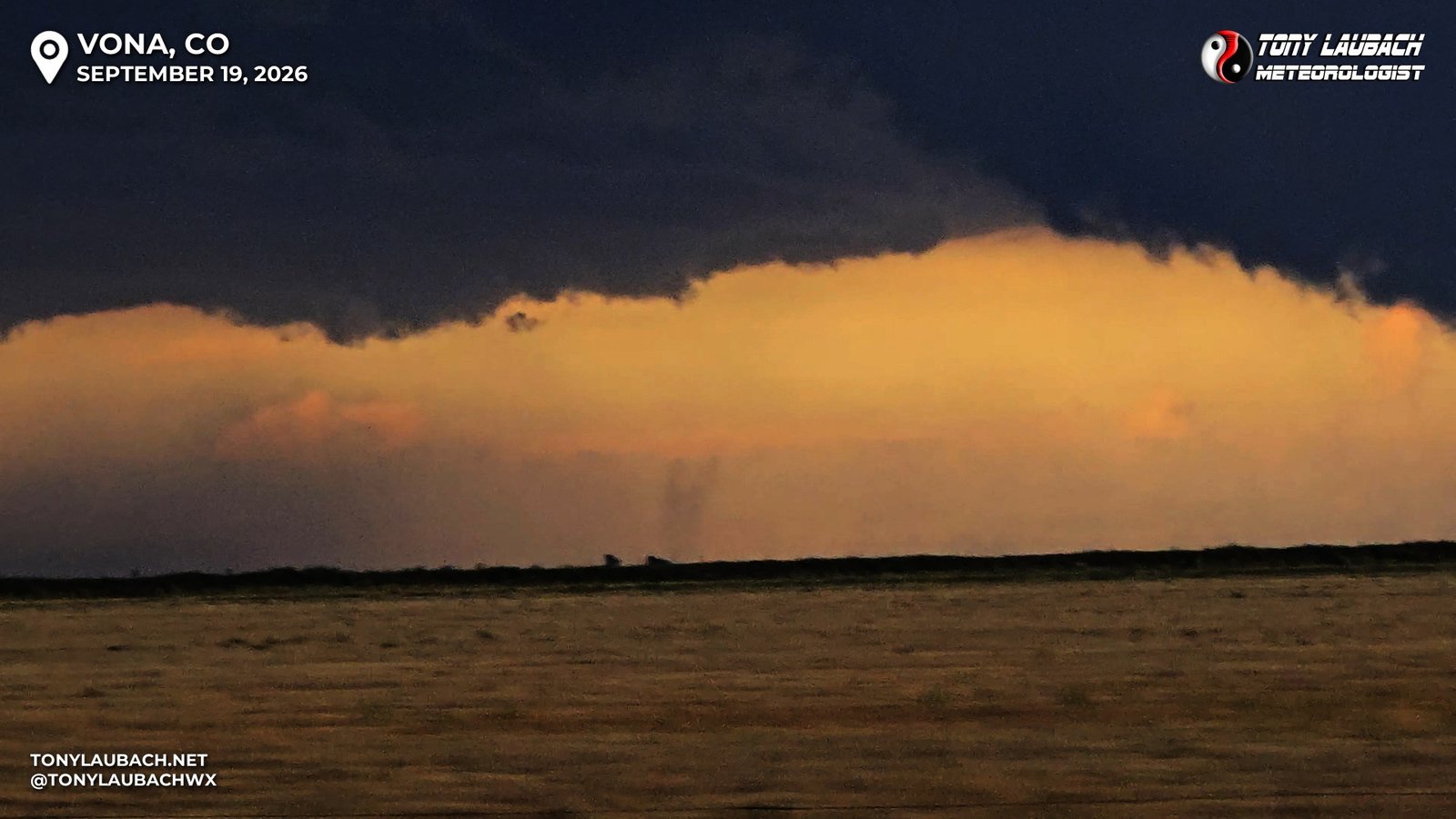
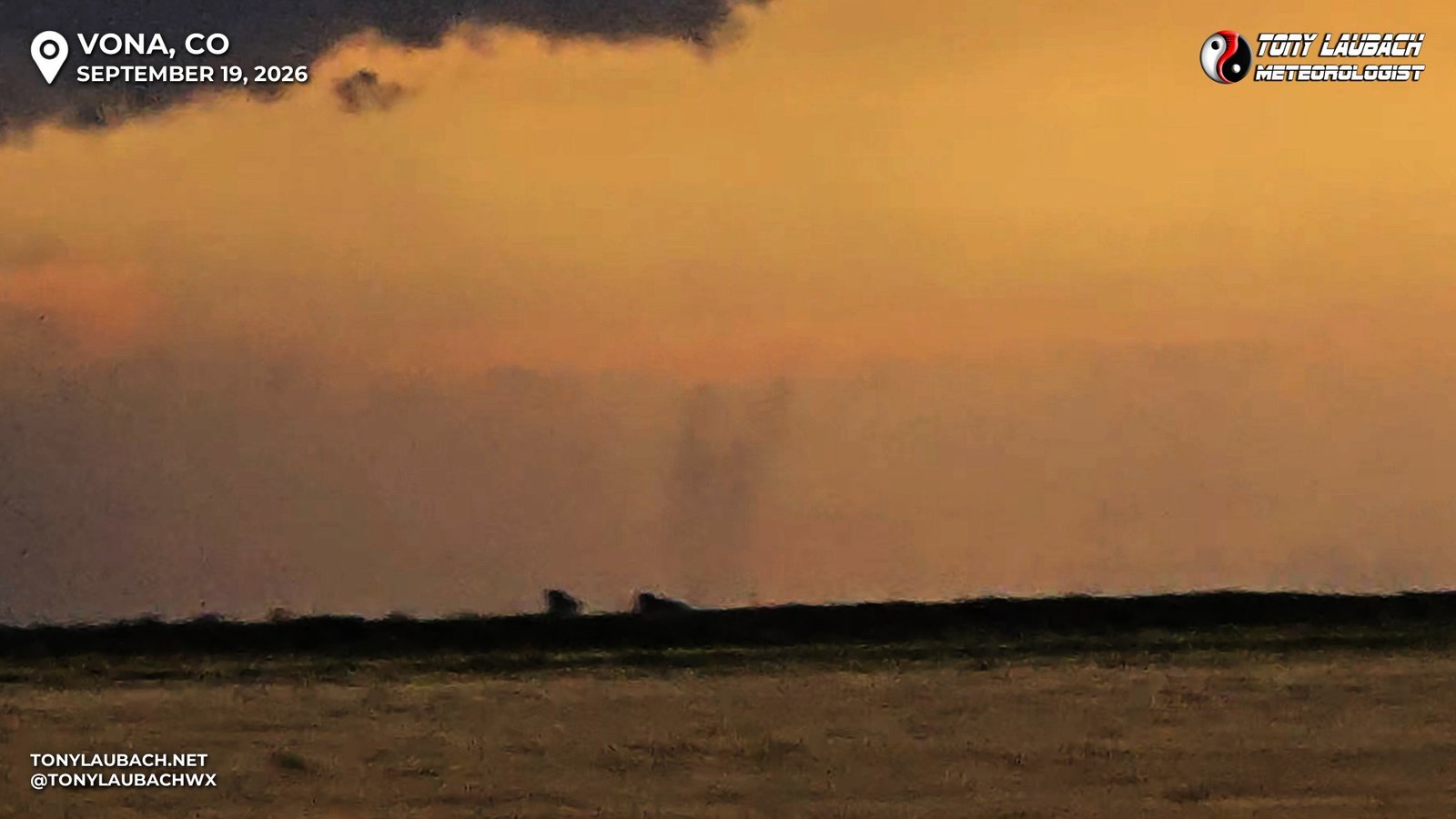
I held on for about a minute or two, and it prompted me off at Vona to poke north of town, but by then, it was gone and the storm was getting mushy. My storm, however, continued to pluck along, and the structure was getting a bit better. I used the Vona stop to snag a few pictures before continuing eastbound again.
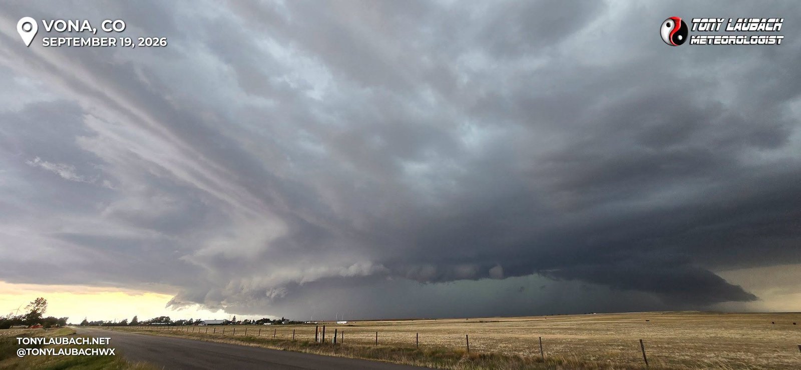
The storm’s core was starting to sink south of I-70, and the storm as a whole was making a slow turn to the southeast. I was definitely starting to get to the end of my range, thinking I would make a run to Burlington, but with the brunt of the storm sliding south of the interstate, I was deciding my next play. With the hail core still very heavy, I was thinking about heading south out of Burlington on US-385 to take one final intercept before releasing the storm to be Kansas’s problem.
Another storm was beginning to develop ahead of the main storm southwest of Burlington, and I wasn’t sure exactly how this would play out. As I arrived to the Bethune exit, I decided to sneak a few miles south. There were a couple east/west county roads that would get me straight across to US-385, so I thought I would go ahead and keep close to the main storm with several options to get east.
I hit my first east option, CR-S, about 3 miles south of Bethune and set up to watch the incoming storm. The newly developed eastern storm was also looking pretty impressive, but the small, but heavy core, was preventing me from seeing the other side. It wasn’t high on my priority list as the structure of my storm was finally showing off. And in realtime, I could see the merger starting to take place.
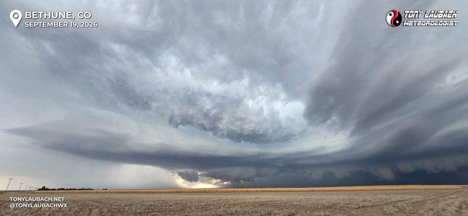
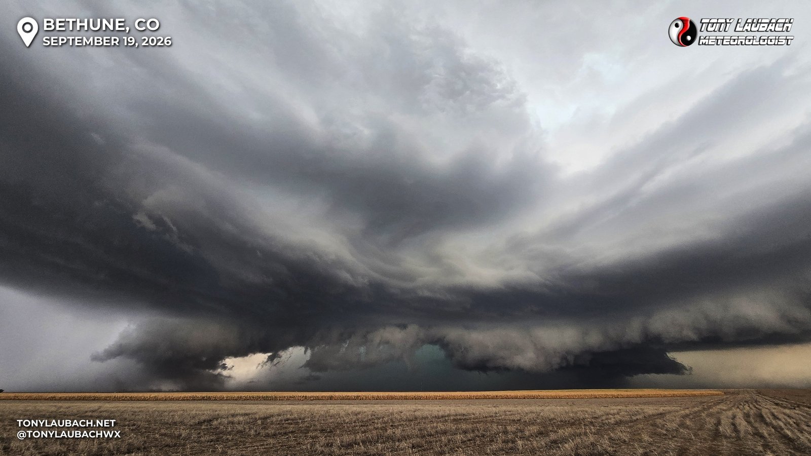
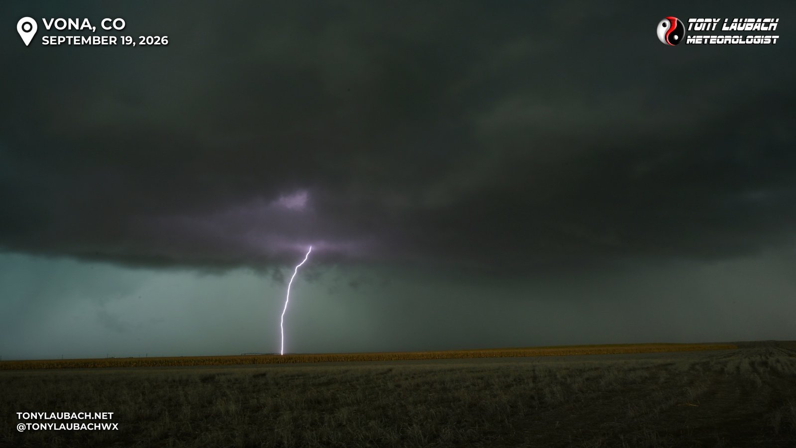
This was fun to watch happen in real time, me snapping pictures as the storm slowly approached.
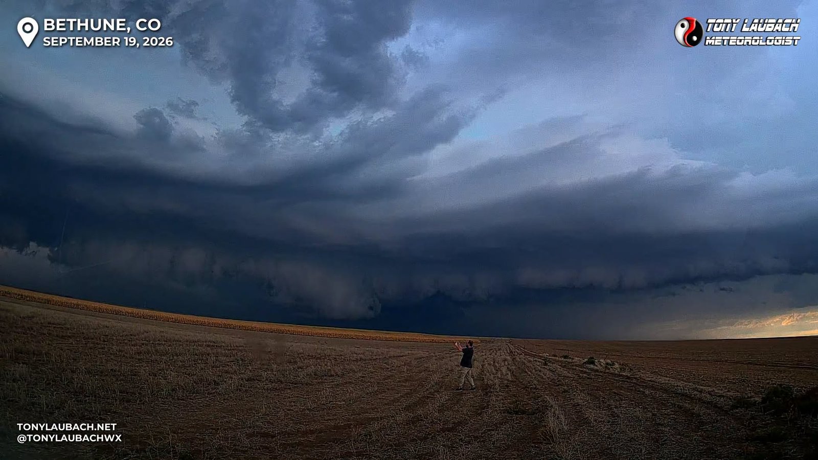
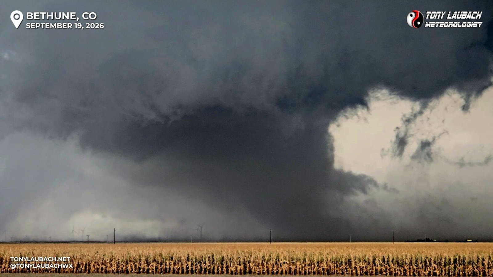
As the storms began to merge to my south/southwest, an area of rotation rapidly developed, and suddenly a bunch of blowing dust got condensed beneath this and a thick dust whirl began to spin on the ground. I was watching this in realtime, wondering if I just saw the birth of a tornado. It had been so long since I had seen a legit one, I wasn’t sure what I was looking at haha. The view was a bit hampered due to dust, but it was a pretty convincing view.
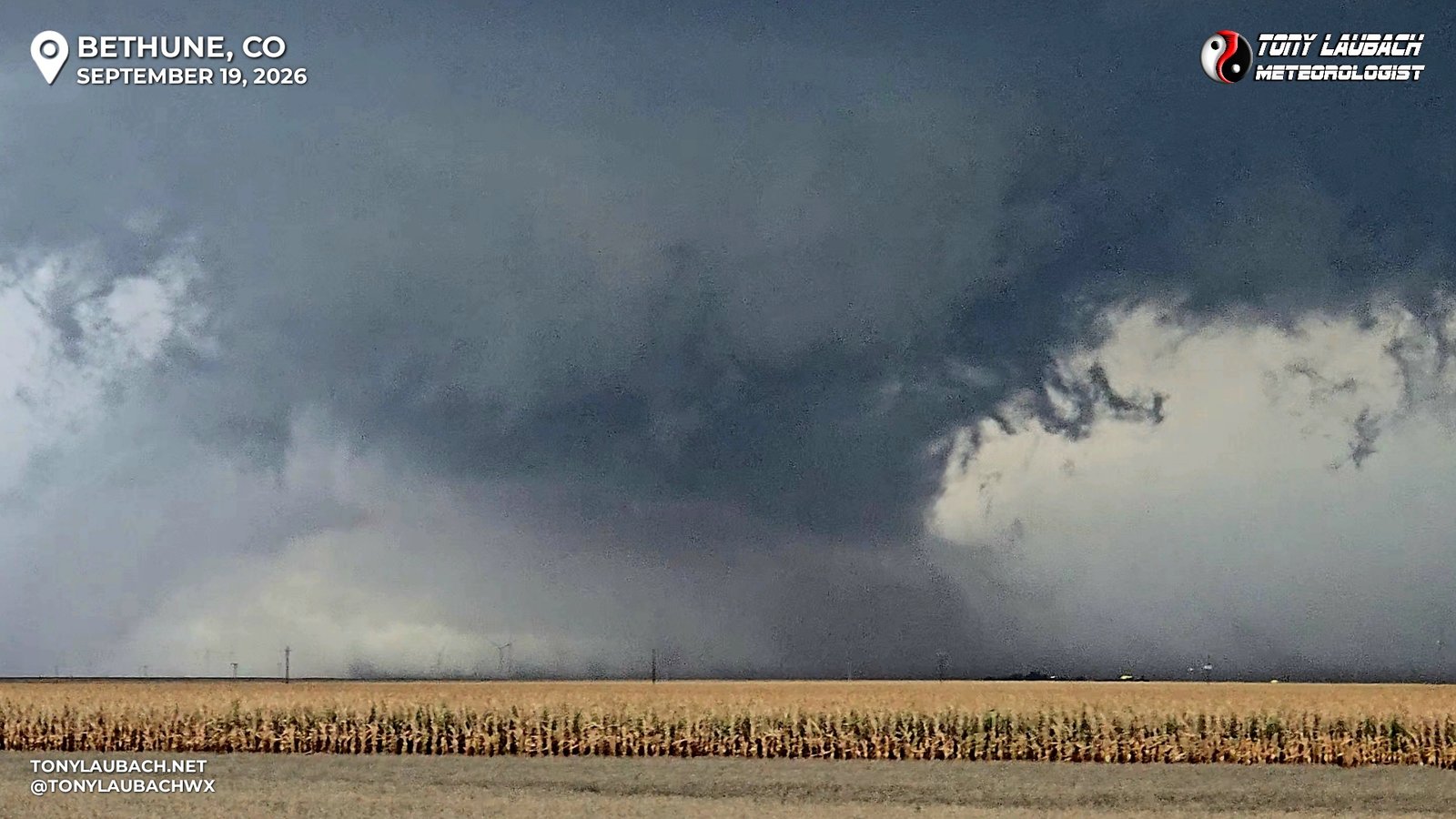
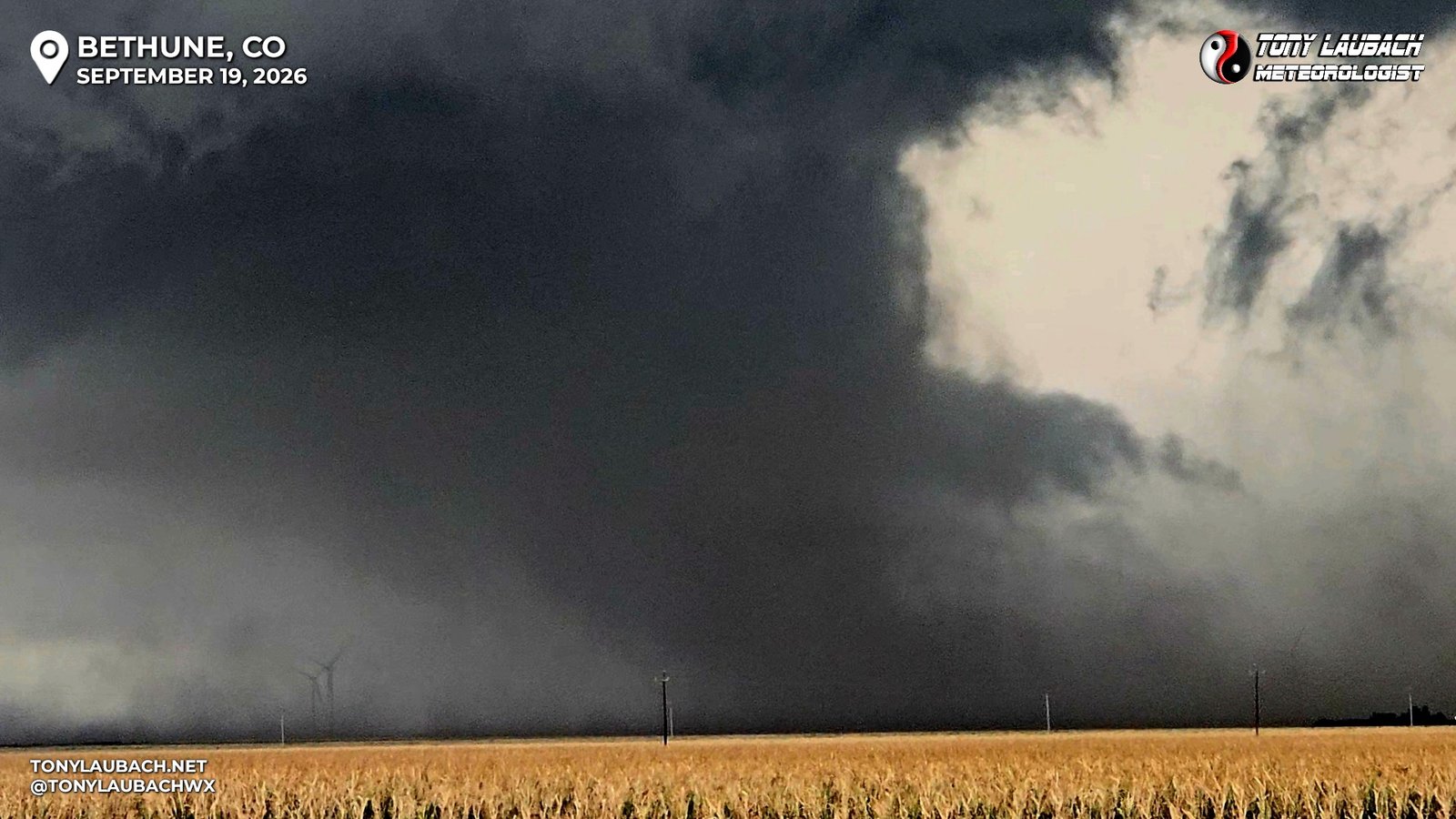
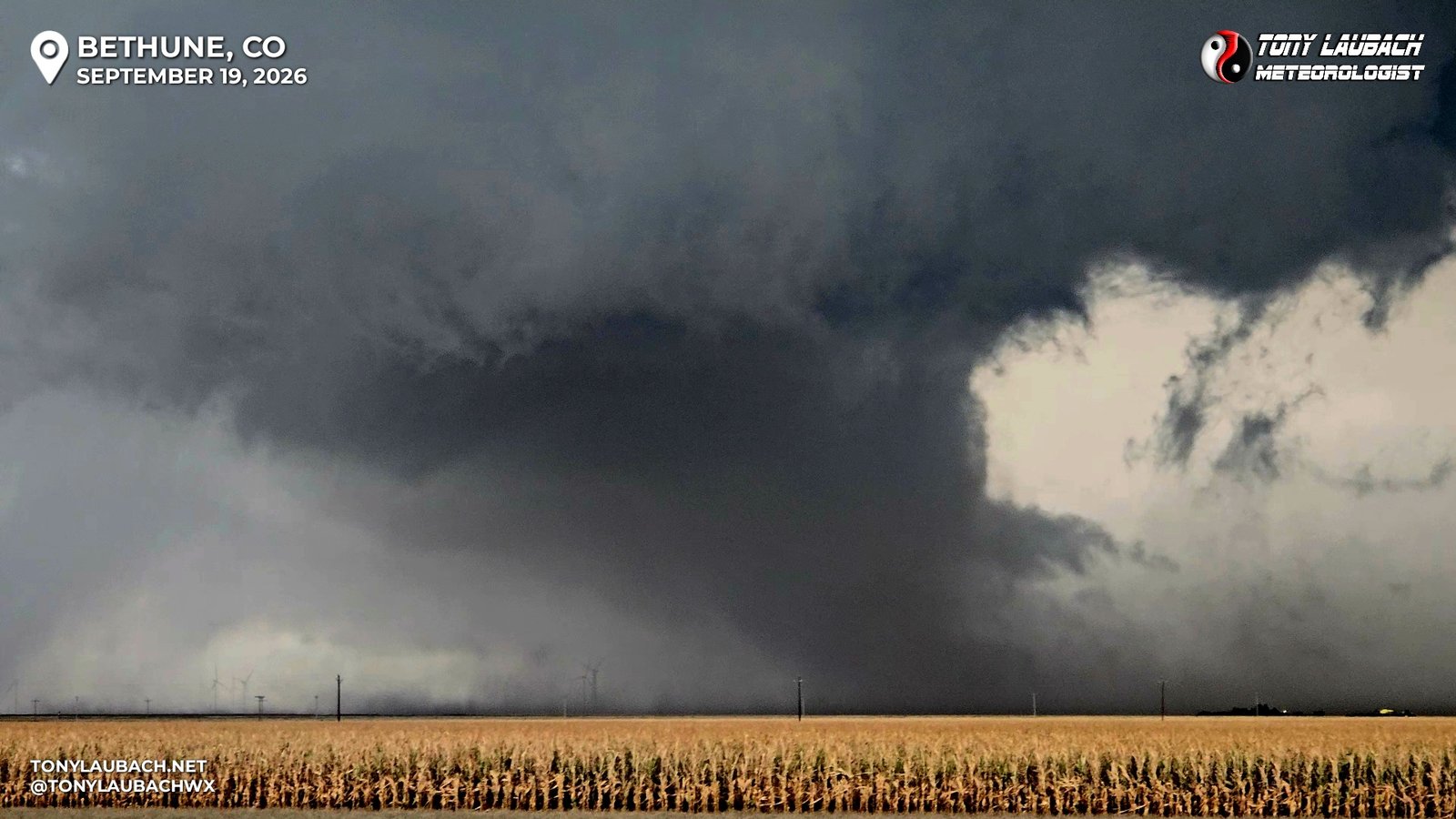
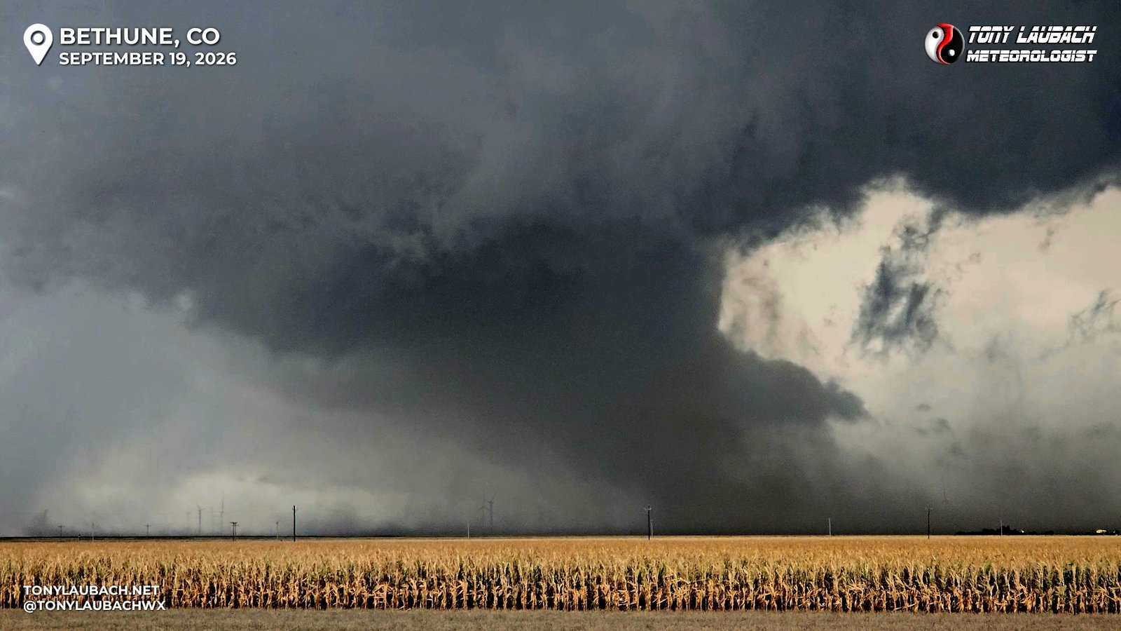
The tornado didn’t last more than two minutes, the outflow from the western cell finally undercutting the circulation, and the storms finally becoming a single mass. I wasn’t sure what I had just seen, honestly was hesitant to call it what it was out of the gate cause it looked so stout on a 0% day. But if its a duck, call it a duck. The storms were starting to overtake me, and after a brief thought of continuing my original plan to get straight east, the growing cluster was overtaking the dirt road, and I didn’t wanna chance the 7-8 miles if heavy precip turned my road to muck, so back to I-70 I went, and I proceeded to Burlington.
I arrived at Loves ahead of the storm, which was now more southeasterly, and likely to hit US-385 well to my south. Despite the recent tornado, which I was very sure was due to the merger, I didn’t figure this had the “if it’s produced once, it’ll produce again” going for it, so I decided NOW was finally the time to end my chase. Haha.. so I thought…
I was tunnel-visioned on my storms, I failed to widen out my radar view. When I previewed what my drive home looked like, I saw several areas of sub-severe storms had gone up, one halfway between me and Limon, one west of Limon, and a few up to the north of I-70 back near Denver. I hopped on westbound I-70 and watched as lightning was flashing out of these storms. One of the nice things about chasing this time of year, it gets dark earlier, meaning lightning photography can commence much earlier, particularly on storms that are west of you, cause they tend to block the remnant sunlight. And that’s what this initial cluster was doing. The storms were hardly anything on radar, but they were pumping out strikes.
As I approached Flagler, I was already contemplating stopping to shoot; the CGs were not particularly often, but were good. As I got near Flagler, the CG frequency picked up enough where I knew I had to stop. I got north and east of town to allow for a clean view to my north and east. And this would prove to be a worthy stop as I set up my tripoded camera under the hatchback of my vehicle, keeping it close to the vehicle to keep it out of the wind and rain, and went to work!
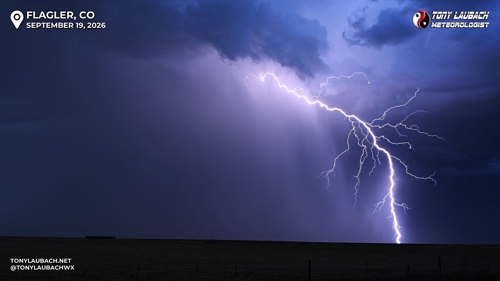
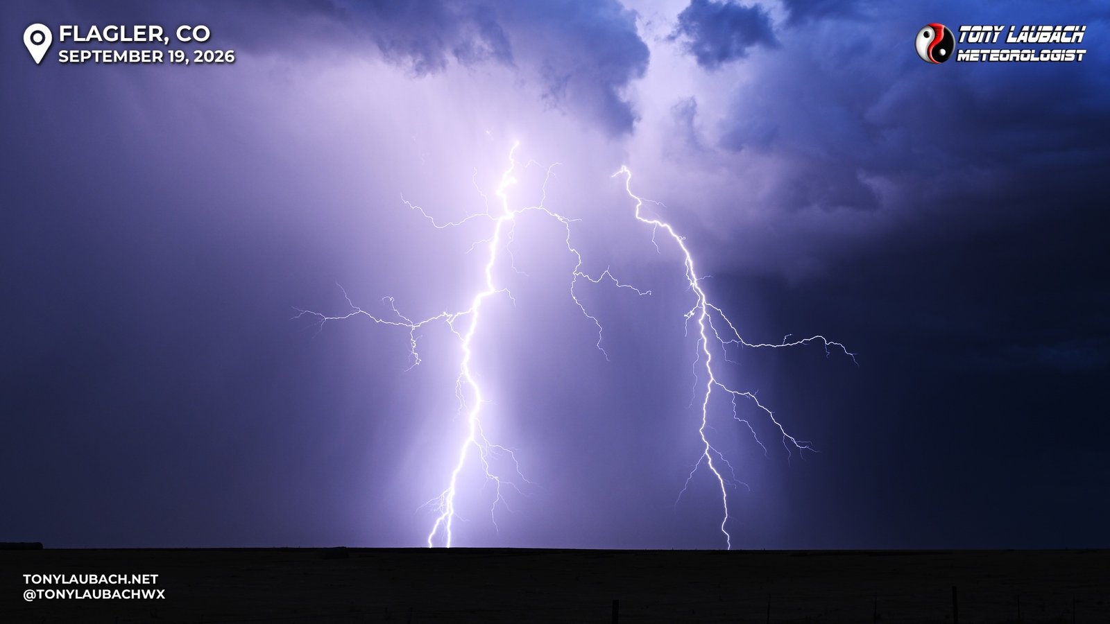
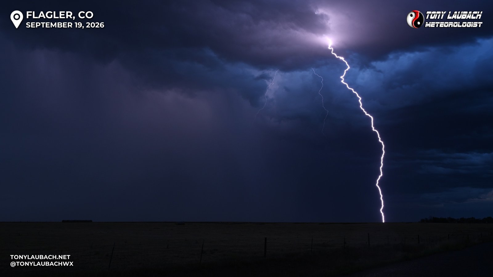
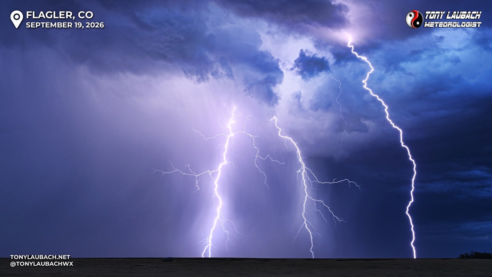
These storms, relatively low-end as they were, continued to move off to the east, and the bolts were becoming further and less vivid, but other cores that were north of me were popping off, and lightning was starting to fire out of storms to the southwest. I literally bounced over I-70 multiple times, shooting the cores north of the interstate, then back south of the interstate.
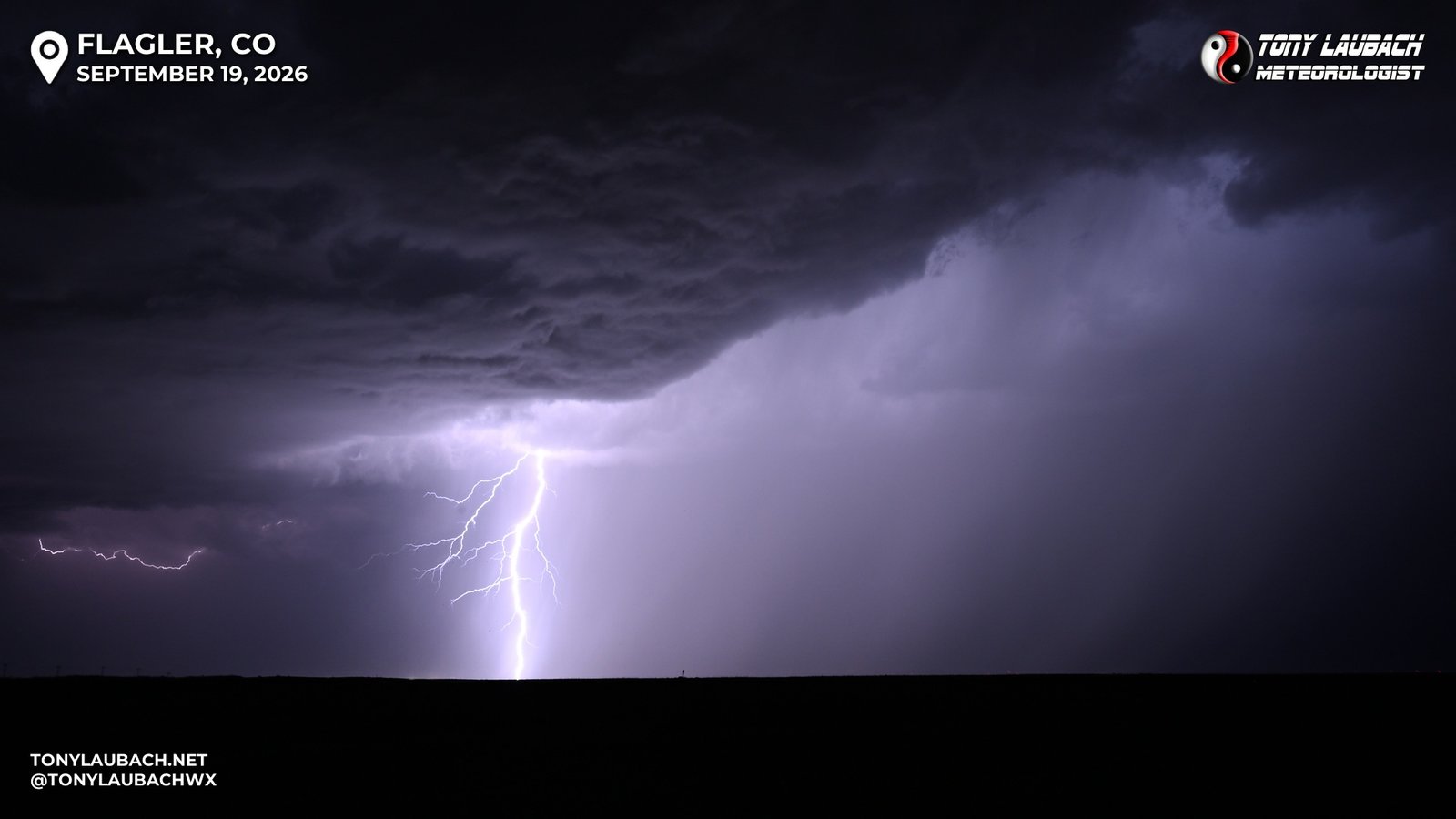
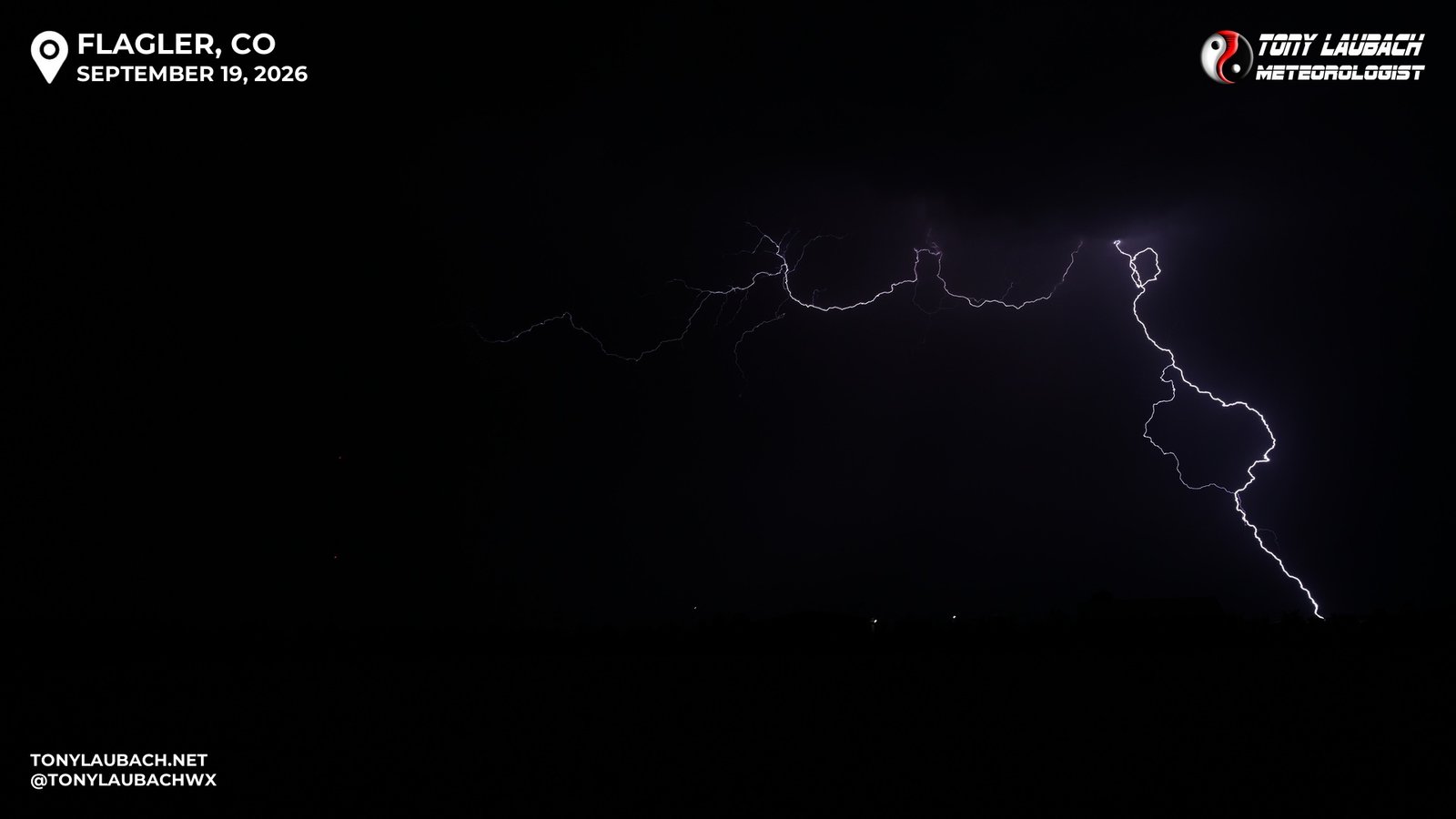
As the capture frequency went down, I decided to push west, closer to home and give storms that were moving at Limon a chance, but those were lackluster at best, and the few good bolts I saw on my approach to Limon were well to the south, and didn’t seem like it was worth the 20-minute one-way detour off I-70, so I pressed on to home, happily satisfied with what ended up being a very over-performing day. After a fuel stop at the Hudson Loves, I rolled into home shortly before 11pm.
September has been pretty lean for tornadoes for me in my 30 years, so that low bar easily put the Bethune tornado at the top of the list for September tornado intercepts. The hail, while not the size, was extremely notable for the quantity, and capping off the chase with lightning meant I fulfilled my Holy Trifecta of chasing; Tornadoes, Hail, and Lightning. This ranks among my best September chases of all time, and certainly one of my favorite chases of 2026. The two tornadoes seen puts me within 3 of hitting 500 for the year, so a solid fall tornado chase could still accomplish the season’s number 1 goal. It hasn’t been a year for quality tornadoes, and today wasn’t great, but it was better than most of what I have seen this year… MOST… haha