
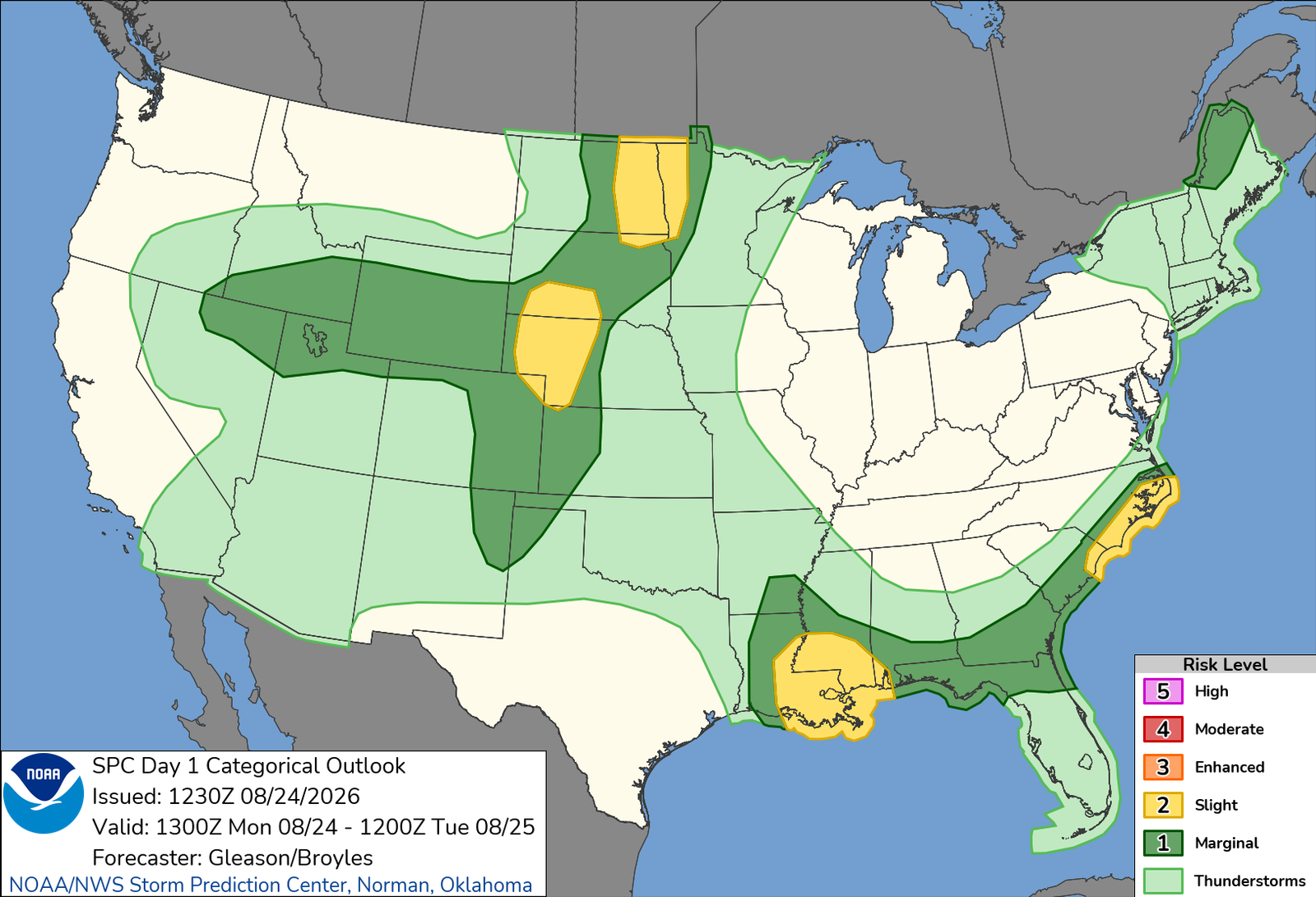
Another day, another setup. This one will take me back up into western Nebraska later this afternoon, day 1 of what will probably be a three-spot to kick off the first half of this final week of August, a month that has been very busy. Once all is said and done and we flip the calendar to the first day of METEOROLOGICAL FALL (omg, please don’t drag summer out), I will have to look back on prior Augusts to see where this sits in comparison to priors. This month has felt very reminiscent of early career Augusts here in Colorado where it seemed like I was out a lot of days of the month. This definitely has that feel, so I will save that reveal for when it’s all done (with potential the last couple days hold potential – more on those later this week).
Anywoo, today, nothing special; damaging wind and hail threat with isolated storms early, then clusters leading to damaging winds. Likely heading out about lunchtime toward Ogallala as its been consistent to see CAMs blowing storms up after 3pm, so that’ll get me up there with some time to spare. Tomorrow, Tuesday, the highest end threat for the stretch. Likely a regional damaging wind event across northern Kansas. There was some potential yesterday about a further south play, southwest Kansas into perhaps the Texas Panhandle, but that’s not as glaring as it was last night. Something I will keep an eye on just in case the shift south is needed, but right now, all indications are that I will be good to rest up this evening a couple hours from tomorrow’s target. Wednesday the lowest end threat of the stretch, but would likely be something to catch heading home Wednesday afternoon in eastern Colorado. Nothing huge to report from that right now, but things look to be pretty close to home, which should be an easy get assuming Tuesday remains a Kansas play.
Quieting down the rest of the week heading into the weekend, but models are showing signs of a pretty hearty system for the northern parts of the plains and Midwest later in the weekend into early next week that will garner some attention as we progress in the week. That could include northern Illinois, which continues to smash tornado records, and may try to add to that with this system if things pan out. We’ll see. But a usual sign that fall is coming is that first big synoptic system. Nothing on those same runs brings Fall temperatures, but amplification in the stream usually starts to be a thing as we get into September.
Also watching the Tropics, but nothing to note on that other than watching the tropics. Those with bigger brains for tropical weather will keep better tabs than I will, but the first significant Atlantic storm likely to get going in the next ten days. Whether that plays for the US or not is highly unknown, but most models are keeping it a fish storm. One thing I have learned with tropical weather in the far out ranges of the models. Don’t believe anything haha So we’ll see if that factors into anything for me the first week and change of September.
Okay, off to load up for another multi-day chase trip! See ya in Nebraska!