Opens in a new tab

Tony's Blogbach, Between the Isobars

Thoughts from Tony Laubach on Weather, Chasing, and the Patterns in Between.

Quick Update on Wednesday’s Chase

June 15, 2026 | Forecast Thoughts

Wednesday is >95% for chasing… I remain in Columbia as I just decided to keep things simple as opposed to packing, moving, and unpacking; just keep my room and hang out.  Maybe, just maybe I will lean my way east tomorrow, but given all I have seen, just about any target for Wednesday is easily well within range of here, so I may keep my home here and depart Wednesday morning.

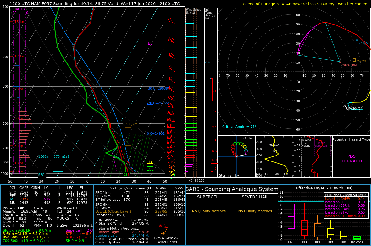
That being said, I am less than 20% for Tuesday, which continues to shift further north and east, and not looking great to begin with, so it was a long shot for me to do it, but grows longer as the drive to do so gets longer.  Wednesday will likely be the sole day of this trip, and it certainly has all the earmarks of a significant severe weather day.  March dynamics combined with June instability.  On paper, it’s big.  Just look at the sounding I pulled off the 12z NAM for central Indiana northwest of Indianapolis; likely very embellished by the model, but that’s some damn big numbers and a hodograph that can’t even stay on the page.

The big question remains, what is the storm mode?  That’s gonna make the difference between tornadoes and damaging winds with embedded tornadoes.  Still, the T-word is going to be a factor, just really depends on storm mode to determine how many and of what severity.  This will be a widespread, impactful system regardless, likely stretching as far back as Kansas all the way into Indiana and Ohio.  Storms will be moving to, you don’t get slow storm speeds out of March dynamics.

So yeah, all on track to be out Wednesday… will probably start to hone in on exactly where through the day tomorrow, and I’ll decide if I need to lean east tomorrow at all.  So stay tuned.

Further out, just for mention, maybe back to some lower, yet worthy high plains setups into the weekend so something to keep tabs on as I return west after Wednesday.

I Have Been Home 10 Hours Since the Beginning of June

I’ve been lacking in the blog department because I literally haven’t had time to myself since June started.  I chased, flew to Chicago for Pokemon GoFest, flew home, then hours later was on the road for the trip that was suppose to conclude today, but has now been extended due to a high-end setup that’s coming into focus for Wednesday.  I will be out likely through Thursday at least, just depending on the drive home that awaits at the conclusion of that event.

Today, Sunday, is a down day here in Columbia where last night’s chase concluded after being chased all day by the storm we targeted.  This has been a four chase, six tornado trip, including multiple tornadoes on Wednesday in Missouri which the big one aired live on AccuWeather, my first legit time doing that this year.  The six tornadoes got me to 490 on my #ChaseTo500, so now within 10 with half of June to go.  Wednesday’s setup COULD easily be the same general areas as last Wednesday, but the question remains whether it’s a discrete supercell kinda day or a big-ass line kinda day.  Too far out to call.  But it’s an opportunity, and it will present the chance for something significant, so if you’re reading this and NOT a chaser in the Midwest, take that as an early warning that this coming Wednesday may be an active one.

I have popped the chase placeholders for the 2026 season for the four chases so far on this trip.  I’m WELL behind write-ups, and perhaps I square out one or two tomorrow after I land wherever I ultimately decide.  Right now, I am leaning toward St. Louis, a simple two hour drive from here, but I am eyeballing the low, and I mean LOW potential of an eastern Illinois chase on Tuesday, which I honestly might partake in given it’s low-end potential and likely lack of too many cars on the road, so we’ll see if I can scrum up enough motivation to do so.

Honestly, this has hands down been my favorite trip of the season.  Chicago was super nice, very low key with a TON of walking, and good time with my wife catching thousands of Pokemon across the city, and I came into this trip well rested and refreshed, my head in as clean a space as it’s been in a while, and the success of this trip along with the number of people I’ve been able to share it with in various forms has just been wonderful, so it’s been a nice breath of fresh air.

Even today, I am feeling pretty good, and have been super productive.  I got my laundry caught up, did some supplies shopping to stretch out for extra week on the road, enjoyed the Rockies scoring 23 runs in their game this afternoon while I tended to a few errands and caught on some computer work.  With the rest of the evening before me, will probably be pretty lowkey, and tomorrow I will get up and head east to wherever makes sense.

So I am alive, as alive as I’ve been for a while this season, and looking forward to what the next few days have to offer.  Meanwhile, stay tuned to my Facebook page… I’ve been doing pretty good about posting updates in the field, and I’m very happy with the exposure it’s been getting, so go be part of the ride!

Memorial Day Weekend

May 25, 2026 | Forecast Thoughts

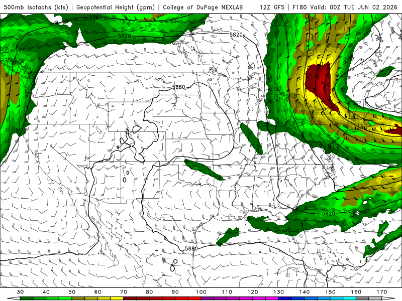
While early on the calendar this year, we’re still in the climatological peak of severe weather season, and there is barely a storm around.  Those who ‘have’ to be out are running back and forth from Texas to South Dakota, many heading down to Texas today.  Ten-plus years ago, that be me… not now haha In fact, I am somewhat content with the down time, albeit weird during THIS holiday, which has usually been one of the busiest times for me.  Not this time, and it looks like the down stretch will likely be an extended one, minus a couple low-end backyarders possible at the end of this week.  Beyond that, nothing in the long-range gives any indication of a pattern shift.  Lots of northwest flow across the central part of the country, likely meaning MCS season up north.  Not usually on my list of things to do to chase, so we’ll see if that amounts to anything that gets me out.  I’m in Chicago the first weekend in June, something unheard of for me to plan something NON-CHASE related during that time of year, but right now, it looks like I am going to enjoy that weekend with not a whole lot to miss.  In fact, I’d argue that I may be in line for storms up that way by default haha  The question remains, what does the middle/back-half of June serve up.  Typically these wonky patterns favor an active pattern for us along the front range; not necessarily for tornadoes, but stormy none-the-less.  Hailers aren’t out of the question with the instability, flooding storms also find their way in.  Indications are for a pretty active monsoon season here, so maybe that’ll offer some lightning ops.  Otherwise, a lot of day-of looks will determine how often I head out.  Holding out hope that the central/northern plains offer some opportunities later in the month.  But right now, nothing I can point to.  That said, lots of look backs on years prior; easily the busiest stretch of days during the chase season for me in years past.  Ain’t gonna be adding anything to that this year, though…

The Barely-A-Tornado Streak Continues

May 22, 2026 | Post-Mortem

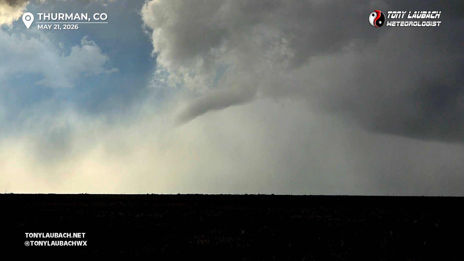
The #ChaseTo500 continues with two more tick marks after yesterday’s pretty solid Colorado chase.  That puts the count to TEN tornadoes so far in 2026, leaving me 16 away from the 500 mark.  But of those ten, the only tornado to really speak of was the Minnesota tornadoes back on April 13.  Everything else I have seen have barely counted as tornadoes.  The two I saw yesterday in Colorado, neither were slamdunk touchdowns; the first, a rather pretty funnel, was confirmed by others that were positioned a bit better as I had just enough of a terrain rise between me and the tornado where it blocked the ground.  The second tornado was another birdfart, a low LCL fingers-to-the-ground type deal where a rotating lowering was just low enough where little clouds would occasionally dip down to ground level.  This, at least visually, was more apparent, but still a pretty meh sighting overall.  Fortunately, neither tornado were strong and did any damage, so yay for that.

Despite a solid outing yesterday, and even as the chase itself met, if not slightly exceeded expectations, 2026 thus far has been very lackluster, and sometimes frustrating for me.  I’ve left a lot on the table, many of the big days either failed to reach their ceilings, or I botched up the day with poor decisions/positioning.  There really haven’t been a TON of high-quality tornadoes outside the Braman/Enid day, so it’s not like I am missing out on a bunch, but the slim number of days thus far have not worked for me to this point.  It’s the grind that is sometimes.  Obviously I came into this season, #30, with the hope that I could hit the 500 tornado milestone in this season.  While certainly well within range, I need to hope June offers some opportunities, or just dump a large majority on a day like Akron 2023.  Sixteen is a large number going into the back third of the peak season, so I’m hopeful I can get back in the game for the opportunities that should present themselves.

The moisture return to eastern Colorado, while not drought-busting as I have said before, is very well timed.  An El Nino tends to support an active pattern for us here locally, so the combination of the two should yield some opportunities in the weeks ahead.  Yesterday, while lackluster in the tornado-department, did yield my first Colorado tornadoes of the season.  But like the majority of the tornadoes I have seen this year, they are fence-scrapers.

Should be a quiet couple of days… some low-end potential exists early/middle of next week, but nothing I am terribly gung-ho for at this time.  We’ll see how it shakes out over the Holiday Weekend.

Colorado Chase Thursday?

May 20, 2026 | Forecast Thoughts

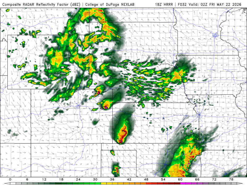
Despite a pretty meh synoptic pattern, a halfway decent, albeit somewhat moisture-deprived setup exists tomorrow across eastern Colorado.  SPC has ticked up their outlook for the region since a general risk last night, opened with a marginal, now we’re sitting at a slight.  But us high plains nerds were all over this before sunset yesterday.  Questions becomes how big a crowd does tomorrow draw?  After the insanity that was the last couple days, one can’t help but be concerned about the crowds that could amass in eastern Colorado where we lack a solid gridded road network.  So lots of people on the few paved highways.  We shall see.

The ‘main’ target, if you will, is likely further southeast.  Better moisture will exist down there, which should increase tornado potential on any supercells that go up along/south of US-50.  CAMs do try to give proof of life further north, along US-36 and even up toward I-76, where slightly less moisture exists.  But don’t get me wrong, there isn’t BIG moisture progged for tomorrow.  Generally, if you want magic, you gotta keep about 20-25 T/Td spreads at most with dews generally at or above 50.  Obviously we take less of the ingredients for good days here, but we’re gonna be borderline in terms of whether what we have to work with tomorrow is enough.  Right now, we’re probably looking mid 70s over upper 40s with good surface flow and a piece of energy moving through, so a lot of good things, but what juice there is to work with remains to be seen.  If we were to somehow start crawling into the low 50s out east, I think you tick up the prospects for the day.  But we shall see… a lot of convection expected south of the region the rest of today into tonight, which MAY stunt some of the moisture advection into the area.  That would be why southeast is the favored zone tomorrow as that has the best chance of seeing better moisture, and there are plenty of indications the dews south of 70 do get into the 50s, which would be plenty in that environment.  I don’t hate the US-36 play, and if we can get flirt with 50s dews and keep temps in the mid 70s, I wouldn’t write off a tornado or two.  Hail, definitely, and given the cooler upper levels, could see copious amounts of smaller stuff with some stones maybe creeping up to golfball or better.

Friday shifts southeast, some indications could make a case for a western target in the Panhandles into northeast New Mexico post-frontal.  Nothing I am sold on yet, and a lot will really depend on where I end up Thursday evening after tomorrow’s chase, so we’ll play with Friday’s potential later on.  Beyond that, not a lot to speak of, at least synoptically, through the rest of May.  Long range pattern hints things perk up a bit as we get into June, and speaking locally, we’ve had a solid stint of moisture here in Colorado.  Nothing that’s going to bust the drought, but the timing of it is very hard to ignore.  Mark my words, the high plains will probably see a couple significant severe weather setups in the coming month.

So yeah, likely chasing tomorrow, possibly on Friday.  Will await to see how Friday looks and make the call as last minute as possible.  Today, I had seen a decent convergence line set up east of Denver, but we just couldn’t warm up enough to do much with it, that and the moisture is well below what I would say the threshold is for dews for a DCVZ shot.  So I’ll keep ‘watching’, but I would venture to say anything of note is highly unlikely today east of I-25.

Back to Blog
Blog Categories
All Posts

Tony's 10-Day Chase Outlook

TODAY OCT 11
Possible Chase Day
60%
Southeast US
TOMORROW OCT 12
Possible Chase Day
40%
Southeast US
TUESDAY OCT 13
Watching
20%
TBD
WEDNESDAY OCT 14
Watching
20%
TBD
THURSDAY OCT 15
No Chase Planned
<5%
FRIDAY OCT 16
No Chase Planned
<5%
SATURDAY OCT 17
No Chase Planned
<5%
SUNDAY OCT 18
No Chase Planned
<5%
MONDAY OCT 19
No Chase Planned
<5%
TUESDAY OCT 20
No Chase Planned
<5%
Latest Facebook Posts