Opens in a new tab

Tony's Blogbach, Between the Isobars

Thoughts from Tony Laubach on Weather, Chasing, and the Patterns in Between.

Historic Branch Breaking May Snowstorm

May 6, 2026 | Weather Highlights

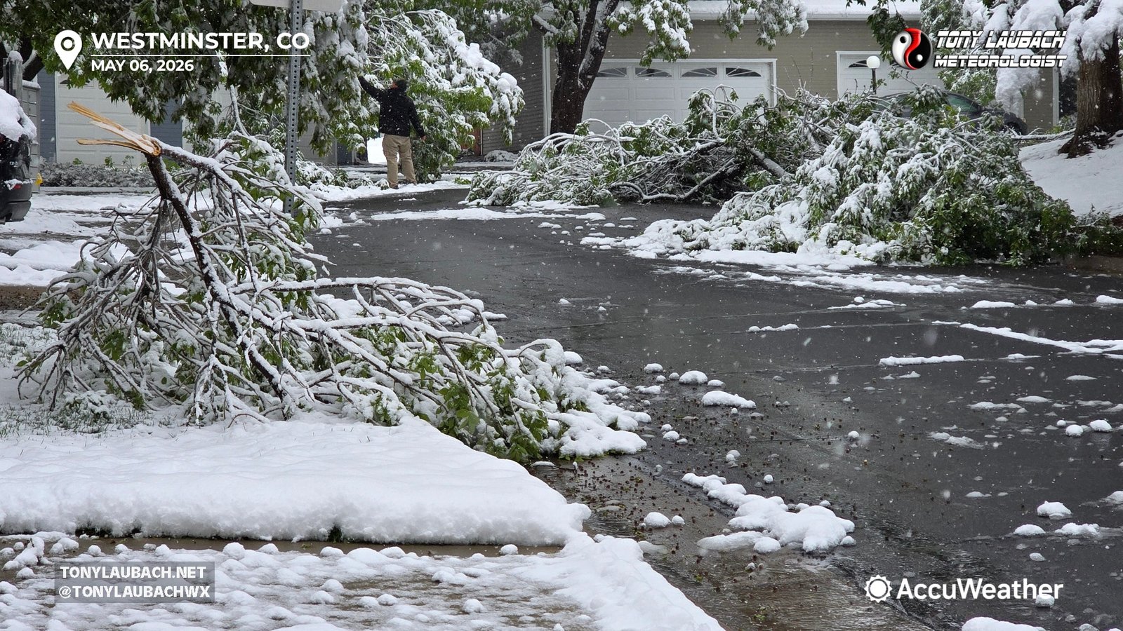
Biggest May snowstorm in over two-decades… ya know I am ALWAYS down for a good snowstorm, but there’s something about being in one in MAY that just adds a little something extra.  This storm boasted some impressive totals for May, coming in at the highest May snowstorm since 2003, and oddly enough was the SECOND biggest snowstorm of this season (a bar that was oh-so-low coming in).  The 5.8″ recorded officially for Denver was about half of what the western burbs saw; me measuring just over 7 inches total (which likely was lower than the actual total given melting/compacting).  And with temperatures just at or even slightly ABOVE freezing for the most part, roads remaining largely wet as opposed to icy or snowpacked, which likely aided in keeping travel impacts down at lower elevations.  Higher elevations had much bigger issues, and over 2′ of snow was measured in many areas up at elevation, so a DESPERATELY needed storm for all areas.  I clocked in with just under an inch of liquid storm total, and I will take every hundredth it had to offer.

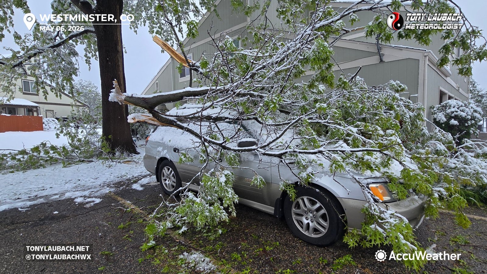
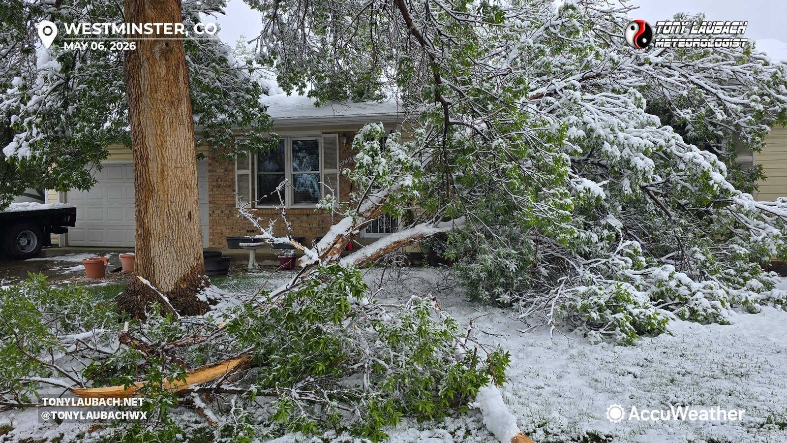
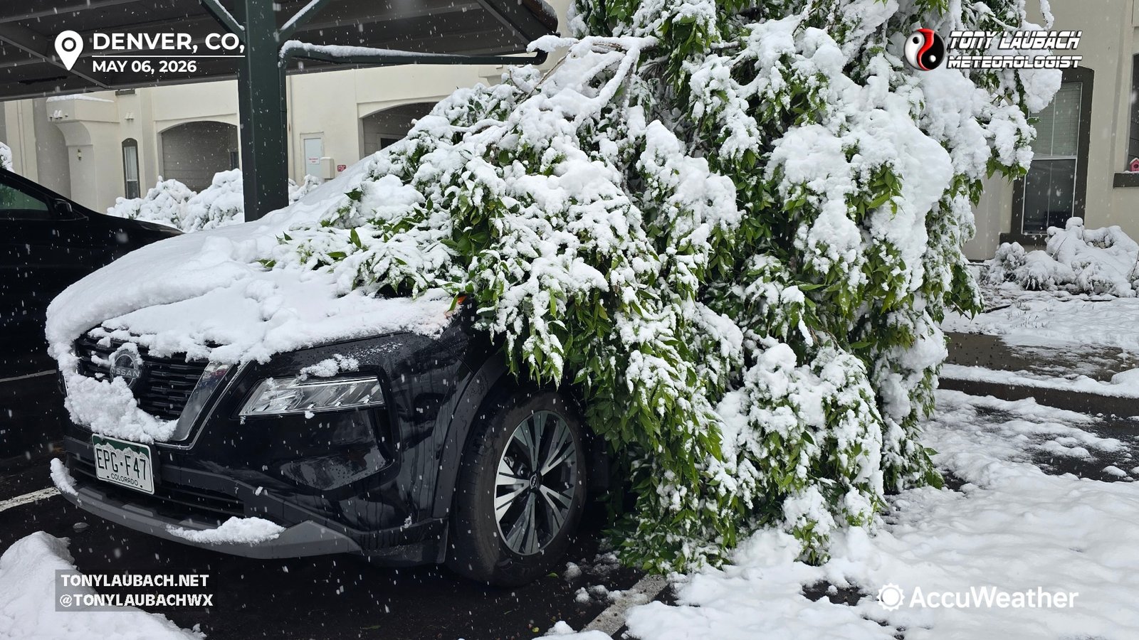
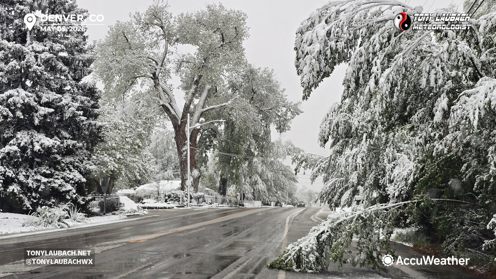
This storm was a branch breaker, a very HEAVY, wet snow piled onto leafed trees and the carnage was all over Denver.  Most of my coverage focused in northwest Denver (Westminster, Arvada, Broomfield, etc), and it was hard to find a street that wasn’t littered with tree debris.  This was always gonna be the main impact from this, and it turned out to be true.  Actually, this was pretty well forecasted; longer range models had this pegged over a week out, at least in terms of a potential snowstorm, and in the days leading up to it, hit it pretty good.  The numbers were on par with what was forecasted, and the impacts were similar.  But the bottom line, the moisture, for both higher and lower elevations, was much needed and well delivered.  I think that is the overall consensus among the Front Range folks as this storm departs.
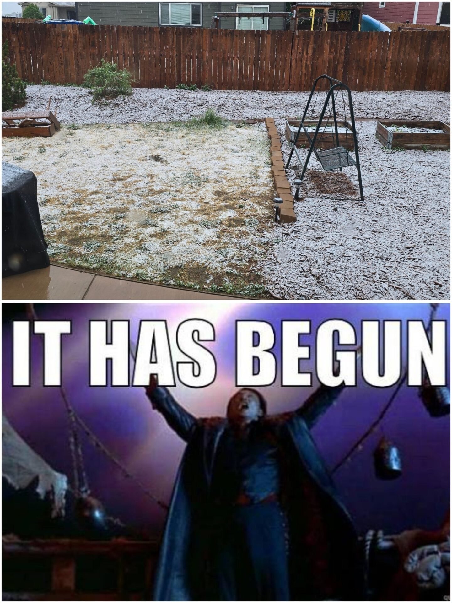
It Has Begun!!

May 5, 2026 | Winter Weather

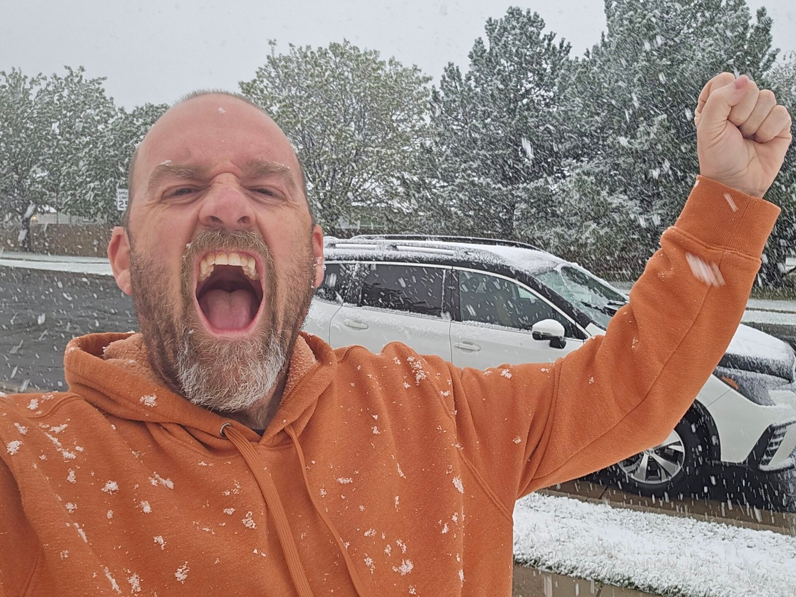
Awakened this morning to falling SNOW already at my house here in northern Colorado.  Ground still warm, so despite a dusting in the heavier bands, most of that melted quickly as snow lightened up.  It’s gonna need some time to stick.  Further north, Wellington to Cheyenne, accumulations are piling up with several inches of snow in/around Cheyenne on the ground already.  Snow probably won’t start sticking in earnest until later today OR we get a consistent, heavier snow to come down to offset the ground warming.

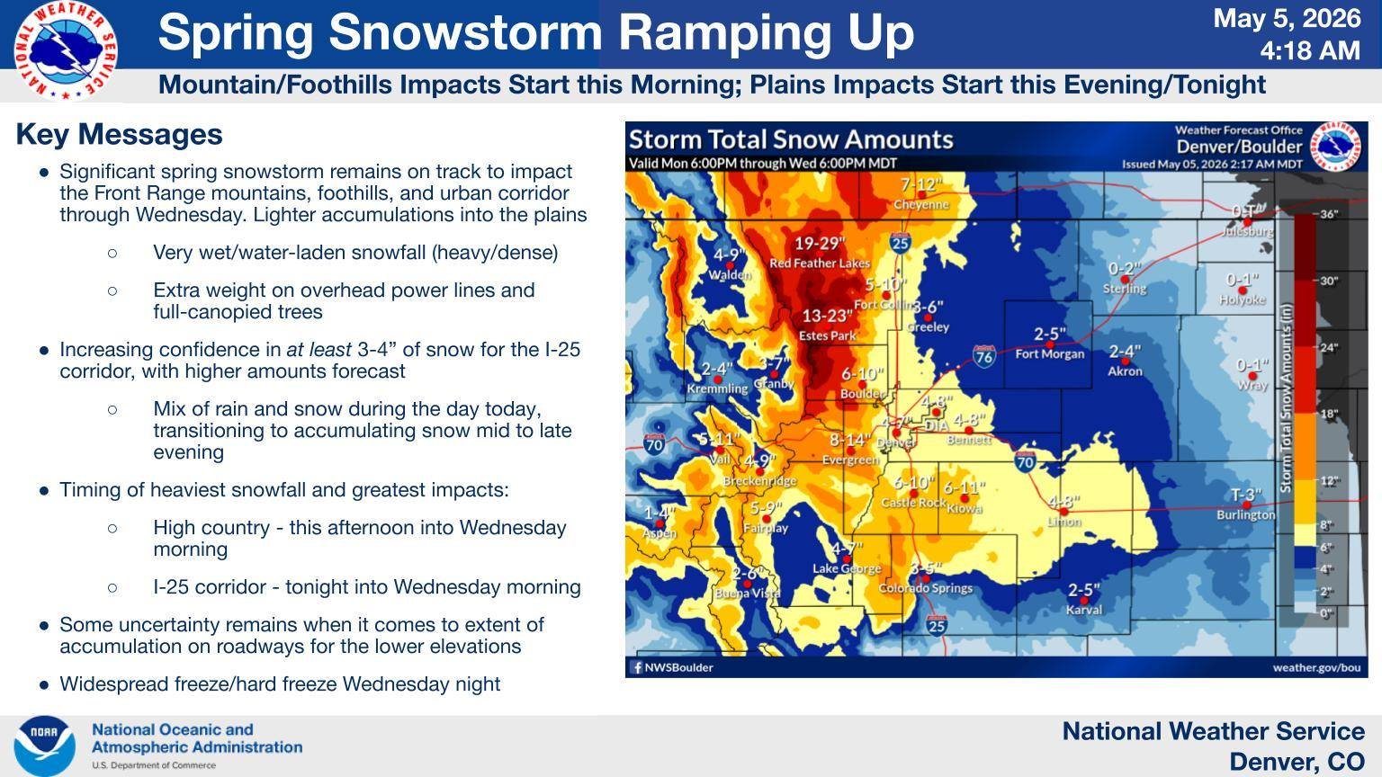
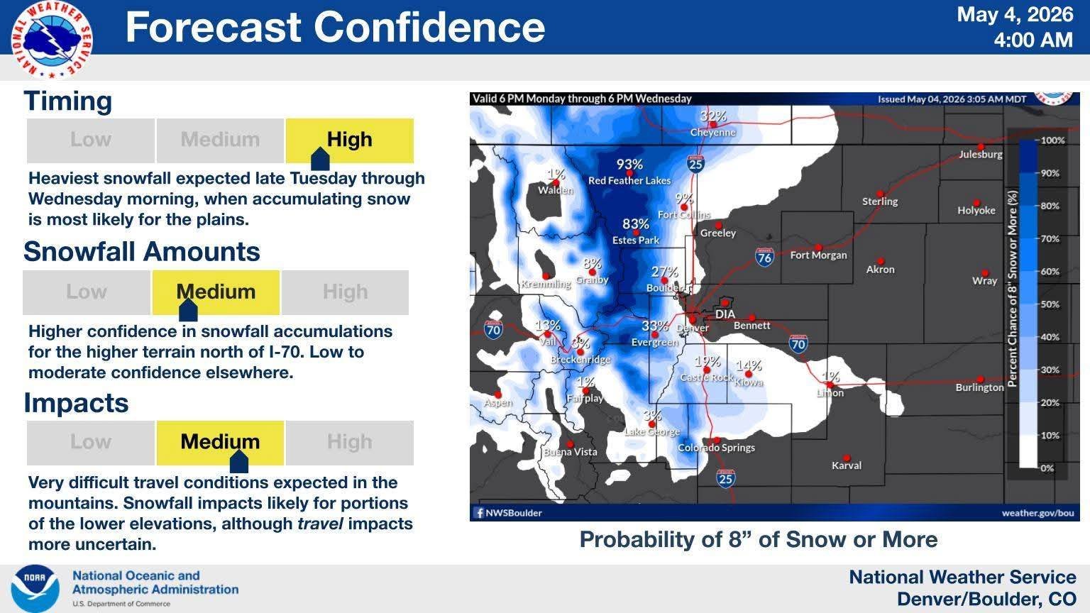
Still, expecting a pretty hefty hit of snow in northern Colorado, a VERY VERY WELCOME need.  With last night’s rain, I am already sitting at 0.66″ of liquid at my place.  Keep it coming!  Below is the latest NWS forecasted accumulations for the storm as of Tuesday morning.  I’ll be heading out shortly!

Tuesday/Wednesday Snowstorm Increasing

May 4, 2026 | Winter Weather

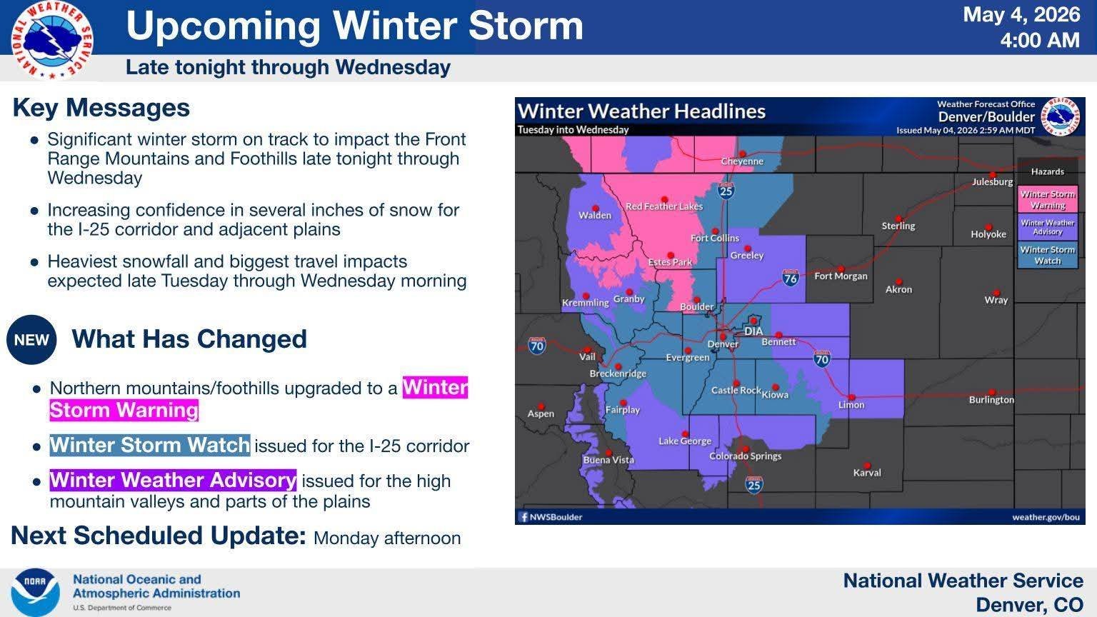
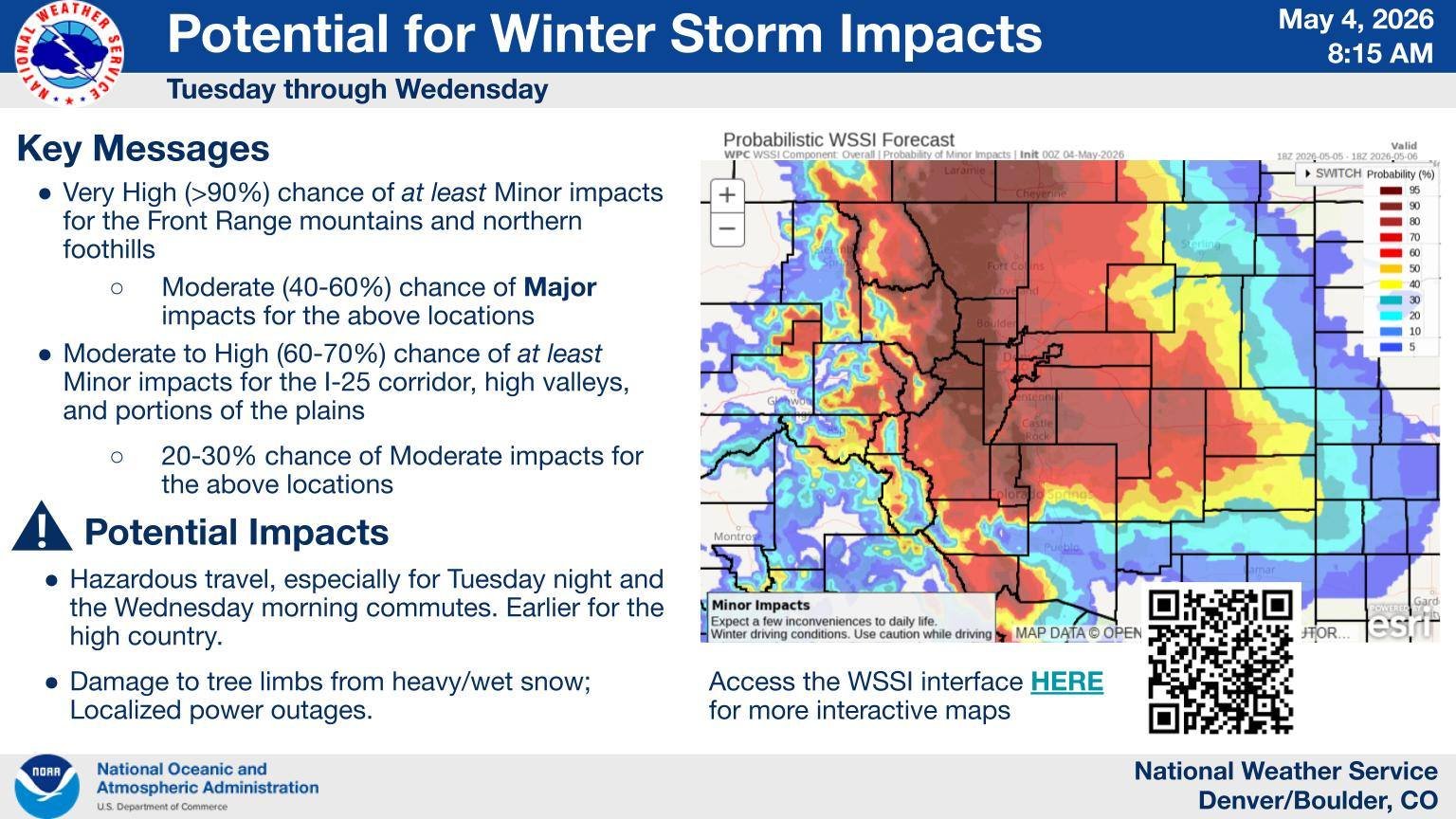
Snowstorm potential increasing as we near the event.  Plenty of questions remain, with the biggest being how much snow falls along the Front Range and Plains.  But everything seems to be coming together for an impactful snow event for northern Colorado starting Tuesday.

Mountains and Foothills oughta do very well, some locations at higher elevations picking up 2’+; foothills locations should come in near a foot in a lot of places.  For lower elevations, Front Range and Plains, a lot of variables remains unknown which will impact snow totals.  Many high-rez models cool us down quick on Tuesday, with changeover from cold rain to snow happening late afternoon; that would help increase our numbers a bit.  The going consensus, and the one I am buying into, would have me think mostly rain all day, with the changeover happening after 7p Tuesday and snowing into Wednesday morning.  How long it takes for that snow to start sticking and piling up will also factor into totals.  Warm ground temps will likely delay any accumulation in the first hours of snowfall, but depending how heavy and quickly things cool, that could happen sooner or later.  So yes, it’s possible it snows 10″, but only 6″ may accumulate.  News stations, Social Mets, and various sources have a wide range of accumulation maps out there, so it’s a bit confusing for the normal person to really get a grasp on what is to come.

What is HIGHLY certain is the moisture; whether it falls as all rain, a mix, or mostly snow, lower elevations in northern Colorado look to do very well moisture-wise, which is the underlying important part of this storm.  That’s gonna be a VERY nice dent in this ongoing drought.  One I think will go a long ways into improving, or at least stalling out, the worsening conditions we have here.  Hopefully this will be the first in a few solid moisture-heavy storm systems in the coming weeks.

My thoughts on the snow… well, it wouldn’t surprise me at all to see double digit totals along the Front Range west of I-25, including in the western suburbs of Denver.  I think the airport, official location, will likely be in the 3-6″ range, with higher ceilings approaching 10″.  As I mentioned in the previous entry, the largest snow for Denver came back in March with 8.5″; so while I don’t think we’ll hit that mark, it is certainly well within the realm of possibility we could, thus making this MAY snow event the highest of the season.  The May snow event we had on the 20th back in 2022 yielded about 6″+ in the western burbs, with Denver officially logging 2.3″ inches, which I feel very confident will be exceeded this go around.  I’ll be stationed in northwest Denver for this event as this looks to be a northern hit for the Front Range, but I will float around as needed.

It’s May, You Chase… SNOW?

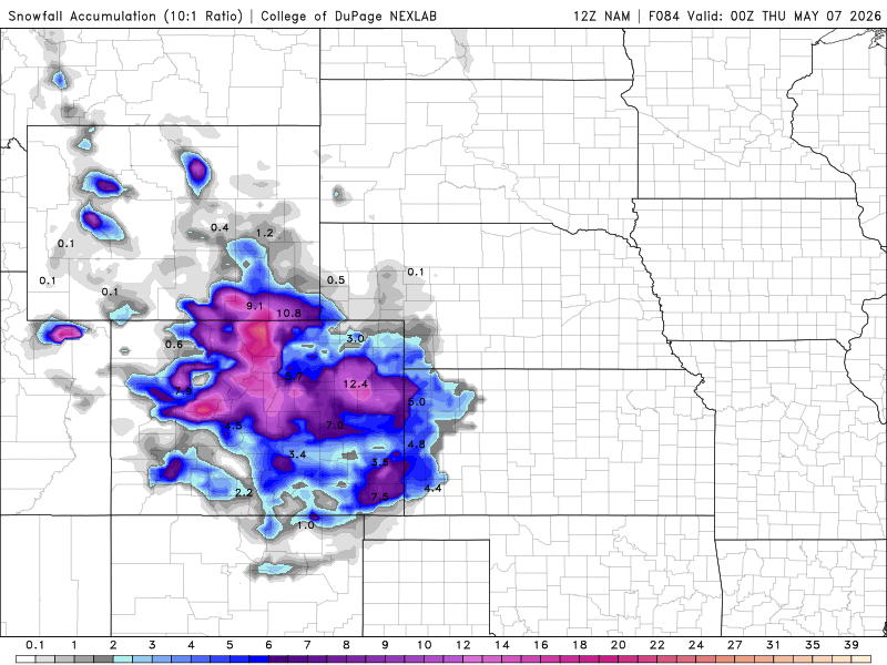
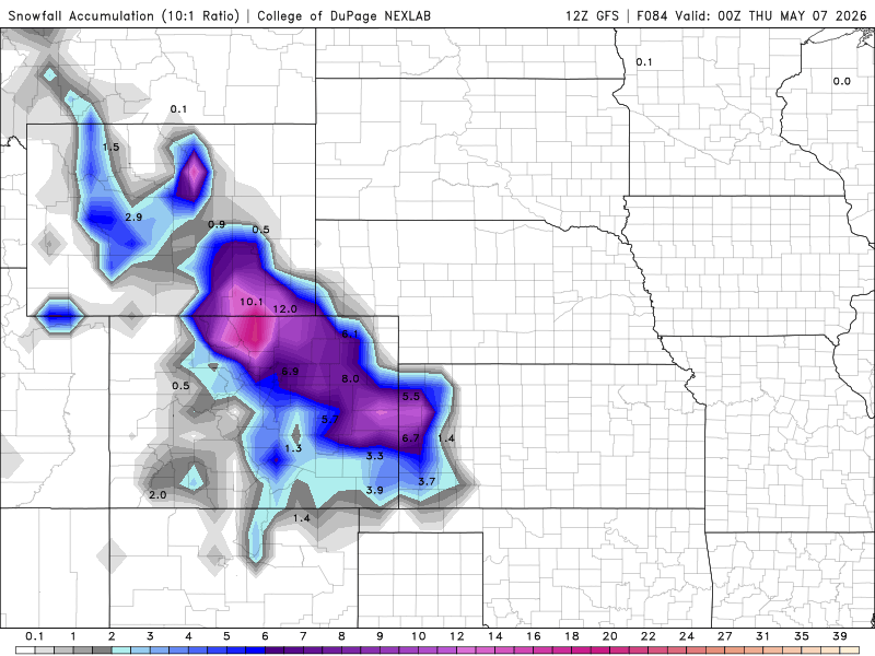
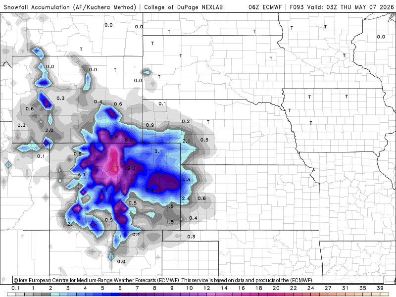
For Colorado, this is not unusual to be talking snow in May… a few years ago, we had a hefty Front Range snowstorm in late May, so popping one out the first week of the month isn’t odd.  What IS odd was that during what is typically our snowiest month in March, many Front Range locations set the record for their earliest 90-degree high temp day.  I hit 90 degrees a couple times in March at my house, which far outweighed any snow we got that month.  Now, there is POTENTIAL we could make a run at the biggest snowstorm of the year midweek.  On March 6, Denver recorded 8.5″ of snow, which by far was the biggest snow event of the season.  While it would take all the good ingredients to come together, it’s not out of the question we make a run for that title midweek.  Below are the morning runs of the NAM, GFS, and Euro (6z), all which are agreeing on significant snow potential for the Front Range and Palmer regions…

Nothing is a slam dunk by any stretch at this range, and while my optimism is growing for a decent snow event, I am not ready to fully invest in the idea.  But having seen consistency in snow potential the last few days, and now all three models are on board with the idea, I am definitely sliding into a cautious level of excitement at the idea I could be playing in snow come Tuesday and Wednesday.  How much cold air can get pulled into all this will really be the key piece, as the moisture definitely seems like it’s there regardless of how it falls.  That being said, this looks like it’ll be our first REAL shot at substantial moisture in a very parched Colorado in a couple months.

There is a severe side to this system, which is usually the case this time of year, but fortunately it’s low enough in the potential where it’s hardly a thought for me.  The setup looks more messy, high winds and hail kinda thing, which is easily beaten out by a solid snow chance here in Colorado.  I personally love it when warm season snowstorms don’t have the difficult choice of chasing verses snow.  Keeps me brain relaxed haha Right now, this is definitely all snow for me unless something incredibly drastic changes, and it would need to do so by tomorrow if I was going to pivot that violently to chase given the distance I would need to cover to get in position for the severe side, which even on its own, is in pretty crappy chase terrain anyway.  Have I mentioned how little interest I have in the severe side of this one haha

So yeah, I am likely looking at playing in the snow midweek here along the Front Range/Eastern Plains.  The models are converging on a wintry system, and obviously the forecasted amounts will vary as the models get a handle on the track.  Nothing is a slam dunk yet, but its leaning in a snowy direction that I rather highly approve of.  So we’ll see… how cold it gets and stays, its timing, and the exact track and phasing of the pieces of energy all remain unknowns and will highly dictate what ultimately comes of this.  But no matter how much falls (if any); it ain’t gonna last long.  Monday, ahead of the system, we’ll be in the 70s, and barring extensive snow cover, may return to the 70s as early as Thursday after the storm departs.  Typical Colorado haha Can’t wait…


Goodnight My Floof

April 30, 2026 | Off the Map

It was a rather forgettable stretch of chasing that was wiped under the rug as my beloved kitty, Zipperfoot, passed away over the weekend a couple months shy of 19 years old.  After Thursday’s horribly disappointing bust, Ed and I abandoned the chase trip to make an all-night haul back home overnight Friday into Saturday so I could be there with my favorite floof bucket. As you know, I’m a cat dad, and this was my boy, and he waited til I got to him before passing. I am heartbroken, but so glad I was able to get to him and be there with him a final time.  Major thanks to my 20-year chase partner and good friend, Ed. He suggested the drive, leaving Wichita at almost 8pm verses me waiting for the next morning flight and pushed off turning into a pumpkin to get us halfway there. Without his insistence and shaving off a lot of miles, I would’ve been too late to be there. I cannot emphasize how important that was to me, so I owe the man a tornado for every year my cat lived.

It’s hard to remember a time without Zip… he’s been the one constant over the years through so much change, so much joy, so much sorrow… he’s been a part of just about my entire adult life… he was more than a cat, more than a pet. He was truly a soulmate… I’ve been blessed with so many wonderful kitties through my life, and have said goodbye to many… but this one hurts the most… they say you’re not suppose to pick a favorite among your children, but I can’t deny how much my favorite he is.  Thank you, Zip for finding your way to us… I know Dania and I gave you the best life, and it showed by everything you gave us in return… I hope you’ve found your Momma bear and Siggles, and are nuzzling with them in the heavens above… and you best be the first one I see when the time comes for us to be together again… you are my floof…

Back to Blog
Blog Categories
All Posts

Tony's 10-Day Chase Outlook

TODAY OCT 10
Likely Tropical Day
>95%
Central Gulf Coast
TOMORROW OCT 11
Possible Chase Day
60%
Southeast US
MONDAY OCT 12
Possible Chase Day
40%
Southeast US
TUESDAY OCT 13
Watching
20%
TBD
WEDNESDAY OCT 14
Watching
20%
TBD
THURSDAY OCT 15
No Chase Planned
<5%
FRIDAY OCT 16
No Chase Planned
<5%
SATURDAY OCT 17
No Chase Planned
<5%
SUNDAY OCT 18
No Chase Planned
<5%
MONDAY OCT 19
No Chase Planned
<5%
Latest Facebook Posts