Opens in a new tab

Tony's Blogbach, Between the Isobars

Thoughts from Tony Laubach on Weather, Chasing, and the Patterns in Between.

Another Denver Day I Didn’t Do

August 16, 2026 | Forecast Thoughts, Post-Mortem

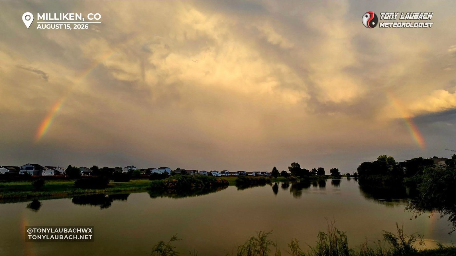
Yesterday was another bleh day for me, all the while Denver took another day on the chin.  I just wasn’t feeling it, and despite those feelings, I did push myself out the door to make a short couple hour round-trip on some storms that fired along the northern Front Range.  Other than a couple clouds pictures and a couple bouts with some torrential rain, my best views came much later in the evening as the golden hour set in and offered up a full rainbow and brightly lit storm backsides.  Denver, particularly southeast Denver, once again took the brunt of storms, and hind-sight says I should’ve just got a hotel there for two nights, perhaps a third if today pans out, but I have already written off any real plans to chase minus a quick outing for something that may pop within a handful of minutes of home.

As for today, a lower end setup exists, that will inevitable over-perform somewhere, but I would hunch that being further south, maybe even beyond the Denver area.  With some at-home stuff to do, and a small trip planned for early week for Nebraska/Iowa chasing, I am going to keep it pretty close to home today.  Unless, like I said, something fires in my immediate vicinity.

As for the week ahead, Monday and Tuesday are target days with Monday being central Nebraska and Tuesday being slightly east of there.  Both days look pretty solid for chasing, so I do have some excitement to see what comes about out of those.  They’re not major severe weather days by any stretch, but a couple good storms oughta be part of the equation.  I will leave for central Nebraska early tomorrow morning, no need to make trails tonight.  I will get packed up and ready, so all I have to do is load the cooler and head out.  Tuesday will be a little further east, but no biggie as I will likely end up somewhere on I-80 in the eastern half of Nebraska by day’s end, which will set me up nicely for Tuesday, wherever that ultimately ends up.

So yeah, kinda of excited for the next couple days.  This week has been busy, with four days in a row of chasing, but the latter two were pretty meh for me, but I take the blame where it’s due, I wasn’t terribly ambitious for either day, thus I got what my effort warranted even as I was hoping for something closer to home.  Maybe today will bridge the gap if something teases me out for a look, but otherwise, my eyes are looking ahead to Monday and Tuesday.
Should’ve Been a Bit More Ambitious Today

August 15, 2026 | Forecast Thoughts, Post-Mortem

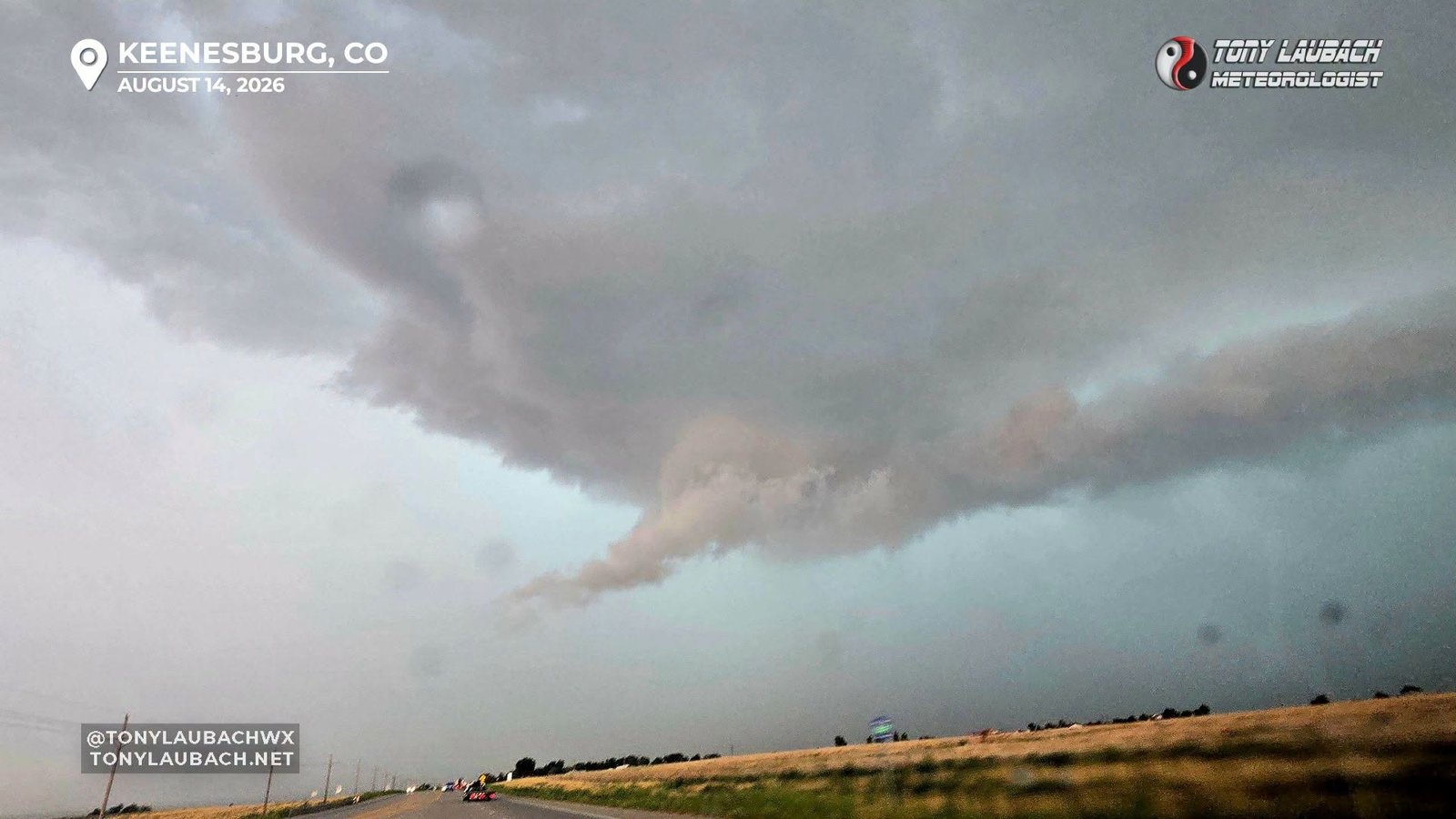
That was my view on southbound Weld County Parkway heading toward Keenesburg as a seven-minute landspout tornado was ongoing in Denver proper north of Dicks Sporting Goods Park.  That was pretty much all today really produced, but that is a pretty big production.  No, a landspout, one that was likely didn’t do any damage, isn’t a headliner in 99% of cases, but one in the metro definitely moves up a couple notches.  Beyond that, sporatic reports of street flooding was about it.  My storms, while advised for landspout potential, all rained themselves out pretty quick, and I ended up in Brighton in traffic and unable to really get to anything in time.  I turned tail and came home when it was clear nothing was worth sticking out for.  Frustrated in the moment as one often is when they are seeing reports of a landspout active in Denver, but the day as a whole was pretty much what I thought it would be if you take the spout out of the equation.

No changes in my thoughts for tomorrow… still likely to venture out, somewhere north of CO-86.  No major changes in the ambient setup minus an increase in dynamics, so would suspect a similar evolution and initiation of storms that we’ve seen the last few days, so it may be a east side of Denver start, then follow out east until its not worth following anymore.  With better dynamics in play, severe weather a bigger threat tomorrow than the last couple days, both of which did present some hefty storms, so I have reason to think we could see the best (or second best) chase day of this four-day stretch.  No tornado risk in the afternoon SPC Day 2, and I don’t see that changing, even if landspouts get a nod from the local offices.  Still a messy setup even with the better dynamics, so not a tornado day by any stretch.  But eeking out a spout or two, not gonna rule it out.

Sunday is another marginal day, likely the last one of the stretch, which will close this five-day stint.  I won’t rule out a backyard chase Sunday, but if I am being honest, I have not looked in great detail, but I would put my chase chances very low as of this entry.  It appears to be a southern Colorado play, and a marginal setup four hour plus drive one-way on a Sunday probably won’t get a yes out of me.

Mount Saint Hailens of Southeast Denver

August 14, 2026 | Forecast Thoughts, Post-Mortem

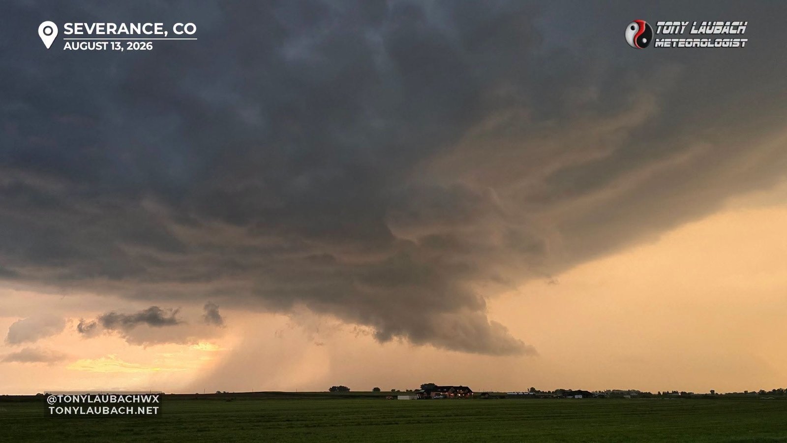
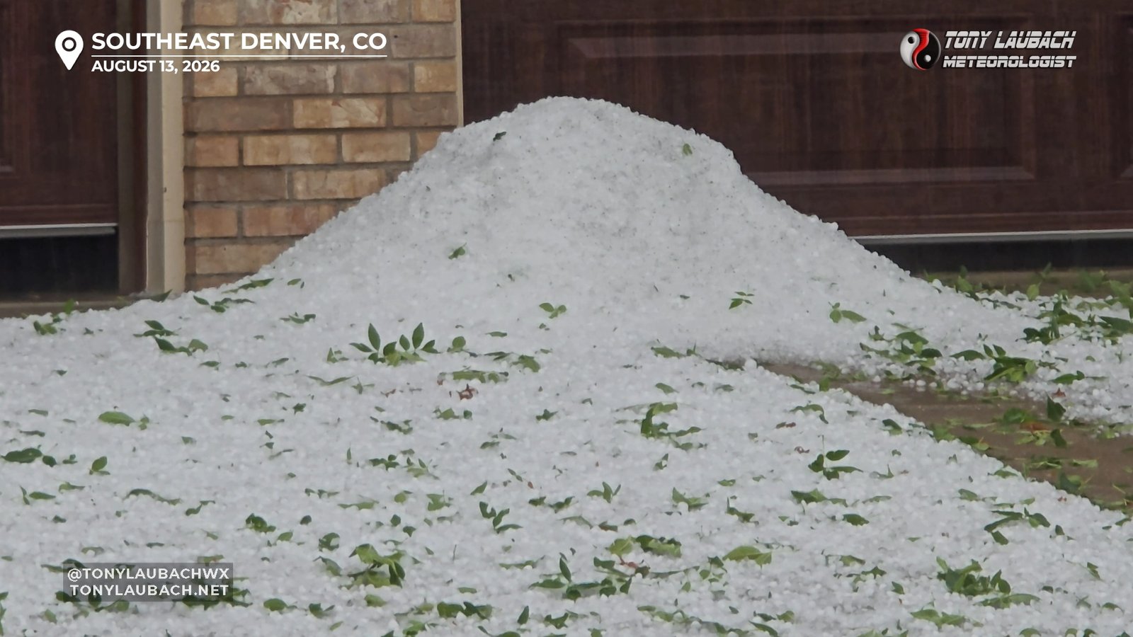
Another marginal setup overperforms in 2026.  The theme continues!  I mentioned yesterday ahead of the chase how there was potential for something, but I would ultimately scrap together whatever I was dealt.  Well, shocker; I got more than I bargined for.  Ended up stationing in Hudson, and never really got off the Front Range.  Initial storms developed in the Foothills southwest of Denver, and my initial storm intercept was a slow-moving meatball that ultimately went severe when copious, and I mean COPIOUS amounts of 1″ hail buried areas around Centennial.  I played the Metro area, which is rare given that you’re well committed due to traffic and logistics, but it was the right move as that storm was the story of the day, for sure.  I got in on the back side of the storm, getting a very small sample of the torrent of hail this thing dumped.  I documented 2-3″ deep accumulations with many yards just buried in hail.  Many yards didn’t look that way only cause a thick layer of tree debris was shredded over it.  Even came across hail drifts 3-feet deep along a roadside creek.  By that point, the eastern Plains stuff had fired, but was an hour-plus away and given the likelihood that most of that would be pulsey in nature and not likely to sustain, I decided to point myself back home, making a dinner stop in Greeley while some new development got going in Fort Collins.  I came out to a full-blown, slowly rotating supercell featuring a ragged wall cloud as it moved to Severance, then became a severe flood maker for the Eaton/Greeley areas where I spent the rest of the evening documenting flooding before arriving home shortly before 10pm.

Today has yet another marginal setup, one that honestly looks no different than yesterday, so I’d argue a similar ceiling could exist, but unless something blows up close to home, I probably will not make a day of it today.  Tomorrow looks a bit better on paper, and that may warrant some effort that exceeds what I am currently feeling about today, so I will keep track.  My, well, lets call it what it is, laziness, doesn’t eliminate me getting out if something within a short drive erupts later today, but honestly, the desire to watch Washington pre-season Football beats out a lower-end setup.  The good news, the 5pm kickoff would mean the game would likely be done if an evening storm fires near sunset, meaning lightning is totally on the table.  Hell, the second-half of yesterday’s festivities kicked off about that time within a VERY easy drive of my house, so if that were to repeat, I would probably invest the miles for that.

Tomorrow, while not a pretty setup by any means, probably on paper looks to be the second-best offering of this stretch of days.  Of course whether it puts out anything big or not remains to be seen, but using the “on paper” rule, I have to give it some credit, and with it being a weekend day, may allow for some caravanning company if a couple local friends get enticed.  After seeing what the last couple days have offered up, the enticement certainly should be there.  That said, we will see!

Today’s Lower End Potential?

August 13, 2026 | Forecast Thoughts

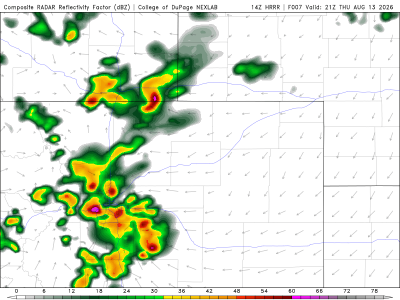
On paper, today doesn’t have quite the spunk that yesterday did, but I am still going to venture out and see what I can scrap out of this.  Today’s setup seemed more focused around the I-70 corridor in eastern Colorado verses yesterday’s I–80/I-76 play.  I will probably depart here in a couple hours, heading down toward Bennett, and following things out east.  SPC keeps it at a marginal, although they’ve teased at the idea of a wind-driven slight.  Regardless, that doesn’t really change the overall setup, but worth noting the potential is there for something.  My guess, I will probably roll east with thee storms, MAYBE cross into Kansas later this evening.  We shall see.  If the HRRR is to be believed, it’s possible everything stays in Colorado through 9-10pm, minus the goodies that may develop further east closer to the border into western Kansas.  Regardless, my play will likely be the stuff coming off the Palmer.  How long I stay with it/how far I go remains to be seen, but we’ll at least give today some attention.  First thing’s first, reload the car and see if SPC goes through on any kind of wind-driven upgrade it their 1630z.  My hunch is no based on the high-rez runs that have come in the last few hours.  Nothing looks terribly focused or organized, so I imagine this will remain a marginal on their account as well as mine.

The Low-End Days Are The Best

August 13, 2026 | Post-Mortem

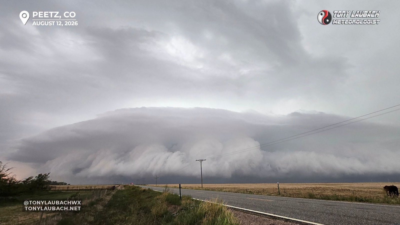
While I have done my fair share of whining about the overall feel of the 2026 chasing season, one of the brighter themes to this year has been the over-achieving of the lower-end, marginal days.  Yesterday was another tickmark in that tradition with another visually stunning storm that I was able to stay with for several hours.  This year is definitely gonna be the year of the shelf cloud, and yesterday’s structure didn’t disappoint.  I’ll be the first to say that once you’ve seen ten shelf clouds, you’ll see ten more, but they never fail to make for good pictures.  I always have said I wasn’t a structure guy, but it’s something that grows on me a bit more and more.  Maybe not to the point where I go out of my way for it, but on days I go into with a very low bar, having multiple opportunities to document good structure definitely makes for a good day.  Add in some hail and some hurricane-force gusts and you have a full day.  But… wait, there’s more!

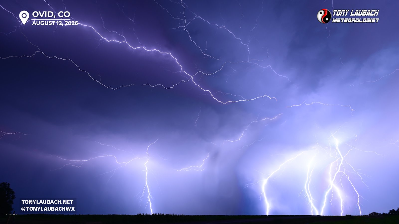
One thing I NEVER EVER EVER tire of shooting… LIGHTNING!  And I got a treat out of last night.  I called my chase early evening after my storms got to I-76 northeast of Sterling and began to weaken substantially.  Given gas prices are cheaper in Nebraska, I basically gave those storms til Ogallala to shape up, and it was there I dinnered up and fueled up ($3.79 for 87 verses $4+ in Colorado).  On my way back, some garden variety storms had developed along and south of I-76 in far northeast Colorado.  As I approached I-76 in Nebraska, I could see flashes, which would reveal some low-end anvil crawlers as I got closer.  Occasionally, I would see something that COULD be good, but nothing blowing my socks off.  Once I passed Julesburg, I would see the frequency of flashes increase, and while still low end, there were more hints that it COULD be worth a stop.  After one or two “ooo, that was good” crawlers, I decided to stop at the next exit after Julesburg, which was Ovid, and camp out on a hill a couple miles south of I-76.  From there, I gave my 14-24mm lens its biggest workout of the year, and for about 45 minutes, I captured a solid handful of keepers.  As usual with a good lightning shoot, I was pretty elated!  The results were great, and the crawlers gave way to some CG action, which was an added bonus.  I shot there til about 10pm or so, rolling to Brush for a bathroom stop before finishing the drive home, rolling in about 12:30am.

Another awesome, low-end day to add to the list.  Today, while not as juicy as yesterday, offers another opportunity for some fun, this time along I-70.  I’ll probably depart here about lunchtime and head down to Bennett to start, following storms out I-70.  Friday is also a low-end day, but looks even less than today, so I’m not as sold on Friday.  I also have the burning desire to start my Football season, as Washington plays Miami in their first pre-season game of 2026.  Ideally I would do that on my couch, but if there is enough to warrant a play on Friday, then I could be convinced to stream that from the road instead.

That said, great day yesterday with awesome structure, and fantastic lightning, which continues to grow a collection that was sorely lacking heading into the summer months and is now becoming a major highlight of this season.

Back to Blog
Blog Categories
All Posts

Tony's 10-Day Chase Outlook

TODAY OCT 10
Likely Tropical Day
>95%
Central Gulf Coast
TOMORROW OCT 11
Possible Chase Day
60%
Southeast US
MONDAY OCT 12
Possible Chase Day
40%
Southeast US
TUESDAY OCT 13
Watching
20%
TBD
WEDNESDAY OCT 14
Watching
20%
TBD
THURSDAY OCT 15
No Chase Planned
<5%
FRIDAY OCT 16
No Chase Planned
<5%
SATURDAY OCT 17
No Chase Planned
<5%
SUNDAY OCT 18
No Chase Planned
<5%
MONDAY OCT 19
No Chase Planned
<5%
Latest Facebook Posts